
by Celeste Lipford and Terry Lipford - last updated on 10/10/2025

Maui is a different experience from Oahu, despite both being part of the same Hawaiian archipelago. Maui has a smaller population, which gives it a more laid-back and peaceful vibe. The island is also known for its natural beauty, including the famous Road to Hana, which takes you on a scenic drive through lush forests, waterfalls, and dramatic coastline.
One of the top attractions in Maui is the Haleakala National Park, where visitors can witness the stunning sunrise or sunset from the summit of the dormant volcano. The park also offers a range of hiking trails, from easy nature walks to more challenging treks.
Another must-see in Maui is the town of Lahaina, which was once the capital of the Hawaiian Kingdom. Today, it is a charming and historic town that offers plenty of art galleries, boutiques, and restaurants. Visitors can also take a stroll down Front Street, which is lined with historic buildings and offers stunning views of the ocean.
Maui is also home to some of the best beaches in Hawaii, including Kaanapali Beach, which is known for its soft sand and crystal-clear water. Other popular beaches include Wailea Beach, which is great for snorkeling, and Napili Bay, which is ideal for families with young children.
PLEASE NOTE: Our last trip to Maui took place in February 2023, prior to the devastating fire that destroyed Lahaina. Please consider a contribution to the "Maui Strong Fund" to help. The Office of the Governor of Hawai'i recommends donations to this fund.
Contributions are also being accepted at the Maui United Way Website. A list of charities that are accepting donations can be found here.


If you enjoy our videos click here to subscribe to our Youtube Channel.

Click the above video poster image to watch our Maui Vacation Travel Guide video provides suggestions for how to spend one week on Maui and some tips. We give an overview Map of Maui and describe the island and then jump into a suggested itinerary that can be considered a starting point for how to spend your week. We discuss visiting Haleakala crater at sunrise, the Kapalua Coastal walk, Lahaina, the Maui Ocean Center, Makena Beach and the lava fields on the south side of Maui and give our view of driving the Road to Hana.
The following is a suggested itinerary based upon maximizing your time on Maui and proximity to these individual destinations;
If you have some extra time, or you are looking to add some variety to your own itinerary, here are a few suggestions to consider;
Maui is one of the Hawaiian Islands and is known as "The Valley Isle" due to the large valley between its two main mountain ranges, Haleakala and the West Maui Mountains. The valley is home to many of Maui's towns, including Kahului, Wailuku, and Lahaina. Haleakala is a dormant volcano that stands at over 10,000 feet tall and is a popular tourist attraction for visitors to Maui, especially for watching the sunrise. The West Maui Mountains, on the other hand, are much older and have been eroded over time, creating dramatic cliffs and valleys along Maui's western coast.
As you can see in this static map, we visited a number of diverse locations, each of them are linked so that you can click on any that you would like to view.
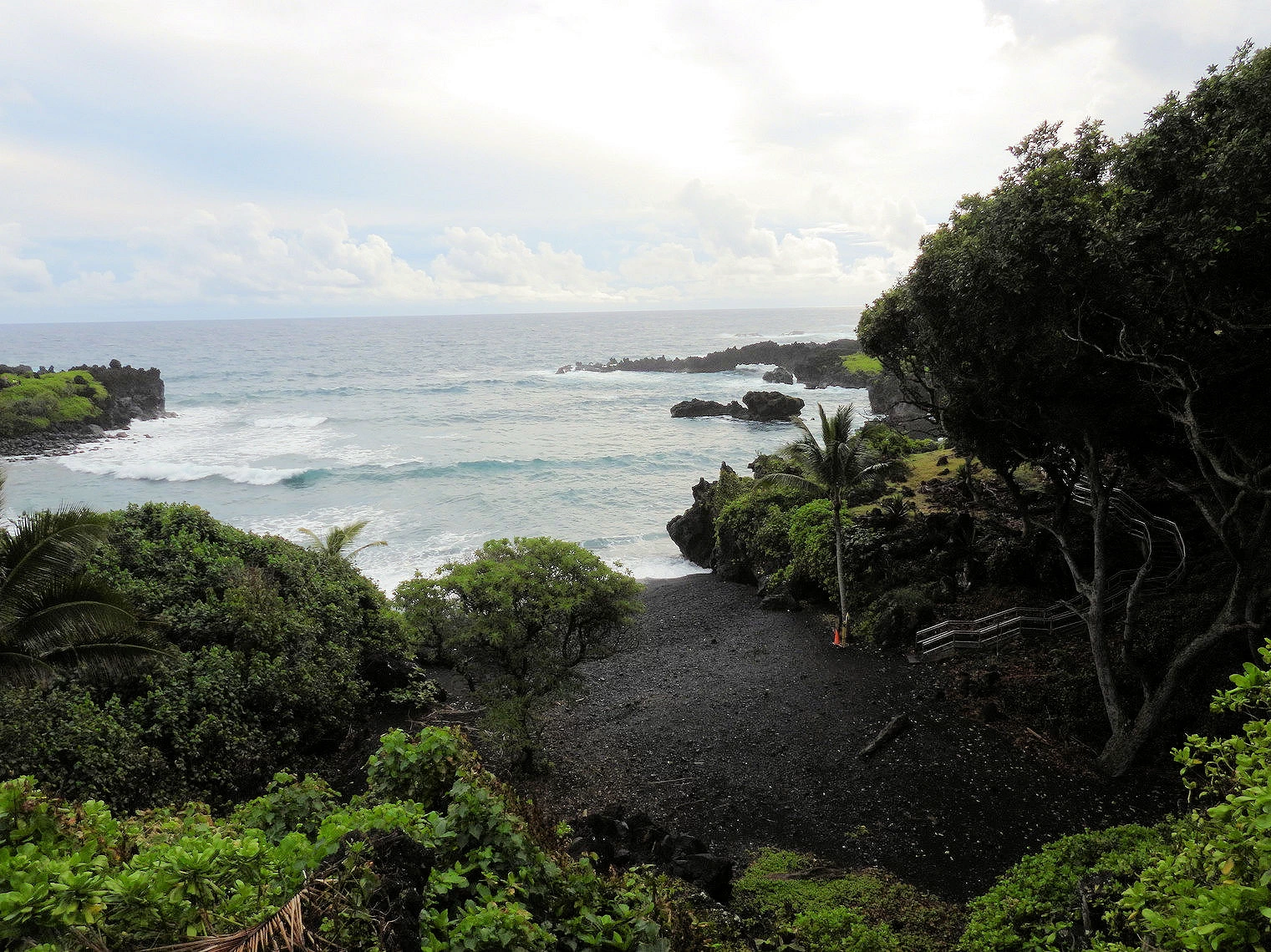 Waiʻānapanapa State Park
 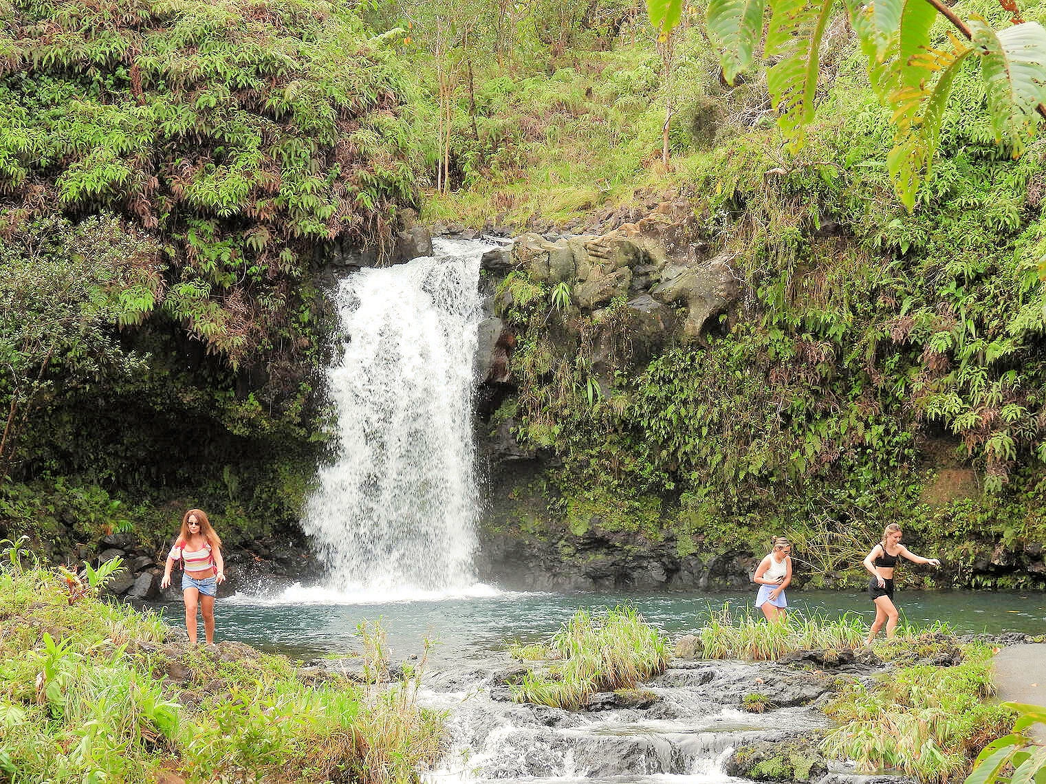 Pua’a Ka’a State Park
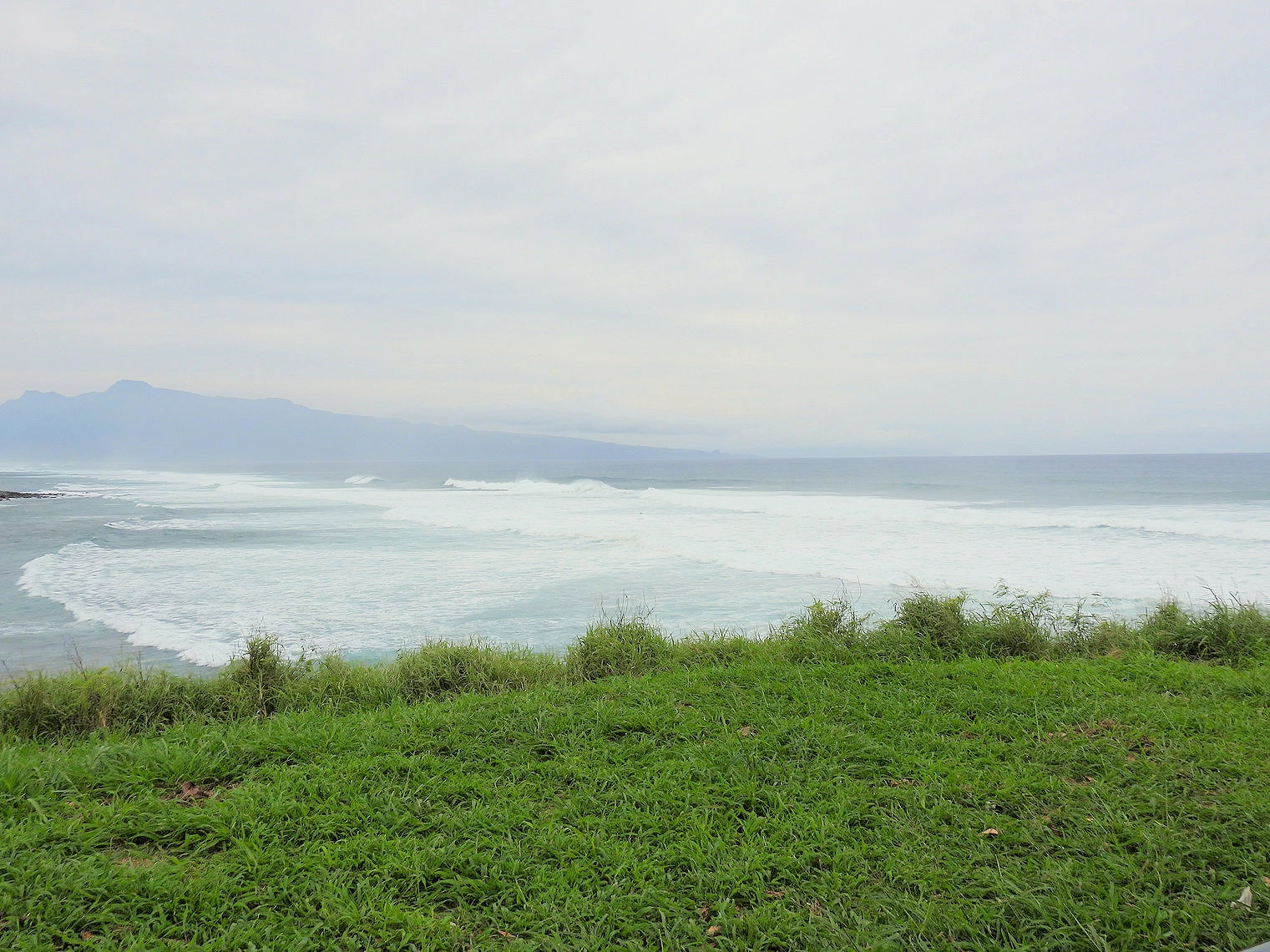 Hoʻokipa Beach Park
The Road to Hana had been on our list "to do" ever since our last trip to Maui over 14 years ago. We were not able to make the drive on
that last trip, and we were determined to make it happen on this trip. This is a challenging drive, as the road is narrow and
becomes narrower across the one lane bridges. Then you have local drivers who know the road and are determined to traverse it at
top speed without regard to the yield signs or oncoming traffic. Be very careful on this road !!!
Click the "map link" above to view a Google Map.
If you have enough time on Maui to make this day long trip, then maybe you want to consider doing it. But frankly there isn't much to see in Hana, it is primarily those places around Hana that are interesting, for example; The Wailua Falls are seven miles past Hana, the grave of Charles Lindbergh is 4.5 miles past the falls, and there are several beaches just past Hana that are nice as well. But if you do not have an entire day to put into such a drive, consider going to the Twin Falls on route 36 that are only 19 miles from Kahului. They are pretty and do not require such a long drive to get to.
Road to Hāna: Should You Drive It Yourself?
The Hana Highway (colloquially referred to as The Road to Hana) is a 64.4-mile-long (103.6 km) stretch of Hawaii Routes 36 and 360 which connects Kahului to the town of Hana in east Maui. To the east of Kalepa Bridge, the highway continues to Kipahulu as Hawaii Route 31 (the Piilani Highway). Although Hana is only about 52 miles (84 km) from Kahului, an uninterrupted car-trip takes about 2.5 hours to drive, since the highway is very windy, narrow, and passes over 59 bridges, of which 46 are only one lane wide. There are approximately 620 curves along Route 360 from just east of Kahului to Hana, almost all of it through lush, tropical rainforest. Many of the concrete and steel bridges date back to 1910 and all but one are still in use. That one bridge, badly damaged by erosion, has been replaced by a portable steel ACROW or Bailey bridge erected by the United States Army Corps of Engineers.
Need to Know – Maui
Road to Hāna drive is slow—start early and don’t try to do everything in one day. Respect closures and private land. Reef-safe sunscreen only. Conditions change—check official updates the morning you go.
Here is a link to our image gallery.
Here is a link to their website. You will find a lot of good advice & information there.
In Kahuilui, take Hawaii Route 36 south past the airport. After you pass Mama's Fish House on your left, Route 36 turns into Route 360 AKA the Hana Highway. Just keep driving south, watch for the signs and be careful on the one lane bridges.
The road itself is manageable at low speeds; the biggest hazard is impatient or inattentive drivers. Leave space, use pull-outs, and be ready to yield at one-lane bridges.
A relaxed out-and-back with a few short stops can still run 6–8 hours. Don’t plan a packed schedule the same day.
Most rental car companies do not allow you to take your rental car past Hana due to its challenging conditions. This route is not recommended for tourism, is often closed due to landslides, lacks infrastructure, and is primarily for local access, according to some sources. While it offers a unique, albeit challenging, experience with breathtaking views, it poses risks like breakdowns, severe weather, potential car-jacking, and rental car contract violations.
If you dislike tight roads and parking hassles, a tour is a great trade-off—you would get to see the scenery without all of the driving stress.
All the above images, unless otherwise noted, are the property of Just Traveling Thru, LLC.
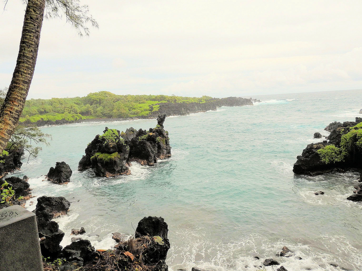 Waiʻānapanapa State Park
OK, so this is actually on the Road to Hana, but it is a beautiful park and one you should visit if you have the time. Remote, wild, volcanic coastline offering solitude and respite from urban life. Lodging, camping, picnicking, shore fishing and hardy family hiking along an ancient Hawaiian coastal trail which leads to Hana. Excellent opportunity to view a seabird colony and natural stone arch. Other features include native hala forest, heiau (religious temple), sea stacks, blow holes and small black sand beach.
Reservations are required, and there are fees both for entrance and parking, click here to obtain more info and your reservations.
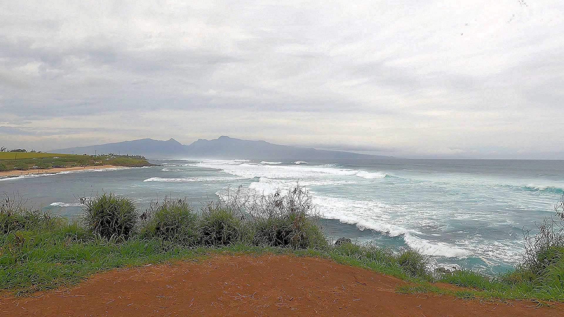 Hoʻokipa Beach Park
This is a stop we made on the way back from our road trip to Hana, and we stopped here for two reasons; (1) The surf was huge and there were some good surfers out there riding and (2) there were porta-potties next to the parking lot. Yes, we had been on the Hana Highway for quite a while!
The surf was huge, couldn't tell exactly what the height was from our location on top of the ridge above the beach, but it looked to be a minimum of 12 to 15 feet. We read later that the beach was closed due to high surf conditions.
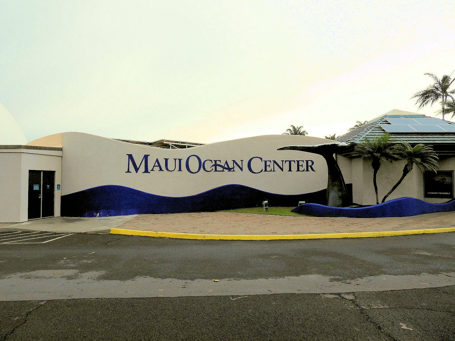 Maui Ocean Center Entrance
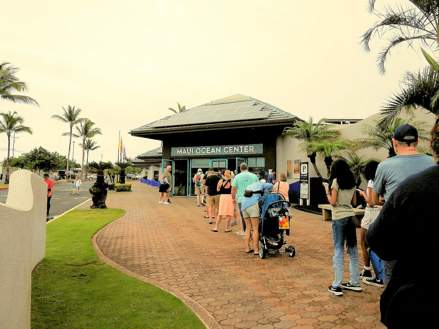 Maui Ocean Center Ticket Line
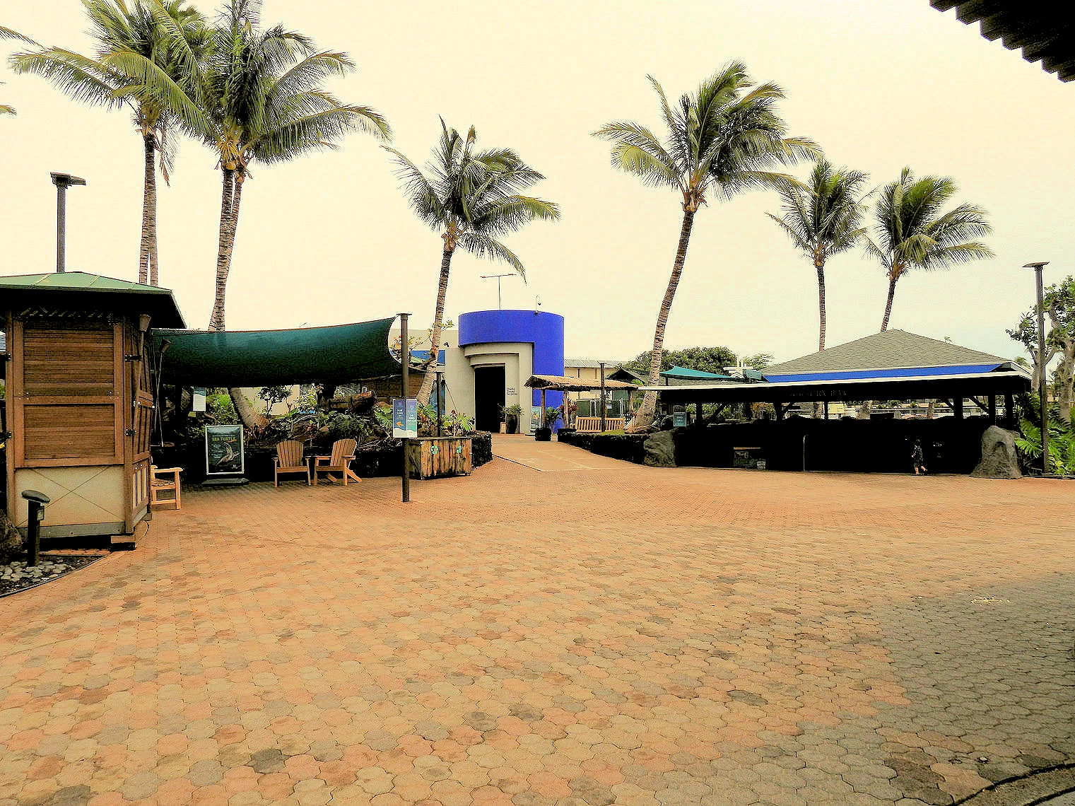 Maui Ocean Center Exhibits Area
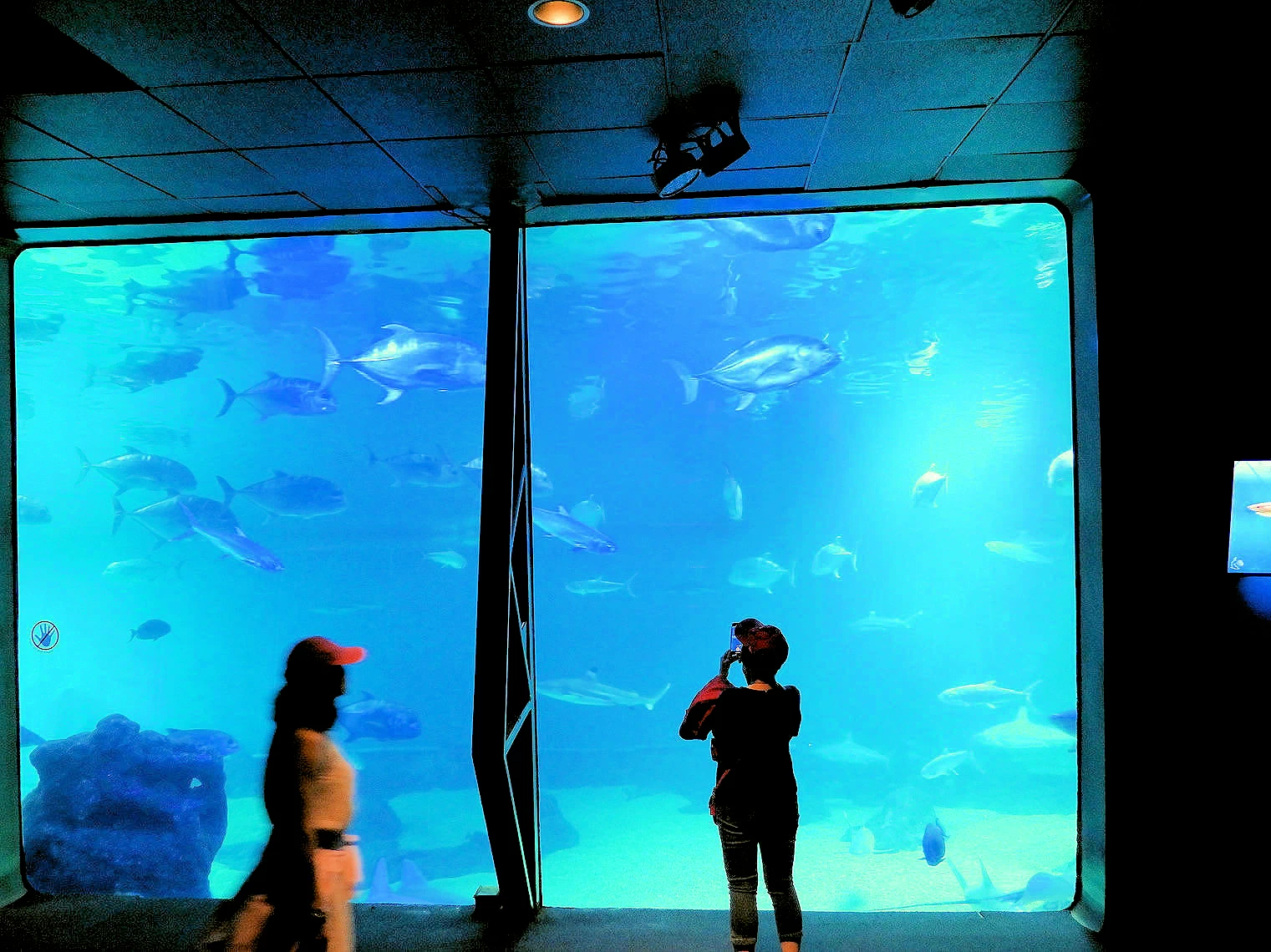 Maui Ocean Center Aquarium Area
Due to inclement weather, we had decided to visit the Maui Ocean Center , as it has a informative & interesting set of displays and going there would allow us to avoid the rainy weather! Besides which, the Aquarium was on the road to Lahaina, our next stop.
The aquarium offer a 3D experience called "Humpbacks of Hawaii" in a 3D domed theater experience with multi-channel surround sound. The teams from the Ocean Mind Experience were looking for a modern way for people to see, hear and interact with these animals without invading their habitat. Humpback whales have been on endangered species watch lists for decades. Working with award winning nature documentarian, Daniel Opitz, the Yessian teams created the sound to bring these whales to life on large format screens through originally recorded sounds deep below the sea combined with sound design and music scoring based on the natural sounds of the whales. This is a very good presentation, and it allows you to feel as though you are swimming alongside these whales.
By arriving early, we were able to enjoy all of the Aquarium before the crowds grew as the day wore on. By the time we departed, the parking lot was completely full and the line at the entrance was getting long. Word to the wise traveler; get there early.
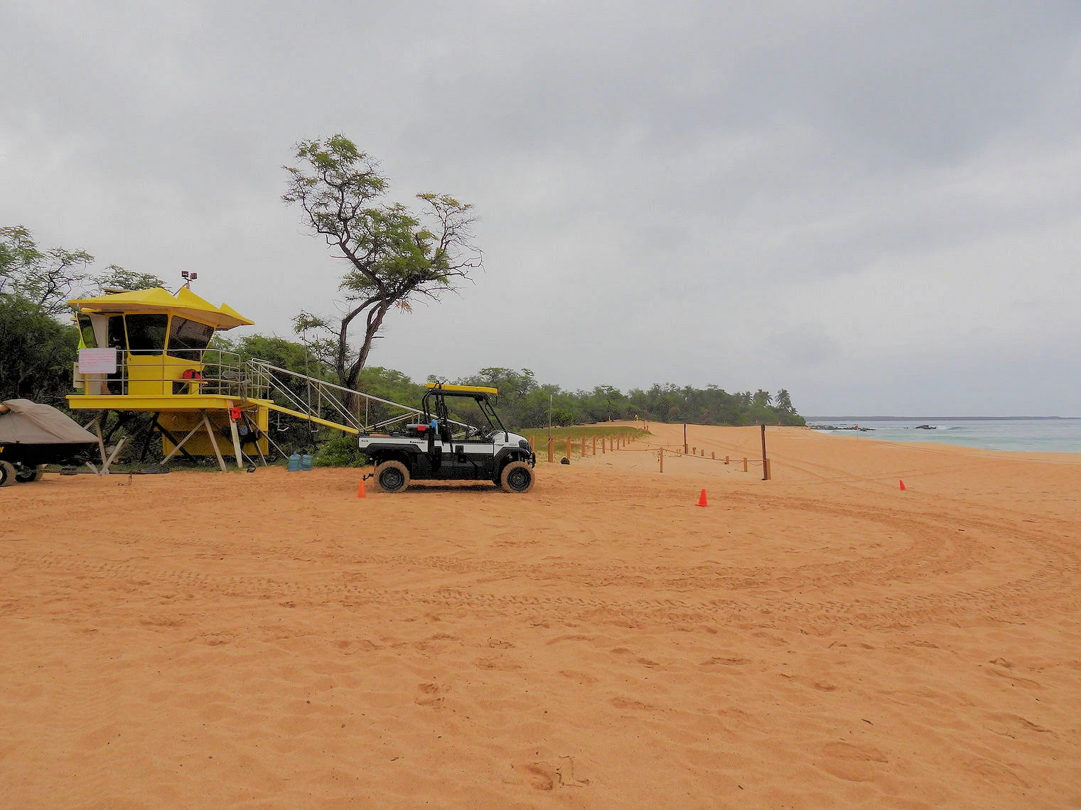 Makena Beach Lifeguards
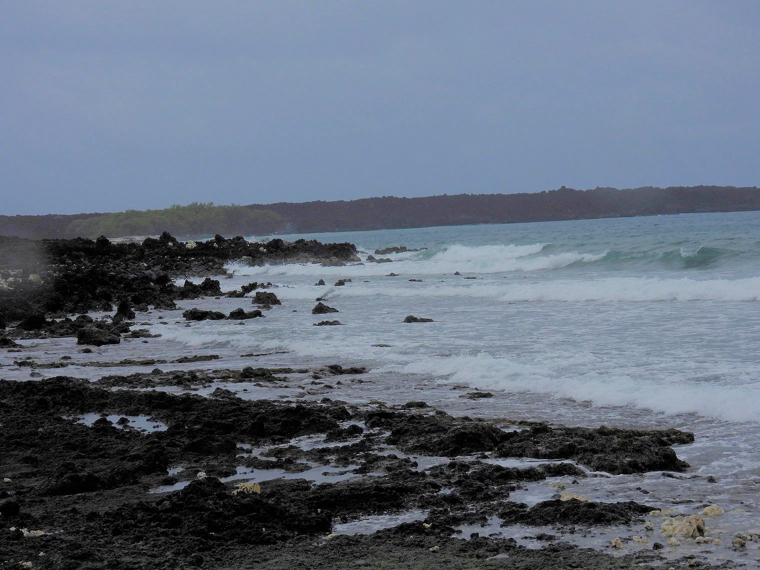 Makena Beach Surf
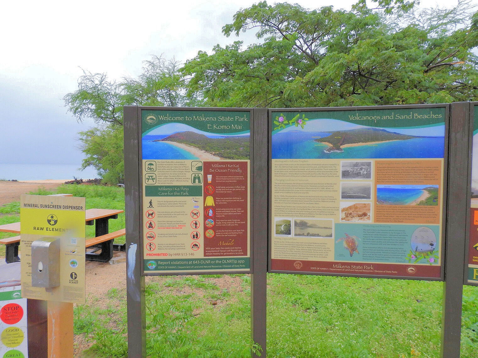 Makena Beach Notices
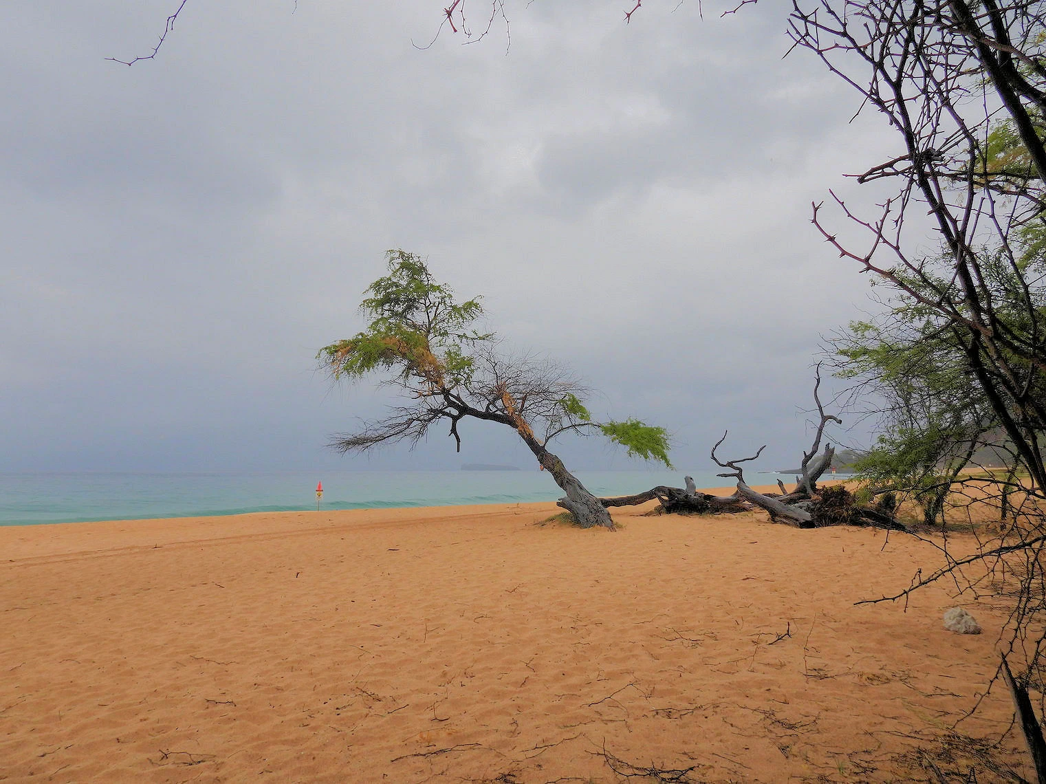 Makena Beach Shore
Makena Beach holds a special place in our hearts & memories, it is not only very pretty but it is somewhere where we were able to spend some private time during our last visit to Maui. Given that this beach has such a prominent place in our memories, it was inevitable that we visited it again, regardless of the rain that day!
Makena Beach is nestled amidst lush tropical vegetation, creating a scenic backdrop for those seeking peaceful walks and picnics. The area is also renowned for its captivating sunsets, attracting photographers and romantics alike. Additionally, the beach boasts exceptional views of the nearby Molokini Crater and Kahoolawe Island, enhancing the overall experience.
 Kapalua Coastal Trail
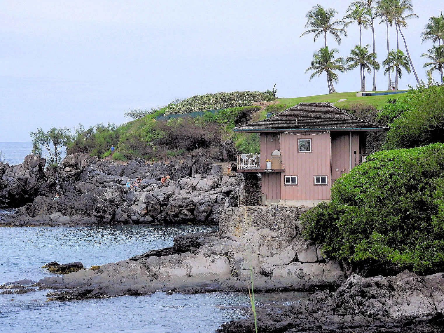 Kapalua Coastal Trail
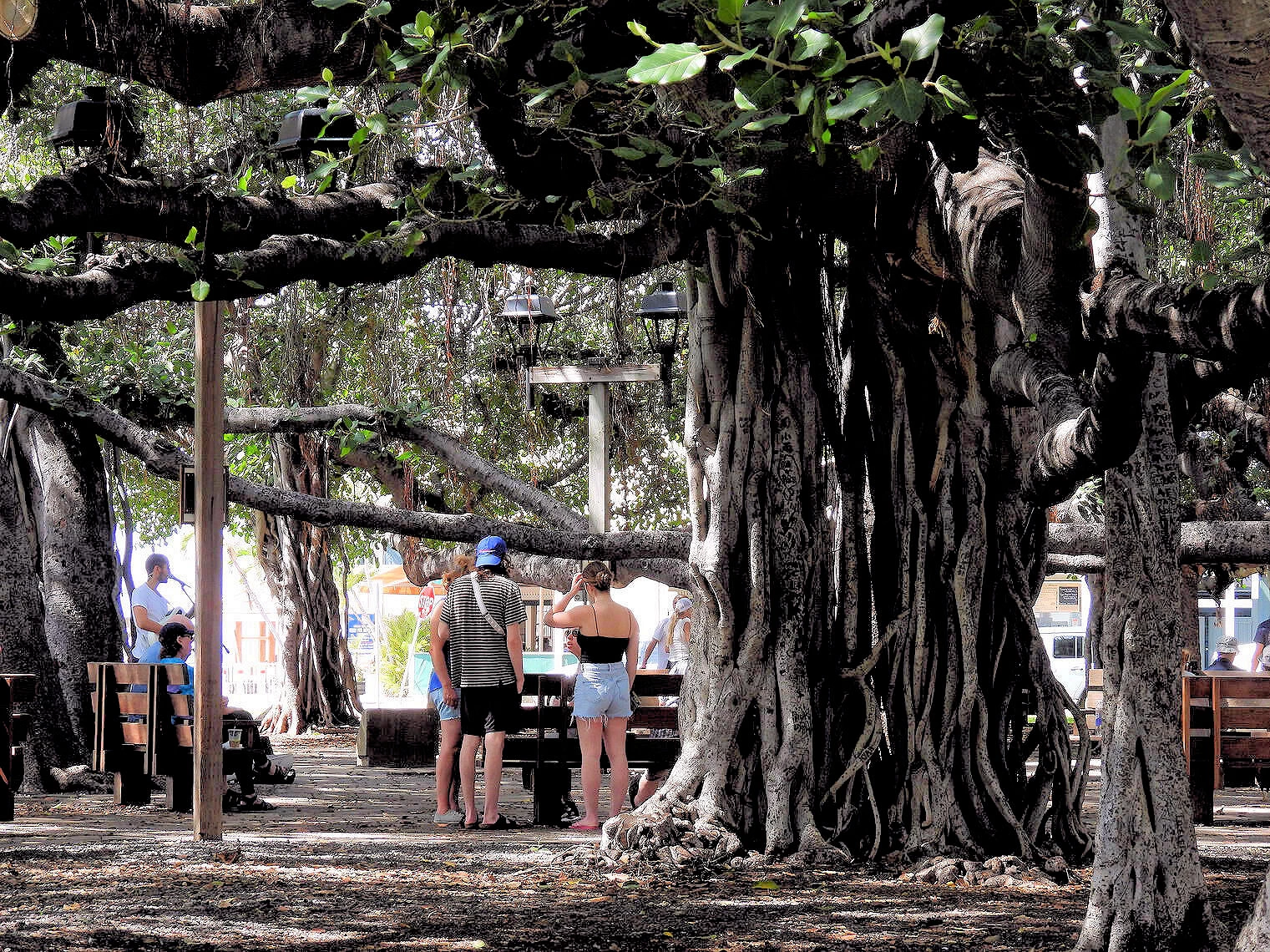 Lahaina Banyon Tree
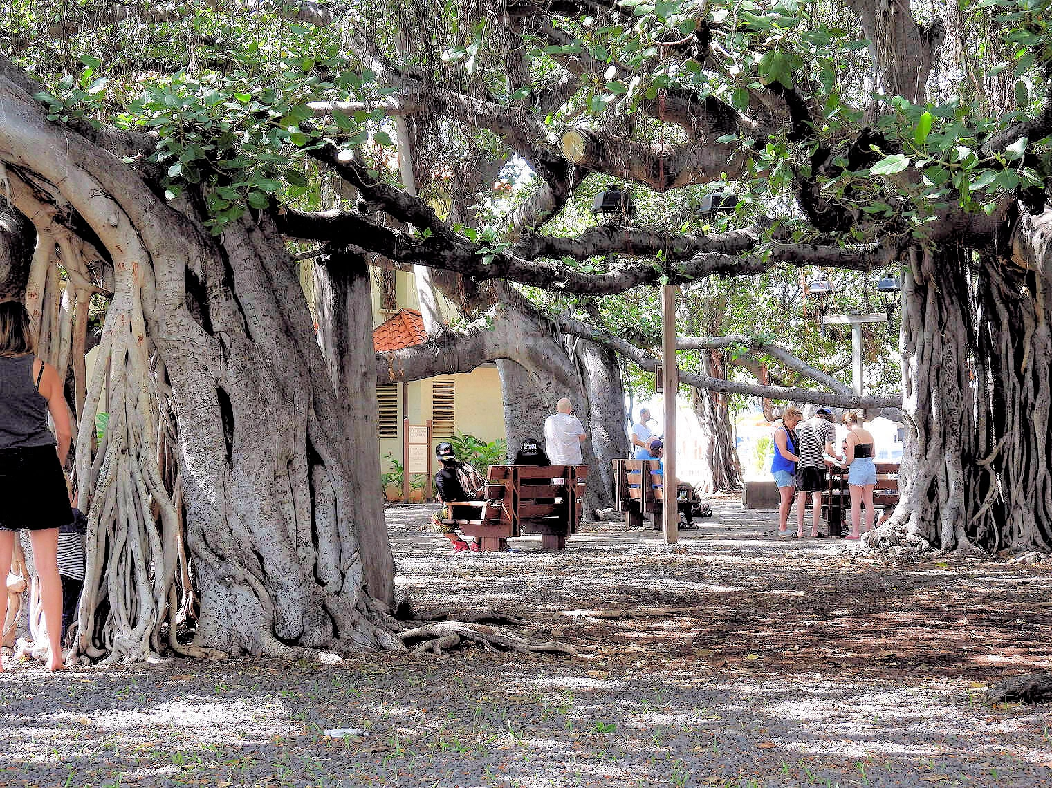 Lahaina Banyon Tree
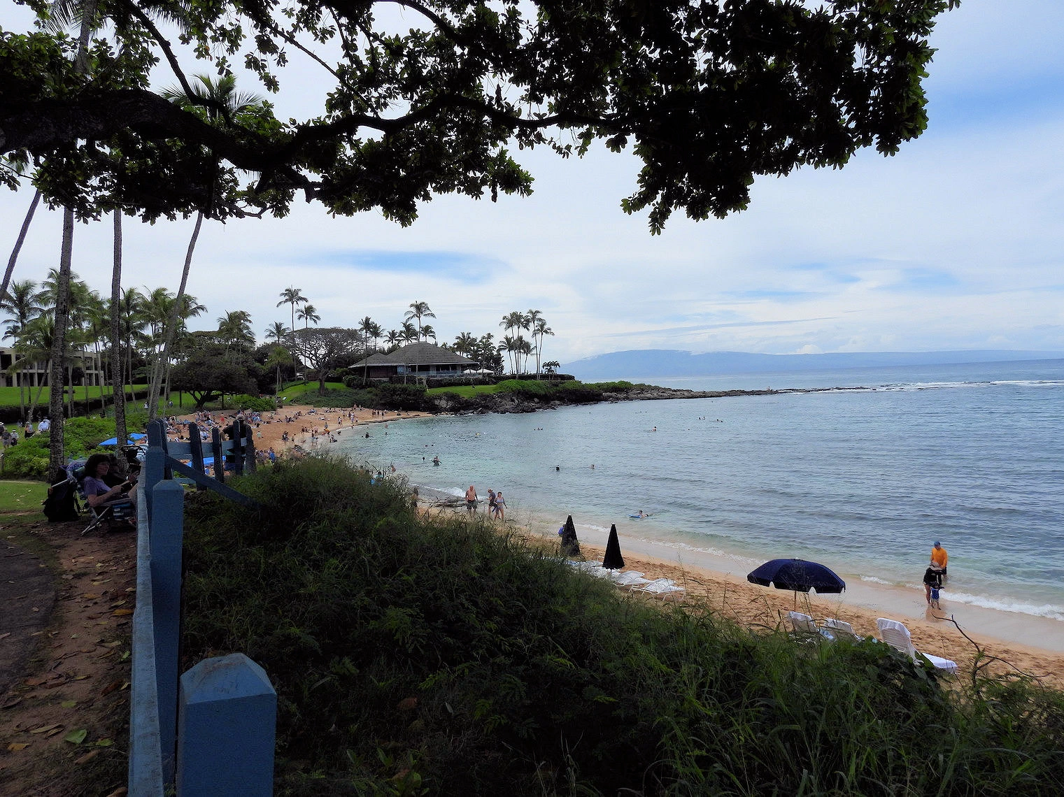
Our next stop after the Maui Ocean Center was meant to be Lahaina, however we realized on the drive there that we had not been north of Lahaina to the Ka'anapali and Kapalua areas. In particular, we wanted to walk the Kapalua Coastal Trail.
Kapalua Coastal Trail is a 2.5-mile out-and-back trail that traverses Kapalua Bay & Namula Bay (it continues past Oneloa Bay if you hike the entire route). Generally considered an easy route, it takes an average of 56 min to complete. This is a very popular area for running and walking, so you'll likely encounter other people while exploring. You'll need to leave pups at home — dogs aren't allowed on this trail. After we completed this trek, we drove to Lahaina to explore there & see the banyan tree. Click the "map link" above to view a Google Map.
Haleakalā National Park is a place of profound cultural and ecological significance, centered on the magnificent Haleakalā volcano. Its history as a protected area began in 1916 as part of the original Hawaiʻi National Park, alongside the volcanoes of Kīlauea and Mauna Loa on the island of Hawaiʻi. The two areas, located on different islands, were split 45 years later. On July 1, 1961, the Haleakalā section was officially established as its own separate national park.
To view how interesting Haleakala is, click here to view our Haleakala National Park page.
Spring and fall bring pleasant weather and smaller crowds. Winter has big surf; summer is the driest.
Yes, advance reservations are required through Recreation.gov for sunrise viewing at Haleakalā National Park. You should keep in mind that the driving time to reach the Haleakala summit is going to be impacted by the numerous curves and other traffic. The drive to the summit of Haleakalā typically takes 2.5 to 3.5 hours, depending on your starting point on the island of Maui, with longer drives for locations like Lahaina and shorter ones for areas near Kahului. The road is narrow, winding, and steep, especially the final stretch from the national park entrance to the summit, so it's crucial to slow down and drive cautiously. So to view the sunrise, you are going to need to start early.
Absolutely. It’s a full-day scenic drive with waterfalls, coastal views, and hiking stops. Start early and allow time to explore. You should take a look at our info on the Road to Hana on this page. There are some less strenous alternatives.
Best locations: Some of the most popular areas are the protected coves of South and West Maui, like Molokini Crater (boat tour required) and Black Rock in Kaanapali.
Boat tours vs. shore snorkeling: Both are options. Boat tours often go to farther destinations like Molokini, while shore snorkeling allows you to go at your own pace.
Accessibility: Some boats, like those at Sea Maui, use a "beach loading" system for boarding.
Time of day: Morning is generally the best time to go, as the ocean and winds are calmer, and visibility is higher.
Time of year: Summer months (May–September) have calmer seas in West and South Maui. Winter brings bigger waves to the North Shore, so sticking to sheltered areas is safer.
Yes. Public transit is limited; renting a car is the best way to explore beaches, Hana, and Haleakalā. A rental car is the most recommended option for fully exploring the island, as public transportation is limited. Uber and taxis are available but can be expensive. Booking your car in advance is highly recommended, especially during peak seasons.
Yes, visitors are welcome on Maui and their support is vital for the island's recovery. The area of West Maui is still in recovery, and visitors should not go to Lahaina Town, Lahaina Harbor, or Front Street out of respect for the community.
Humpback whales are typically found in Maui's waters from December through April, with peak viewing from January to early April.
The most popular areas are West Maui (including Kāʻanapapali and Kapalua) and South Maui (Wailea and Kīhei). Both offer stunning beaches and a range of accommodations, from resorts to condos. The most affordable lodging is generally found in Kīhei.
Maui offers a variety of popular hiking trails, from easy coastal walks to challenging volcanic climbs, catering to all skill levels. The hikes below are grouped into difficulty levels, but conditions can change quickly due to mud or rain, so it's always wise to check the weather and bring proper footwear and plenty of water. Note that each "Trail Name" is linked to a more authoratative website for more detailed information:
These trails are generally short, well-maintained, and suitable for all skill levels, including families with children.
'Iao Needle Lookout Trail and Ethnobotanical Loop: The ʻIao Needle Lookout Trail is an accessible, paved, 0.5-mile loop in ʻIao Valley State Park, Maui, that offers stunning views of the iconic ʻIao Needle, a distinctive 1,200-foot erosional formation, and the surrounding verdant valley, including views of the stream with small cascades. While the main trail is easy with stairs, there are also dirt trails to explore, and the "Ethnobotanical Loop" aspect refers to the trail's passing by various botanical species brought to Maui by ancient Hawaiians, providing insight into their history and the valley's cultural significance as a sacred site and historical battleground.
Kapalua Coastal Trail: The Kapalua Coastal Trail is a scenic, roughly 3.5-mile out-and-back trail in West Maui that offers stunning ocean views as it winds along the coast. While some sections are paved or boardwalk, other parts are rocky and can be sandy, requiring sturdy shoes, though the overall lack of significant elevation change makes it a popular and relatively easy hike for many. Hikers will pass by several beautiful beaches, including Kapalua Bay and D.T. Fleming Beach Park, and can often spot sea turtles or, during winter, humpback whales.
'Ohai Loop Trail: The ʻŌhai Loop Trail is an easy, relatively flat 1.2-mile coastal trail on Maui's North Shore, offering scenic views of the ocean and providing a habitat for native Hawaiian plants, including the namesake ʻŌhai shrub. The trail is an excellent option for a leisurely walk, even with young children, and features a small parking area located between highway mile markers 40 and 41. Hikers should bring water, sun protection, and sturdy shoes due to the rough terrain and dry environment.
These hikes are longer or have more significant elevation gain and may feature uneven terrain. A moderate level of fitness is recommended.
Waiheʻe Ridge Trail: The Waiheʻe Ridge Trail is a strenuous 4-mile roundtrip hike in Maui's West Maui Mountains, offering breathtaking panoramic views of the lush Waiheʻe Valley, Makamakaole Falls, and the Pacific Ocean from its 2,500-foot summit. The well-maintained but challenging trail features a steep, continuous incline, dense native flora like ferns and ʻŌhiʻa trees, and abundant opportunities for bird watching, though it can become muddy and slippery after rain. Hikers should arrive early to avoid afternoon clouds, which often obscure the expansive views, and bring water, sturdy hiking boots, and appropriate rain gear for the unpredictable weather.
Pipiwai Trail: The Pipiwai Trail is a moderately strenuous, 4-mile roundtrip hike within Haleakalā National Park's Kipahulu District on Maui, leading to the base of the 400-foot Waimoku Falls through diverse environments including coastal views, a banyan tree, a stunning bamboo forest, and the Makahiku Falls overlook. This well-maintained path showcases the unique ecosystem of East Maui, offering an immersive and rewarding experience for nature lovers despite potential mud and humidity.
Hoapili Trail: The Hoapili Trail, or King's Highway, is a historic, moderate-difficulty hike on Maui's south coast starting at La Perouse Bay, leading over rugged lava rock from an 1790 eruption to provide stunning coastal views and glimpses of wild goats. Hikers should wear sturdy shoes for the sharp, hot lava rock, protect themselves from the sun, and be prepared for windy conditions while exploring this rugged, otherworldly landscape.
These demanding trails are best suited for experienced hikers who are prepared for significant elevation changes, rugged terrain, and varying weather conditions.
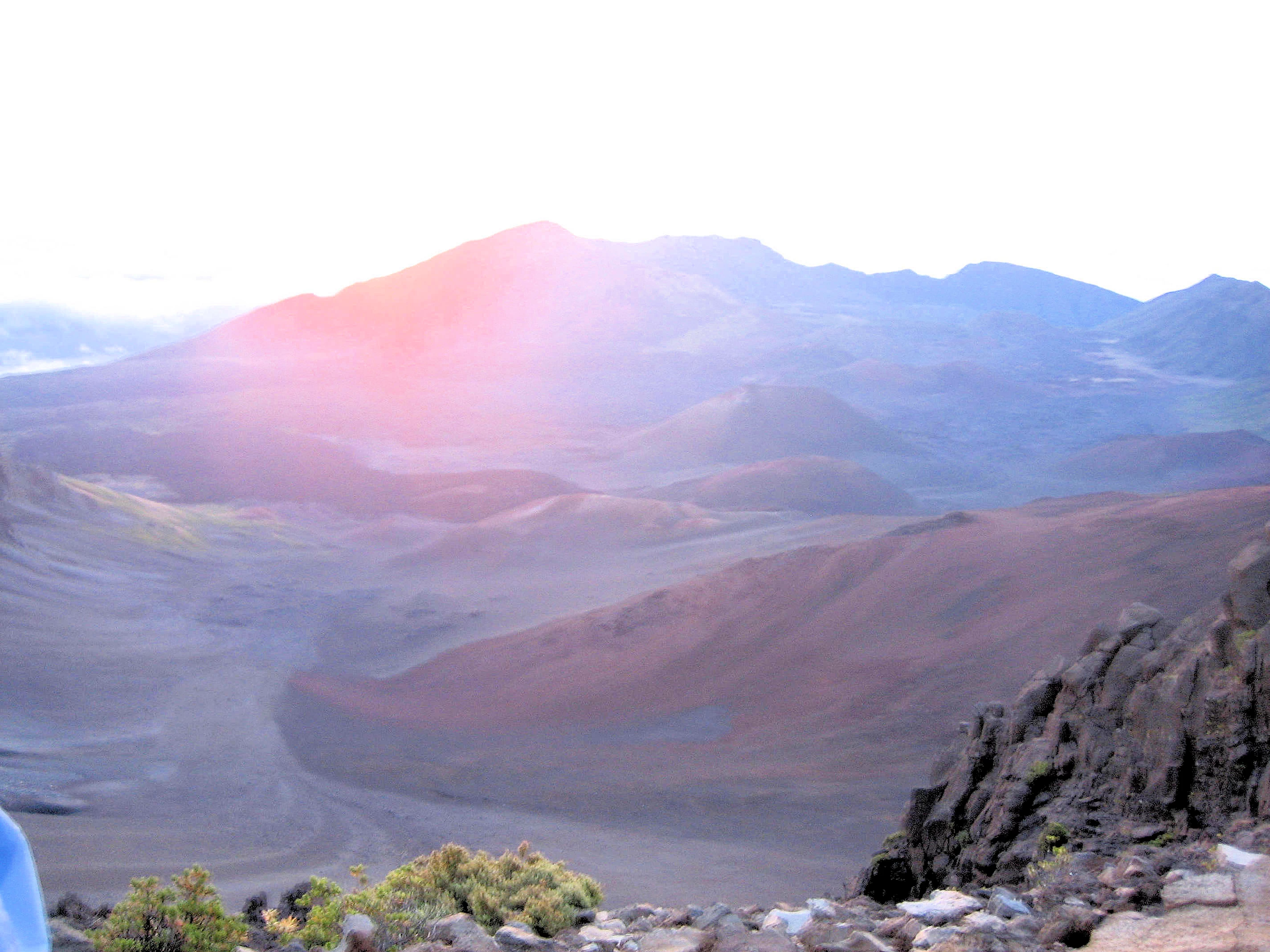
Sliding Sands Trail: The Sliding Sands Trail is a challenging, out-and-back hike located in Haleakalā National Park on Maui, descending from near the summit into the otherworldly, vast volcanic crater with striking red and orange cinder hills and black volcanic sand. The trail offers a unique opportunity to hike through a landscape often described as resembling Mars, with views of volcanic cones and endemic plants like the endangered Silversword. Hikers should be prepared for a strenuous ascent back to the trailhead, which takes considerably longer than the initial descent, and carry ample water, warm layers, and consider hiking poles for the loose terrain.
Lahaina Pali Trail: The Lahaina Pali Trail is a historically significant and strenuous 5-mile (out-and-back) or 10-mile (point-to-point) hike in West Maui, known for its ancient, rocky path, intense elevation gain, and panoramic coastal and island views from the top near the windmills. Hikers should be prepared for hot, sweaty conditions and potential weather changes, as well as rocky footing and a lack of shade along the exposed route. The trail offers a challenging way to see whales during the season, historic interpretive displays, and spectacular scenery from its summit.
Haleakalā Crater Loop: The Haleakalā Crater Loop is an immersive, 11-mile hike at high elevation within Haleakalā National Park, starting from the summit area and descending into the vast, Martian-like landscape of the dormant volcano's crater, where visitors can witness unique volcanic formations and colorful cinder cones before ascending back to the rim. This popular trail, offering incredible views of the crater's immense scale, allows hikers to experience the dramatic scenery up close and is considered a must-do for those who can handle the strenuous, high-altitude trek.
The above is obviously NOT all of the hiking trails on Maui, for a more complete list we would recommend you utilize the All Trails website. They provide excellent trails descriptions, maps, and other useful info.
Trails/closures change—always check official updates day-of; carry water, respect signage, and pack out trash.
Note: All images featured on this page are the exclusive property of Just Traveling Thru, LLC, unless otherwise stated. When images from external sources are used, full credit is given to the original creator, along with a link to the specified license or usage terms. We are committed to respecting copyright and intellectual property rights, ensuring that all third-party images are properly attributed. If you have any questions regarding image ownership or usage rights, please feel free to contact us.
Affiliate Links: We may earn a commission if you make a purchase through one of our affiliate links. This helps support our travel content — thank you!
Content: To review any of our content, make suggestions and/or comments, please click the "About" menu link at the top of this page. You will find our "Contact Us" link on that drop-down menu.

 Click above Image to view larger Google Map
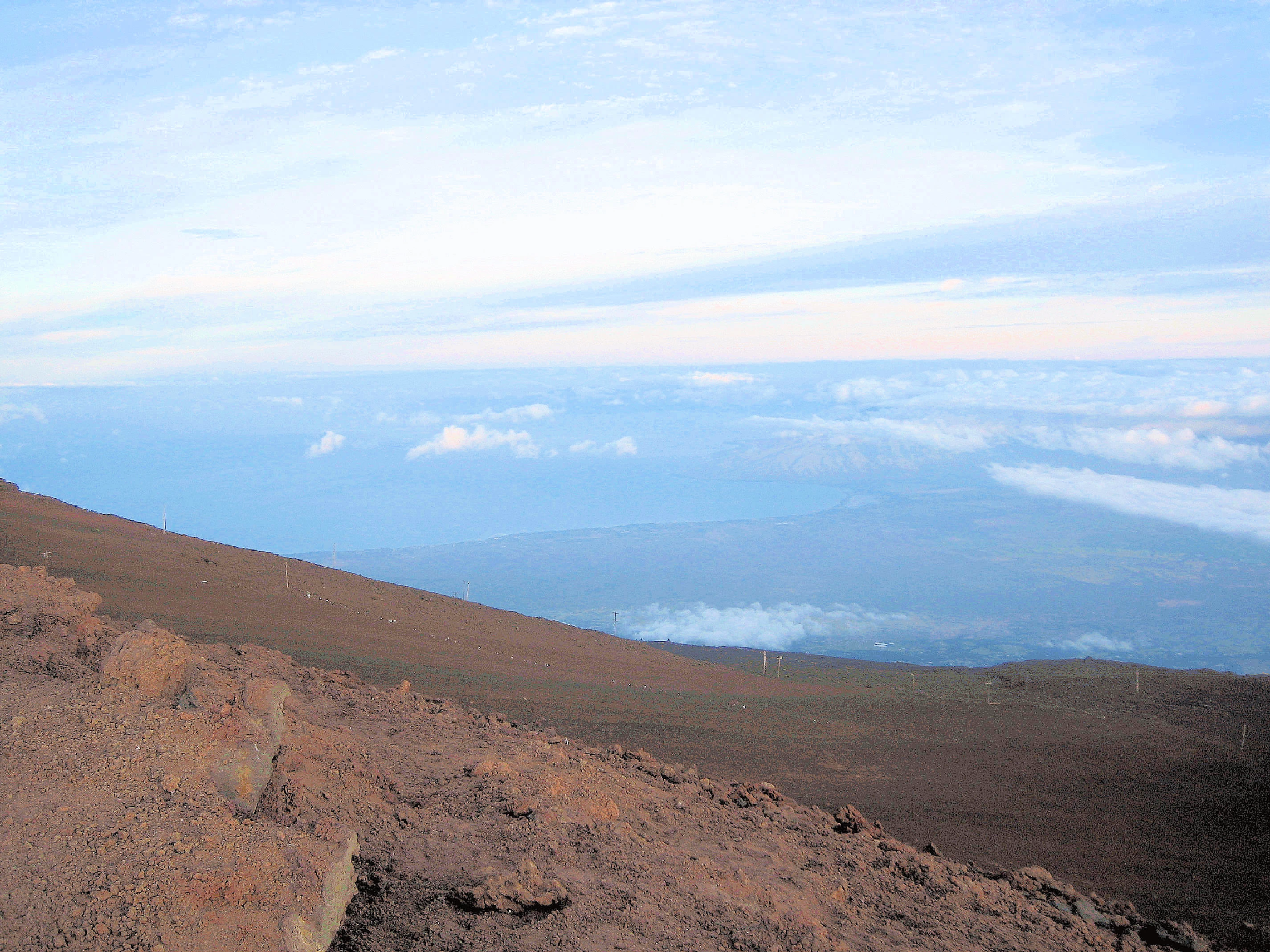