
by Celeste Lipford and Terry Lipford - last updated on 10/1/2025
After an unforgettable stay in Maui, our adventure continued to Hawaii’s Big Island, the largest and most diverse of the Hawaiian Islands. Unlike the other islands we had previously explored, this was our first visit to the Big Island, and we were excited to see what this unique destination had to offer. With plans to divide our time between Hilo on the east coast and Kona on the west, we were confident that our itinerary would give us a well-rounded experience of the island’s incredible natural beauty, culture, and history.
Armed with a solid game plan, all of our reservations in order, and a growing sense of anticipation, we set out to explore both the lush, tropical rainforests of Hilo and the sun-drenched, volcanic landscapes of Kona. We thought we were prepared for anything. But we quickly discovered that Mother Nature had a different plan for us, and it came in the form of a Kona Low weather system.
If you’ve never heard of a Kona Low, you’re not alone. We hadn’t either — until we experienced it firsthand. The Kona Low is a seasonal weather phenomenon that can have a major impact on the Big Island's weather, particularly on the windward (east) side.
A Kona Low is a low-pressure system that typically develops off the coast of Hawaii during the winter months. Unlike the typical trade winds that bring dry, stable weather to the islands, the Kona Low brings in moist air from the south and causes heavy rainfall, strong winds, high surf, and occasionally thunderstorms. The system is unpredictable and can last for several days, causing flooding in low-lying areas and hazardous driving conditions.
Had we been more familiar with the Kona Low phenomenon, we probably would have reconsidered the amount of time we planned to spend in Hilo. As we arrived on the windward side of the island, the weather quickly took a turn. What started as light, misty rain turned into relentless downpours that lasted for days, accompanied by gusty winds and occasional thunder.
Despite the challenges posed by the Kona Low, we still found moments of beauty and tranquility in Hilo. The lush greenery, majestic waterfalls, and serene coastline were breathtaking, even in the rain. We quickly learned that rain is part of the experience in Hilo, and it’s one of the reasons why the area is so incredibly fertile and verdant.
Our time on the Big Island taught us a valuable lesson about Hawaiian weather patterns. If you’re planning a trip to the Big Island, especially during the winter months, it’s important to be aware of the Kona Low phenomenon and plan accordingly.

NOTE: This video is the property of Just Traveling Thru, LLC.
If you enjoy our videos click here to subscribe to our Youtube Channel.
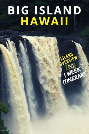
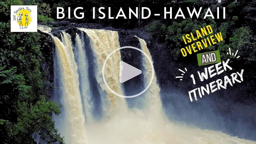
Click the above video poster image to watch our video overview of the Big Island and a suggested 1 week Itinerary. The Big Island is appropriately named because it is the biggest in the Hawaii Islands, as well as it is the biggest island in the United States. There is a lot of ground to cover from the beautiful shore along the Kohala coast to Kona, to the waterfalls of Hilo, Volcanoes National Park to visit an active Hawaii volcano, and if you like coffee the Big Island is the place to be with over 650 coffee farms. Watch our video for some of the top things to do.
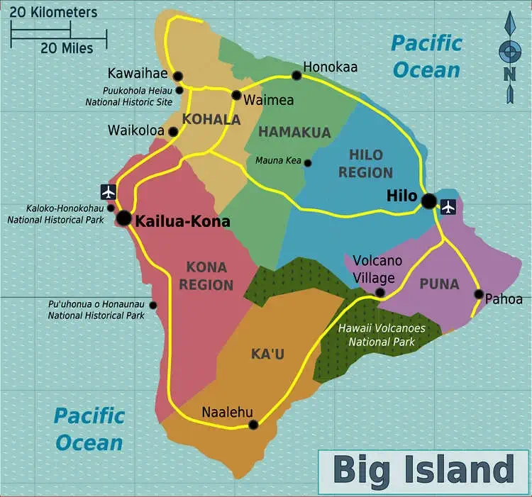
IMAGE CREDIT: This image is the property of PerryPlanet via Wikimedia Commons and the CC0 1.0 license.
Here is a suggested one week itinerary, but first a few things we learned that we thought you might find useful:
or if Mauna Kea is not your thing…
Drive home, unpack, etc, etc, etc.....
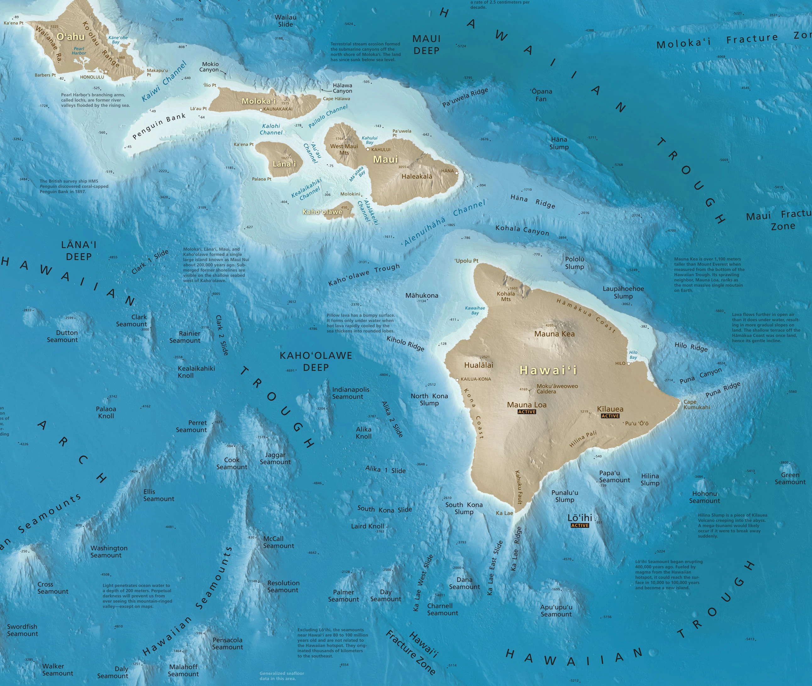 Image is the property of "Shaded Relief" and is licensed as a Public Domain image
The Pacific Ocean depths near the Big Island of Hawaii are among the deepest in the world, with depths reaching over 6,000 meters. The ocean floor in this region is characterized by steep, rocky slopes and canyons that are home to a diverse range of marine life, including deep-sea corals, sponges, and other organisms.
Min & Max Depths near the Big Island
The "Big Island" is officially known as the island of Hawaiʻi and received this nickname for a good reason: it is the largest island in the United States with a total surface of 4,029 square miles (10,433 square kilometers)! Its surface area is also greater than that of all other Hawaiian islands combined.
Click on any location below, to jump to that part of this page.
 Kona International Airport Big Island
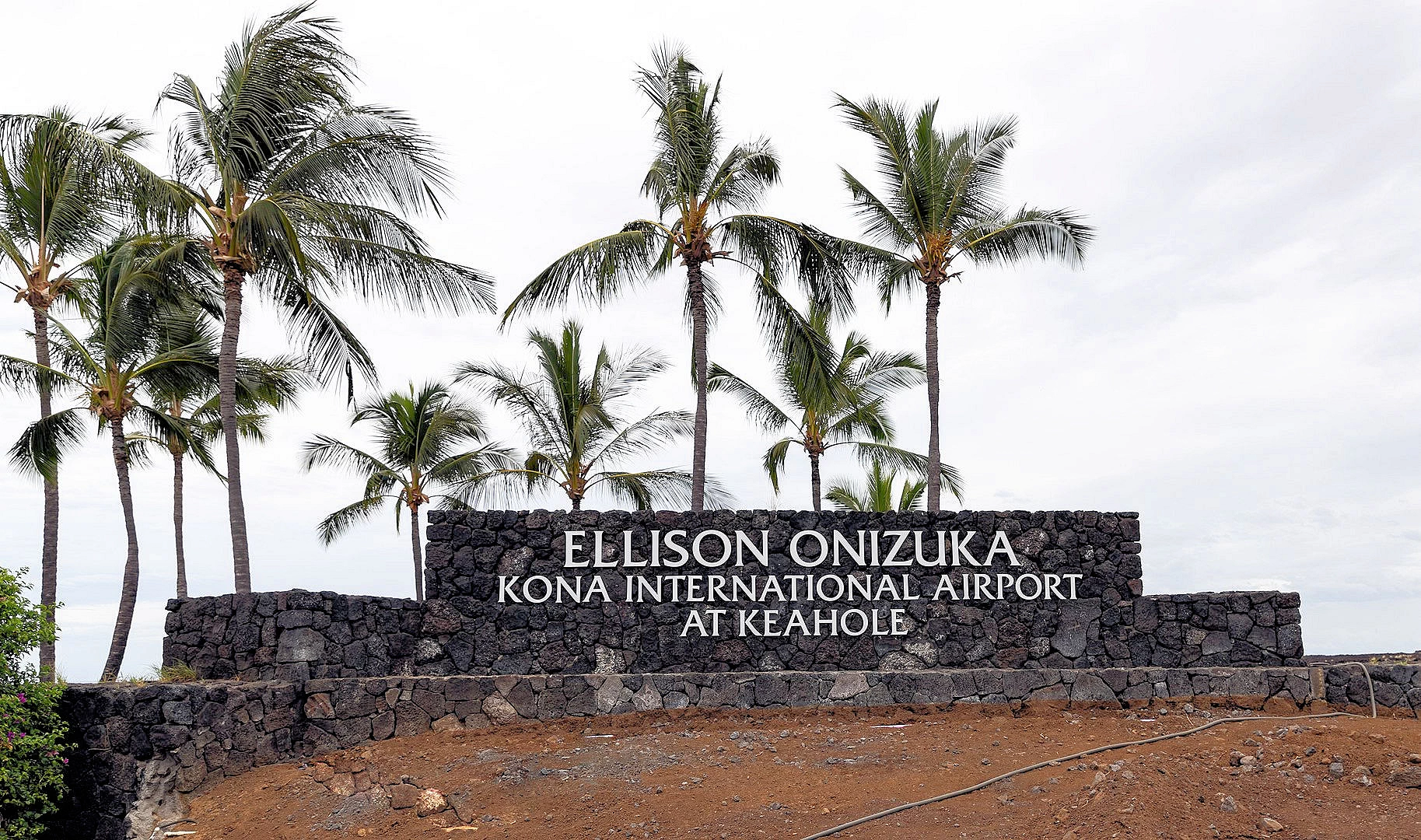
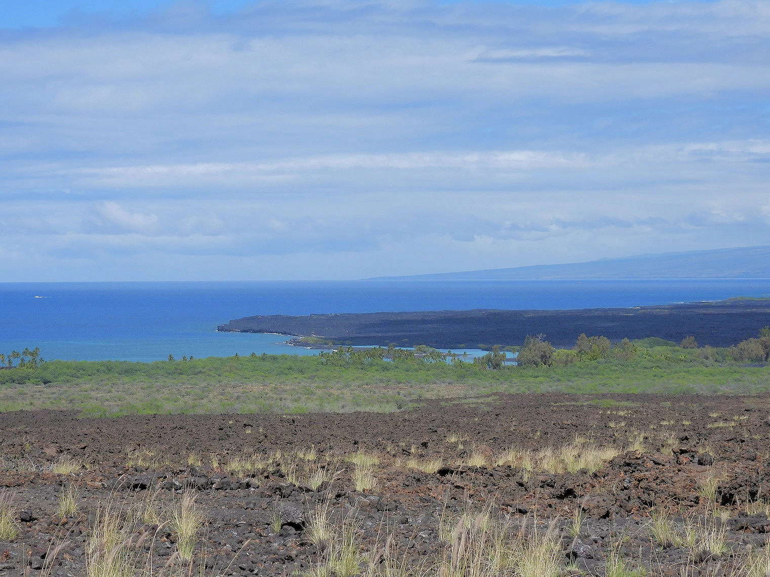
We do not normally describe, or talk about, airports in our Travel Blog. However, Kona is unique in that as you land here and notice all the blackened ground in and around the airport, you realize that the blackened ground is the result of lava flows. Much of the runway is built on lava flow from the 1801 Huʻehuʻe flow from the Hualālai volcano. This flow extended the shoreline out an estimated 1 mi (1.6 km), adding some 1.5 sq miles of land to the Big Island and creating Keāhole Point. The airport opened on July 1, 1970, with a single 6,500-foot runway; the previous smaller airstrip was converted into the Old Kona Airport State Recreation Area.
The airport is also uniquely named after an Astronaut; The airport is named in honor of Ellison Onizuka, a Hawaiian-born astronaut who perished in the Challenger Space Shuttle disaster in 1986. This adds cultural and historical significance to the airport for locals and visitors alike.
Even after we picked up our rental car and proceeded north on Hawaii route 19, there were a number of blackened areas that we could see. It was only after we reached the eastern swing of route 19, that the blackened areas were no longer visible. Click here for a map of our driving route to Hilo from the Kona Airport.
More Info for the Kona International Airport
 Hapuna Beach
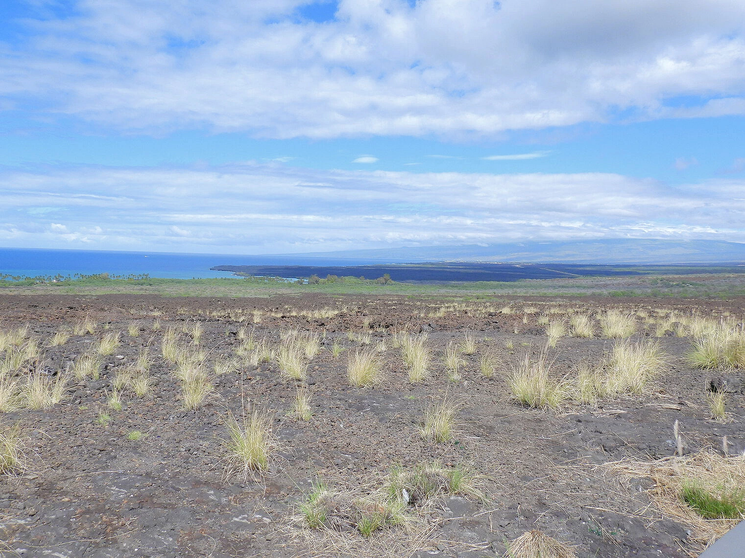 Saddle Road Region
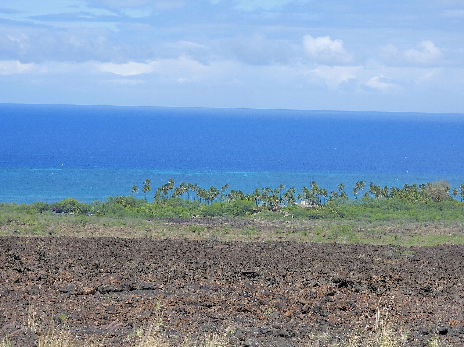 Waikui
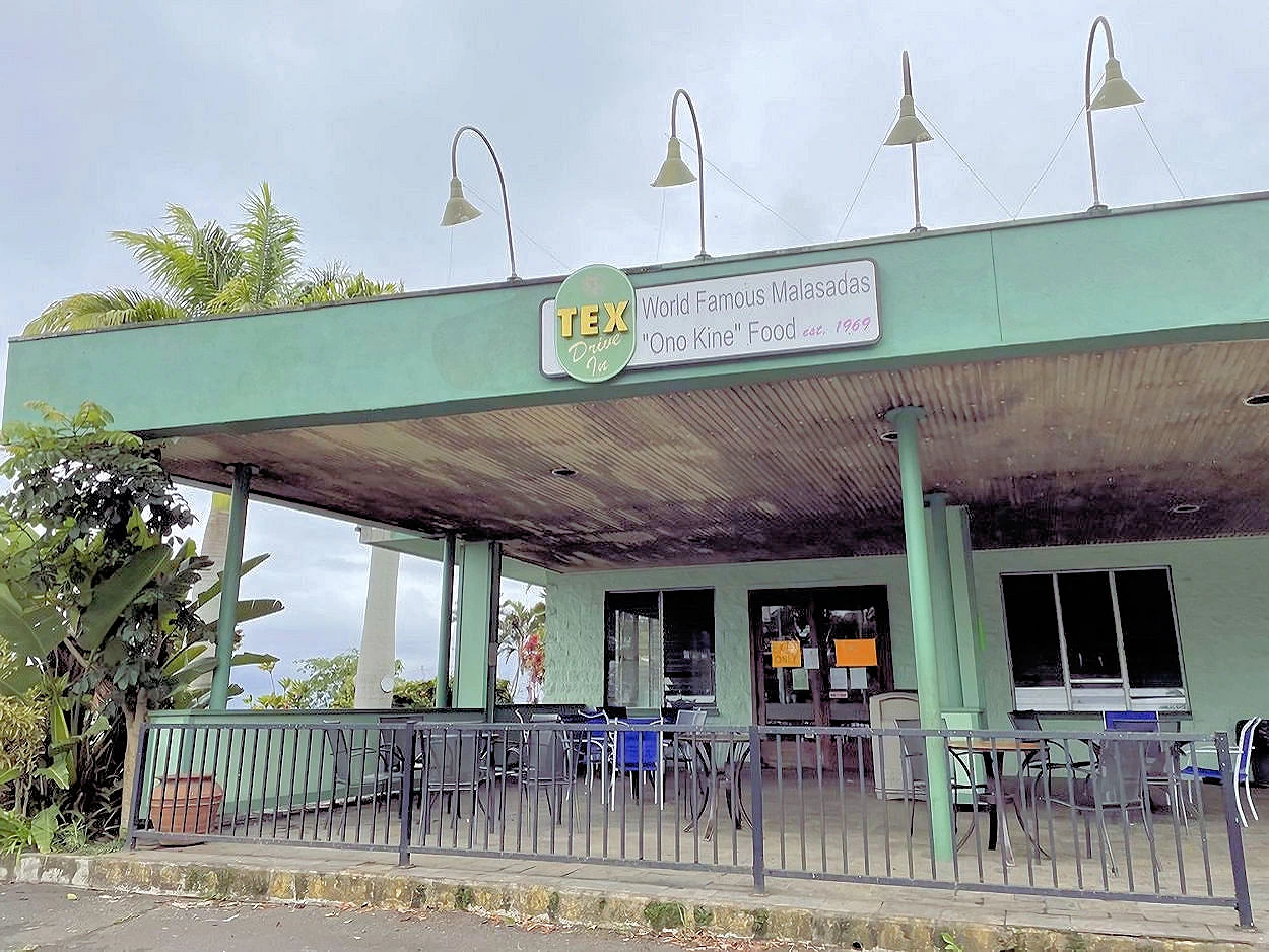 Tex Drive-in
Even though we flew into the Kona Airport, we decided to drive around the northern coast of the Big Island Click here for a map of our route from the Kona Airport to Hilo. because we had never been here and we wanted to see everything we could. Besides which, there was a Portuguese Bakery in Honokaa that we wanted to stop at! The drive is interesting because as you proceed north you depart the "high desert" like environment of the leeward side and you enter the rain forest appearance of the windward side of the island. Little did we know yet, that a Kona Low was going to bring occasional torrential rains to the eastern side of the island! A "Kona Low" describes a switch in the prevailing wind direction over the islands. Typically, Hawaii's weather is dominated by the trade winds which blow from the northeast - however the Kona Low causes moisture rich air to go to places that it does not normally go to and precipitation increases are the end result.
The eastern side (AKA windward side) of the Big Island is covered in green, lush, tropical rainforest. This is made possible by the large amount of rain that falls there, averaging around 140 inches of rain per year! This area is home to many of the Islands' waterfalls, and has interesting terrain, shaped by the rains and winds. Banyan and Bamboo trees are common, and grow to considerable size.
Click here to see where we went in Honokaa and to see an image of the great malasadas there..
Background Info from Wikipedia
Hawaii is the largest island in the United States, located in the state of Hawaii. It is the southeasternmost of the Hawaiian Islands, a chain of volcanic islands in the North Pacific Ocean. With an area of 4,028 square miles (10,430 km2), it has 63% of the Hawaiian archipelago's combined landmass. However, it has only 13% of Hawaiʻi's population. The island of Hawaiʻi is the third largest island in Polynesia, behind the two main islands of New Zealand.
NOTE: The Big Island is the largest Island in the United States.
More Info for the North Side/Honokaa
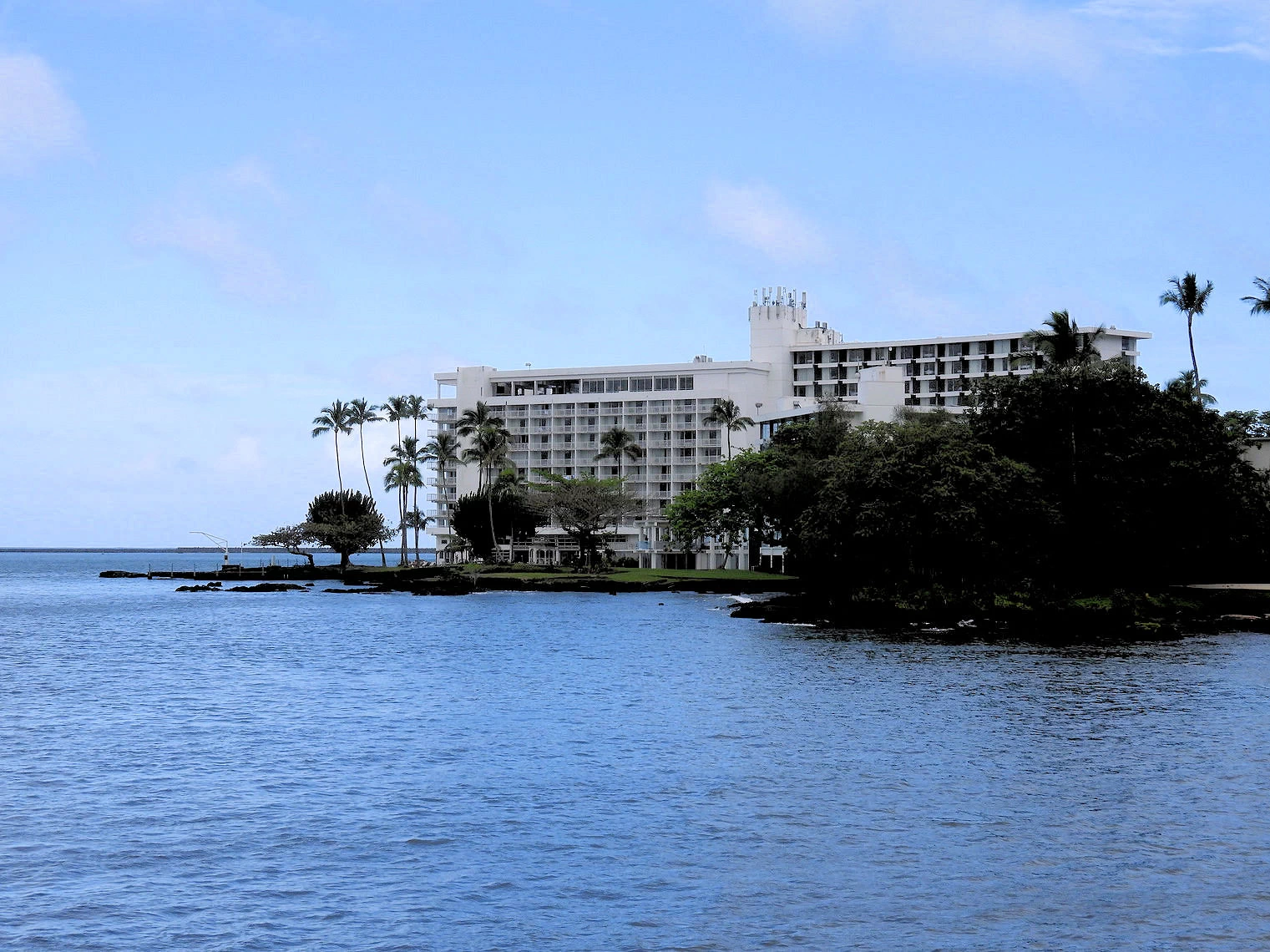
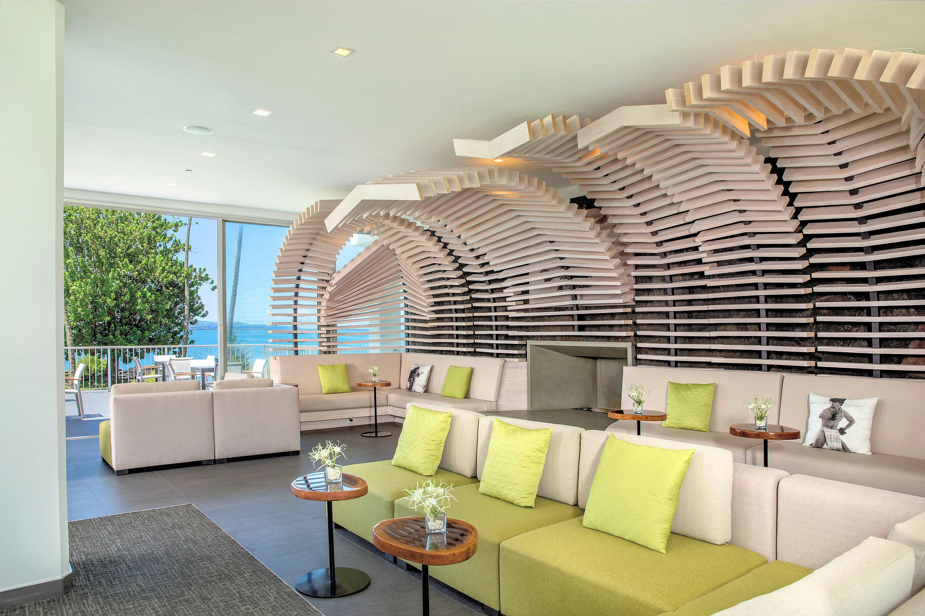
This was our hotel while we were in Hilo for 4 nights, good location as regards beautiful bay views, restaurants, etc - but - the weather was frequently intense rain showers. We had brought good rain gear with us, so we decided that we would just deal with the rain and not let it disrupt our explorations. The weather pattern known as the "Kona Low" was the cause of all the increased rainfall, and given that Hilo is already known as the "fourth wettest city in the USA" (averaging 126.72 inches yearly), residents & tourists alike were utilizing rain gear of all types to deal with the heavy rain.
More Info for the Grand Naniloa Hotel Hilo
 Liliʻuokalani Park
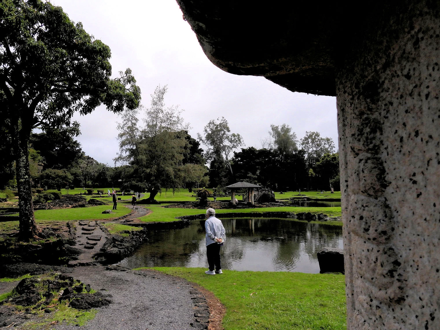 Liliʻuokalani Park Koi Pond
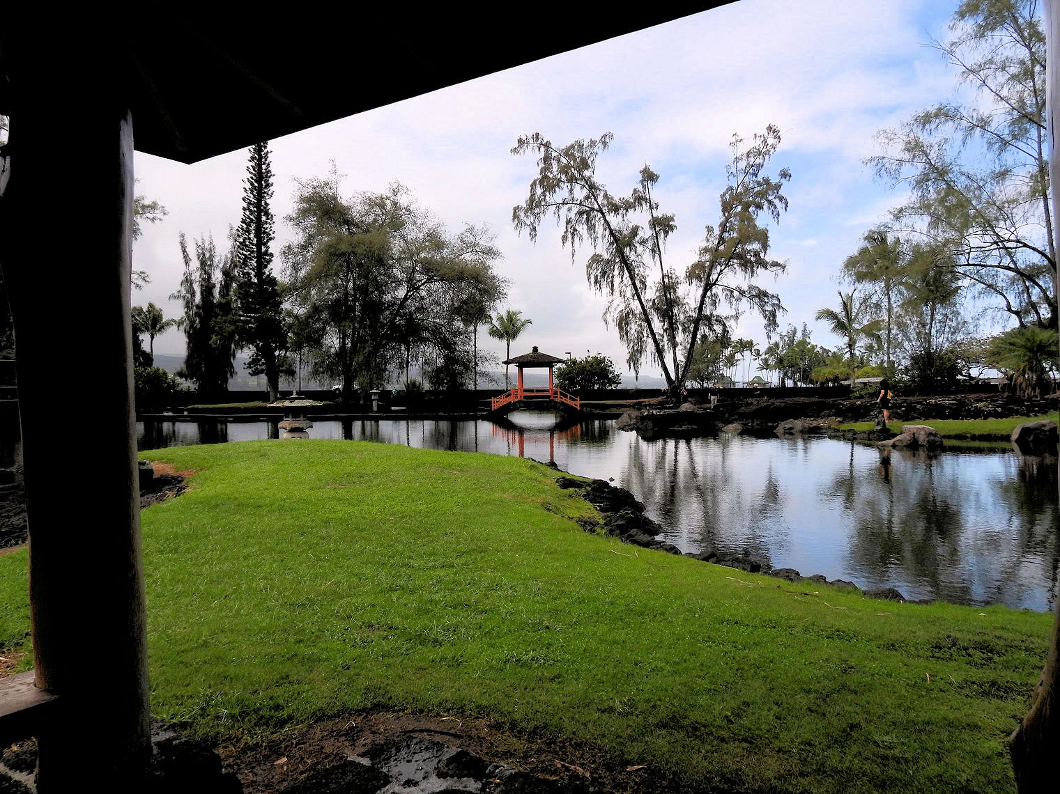 Liliʻuokalani Park Koi Pond
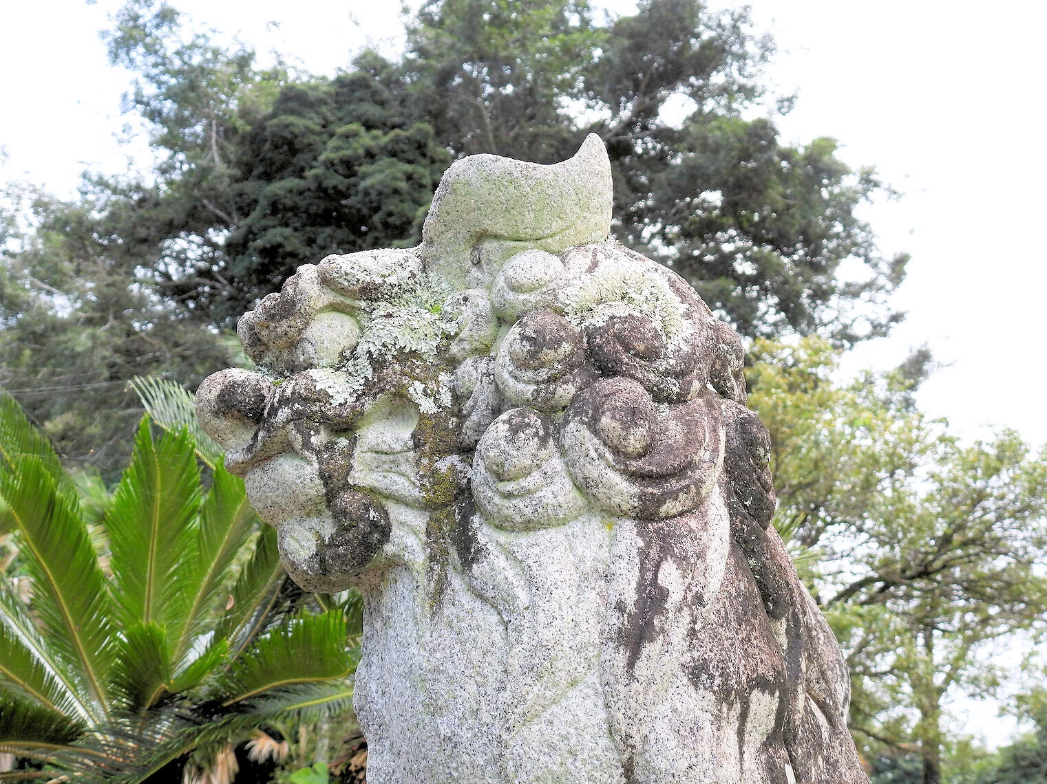 Liliʻuokalani Park
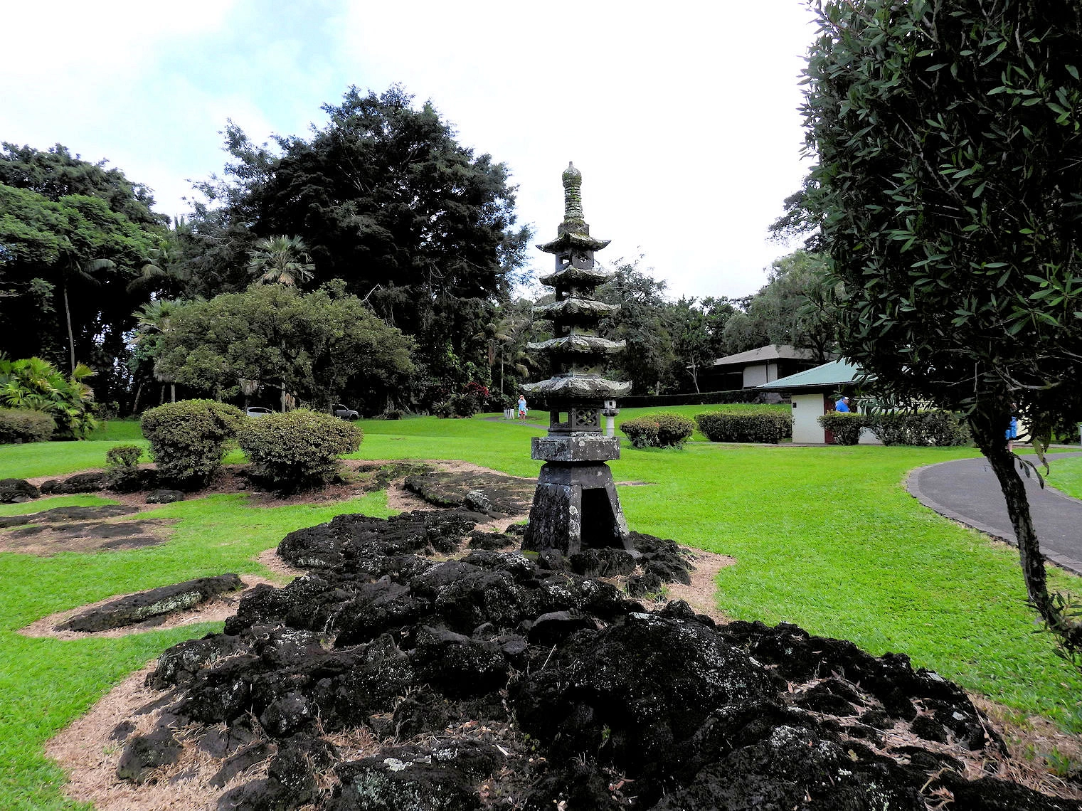
Liliʻuokalani Park and Gardens is a stunning 24.14-acre public park renowned for its authentic Japanese-style landscaping and peaceful atmosphere. Located along Banyan Drive and adjacent to the Grand Naniloa Hotel, the park is one of Hilo's most beloved landmarks. It sits on the Waiakea Peninsula, offering scenic views of Hilo Bay and a peaceful retreat from the hustle and bustle of daily life.
The park was donated by Queen Liliʻuokalani, the last reigning monarch of Hawaii, as a symbol of friendship and cultural exchange between Hawaii and Japan. It remains the largest Edo-style Japanese garden outside of Japan, making it a significant cultural and historical site in the islands.
The gardens are meticulously maintained, featuring lush tropical vegetation, meandering pathways, and ornamental ponds filled with koi fish. Traditional Japanese stone lanterns (tōrō) and pagoda sculptures are carefully placed throughout the park, adding an authentic Japanese aesthetic to the serene landscape.
Visitors can explore arching red bridges (taiko-bashi) that cross over tranquil ponds, offering picturesque photo opportunities and a chance to immerse themselves in the natural beauty. The bridges and ponds are surrounded by bamboo groves, cherry blossom trees, and bonsai-style hedges, all of which contribute to the park's tranquil atmosphere.
The park also features gazebos and shaded pavilions, ideal spots to relax, reflect, and enjoy a peaceful picnic. Several benches are thoughtfully placed along the pathways, allowing visitors to sit and admire the serene views of Hilo Bay and the snow-capped peaks of Mauna Kea in the distance.
More Info for the Liliʻuokalani Park and Gardens
 Carlsmith Beach Park
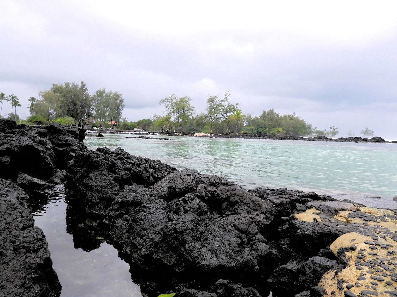 Carlsmith Beach Park
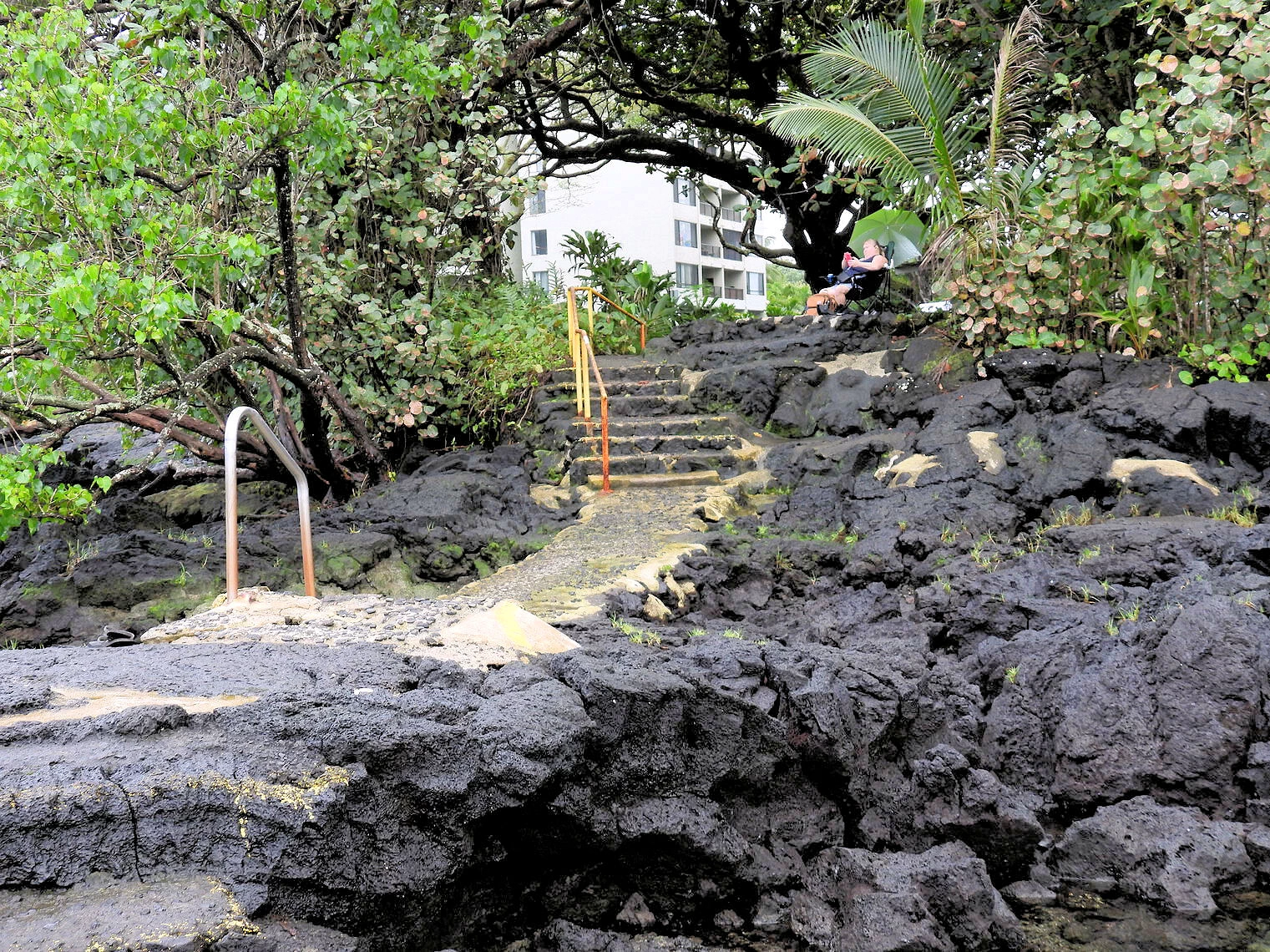 Carlsmith Beach Park
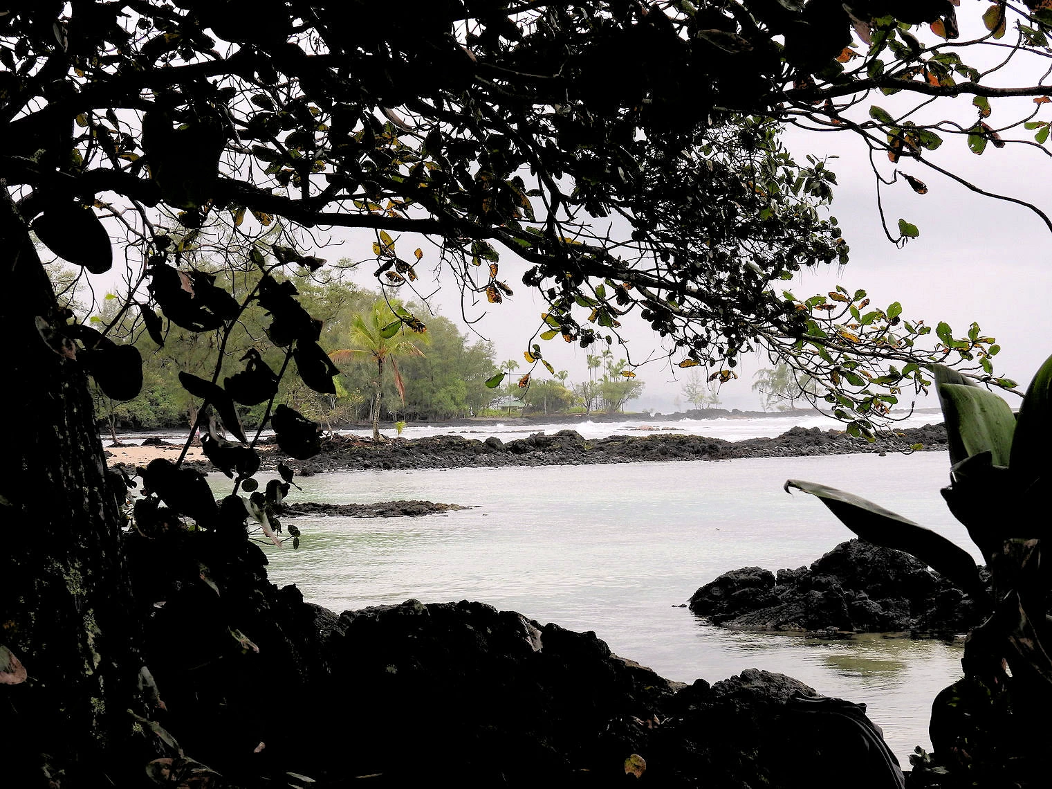 Carlsmith Beach Park
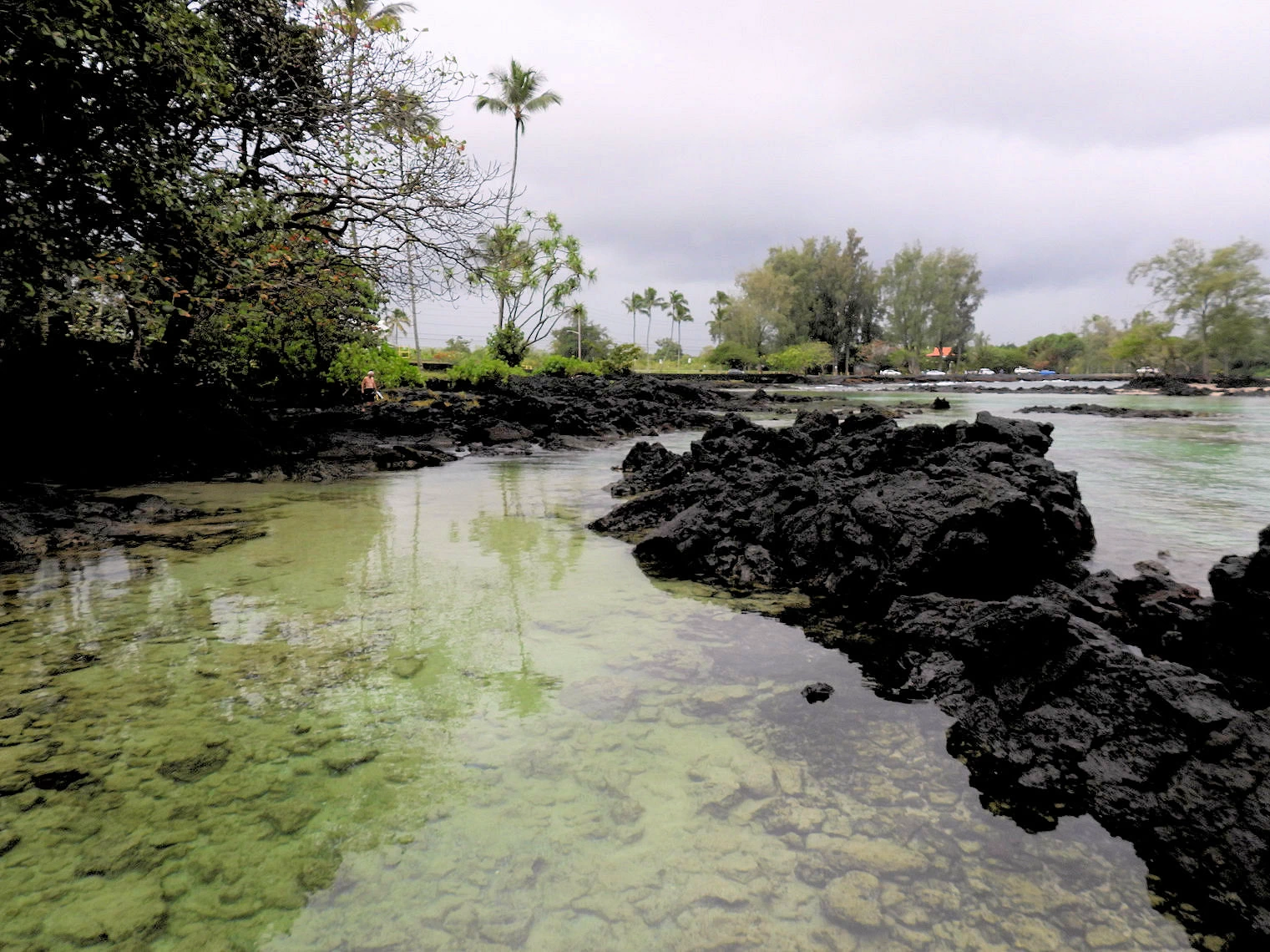
We had heard that Carlsmith Beach Park, a beloved local spot in Hilo, is a frequent hangout for Hawaiian green sea turtles (honu). Naturally, we were excited at the prospect of seeing these graceful creatures up close. Unfortunately, it seemed the turtles didn’t get the memo about our visit! Despite the absence of our shelled friends, we discovered something equally captivating — the stunning lagoons and natural pools that make this beach park such a unique destination.
One of the main attractions at Carlsmith Beach Park is the series of natural pools formed by ancient lava rock formations, often referred to as "Queen's Bath." These calm, brackish pools are fed by both fresh water and ocean tides, creating a refreshing mix of warm and cool waters. The protected lagoons make the area perfect for swimming, snorkeling, and wading, offering visitors a safe and serene spot to enjoy the water without battling rough ocean waves.
The pools are relatively shallow, and the smooth, sandy ocean bottom is a pleasant surprise in a region largely characterized by jagged lava rocks. The lava rock formations not only create the pools but also act as natural barriers, keeping the water calm and making it an ideal spot for families with children.
For those interested in snorkeling, Carlsmith Beach Park offers crystal-clear waters teeming with marine life. The protected pools provide a safe environment for beginners, and the calm waters make it easy to spot colorful fish, sea urchins, and even octopus if you're lucky. While the turtles eluded us that day, locals assured us that honu sightings are quite common, especially during the mid-morning hours when the turtles come in to feed on the seaweed-covered rocks.
The park's expansive lawn area, shaded by swaying palm trees, offers a peaceful setting for picnics and sunbathing. It's also a fantastic spot to witness the breathtaking sunrise over the Pacific Ocean.
More Info for Carlsmith Beach Park
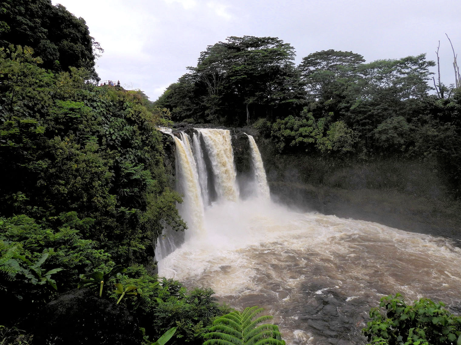
 Akaka Falls
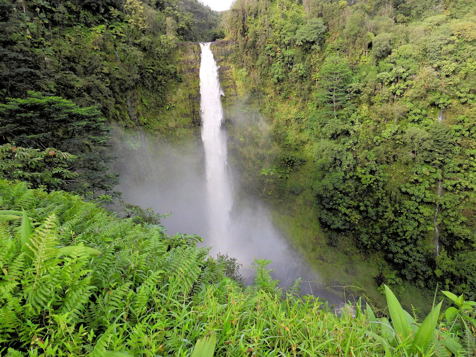 Akaka Falls
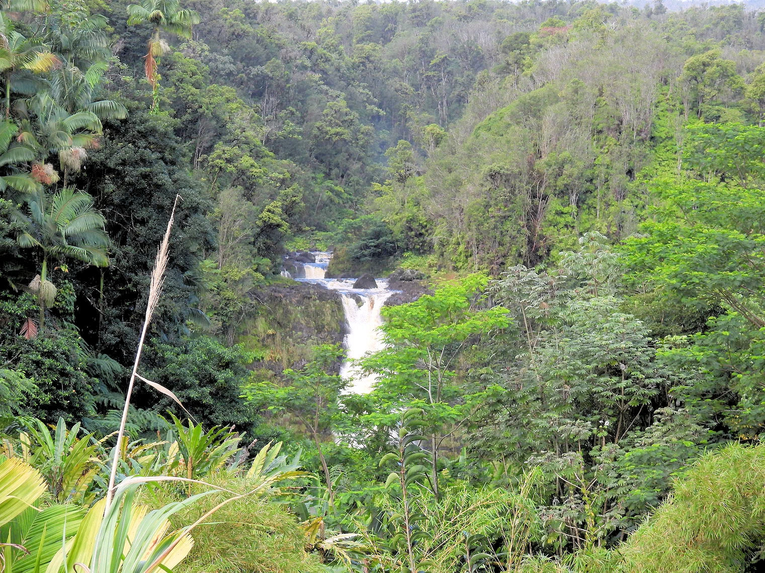 Kahuna Falls
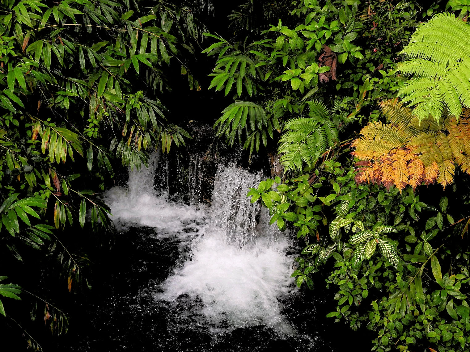 Kahuna Falls
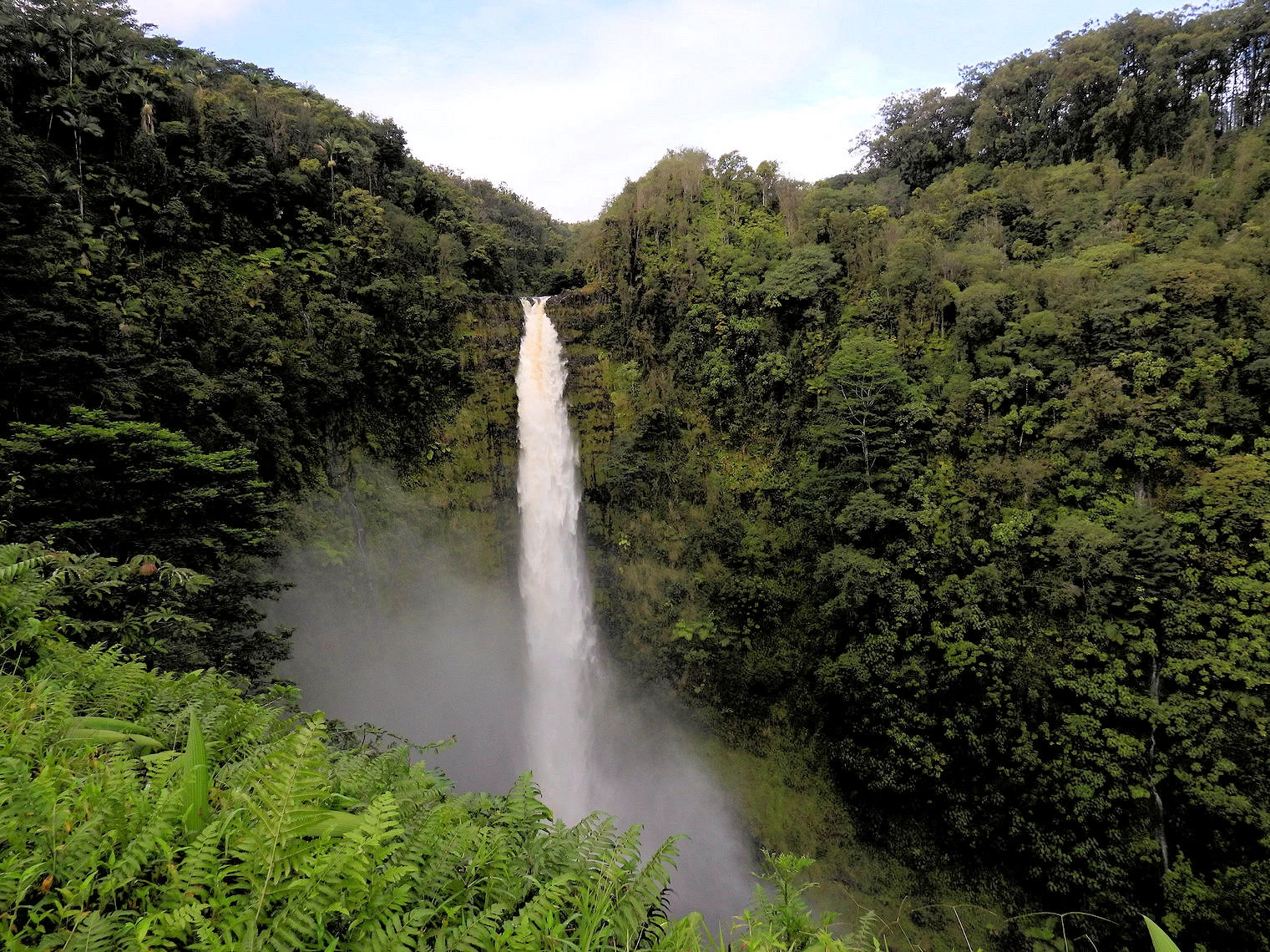
Akaka Falls State Park
Located 16.6 miles from our hotel, there are actually two waterfalls; Akaka Falls (442 feet high) and Kahuna Falls (100 feet). The walkway is paved for the entire route around the grounds (.4 mile) and there are roughly 200+ steps, so the trail is not wheelchair accessible. The parking lot is not large, and you should arrive here early in the day to avoid the tour buses that will start arriving after 10am.
As you walk along the walkway, you’ll first come across the smaller Kahūnā Falls, which cascades down 100 feet. Continuing on, the trail leads to the majestic ʻAkaka Falls, which plunges 442 feet into a deep gorge below. The sight of ʻAkaka Falls, set against the backdrop of dense tropical foliage, is truly breathtaking and offers excellent photo opportunities. The sound of the waterfall and the surrounding birdsong enhances the tranquil, natural atmosphere.
The park also offers interpretive signs along the trail, providing information about the local flora and fauna, including details about native Hawaiian plants. The easy hike is suitable for all ages, making it an ideal destination for families and nature lovers alike.
The hike through the jungle to see the two waterfalls is not strenuous, and the views are constantly changing as you walk along.
More Info for Akaka Falls State Park
 Rainbow Falls
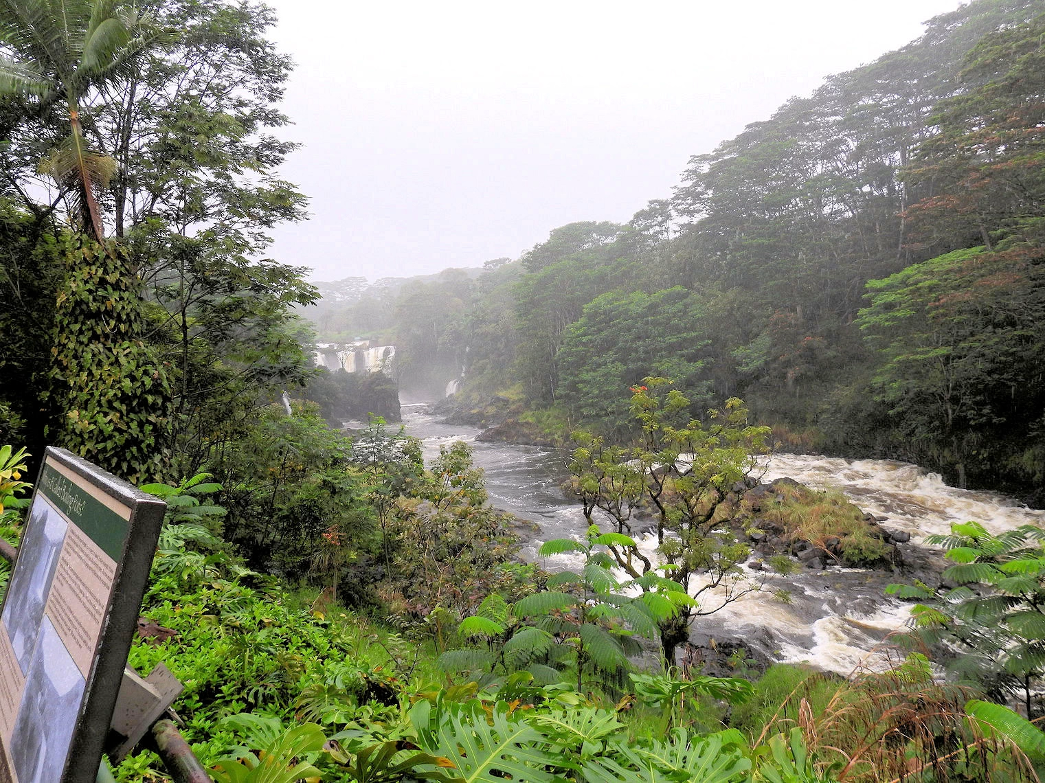 Rainbow Falls
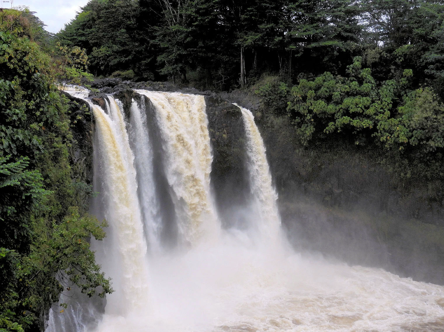 Boiling Pots
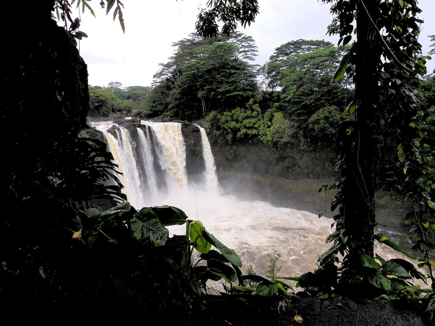 Rainbow Falls
Wailuku River State Park - Rainbow Falls and Boiling Pots
Within the 18 mile-long Wailuku River, near downtown Hilo, one can find the Rainbow Falls - 80 feet tall and almost 100 feet in diameter. Rainbow Falls got its name from the fact that on sunny mornings around 10am, rainbows can be seen in the mist thrown up by the waterfall.
According to the United States Geological Survey, the river was formed by at least two lava flows coming from Mauna Kea, the oldest being as old as 10,500 years old, which is the same flow that formed Rainbow Falls. The “Boiling Pots of Wailuku” article by Katie Yamanaka states that the Boiling Pots get their name due to the sensation that happens when it storms, making the river rise and creating the “Boiling” look within the pots.
The Boiling Pots area are located approximately 1.7 miles west of Rainbow Falls accessible via Waianuenue Avenue.
More Info for the Wailuku River
Akaka Falls State ParkRichardson Ocean Park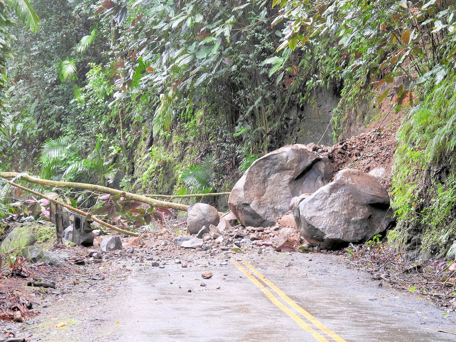 Richardson Ocean Park
We were able to cover quite a bit of ground during our stay in Hilo, as far north as Akaka Falls State Park, Rainbow Falls & Boiling Pots, as well as downtown Hilo. Carl Smith Beach Park to the east of Hilo, as well as Richardson Ocean Park. Point being, there is quite a bit to see and do here. If the weather had cooperated, we had plans to do even more but that will have to wait for another trip here.
As you can in the above images, we narrowly avoided getting caught in a rain induced rock slide that closed the highway we were taking down to the beach near the Hawai‘i Tropical Bioreserve & Garden (Old Mamalahoa Highway, Papaikou). Needless to say, we had to turn around and go back up to the highway! The size of those boulders made it clear that it was going to take some effort to clear the road.
We had plans to visit the Waipio Valley area, but discovered that Hawaii had stopped allowing private vehicles to traverse the only road in that valley. Waipio Valley Road is open to locals who live or work there, or if you are in a tour bus - but otherwise you are precluded from driving on that road. We might have taken the tour bus, but with the weather being so erratic, we decided to skip it.
Background Info from Wikipedia
Hilo is a census-designated place (CDP) and the largest settlement in Hawaii County, Hawaii, United States, which encompasses the Island of Hawaiʻi. The population was 44,186 according to the 2020 census. It is the fourth-largest settlement in the state of Hawaii and largest settlement in the state outside of Oahu.
The above info came from Hilo Wikipedia Article.
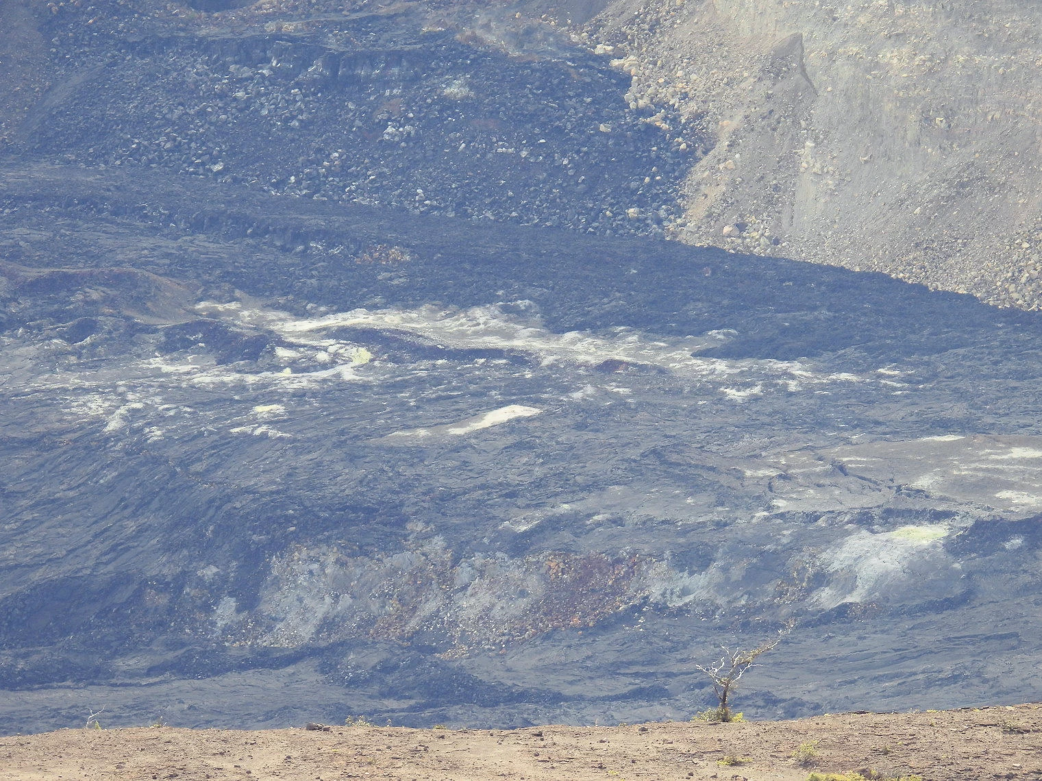
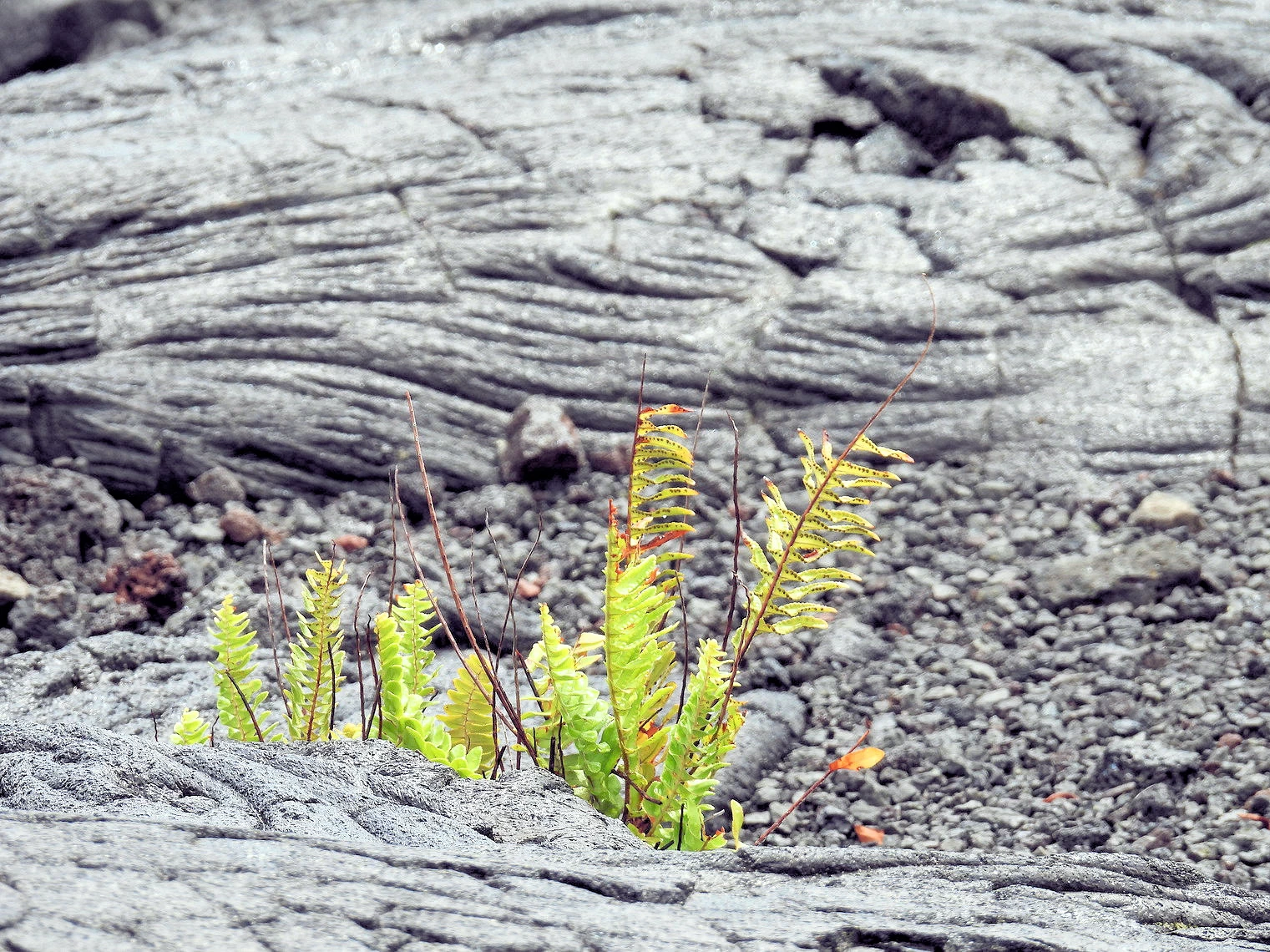
Since we were going to be driving from Hilo to Kailua-Kona anyway, and since the park is sort of "on the way" and as we have never been that close to a volcano, it was an easy decision to make to go to the park. Wow, we toured about amazed at the Kīlauea caldera. If you go there, be sure to stop at the Visitor Center as they have maps and a great deal of good information for your visit.
Click here to go to our Volcanoes National Park Page
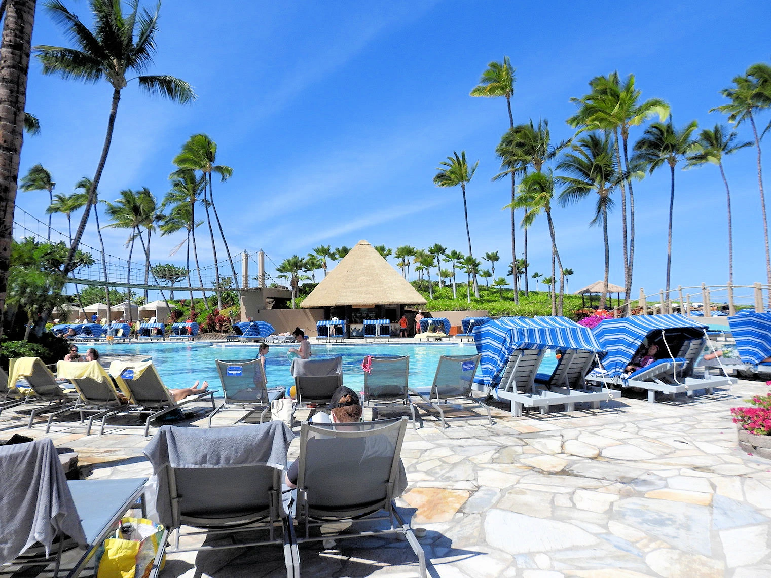 Hilton Waikoloa Village
This was a day trip we made from Hilo, just to get out of the constant rainfall! This 62 acre oceanfront resort offers a taste of the island life, poolside relaxation, a really nice Dolphins lagoon, multiple pools, beaches/lagoons and even a Disney style tram to move people about the facility.
There are tennis courts, a fitness room with fitness classes, and a running track. They also offer all sorts of water sports including paddle boarding and kayaking in the 4 acre saltwater lagoon. There are also three swimming pools, including one with a spectacular 175 foot water slide and a waterfall, and one that is an adults only pool. There are two championship golf courses available at the resort; You can play a round at either the Waikoloa Beach Resort’s oceanfront Beach Course or the King’s Course on the sunny Kohala Coast.
Hilton offers a "Day Pass" (good for 10am to 5pm) which allows you full access to all of their amenities. If you make a minimum $50 food and beverage purchase, they will also validate your parking ticket as well. It isn't cheap, but given that Hilo was going through torrential rains, it felt great to kick back and enjoy a sunny day, watch the Dolphins play, and explore.
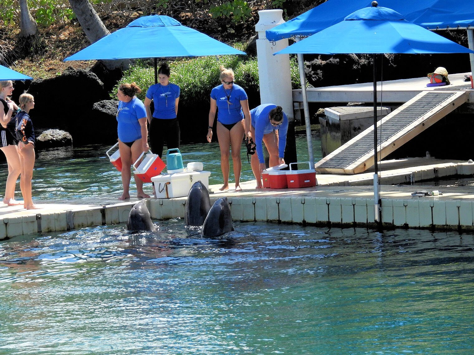 Dolphin SHow
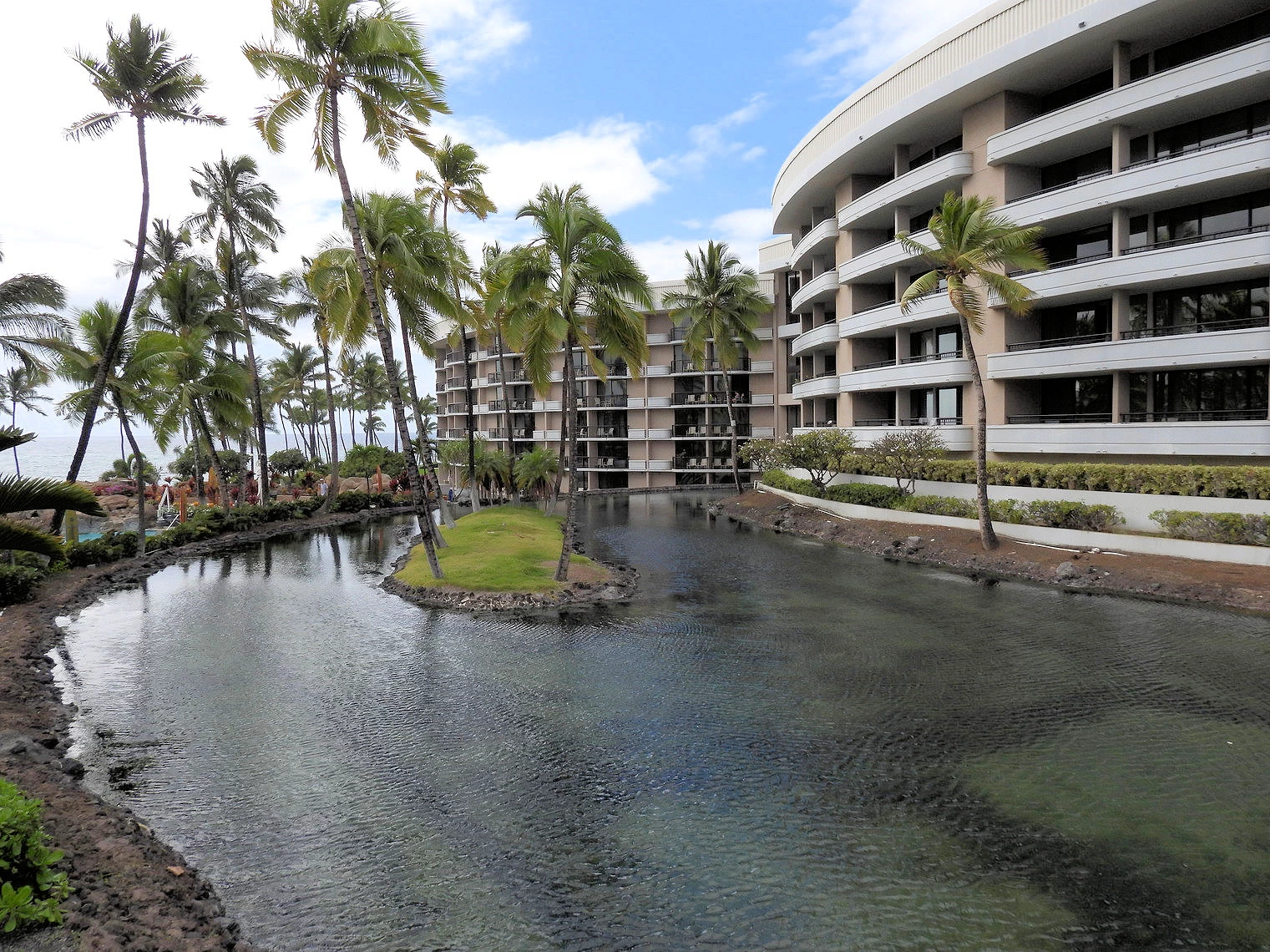 Hotel Canal
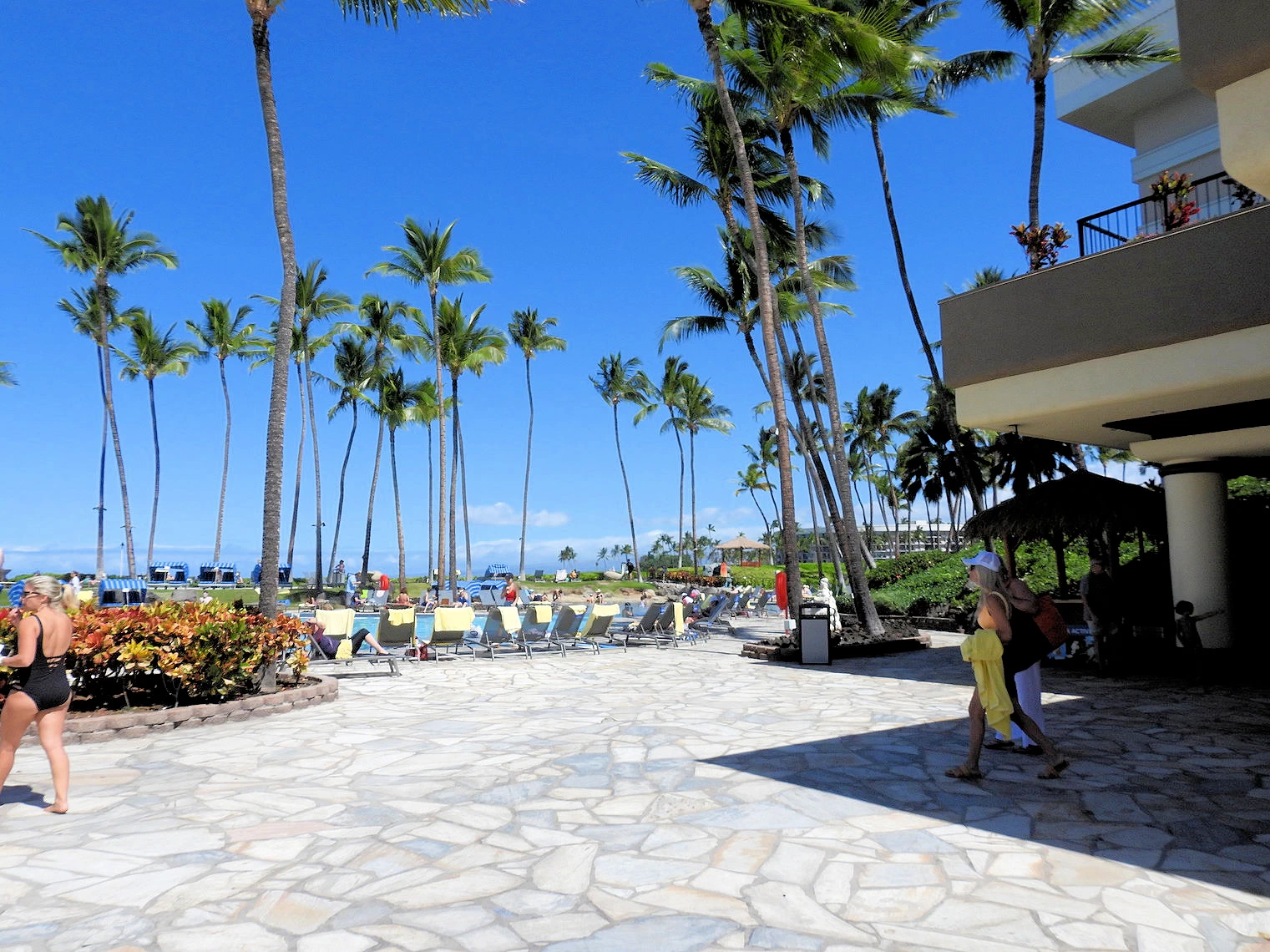 Pool Area
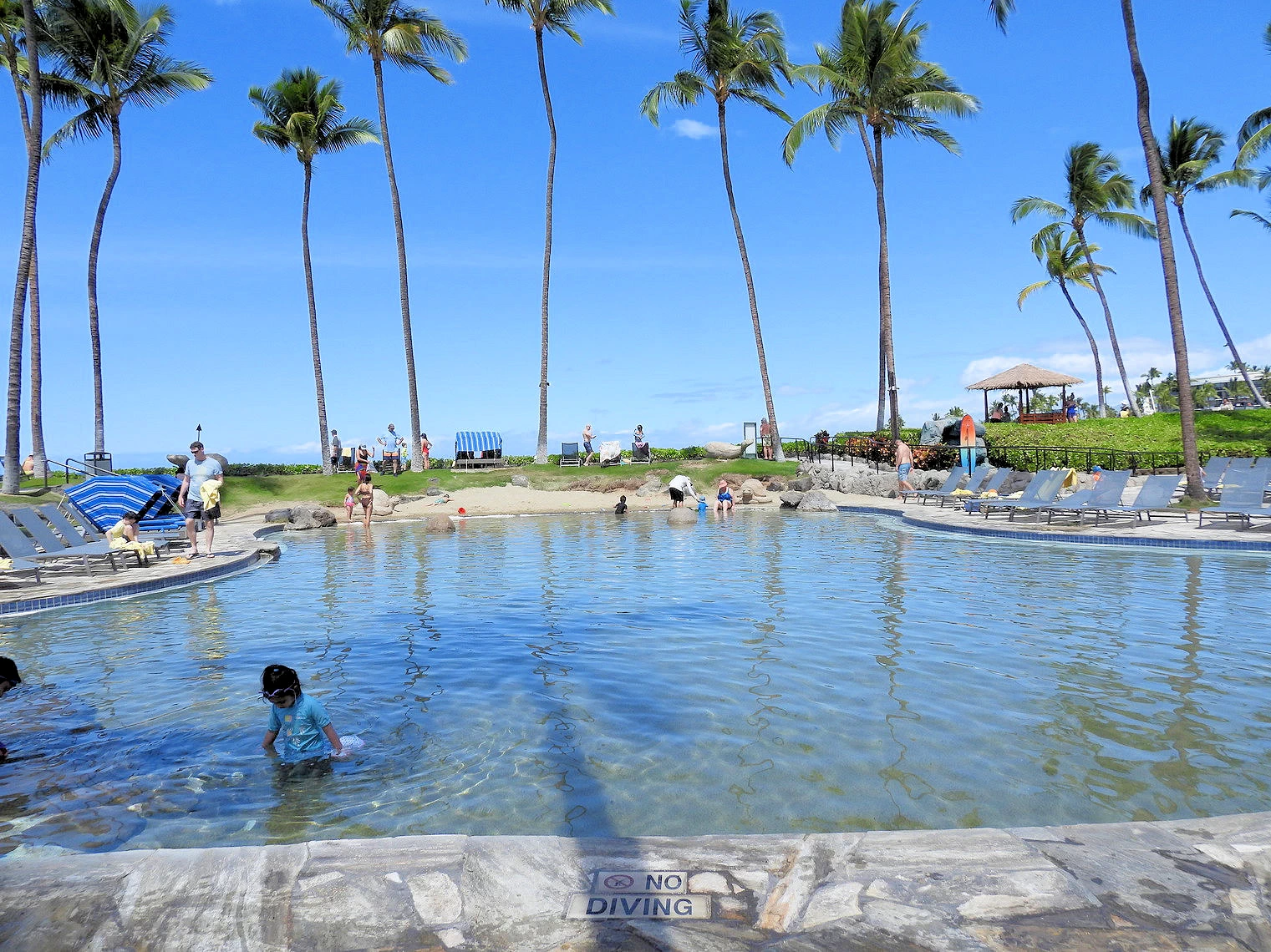 Lagoon Area
As you can see in our images, this is a very large hotel complex but it is really nicely laid out. Each of the pools (and the lagoon) are widely separated from each other, and there are numerous facilities to make your visit or stay as comfortable as possible.
More Info for the Waikoloa Hilton Village
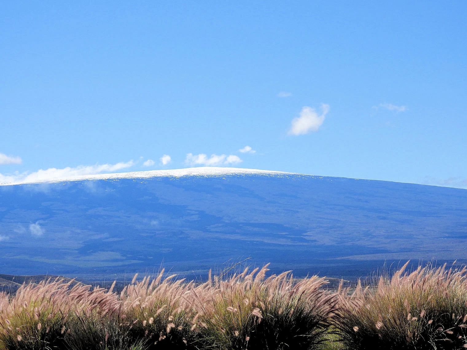 Mauna Kea Volcano
The drive from Hilo to Waikoloa brings you alongside Mauna Kea on Hawaii route 200. It is an interesting drive, and it is fascinating to see that Mauna Kea has snow at the top! It is a wee bit nerve wracking to think that you are on a road, in an area between two huge volcanoes (Mauna Kea & Mauna Loa), and if either were to erupt, you could be obliterated!
The height of Mauna Kea allows the summit to be constantly snow covered, as you can see in the above image. Map We could have made a stop at the Mauna Kea Observatory, which is approximately 15 miles from Hawaii route 200 (formerly known as Saddle Road), but we could already see the snow on the summit and we were ready for some sunshine that we knew we'd have at the Hilton Waikoloa Resort. If you have more time, then you might want to consider visiting the summit observatories - they are described as providing the best star gazing that you will have ever seen.
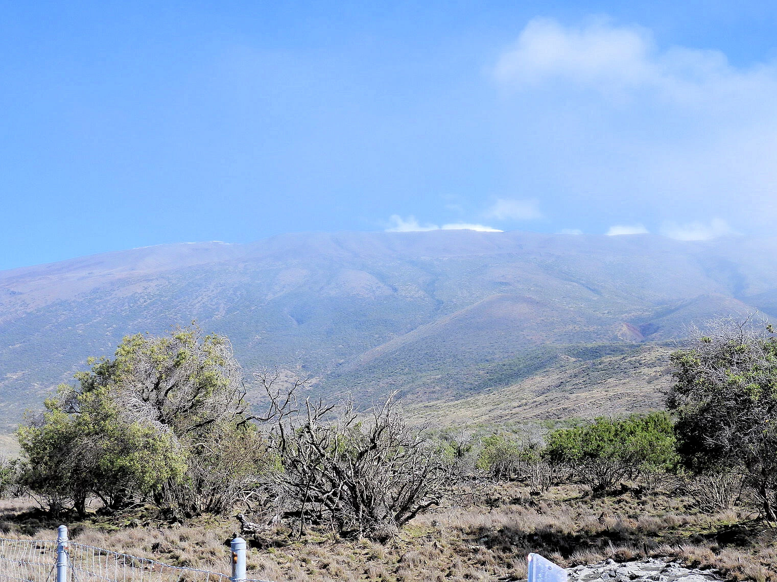 Snowcapped Mauna Kea
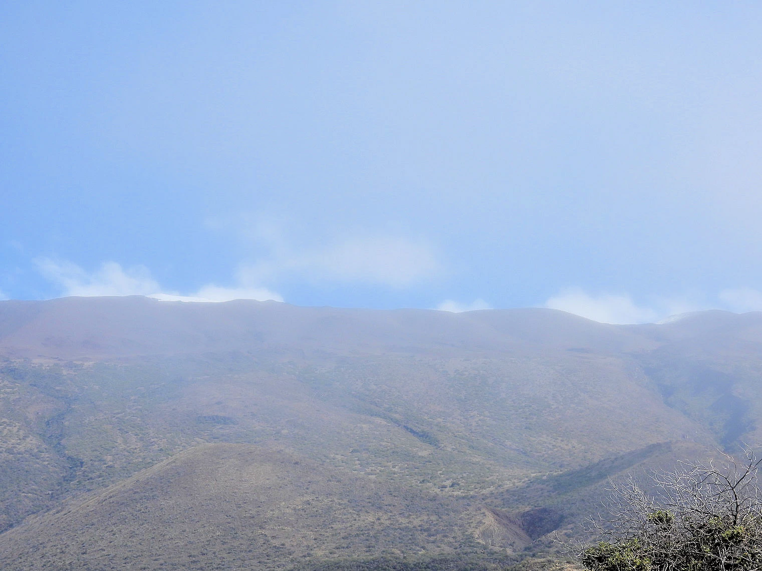 Snowcapped Mauna Kea
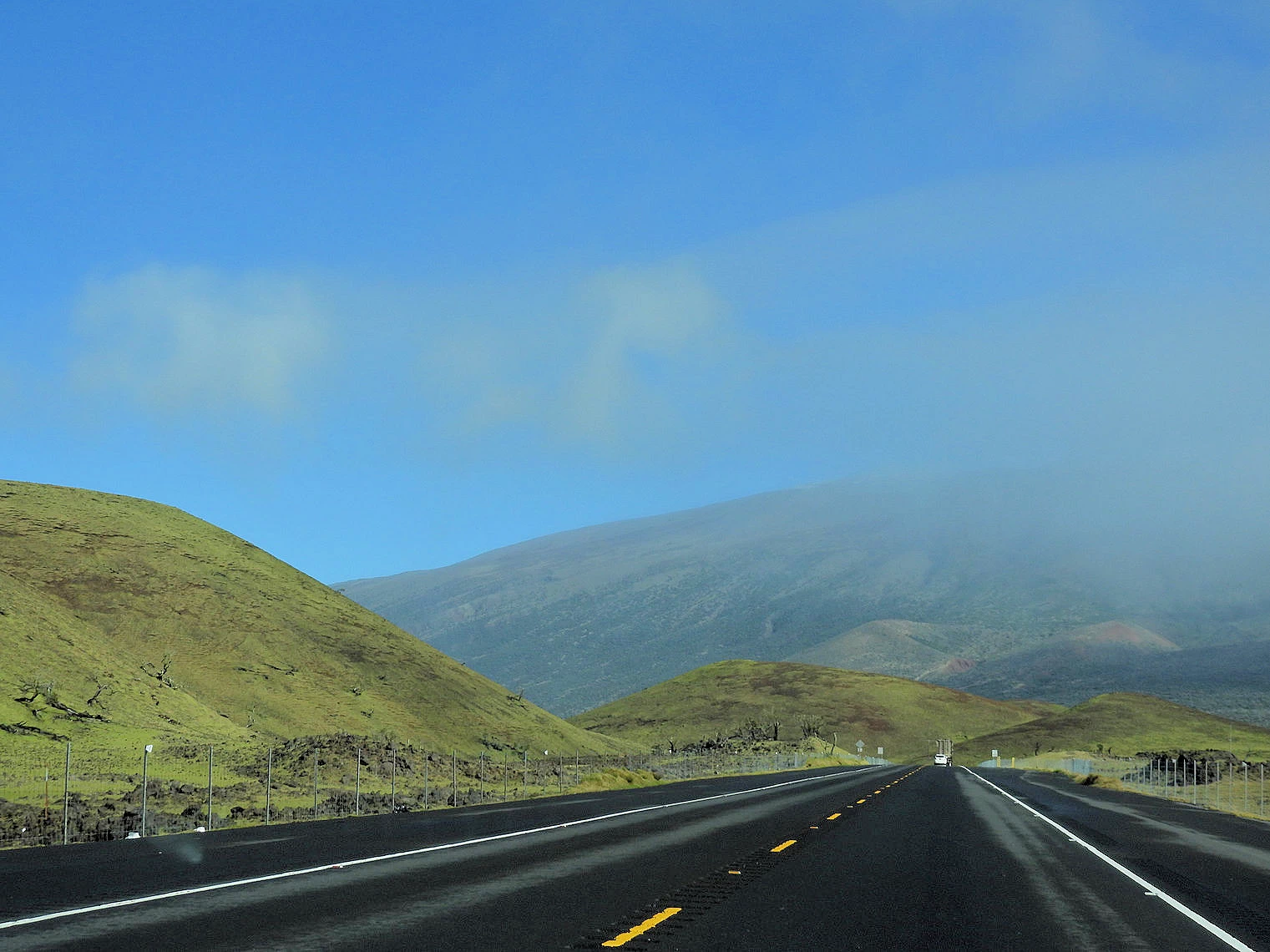 Hawaii Route 200Snowcapped Mauna Kea
It helps to have read that Mauna Loa last erupted in November 2022, so we could somewhat assume that we would not be caught in that volcano's eruption as we drove by. Mauna Kea last erupted 4,500 years ago - so it was reasonably safe to assume that we would not be caught up in an eruption from that volcano either. Note that the USGS says that Mauna Kea will eventually erupt again.
Background Info from Wikipedia
Mauna Kea's peak is 4,207.3 meters (13,803 ft) above sea level, making it the highest point in the state of Hawaiʻi and second-highest peak of an island on Earth. The peak is about 38 meters (125 ft) higher than Mauna Loa, its more massive neighbor.
NOTE: Click here to view the Mauna Kea Wikipedia article that this info came from.
More Info for Mauna Kea
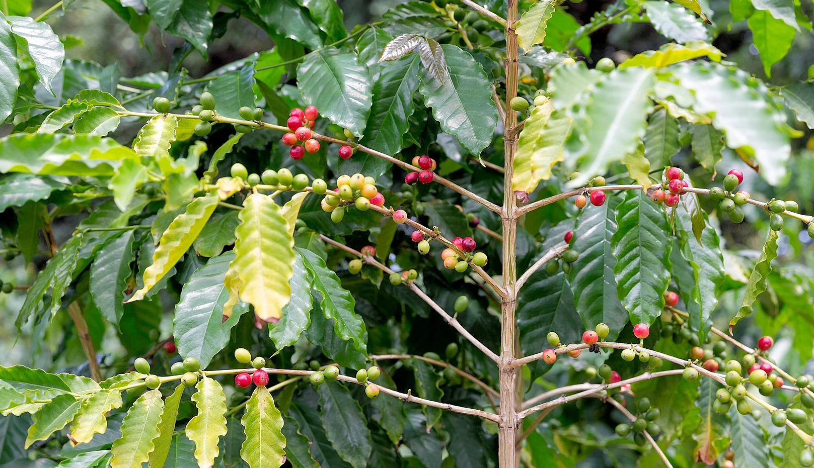 Coffee Bush
Because the drive from Hilo to Kailua-Kona via Volcanoes National Park was a very long day, with a lot of stressful driving, we wound up stopping at several interesting coffee establishments along the way, including; Kaʻū Coffee Mill Plantation (Pahala, HI) where we got to see a huge macadamia nut tree grove as well as the coffee farm.
After we got a few more miles down the road, we stopped at the Miranda Coffee Farm Cafe (Naalehu, HI) and had an excellent iced coffee. In between those two stops, we had malasadas at the Punalu'u Bake Shop also in Naalehu.
There are more than 650 coffee farms of all sizes clustered along the ±20 miles of scenic roads on the Hualalai and Mauna Loa slopes. Many of these farms offer tours to the public, click here to view a web page describing various Kona Coffee tours that are available.
This turned out to be a 145+ mile drive, through some really interesting areas - however - all on curvy, narrow two lane roads, very little traffic but the road required very focused attention. Map
NOTE 1: Ka'u coffee beans are recognized around the globe for their intense flavor, smooth delicate flavor and low acidity. Grown next door to the Kona Coffee belt, Kau Coffee has been dubbed the "cousin of Kona." Point being, both the Kaʻū Coffee Mill Plantation and the Miranda Coffee Farm Cafe sell Ka'u coffee and not Kona.
NOTE 2: Coffee comes from trees and not bushes. Coffee trees are pruned short to conserve their energy and aid in harvesting, but can grow to more than 30 feet in height. Click here to read a complete description regarding coffee plants.
NOTE 3: Kona coffee is the market name for coffee (Coffea arabica) cultivated on the slopes of Hualalai and Mauna Loa. Ka'u coffee is also considered to be "coffee arabica". Click here for a more detailed description of Kona and Ka'u coffees.
Image Credit: The large coffee bush image is the property of HylgeriaK via Wikipedia Commons using the Creative Commons Attribution 4.0 license
Ka’u Coffee Mill
We visited the Kaʻū Coffee Mill and found it to be an immersive experience into the journey of Hawaiian coffee, from walking through the coffee orchards to witnessing the processing and roasting of beans, culminating in a tasting of award-winning Kaʻū coffee in the tranquil southern countryside of Hawaiʻi's Big Island. The mill provides an educational and cultural encounter, connecting visitors with local traditions and the rich, resilient agricultural heritage of the Kaʻū district, where mineral-rich volcanic soil contributes to the unique, complex flavors of the coffee beans. And we fell in love with Kaʻū Coffee!
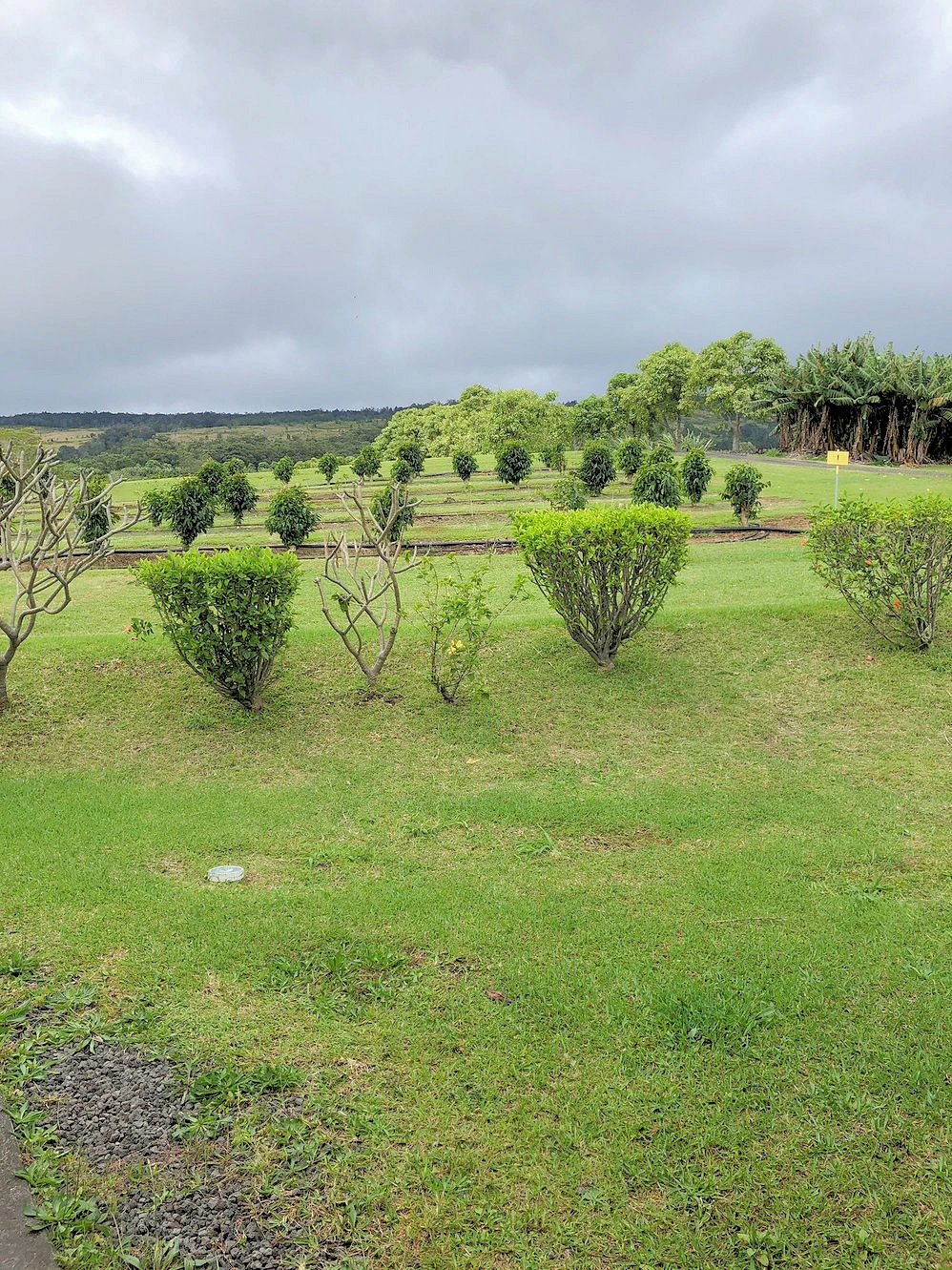 Coffee Plantation
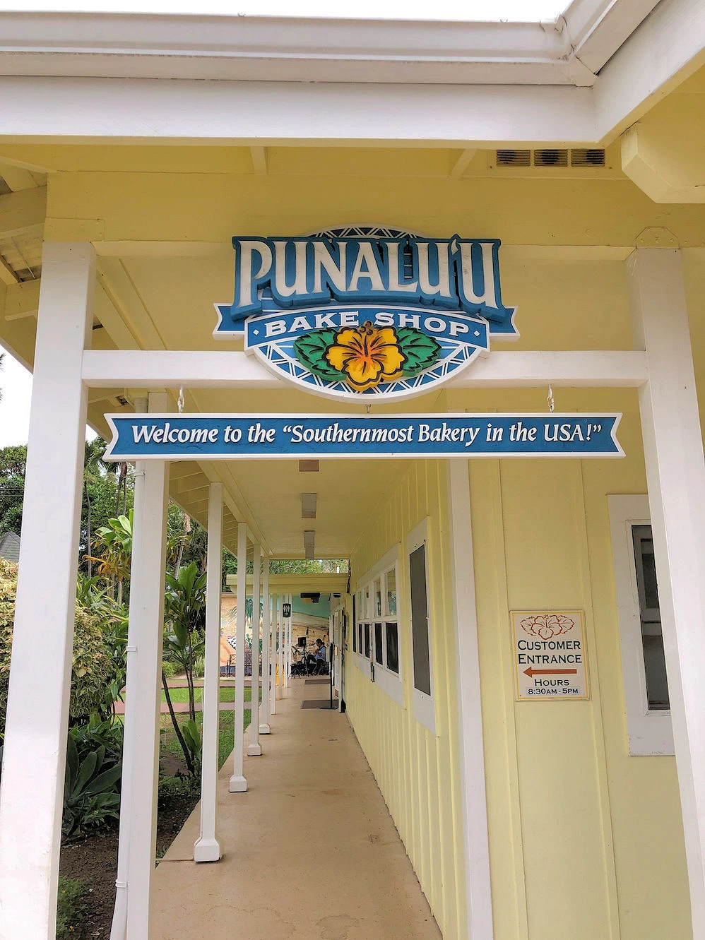 Punalu'u Bake Shop
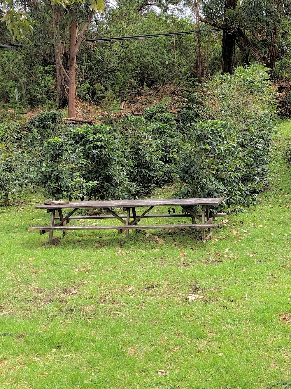 Relax & Watch Coffee Grow
Coffee Plantations Explorations
On our drive through Nā‘ālehu & Pāhala and on to Kailua-Kona, we passed through areas where coffee plantations are numerous. As route 11 winds its way through the hills, visitors are treated to stunning vistas of the Pacific Ocean, rolling green hills, and rugged volcanic terrain. You will want to keep your camera at the ready, because some of the coastline views are amazing.
As the southernmost town in the United States, Nā‘ālehu exudes a quiet, small-town vibe surrounded by lush greenery and rolling hills. The short drive between Nā‘ālehu & Pāhala winds through verdant landscapes, with glimpses of the coastline and volcanic terrain in the distance.
More Info for Kona Coffee & the Kaʻū Coffee Mill Plantation
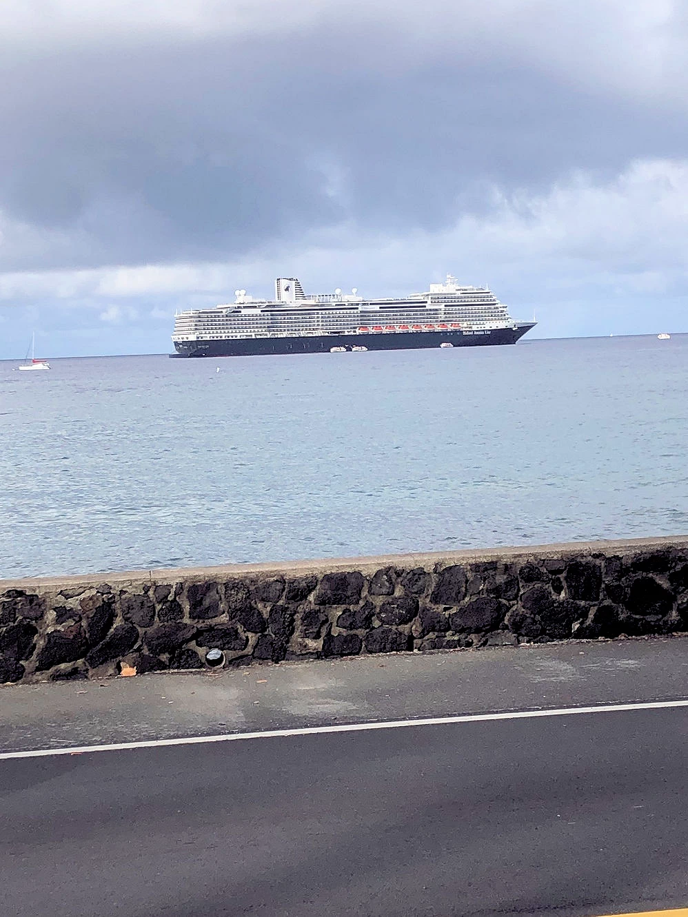
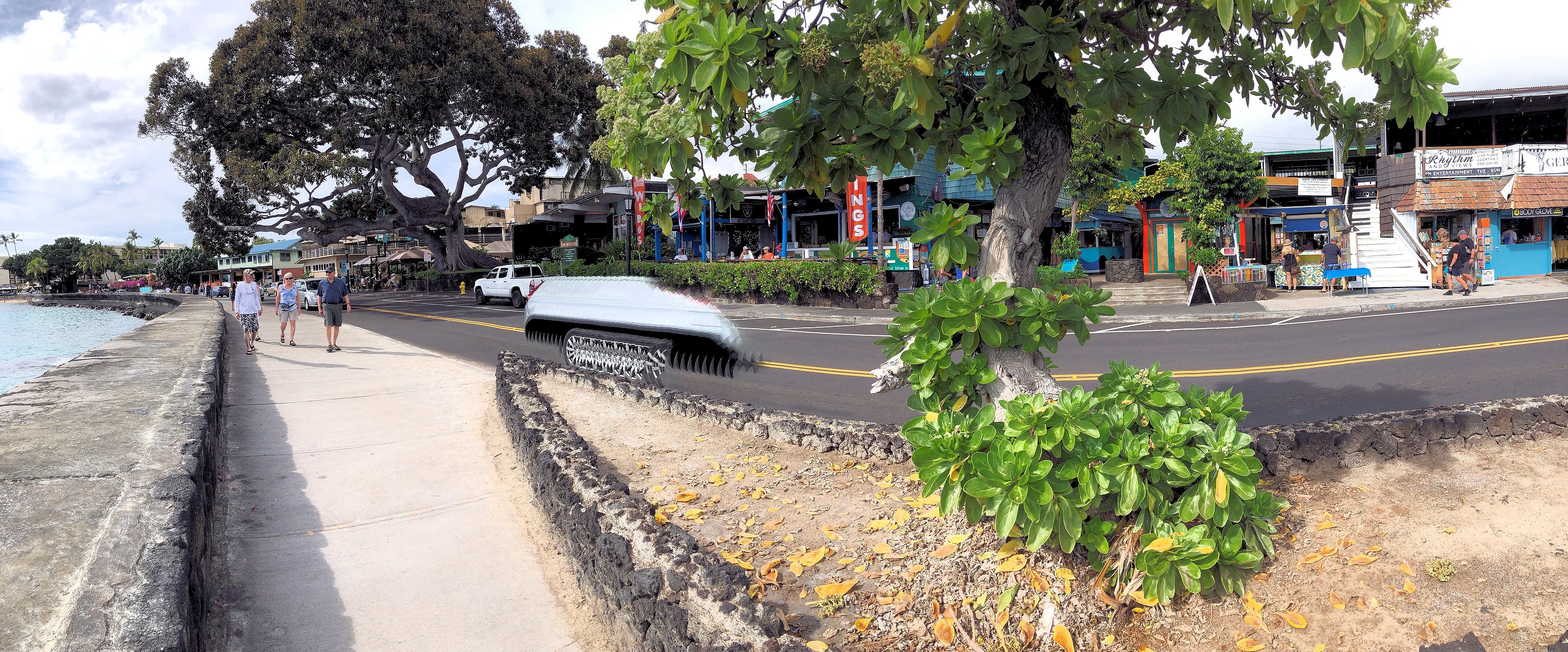 Kailua-Kona Area
Since we were scheduled to fly back to the mainland from Kona Airport to Los Angeles, our plans were to depart Hilo and move over to Kailua-Kona. This would leave us within 7 miles of the airport, in a town that is loaded with restaurants and beautiful coastline. As you see by our images, the coastline is very pretty, and cruise ships arrive here frequently. However, we had thought we had left all of the rain behind in Hilo, but it chased us all the way across the Big Island and we got rain in the morning of our last Saturday.
We didn't realize how popular the area was until we started doing some research for this web page, ie; Kailua-Kona is the start and finish of the annual triathlon Ironman World Championship , the Kona Coffee Festival , and the Hawaiian International Billfish Tournament .
Image Credit: The above image is the property of Calbear22 via Wikimedia Commons with a Public Domain License.
 Exploring Kailua-Kona
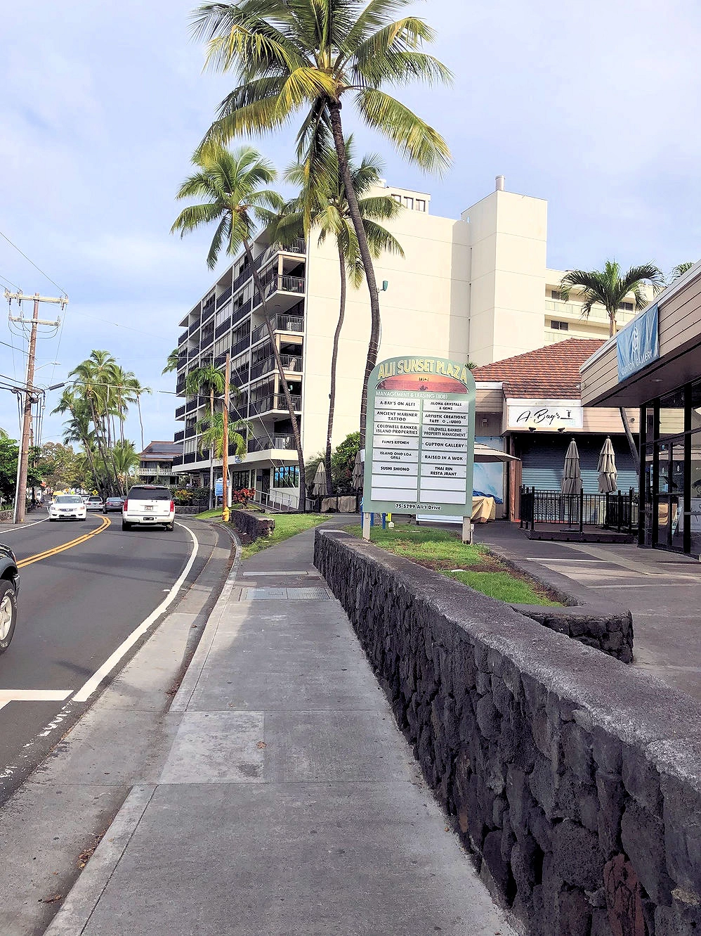 Exploring Kailua-Kona
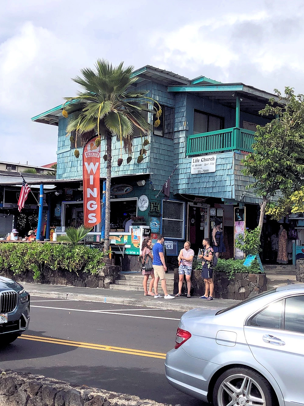 Exploring Kailua-Kona
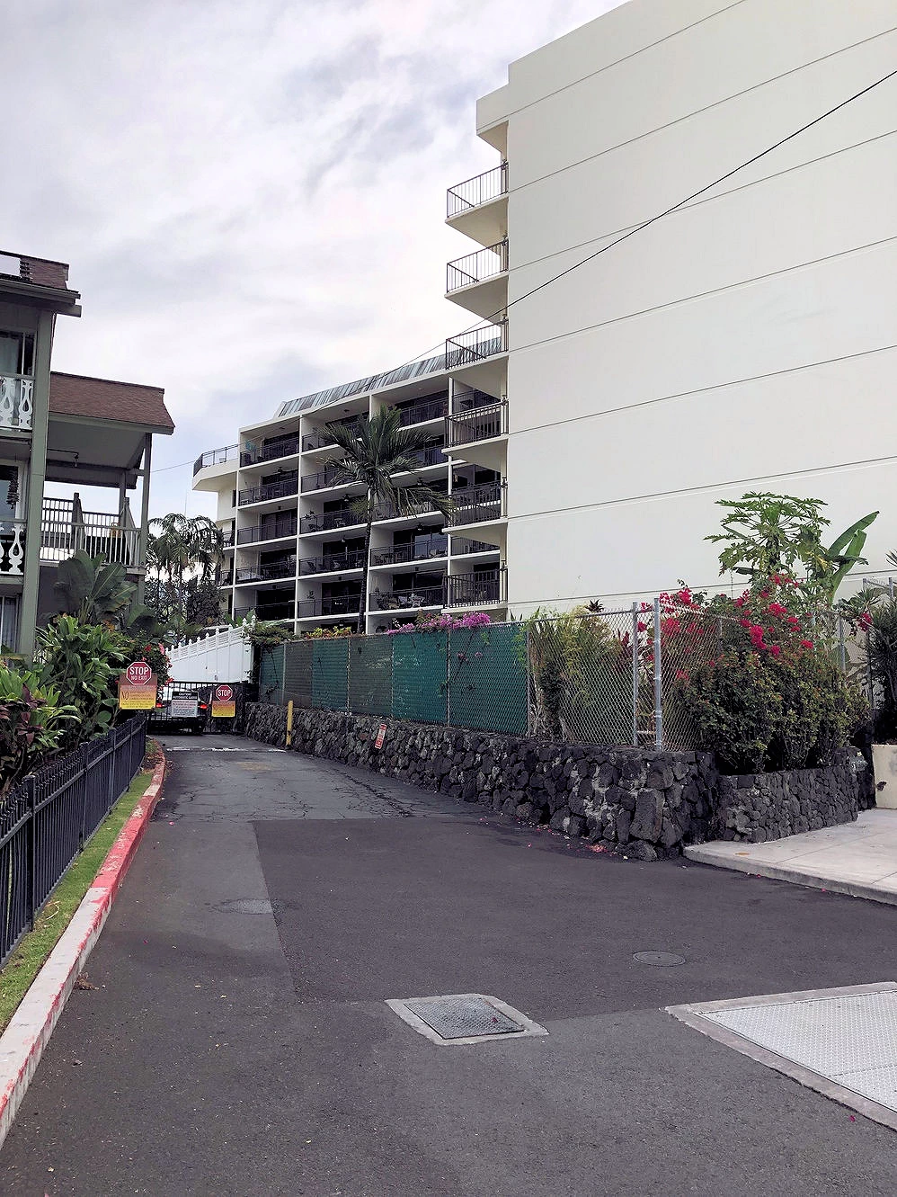 Exploring Kailua-Kona
Kailua-Kona Scenes
Our condo was situated in a great location, and there was a excellent view of the bay as well as the surrounding area. Numerous restaurants and pubs surrounded us. The front steps of our condo were on Ali'i Drive, and the Ocean was just on the other side of the street. Image # 1 above was our view as we came out the front door of the condo building, image # 2 is the condo building, image # 3 is south of the condo approximately 1/2 block and image # 4 is our condo building's parking lot.
NOTE: Just wanted to point out that we rented this nice condo through VRBO, and we have always had very good luck with them! We don't want to sound like an advertisement for VRBO, but they have global reach now that they are a part of the Expedia Empire, and we've used them for rentals all over the world and have never had any problems.
NOTE: Click here to view this VRBO rental on the VRBO website
 Pele's Well Area
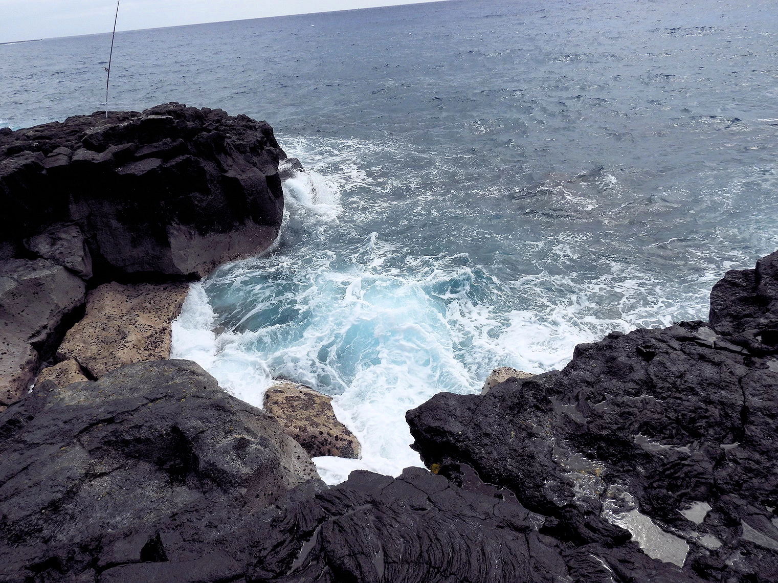 Pele's Well Area
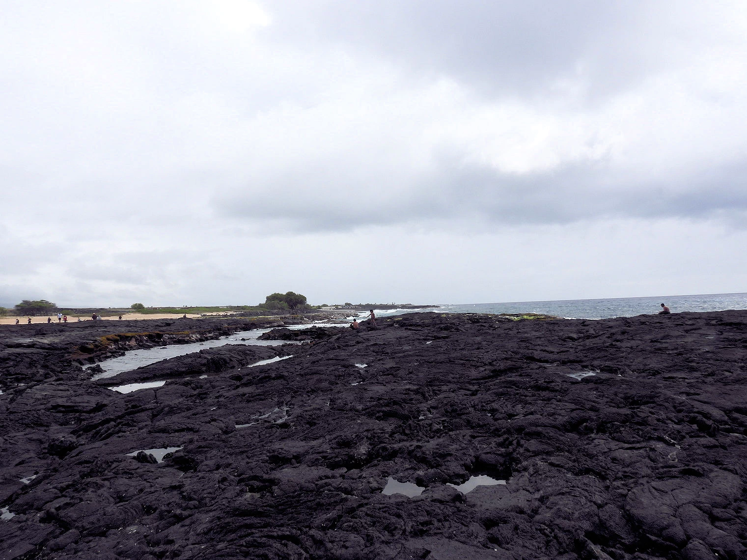 Pele's Well Area
 Pele's Well Area
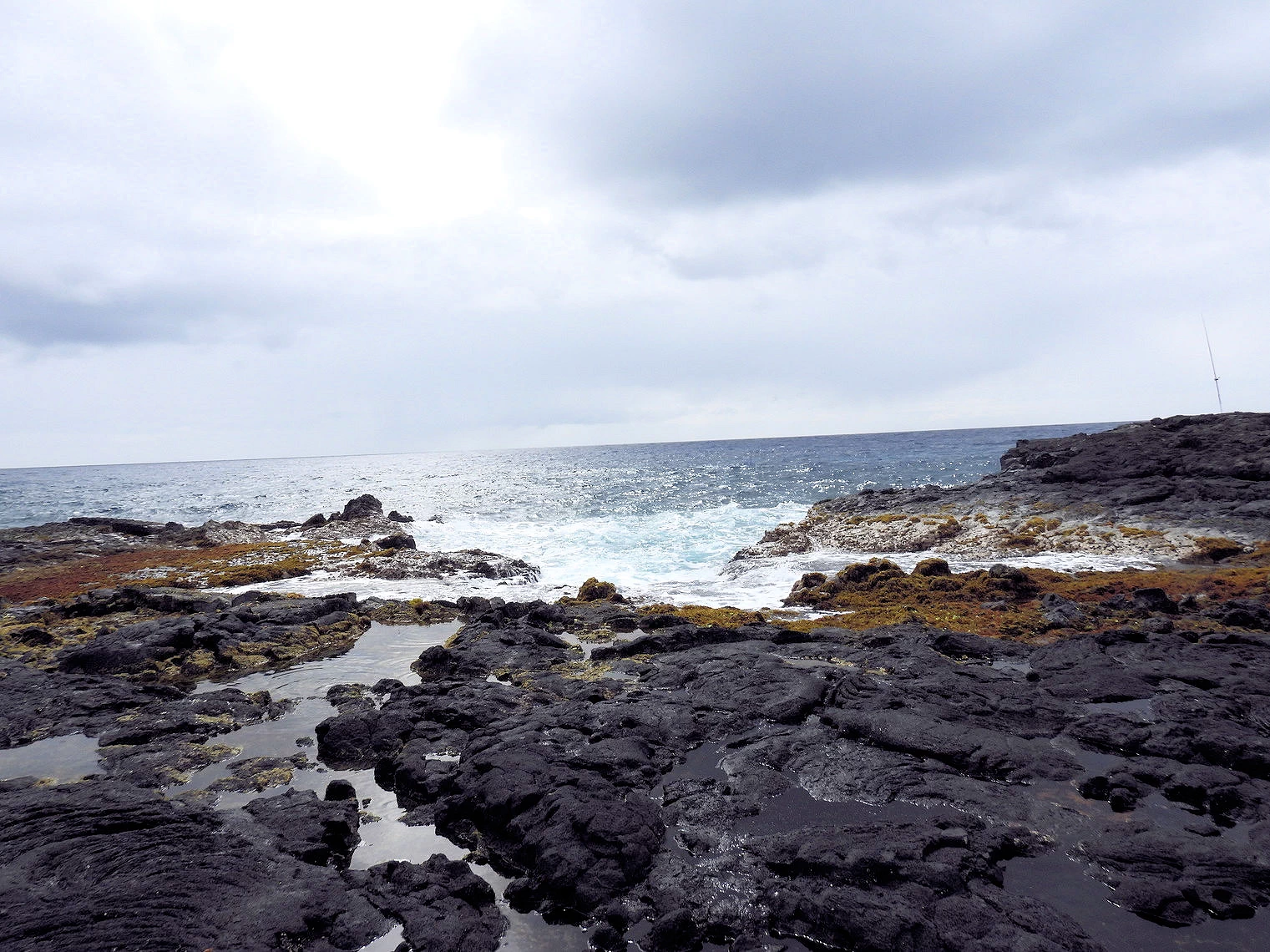
Searching for Pele's Well
We wanted to search for and visit "Pele's Well" (located within Wawaloli Beach Park ) which is a lava tube that surfaces just below the surface of the Ocean.
Pele's Well, also known as The Witch's Well, is a natural blowhole on the Big Island of Hawaii, near Queen's Bath. Located along the island's rugged coastline, Pele’s Well is formed from volcanic rock, which creates a natural pool that fills with seawater during high tides and large ocean swells. When waves crash against the rocks, water surges into the well, creating dramatic and powerful sprays that shoot up into the air.
Named after Pele, the Hawaiian goddess of fire and volcanoes, the well is a mesmerizing and dangerous phenomenon. Visitors should exercise extreme caution, as large waves can unpredictably sweep over the rocks and cause powerful surges in the well, making it dangerous for those too close to the edge.
We were sure that we were pretty close to Pele's Well, but we did not apparently get to the correct location. Even so, this area was interesting and we explored it as far as we could.
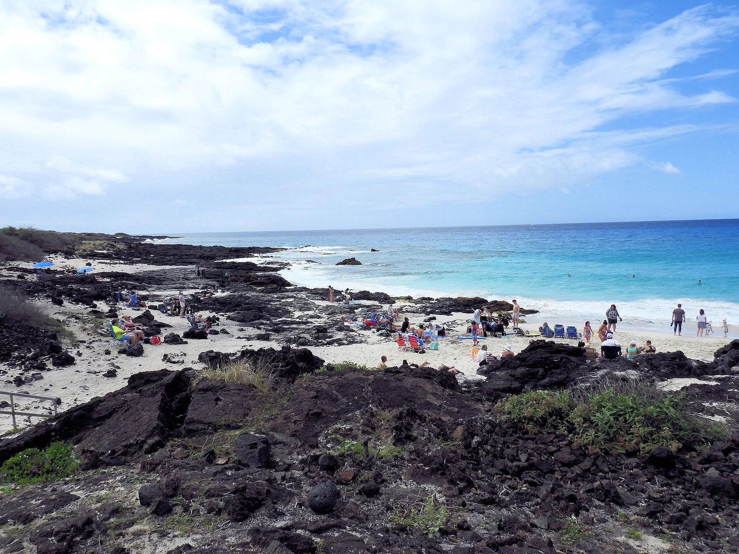 Manini'owali Beach
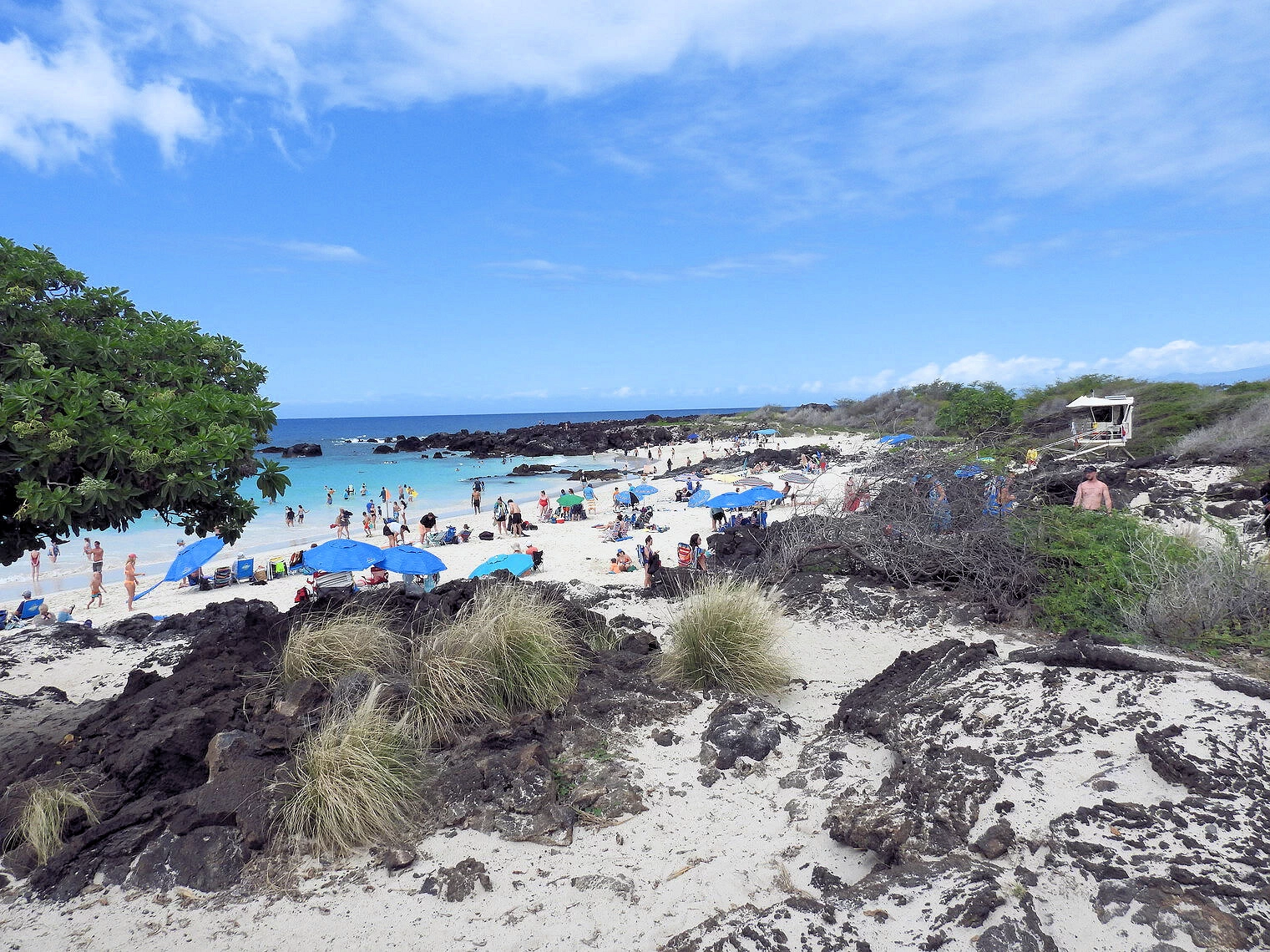 Manini'owali Beach
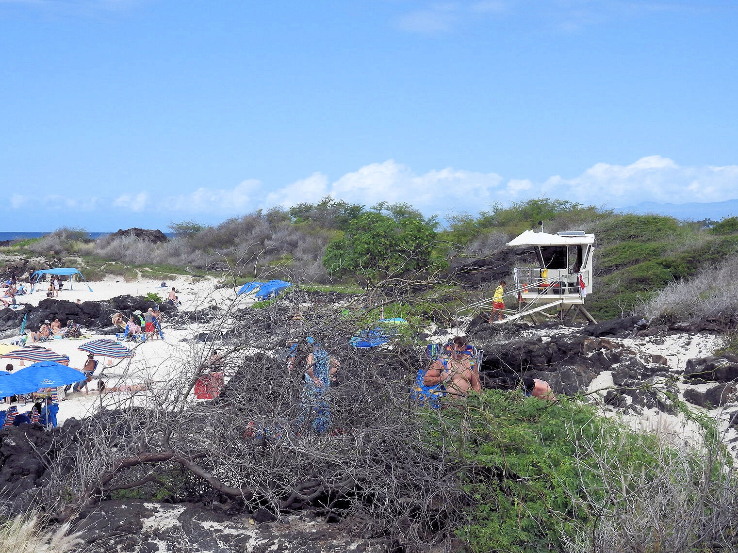 Manini'owali Beach
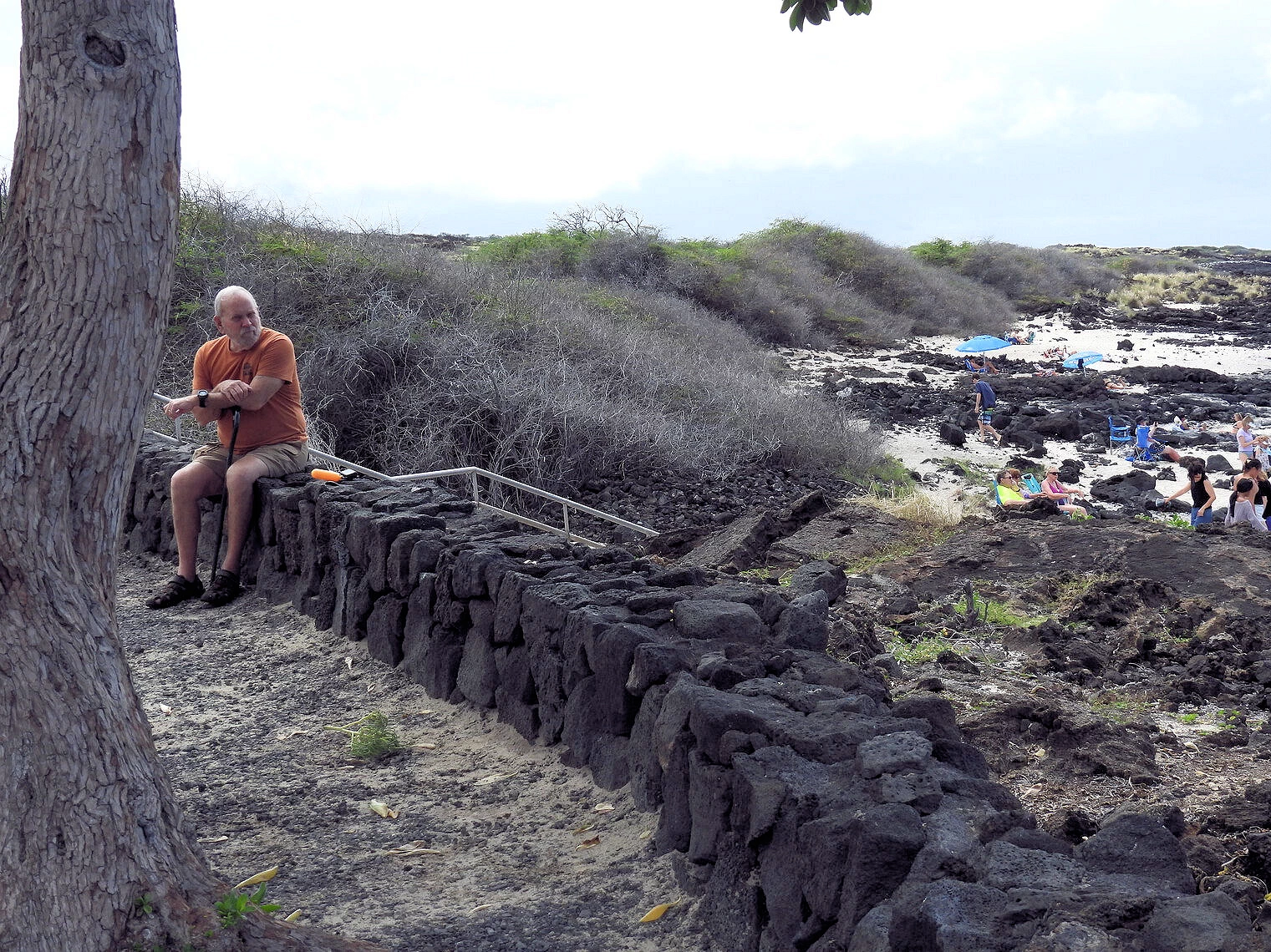 Manini'owali Beach
Manini'owali Beach at Kua Bay
Once the rain relented, we decided to drive up to Kua Bay as our research had shown us that the beach there was very pretty. What we did not discover during our research, was that parking there is very limited and is available only along the narrow road that leads there. We were fortunate to be in a tiny car and were able to grab a parking spot!
While the beach is beautiful, visitors should be aware that there is little shade, so sun protection is essential. The beach has basic amenities like restrooms and showers, but there are no lifeguards on duty, so swimmers need to be cautious of changing ocean conditions.
Parking Warning!
The parking here is very limited, you need to get here early in the day or you may not be able to find a parking spot.
More Info for Kailua-Kona
Do you need a car on the Big Island?
Yes. Distances are long and transit is limited. A rental car saves hours and unlocks beaches and scenic drives.
Best time to visit?
Late spring and fall for balance; winter for whales and cooler temps; summer for calmer water on many west-side beaches.
Can I see lava?
Only if there’s activity and open viewpoints. Check Volcanoes National Park “Current Conditions” the day you visit and follow ranger guidance.
Kona vs. Hilo – Where Should You Stay?
Kona side (West) is sunny with easy beach access, snorkel spots, sunsets, and lots of dining—great for first-timers and short trips. Hilo side (East) is greener and closer to Hawaiʻi Volcanoes National Park and waterfalls; it’s rainier with fewer resort beaches. If you have 4+ nights, consider a split stay: 2–3 nights Kona + 1–2 nights Hilo for Volcanoes/Waterfalls.
3–5 Day Big Island Itinerary (Simple Loop)
Tip: Driving distances on the Big Island are considerable due to its large size, with a full circumnavigation via Hawaii Belt Road taking approximately six hours of driving time, or 222 miles for the main encircling route. However, travel between key areas like Kona and Hilo can take two to three hours, and many attractions require specific routes into the interior, such as up Mauna Loa or into Hawaii Volcanoes National Park. Drivers should also account for potentially challenging conditions, including narrow, winding, and sometimes foggy roads.
Big Island Itinerary
For a more detailed itinerary, take a look at this destination list on this page.Note: All images featured on this page are the exclusive property of Just Traveling Thru, LLC, unless otherwise stated. When images from external sources are used, full credit is given to the original creator, along with a link to the specified license or usage terms. We are committed to respecting copyright and intellectual property rights, ensuring that all third-party images are properly attributed. If you have any questions regarding image ownership or usage rights, please feel free to contact us.
Affiliate Links: We may earn a commission if you make a purchase through one of our affiliate links. This helps support our travel content — thank you!
Content: To review any of our content, make suggestions and/or comments, please click the "About" menu link at the top of this page. You will find our "Contact Us" link on that drop-down menu.

") Click above Image to view larger Google Map
Click above Image to view larger Google Map
