The Gathering Place (Oahu's nickname in the Polynesian language) is the third largest Hawaiian island comprising 597 square miles. Both Maui and the Island of
Hawaii (AKA "The Big Island") are larger however Oahu is the most populous with over 1 million people which is approximately 70% of the
population of the state of Hawaii. Oahu is home to Waikiki Beach, Diamond Head, Pearl Harbor, and its north shore is famous for its
surf and surf culture. Oahu is situated northwest of the Big Island and Maui.
Crave heart-pounding action? Ride legendary waves at Waikiki Beach (or the North Shore), a surfer's paradise, or delve into the underwater
world teeming with colorful fish through world-class snorkeling and diving.
Yearning for serenity? Secluded beaches like Lanikai offer pristine sands and crystal-clear waters, perfect for unwinding
with a book or soaking up the sunshine. Hike through lush rainforests or explore volcanic craters for breathtaking panoramas.
Are you a history enthusiast? Then you have to visit Pearl Harbor, a poignant reminder of the past, and the Polynesian Cultural
Center, showcasing the vibrant traditions of the Pacific Islands. Foodies can tantalize their taste buds with fresh seafood
dishes, traditional Hawaiian fare, and a fusion of international flavors.
Some people opt to skip Oahu when they visit Hawaii for the first time due to things they’ve heard or read about the traffic and crowds. In
our opinion this would be a mistake. Oahu has a lot of things to see and do. Waikiki is known for its shopping, beautiful sandy beach with
rolling waves perfect for beginner surfers, wonderful food and an unforgettable view of Diamond Head in the distance. You have to try a mai tai
at Duke’s restaurant while watching the surf along Waikiki beach at least once in your lifetime! There is traffic in Waikiki but if you skip
the car rental and walk and use the transportation system it’s easy to get around. You can always rent a car for a day when exploring other
areas of the island. It’s also easy to get to other islands. So, spend a few days in Oahu checking things out and then hop over to another
island or two if you have the time.
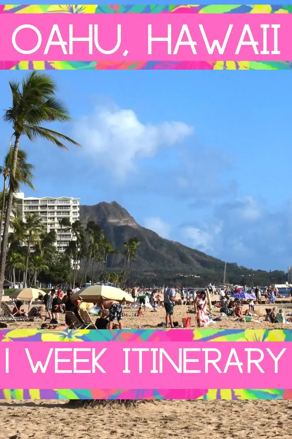
This video provides a suggested 1 week Itinerary for visiting Oahu Hawaii. There is a lot to see and do on the island of
Oahu including Waikiki, Pearl Harbor, the Polynesian Cultural Center, Diamond head and many more sites and beaches you
may not have heard of including opportunities to learn about Hawaiian Culture.
If you enjoy our videos click here to
subscribe to our Youtube Channel.
Please note that both of these videos are the property of Just Traveling Thru, LLC.

Oahu Hawaii is usually the first stop in any of our Hawaiian Vacations. Even though we’ve been there a number of times we
like to start each trip with a few days on Oahu. There is so much to see and do, you’ll want to spend your time wisely. This
video is designed for first time visitors to help familiarize you with Oahu and provides some tips to make your trip a
success. We answer questions like how to get around and whether you should rent a car on Oahu and which popular sites require reservations.
FAQ for Oahu
The most frequently asked questions about Oahu focus on trip planning, including the best time to visit, booking
activities, transportation, and what to pack. Many people also ask about must-see attractions,
the island's famous beaches, and how to respectfully engage with local culture and nature.
- Did the "Hang Loose" Symbol originate in Oahu?
Yes, this hand symbol originated in the North Shore of Oahu at Laie. A man named Hamana
Kalili was a fisherman and construction worker whose legacy included raising money for the building that would become the Polynesian Cultural
Center and fathering two Olympians. Hamana Kalilii had lost three fingers from his right hand in an industrial accident. When he waved at
somebody, it looked like the hang loose sign.
- What was the Lowest Temperature Ever Recorded in Oahu?
The lowest temperature in Oahu occurred in 1969 at 52 degrees
Fahrenheit!
- Is Oahu home of the World’s Largest Plant Maze?
The pineapple maze at the Dole plantation is the largest maze made out of plants in the world. Visitors
can utilize a free app on their phones to help the as they wander amongst the greenery.
- Does Oahu contain the only official royal residence in the United States ?
Iolani Palace on Oahu was once the home of Hawaiian monarchs. Both King
Kalakaua and his sister Queen Liliuokalani ruled from this historic location from 1882-1893.
- Is Oahu home to one of the world’s largest wind generators?
The windmill is located in the Kawailoa Wind Farm on the North
Shore of Oahu.
- Is Honolulu expensive to live in?
Yes, Honolulu is the fourth most expensive city in the United States to live in according to
Rocket Mortgage. For
example, the median home price is $1.2 million in Honolulu, nearly the same as San Francisco (#3 most expensive), $975,000 in Los
Angeles (#2 most expensive) and $850,000 in New York City (#1 most expensive). Honolulu's housing expenses are 214% higher than the national average and
the utility prices are 42% higher than the national average. Transportation expenses like bus fares and gas prices are 26% higher than the national
average. Honolulu has grocery prices that are 50% higher than the national average.
- Is Hawaii the most isolated population center on Earth?
Yes, it is 2,390 miles from California, 3,850 miles from
Japan and 4,900 miles from China. Gives you an idea why goods can be very expensive
to ship to Honolulu!
- What is the size of Oahu?
At 596.7 square miles, it is the third largest Hawaiian Island. Oahu has 112 miles of coastline, including some of the
world's most beautiful and most famous beaches.
- What is the size of Waikiki Beach?
It is approximately two miles long and a little over a half mile at its widest point, extending
from Duke Kahanamoku Lagoon (also called Hilton Lagoon) in the west to San Souci Beach, Kapiolani
Park in the east.
- How many Hotels are on Waikiki Beach?
As of 10/11/2025 Google says there are 147, here is a
link to a Google Search Results list.
- What is the time difference from the continental U.S.?
Hawaiʻi follows Hawaiʻi Standard Time (GMT-10 hours), which is five hours behind
Eastern Standard Time and two hours behind Pacific Standard Time. Hawaiʻi does not observe Daylight Saving Time, so add one extra hour to the time
difference during this period (March through November).
- Is it difficult to drive in Honolulu?
Yes, Honolulu can have heavy traffic congestion, especially during rush hour. The onramps to the
H-1 are limited and a Ramp Metering System is utilized, so the city street onramp access points get very congested. You will need to plan your
route and factor in potential traffic delays. Once you get away from the Honolulu area, traffic
is much more manageable.
- When is the best time to visit Oahu?
The "shoulder seasons" from mid-April to early June and September to mid-December are
often recommended for their lower prices and smaller crowds. During the summer (mid-June
to August), the weather is sunny with fewer rain showers, but tourist volume is at its
peak. The winter months (late December to early April) are popular but pricier,
attracting surfers to the North Shore's big waves.
- Do I need a rental car on Oahu?
If you plan on staying primarily in the Honolulu/Waikiki area, a car is not necessary. The area
is very walkable and has a good public transportation system, including buses and trolleys.
If you are planning on doing some island-wide exploration a rental car is the
best option for exploring outside of Honolulu, such as the North Shore and East Oahu.
However, be prepared for significant traffic, especially during rush hour in and out of
Honolulu. The freeway ramps backup for blocks and all drivers are impatient.
- Why is Spam so popular in Oahu?
The answer is actually simple, you can read about the "why" on this page in
our "Spam" history section.
Spam in Hawaii
Why is Spam so popular -
It may be because of food shortages during WW2, the answer might be a bit more
complex than that, so we would suggest you read
"the history of Spam in Hawaii".
This love for Spam dates back to World War II, when American soldiers stationed in Hawaii received Spam in their rations
due to its long shelf life. After the war, Spam became a household item, partly due to limited access to fresh meat
and its affordability compared to other protein sources.
Because it is so popular, Spam is widely available in Honolulu, Hawaii, and can be found at many restaurants, convenience stores, and grocery
stores. Below are some places to find Spam in Honolulu:
- Liliha Bakery: Offers Spam & Eggs sandwiches and other Spam breakfast options.
- Rainbow Drive-In: Serves a delicious Spam breakfast plate among its local plate lunches.
- Musubi Cafe Iyasume: Serves a variety of Spam dishes, including Spam musubi, Teriyaki Spam, Egg Spam, and Bacon & Egg Spam.
- Pork Tamago Onigiri: An Okinawa-based chain that specializes in Spam, egg, and rice foldover sandwiches.
- McDonald's: Serves Spam and eggs for breakfast.
- Eggs 'N Things: Features a Spam and three cheese quesadilla.
- Aloha Pizzeria: Serves Hawaiian pizza with Spam, Banzai Burger, and Hawaiian burger with Spam.
- Camado Ramen Tavern: Serves Spam fried rice.
- Eating House 1849: Serves an adobo hapa burger and Spam and three cheese quesadilla.
- 7-Eleven: Sells Spam musubi at all locations.
- Highway Inn: Provides traditional Hawaiian-style Spam breakfast options.
- The Buffet at the Hyatt: Includes Spam kimbap and rice cake with Spam and chili cream.
The list will ebb & flow as restaurants come & go, so to view a current list, you should take a look at this
Google Search Results list for "restaurants in Oahu with Spam on the menu".
Additionally, Hawaii hosts the
annual "Waikiki Spam Jam" festival, where
vendors offer creative Spam dishes, celebrating the beloved canned meat.
Oahu Places to Visit
The following is a suggested itinerary based upon maximizing your time on Oahu and proximity to these individual destinations;
Day 1: Arrive at Waikiki Beach
- Get unpacked and get into the Hawaii vibe & timezone. This of course depends on how long it took you to get to Waikiki.
Day 2: Waikiki Beach & Honolulu
- Hang at the beach
- Explore Waikiki beach - the boardwalk is nearly continuous from the Hilton Hawaiian Village south to the Duke Paoa Kahanamoku Statue.
- Explore Waikiki beach - It's a great walking area but if your feet get tired use the local bus system.
The Pink Bus Trolley is $5 per day.
- Hit Dukes for your first umbrella drink & try at least one Mai Tai. They don’t make them
any better anywhere else!
Day 3: Diamond Head & Honolulu
- Hike Diamond Head in the morning, you will
need day/time reservations from Hawaii.GOV site
- Go Surfing/Supping/Kayaking or consider visiting Hanauma Bay, or other beach activity. Please note that Hanauma Bay entrance
requires advance date/time reservations from the Hawaii.GOV site as well.
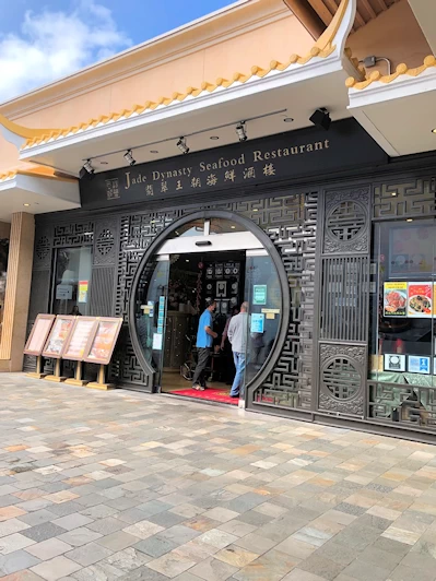
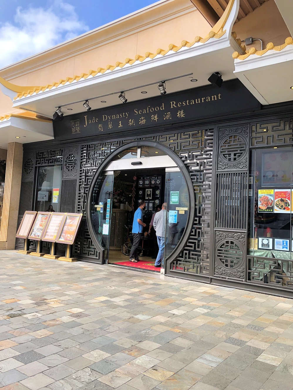
- Visit the Jade Dynasty Seafood Restaurant - Legendary Dim Sum! Expect to wait because this place is popular!
Day 4: Pearl Harbor in the morning
There is a lot to see at Pearl Harbor. If you are interested in world war II history
then you may want to see everything. Most people want to take the boat out to the Arizona Memorial but all of the sites are
worth seeing if you are up for it. Take a look at our
Pearl Harbor visit.
Day 5: A bit of driving
- Take the Pali Highway (Hawaii Route 61) to the
Nuʻuanu Pali Lookout and enjoy the
amazing view of the valley below (you will be 2,000 feet above the valley).
- Make advance reservations at the Polynesian Cultural Center on Hawaii route 83 near Laie. Learn more about Hawaii, eat at the
Luau and then take in the show afterward. This is an excellent family outing and great if looking for something to do with a
large group.
You can obtain tickets here.
Day 6: Enjoy your last day on Oahu however you want
If you don't have plans consider taking a ride to the famous Oahu north shore. It’s
not a “must do” on Oahu as it’s mostly just a laid back surfing area.
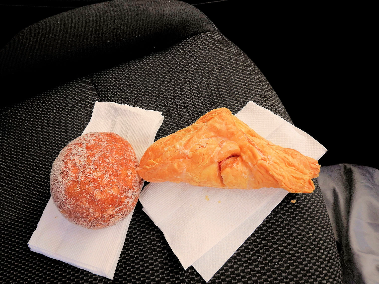
- Stop for malasadas in the morning at Paalaa Kai Bakery near Wailua - they are excellent!
- Visit Waialua Bay - in the summer it can be calm and in the winter sometimes there are large waves. It’s a nice
beach to spend a few hours.
To get info on where the surf is best, click here.
- Eat lunch at a shrimp food truck
Day 7: Return Home
If you have some extra time, or you are looking to add some variety to your own itinerary, here are a few suggestions to
consider;
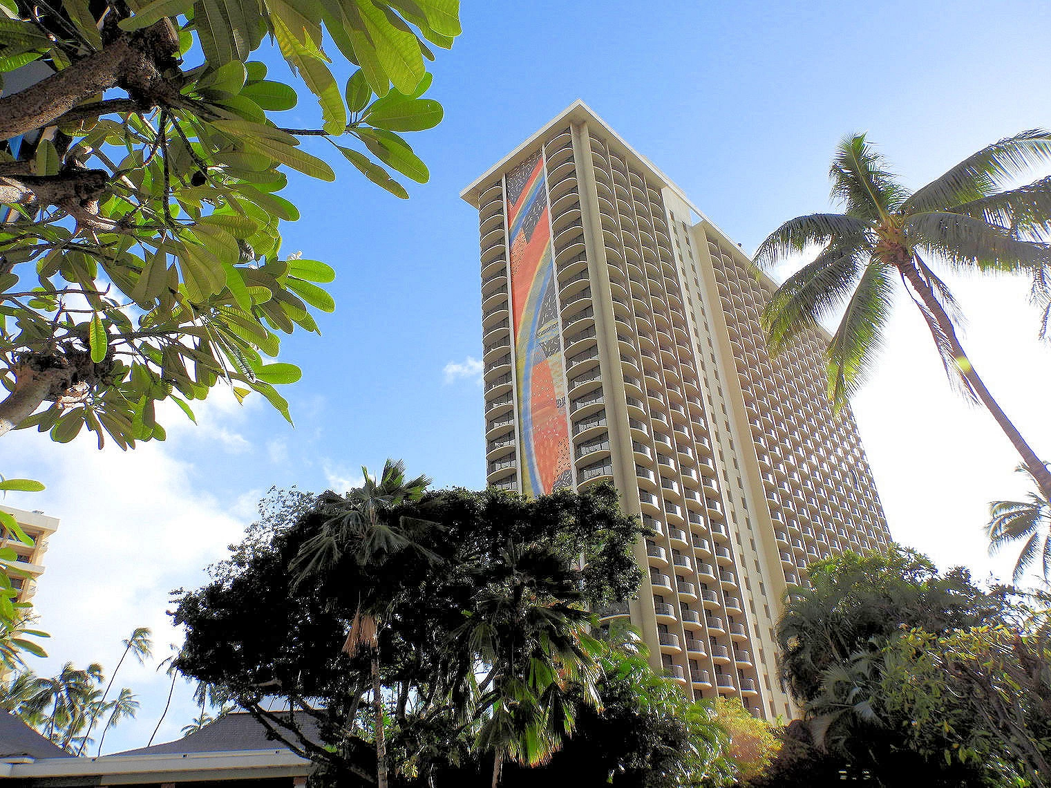
Hilton Hawaiian Village Waikiki Map
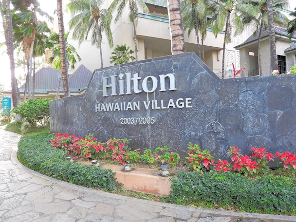 Hilton Hawaiian Village Waikiki
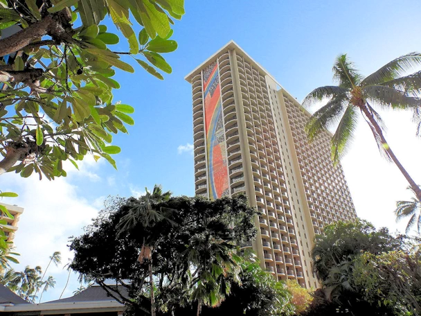 Hilton Hawaiian Village Waikiki
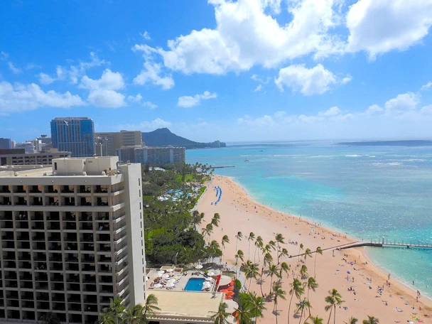 Hilton Hawaiian Village Waikiki
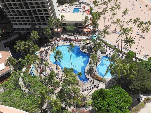 Hilton Hawaiian Village Waikiki
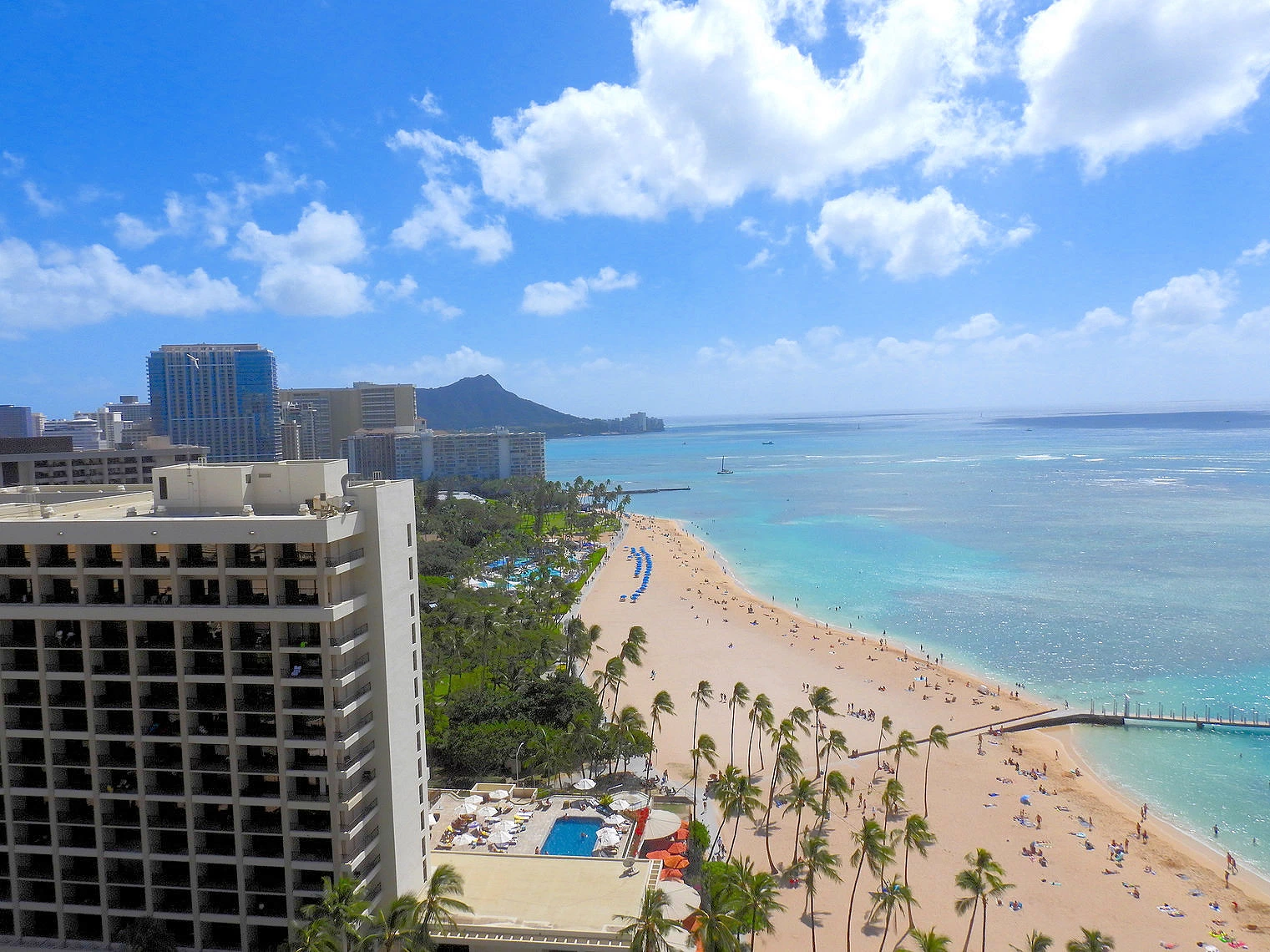
The Hilton Hawaiian Village is a beautiful resort and village consisting of multiple towers, restaurants, pools, parking, lagoon, and shopping and it
has the perfect location on Waikiki beach. It's right on Waikiki Beach with a view of Diamond Head in the distance. An easy stroll to Waikiki
restaurants and shopping and the pink line trolley bus stop is right in front of the hotel. Beach chair, scuba, stand up paddle board rentals, or
even surfing lessons are available. We've stayed here numerous times and based on how much we like it, we've never stayed anywhere else when we come to Oahu.
You might want to read
our comprehensive review of the Hilton Hawaiian Village Resort, there is a wide variety of information
and useful tips on that page.
More info for the Hilton Hawaiian Village
Waikiki Beach Area
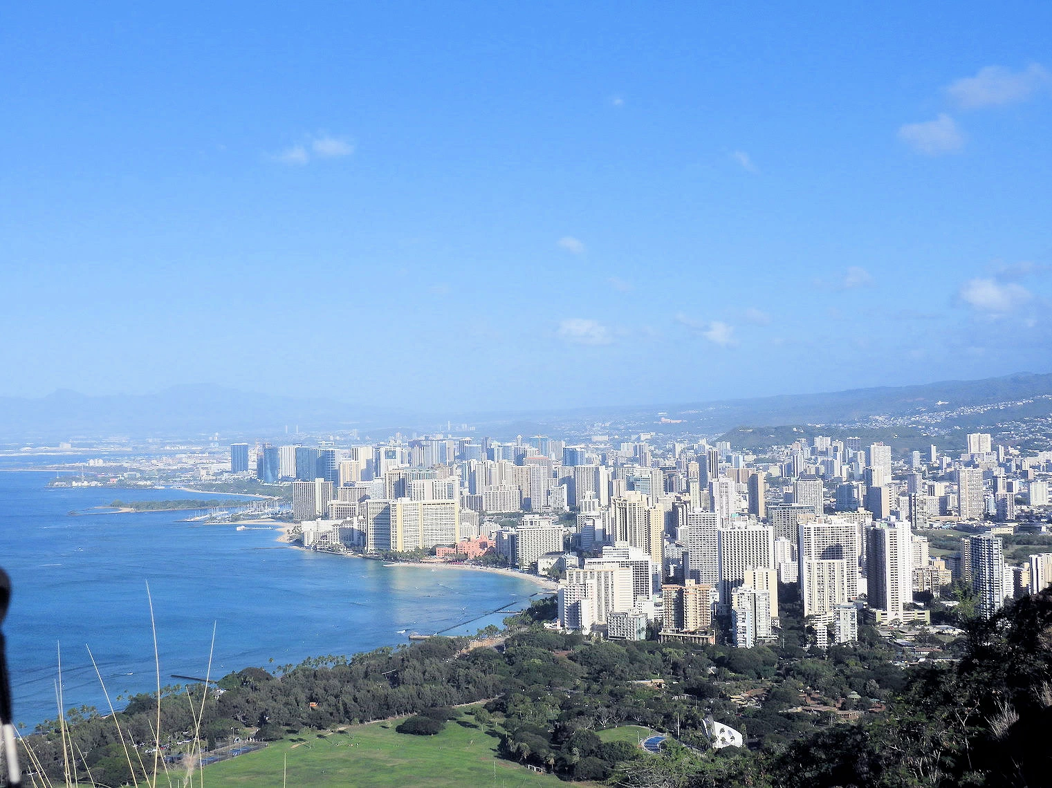
 Honolulu from top of Diamond Head
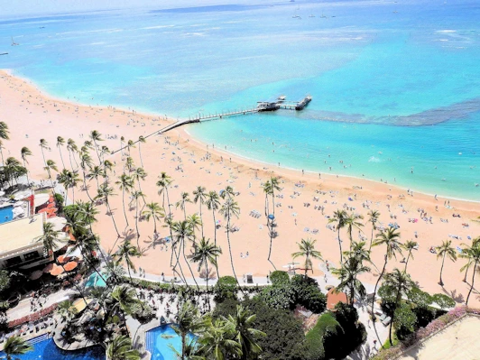 Waikiki from our Hilton Resort Room
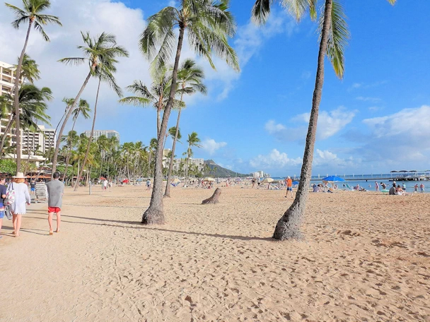 Strolling down Waikiki
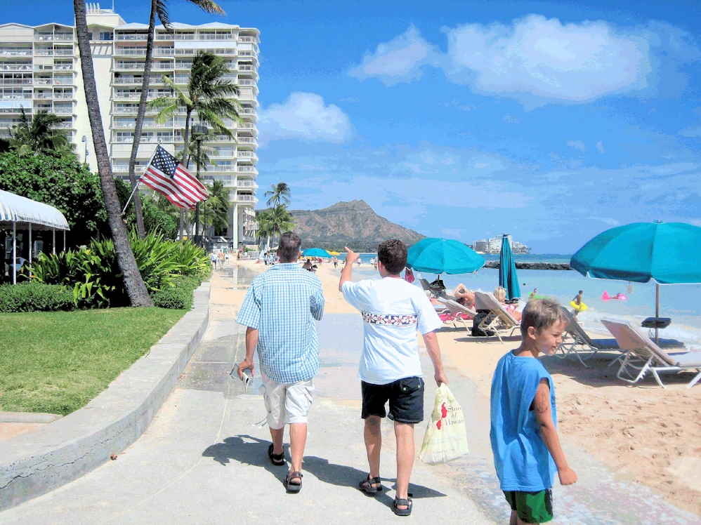 Exploring Waikiki
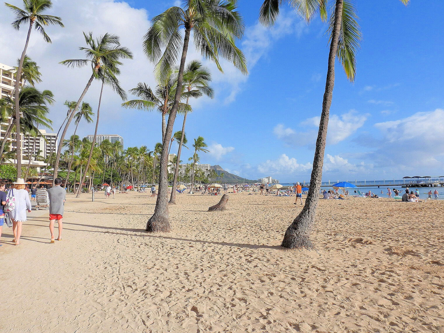
Waikiki Beach is a magnetic draw for visitors seeking a quintessential Hawaiian experience. Its world-renowned
stretch of golden sand and crystal-clear turquoise waters offer an idyllic setting for relaxation and water
sports. Whether it's swimming, surfing, paddleboarding, or simply soaking up the sun, Waikiki caters to all.
Beyond the beach, the vibrant energy of Waikiki is infectious. Visitors are captivated by the lively atmosphere, with
world-class shopping, diverse dining options, and exciting nightlife. The iconic Diamond Head crater provides a
stunning backdrop, while the convenience of exploring the rest of Oahu is a major plus.
Waikiki's allure extends to its rich cultural heritage. Visitors can immerse themselves in Hawaiian traditions
through luaus, hula performances, and local art. With its perfect blend of natural beauty, modern amenities, and
cultural experiences, Waikiki continues to be a top destination for travelers from around the world.
More Info for the Waikiki Beach Area
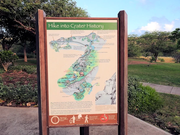
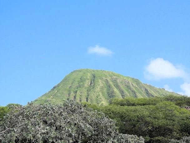
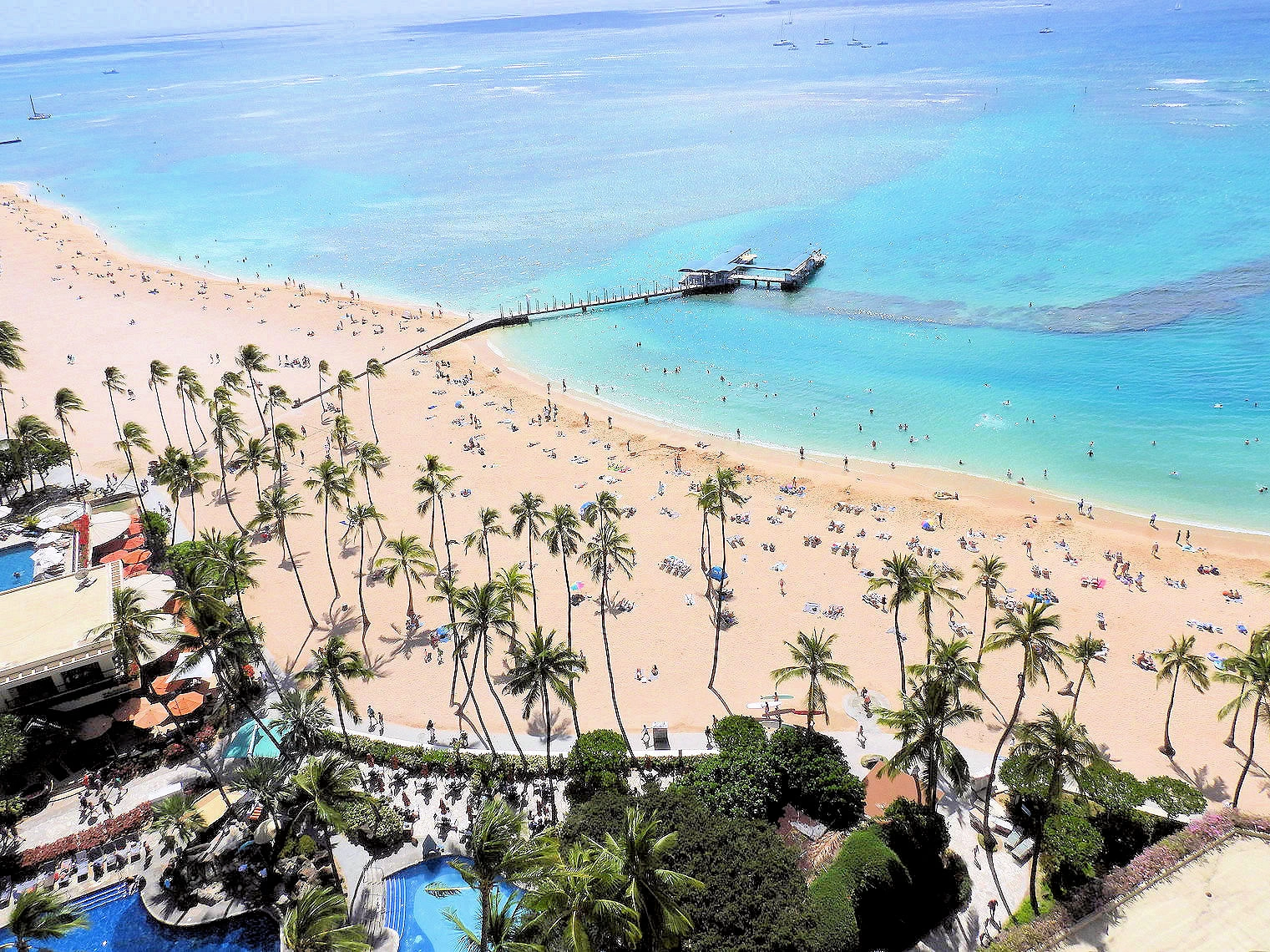
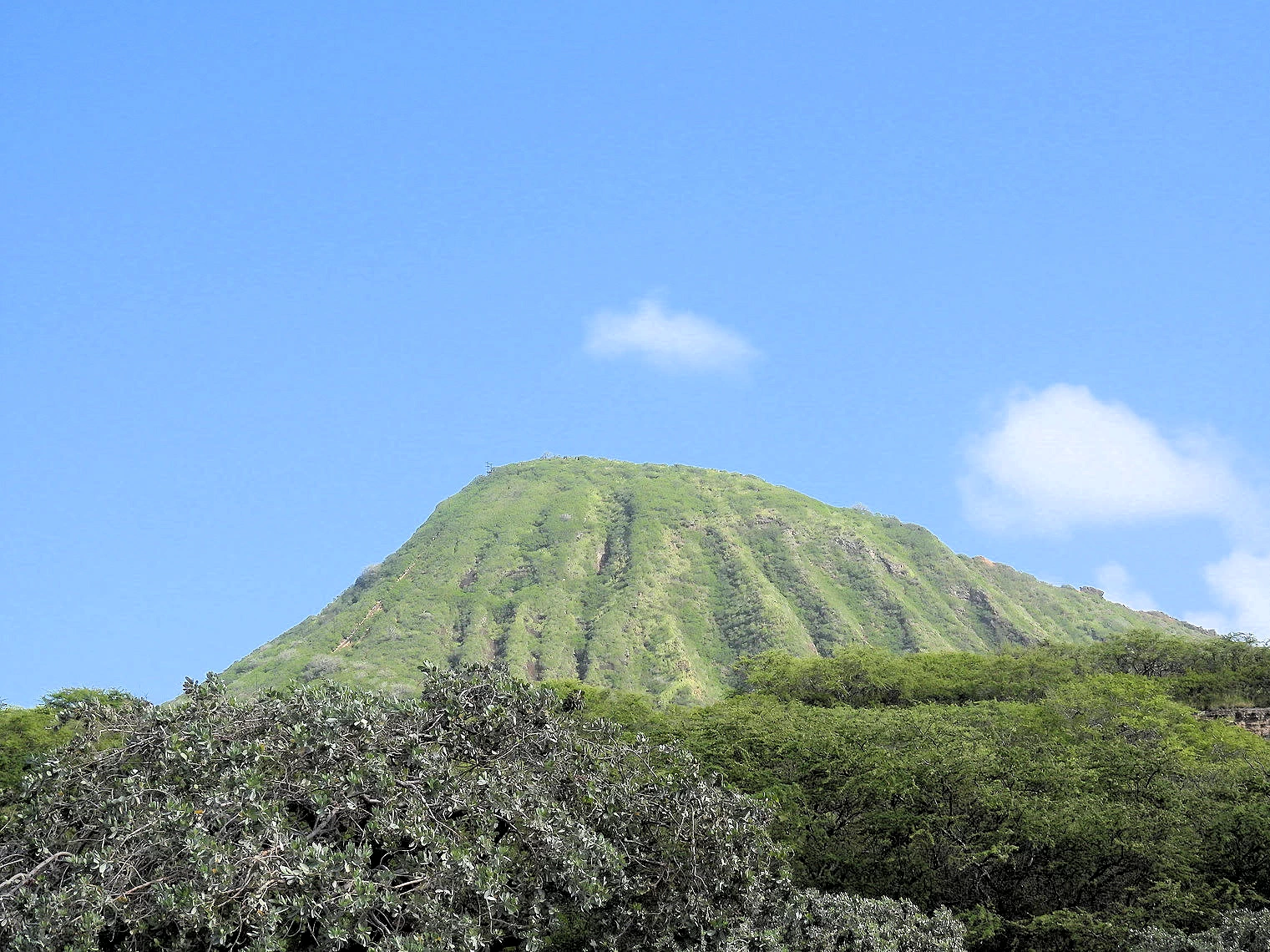
Diamond Head State Monument
 Diamond Head from Above
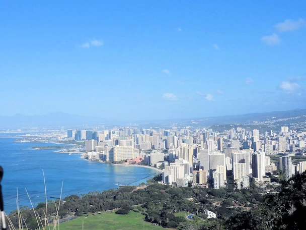
Diamond Head is a volcanic tuff cone on Oʻahu and known to Hawaiians as Lēʻahi. The Hawaiian name is most likely
derived from lae (browridge, promontory) plus ʻahi (tuna) because the shape of the ridgeline resembles the shape of a tuna's dorsal fin.
Its English name was given by British sailors in the 19th century, who named it for the calcite crystals on the adjacent beach.
Diamond Head is part of the Ko'olau Range of volcanoes that began erupting below sea level over 2.6 million years ago. A single
eruption around 300,000 years ago created the crater. The crater encompasses 350 acres. The crater is much larger than its rim as it was
formed explosively.
Image Credit: This image is the property of
Steve Jurvetson via Wikimedia Commons
using the Creative Commons Attribution 2.0 Generic license.
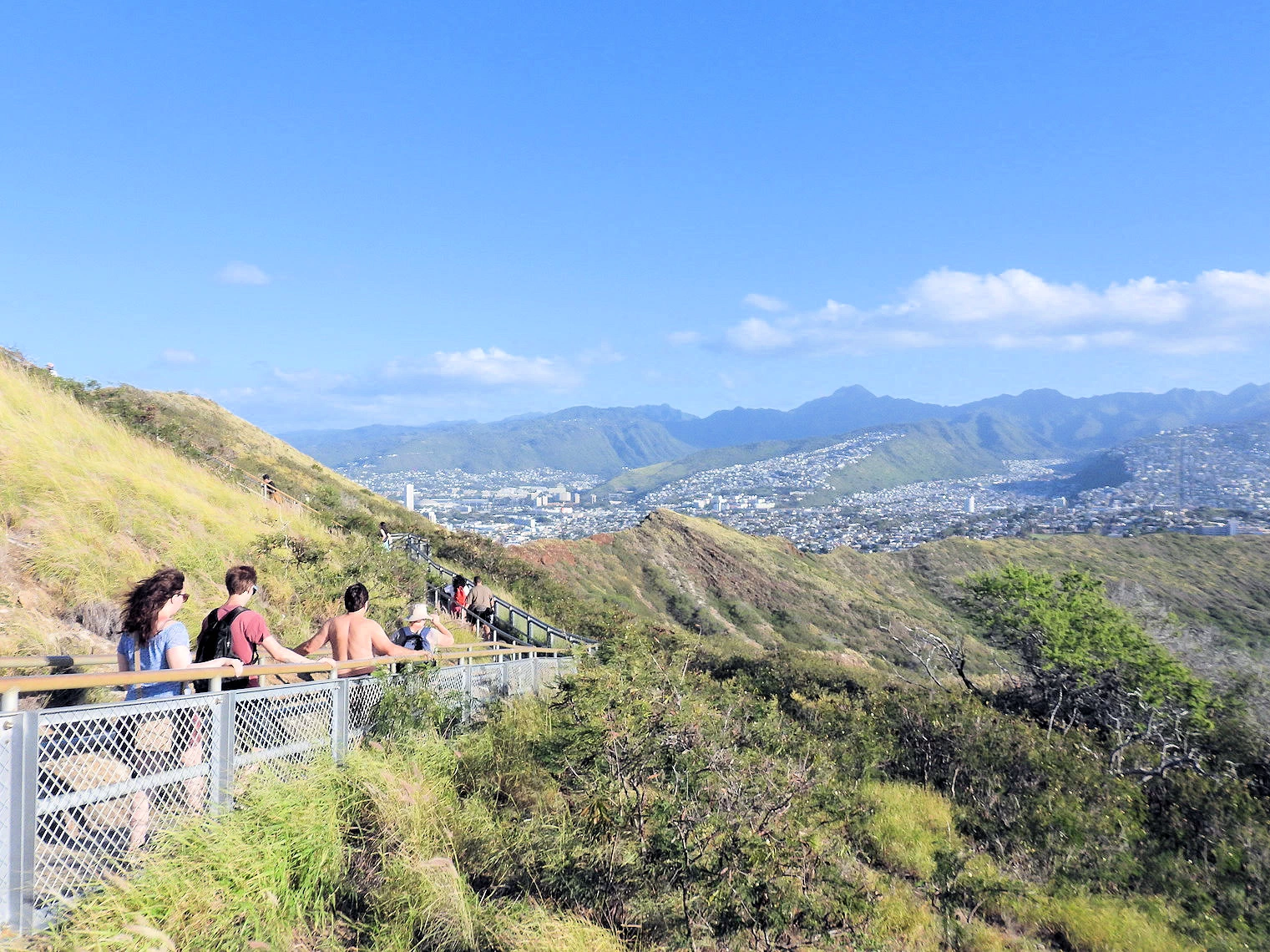
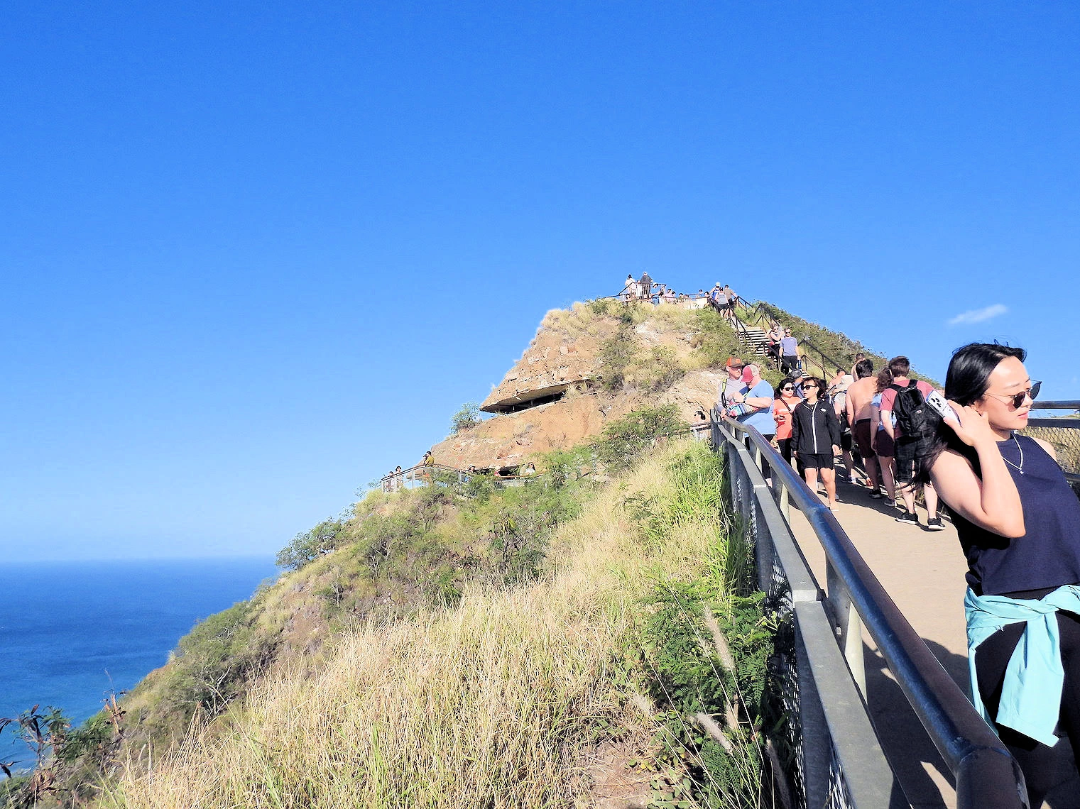
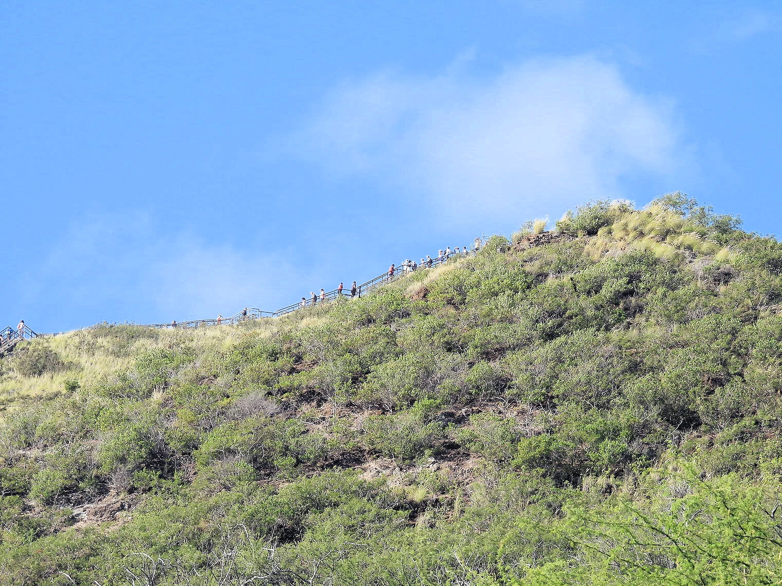
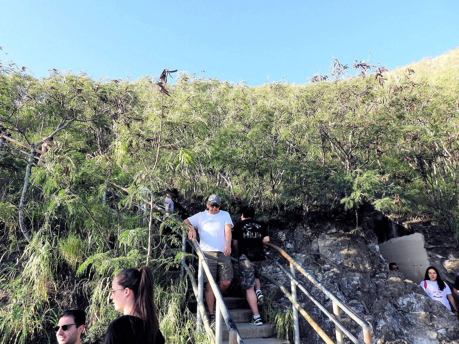
 Diamond Head State Park
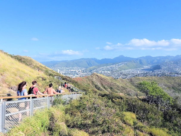 Hike to the Top
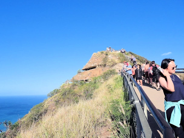 The Top is Near
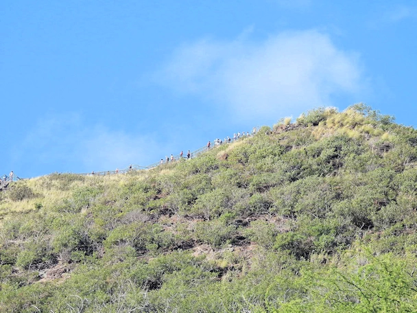 Crowded at the Top
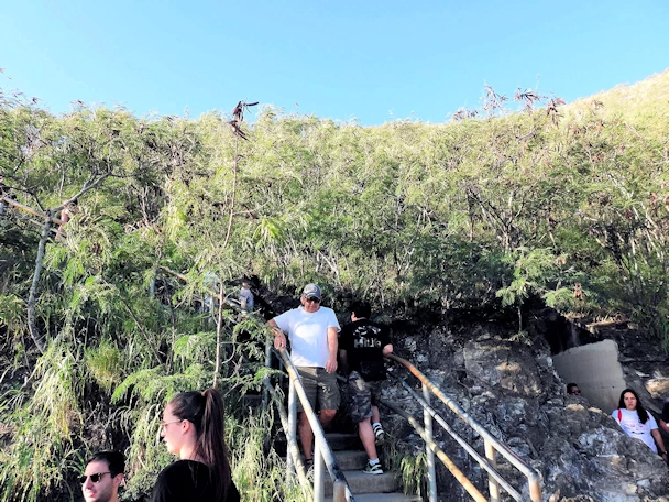 Hiking back Down
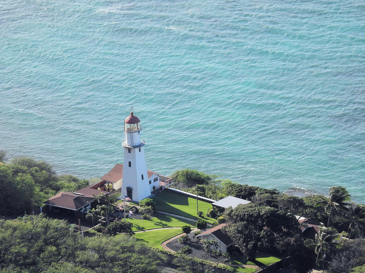
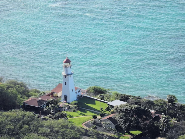 Diamond Head Lighthouse
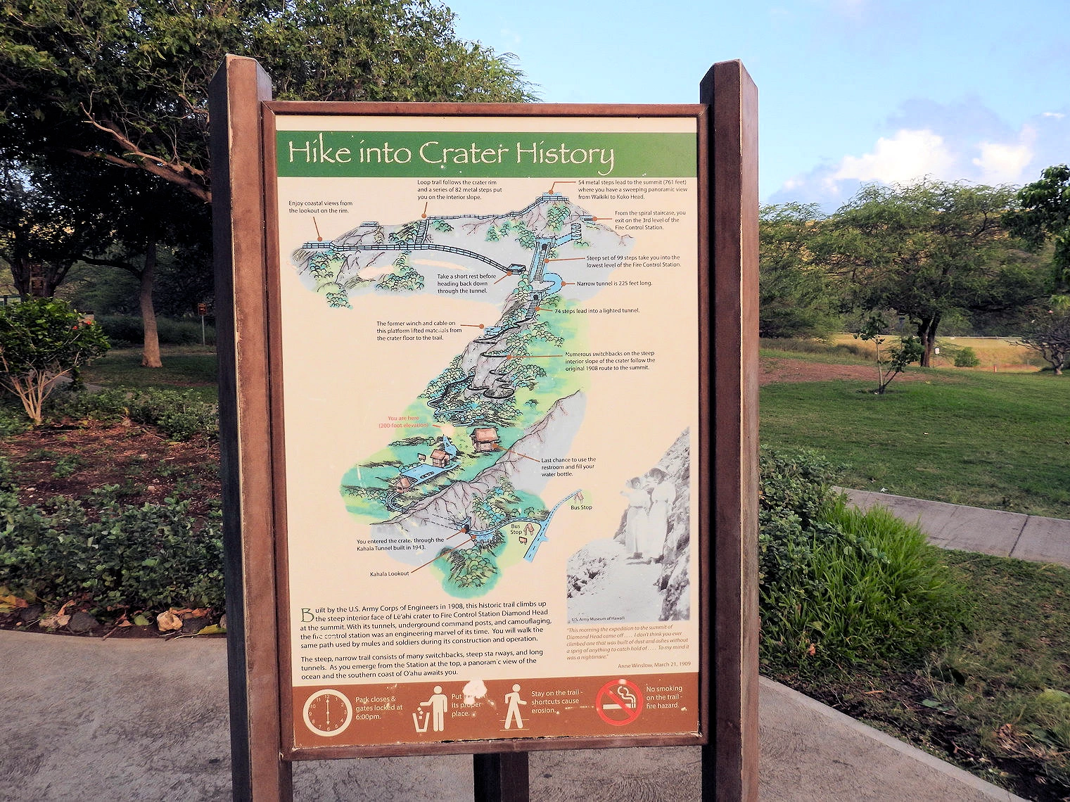
Our goal for this visit to Diamond Head was to hike up the trail to the top, where the views of Honolulu and the Pacific Ocean
are just stunning. From the parking lot on the crater floor, the trail to the summit is 0.8 mile one way and climbs 560 feet in elevation. There
is a paved concrete walkway for a distance of 0.2 miles at the start of the hike, but the trail becomes uneven and steep, requiring caution and
appropriate footwear. Portions of the trail involve steep stairways and another portion of the trail goes through a long, narrow tunnel which is
lighted.
Reservations are required and can be obtained online here. The
fee is partially for entrance and partially to park inside the parking lot. Reservations are for a specific date & time, so that the park does
not become over crowded.
Tip: Diamond Head uses timed entry/parking systems that change—check
the official page
before you go.
More Info for Diamond Head State Monument
- Diamond Head State Monument Wikipedia Article: Here is the link to the
Wikipedia Article..
- Google Images set for Diamond Head State Monument: Here is a
link to that Images Set.
- Diamond Head State Monument Map: Here is a
Google Map link.
- Diamond Head State Monument Website:
Here is a link to their website.
- Our Diamond Head State Monument Image Gallery:
Here is a link to our Image Gallery.
- Diamond Head State Monument Parking:
Here is a link to the reservations page. Reservations
can be made 30 days in advance. You are required to arrive within the first 30 minutes of your reservation period. If you arrive after 30 minutes into your
reservation period, you may be denied access and/or parking. There will be no refunds for no-shows or late arrivals.
- Diamond Head State Monument Entry Fees:
Out of state visitors (non-residents) are subject to an entry fee. Currently it is $10 per vehicle if you park inside the crater, or $5 per
person if you walk in or arrive via bus/taxi/trolley/ride share. Fees are payable only via credit card.
- Diamond Head State Monument Hours:
6:00 am to 6:00 pm Daily – Last entry at 4:00pm. Gates Close at 6:00 pm. For more information,
click here to go to the Diamond Head Monument Website.
- Diamond Head State Monument Facilities:
There is a rest room and a small gift shop adjacent to the parking lot, however there are no facilities anywyhere on the trail.
- Google Reviews for Diamond Head State Monument
- Image Credits: The large Diamond Head Aerial view image is the property of the Hawaii Department of Land and Natural Resources -
Division of State Parks
All other images, unless otherwise noted, are the property of Just Traveling Thru, LLC.
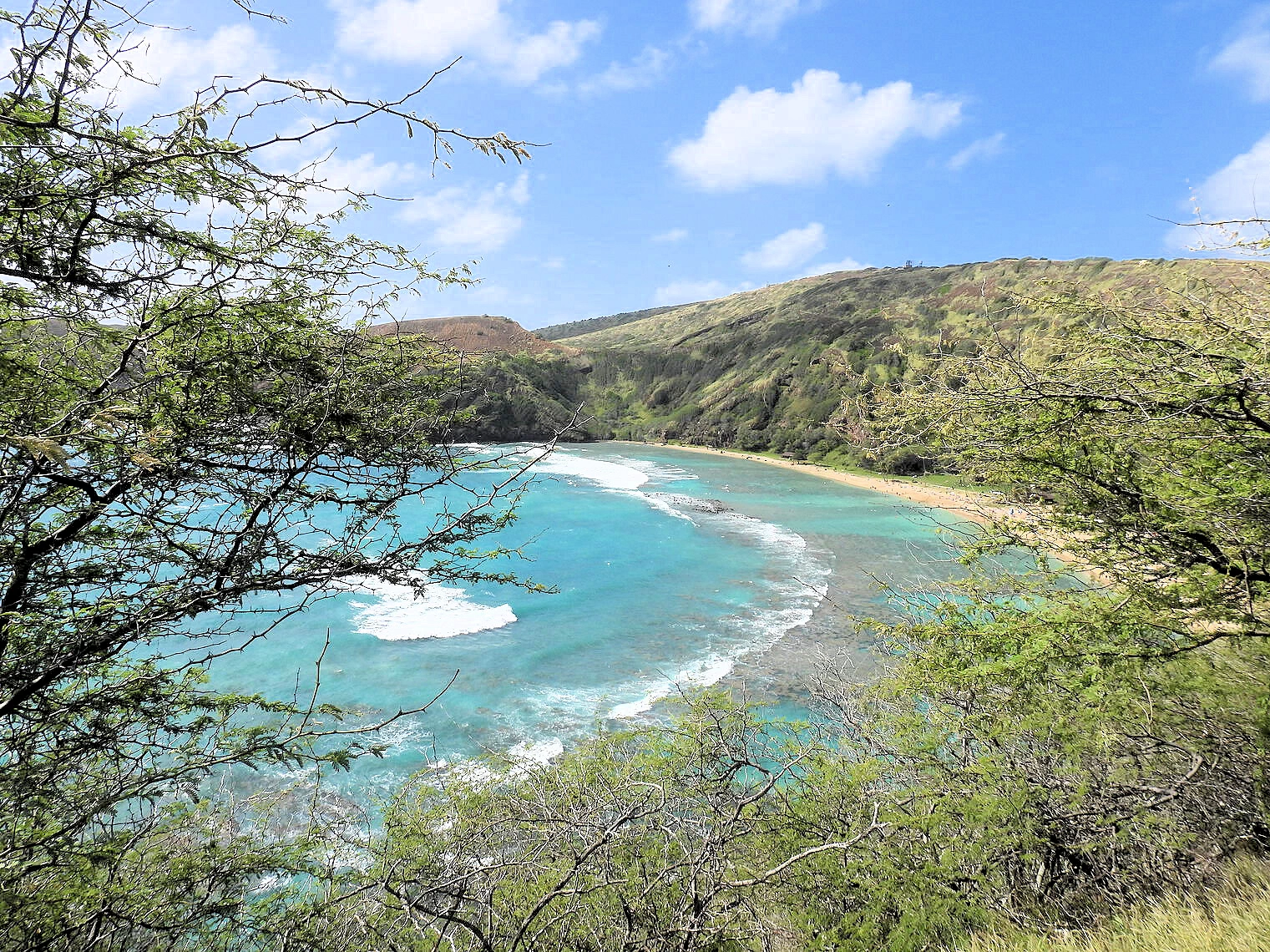
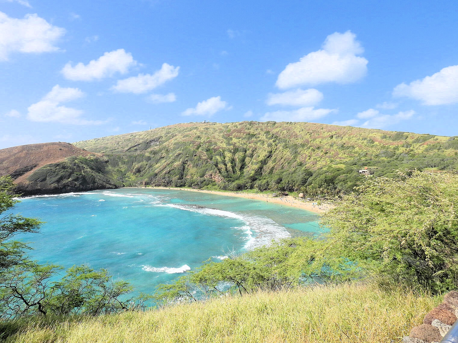
 Hanauma Bay
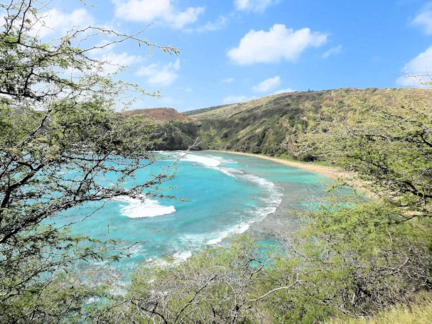 Hanauma Bay
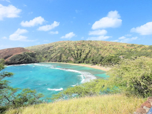 Hanauma Bay
We drove here after completing our Diamond Head hike because it is only 8.4 miles south. There is quite a bit of parking here, however you are
required to pay a small fee to use the parking lot. The bay area itself requires
reservations, click here to learn more. We
did not walk down the hill to the shoreline as my legs were still screaming from the Diamond Head hike.
Hanauma Bay is only 2.3 miles north of
Sandy Beach which generally has some interesting
surf - but a word of caution as the shore break there can be rugged and has caused a lot of injuries. Enjoy the locals body boarding there but
be careful if you go into the water. The Halona Blowhole Lookout is just .5 mile before you reach Sandy Beach, and it too is well worth a look.
Background Info from Wikipedia:
Hanauma is both a Nature Preserve and a Marine Life Conservation District (the first of several established in the State of Hawaiʻi). Reflecting
changes in attitude, its name has changed over time from Hanauma Bay Beach Park to Hanauma Bay Nature Preserve. Visitors are required by law
to refrain from mistreating marine animals or from touching, walking, or otherwise having contact with coral heads, which appear much like
large rocks on the ocean floor (here, mostly seaward of the shallow fringing reef off the beach).
Click the Wikipedia link below to read the full article about Hanauma Bay.
More Info for Hanauma Bay State Park
Pearl Harbor Memorials Map
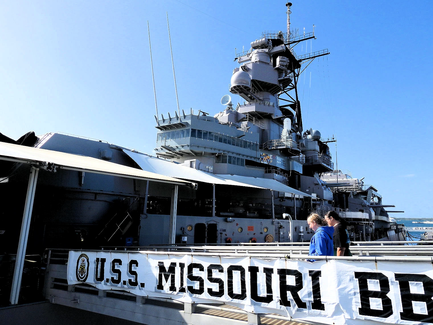
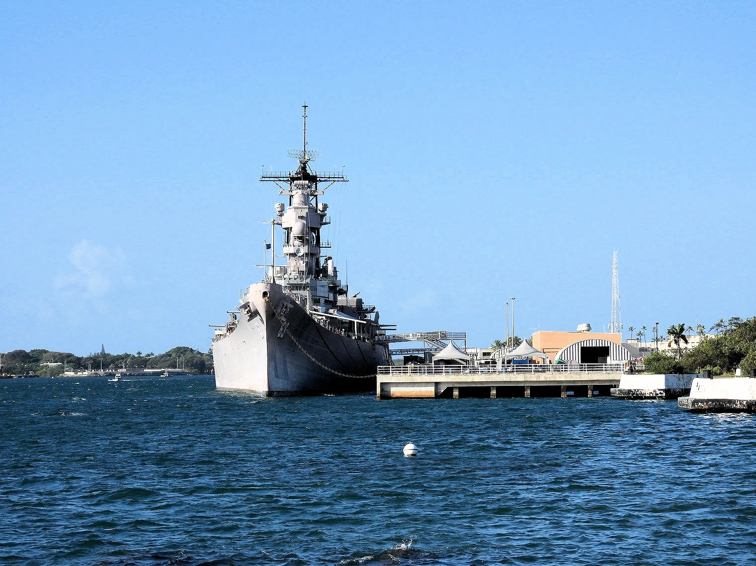
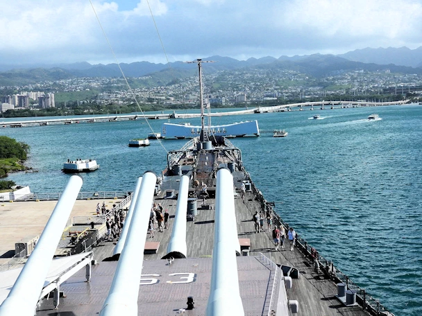 USS Missouri
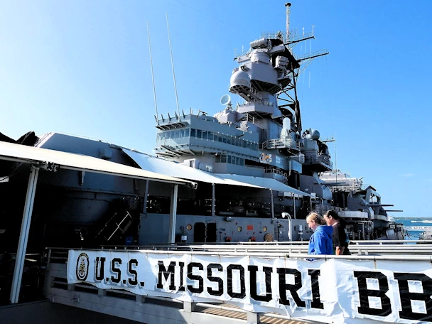 USS Missouri
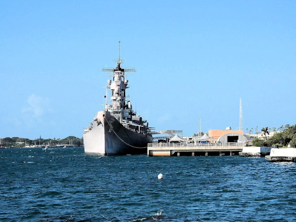 USS Missouri
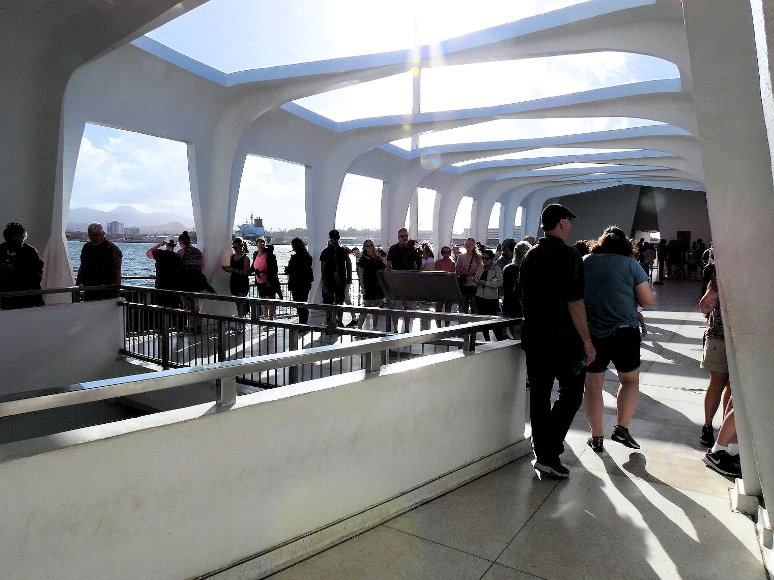
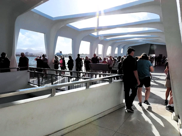 USS Arizona Memorial
We visited the USS Arizona (BB-39) Memorial and then took the bus over to visit the USS Missouri (BB-63). The Missouri is one of the four Iowa class
battleships that were built late in WW2 (BB-63 entered service on 11 June 1944). The Navy had originally ordered six ships based
upon the Iowa ship class design of which four were completed (
USS Iowa BB-61,
USS Missouri BB-63,
USS Wisconsin BB-64 and
USS New Jersey BB-62), and two were cancelled (
USS Illinois BB-65 and
USS Kentucky BB-66) in
order to build more aircraft carriers.
During 1945-1958, the hull of the unfinished battleship USS Illinois (BB-65) was located at the
Philadelphia Naval Shipyard in Philadelphia, Pennsylvania. Its construction was canceled in August
1945, but it remained in the dry dock until September 1958, when it was finally scrapped.
From 1945 till 1950 the USS Kentucky was docked in a partially constructed state at the Norfolk Naval
Shipyard. Construction was suspended multiple times - it was sold for scrap in 1958 after
being used as a parts ship, most notably providing its bow for the USS Wisconsin after a 1956
collision. The ship was one of the final Iowa-class battleships whose construction was canceled
due to the post-WWII military drawdown and the rapid advancement of missile technology, which
made large battleships less relevant.
The USS Missouri played a significant role in World War II, particularly in the Pacific Theater, and was the site of the Japanese surrender
on September 2, 1945, which marked the end of the war. After World War II, the USS Missouri was decommissioned and then recommissioned several
times, serving in the Korean War and the Gulf War, among other conflicts.
The Iowa-class battleships were indeed a remarkable feat of engineering and design, and they were built to be formidable warships capable of
engaging in naval battles on a large scale. It's unlikely that we will ever see such large and heavily armed battleships again, as modern
naval warfare has shifted toward smaller, more agile ships with advanced technology and weaponry. Nonetheless, the Iowa-class battleships
remain a testament to the technological achievements of their time and their significant contributions to naval history.
Where are all of the Iowa Class Battleships Today?
Pearl Harbor Background Info from Wikipedia:
Pearl Harbor is a lagoon harbor on the island of Oahu, Hawaii, west of Honolulu. It was often visited by the Naval fleet of the United States, before
it was acquired from the Hawaiian Kingdom by the U.S. with the signing of the Reciprocity Treaty of 1875. Much of the harbor and surrounding lands
are now a United States Navy deep-water naval base. It is also the headquarters of the United States Pacific Fleet. The U.S. government first
obtained exclusive use of the inlet and the right to maintain a repair and coaling station for ships here in 1887.
Click the Wikipedia Link below to go to the full article about Pearl Harbor.
More Info for Pearl Harbor
- Arizona Memorial Entrance: The USS Arizona Memorial requires advance purchase day/time tickets/reservations -
which can be found here. Note that because the
USS Arizona site is maintained as a
National Memorial, there is no
cost to visit it. If you obtain your access tickets online, there is a one dollar fee for handling.
- Our Pearl Harbor Image Gallery: Here is a link to
our image gallery..
- Pearl Harbor Wikipedia Article:
link to that Article..
- Pearl Harbor Google Images Set: Here is a
link to that Google Images Set.
- Pearl Harbor Website
The National Park Servie Pearl Harbor Page.
- Pearl Harbor Memorial Parking:
Pearl Harbor National Memorial charges a parking fee to all those arriving in personal or rented vehicles. The parking fee
will be $7/day and will be paid via a virtual pay system through visitors' mobile devices or though an onsite kiosk located
within the Visitor Center complex. The parking lot is large, but spreadout, so if you have people with you that have difficulty
walking, try to drop them at the entrance.
- Google Reviews for the Pearl Harbor Arizona Memorial
- Image Credits: All the above images, unless otherwise noted, are the property of Just Traveling Thru, LLC.
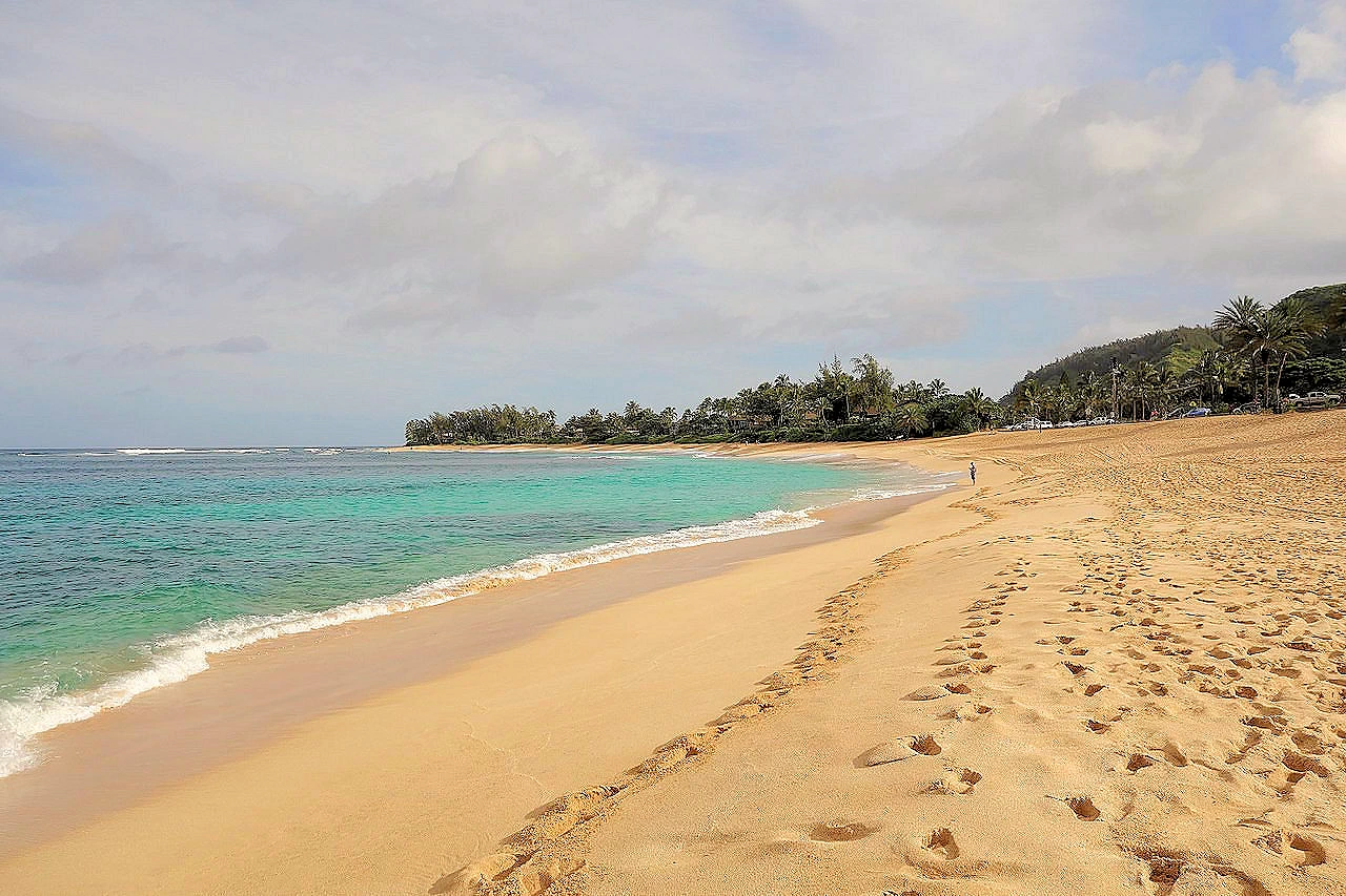
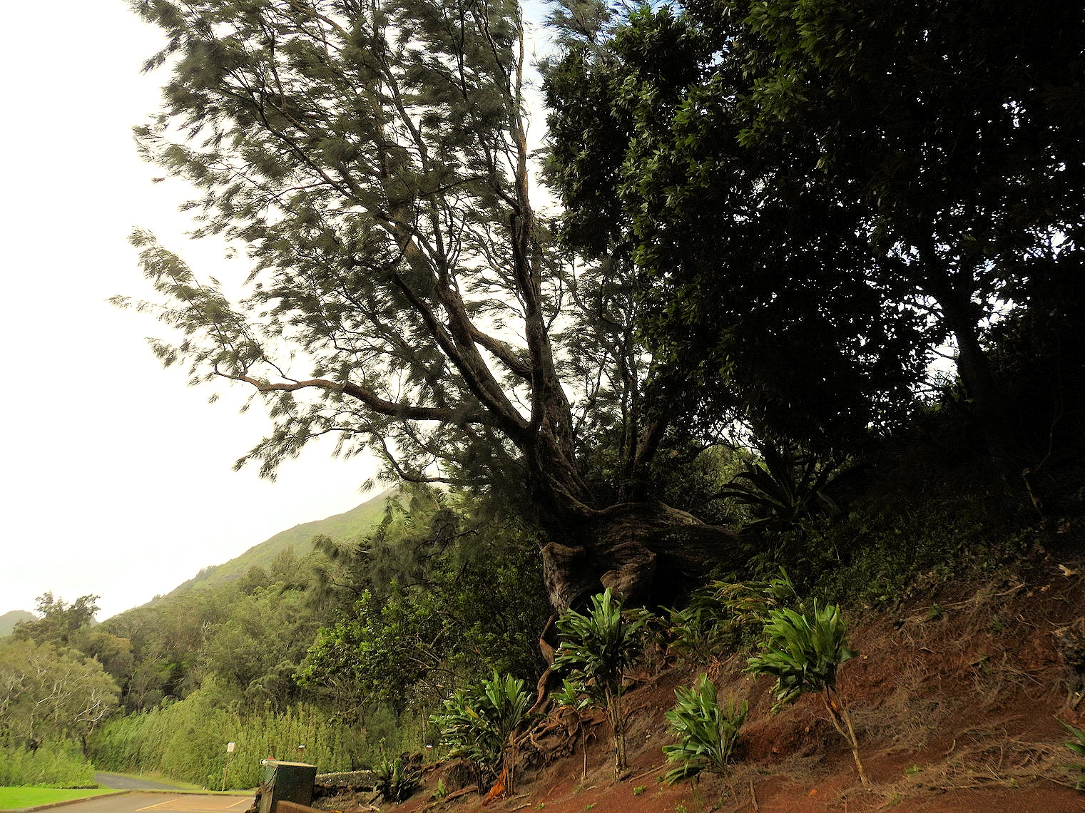
North Shore of Oahu
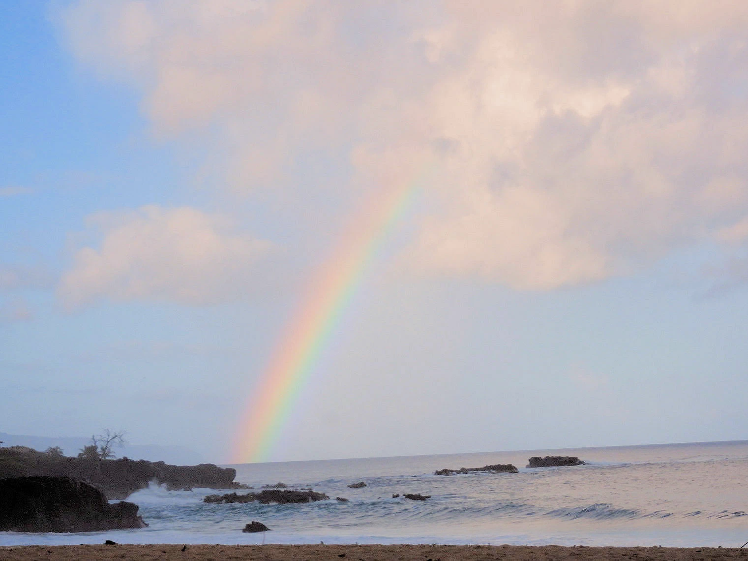
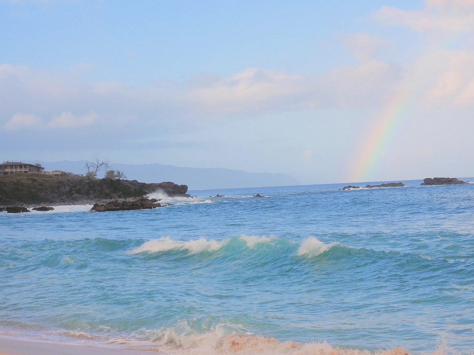
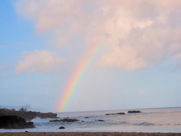 Rainbow at Haleʻiwa Beach
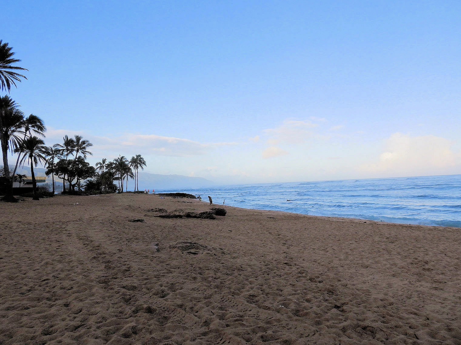
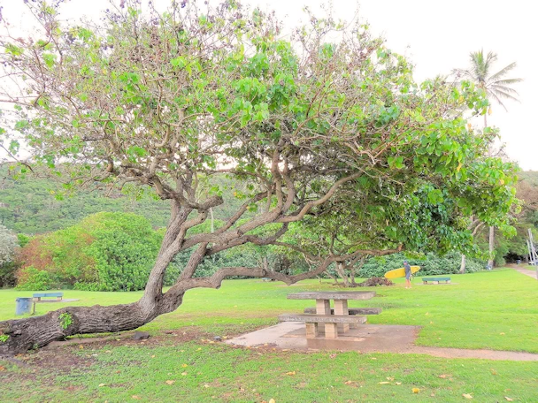 Kaiaka Beach State Park
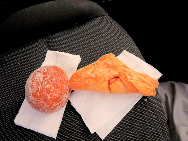 Malasadas from Waialua
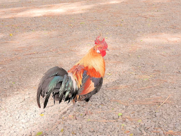 Haleiwa Rooster
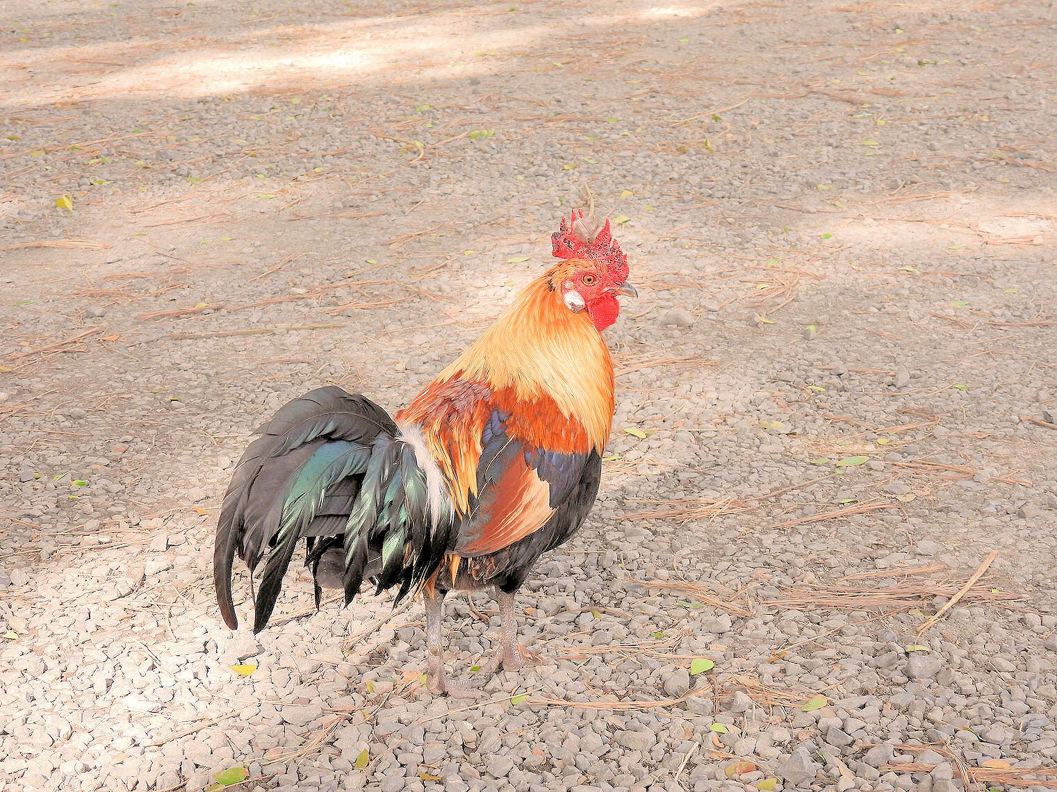
If you look at a map of Oahu, the "North Shore" is pretty much where you would expect, it is the entire north end of the island. We wanted to
traverse Haleiwa, Waimea Bay and then continue on around the north end and then south to Kaneohe so we could come back to Honolulu via the Pali
Pass.
The North Shore of Oahu is a beautiful and iconic stretch of coastline that spans approximately 7 miles along the northern coast of the island
of Oahu, Hawaii. It is famous for its big waves, pristine beaches, and lush tropical scenery. The North Shore is also a popular destination
for surfers and water sports enthusiasts, as it boasts some of the world's most challenging and rewarding surf breaks.
Aside from its surfing fame, the North Shore boasts stunning beaches, including the peaceful
Ehukai Beach Park and the scenic Turtle Bay. The area is also
rich in cultural history, with the charming town of Haleiwa serving as the cultural and
artistic heart of the North Shore.
Getting to the North Shore from the Hotel was straight forward; North on the H-1 to the H-2 and then exit onto route 99 to Haleiwa. We hung out awhile
at the beach there, and then drove further north on route 83 (Kamehameha Highway) to Waimea Bay. Route 83 begins to swing south at
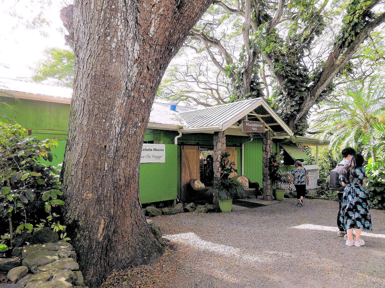
Kawela Bay and we continued south to
Tropical Farms Macadamia Nuts , where we stopped to purchase some nuts
and enjoy their coffee. From there we continued south to route 61 that took us back to Honolulu via the Pali Pass.
More Info for the North Shore
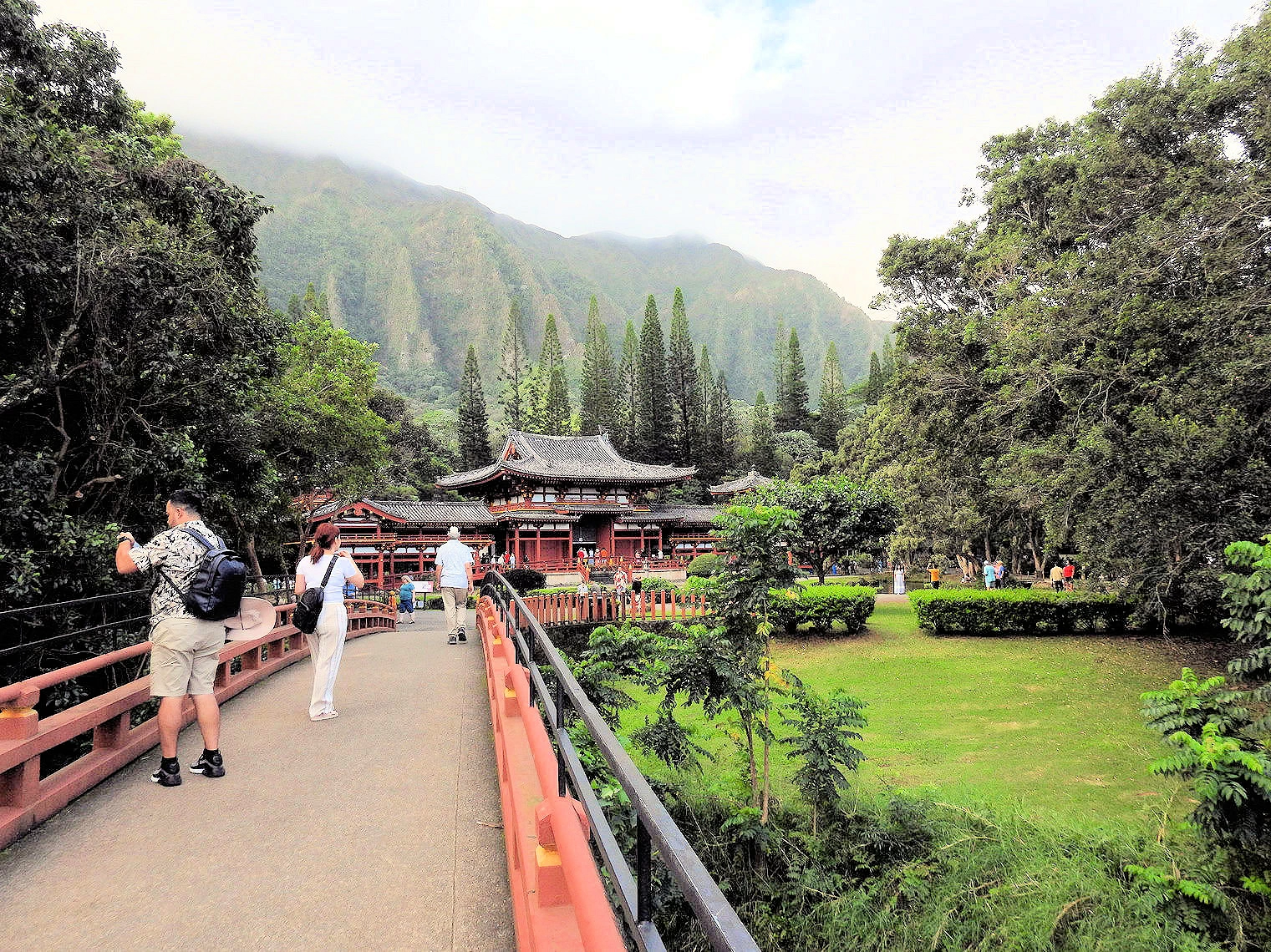
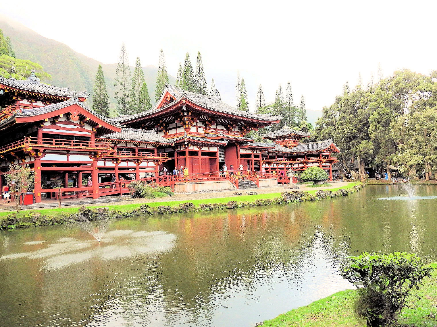
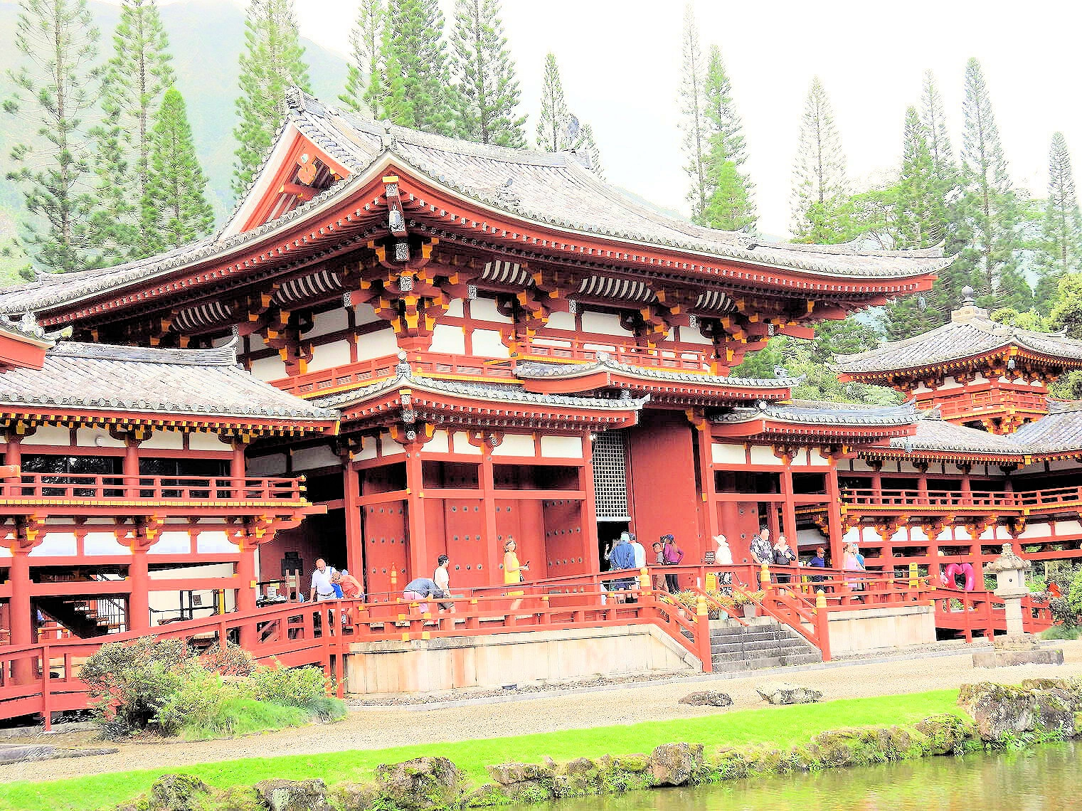
 Byodo-in Entrance Bridge
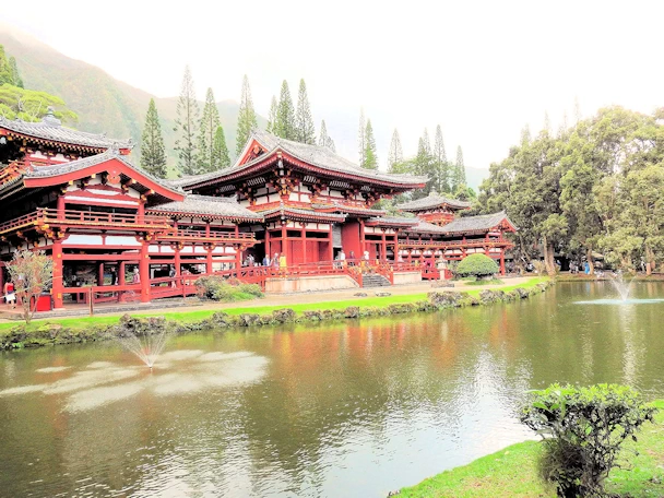 Byodo-in Japanese Temple
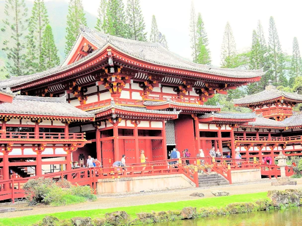 Byodo-in Japanese Temple
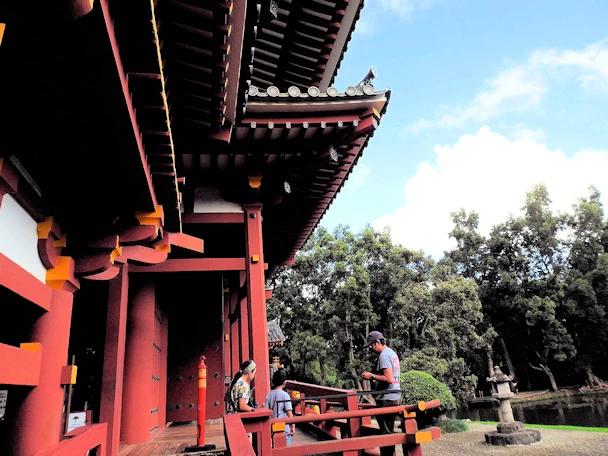 Exploring the Byodo-in Temple
The Byodo-in Japanese temple can be found on the windward side of Oahu in Kaneohe on route 83. The temple is a scale replica of a
temple in Uji, Japan. It was constructed to celebrate the 100th anniversary of Japanese immigration to the Hawaiian islands. The
temple and grounds are picturesque and it’s worth stopping for some photos and to appreciate the temple and grounds on your way to or
from that side of the island.
The temple's architecture is a masterpiece of Japanese design, featuring a stunning crimson pagoda and tranquil reflecting pond surrounded by vibrant
gardens and towering trees. Visitors are greeted by the towering "Phoenix Hall," which houses a breathtaking nine-foot statue of the Buddha, casting
a sense of serenity over the surroundings.
The Byodo-in Temple is not an active place of worship but serves as a contemplative and educational destination, inviting people of all backgrounds
to appreciate the beauty of Japanese culture and spirituality. The temple grounds offer a sense of tranquility, making it a popular spot for meditation, reflection,
and photography. It's a unique and spiritual oasis, providing a glimpse into the rich tapestry of Japanese heritage while offering visitors a peaceful escape
from the modern world.
More Info for the Byodo-in Temple
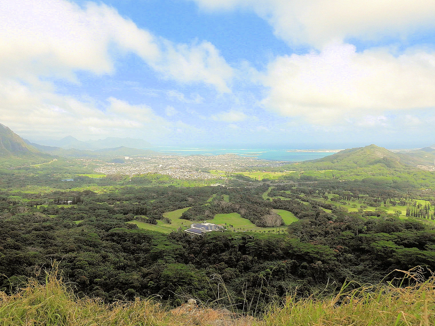
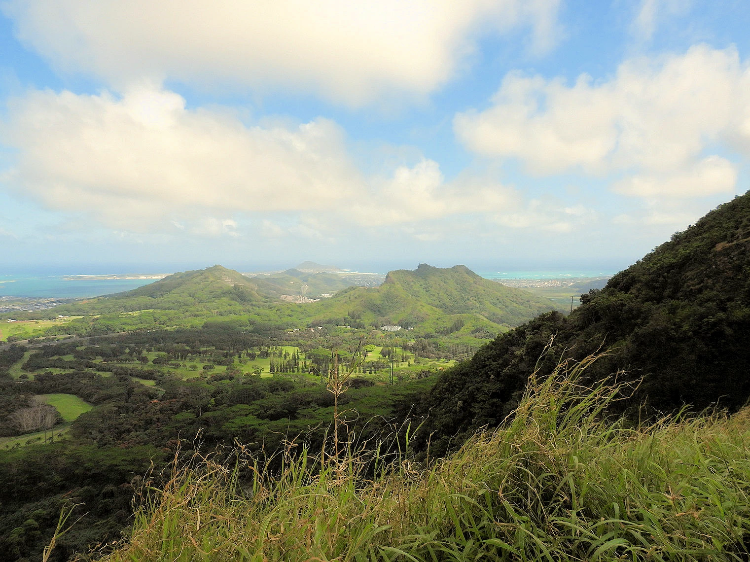
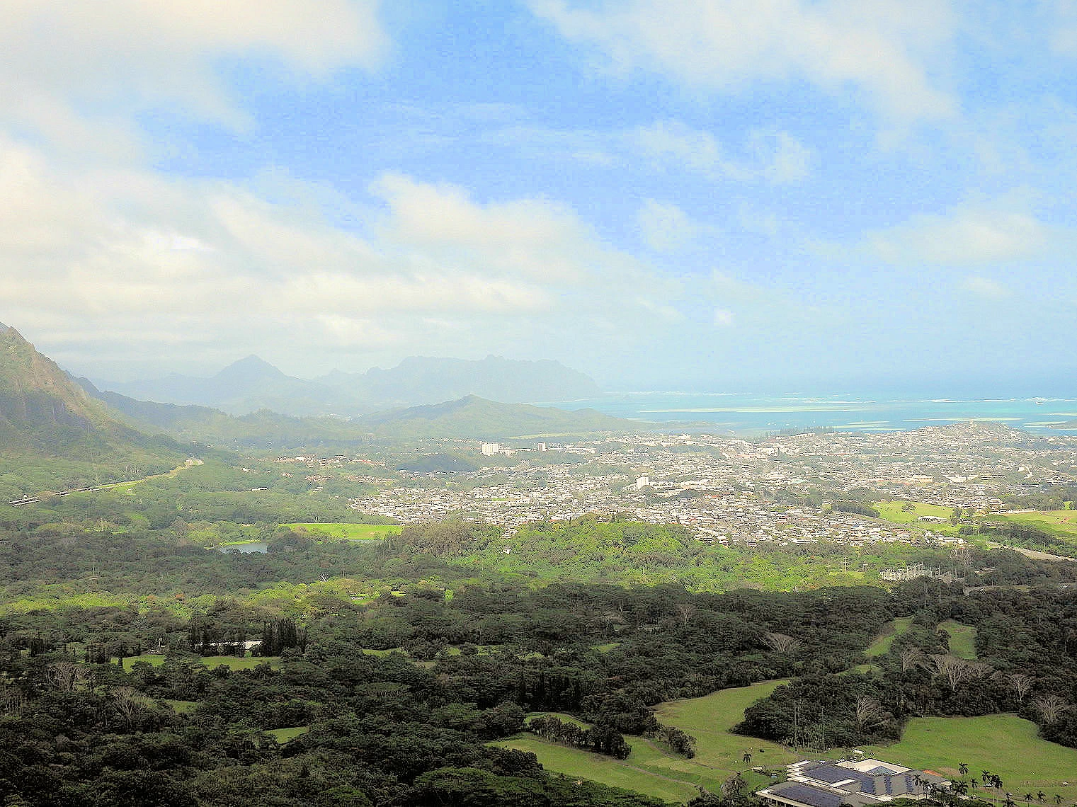
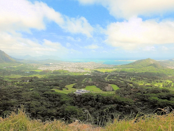 Nuʻuanu Pali Lookout
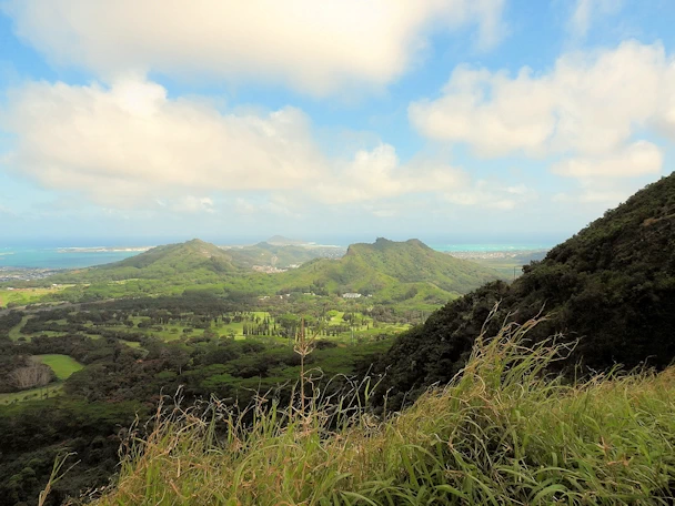 Nuʻuanu Pali Lookout
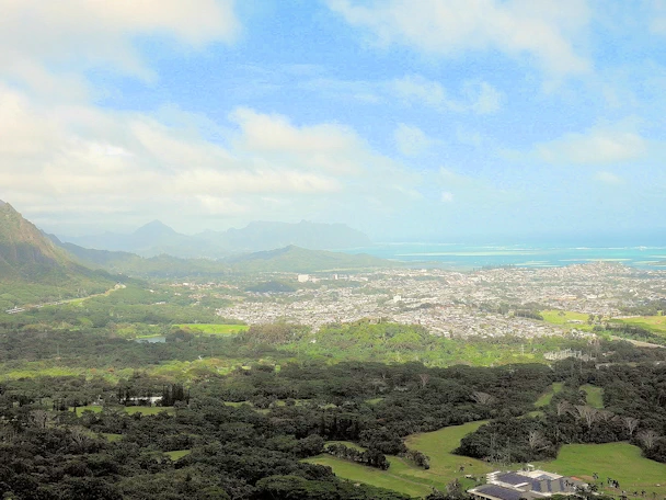 View of Kāneʻohe Beach from Nuʻuanu Pali
 Nuʻuanu Pali Lookout
Nuʻuanu Pali is a section of the windward cliff of the Koʻolau mountain located at the head of Nuʻuanu Valley on the island of Oʻahu. It
has a panoramic view of the windward (northeast) coast of Oʻahu. The Pali Highway (Hawaii State Highway 61) connecting Kailua/Kāneʻohe with
downtown Honolulu runs through the Nuʻuanu Pali Tunnels bored into the cliffside.
This is always a fun place to visit because of the views, but also because the winds are always strongly blowing! The trade winds blow through the valley between the
high mountains on either side, forming a strong wind tunnel of sorts. Wind speeds of up to 74 mph have been recorded here, and it is nearly impossible
to walk upright against winds like that! My wife was nearly blown down by the winds that day, after I went forward and we both groped our way
to the lookout area - because together we could safely navigate the winds.
More Info for the Nuʻuanu Pali Lookout
- How to get to the Nuʻuanu Pali Lookout? If you are driving east on Hawaii Route 61, exit onto Nuuanu Pali Drive and proceed east to the parking lot. If
you are driving west on Hawaii Route 61, you will exit right onto Nuuanu Pali Drive and drive east to the parking lot. The Nuʻuanu Pali Lookout is adjacent to the
parking lot.
- Our Nuʻuanu Pali Image Gallery: Here is a link to
our image gallery..
- Nuʻuanu Pali Wikipedia Article:
here is a link to that Article..
- Nuʻuanu Pali Google Images Set: Here is a
link to that Google Images Set.
- Nuʻuanu Pali Hiking Info
Here is a link to the All Trails Site.
- Google Reviews for the Nuʻuanu Pali Lookout
- Image Credits: All the above images, unless otherwise noted, are the property of Just Traveling Thru, LLC.
National Memorial Cemetery of the Pacific Map
 Punchbowl Cemetery
 Punchbowl Cemetery
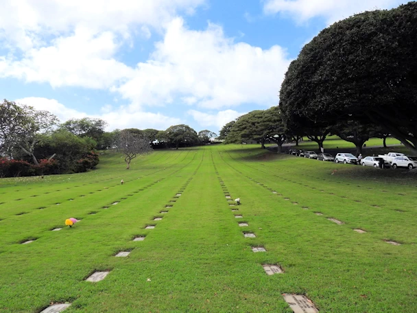 Punchbowl Cemetery
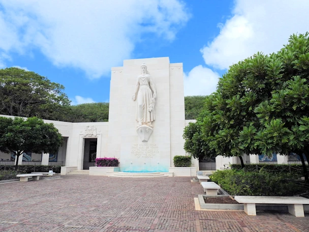 Punchbowl Cemetery
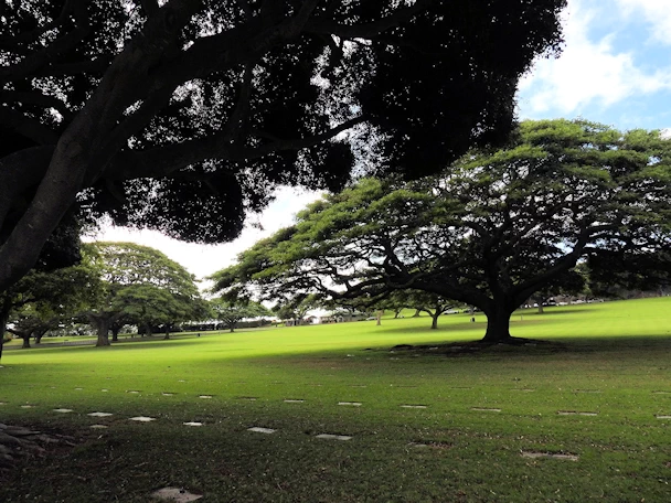
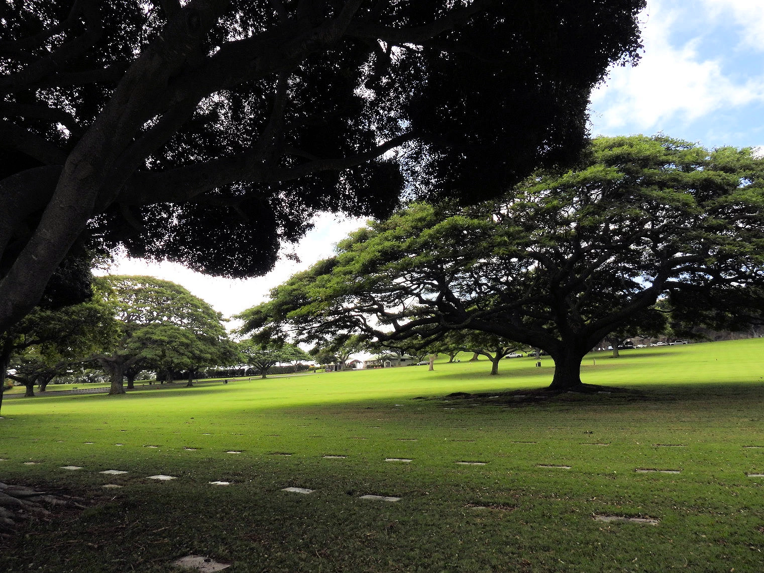
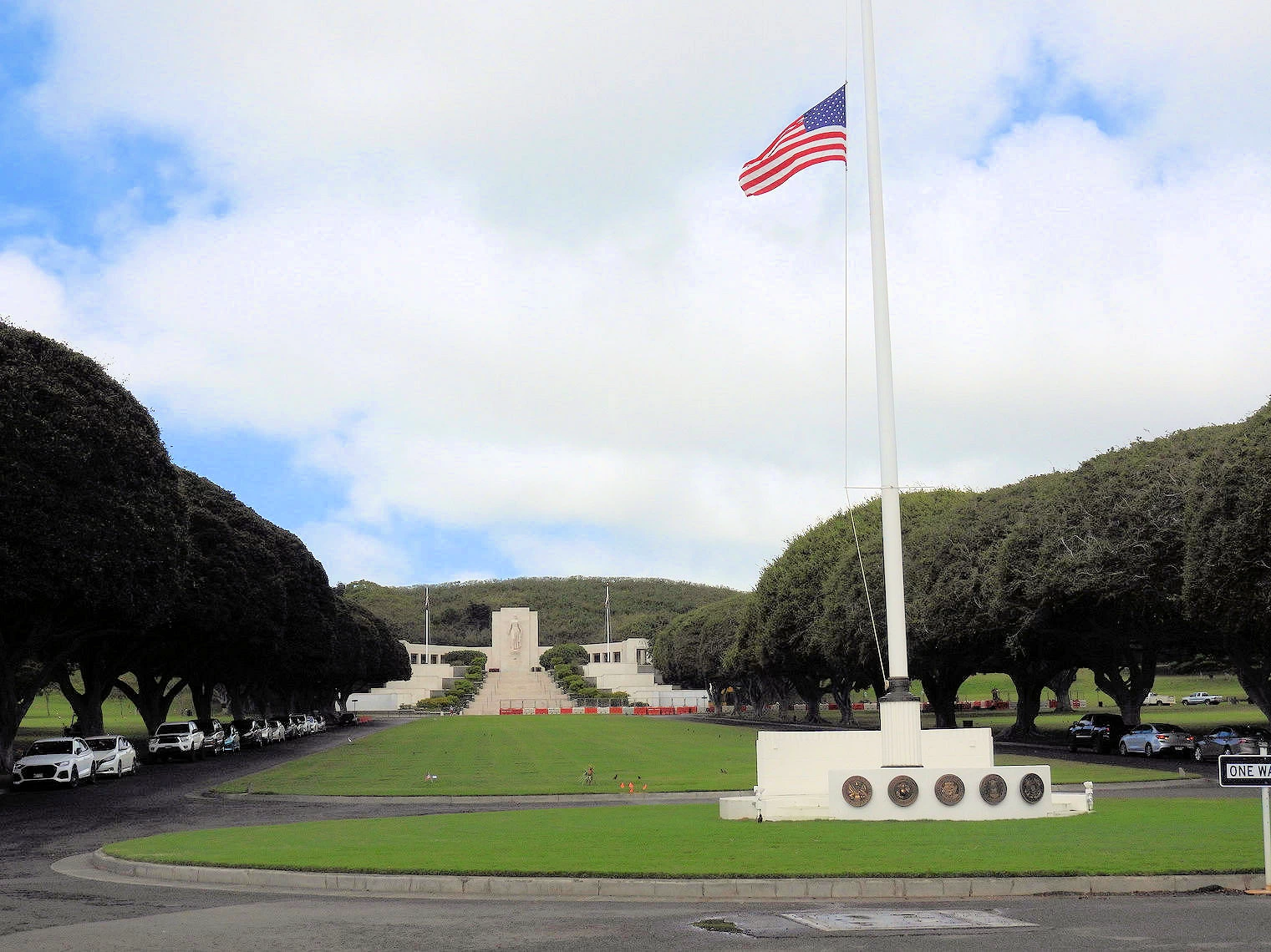
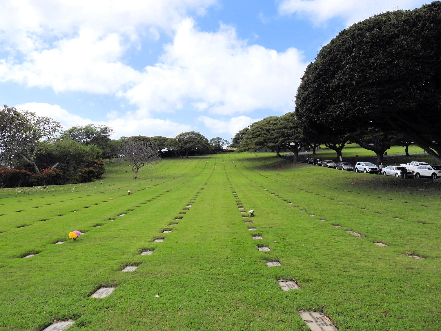
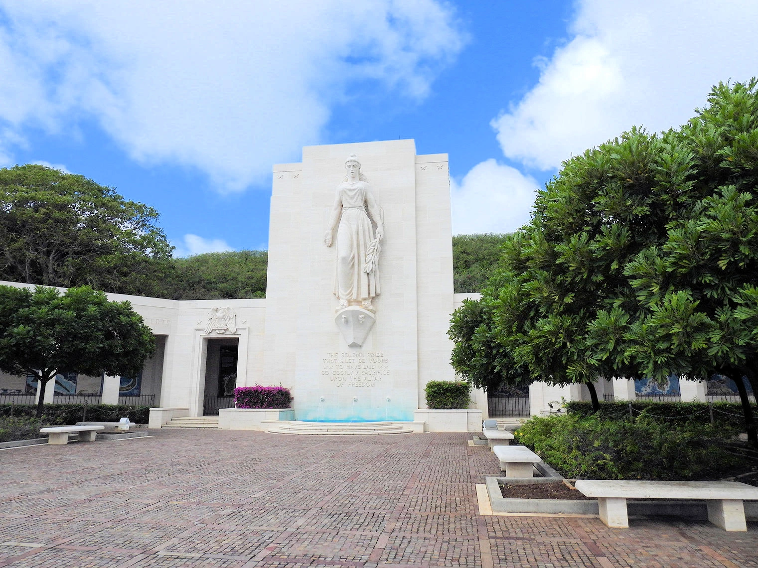
The National Memorial Cemetery of the Pacific (informally known as the Punchbowl Cemetery) is a national cemetery located at Punchbowl Crater
in Honolulu, Hawaii. Since it is located in the same general direction of the Pali Lookout, we stopped here on the way up to Pali Pass. In addition,
one of Celeste's uncles (James Serrenho) has his name inscribed on the memorial wall. Mr. Serrenho was aboard the USS Morrison (DD-560) during
the invasion of Okinawa when the ship was sunk after repeated kamikaze attacks on May 4th 1945.
Located within the crater of an extinct volcano, the cemetery offers a serene and contemplative atmosphere. Lush
tropical greenery cascades down the crater walls, creating a vibrant contrast against the white marble
headstones. Meticulously maintained lawns and gardens provide a sense of peace and tranquility. The cemetery's
architecture is both solemn and inspiring, with the towering white columns of the Memorial symbolizing the
sacrifice of those honored within. As visitors gaze out from the crater rim, they are rewarded with
breathtaking panoramic views of Honolulu, adding to the overall sense of awe and respect.
When you realize that all of these grave sites are occupied by WW2 heroes, it is a beautiful tribute to the price they paid
to our country.
More Info for the Punchbowl Cemetery
- Our Punchbowl Cemetery Image Gallery: Here is a link to
our image gallery..
- Punchbowl Cemetery Wikipedia Article:
link to that Article..
- Punchbowl Cemetery Google Images Set: Here is a
link to that Google Images Set.
- Punchbowl Cemetery Website
The National Cemetery Administration Page.
- Punchbowl Cemetery Parking:
Parking is available to the side and in the back of the Memorial. The Memorial consists of the monumental stairs flanked by
the ten "Courts of the Missing."
- Punchbowl Cemetery Hours:
The cemetery is open daily from 8:00 a.m. to 6:00 p.m.
- Punchbowl Cemetery Map:
link to a Google Map.
- Punchbowl Cemetery Viewpoints:
The views from the "Punchbowl Scenic Lookout" of Honolulu are very good, just drive up the hill inside to the left of the
Punchbowl Cemetery entrance and park in the area fronting the restrooms. There are also good Views of Diamond Head along the walk
up Pouwaina Drive on the eastern slopes of Punchbowl Crater.
- Google Reviews for the Punchbowl Cemetery
- Image Credits: All the above images, unless otherwise noted, are the property of Just Traveling Thru, LLC.
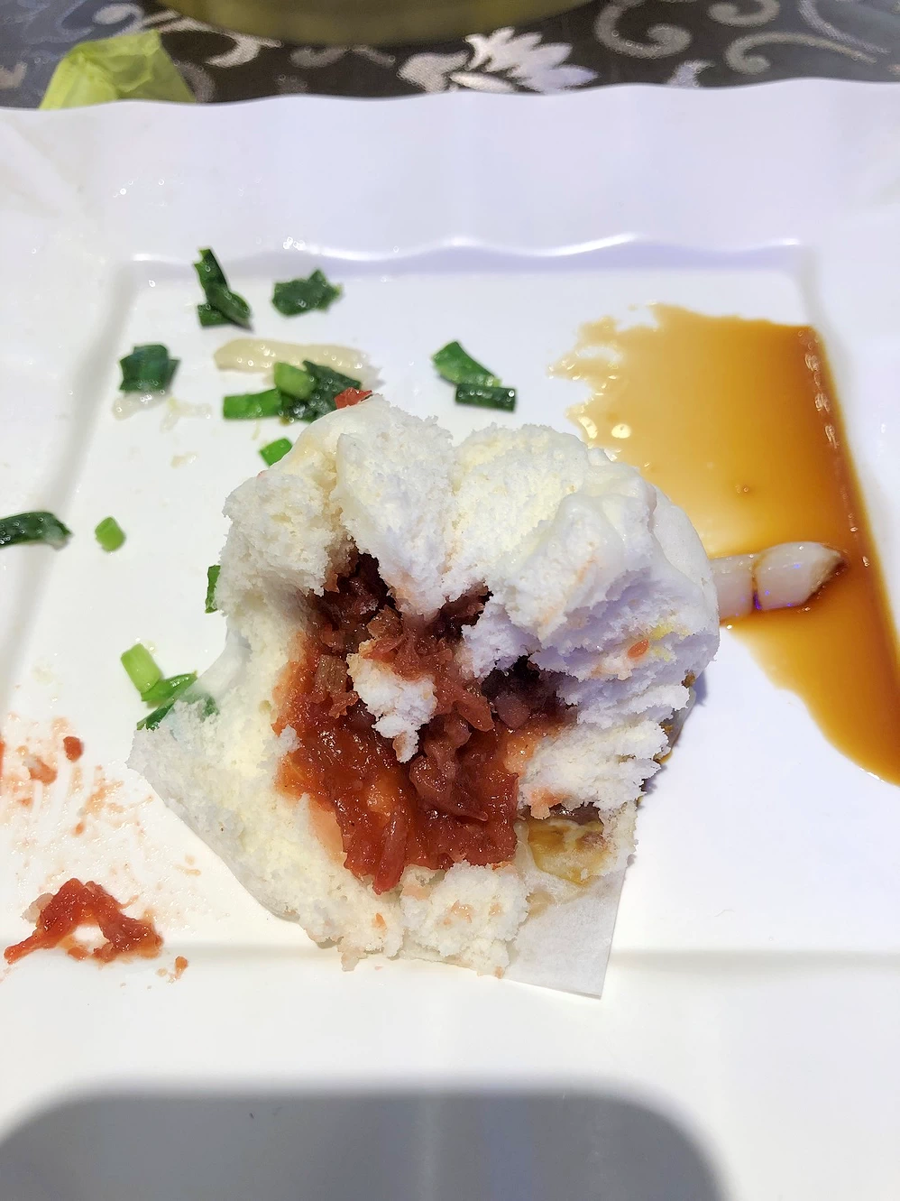
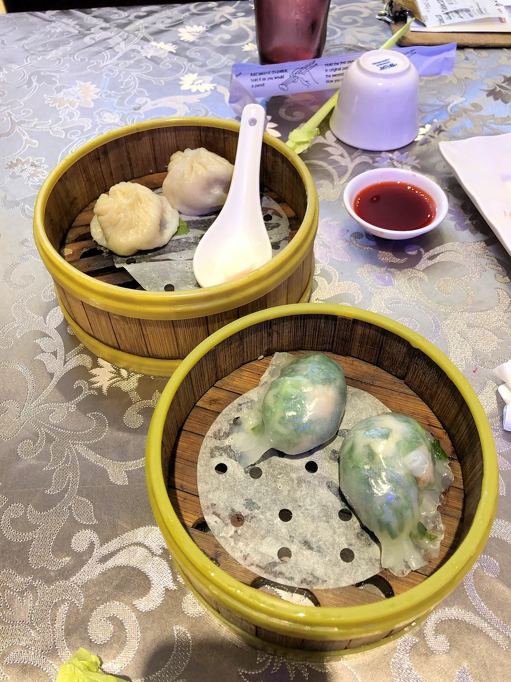
Jade Dynasty Seafood Restaurant Honolulu Map
 Jade Dynasty Seafood Restaurant
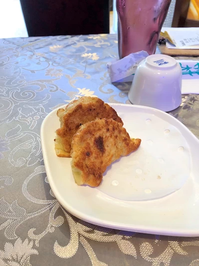 Dim Sum at Jade Dynasty
 Dim Sum at Jade Dynasty
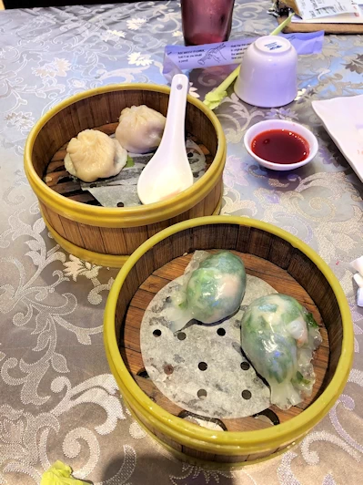 Dim Sum at Jade Dynasty
We were searching for some Chinese food and Celeste found this restaurant, and since it is highly rated, we decided to give it a try
for lunch. WOW - we sampled several
dishes from their dim sum menu and everything we had was excellent! We had to wait a few minutes, as this is a very popular
restaurant in Honolulu - have patience because you will enjoy the food here!
The food here is very good, or should I say we found it to be good. Apparently a lot of Honolulu residents like it too, because there was
a line of people who were waiting to have a meal. Their menu is varied and extensive and can be
found here.
More Info for the Jade Dynasty Seafood Restaurant
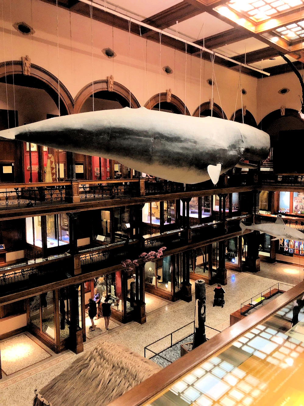
Bishop Science Museum Map
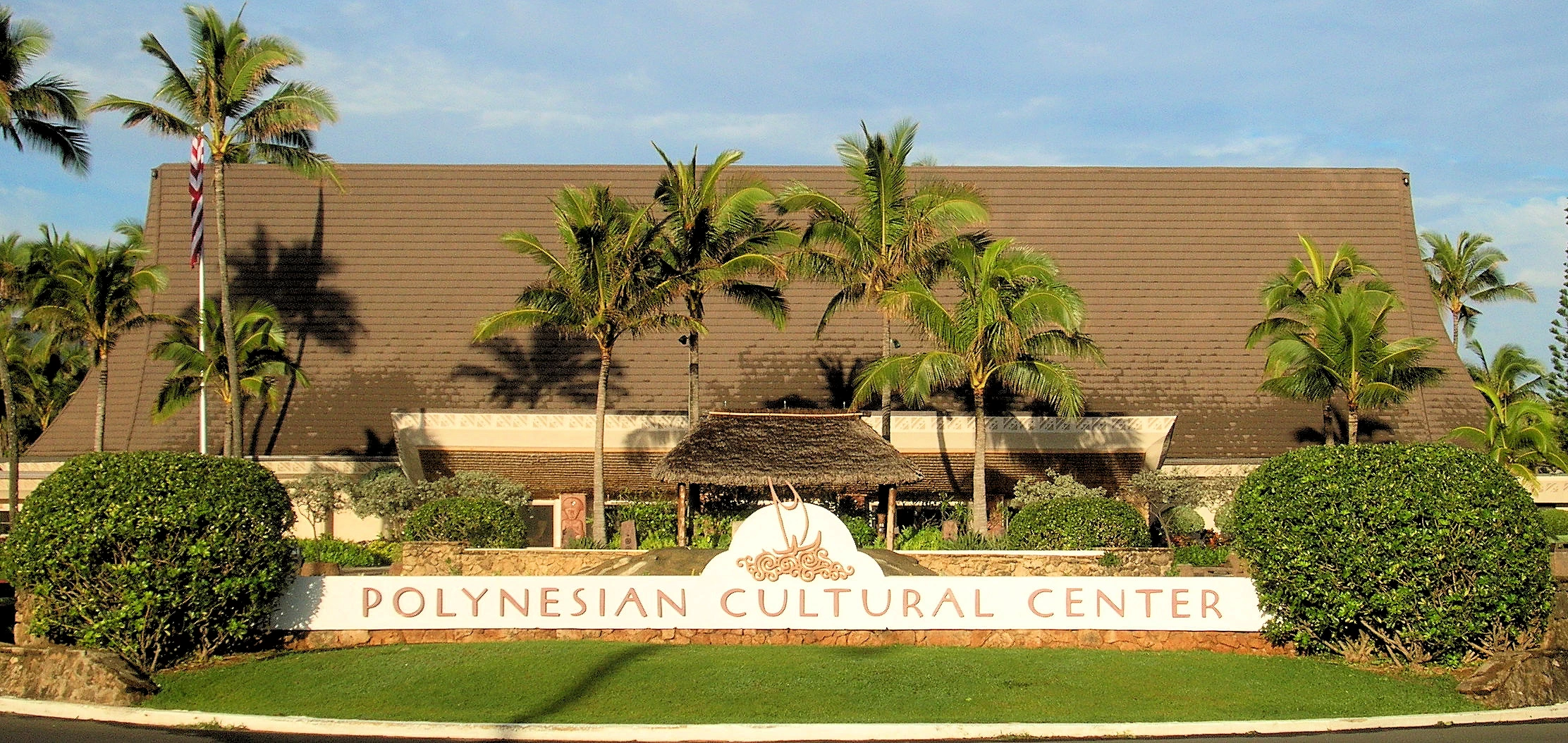
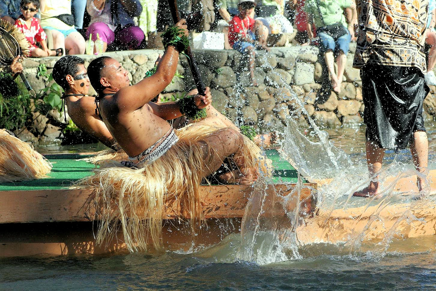
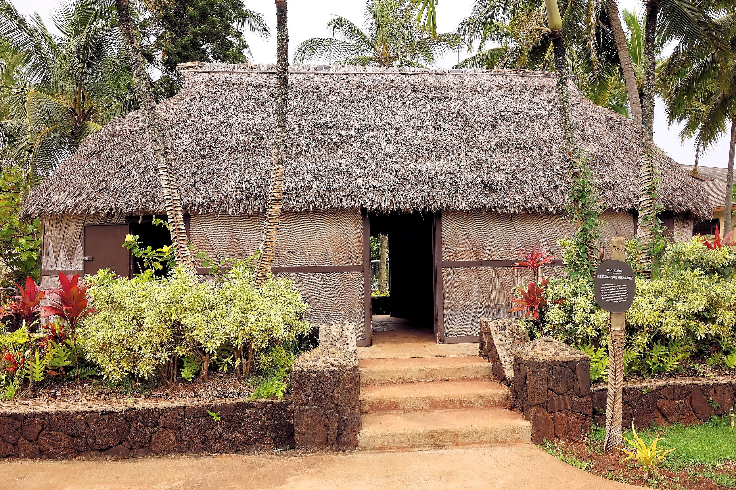
The Polynesian Cultural Center is Hawaii’s premier visitor attraction, offering an immersive and educational journey through the
diverse cultures of the Pacific. Located in Lā‘ie, on Oahu’s North Shore, this 42-acre living museum brings to life the traditions,
history, and artistry of Polynesia through its six authentic island villages representing Hawai‘i, Fiji, Aotearoa (New Zealand), Samoa,
Tahiti, the Marquesas Islands, and Tonga.
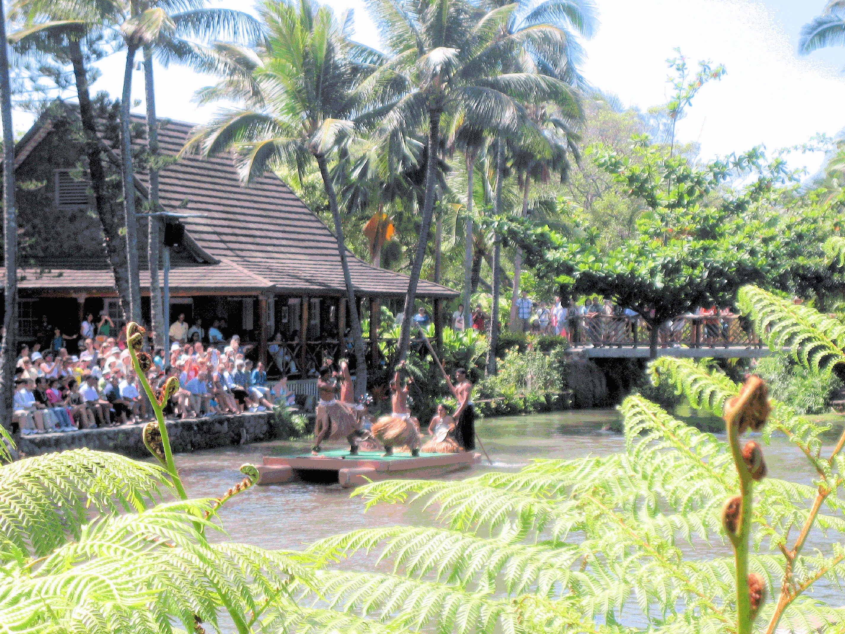
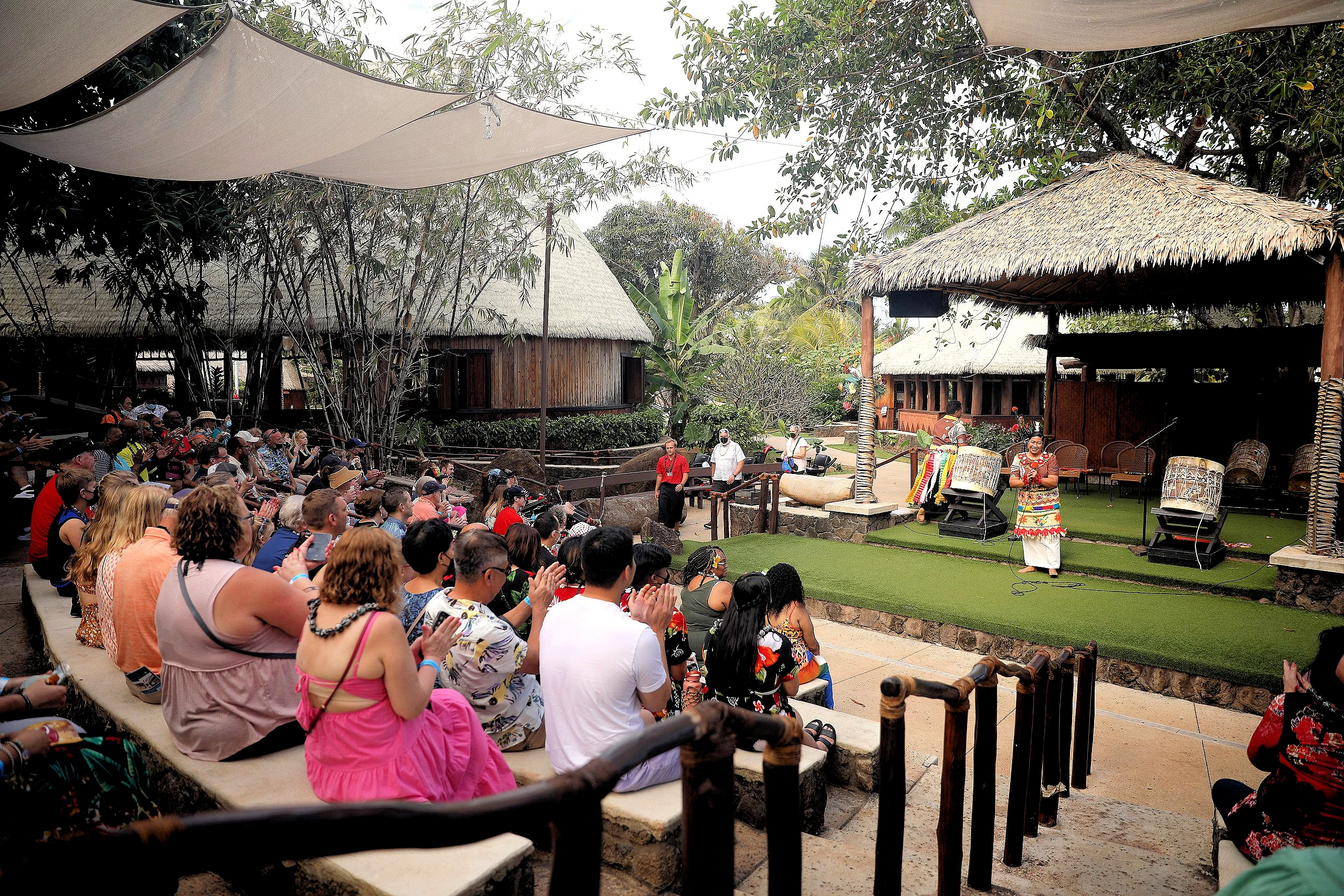
Visitors can explore each village to experience firsthand the unique customs, music, dance, and craftsmanship of these Pacific Island
cultures. Interactive exhibits, cultural demonstrations, and engaging performances provide a deeper understanding of Polynesian heritage. The
centerpiece lagoon offers daily canoe tours, allowing guests to glide through the lush landscape while learning about the traditions of
Polynesia from knowledgeable guides.
Beyond the villages, the PCC features spectacular entertainment, including the world-renowned evening show "HĀ: Breath of Life," a breathtaking
performance combining fire dancing, storytelling, and traditional Polynesian choreography. Guests can also enjoy authentic Polynesian
cuisine, including a luau experience with traditional dishes such as kalua pig, poi, and haupia (coconut pudding).
More Info for the Polynesian Cultural Center
- Our Polynesian Cultural Center Image Gallery: Here is a link to
our image gallery.
- Polynesian Cultural Center Website:
here is a link to their website. You should note that they
offer various packages, including dinner & show. Check their website for date & time availability.
- Polynesian Cultural Center Google Images Set: Here is a
link to that Google Images Set.
- Polynesian Cultural Center Wikipedia Article: Here is a
link to that article.
- Polynesian Cultural Center Map
Here is the Google Map link. Note that you have
two choices for how to drive there; The direct way from the Waikiki Beach area is to drive east on Hawaii Route 61 (or Hawaii H-3) and then go north on Hawaii Route 83. Or
if you have the time, you could drive to the North Shore area and then take Hawaii Route 83 east & south to the Polynesian Cultural Center.
- Google Reviews for the Polynesian Cultural Center
- Image # 1 Credit: The first Polynesian Cultural Center image is the property of
gh5046 via Wikimedia Commons using the Public Domain license.
- Image # 3 Credit: Image is the property of
Gage Skidmore via Wikimedia Commons using the
CCSA 2.0 license.
- Image # 4 Credit: Image is the property of
JayH via Wikimedia Commons using the
Public Domain license.
Scenes Around Honolulu
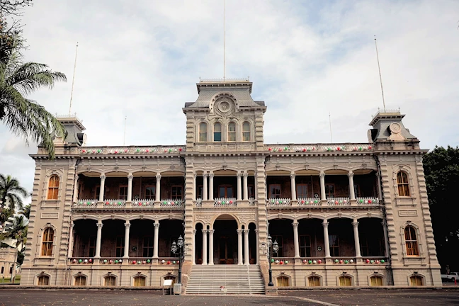
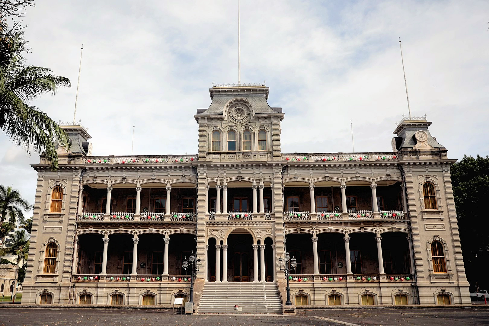
Iolani Palace
The ʻIolani Palace was the royal residence of the rulers of the Kingdom of Hawaiʻi beginning with Kamehameha III under the Kamehameha
Dynasty (1845) and ending with Queen Liliʻuokalani (1893) under the Kalākaua Dynasty, founded by her brother, King David Kalākaua.
It is now a National Historic Landmark listed on
the National Register of Historic Places.
Image is the property of Bernard Spragg via Wikipedia Commons using the
CC0 1.0 Universal (CC0 1.0)
Public Domain license. All
other images are the property of Just Traveling Thru, LLC unless otherwise noted.
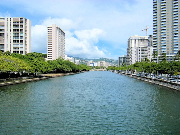
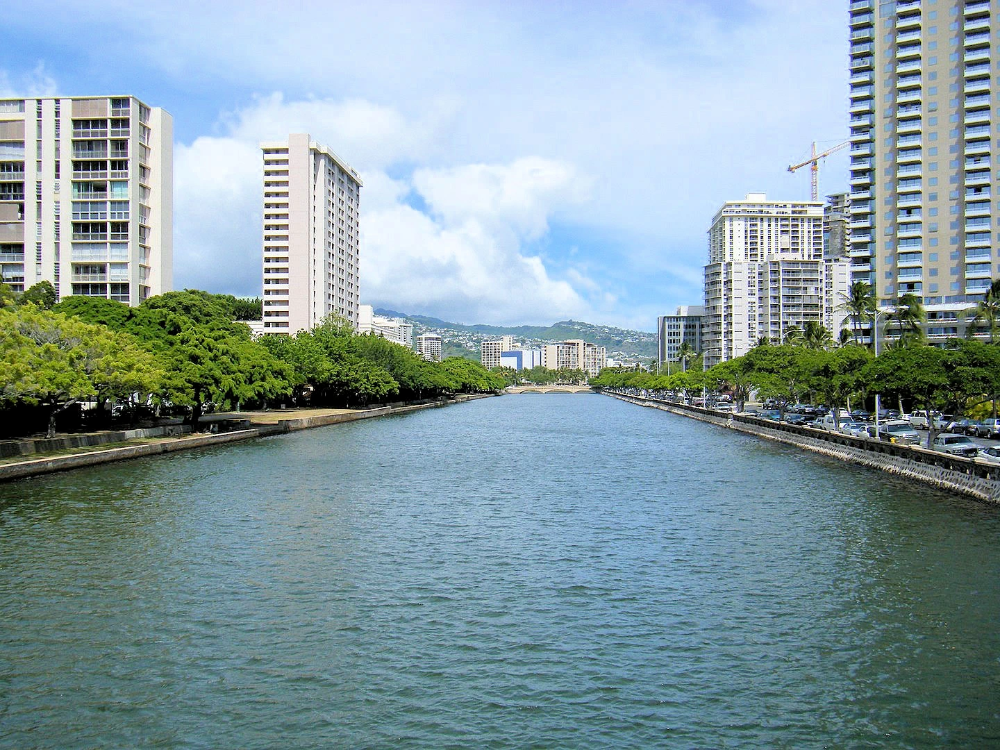
Ala Wai Canal
The Ala Wai Canal is an artificial waterway in Honolulu, Hawaii which serves as the northern boundary of the tourist district of
Waikiki. It was created in 1928 to drain the rice paddies and swamps which would eventually become Waikiki. It also serves as a
primary drainage corridor for the rivers and streams that run through central and east Honolulu.
Image is the property of Thurston via Wikipedia Commons using the
CC BY-SA 3.0 license. All
other images are the property of Just Traveling Thru, LLC unless otherwise noted.
Duke's Waikiki Restaurant Map
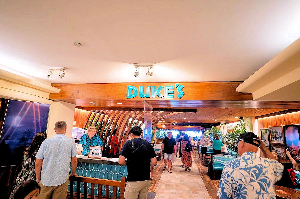 Duke's Waikiki Restaurant
Duke’s Waikiki: A Celebration of Surfing, Aloha Spirit, and Island Flavors
Duke’s Waikiki is ideally located inside the Outrigger Waikiki Beach Resort, right on Waikiki
Beach. With its open-air dining area, guests can enjoy stunning views of Diamond Head, the Pacific Ocean, and
breathtaking Hawaiian sunsets.
The ambiance at Duke’s is a seamless blend of history and aloha spirit—a place where the legacy of surfing’s greatest ambassador
is honored through its decor, laid-back vibe, and warm hospitality. Live Hawaiian music fills the air, and the open-air setting
allows guests to experience the magic of Waikīkī’s golden sunsets with their toes in the sand.
Culinary Delights & Signature Cocktails
Duke’s is known for its exceptional island fare and handcrafted tropical drinks. During our visit, we indulged in their famous Mai Tais, expertly
mixed with premium rum and fresh tropical flavors, perfectly complementing the beachside setting. We also tried their macadamia nut hummus, a
unique and flavorful twist on a classic dish, which was absolutely delicious.
Their menu features a variety of fresh, locally inspired dishes, including:
- Hula Pie – a decadent macadamia nut ice cream dessert, drizzled with chocolate and whipped cream
- Fresh Island Fish – served grilled or prepared with signature Hawaiian flavors
- Kalua Pork Sandwiches & Huli-Huli Chicken – local favorites bursting with smoky, sweet flavors
- A wide selection of handcrafted cocktails - including their renowned Lava Flow and Tropical Itch
If you’re interested in exploring Duke’s full menu and drink offerings -
click here for their menus and drink list.
Who Was Duke Kahanamoku?
Duke’s Waikiki pays homage to Duke Paoa Kahanamoku (1890–1968), a Hawaiian hero known as the "Father of Modern Surfing." Duke was an
Olympic gold medalist in swimming, a Hollywood actor, and an ambassador of Hawaiian culture. His legacy lives on in the restaurant’s
atmosphere, from vintage surfboards and historical photos to the warm hospitality that mirrors his legendary Aloha spirit.
More Info for Duke's Waikiki Restaurant
Oahu Hiking Info
Oahu offers a wide variety of hikes, from easy paved paths to challenging ridge climbs. Below are
trails categorized by skill level. Note that each trail name is linked to its
Division of State Parks page. If you need further information on Oahu trails, the All Trails
website can provide you with detailed descriptions, trail maps, etc.
- Easy Hikes:
Makapuʻu Point Lighthouse Trail:
The Makapuʻu Point Lighthouse Trail is a popular, 2.5-mile paved trail on the eastern coast
of Oʻahu, offering stunning panoramic ocean and coastal views for hikers of all skill levels.
The out-and-back route gradually ascends to an observation area, where hikers can view the
historic red-roofed Makapuʻu Lighthouse perched on a 647-foot sea cliff. Along the way,
trekkers can also take in vistas of other Hawaiian islands, like Molokaʻi and Lanaʻi on
a clear day, and spot offshore islands that are seabird sanctuaries. The exposed trail
is a particularly excellent place for whale watching during the humpback migration season
from November to May.
Diamond Head State Monument Trail:
The Diamond Head State Monument Trail is a popular, well-maintained hike up a volcanic crater on Oʻahu, Hawaii, featuring paved walkways,
steep staircases, and a tunnel, which rewards hikers with stunning panoramic views of the Oʻahu
coastline and the vast Pacific Ocean. Advanced reservations are required for out-of-state visitors
to access this iconic trail, which offers a moderate workout suitable for most fitness levels, with
the summit providing a breathtaking, expansive vista of Waikīkī and the surrounding coral reefs.
Koko Crater Botanic Garden Trail:
The Koko Crater Botanical Garden Trail is an accessible, family-friendly, two-mile loop
located inside an ancient volcanic crater, showcasing a dryland garden featuring diverse
plants like plumeria, cacti, and native Hawaiian flora organized into geographical sections,
with walking taking about one to two hours to complete and offering a serene experience away
from the more challenging summit hike.
Aiea Loop Trail:
The Aiea Loop Trail is a moderate 4.8-mile loop located in the lush Keaīwa Heiau State Recreation
Area on Oahu. As it follows the ridge along the west side of Halawa Valley, the trail offers
sweeping views of the island's southern coastline, including Pearl Harbor and Diamond Head. Hikers
traverse a diverse landscape, from fragrant lemon eucalyptus and rainbow eucalyptus groves to
native koa and ohia trees, and may also spot the poignant wreckage of a B-24 bomber that crashed
in 1944.
- Moderate Hikes:
Lanikai Pillbox Trail:
The Lanikai Pillbox Trail, also known as the Kaʻiwa Ridge Trail, is a popular, moderate hike on Oʻahu
renowned for its breathtaking, panoramic views of Lanikai Beach, the Mokulua Islands, and the Windward
coast. The out-and-back trail is relatively short, around 1.6 to 1.7 miles roundtrip, but features a
steep, strenuous incline at the start with loose dirt and rocks that can be slippery, especially when
wet. Along the ridge, hikers pass two historic, graffiti-covered WWII-era military bunkers, with the
second pillbox offering even more expansive ocean vistas. While the trail is unshaded and most famous
for its stunning sunrise scenery, the rewarding views of the vibrant turquoise ocean and lush green
landscape make the challenging ascent worthwhile for hikers of various skill levels.
Koko Crater Railway Trail:
The Koko Crater Railway Trail is considered a grueling and challenging hike due to its short
but intensely steep ascent up over 1,000 uneven railway ties. The relentless climb, which
includes sections where the incline becomes significantly steeper, can be a major cardiovascular
test even for very fit hikers, especially under the full sun, as there is no shade. A
particularly difficult feature is a "bridge" portion of the track suspended over a ravine, which
can be intimidating for those with a fear of heights, though a bypass exists. The descent is
also challenging, demanding concentration and strong knees to navigate the steep and sometimes
slippery steps.
Mariner's Ridge Trail:
The Mariner's Ridge Trail is a private hiking trail on Oahu, Hawaii, known for its challenging
terrain involving rock and tree climbing and its breathtaking, panoramic views of Kaneohe,
Diamond Head, and the coast. While the trail offers a great workout and lush forest scenery,
its private status means it is not a public trail and is sometimes closed to the public,
requiring hikers to respect private property and find public alternatives if they cannot
access it.
- Advanced Hikes:
Olomana Three Peaks Trail:
A favorite for many, this trail involves steep climbs and rope sections to reach three peaks
with sweeping views. This is one of Oahu's most difficult and dangerous hikes, with steep, rugged
sections that require ropes. The first
peak is very challenging, and the second and third are only recommended for expert hikers.
Stairway to Heaven (Haʻikū Stairs):
A historic and steep trail with 3,922 steps along the Koʻolau mountain range. The Haʻikū Stairs,
or "Stairway to Heaven," is a dangerous and illegal steel step path on Oʻahu, Hawaiʻi, that was
once used for military radio transmissions but has been closed to the public since 1987 due to
safety hazards. After a city council vote to remove them in 2021 and a subsequent legal battle,
the demolition process to dismantle the iconic, over-3,900-step structure began in late April 2024.
Accessing the stairs is illegal, with potential fines of up to $1,000 for trespassing.
- Challenging Hikes:
Pali Puka Trail:
The Pali Puka Trail is a strenuous and narrow 1.5-mile round-trip hike on Oʻahu, starting near the
Pali Lookout, that climbs a steep, exposed ridgeline of the Koʻolau Mountains to a natural hole
(puka) in the rock, offering stunning, panoramic views of the windward coast. Due to high winds, a
steep and exposed path with sheer drops, and potentially loose, muddy conditions, especially after
rain, this dangerous hike is only recommended for experienced hikers comfortable with heights and
extreme caution.
Pali Notches Trail:
The Pali Notches Trail on O'ahu is a short, challenging, and dangerous hike up a narrow, exposed ridge
of the Ko'olau Mountains, requiring careful navigation over steep rock faces and through man-made notches
historically used to house cannons during the Battle of Nu'uanu in 1795. Hikers must navigate
treacherous, slippery terrain with sheer drops and severe winds, with the option to continue past
the notches to "The Chimney" before returning to the Nu'uanu Pali Lookout. While offering epic
panoramic views, the trail is not maintained and demands a high level of fitness, experience, and
caution, especially for solo hikers.
The above is obviously NOT all of the hiking trails on Oahu, for a more complete list we would
recommend you utilize the
All Trails website. They
provide excellent trails descriptions, maps, and other useful info.
Trails/closures change—always check official updates day-of; carry water, respect signage, and pack out trash.
Plan Your Trip to Oahu
Plan Your Visit Travel Resources — Maps, Parking, Passes & Links
Where to Stay & Eat Travel Resources — Maps, Parking, Passes & Links
More Info Travel Resources — Maps, Parking, Passes & Links
Our Hawaii Pages


 Click above Image to view larger Google Map
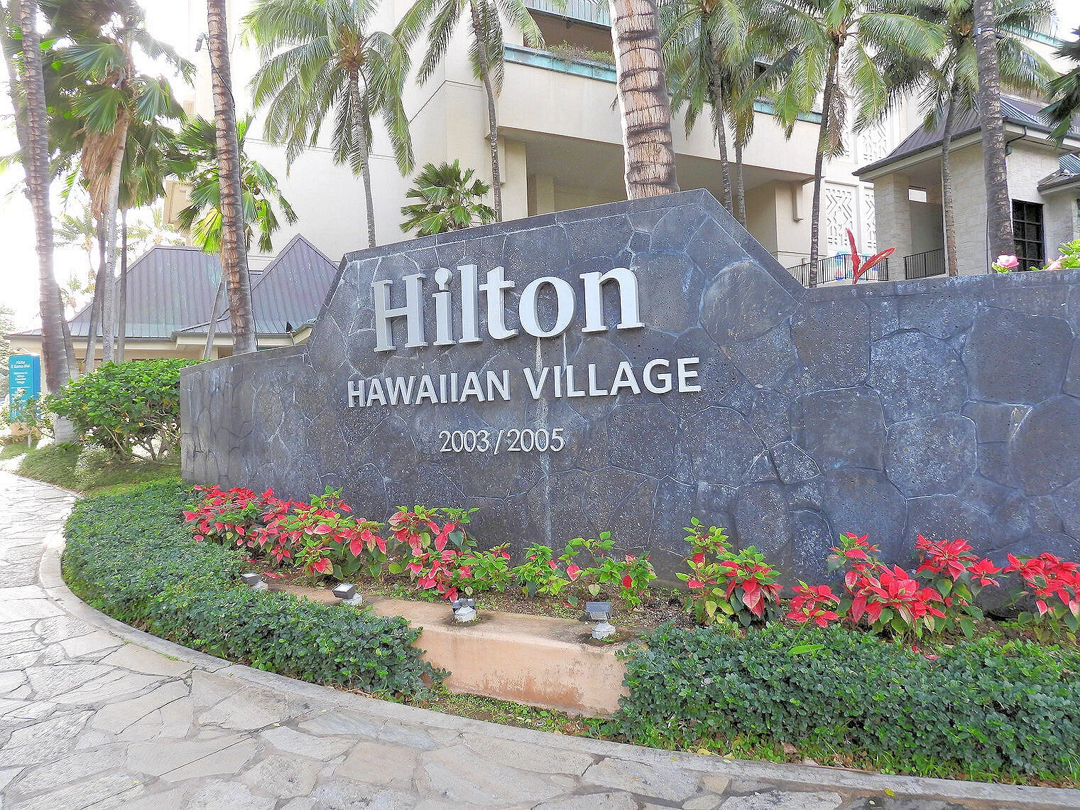


