
by Celeste Lipford and Terry Lipford - last updated on 1/20/2025
This was a Christmas present to ourselves, made simpler through use of United Airlines miles to acquire our family's tickets. And of course, the desire to return to those beautiful Hawaiian Islands at a time when our home in Virginia is cold!
Kauai is roughly 33 miles at its longest point, and 25 miles at its shortest, the island averages 26 miles in diameter and encompasses 554 square miles. Because of its relatively old geologic age, Kauai's 90 miles of shoreline have more beaches per mile than any other Hawaiian Island.
Because Kauai lies at the edge of the tropical zone, it technically has only two seasons, both of them warm. The dry season corresponds to summer, and the rainy season generally runs during the winter from November to March.
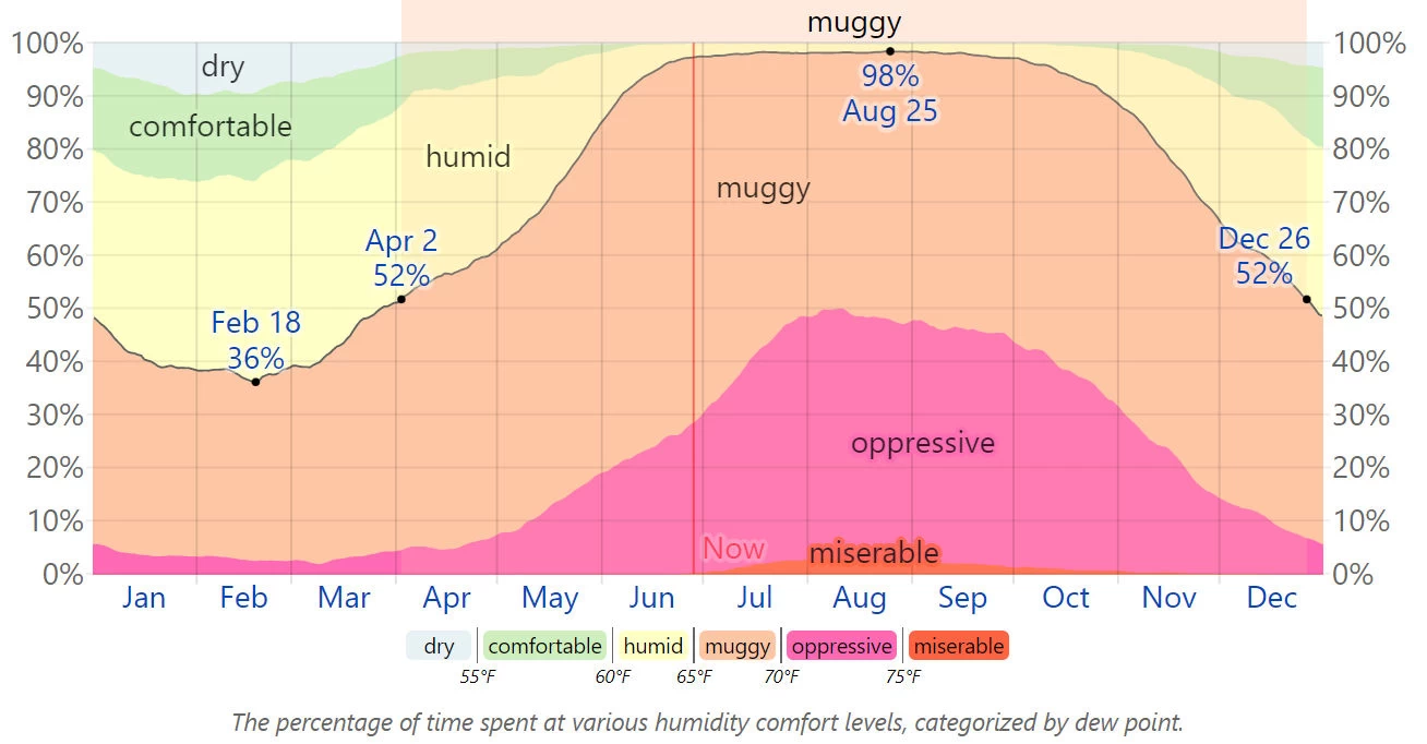 Above image is the property of the
Weather Spark Web Site
Above image is the property of the
Weather Spark Web Site

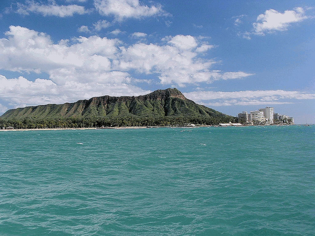
Could there be a more iconic symbol of Hawaii than Diamond Head? Beautiful from every direction! Not only is it a beautiful sight from the ocean direction, but inside the cone is a large state park with an amazing walking trail up to the top - where the views of Honolulu are stunning!
Approaching Oahu from the ocean, Diamond Head stands as a majestic, unmistakable landmark. The extinct volcanic crater, with its sloping ridges and rugged profile, emerges prominently from the coastline of Honolulu. Its shape contrasts vividly with the vibrant, azure waters of the Pacific, creating a postcard-perfect scene. Often surrounded by white sandy beaches and the glimmering skyline of Waikiki, Diamond Head evokes a sense of tropical serenity and the spirit of Hawaii.
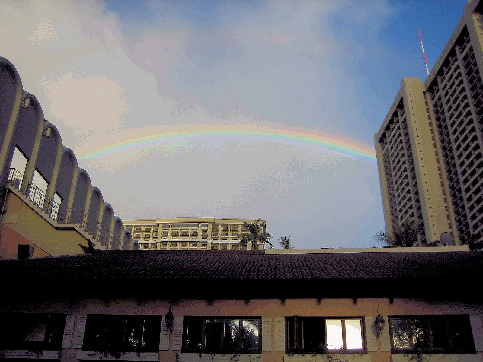
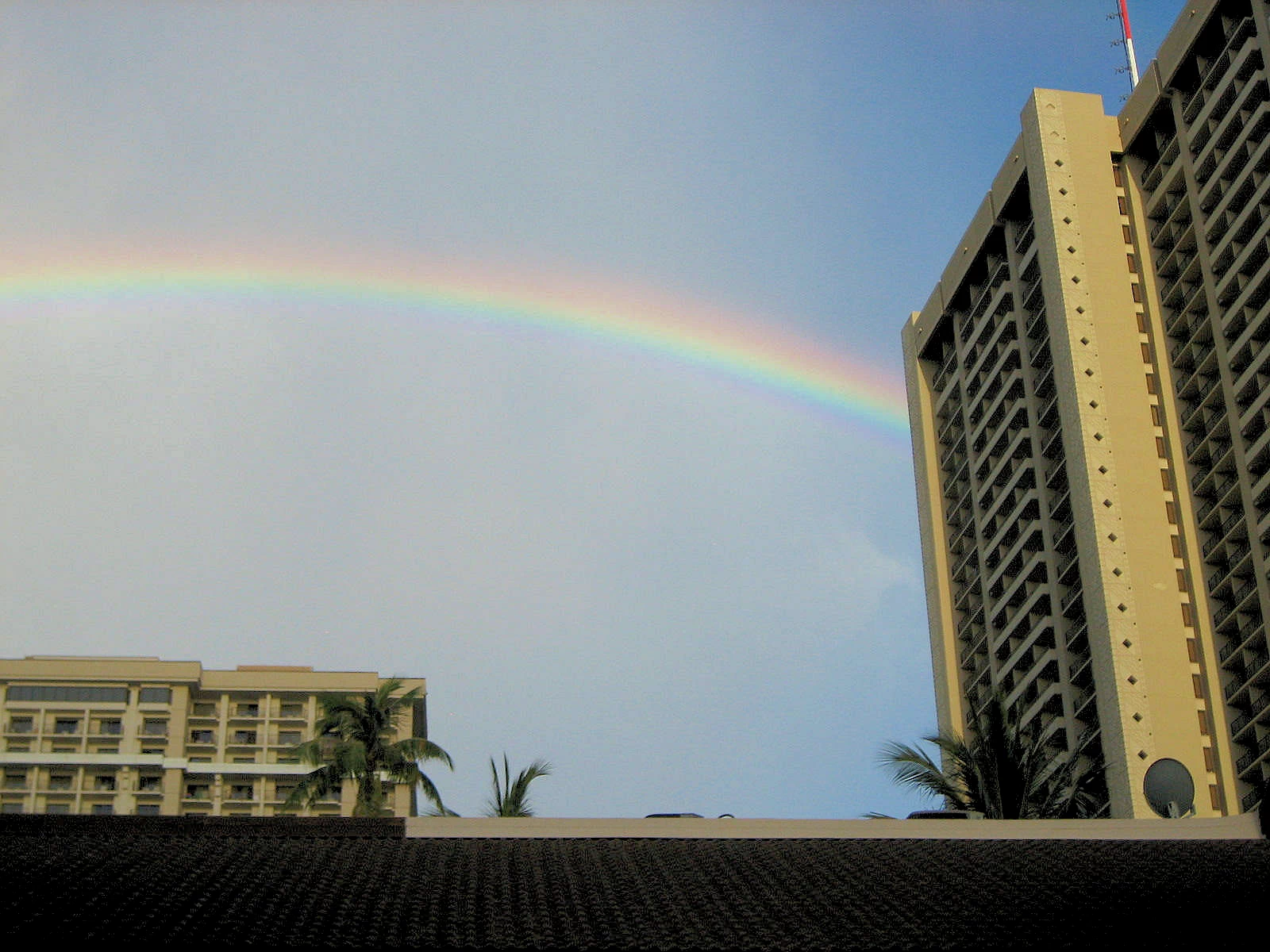
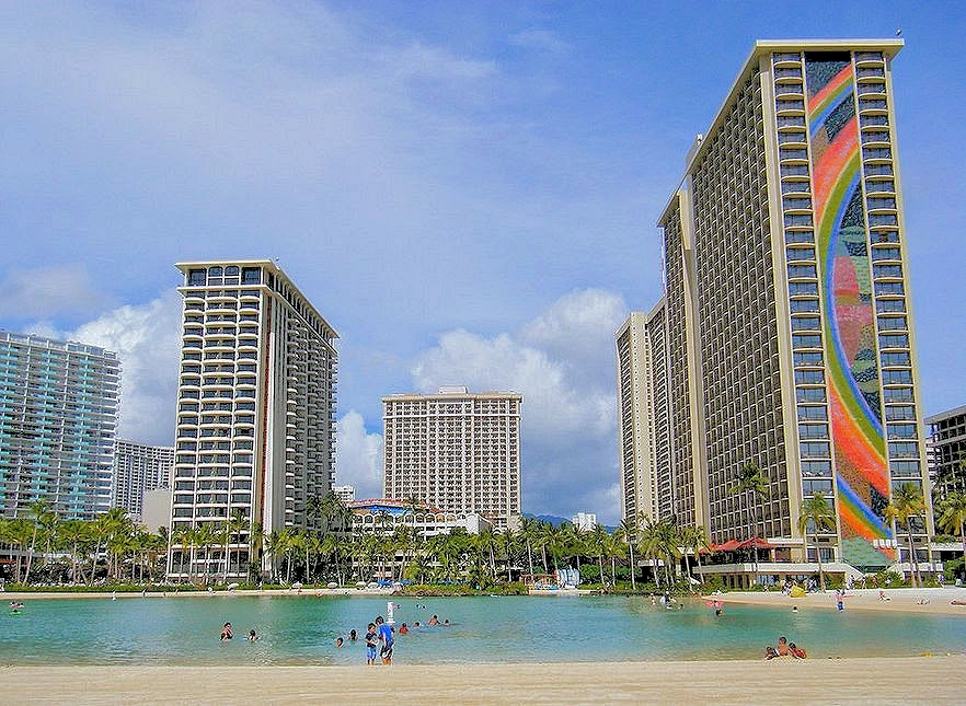
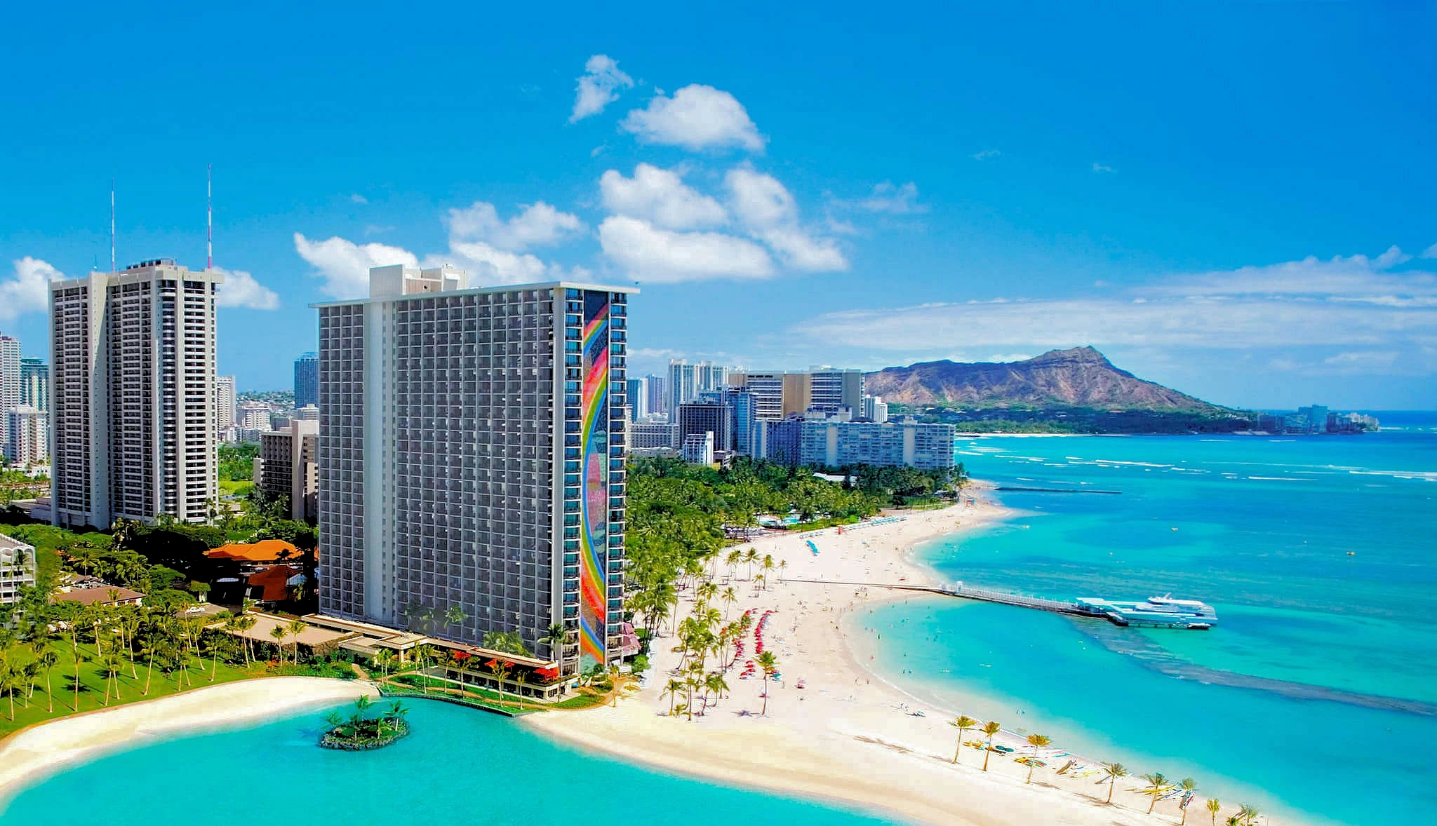
Our game plan was to stay at the Hilton Hawaiian Village Hotel again (and use up those Hilton Points!), as it is on Waikiki Beach and is really a nice place to stay being right on the beach, large pools, good entertainment, etc.
Located in the heart of Waikiki, this hotel is 10 minutes from Pearl Harbor and 25 minutes from Honolulu International Airport (HNL). Ala Moana, the largest shopping mall in Hawaii, is just a five-minute drive away giving you easy access to over 340 shops, services and entertainment.
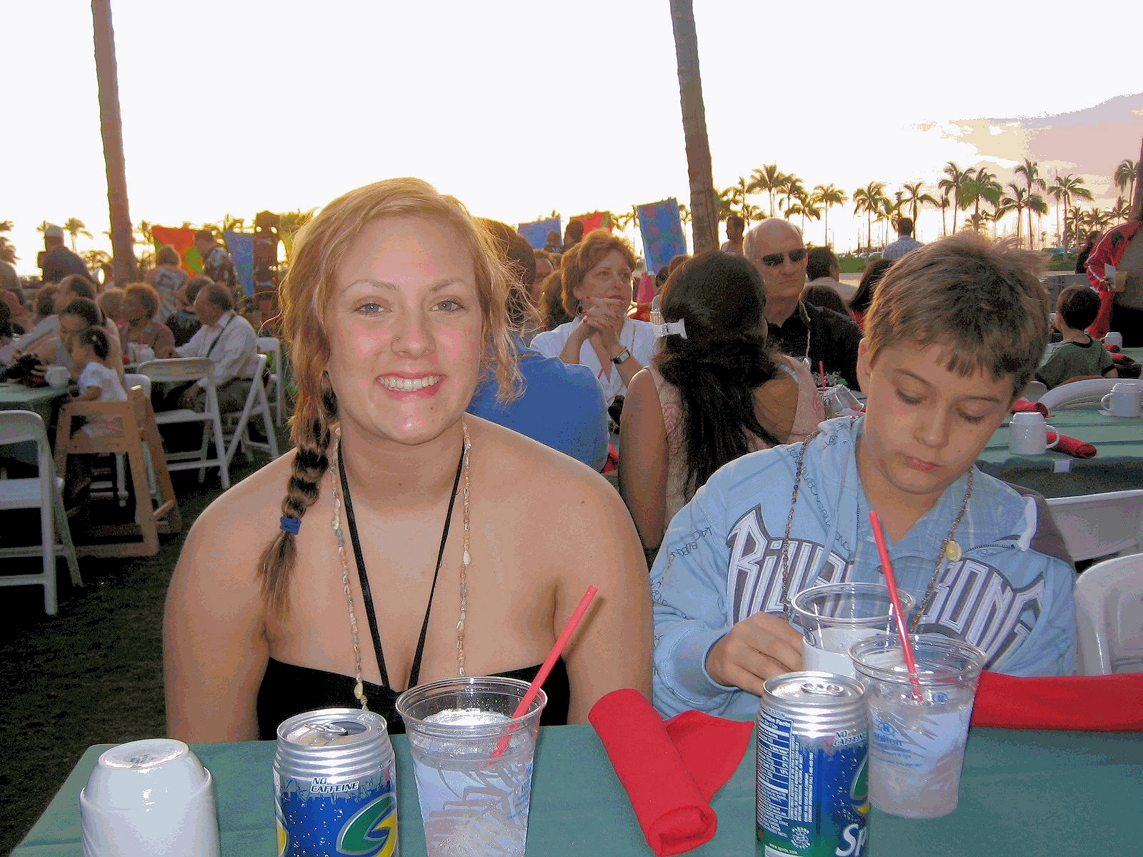
If you are visiting Hawaii, you have to have at least one Luau Dinner! In image # 1 we are waiting for the main course to be brought to our table. Without a doubt, the main course was going to be a bit of roast pork!
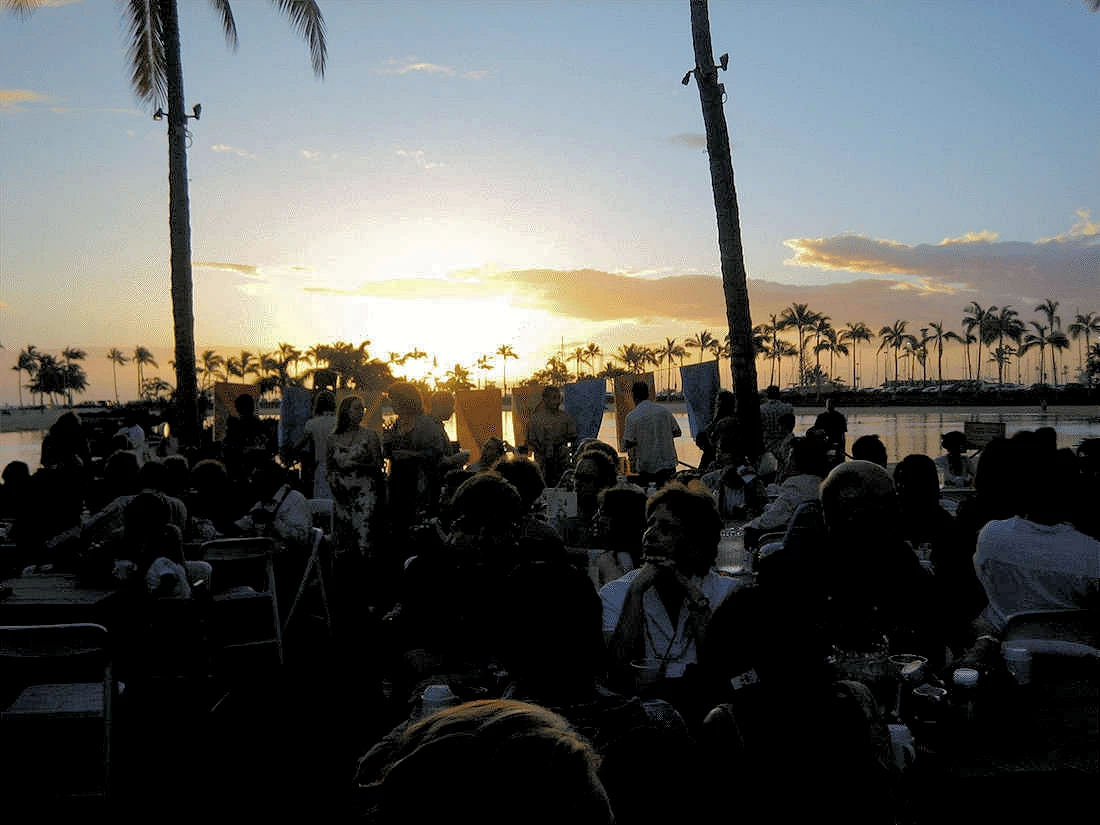
In image # 2 you can see the final rays of the sunset, and perhaps also see that some of the luau attendees are dreading the arrival of their Poi. Yes, Poi will be served at a Hawaiian Luau, you really should give it a try.
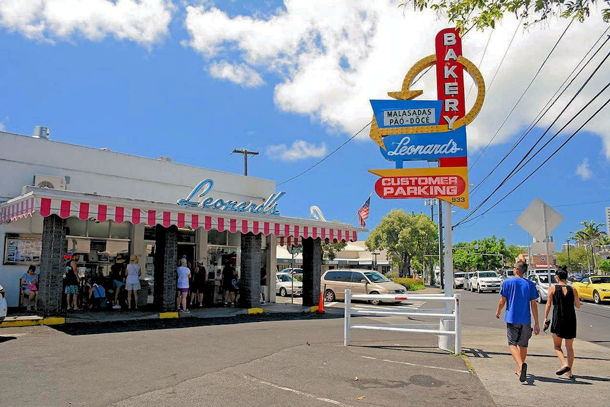
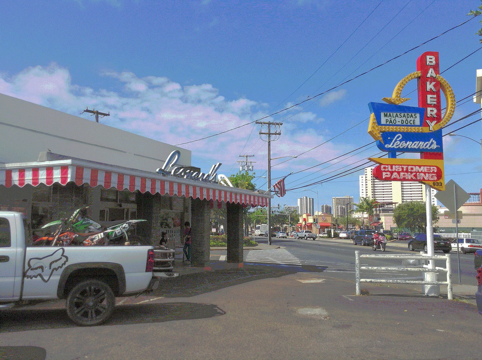
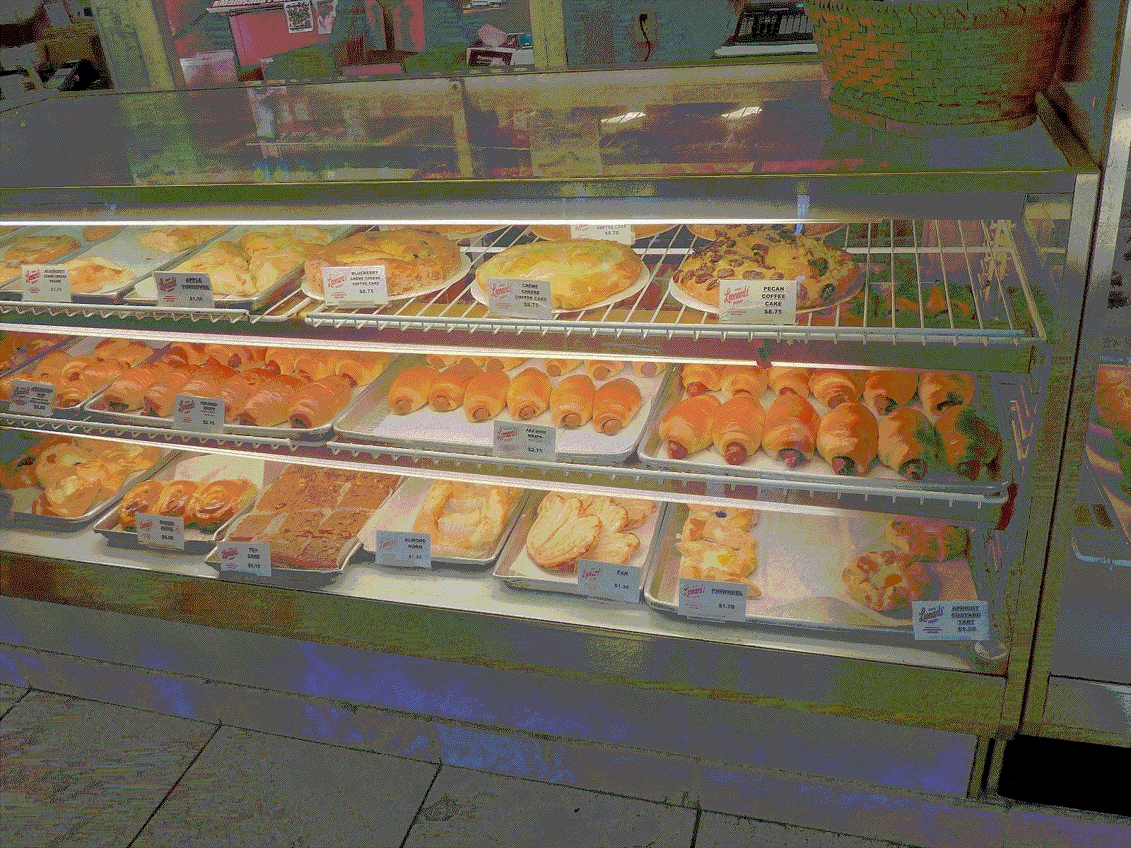
We stopped at Leonard's Bakery on the way to Diamond Head, as they have the most fantastic Portuguese baked goods there. The menu here is very, very good; malasadas, doughnuts, pastries (including cream puffs & strudels), cookies, cakes, pies, coffee cakes, pao doce (large & mini size), wraps, various coffees and espresso, fountain drinks and milk.
Leonard’s Bakery in Oahu is a must-visit destination for anyone exploring Hawaii, and here’s why:
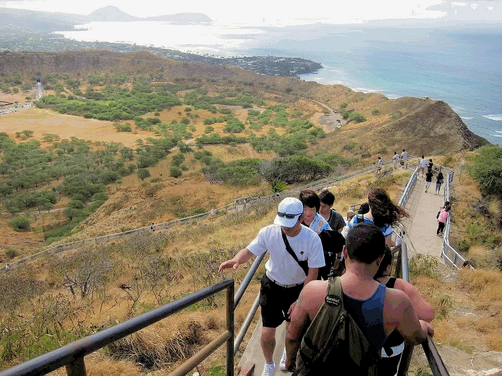
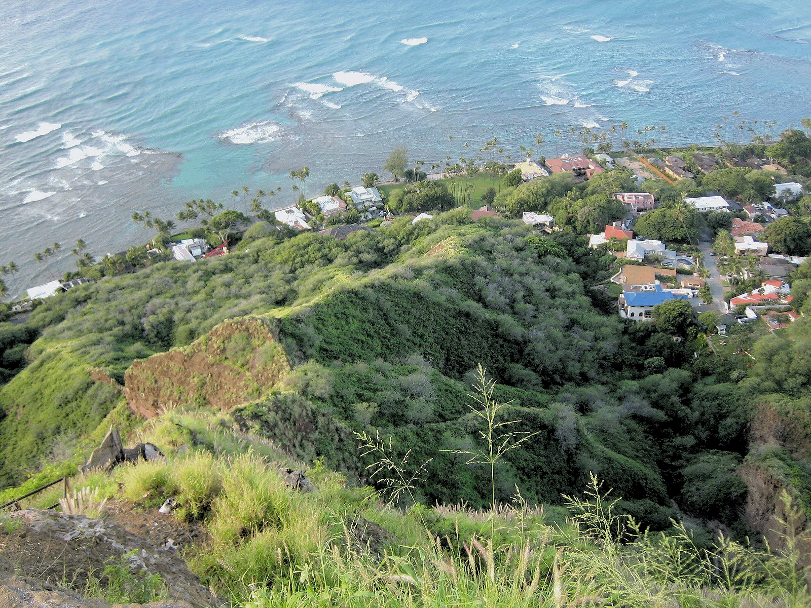
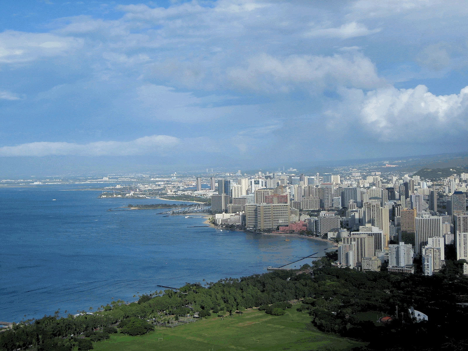
After we finished our excellent Leonard's baked goods, our next step one was to complete our desired Diamond Head hike, and even though it is only 760 feet above sea level, the final portion of the hike is via a very steep set of stairs to the WWII Army observation post - and the view from the top is incredible! Waikiki is immediately to the north, and all the hotels and beach are easily seen (we brought binoculars this trip), and to the south you can see the next bay and it's beautiful beach.
This was the "easy part" of the trail! See how the trail descends off to the left? That brings you back down to the parking lot area, and that part of the trail is a much more modest descent.
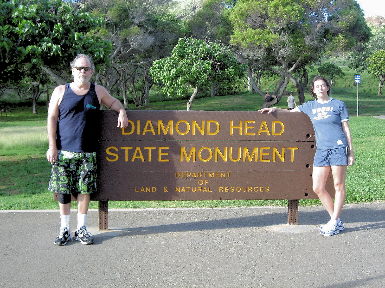
The entire mountain and crater is a state park known as Diamond Head State Monument. Diamond Head Crater measures 3,520 feet (1,073 meters) across and 760 feet (232 meters) in height. A hiking trail leads from the crater up to a lookout point.
The park facilities on the crater floor of Diamond Head are fully accessible to those with disabilities. The hiking trail to the summit is not ADA accessible, it is very steep and uneven in some areas. The last 1/10 of a mile is all stairs and especially steep. Allow 1.5 to 2 hours for your hike.
NOTE: The above information came from Wikipedia
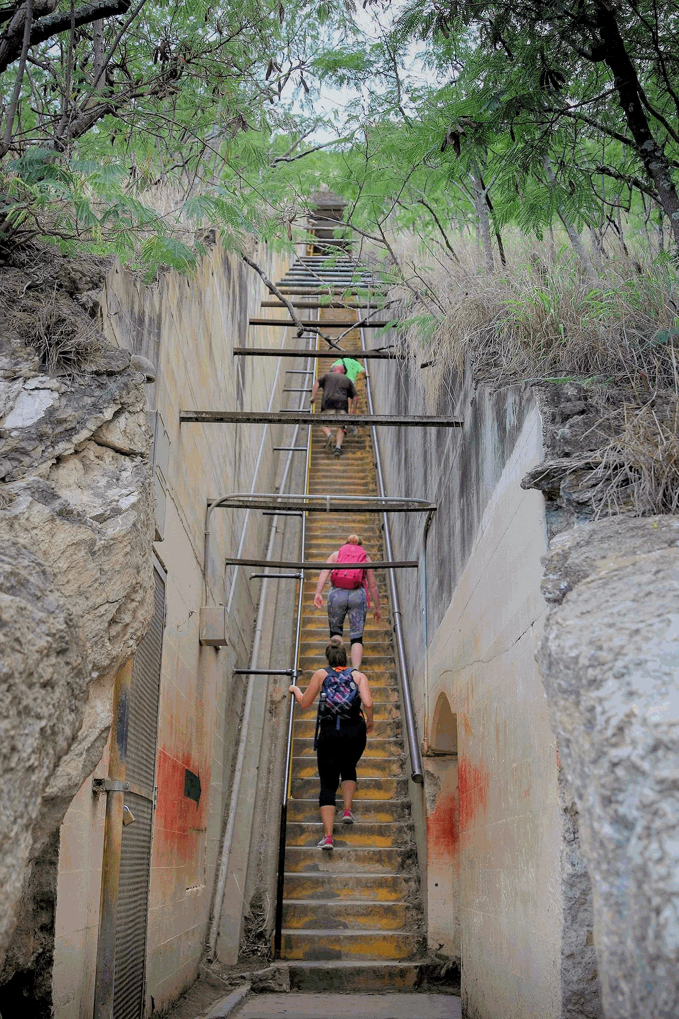
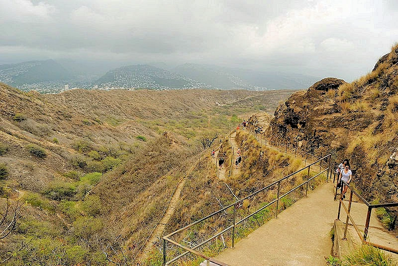
Image # 1 is the set of stairs on the way up to the old Military bunker, perhaps 99 or so steps, but very steep! From there, 54 more steps will lead you to the final lookout point. Warning These stairs are steep, if you are not in reasonably good physical condition, you are going to find this climb to be difficult!
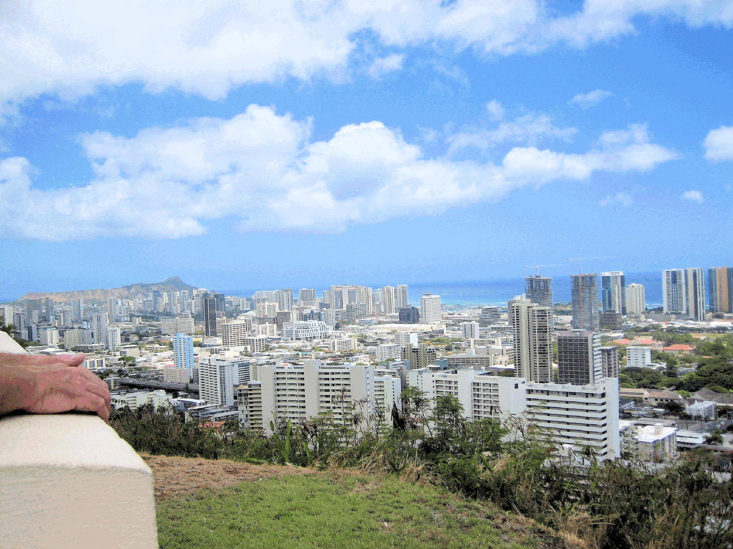
After you climb those final 54 steps, you will reach the summit of the Diamond Head Crater, giving you one of the finest panoramic views on Oahu - take a short walk around and savor the moment.
On a clear day, you see forever. Standing atop the lookout, viewing Oahu’s entire leeward (western) side, feeling the trade winds and hearing waves crashing far below, one can’t help but feel humbled to be on this beautiful island.
Image # 1 is the payoff for getting to the top, this is looking down the slopes of Diamond Head after we had ascended to the very top of the trail. Those houses are next to the Pacific Ocean and they are located at the southern edge of Honolulu as it bumps into Diamond Head.
Image # 2 is the view you get of Honolulu from the top of Diamond Head, Pearl Harbor in the left center area of this picture. It is only 14 miles to Pearl Harbor from where we were standing, the height of Diamond Head (762 feet) provides you with a gigantic panoramic view of the surrounding area.
The 360-degree perspective from Diamond Head is both rewarding and humbling, encapsulating Hawaii’s unique blend of natural beauty and urban charm. It’s a must-see for hikers, photographers, and anyone seeking to connect with the island’s breathtaking landscapes.
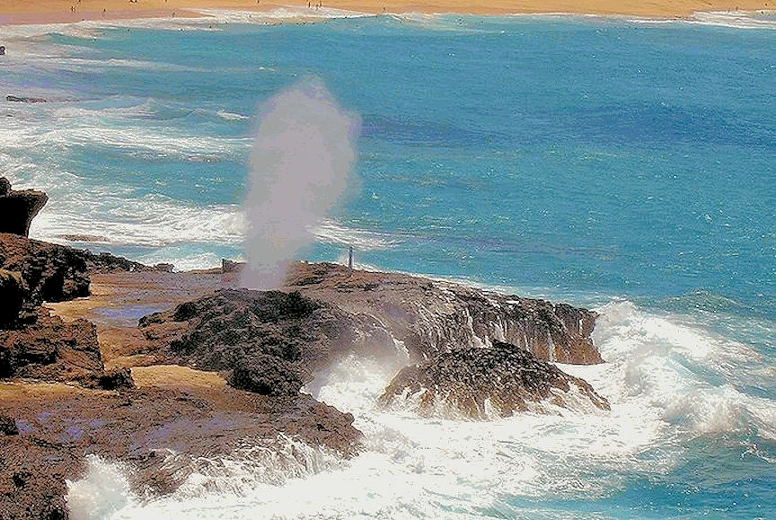
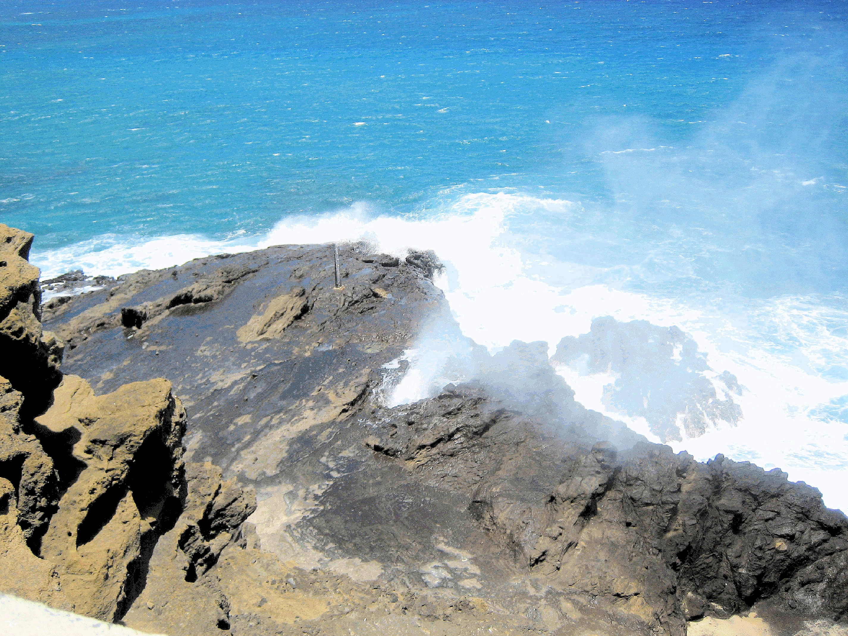
We toured about the island extensively again, traveling south from Honolulu to the Blow Hole and Sandy Beach. These images are the Halona Blow Hole and you can just see Sandy Beach beyond it. The day we were at Sandy Beach, they were having a boogie board contest, and we saw some amazing examples of all ages riding (standing and laying down) those boards!
The blowhole is a lava tube formed by ancient volcanic activity. When the lava cooled and solidified, it left behind hollow channels in the rock. When Ocean waves force water into the lava tube's narrow opening at the base of the cliffs, it creates intense pressure. The built-up pressure pushes air and water through the vertical shaft of the tube, causing water to spray dramatically into the air. The force and height of the spray depend on wave strength and tidal conditions.
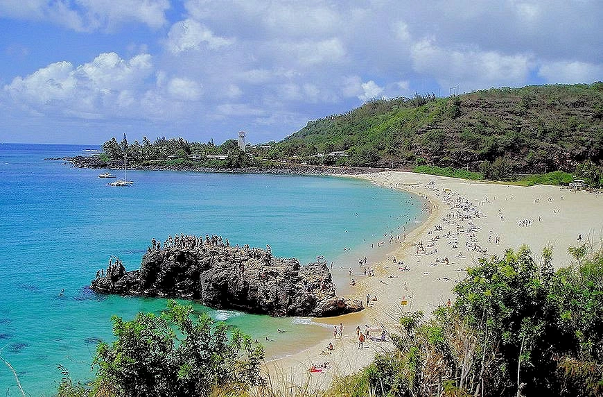
Waimea Bay is a beautiful area, with a very nice beach. Obviously in image # 1 , the big surf was not present that day, but you can see everyone climbing up on that rock (known as "the Rock") in order to jump into the water - which seemed to be how Hawaiians amused themselves when the big surf was not available.
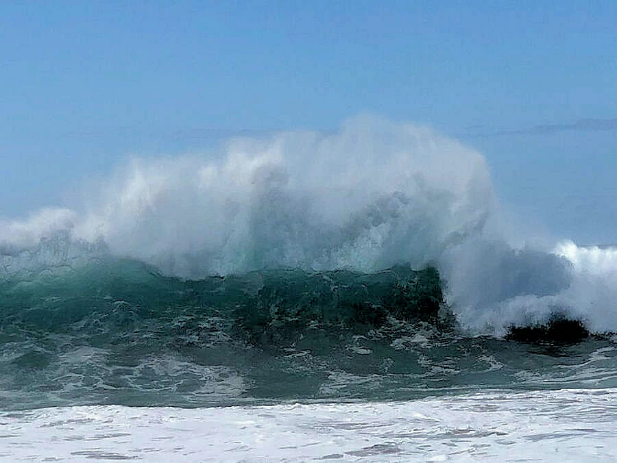
In image # 2 the surf there was high the day we were there , but since it was breaking right onto the beach, it was just not ride-able for we mere mortals. You can see in this picture, how high the waves are, Waimea surf can be as high as 30 feet, but generally is between 10 and 20 feet on good days.
As each wave broke on the beach, it made a sound like thunder because the waves were so large and so broad! The "lay on the sand area" of the beach there is probably 8 to 10 feet "above" the actual water line, but there were waves that sometimes required you to look up at their crests !
Later that week, we got caught in the "great Oahu blackout" of Friday December 26, 2008, and because Obama was on the island, it was initially scary wondering if what we were going through was the initial phase of a terrorist attack!
Our stay at Hilton Hawaiian Village Resort on Waikiki Beach, was marred by the great Oahu Electrical failure of 2008.
The Resort staff were not prepared to deal with such a major electrical outage (the entire island was blacked out). We are big fans of Hilton Hotels, but this event was not their "finest hour".
All the stairs were locked, all elevators were of course not working, and only after my wife went to the main desk and asked them why the locks were not opened, were we able to gain access and walk up to the 16th floor to get to our room ? I don't know how many of you guys have walked up 16 floors before, but I can tell you that it is a long, long hike! Imagine if you will, that every hotel customer was left milling around the hotel building area waiting for someone to open the hotel doors !
Our society depends upon electricity, yet when it is not available, we do not seem to have an alternate plan in place! Imagine if you will, a world without electricity; no elevators, no stop lights, gas pumps in gas stations do not work, and Starbucks would not be working either!
The power was still not on the next morning, but we managed to pack our suitcases via flash light and got everything downstairs via a bell boy, a service staff elevator and a luggage cart. No traffic lights were operating, but we knew the way to the freeway and got to Honolulu International without any further problems. Our rental car was supposed to be re-filled with gasoline prior to returning it, but with all of the city's gas stations out of service due to no electricity, we had to deal with a very angry car rental clerk at the airport!
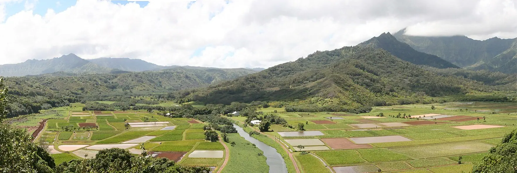
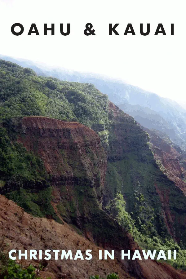
Kauai, Hawaii
We planned to spend our second week of this Hawaii trip on Kauai, for several reasons; We had never been there, it is far less crowded than Oahu and it has spectacular geography & beaches!


Note: All images featured on this page are the exclusive property of Just Traveling Thru, LLC, unless otherwise stated. When images from external sources are used, full credit is given to the original creator, along with a link to the specified license or usage terms. We are committed to respecting copyright and intellectual property rights, ensuring that all third-party images are properly attributed. If you have any questions regarding image ownership or usage rights, please feel free to contact us.
Affiliate Links: We may earn a commission if you make a purchase through one of our affiliate links. This helps support our travel content — thank you!
Content: To review any of our content, make suggestions and/or comments, please click the "About" menu link at the top of this page. You will find our "Contact Us" link on that drop-down menu.