Google Reviews are user-generated ratings and comments left on Google Maps and Search to provide feedback about businesses, landmarks, and locations. Users with a
Google account can leave a review by selecting a star rating (1–5) and optionally adding text, photos, or videos. As new reviews are added, the overall rating dynamically updates
based on the cumulative average of all reviews. Older reviews remain visible, but recent and relevant ones are often prioritized in search results. Google’s
algorithm also factors in review frequency, recency, and engagement to ensure the most helpful and authentic feedback is displayed prominently.
Additionally, businesses can respond to reviews, influencing customer perception and engagement. While the average of
individual ratings is a core component, Google also analyzes review content using
natural language processing to gauge sentiment and potentially adjust the final
rating.
Cape Cod Rail Trail
The Cape Cod Rail Trail is a 25-mile paved pathway that stretches from South Dennis to
Wellfleet, offering scenic views and opportunities for biking, walking, and running. The
trail follows a former railway line, providing a mostly flat, family-friendly experience. It
connects to other trails, including the Old Colony Rail Trail leading to Chatham and trails
within Nickerson State Park.
Page Help Tips
Site Search: Our search feature is powered by Google, and the search results you will receive will
contain several Google Advertisements followed by a list of pages where your search phrase was found. For
example, if you entered "Portugal" in the search text box, Google will show you every page on our site where
the word "Portugal" appeared. Please note that our Site Search results are restricted to our Website
only.
External Links: Where appropriate, points of interest, other sites, specific locations, etc will be linked to allow you to directly visit their website. These links will always be "blue" to allow you to distinguish normal text from links. These links generally are of other websites, Wikipedia Articles or other informative Web Page.
Pinterest: Because we allow & support Pinterest picture acquisition for all of our images, you will be able to "see" a Pinterest icon in the upper left corner of any of our images. The Pinterest icon will be visible when you hover your mouse over an image (on a desktop or laptop). To make the Pinterest icon visible on a mobile device (think iPad or iPhone), single click the image and the Pinterest icon will be made visible.
NOTE: Some images on various pages will not be Pinterest "pin-able". You will have to go to that page's Image Gallery where all images are allowed to be "pin-able".
Slide Show: Left click any image (not on the Pinterest icon), and the slide show will start. To dismiss the slide show, click the "X" in the upper right corner of the window.
Next Image: use either the right arrow
key or place the mouse on the right side of the window and click the "next" arrow link.
Previous Image: use either the left arrow key or place the mouse on the left side of the image and click the "previous" arrow link.
Stop Slide Show: The area at the upper right of the window has 4 icons, which in order (left toright) are; Zoom image, Run automatic slide show, display list of images and exit popup image.
Display Image from Image List: The Image List is displayed after you click the upper right third icon, and then all
images are displayed on the right side of the window. Click anyone of those images in the list to display it.
Intrapage Navigation: On all of our pages, on the far right side of the page, there will be an "up arrow" and a "down arrow"
which when clicked will scroll to the top or bottom of that page. On most pages there will be a "hamburger
menu icon" (below the "down arrow") which if clicked, will popout a menu list of locations on the page you are currently
viewing. Clicking any of the items listed will scroll you to that location & the popout menu will disappear.
Change Page Font Size: By holding the CTRL and SHIFT keys while you click the plus sign key (+), your browser will increase the font size. To decrease
the font size, hold the CTRL key down and push the minus sign key (-) and the browser will decrease the font size.
Tucson is considered to be a food lover's haven. The city's food culture is so rich, in fact, that UNESCO named Tucson a
City of Gastronomy — one of
only two American cities to earn the distinction.
Tucson beckons travelers with its unique blend of natural beauty, cultural richness, and outdoor adventure. The "Old Pueblo"
boasts a captivating desert landscape, encompassing the saguaro cacti-studded Saguaro National Park, and the breathtaking Catalina
Mountains. Outdoor enthusiasts can hike, bike, or horseback ride through picturesque trails, or explore the rugged beauty of the
nearby Sonoran Desert.
Beyond its scenic charm, Tucson boasts a vibrant cultural scene. The city's rich history is on display in its historic districts, and
its dynamic arts community thrives in museums, galleries, and lively festivals, such as the Tucson Gem and Mineral Show. Tucson's
culinary scene is equally diverse, offering delectable Southwestern cuisine and a thriving farm-to-table movement.
However, our decision to make this trip was motivated by several other types of considerations, ie;
My sister's oldest daughter & family live in Tucson and we wanted to visit them.
I had lived in Tucson after my family moved back to the USA from Guam, however I had not gone back since we moved in 1959.
We wanted to visit the Sedona & the Grand Canyons, both of which are not only beautiful but are interesting places to explore.
We wanted to take Jeremy to a dude ranch to horseback ride, and hike Sabino Canyon.
We wanted to end the trip in Phoenix, hike Piestewa Peak, and visit Celeste's niece.
You have never had Mexican food unless you've had it somewhere in the Southwest, and Tucson has a number of high quality restaurants. Take
a look at
this list of Mexican food restaurants and you will learn why we had some great dinners while there!
Tucson, Arizona, earned its designation as the first UNESCO City of Gastronomy in the United States in 2015 due to its deep-rooted agricultural
heritage, diverse culinary traditions, and commitment to sustainability. The city’s food culture is shaped by over 4,000 years of continuous
agriculture, making it one of the oldest cultivated regions in North America. Indigenous peoples, such as the Tohono O’odham and Pascua Yaqui,
developed farming techniques that allowed them to thrive in the harsh desert environment, cultivating traditional crops like tepary beans, cholla
buds, mesquite, and prickly pear. Spanish missionaries and Mexican settlers later introduced wheat, cattle, and other influences that further
shaped the region’s cuisine.
Tucson’s UNESCO recognition was also based on its strong commitment to sustainable food systems, local food production, and culinary innovation. The
city has a thriving farm-to-table movement, with restaurants and chefs incorporating heritage ingredients and traditional techniques into modern
Southwestern cuisine. Organizations such as Native Seeds/SEARCH and the University of Arizona’s Southwest Center have played key roles in preserving
and promoting indigenous and regional crops. Events like the Tucson Meet Yourself festival celebrate the city's multicultural food scene, while
farmers’ markets and community gardens ensure the continued practice of local, sustainable agriculture. By blending historic food traditions with
contemporary culinary creativity, Tucson has established itself as a global model for sustainable gastronomy and cultural preservation.
As of February 23, 2025 Tucson and San Antonio, TX are the only UNESCO Cities of Gastronomy in the
United States.
United States UNESCO Sites
If you are interested in where the United States UNESCO Sites are, take a look
at our UNESCO Sites Page.
Our goal while in Tucscon, was to enjoy a Mexican dinner with my niece and her family - so obviously we were more focused on the
vibrant Mexican culinary scene, which offers a variety of authentic and
innovative dining experiences. Here are some of the top-rated (as of 2/17/2025) Mexican restaurants in the area:
La Chingada Cocina Mexicana:
Step into the vibrant spirit of Mexico at La Chingada Cocina Mexicana. Enjoy traditional flavors alongside friendly service and
lively atmosphere that embodies the true spirit of Mexico. Bienvenidos a La Chingada!
The Little One:
Come on down to the little one we have been open since 1985, And we are a local Mexican women-owned small business!
Casa Madre Restaurant:
Casa Madre Restaurant is located near the 5 points intersection. We are a boutique fine dining restaurant featuring a Himalayan
salt wall. The menu is focused on Latin, Mediterranean and European food and uses local and organic ingredients when possible.
El Charro Café Downtown:
Established in 1922, El Charro Café of Tucson, Arizona is The Nation's Oldest Mexican Restaurant in continuous operation by the same family.
Seis Kitchen:
What began as a food truck in 2012, this local family-owned business has expanded into 3 Award-winning Restaurants, offering a
deletable Menu of Regional Mexican Cuisine in a complete scratch kitchen, using whole ingredients and environmental-sound practices.
If you would prefer to perform your own Mexican Restaurant research, here is a link to the
Google Search Results for
"what are the top rated mexican restaurants in downtown tucson". You can re-sort this list using any of the Google Filters.
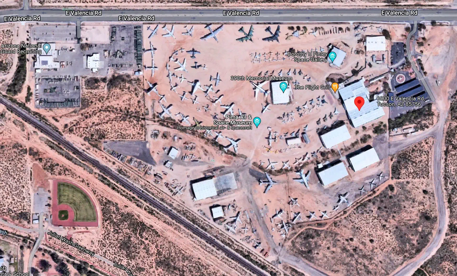
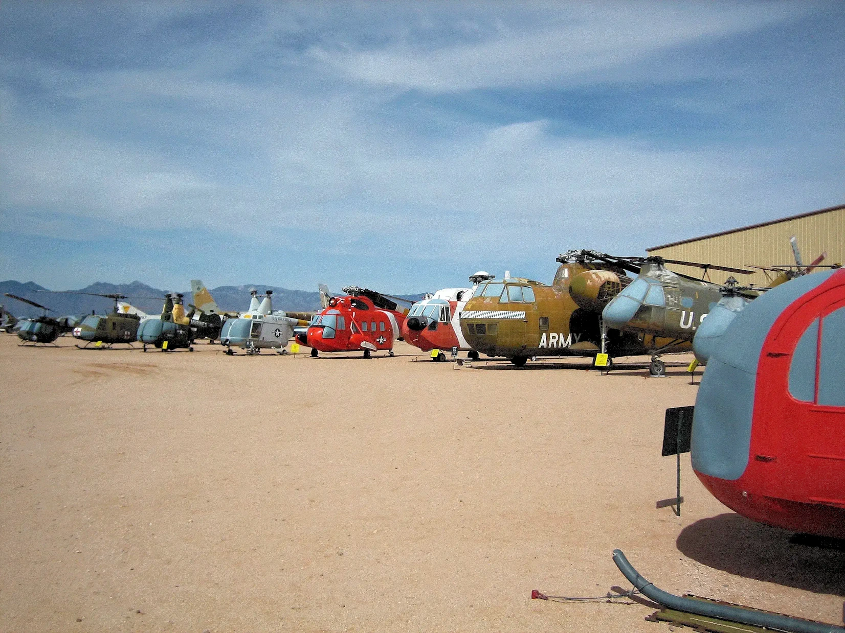
One of our first adventures, was a trip to the Pima County Air Museum.
Most of this area used to belong to the Air Force, where all of the Air Force retired aircraft were stored in a huge area. My parents were
stationed at Davis-Monthan Air Force Base in Tucson, and our house (within base housing) backed up to the aircraft storage area. So a lot of
us kids would sneak through the fence to go out into the storage yard and play inside the WW2 aircraft stored there. A ton of fun for 12 & 13
year old boys!
Convair B-36
Convair B-36
This was the largest mass-produced piston-engined aircraft ever built, it's wing span of 230 feet was the largest of any combat
aircraft ever built. 384 aircraft were built. Initially powered by six 28-cylinder Pratt & Whitney R-4360 'Wasp Major' radial engines,
later enhanced by the addition of four jet engines.
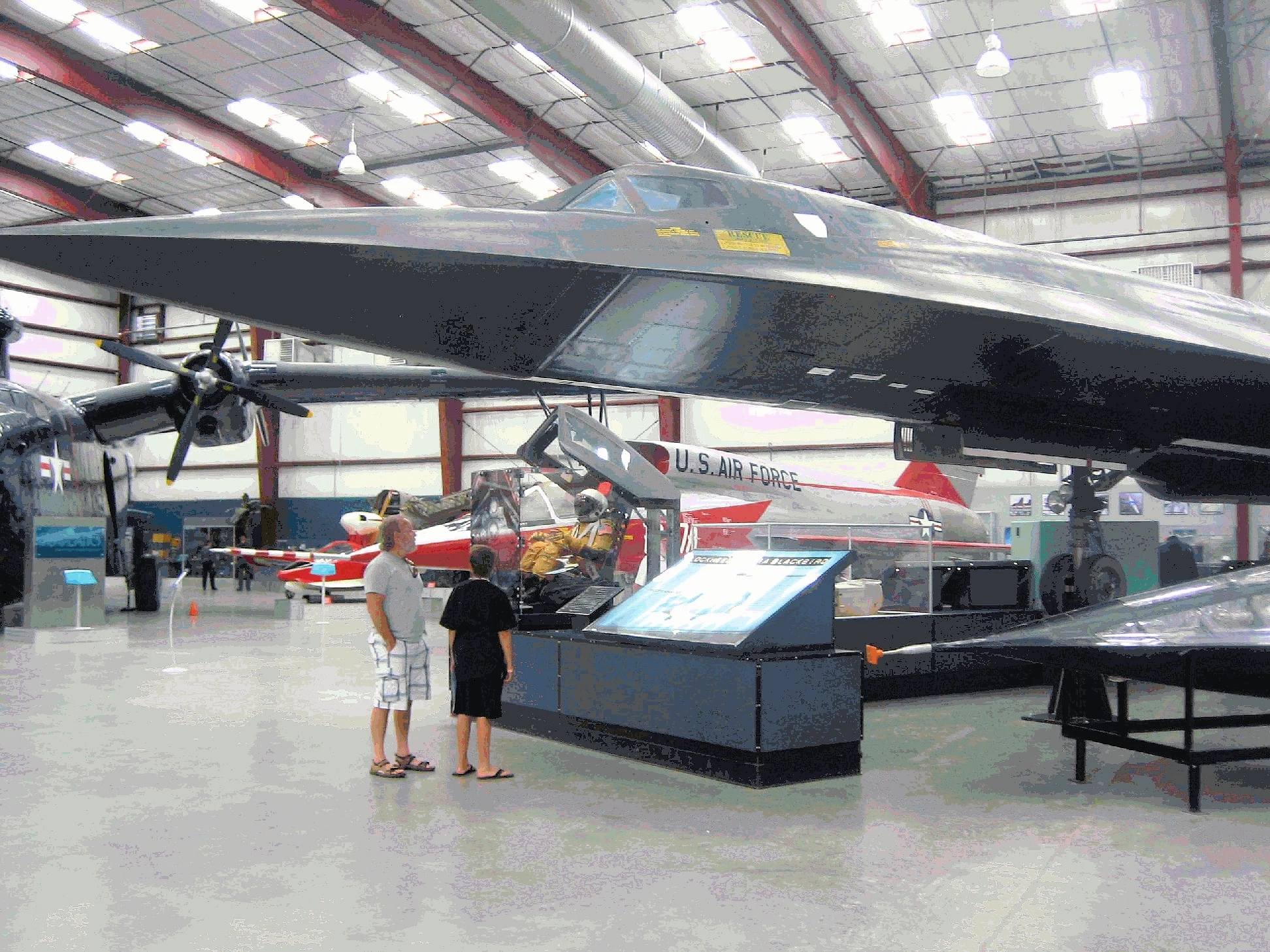
Lockheed SR-71
Lockheed SR-71
The Lockheed SR-71 was (and still may be) the fastest airplane ever built & flown. Powered by the Pratt & Whitney J-58 jet engine, an after-burning turbojet engine with a unique compressor bleed to the afterburner that gave increased thrust at high speeds.
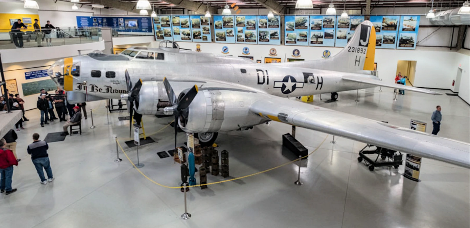
This was the predominant bomber used in Europe in WW2, only 9 are left out of 12,731 that were constructed. Powered by the Pratt & Whitney R-1690 Hornet radial engines. 42.6% of all bombs dropped on Nazi Germany were delivered by the B-17.
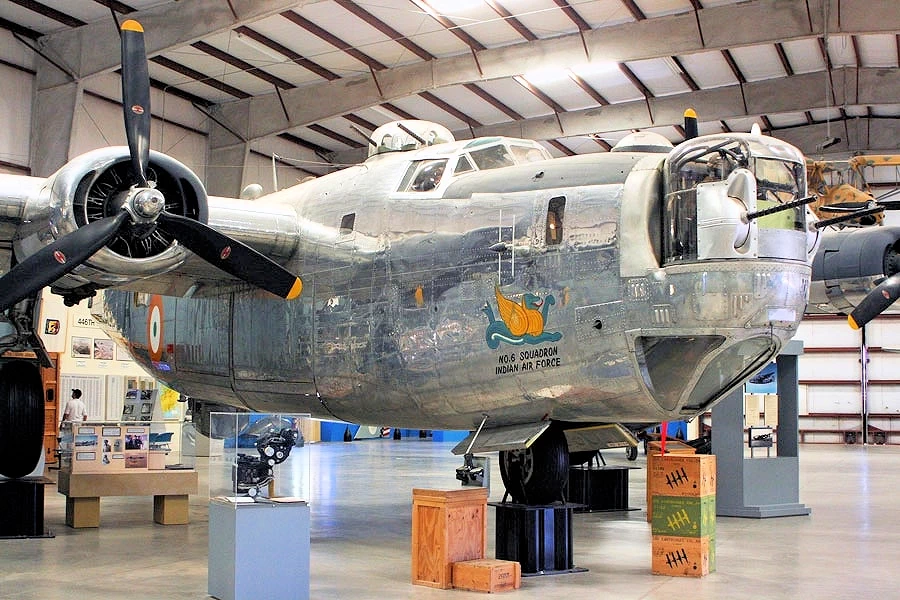
Consolidated B-24
Consolidated B-24
This aircraft and the B-17 were the primary long range bombers in WW2. There were 19,256 (includes all variants) of these aircraft built in WW2 with
only 18 remaining in the entire world. This aircraft was powered by the 14-cylinder Pratt & Whitney R-1830 "Twin Wasp" radial.
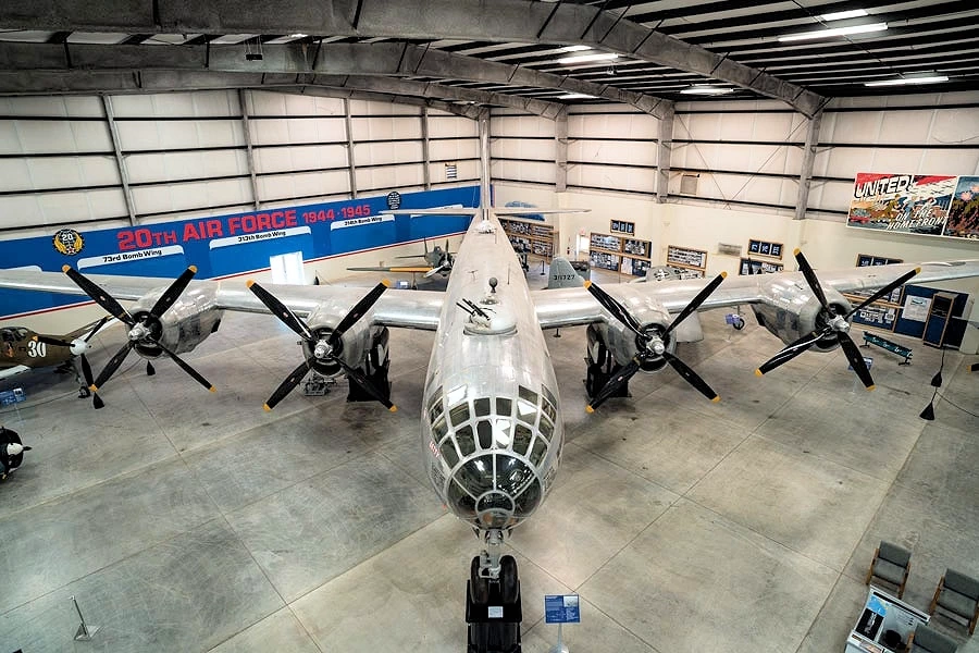
Boeing B-29
Boeing B-29
This aircraft used one of the most complex piston engines in WW2; the Wright R-3350 Duplex-Cyclone (initially the model R-3350-13
and in 1943 the model R-3350-21); a twin-row, supercharged, air-cooled, radial aircraft engine with 18 cylinders. 3,970 aircraft
were built and only 22 remain.
The Air Force Materiel Command's 309th Aerospace Maintenance and Regeneration Group (AMARG) operates the largest aircraft repair shop and
storage facility on Earth. Covering 2,600 acres, it has sufficient space for 4,200 aircraft and 40 aerospace vehicles at one time, while
still leaving room for 350,000 production tools. This facility is two miles from the Pima County Air Museum, and the museum is able to acquire
some of the aircraft that the Air Force would have disposed of. The use of the word "regeneration" tells you that some aircraft are rebuilt
and put back into service, others serve as "parts donors" for aircraft still in service. This method is utilized because some aircraft are
still in service, but the factory has long since been retired and there are no "new parts" available.
The museum has at least one of every thing the Military has ever flown, and even though they refurbish and sell some aircraft & aircraft parts, and
destroy others, they maintain a set of aircraft for the museum so that the general public can see where their tax dollars have gone!
More Info for the Pima Air & Space Museum
Pima Air & Space Museum Wikipedia Article:
Pima Air & Space Museum Google Images Set:
Our Pima Air & Space Museum Image Gallery:
Where do I get Pima Air & Space Museum Tickets:
Google Reviews for the Pima Air & Space Museum
Image Credits:
Image Credits:
All of the above images (with the exception of the B-36 picture) are the property of the
Pima Air & Space Museum via their website.
All other images are the property of Just Traveling Thru, LLC.
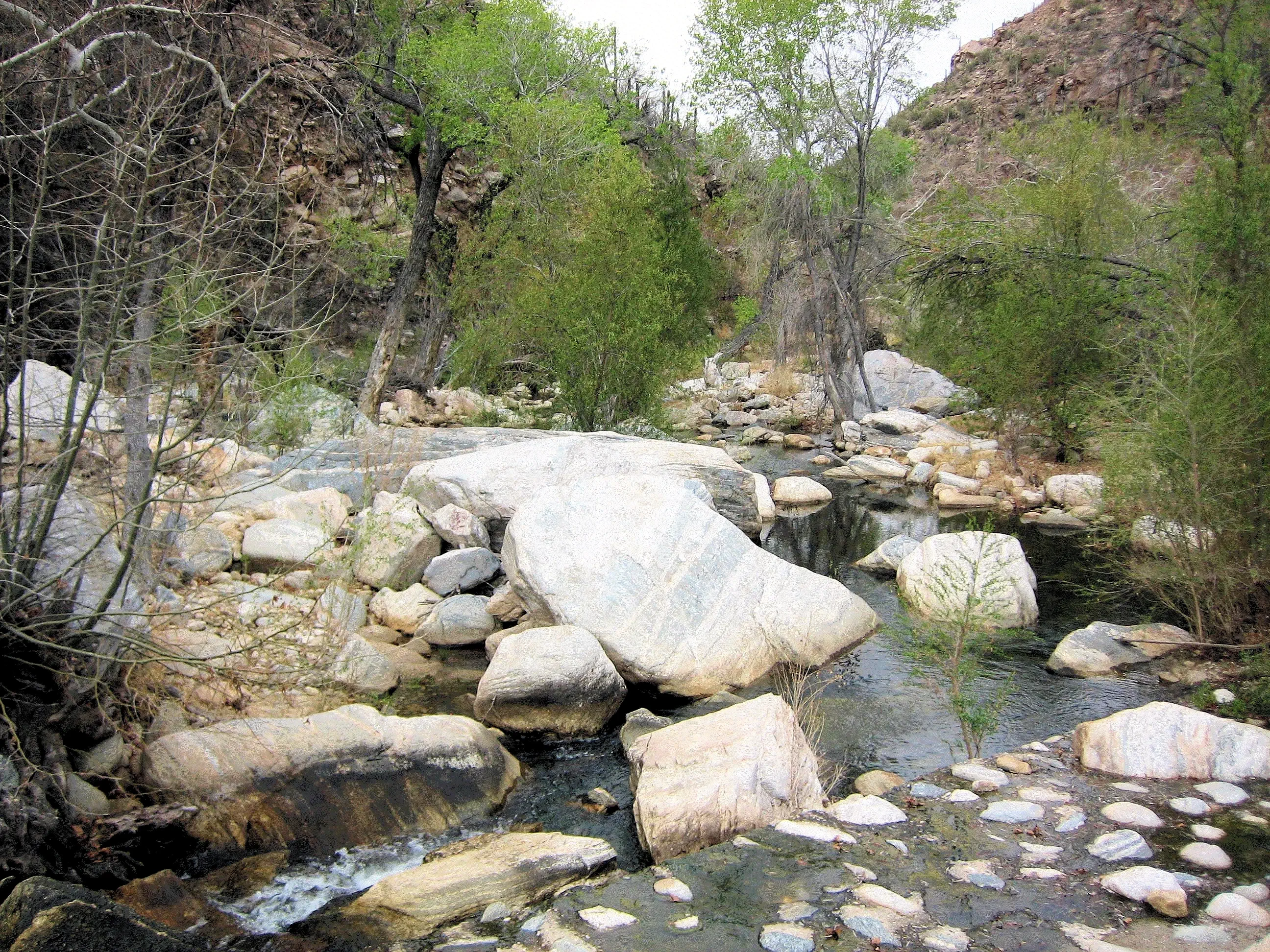
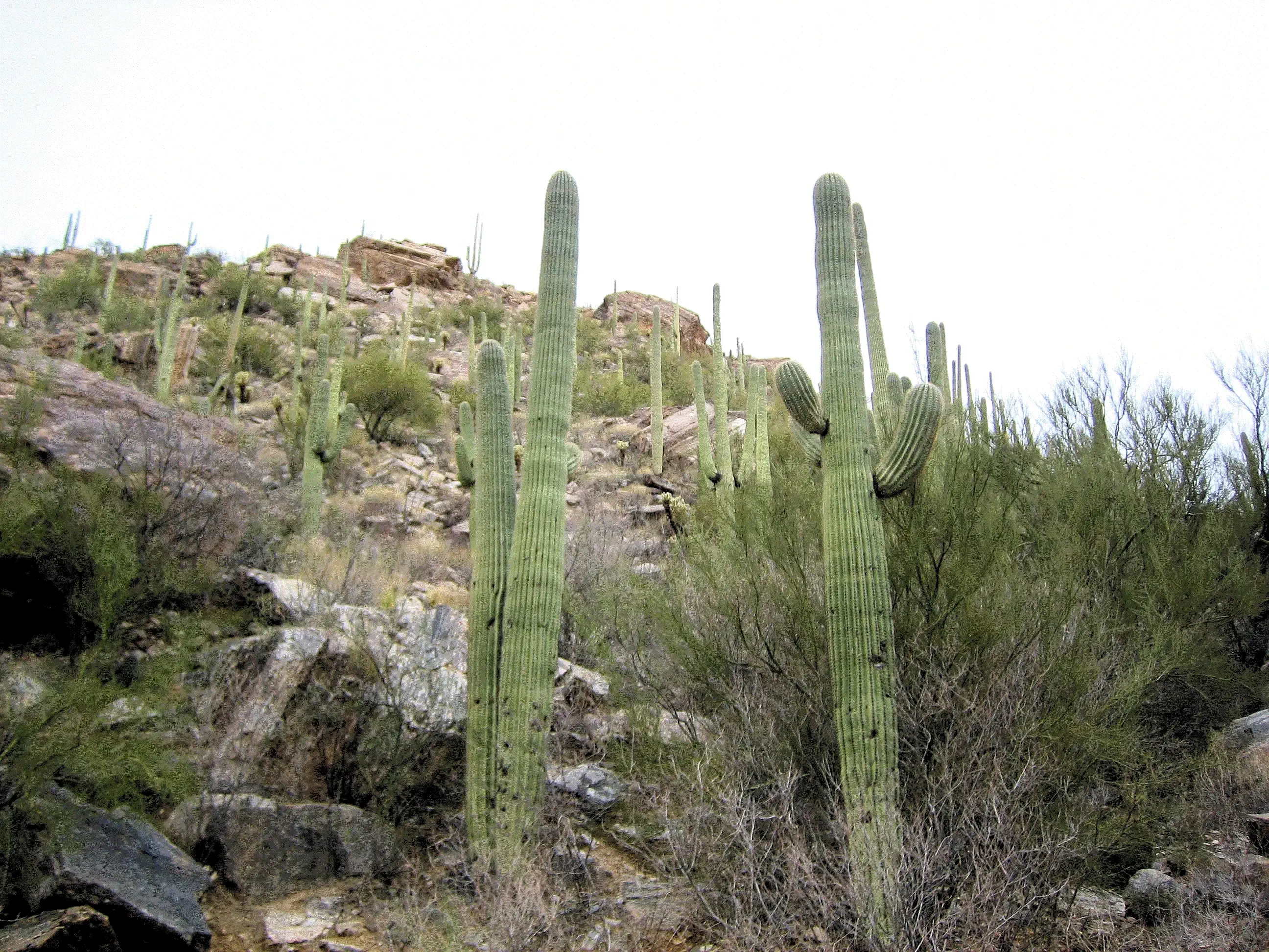
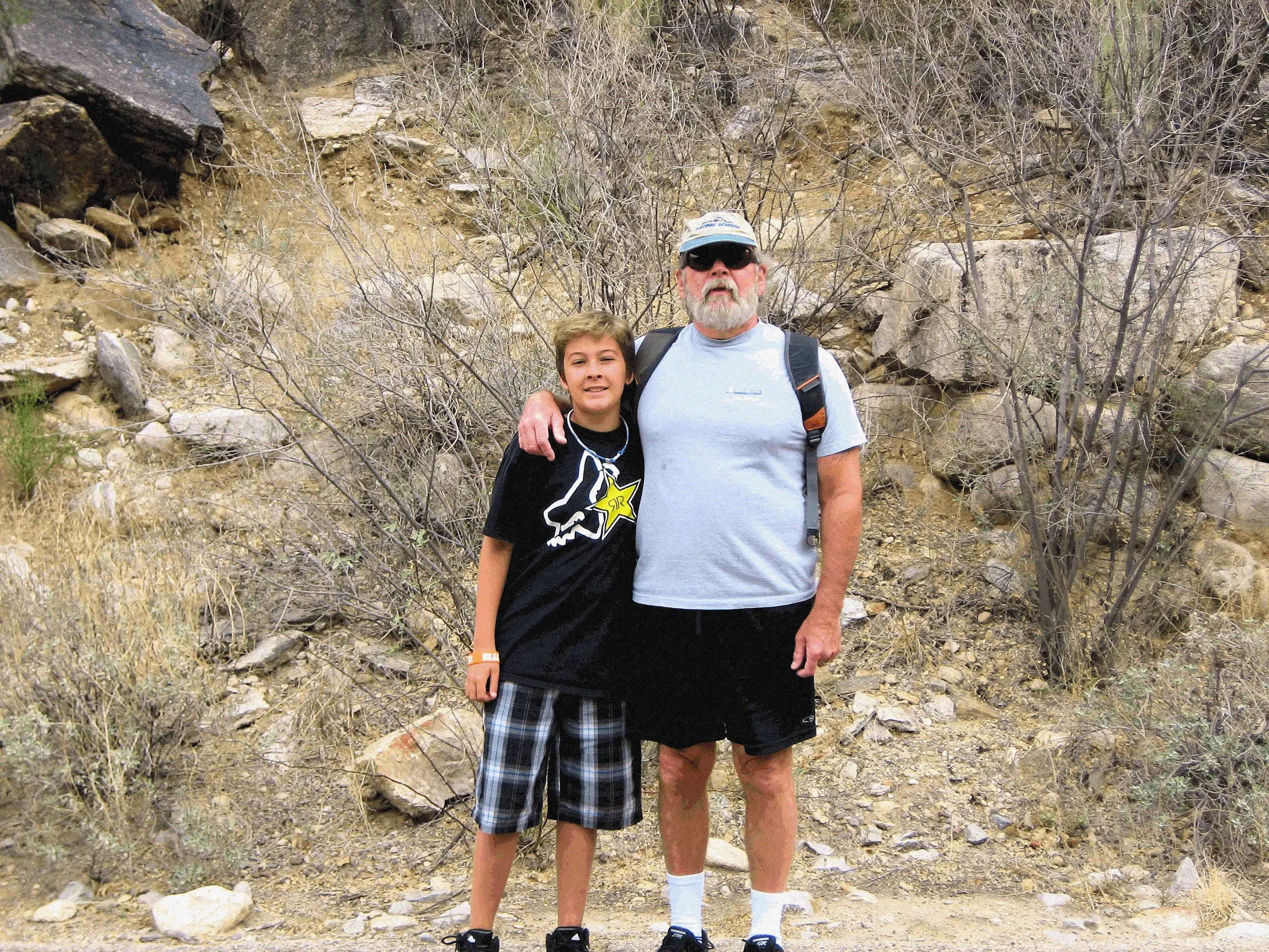
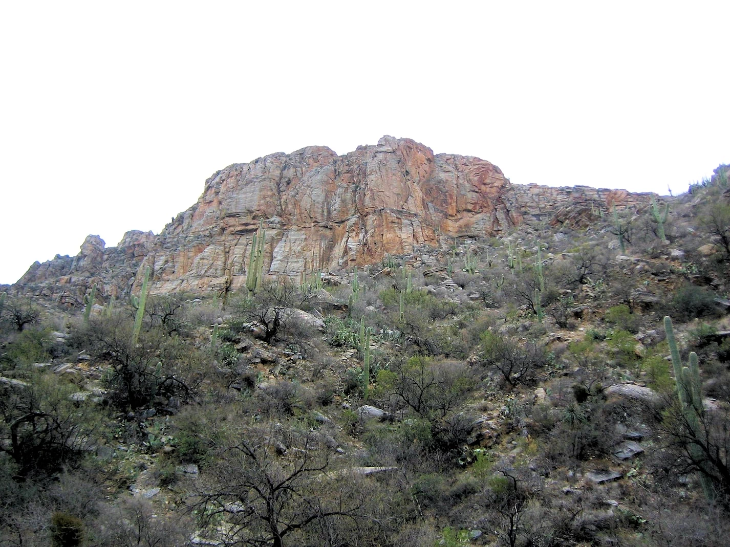
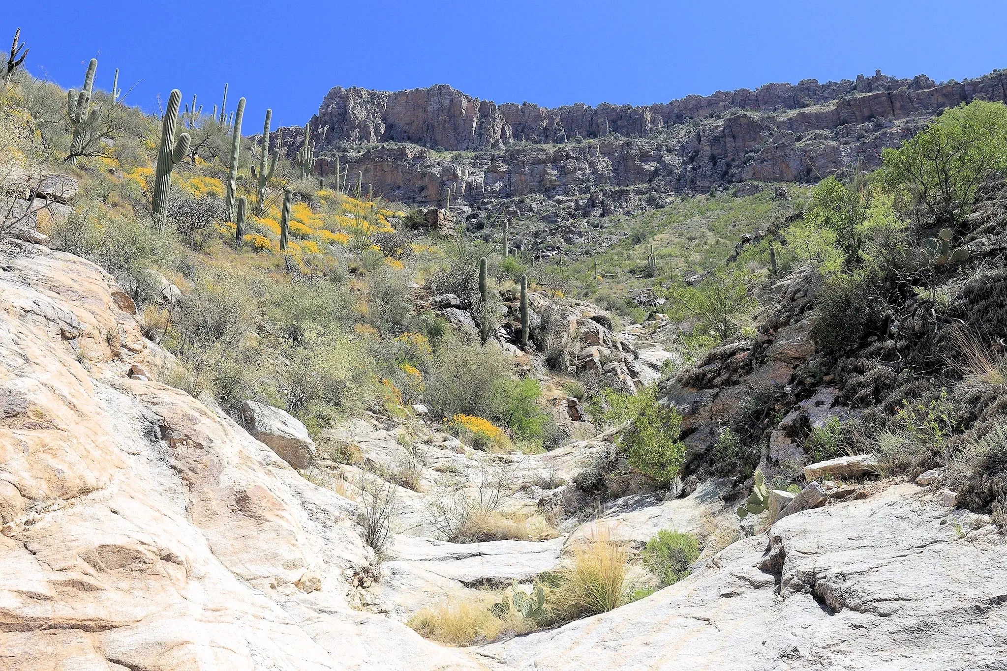
Celeste, Jeremy, and I set out early for a spectacular hike up Sabino Canyon, making the most of the cooler morning air
before the desert heat took over. The journey was both challenging and rewarding, and by the time we reached the top, we
felt like we had truly earned our dinner—as the saying goes!
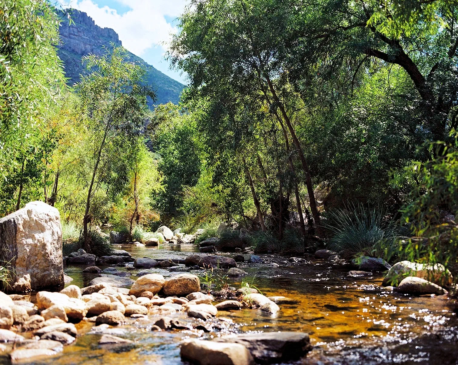
The highlight of our trek was Seven Falls, a stunning series of cascading waterfalls 4.2 miles from the parking area. The
round-trip hike was no small feat, but the breathtaking views and the sense of accomplishment made every step worth it.
can confidently say that hiking Sabino Canyon is not for the faint of heart in the hotter months. Even with our early start
and plenty of water, we were completely drenched in sweat by the time we made it back to the car. But despite the intensity, the
experience was unforgettable—a perfect blend of adventure, natural beauty, and great company.
More Info for the Sabino Canyon Recreation Area
Sabino Canyon Wikipedia Article:
Sabino Canyon Google Images Set:
Our Sabino Canyon Image Gallery:
Google Search Results list for "places to eat near Sabino Canyon":
Google Reviews for the Sabino Canyon Recreation Area
Image Credits:
All of the above images are the property of Just Traveling Thru, LLC.
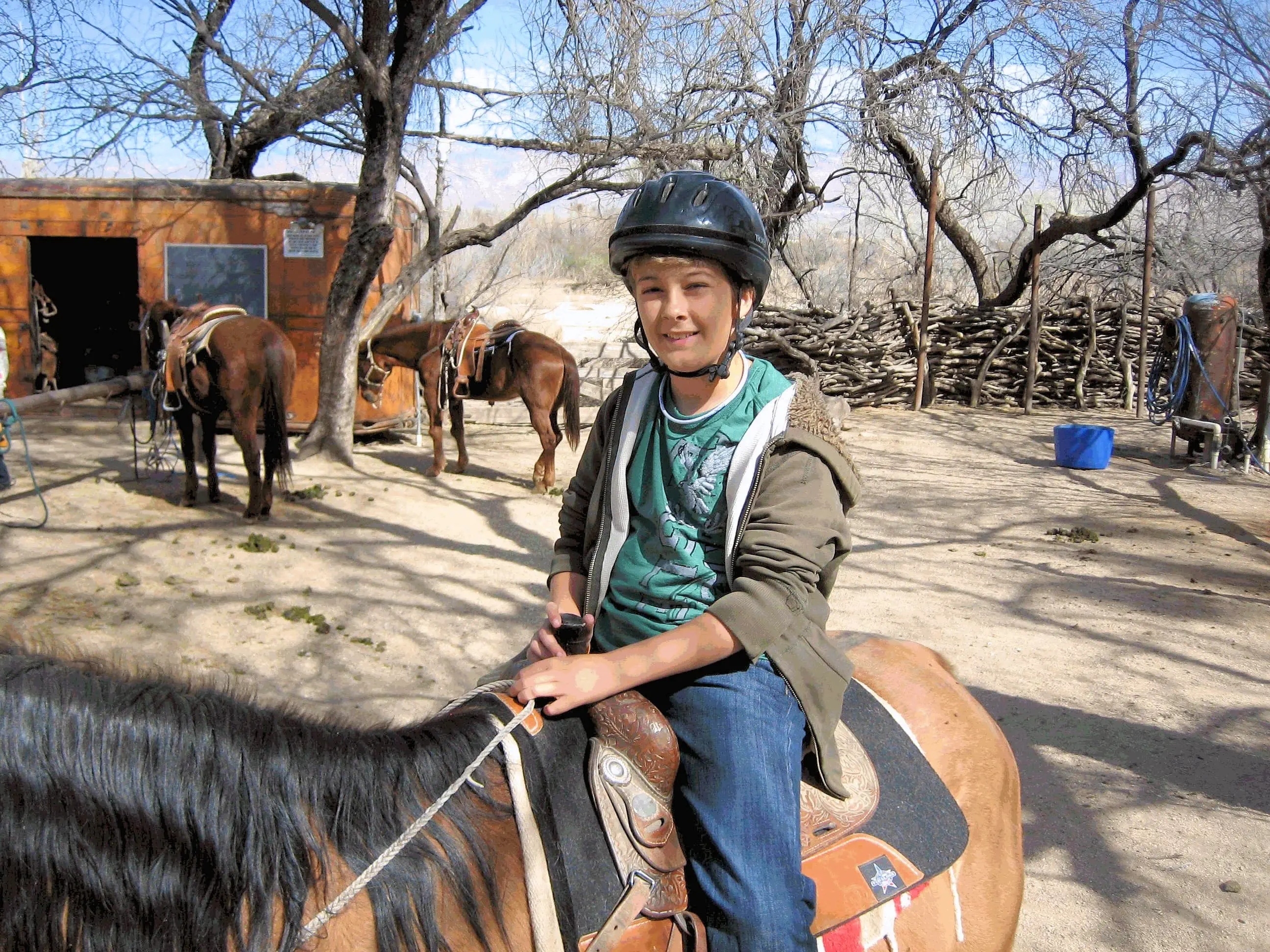
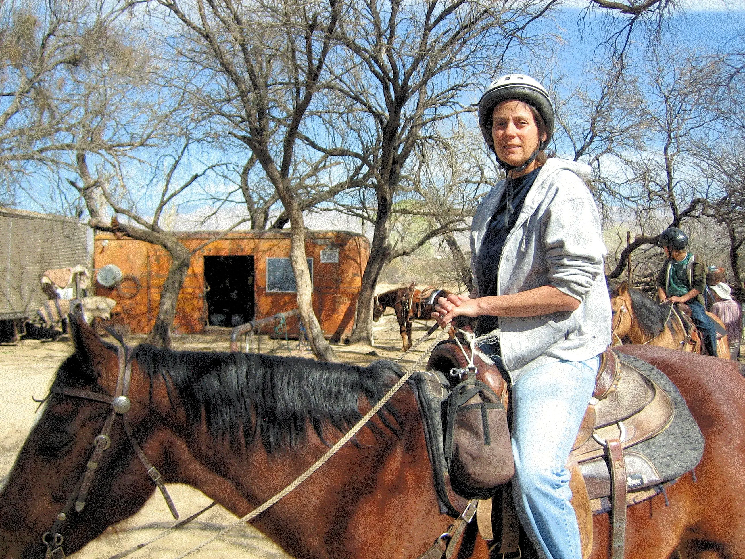
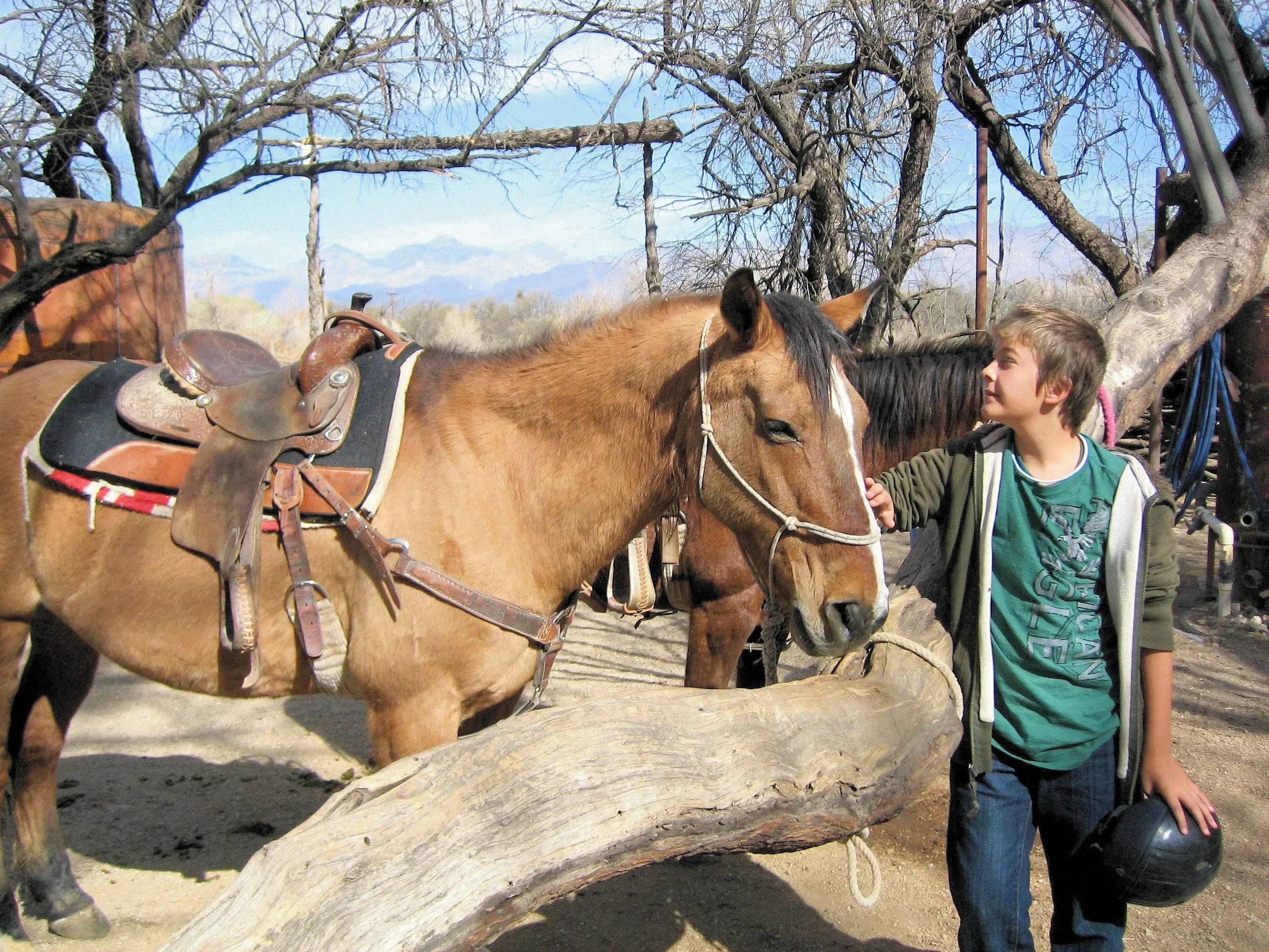
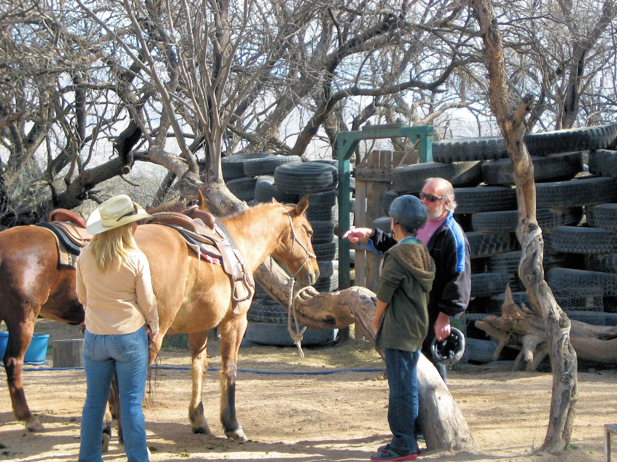
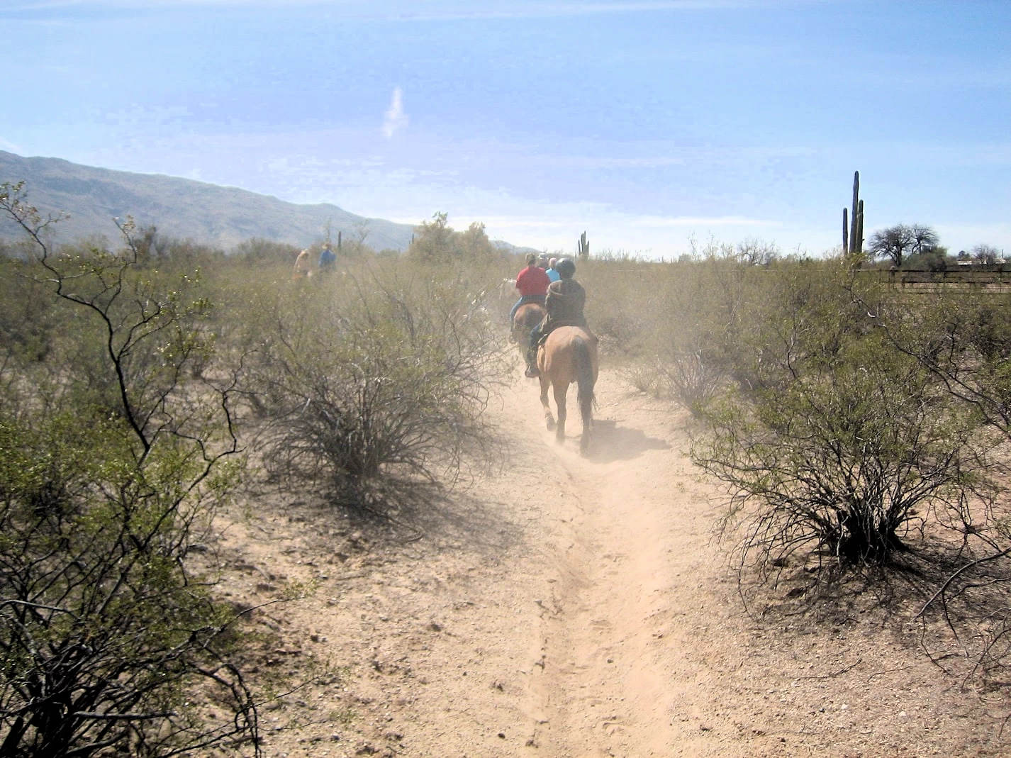
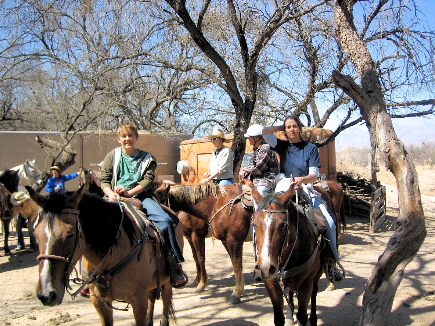
The next day's adventure was all about introducing Celeste and Jeremy to horseback riding—an experience I was excited to share
with them. We found a great dude ranch near Tanque Verde Ranch, a place steeped in the classic Western tradition of riding and
ranching. Interestingly, I used to work at a riding stable in this very area when I was a teenager, but after all these years, I
couldn’t quite pinpoint which one it had been!
As everyone got saddled up and ready for the ride, I watched with a mix of excitement and nostalgia. Unfortunately, my back wasn’t
in the best shape, so while I would have loved to join them on the trail, I knew the movement and bouncing of the ride would have
been too much for me. Instead, I helped them get ready, made sure they were comfortable on their horses, and then waited for their
return, eager to hear all about their experience.
The ranch owners were fantastic, ensuring that every rider was matched with a horse suited to their size and skill level. They took
the time to provide clear instructions, making it easy and enjoyable for first-time riders like Celeste and Jeremy. The surrounding
landscape was classic Sonoran Desert—wide open spaces dotted with cacti, low-rolling hills, and a breathtaking backdrop of distant
mountains. Since the terrain near the ranch was mostly flat, it was the perfect setting for a relaxed and scenic ride, ideal for
beginners getting their first taste of horseback riding in the Southwest.
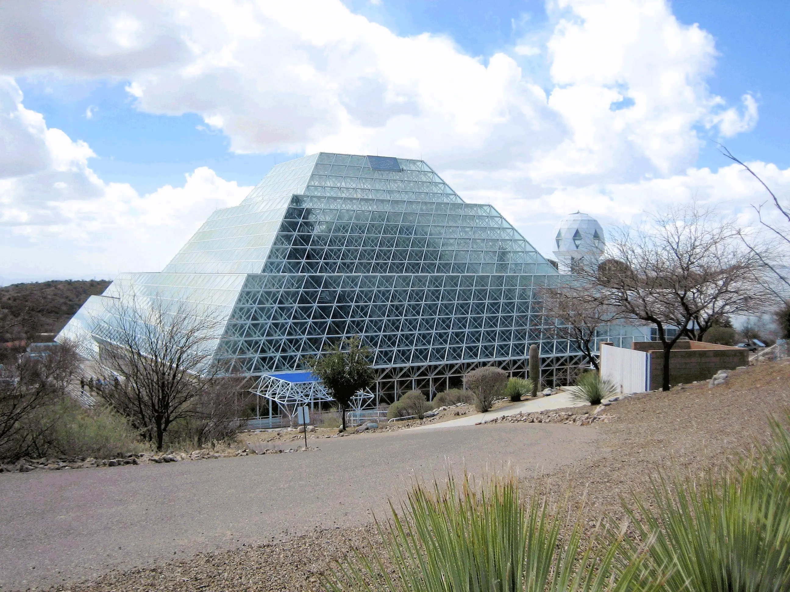
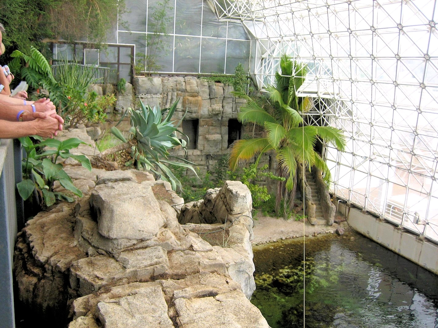
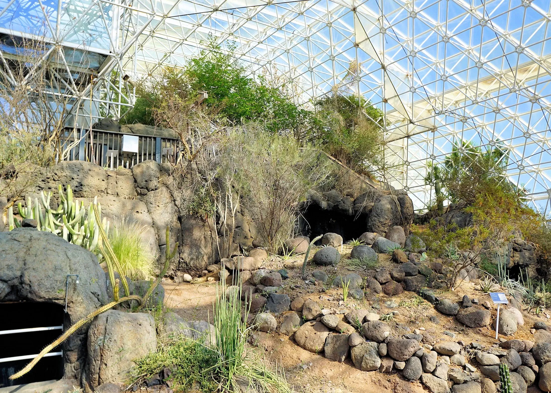
We drove out to Biosphere 2, located north of Tucson near Oracle, AZ, and found it to be a fascinating and thought-provoking
experience. The facility is renowned for a highly publicized scientific experiment in the early 1990s, where a group of
researchers lived inside the sealed environment for two years to study the challenges of sustaining human life in a closed
ecosystem, simulating conditions that might be encountered on other planets.
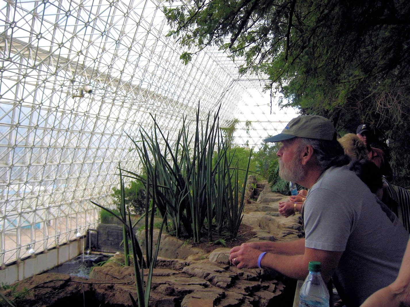
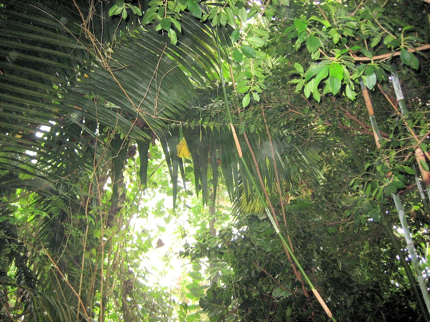
During our guided tour, we explored several distinct biomes, including a rainforest, desert, and ocean with a coral reef, all
housed within the massive glass structure. Each section was designed to function as a self-contained ecosystem. We learned how
the inhabitants of the Biosphere grew their own crops for food, recycled water, and worked to maintain balance in their environment.
The narration provided unique insights into the successes and challenges of the project, as well as ongoing research aimed at
understanding climate change, sustainability, and the possibilities of space colonization. Walking through the various environments
felt like stepping into a science-fiction story come to life. The blend of science, history, and environmental exploration made
it an unforgettable stop during our Arizona adventure.
Biosphere History Lesson
The biosphere was originally constructed between 1987 and 1991 by Space Biosphere Ventures. In total the project cost about 200 million
dollars and its key builders were John P. Allen and Margret Augustine. It got its name, Biosphere 2, due to the fact it was meant to be the
second fully self-sufficient Biosphere after the Earth.
Its 5 biomes are all 1,900 square metered rainforests with oceans, coral reefs, mangrove wetlands, fog deserts and multiple agricultural
systems. Biosphere 2 was only used twice for its original purpose as a closed system experiment that went on from 1991-1993, and the
second time from March to September 1994. Furthermore, both attempts ran into problems that included; low amounts of food and oxygen,
die-offs of many animal and plant species, squabbling among the resident scientists and management issues.
Distance from Sedona to the Grand Canyon is 122 miles (via 89A to I-40 to route 64). We were all eager to get there, as there cannot be
a more incredible canyon in the United States! However, this is a long stretch of wide open desert with very few opportunities to stop, so
you want to be careful about food, drink and gasoline.
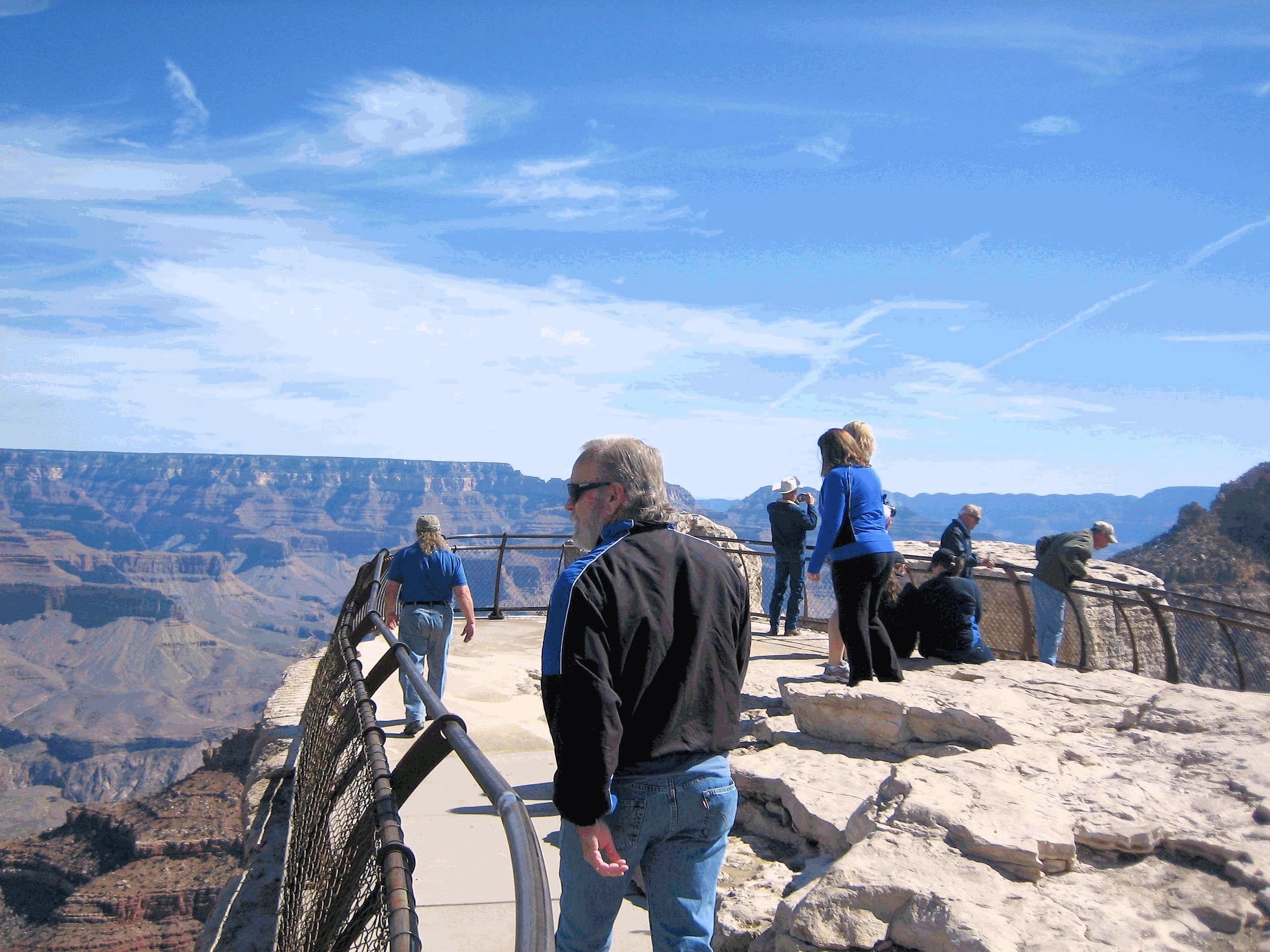
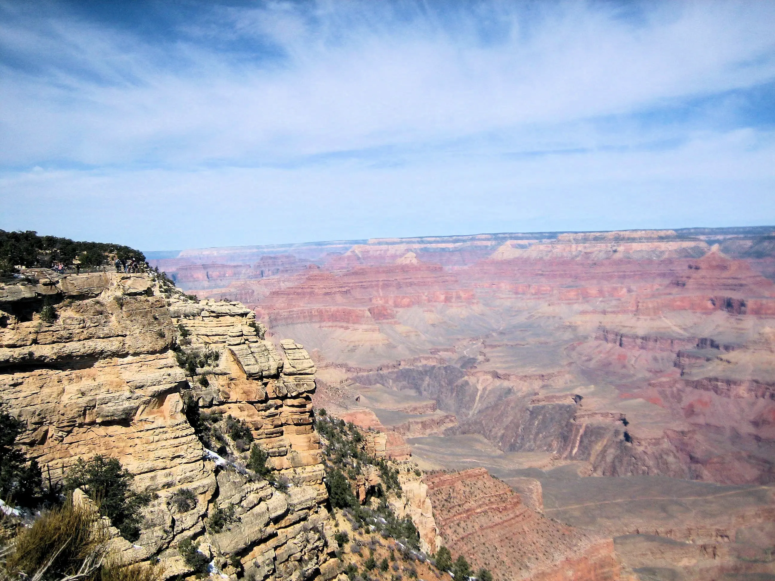
Grand Canyon Observation Point
One of the observation points on the rim of the Grand Canyon, magnificent view of the
valley below.
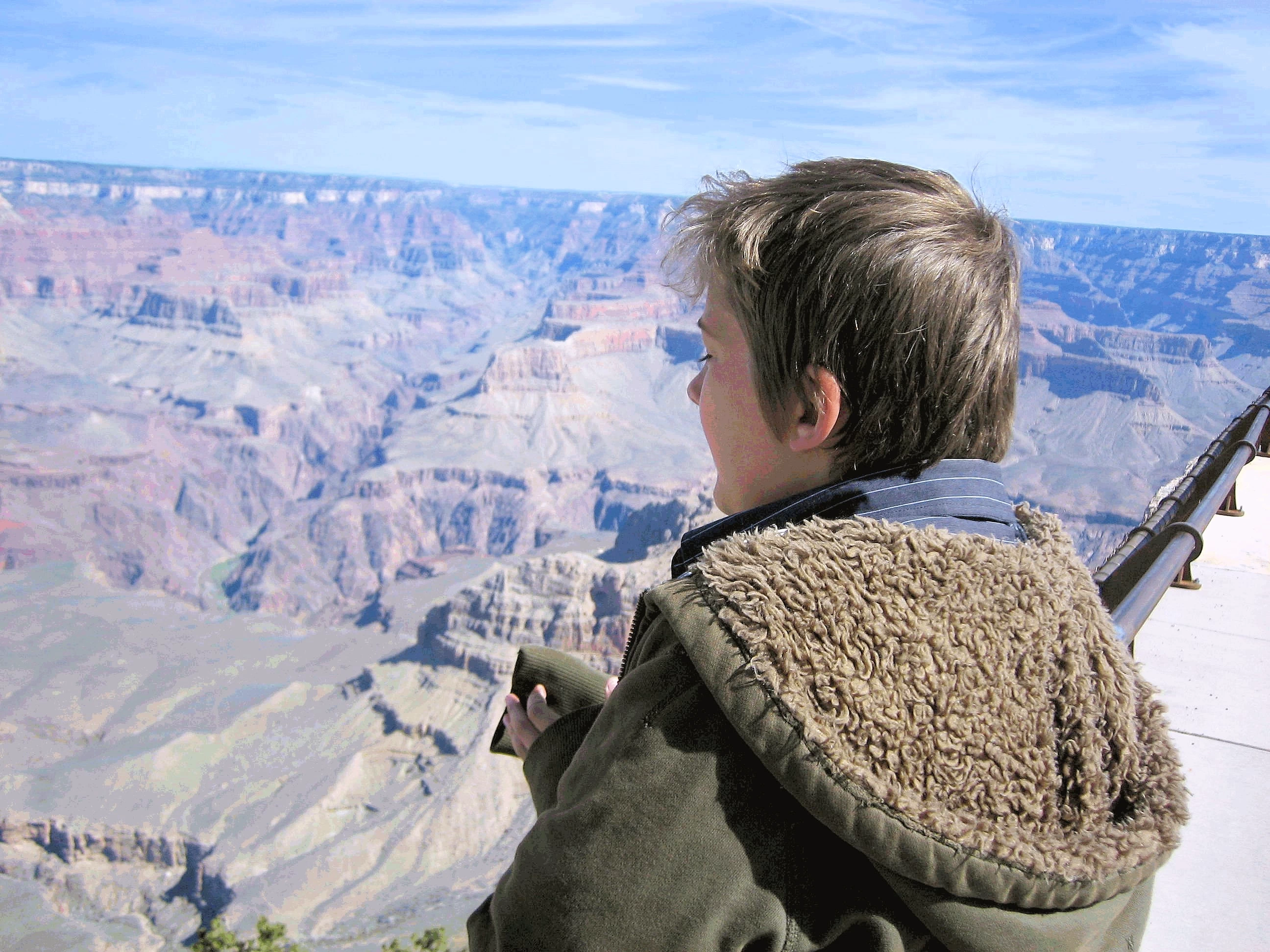
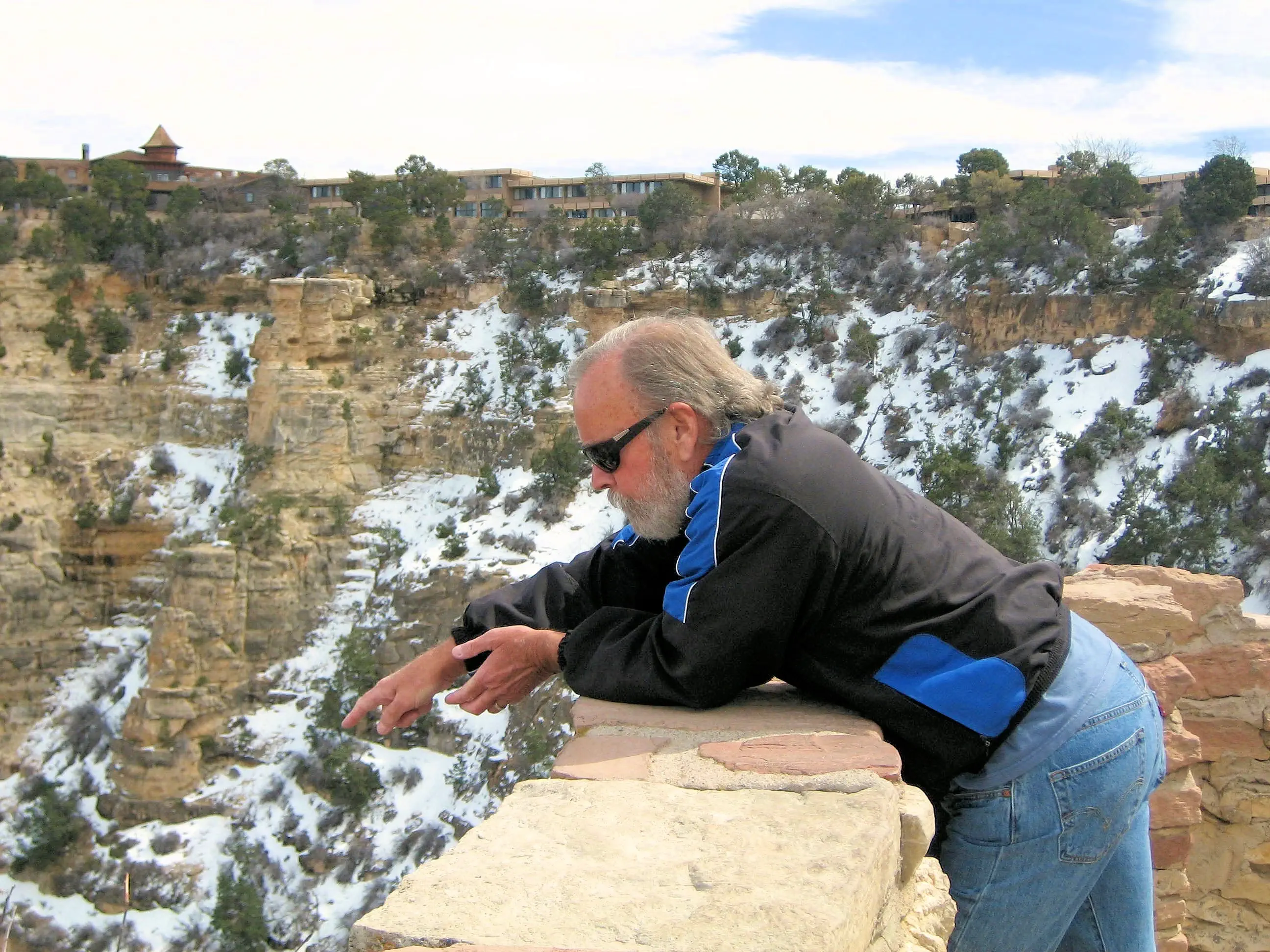
Grand Canyon
Jeremy is pondering the valley of the Grand Canyon, 6,000 feet below where we are standing.
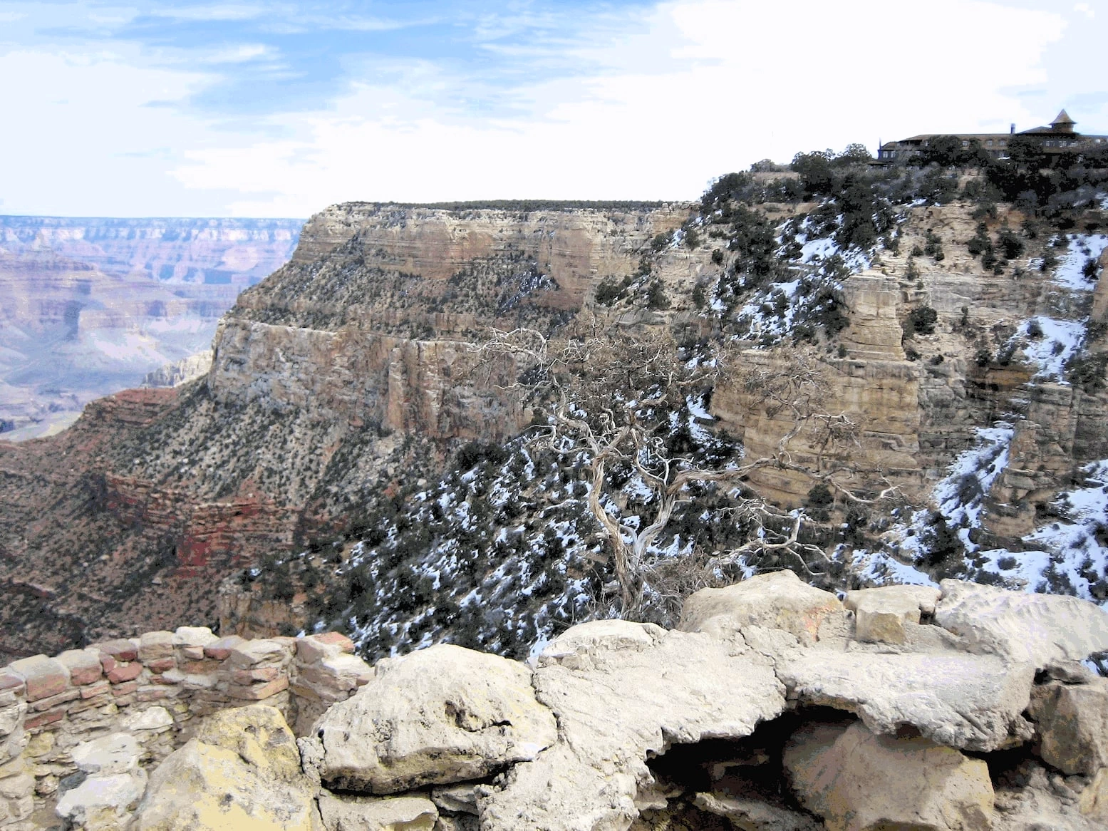
Grand Canyon North Rim
The canyon is immense! That is the North Rim in the distance, it
is approximately 18 miles from where we were standing.
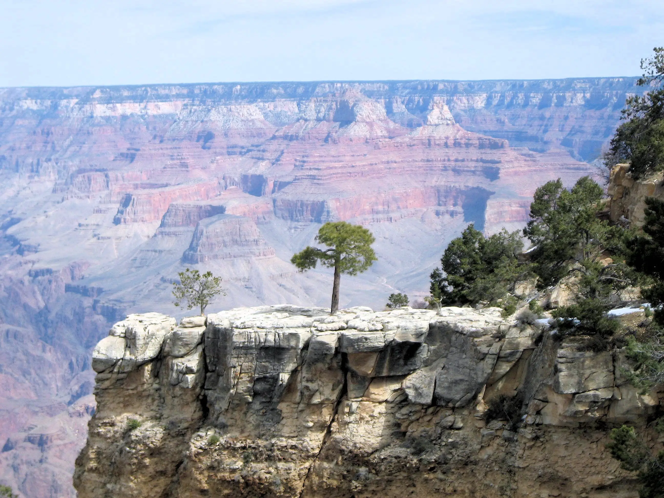
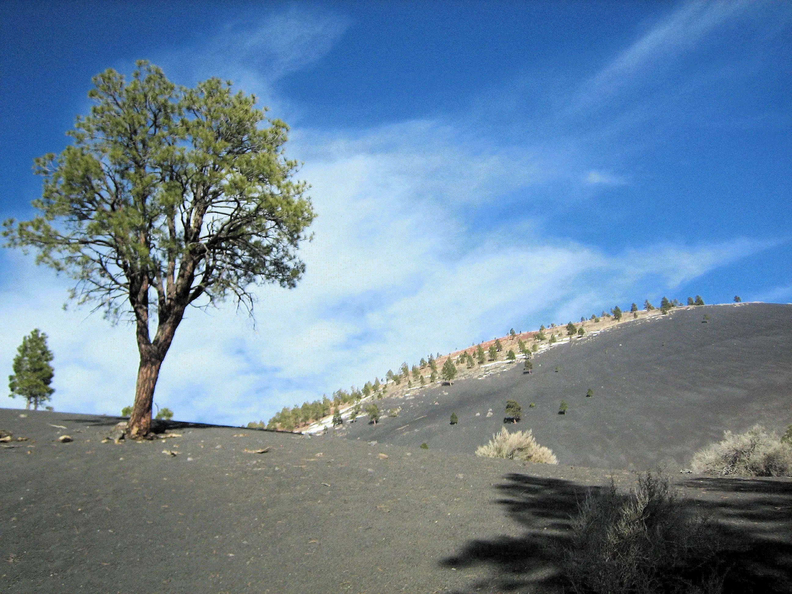
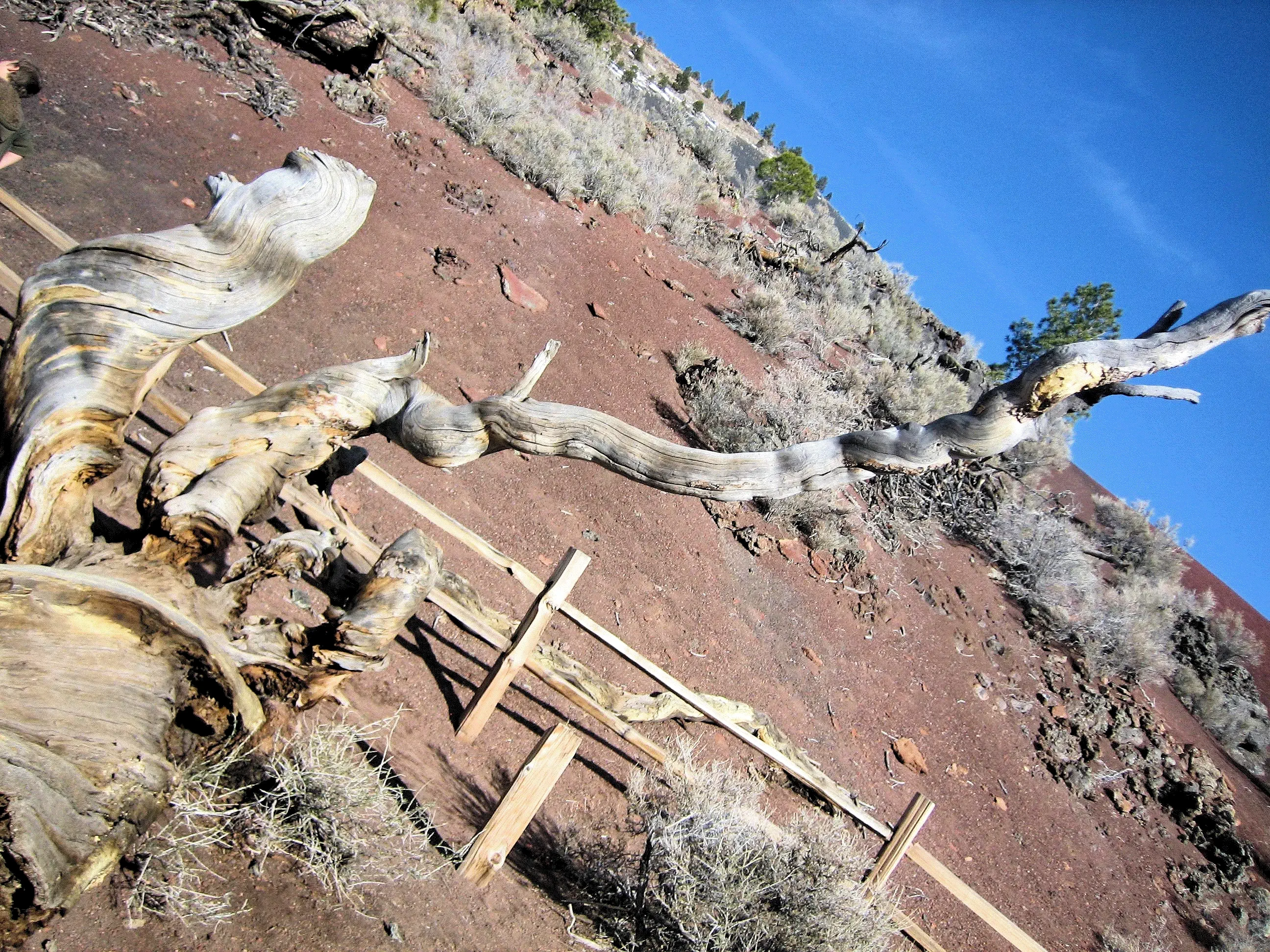
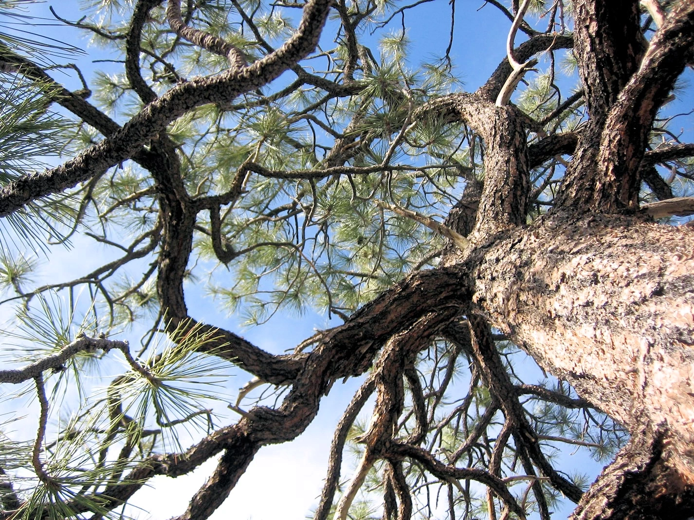
Trees Growing out of Solid Rock
It is a testament to the hardiness of those trees that they can grow out of the solid rock! Most of the vegetation
on the rocks, is pinyon pine and various species of juniper.
Grand Canyon West View
Looking west from the lookout point we were standing on, the Canyon continues for a number of miles before it ends near
Hoover Dam.
Grand Canyon Mule Trains
I had just noticed that a "mule train" of Canyon visitors were coming back up the trail, I am pointing them out to
Celeste and Jeremy.
Grand Canyon Dimensions
Did you know the Grand Canyon is bigger than the state of Rhode Island? It is over a mile deep, 277 miles long and 18 miles wide - a total of
1,904 square miles. Rhode Island is 1,214 square miles. The Grand Canyon attracts millions of visitors to northern Arizona each year, all hoping to snap an amazing photo of the canyon’s
vast landscape. The mile-deep gorge is the centerpiece of such an expansive view that it can’t all be seen at once; at 277 miles
long and up to 18 miles wide, the Grand Canyon is so large, it creates its own weather. In fact, getting a view from its two most
popular rims (aka tops) requires nearly five hours of travel time.
More Info for Grand Canyon, AZ
Grand Canyon, AZ Wikipedia Article:
Grand Canyon, AZ Google Images Set:
Our Grand Canyon, AZ Image Gallery:
Our second trip to the Grand Canyon:
Google Reviews for the Grand Canyon National Park
Image Credits:
All of the above images are the property of Just Traveling Thru, LLC.
Sunset Crater Volcano National Monument, AZ 3D Map
Since the weather conditions in the Grand Canyon blocked our goal of a flight
down into the Canyon, we decided to drive back to Sedona via an alternate route. We
took a look at the Arizona map and decided that it would be interesting to drive to the
Sunset Crater Volcano National Monument.
Exploring Sunset Crater Volcano National Monument
Exploring Sunset Crater Volcano National Monument
Exploring Sunset Crater Volcano National Monument
Exploring Sunset Crater Volcano National Monument
Exploring Sunset Crater Volcano National Monument
Exploring Sunset Crater Volcano National Monument
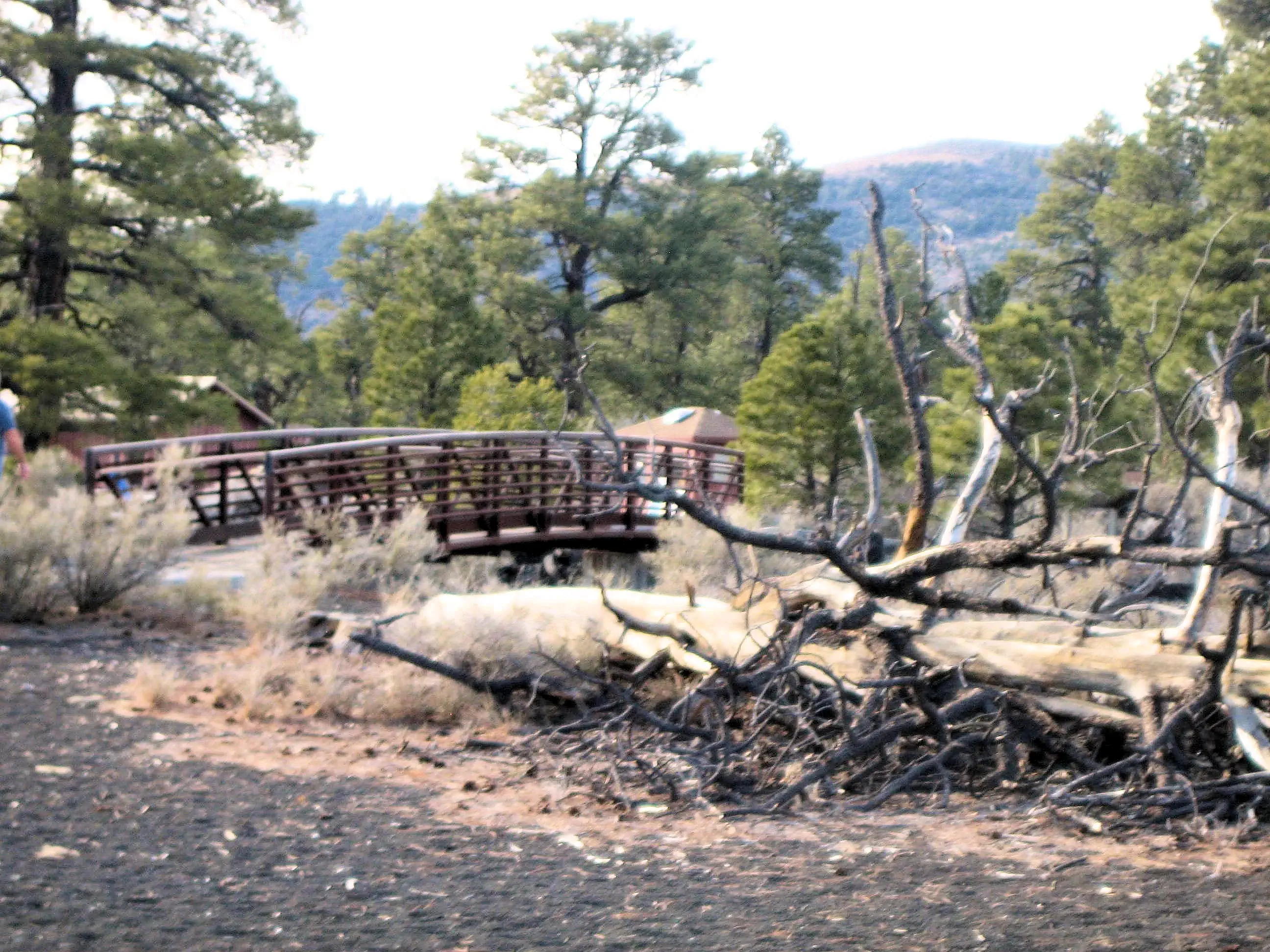
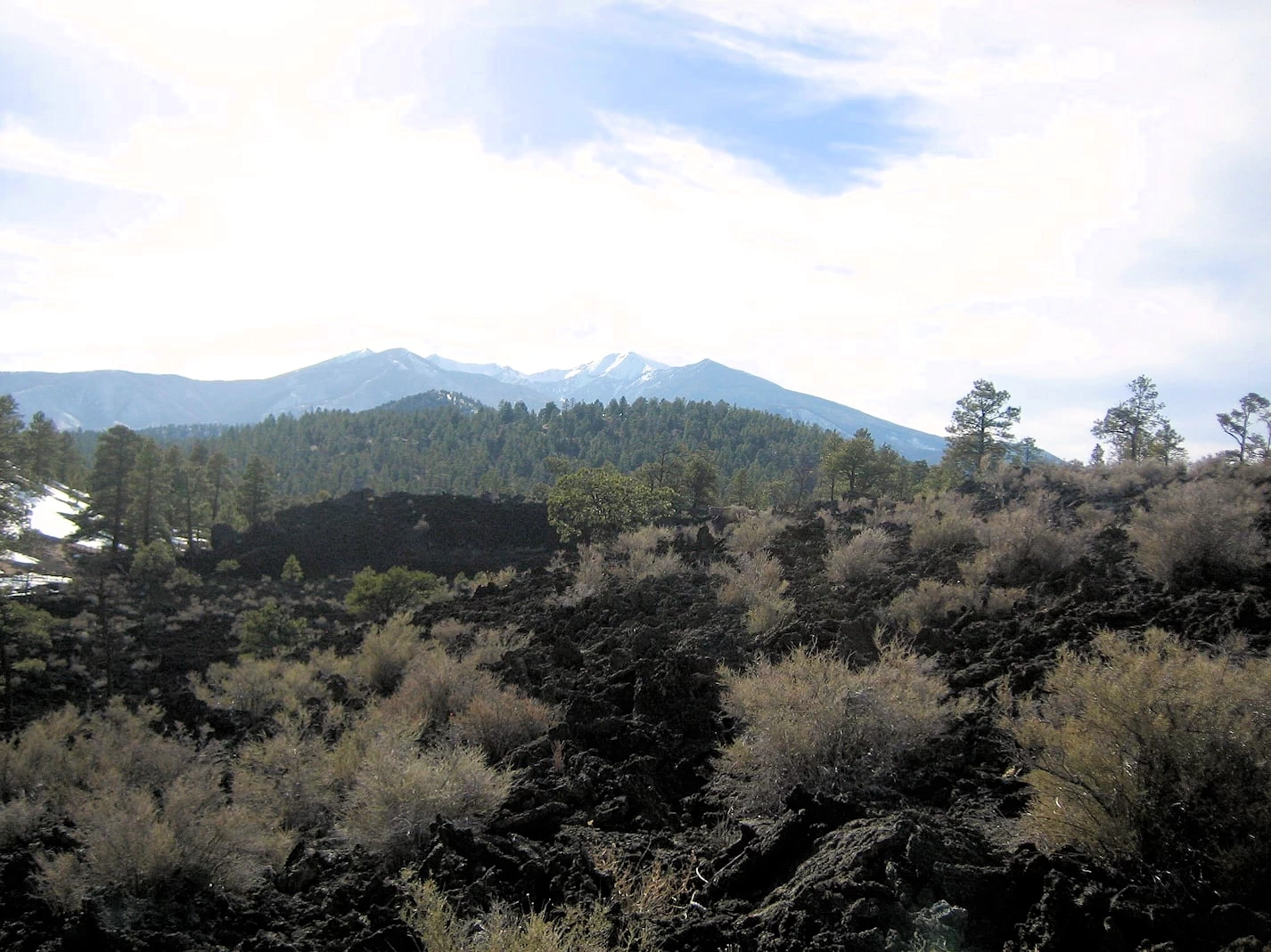
As you can see in these images from Sunset Crater Volcano National Monument, the landscape is a stunning blend of volcanic ash
fields, lava flows, and barren, weathered trees, creating a striking and otherworldly atmosphere. The black, jagged lava rocks
contrast sharply with the surrounding pine forests, making for a unique and memorable visual experience. The park’s unusual
topography is a result of the volcanic eruption that occurred nearly 1,000 years ago, transforming the region into a dramatic display of geological history.
Visitors can explore the 1.6-kilometer Lava Flow Trail, a scenic loop that winds through the park, offering close-up views of ancient lava
formations, cinder fields, and volcanic debris. Interpretive signs along the path provide fascinating insights into the eruption’s impact on
the area and the resilience of nature over time.
Although hiking to the summit of Sunset Crater was once permitted, the trail to the top has been closed since 1973 due to erosion caused by foot
traffic. This closure helps preserve the crater's unique features and ensures future generations can continue to appreciate this incredible
volcanic site. The hike is still an exciting adventure, allowing visitors to witness the powerful forces of nature that shaped this remarkable landscape.
More Info for Sunset Crater National Monument, AZ
Sunset Crater, AZ Wikipedia Article:
Sunset Crater, AZ Google Images Set:
Google Search Results list for "places to eat near Sunset Crater National Monument":
Google Reviews for Sunset Crater National Monument
Image Credits:
All of the above images are the property of Just Traveling Thru, LLC.
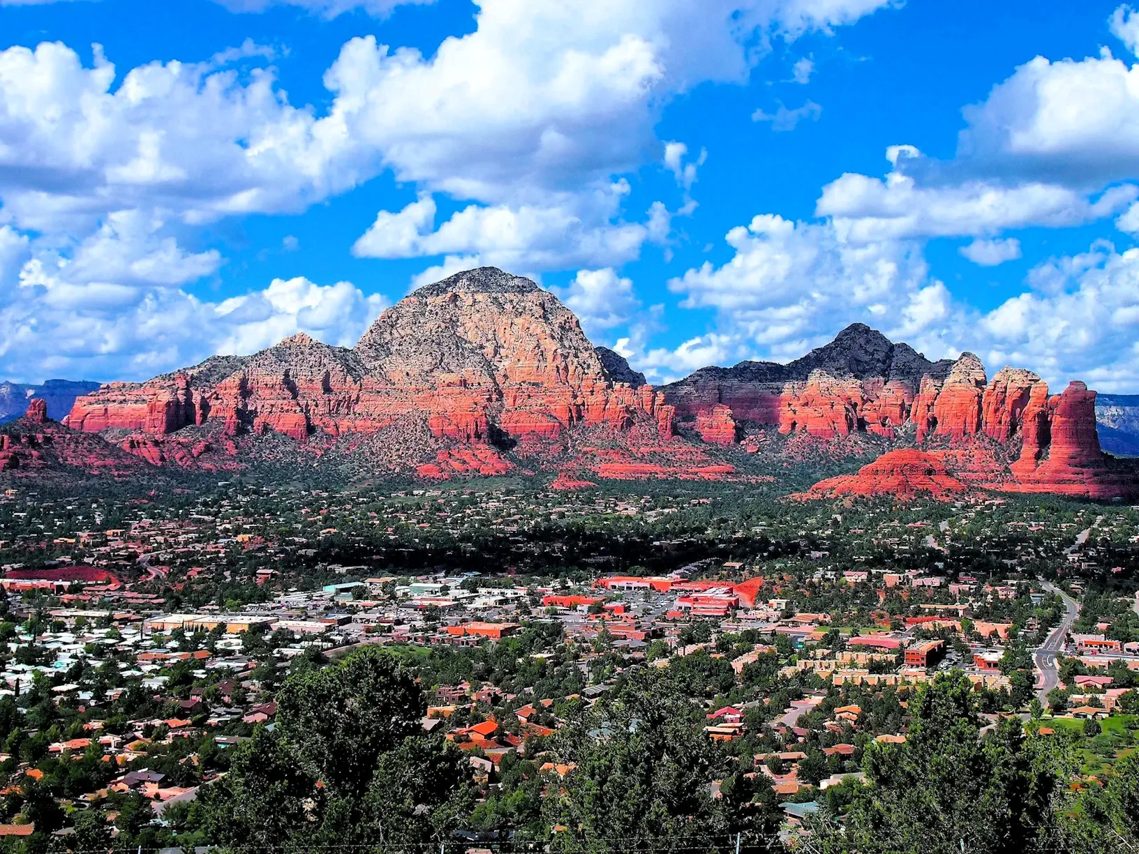
The Verde Valley, a lush oasis nestled amidst Arizona’s iconic red rock landscapes, offers a captivating blend
of natural beauty, rich history, and outdoor adventure. This hidden gem is a must-visit for travelers seeking
a unique and unforgettable experience.
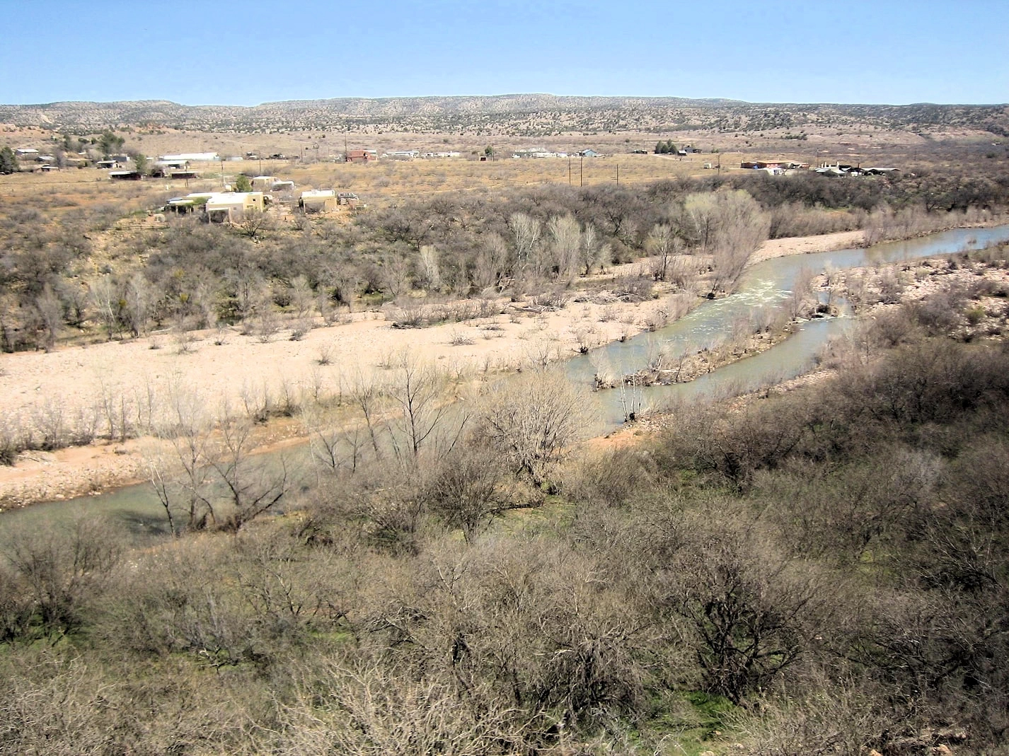
One of the Verde Valley’s greatest draws is its stunning natural environment. Explore the Verde River, Arizona’s
only designated Wild and Scenic River, offering opportunities for kayaking, fishing, and simply enjoying the
tranquil waters. Hike through the diverse landscapes of Oak Creek Canyon, where towering red rocks frame lush
greenery. For a truly unforgettable experience, visit Montezuma Castle and Tuzigoot National Monuments to
marvel at ancient Native American cliff dwellings.
We visited Verde Valley in order to ride the Verde Valley Railroad, a scenic train journey through the heart of
Arizona offers a unique opportunity to experience the region's natural beauty in a truly special way. The train ride
will take us along the Verde Canyon & the Verde River.
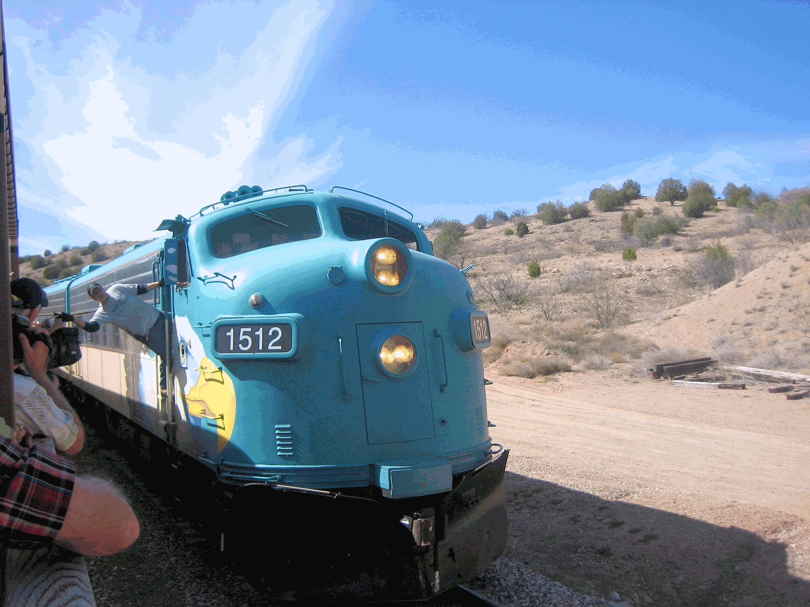
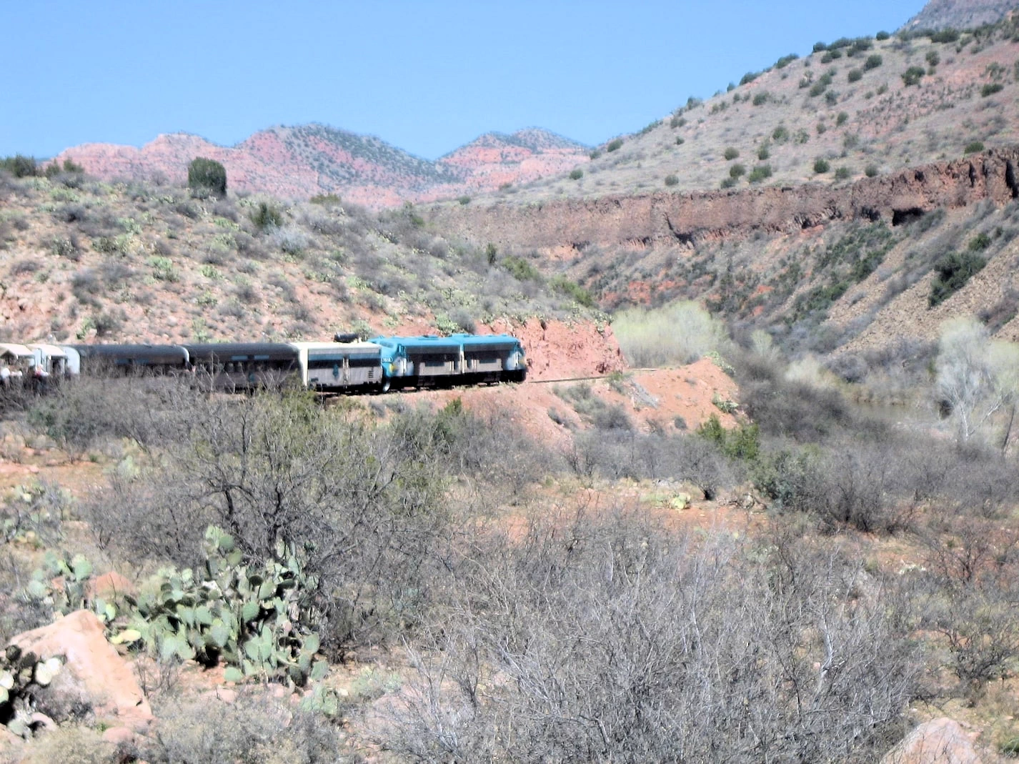
Verde Valley Railroad Locomotive Repositioning
Verde Railroad locomotive after dropping us off at the mid-point of the train ride.
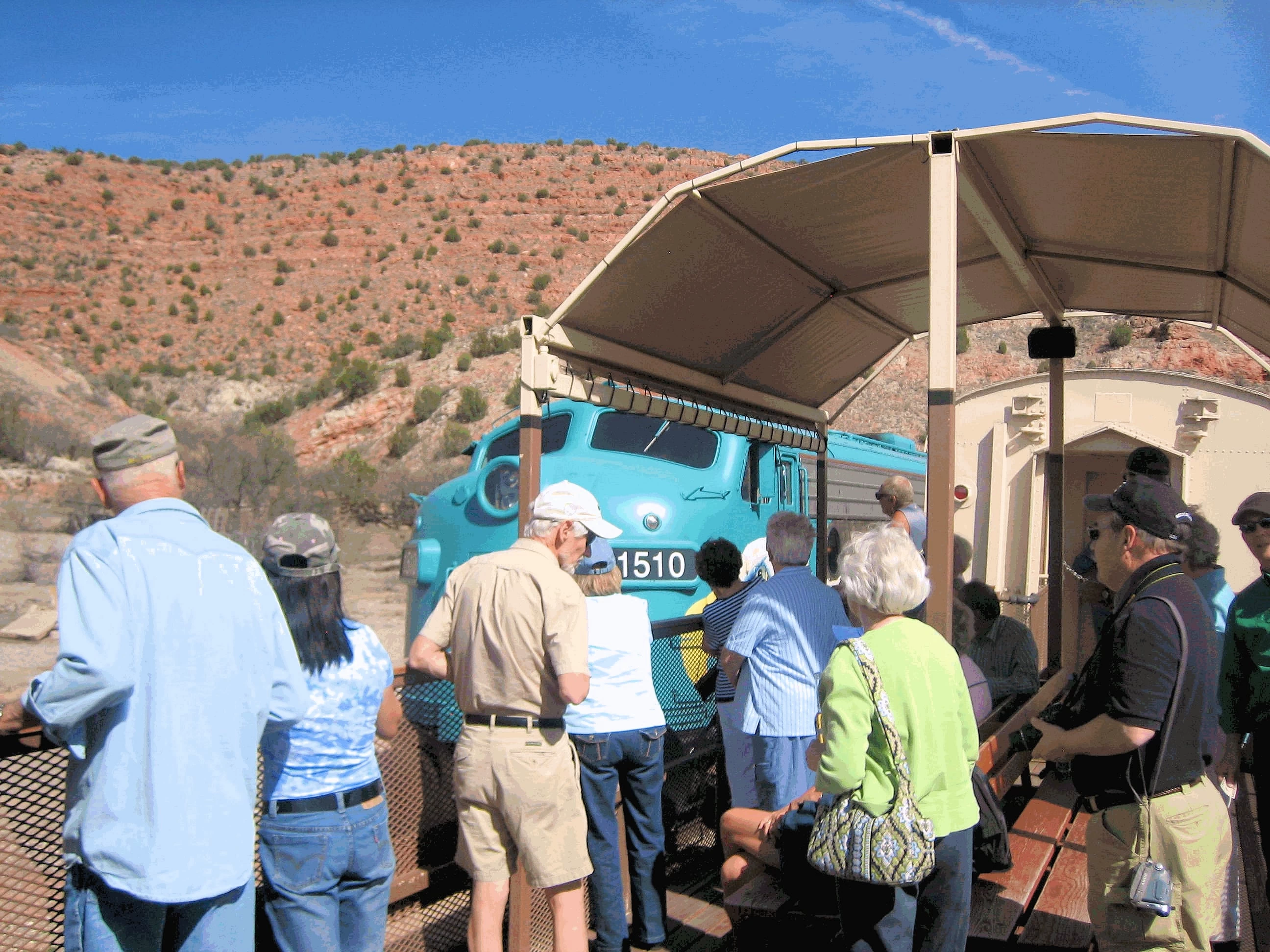
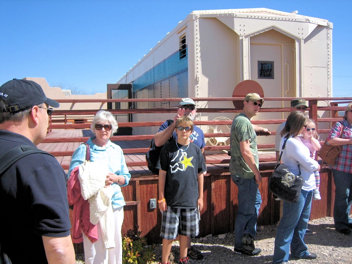
Verde Valley Railroad Reboarding Queue
Waiting to reboard the train for the return trip through Verde Canyon.
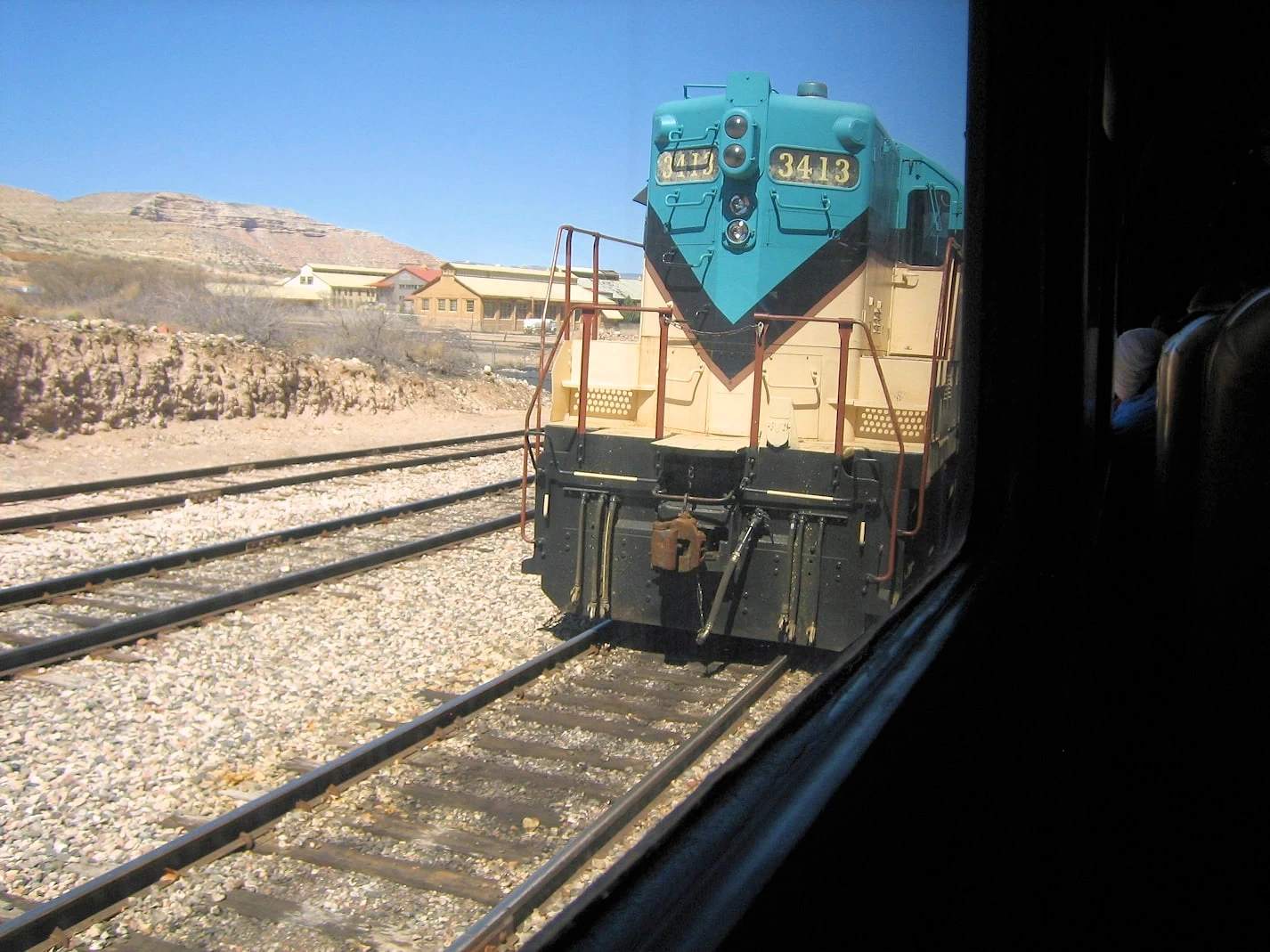
Verde Valley Railroad Locomotive Ready?
The train had to be driven down to where they could put the locomotive back on the front
cars to enable us to return back to the starting point.
Verde Valley Railroad Locomotive Arrival
The locomotive has repositioned, and it is headed to the front of the train to start our ride to Perkinsville.
Verde Valley Railroad Reboarding Queue
Everyone is queued up waiting to board the train, it is a beautiful day with clear skies, so our visibility should be
very good.
Verde River
The train route parallels the Verde River as it heads out to Perkinsville, AZ where the turn-around point is located.
More Info for the Verde Canyon Railroad
Verde Canyon Railroad Wikipedia Article:
Verde Canyon Railroad Google Images Set:
Where to obtain Verde Canyon Railroad Tickets?
Google Search Results list for "places to eat near Verde Canyon Railroad":
Google Reviews for Verde Canyon Railroad
Image Credits:
All of the above images are the property of Just Traveling Thru, LLC, unless otherwise noted.
Piestewa Peak & Trip Summary
Hilton Phoenix Resort
You may have noticed that there aren't many pics of the Grand Canyon? We were to go on a "discovery drive" around the Canyon rim and were planning on taking a
flight the next day to tour the Canyon, however, the next day a raging snow storm precluded us from taking that flight. So we did all the other things you see in this post. And eventually, as it always does, we had to return back home to Florida.
As I said, we did everything else we described which included us hiking
Piestewa Peak in Phoenix - but we did not bring cameras on the hike, because it is very rough terrain and it was very hot. In fact, the first time we attempted the hike, we aborted the trek half-way up cause it was just too hot! We went back to the
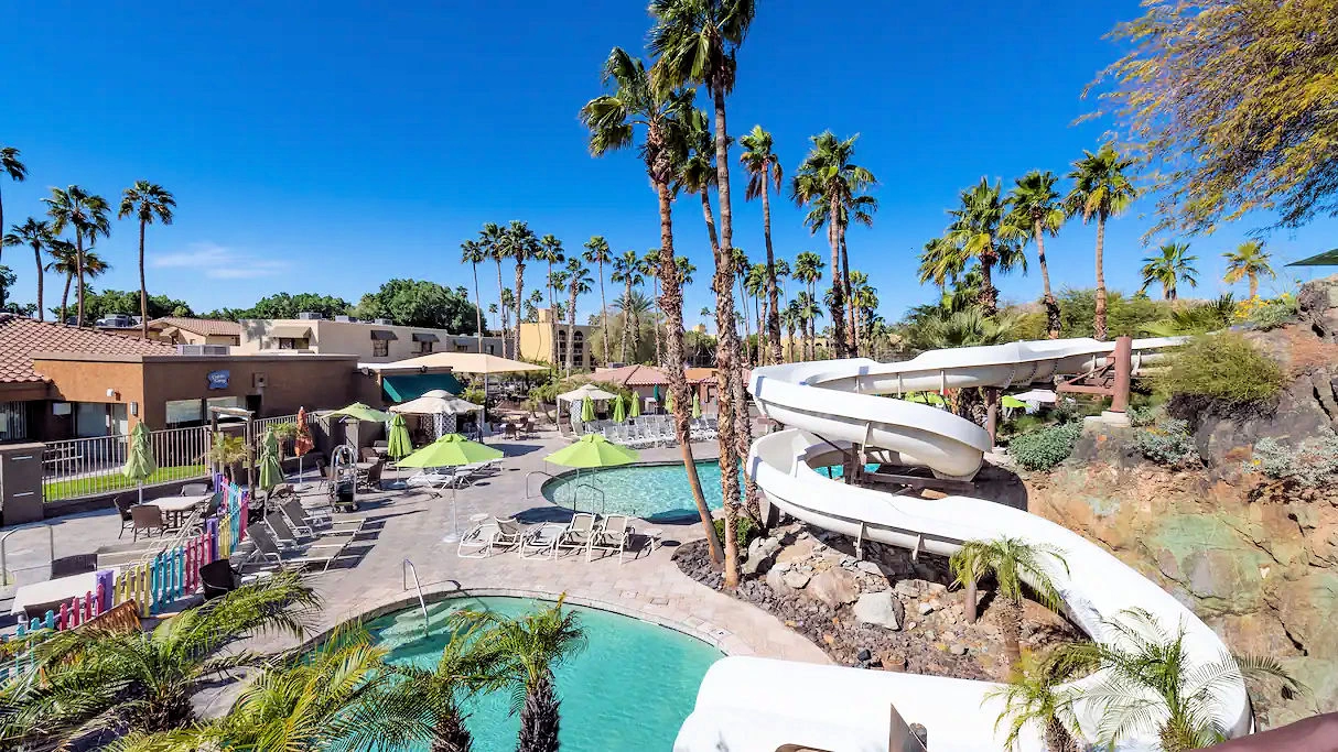
Hilton Phoenix Resort at the Peak which
has a great water park around a large pool and we had a great time. This hotel is an "all suites" setup and it is very comfortable.
We got up very early the next morning and made the hike to the top
where the views of the entire Phoenix Valley are amazing.
There are some really good & informative links below for Piestewa Peak and it's interesting trail.
NOTE: Most of our planning for this trip was based upon Expedia, Hilton, Wikipedia, etc. Planning & research for the Verde Valley Rairoad, the Grand Canyon,
Sabino Canyon, the Sunset Crater Volcano National Monument, Sedona Canyon, the Palatki Heritage Site, Horseback riding, the Biosphere
Oracle and the Pima County Air Museum were all done through extensive use of Google.
More Info for Piestewa Peak
Piestewa Peak Wikipedia Article:
Piestewa Peak Google Images Set:
The Piestewa Peak Trail on the "Modern Hiker" Website:
Google Search Results list for "accommodations near Piestewa Peak":
Google Search Results list for "places to eat near Piestewa Peak":
Note: All images featured on this page are the exclusive property of Just Traveling Thru, LLC, unless
otherwise stated. When images from external sources are used, full credit is given to the original creator, along with a link to the
specified license or usage terms. We are committed to respecting copyright and intellectual property rights, ensuring that all third-party
images are properly attributed. If you have any questions regarding image ownership or usage rights, please feel free to contact us.
Affiliate Links: We may earn a commission if you make a purchase through one of our
affiliate links. This helps support our
travel content — thank you!
Content:
To review any of our content, make suggestions and/or comments, please click the "About" menu link at the top of this page. You will
find our "Contact Us" link on that drop-down menu.

 Click Image to view a larger map
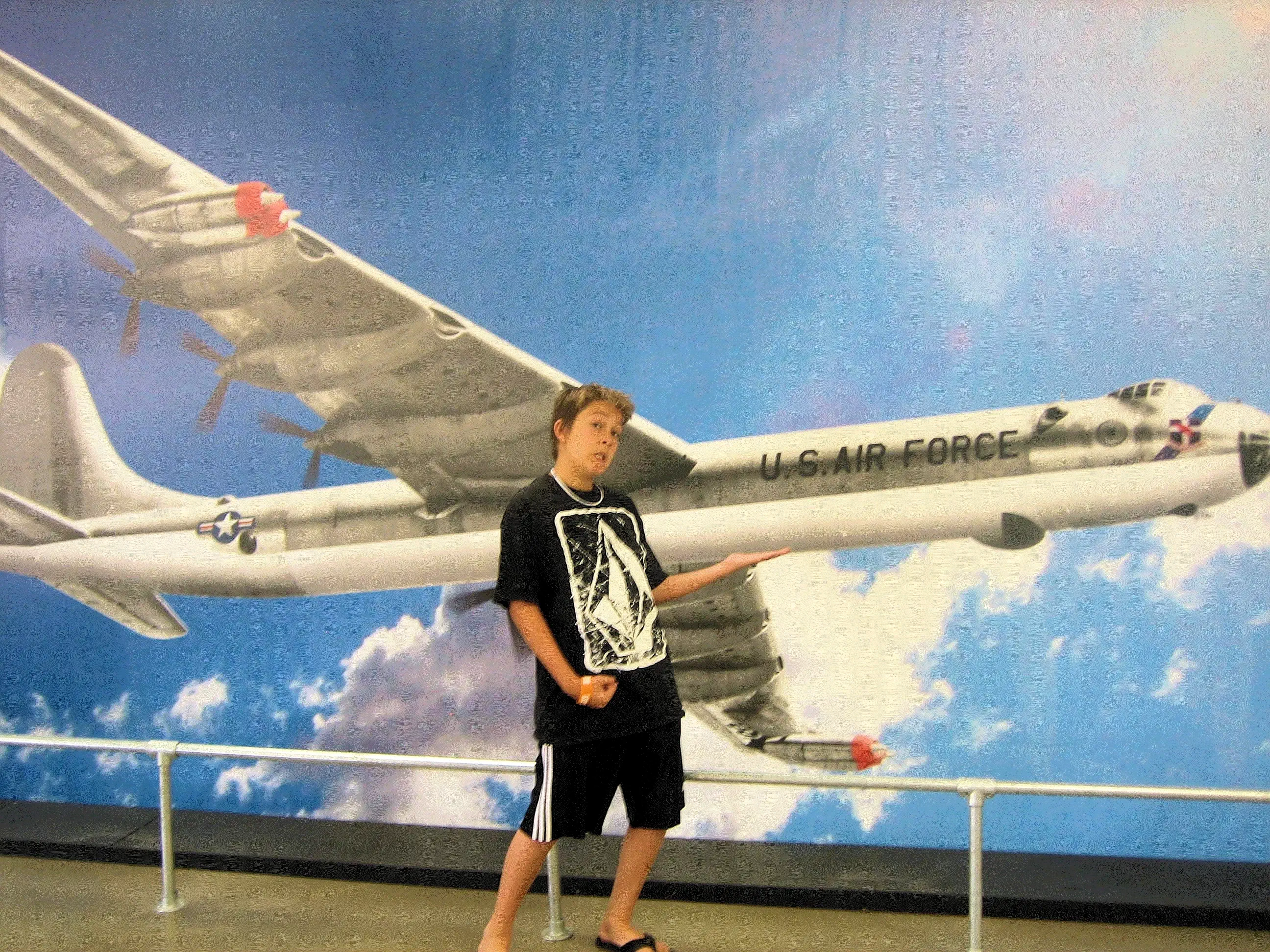 Convair B-36


