
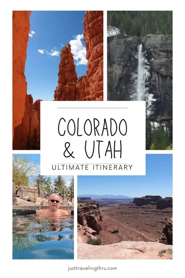
by Celeste Lipford and Terry Lipford - last updated on 8/28/2025
Lake Powell is a man-made reservoir located in northern Arizona and southern Utah, created by the construction of the Glen Canyon Dam on the Colorado River. With a capacity of over 24 million acre-feet, it is the second-largest reservoir in the United States and the largest in the Southwest. Spanning over 186 miles, Lake Powell offers an incredible variety of outdoor recreational opportunities, making it a popular destination for both locals and tourists alike.
This was our next stop after we departed Zion National Park and our plan was to spend one night in Page, AZ and explore Glen Canyon Dam and Lake Powell. We also wanted to avoid a full day's drive into Durango, CO (our next pit stop) and stopping in Page, AZ allowed us to explore Lake Powell and then drive on to the Four Corners area.
Lake Powell plays a vital role in the region's water supply and hydroelectric power generation. The construction of Glen Canyon Dam in the 1960s created this impressive reservoir, which can store up to 27 million acre-feet of water. Beyond its recreational significance, the area surrounding Lake Powell is a haven for outdoor enthusiasts, with hiking, camping, and sightseeing opportunities in the nearby Glen Canyon National Recreation Area and beyond. Whether you're seeking adventure or simply looking to immerse yourself in the unparalleled beauty of the American Southwest, Lake Powell is a destination that never fails to captivate.
It is more accurate to say that our destination was actually Page, AZ as well as Lake Powell & the Glen Canyon dam. We had selected this area as a stop-over on the way back to Colorado because it is a boater's paradise in the middle of a very arid desert.
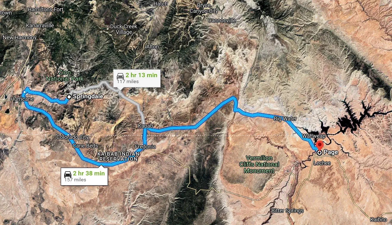
You may have noticed on our "route map" that when we departed Springdale, UT we went west instead of the shorter route through the park? This is because the Mt. Carmel Tunnel was being operated one way (switching back & forth), as well as having height & width restrictions. When we entered the park, we did not have to wait to enter the tunnel, however on the western side of the tunnel there was a five mile backup waiting to go east through the tunnel. As we did not want to sit in a traffic queue for our departure, we decided to take the western route.
The Colorado Plateau is a 150,000-square-mile showcase of Earth’s history. It’s located in an area called the Four Corners, where the states of Arizona, Colorado, New Mexico, and Utah all converge. The plateau’s elevation ranges from canyons at 2,461 feet to 12,600-foot-tall mountain peaks. Lake Powell is situated on the Colorado Plateau; the reservoir is primarily located within the Glen Canyon National Recreation Area, which itself is part of the Colorado Plateau region.
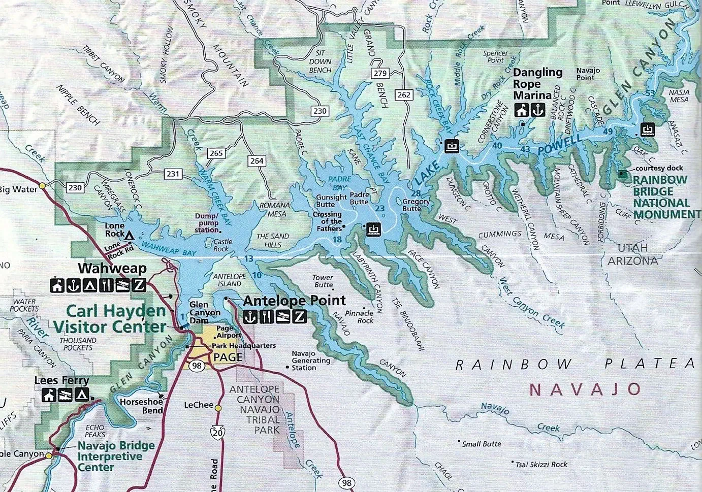
The above image is the property of The World According to Barbara via her website. This map gives you a better idea of how large this body of water is. The lake is nearly 300 kilometers from end to end, 254 square miles, 7.198 cubic miles total volume and a max depth of 558 feet.
Google shows that (as of 10/11/2024) there are 59 hotels in Page, AZ. This list includes all types, ratings, locations, etc. If you would prefer to conduct your own research, click here to view the Google Search Results list for "accommodations in Page, AZ". Once you are on that Google Search Results page, you can then change the filters to resort the hotels list by price, # of stars, property type, etc. This is a very useful tool for when you are research planning a trip.
NOTE: Google calculates a business's review score by averaging all of the ratings that have been published on Google for that business. The rating scale is 1–5 stars, with 5 being the highest possible rating.
As of 4/29/2025 and based upon what Google says are based upon guest ratings, here are the five most popular accommodations in Page;
We decided to stay at the Hampton Inn and Suites, as we wanted a comfortable hotel room and easy access to local amenities.
Page, Arizona, offers a surprising variety of culinary options for a small desert town, catering to locals and the many tourists exploring nearby landmarks like Antelope Canyon and Lake Powell. Visitors can enjoy hearty Southwestern and American cuisine at local favorites, with dishes like Navajo tacos and ribs being popular choices.
Here is a list of the top 5 guest reviewed restaurants in Page;
If you would like to perform your own restaurant research, here is the link to a Google Search Results list for "places to eat in page az".
After 157 miles of desert driving, the first thing we saw as we descended route 89 (into Page) is Lake Powell off to our left and then you come up to the Glen Canyon Dam. The story about the Dam, it's construction and what issues the continued drought is causing, can be read in more detail here. The bottom line is that the Glen Canyon Dam may have to be removed (or bypassed) in order to save Lake Mead (close to Las Vegas).
The dam is a 710 feet high arch-gravity construction positioned such that bridge traffic into Page, AZ receives a full view of the dam as they cross the bridge. The steel arch Glen Canyon Bridge is 1,271 feet in length and is 700 feet above the river. It is the sixth tallest bridge in the United States (the Royal Gorge Bridge in Colorado is the tallest at 955 feet).
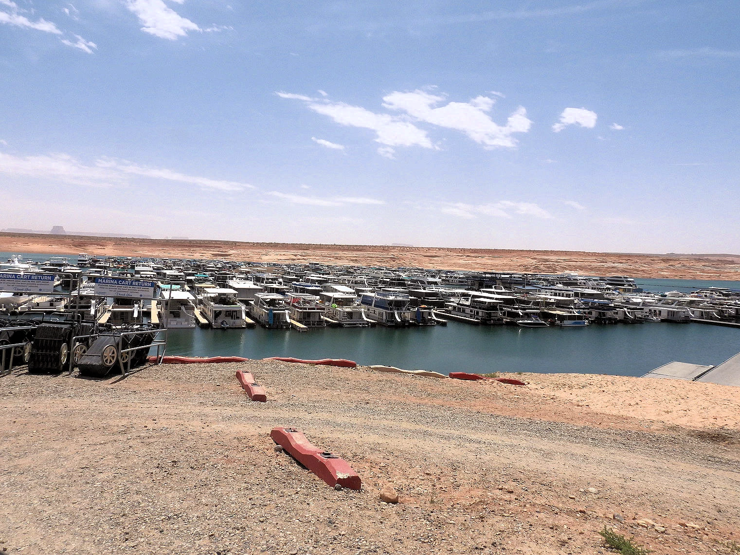 Wahweap Marina from Parking Lot
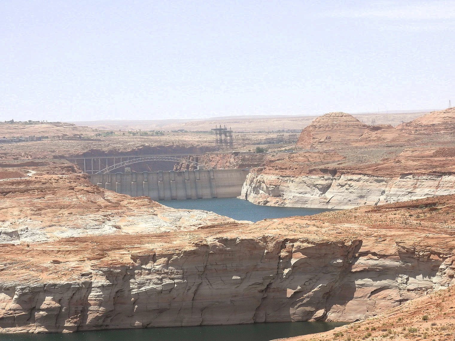 Wahweap Marina South View
 Wahweap Marina North View
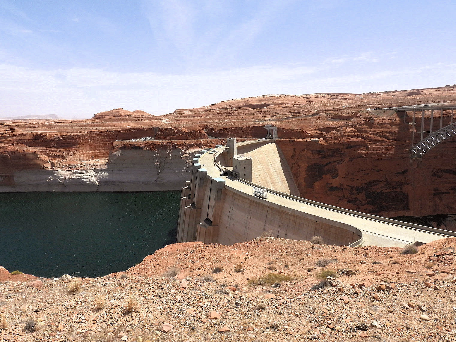 Top of Glen Canyon Dam from Visitor Center
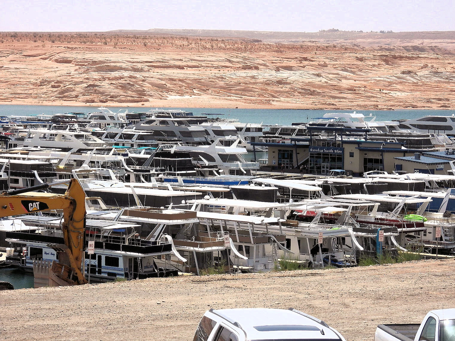 Wahweap Marina
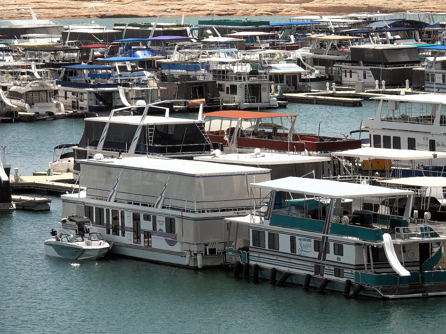 Wahweap Marina
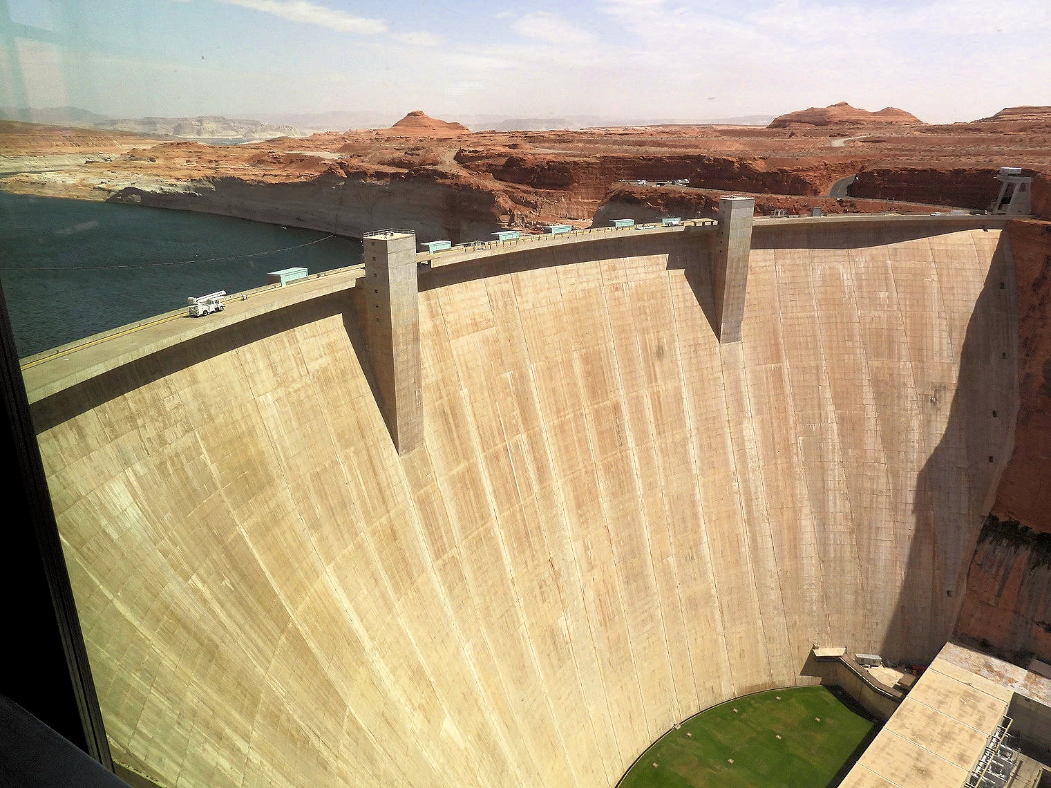 Glen Canyon view from Visitor Center
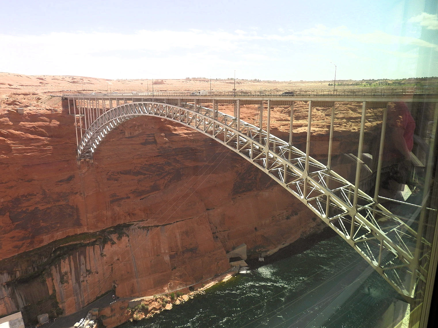 Highway 89 Bridge
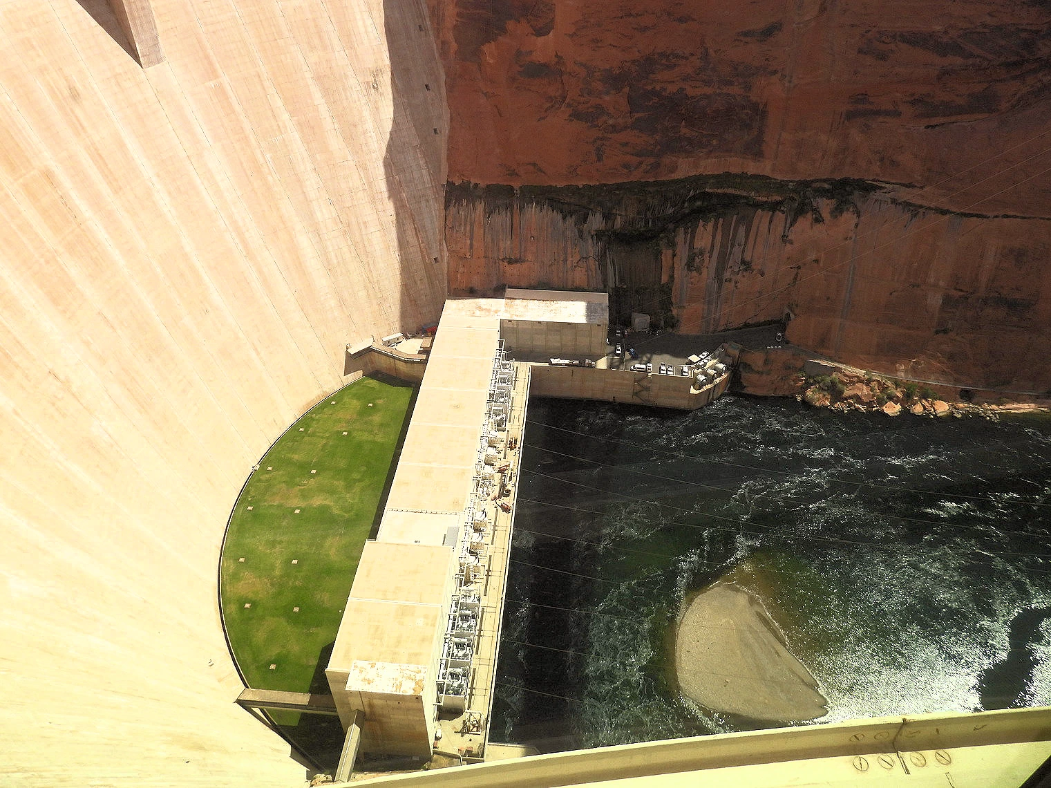 Glen Canyon Spillway
Lake Powell has over 2,000 miles of shoreline which is more than the combined states on the Pacific Coast. It is 400 feet deep, 186 miles long and has a water storage capacity of 27,000,000 acre feet of water.
Due to the continued drought, there are a number of launch ramps that are currently closed, you should check the National Park Service alerts list to see what is closed. There are also various webcams available online for sites around Lake Powell, click here to view that page.
More Info for the Glen Canyon Dam & Image Credits


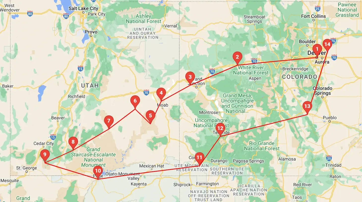 Click above map to view a larger Google Map
 As you can see by the this map, our trip covered 3 different states, approximately 1,600 road miles and allowed us to see some spectacular geography. You might think that a trip of this distance would be something that would result in a "tired of driving" mood - but our stops were so diverse with such incredible geography and fun things to do, that we found that we looked forward to each morning to where we could continue our adventures!
Click any link below to go directly to that page;
Note: All images featured on this page are the exclusive property of Just Traveling Thru, LLC, unless otherwise stated. When images from external sources are used, full credit is given to the original creator, along with a link to the specified license or usage terms. We are committed to respecting copyright and intellectual property rights, ensuring that all third-party images are properly attributed. If you have any questions regarding image ownership or usage rights, please feel free to contact us.
Affiliate Links: We may earn a commission if you make a purchase through one of our affiliate links. This helps support our travel content — thank you!
Content: To review any of our content, make suggestions and/or comments, please click the "About" menu link at the top of this page. You will find our "Contact Us" link on that drop-down menu.