
by Celeste Lipford and Terry Lipford - last updated on 3/1/2025
As of February 18, 2025, the Kingdom of the Netherlands is home to 13 UNESCO World Heritage Sites, recognized by the United Nations Educational, Scientific and Cultural Organization (UNESCO) for their outstanding cultural, historical, and natural significance. Additionally, two sites remain on the tentative list, under review for potential future inscription. These landmarks, spread across the Netherlands and its territories, reflect the country’s rich heritage, innovative engineering, and commitment to preservation.
The information presented here is primarily derived from the official "List of World Heritage Sites in the Netherlands", supplemented by additional research and insights. Some portions of the narrative on this page were developed with the assistance of OpenAI’s ChatGPT (2025), a large language model, to provide a comprehensive and informative resource.
Whenever applicable, we have provided links to our destination pages whenever a UNESCO Site is connected to that destination.
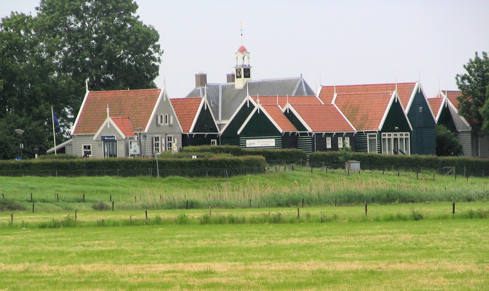
The Schokland and Surroundings are a fascinating example of Dutch water management and human resilience. Once an island in the former Zuiderzee, Schokland was eventually reclaimed as part of the Flevoland polder in the 20th century. This unique landscape showcases the Netherlands' centuries-long battle against the sea, featuring archaeological remains, historic dikes, and reclaimed farmland. Visitors can explore the Schokland Museum, ancient settlements, and walking trails that highlight the region’s rich history. A must-visit for history lovers, nature enthusiasts, and cultural explorers, Schokland stands as a symbol of human adaptation to changing environments.
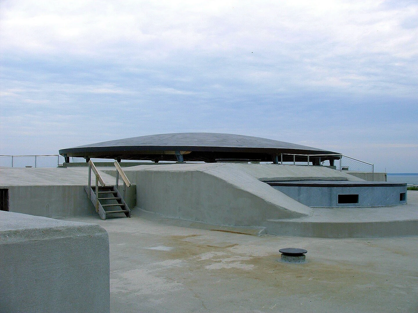
The Dutch Water Defence Lines showcase the Netherlands' ingenious military water management system, designed to protect the country from invasions. Built between the 17th and 19th centuries, these strategic defence lines, including the New Dutch Waterline and the Defence Line of Amsterdam, used controlled flooding to create a natural barrier against enemy forces. Stretching over 200 km, the network features forts, sluices, dikes, and canals, blending military innovation with Dutch water engineering expertise. Today, visitors can explore historic fortresses, scenic cycling routes, and interactive museums, making it a must-visit destination for history buffs, nature lovers, and cultural travelers.
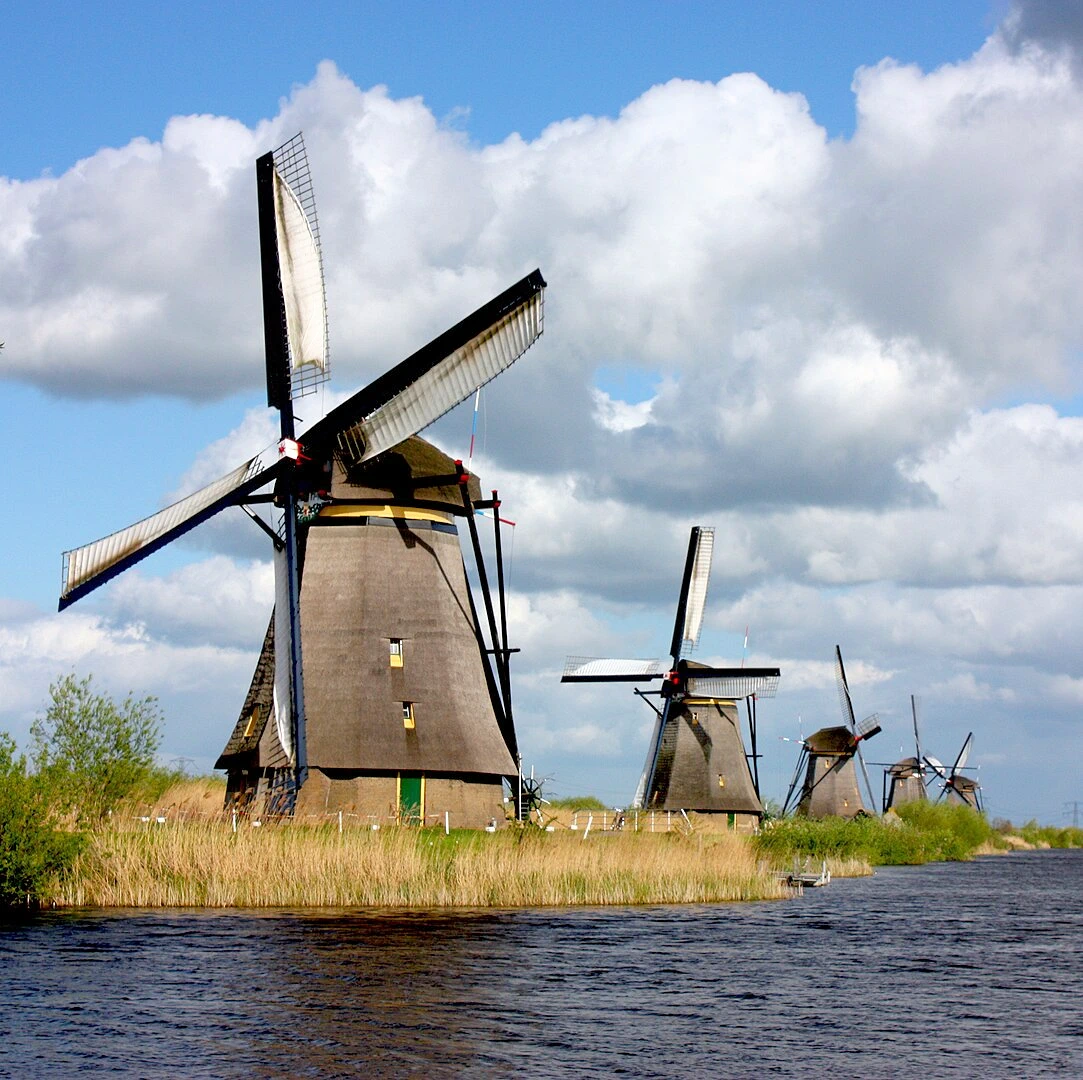
The Mill Network at Kinderdijk-Elshout is a stunning example of Dutch water management and engineering. This iconic site features 19 historic windmills, built in the 18th century, designed to control flooding in the low-lying polders. Surrounded by scenic waterways, Kinderdijk offers visitors a glimpse into the Netherlands' battle against rising water levels through its windmills, pumping stations, and dikes. A must-visit for history enthusiasts, photographers, and nature lovers, Kinderdijk provides boat tours, cycling paths, and interactive museums, making it one of the most picturesque and educational attractions in the Netherlands.
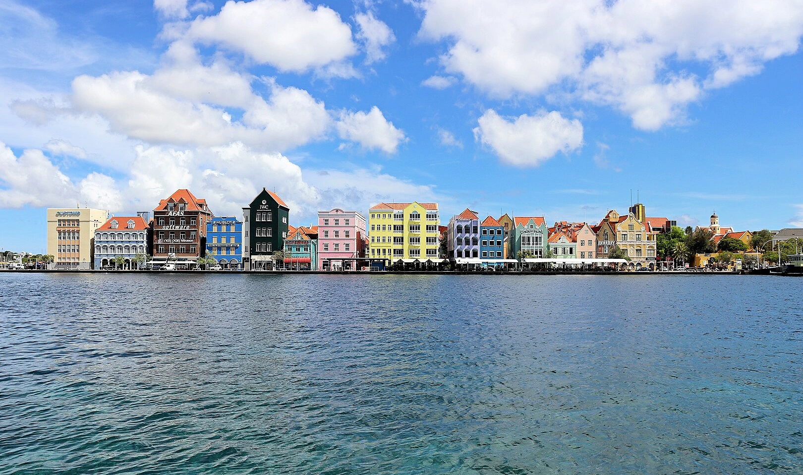
The Historic Area of Willemstad, Curaçao is a vibrant Caribbean city known for its colorful Dutch colonial architecture, historic waterfront, and rich cultural heritage. Founded in 1634, Willemstad boasts well-preserved districts like Punda, Otrobanda, Scharloo, and Pietermaai, featuring charming pastel-colored buildings and iconic landmarks such as the Queen Emma Bridge and the Handelskade waterfront. Visitors can explore museums, local markets, and lively cafés, while enjoying the city's unique blend of European and Caribbean influences. A must-visit for history lovers, architecture enthusiasts, and cultural travelers, Willemstad offers a stunning mix of history, charm, and island beauty.
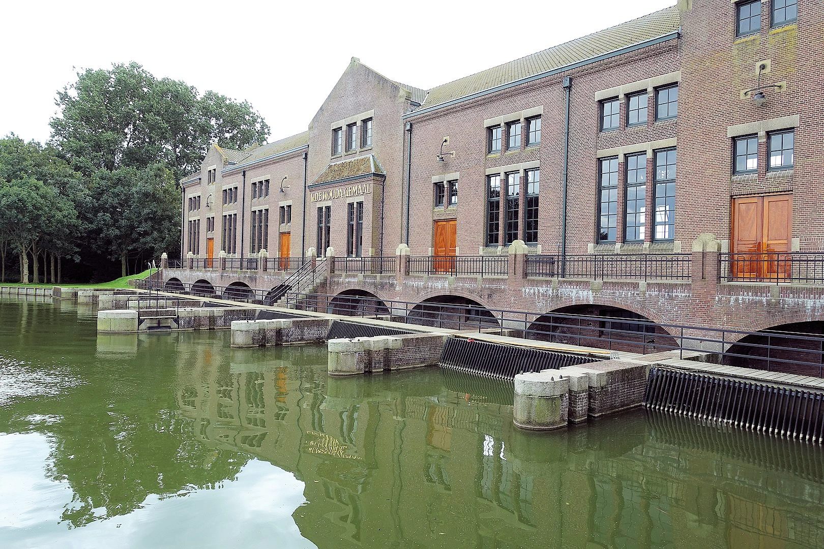
The D.F. Wouda Steam Pumping Station is the world’s largest operational steam-powered pumping station. Built in 1920, this remarkable feat of Dutch water management and engineering has played a crucial role in preventing floods and controlling water levels in Friesland. Featuring impressive brick architecture and massive steam engines, the station remains fully functional and is a testament to the Netherlands’ long-standing battle against water. Visitors can explore the interactive visitor center, guided tours, and live steam demonstrations, making it a must-visit for history buffs, engineering enthusiasts, and travelers interested in Dutch innovation.
The Beemster Polder is a masterpiece of Dutch land reclamation and water management. Created in 1612, this meticulously designed polder transformed a former lake into fertile farmland, showcasing a perfectly planned geometric landscape with canals, roads, and fields arranged in a harmonious grid. The Beemster Polder exemplifies 17th-century Dutch engineering ingenuity, demonstrating how the Netherlands successfully managed water to create livable and productive land. Visitors can explore historic windmills, picturesque villages, and scenic cycling routes, making it an ideal destination for history lovers, nature enthusiasts, and cultural travelers.
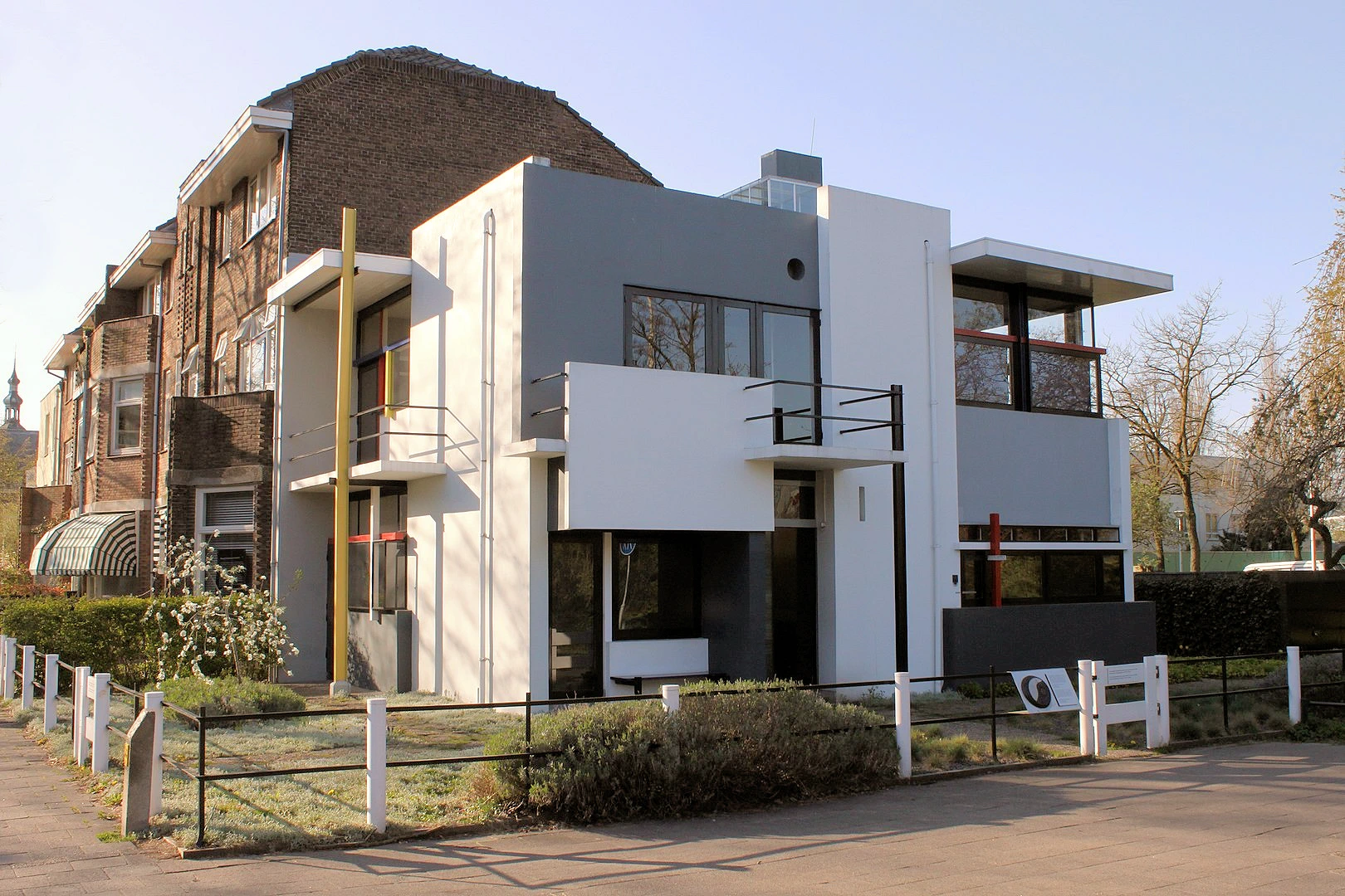
The Rietveld Schröder House is a groundbreaking example of modern architecture and De Stijl design. Built in 1924 by architect Gerrit Rietveld, this innovative home features an open-plan layout, dynamic sliding walls, and bold primary colors, reflecting the principles of the De Stijl movement. A true masterpiece of functional and minimalist design, the house broke away from traditional architecture, influencing modernist styles worldwide. Visitors can explore its ingenious interior, interactive exhibits, and guided tours, making it a must-visit for architecture enthusiasts, design lovers, and cultural travelers.
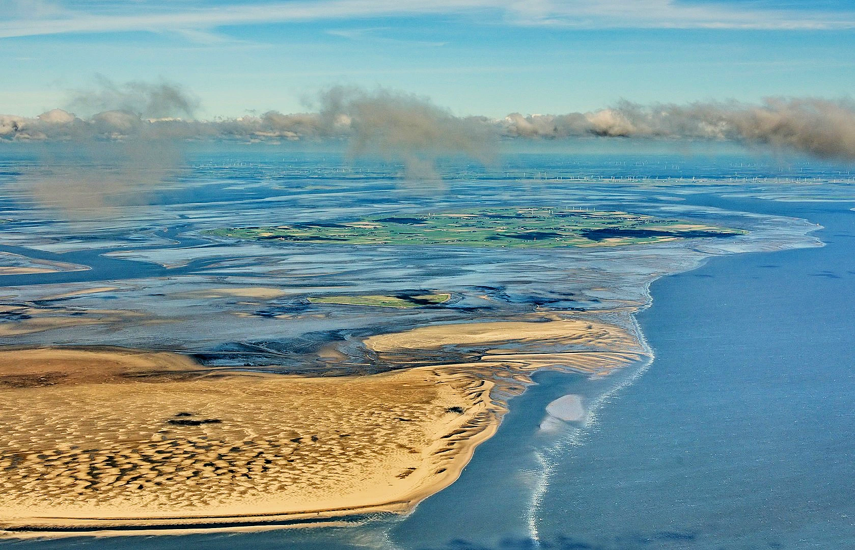
The Wadden Sea is the world’s largest unbroken tidal flats system, stretching along the coasts of the Netherlands, Germany, and Denmark. This unique ecosystem is a vital habitat for millions of migratory birds, seals, and diverse marine life, making it one of the most important wetlands and nature reserves in the world. Visitors can explore its vast mudflats, shifting sandbanks, and salt marshes through guided mudflat walks, boat tours, and birdwatching excursions. A paradise for nature lovers, wildlife enthusiasts, and eco-tourists, the Wadden Sea offers an unforgettable glimpse into Europe’s coastal biodiversity and dynamic tidal landscapes.
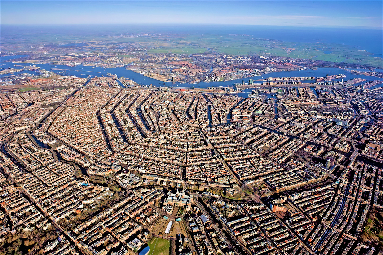
The Canal Ring Area of Amsterdam is a stunning example of 17th-century urban planning and Dutch Golden Age architecture. Built in the early 1600s, this iconic network of concentric canals, including Herengracht, Keizersgracht, and Prinsengracht, reflects Amsterdam’s rich history as a global trading hub. Lined with elegant gabled houses, historic bridges, and houseboats, the canal district offers scenic boat tours, world-class museums, and charming cafés. A must-visit for history buffs, architecture lovers, and cultural travelers, Amsterdam’s canal ring is the perfect place to experience the city’s unique charm, heritage, and picturesque waterways.
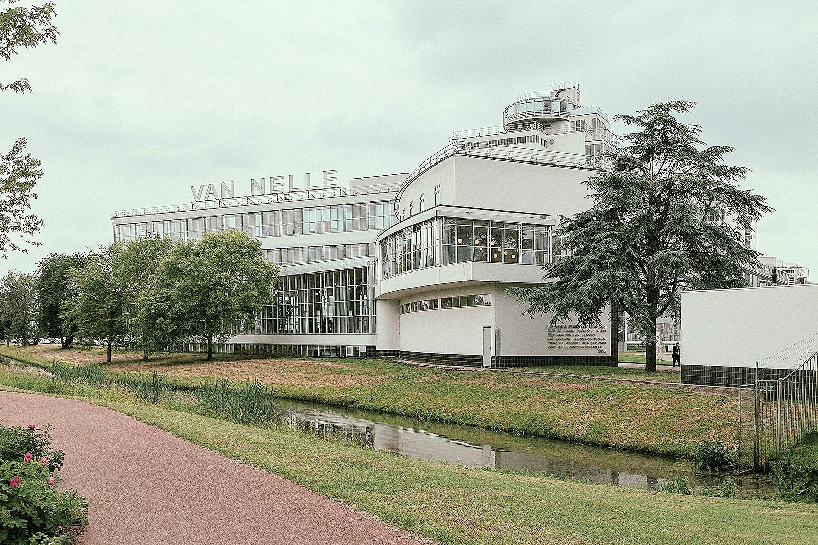
The Van Nelle Factory in Rotterdam is a masterpiece of 20th-century modern architecture and a landmark of industrial innovation. Built in 1925–1931, this former tea, coffee, and tobacco factory is a pioneering example of the International Style, featuring steel and glass curtain walls that maximize natural light. Designed by Leendert van der Vlugt, the factory revolutionized workplace environments with its open, airy spaces. Today, the site hosts offices, events, and guided tours, making it a must-visit for architecture enthusiasts, design lovers, and industrial heritage explorers in the Netherlands.
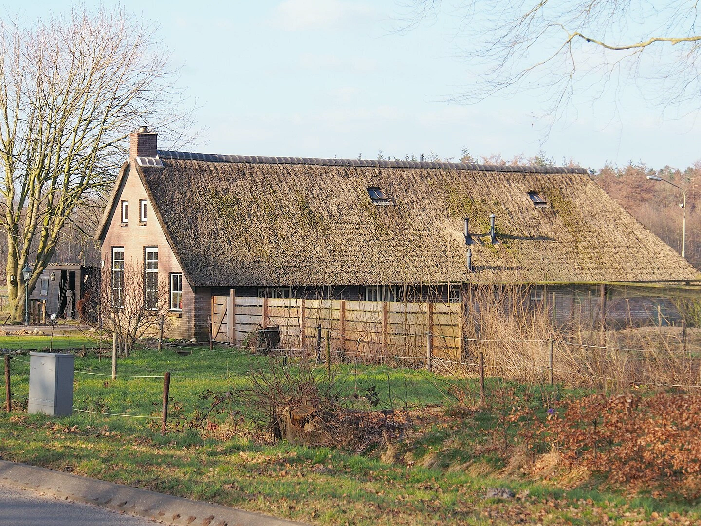
The Colonies of Benevolence are a unique network of early 19th-century social settlements designed to help the poor and destitute by providing work, education, and a healthy living environment. These pioneering model villages were established as part of a philanthropic movement led by reformers such as Hendrik Pieter Godfried in the early 1800s, focusing on moral rehabilitation and self-sufficiency. Visitors can explore the well-preserved colonies, including Wormer, Frederiksoord, and Ommerschans, and learn about their significant role in early social welfare. Ideal for history enthusiasts and cultural travelers, the Colonies of Benevolence provide a fascinating glimpse into early social reform and communal living.
The Society of Benevolence (Maatschappij van Weldadigheid), established in 1818, was a philanthropic organization in the Netherlands and Belgium, focused on creating model colonies to assist the poor and destitute through work, education, and rehabilitation. In Belgium, the Society of Benevolence established several colonies, including: Péruwelz Colony in Péruwelz, Wallonia, Belgium and La Glanerie Colony in Mons, Wallonia, Belgium.
These colonies were part of the Society of Benevolence’s broader efforts, which also included colonies in the Netherlands like Frederiksoord and Wormer.
The Danube Limes (meaning 'frontier' in English) marks the northern frontier of the Roman Empire along the Danube River, spanning modern-day Germany, Austria, Slovakia, Netherlands and Hungary. This remarkable archaeological site preserves the remains of Roman forts, watchtowers, military camps, and civilian settlements, showcasing the strategic and cultural significance of the empire’s border defense system. As part of the larger Frontiers of the Roman Empire, the Danube Limes offers insight into ancient Roman engineering, trade, and daily life. Visitors can explore well-preserved ruins, museums, and scenic river landscapes, making it a must-visit destination for history enthusiasts and cultural explorers.
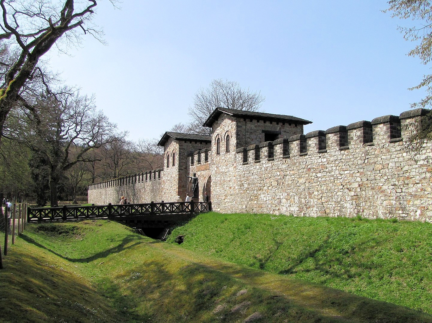
The Lower German Limes protected the Roman province of Germania Inferior (Lower Germany), along the Rhine from the Rhenish Massif to the North Sea coast. There are 39 Roman Fortification sites in the Netherlands. Sites include remains of forts, towns, roads, and other infrastructure.
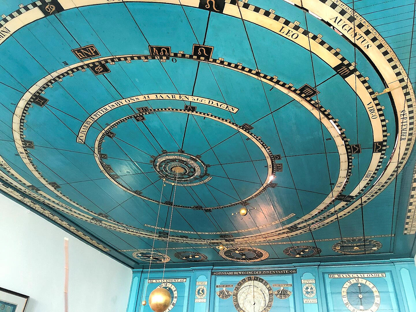
The Eisinga Planetarium in Franeker is the world’s oldest working planetarium, built between 1774 and 1781 by Eise Eisinga in his own home. This incredible feat of 18th-century astronomy and engineering features a precisely functioning orrery, where the movements of the solar system are displayed on the ceiling using a system of gears and weights. A must-visit for science lovers, history enthusiasts, and curious travelers, the planetarium offers interactive exhibits, guided tours, and a glimpse into the genius of early astronomical innovation, making it one of the most fascinating cultural sites in the Netherlands.
Note: All images featured on this page are the exclusive property of Just Traveling Thru, LLC, unless otherwise stated. When images from external sources are used, full credit is given to the original creator, along with a link to the specified license or usage terms. We are committed to respecting copyright and intellectual property rights, ensuring that all third-party images are properly attributed. If you have any questions regarding image ownership or usage rights, please feel free to contact us.
Affiliate Links: We may earn a commission if you make a purchase through one of our affiliate links. This helps support our travel content — thank you!
Content: To review any of our content, make suggestions and/or comments, please click the "About" menu link at the top of this page. You will find our "Contact Us" link on that drop-down menu.