
by Celeste Lipford and Terry Lipford - last updated on 5/28/2025


This trip was all about the NHRA New England Nationals drag race in Epping NH combined with a desire to visit areas of Maine that none of us had ever visited; Bar Harbor, Acadia Park, Portland, etc. Since we have a number of family members in the New England area, plus we are huge seafood enthusiasts, making this trip was a very easy decision!
The secondary concept of wrapping the trip around a stay with Celeste's brother Chris before beginning our Maine exploration, was icing on the cake!
This trip started with a telephone conversation with Chris, who invited us up to watch the NHRA New England Nationals drag race. Chris is a NHRA fan (as I am), and as we continued to discuss the idea, we agreed to combine the Drag Races with a trip up into areas of Maine that none of us had ever visited - including some side trips to visit other family members at Wells Beach, ME.
Our arrival and destination locations were both Boston Logan International Airport, all other destinations are listed below, select any and click it to view that location.
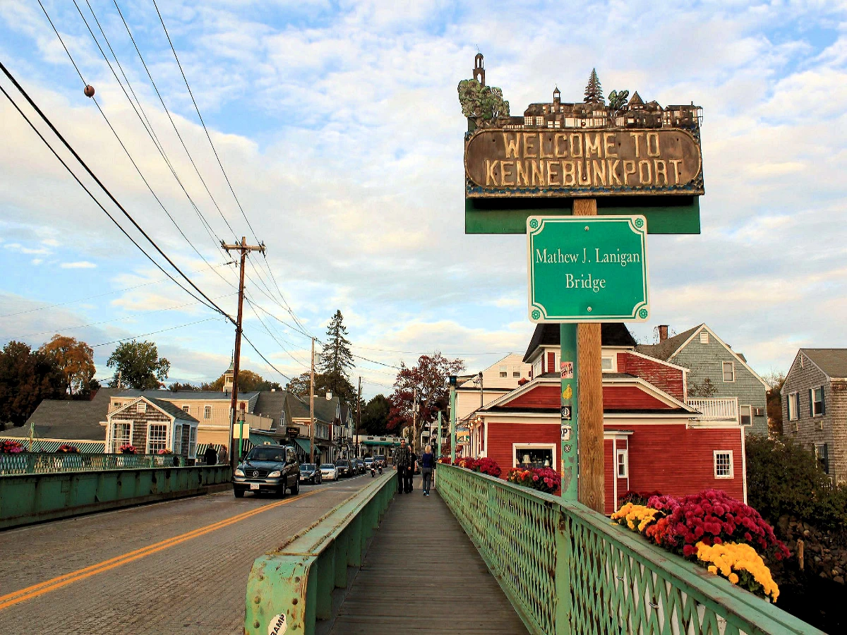 Kennebunkport, ME
This is a scenic & interesting place to visit, plus we had a fantastic dinner with some old friends of ours. Situated on the southern coast of Maine, is a charming seaside town renowned for its picturesque landscapes, historic charm, and vibrant coastal culture. Visitors flock to its sandy beaches, like Goose Rocks Beach and Gooch's Beach, for sunbathing and water activities. The town's Dock Square offers a delightful mix of boutiques, art galleries, and seafood restaurants. Kennebunkport is also famous for its stately mansions, including the Bush family compound at Walker's Point. Outdoor enthusiasts can explore the nearby Rachel Carson National Wildlife Refuge or take scenic boat tours along the rugged coastline. Kennebunkport offers a quintessential New England coastal experience.
Click here to read more about our Kennebunkport visit
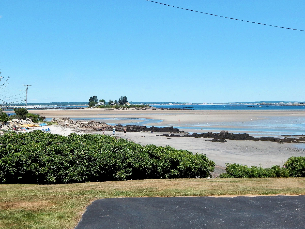 Biddeford Pool, ME
This is an example of the tidal variation in Maine, the tide is at it's lowest level when this picture was taken. That is "Stage Island" on the right, and "Basket Island" on the left, both can be easily walked to when the tide is this low.
Biddeford Pool in Maine experiences notable tidal variations due to its proximity to the Atlantic Ocean. The area witnesses semi-diurnal tides, with two high tides and two low tides occurring each day. These tidal fluctuations are influenced by the gravitational pull of the moon and the sun. During high tide, the water inundates the sandy shores and marsh areas, creating dynamic landscapes. Conversely, at low tide, extensive tidal flats are exposed, revealing rich marine life like crabs, clams, and shorebirds.
 New England Dragway
After our Kennebunkport, ME visit concluded, we drove to Manchester, NH to stay with Celeste's brother Chris, and to attend the drag races that Sunday. The 2018 NHRA New England Nationals event took place at the drag strip in Epping, NH. I was supposed to go with them, but I had tweaked my back (once again) to the point where sitting in bleacher-style seats all day was not an option, so I stayed at Chris's house and watched the races on TV. This wasn't the way I had expected to view the races, but it allowed me to keep icing my back, to stretch and prepare for the car ride into Maine.
IMAGE CREDITS This image is the property of National Hot Rod Association via their website. All other images are the property of Just Traveling Thru, LLC unless otherwise noted.
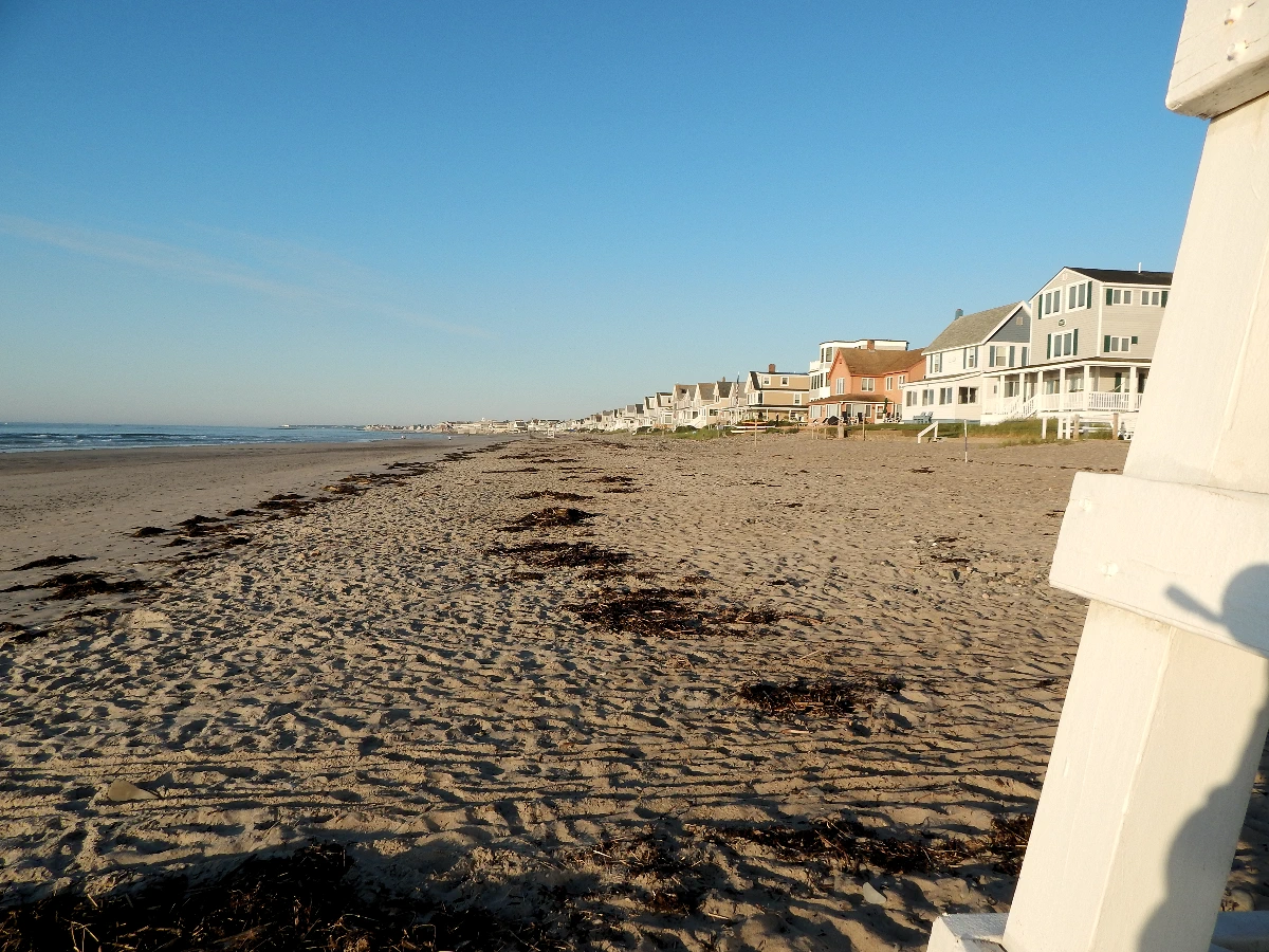 Wells Beach, ME
Wells Beach, ME is one of those "off the beaten path" places that are unique, not crowded and enjoyable to visit. Located on the southern coast of Maine, is a scenic and family-friendly destination known for its long stretch of sandy shoreline and picturesque views. The beach offers visitors ample opportunities for sunbathing, swimming, and beachcombing, making it a popular spot for relaxation and recreation during the summer months. Lifeguards are on duty during peak season, ensuring a safe experience for beachgoers of all ages. Additionally, Wells Beach boasts convenient amenities such as restrooms, picnic areas, and nearby restaurants. Nature enthusiasts can explore the nearby Rachel Carson National Wildlife Refuge or take a leisurely stroll along the Marginal Way coastal path. Wells Beach provides an idyllic coastal retreat for visitors seeking sun, sea, and serenity.
Click here to read more about our Wells Beach visit
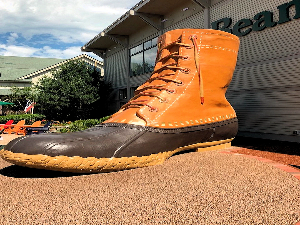
People visit the iconic L.L. Bean store in Freeport, Maine, for its unique shopping experience, outdoor inspiration, and immersive brand history. Established in 1912, this flagship store is open 24/7, 365 days a year, offering a landmark experience for outdoor enthusiasts and curious tourists alike. The store spans multiple buildings, each dedicated to specific categories, including apparel, footwear, outdoor gear, and home goods.
One of the main attractions is the store's outdoor discovery programs, which provide hands-on experiences like kayaking, paddleboarding, archery, and fly-casting. Visitors often come for these classes to learn new skills under expert guidance and with high-quality equipment. The L.L. Bean campus also includes family-friendly activities, such as trout ponds, a 16-foot-tall boot sculpture, and beautiful seasonal displays, making it a favorite destination for families and travelers exploring New England.
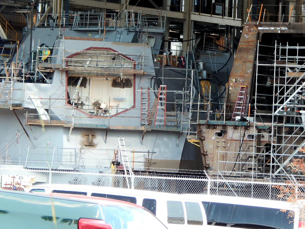 Bath Iron Works Shipyard
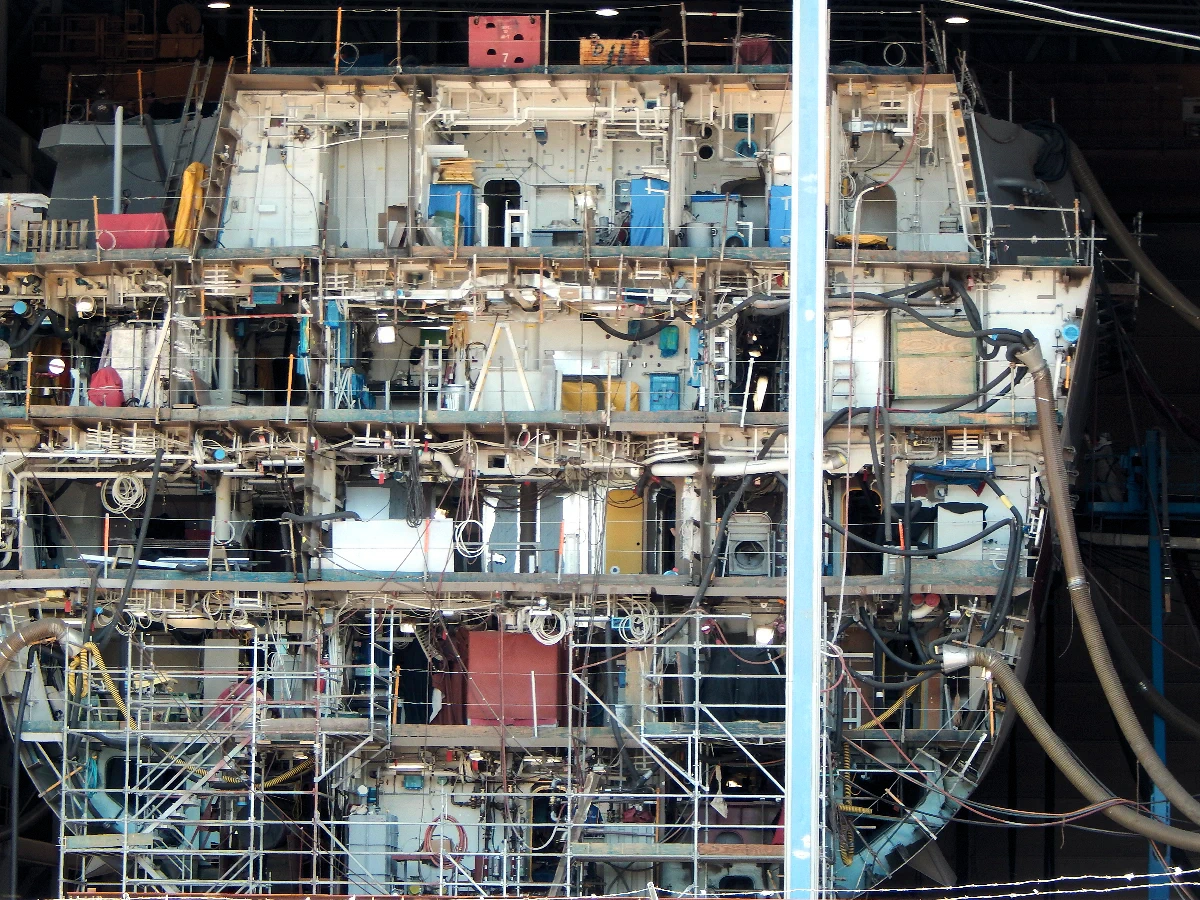 Bath Iron Works Shipyard
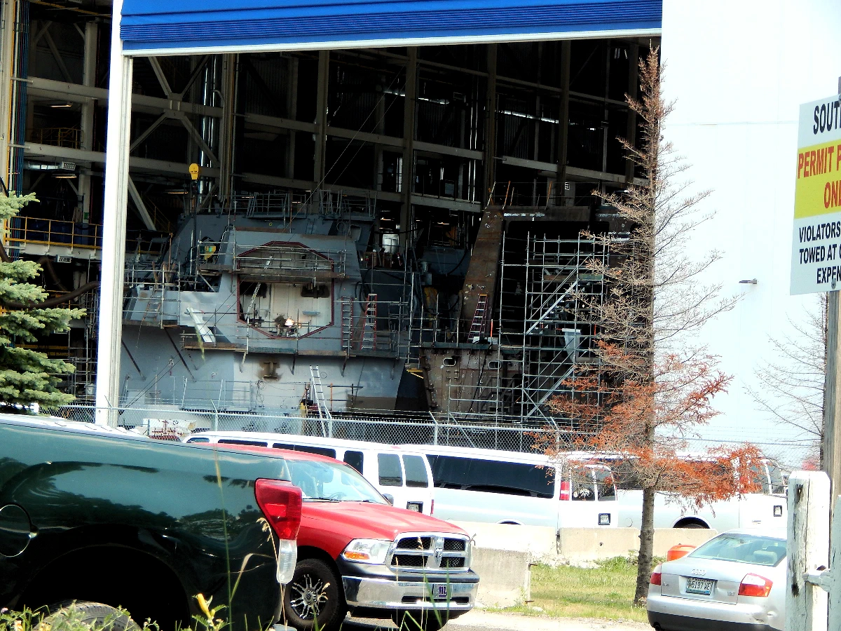 Bath Iron Works Shipyard
During the drive north from the Wells area, we decided to stop in Bath to drive by the Bath Iron Works (BIW) Shipyard and to visit the Maritime Museum. In image #1, you can see a new Zumwalt class Destroyer being built for the U.S. Navy.
In images 2 & 3 there are several other ships were being built next to the destroyer, the ships are built in a modular fashion, and then assembled inside these "sheds".
Founded in 1884, BIW has a rich history of constructing naval vessels, particularly renowned for its Arleigh Burke-class destroyers. Specializing in advanced ship design and construction, BIW plays a crucial role in supporting the U.S. Navy's fleet. The shipyard employs cutting-edge technologies and a skilled workforce to produce sophisticated warships. Known for its commitment to quality and innovation, Bath Iron Works remains a key contributor to national defense, crafting vessels that embody excellence in maritime engineering and technology. It is now the largest public employer in Maine.
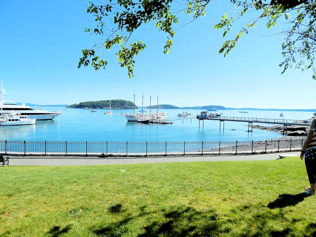
Bar Harbor, located on Mount Desert Island along the coast of Maine, is a charming town celebrated for its coastal beauty and proximity to Acadia National Park. Established in the 18th century, it evolved into a popular tourist destination with a vibrant downtown featuring shops, restaurants, and galleries. Serving as the gateway to Acadia, visitors can explore scenic landscapes, hiking trails, and landmarks like Cadillac Mountain. The town also offers boat tours, whale watching, and opportunities to savor fresh seafood. Bar Harbor's rich maritime history and stunning natural surroundings make it a delightful blend of culture, recreation, and coastal allure.
Want to read more about Bar Harbor? Then click here to view our Bar Harbor page.
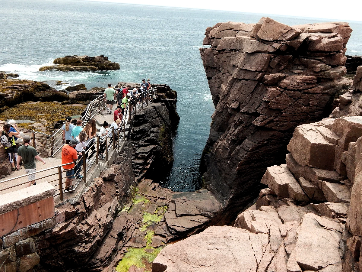
Acadia National Park in Maine is a natural masterpiece, encompassing 49,075 acres of rugged coastal beauty. Established in 1919, it is renowned for its granite peaks, pristine lakes, and diverse ecosystems. Cadillac Mountain offers the first glimpse of sunrise in the United States, a captivating experience. The park's network of hiking trails, including the iconic Jordan Pond Path, provides access to panoramic vistas and serene landscapes. Coastal wonders like Thunder Hole and Sand Beach add to the allure. Visitors can explore carriage roads, bike trails, and engage in birdwatching, making Acadia a haven for outdoor enthusiasts seeking the wonders of the Maine wilderness.
Want to read more about Acadia National Park? Then click here to view our Acadia National Park page.
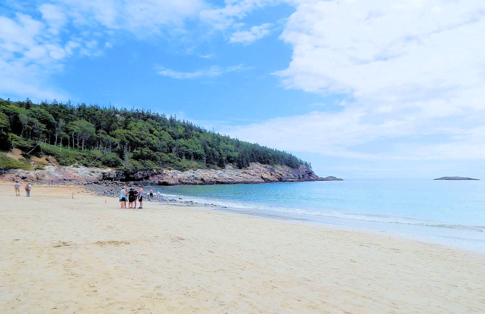
Sand Beach, located within Acadia National Park on Mount Desert Island, Maine, is a stunning coastal gem. Known for its unique blend of sandy shores and rugged cliffs, the beach offers a picturesque escape. The crescent-shaped stretch of golden sand is framed by pink granite formations and surrounded by evergreen forests. Despite its name, the water can be chilly, as it's part of the colder northern Atlantic. Visitors can enjoy sunbathing, picnics, and exploration of nearby trails like the Great Head Trail. The beach, with its scenic vistas and tidal pools, exemplifies the natural beauty of the Maine coastline.
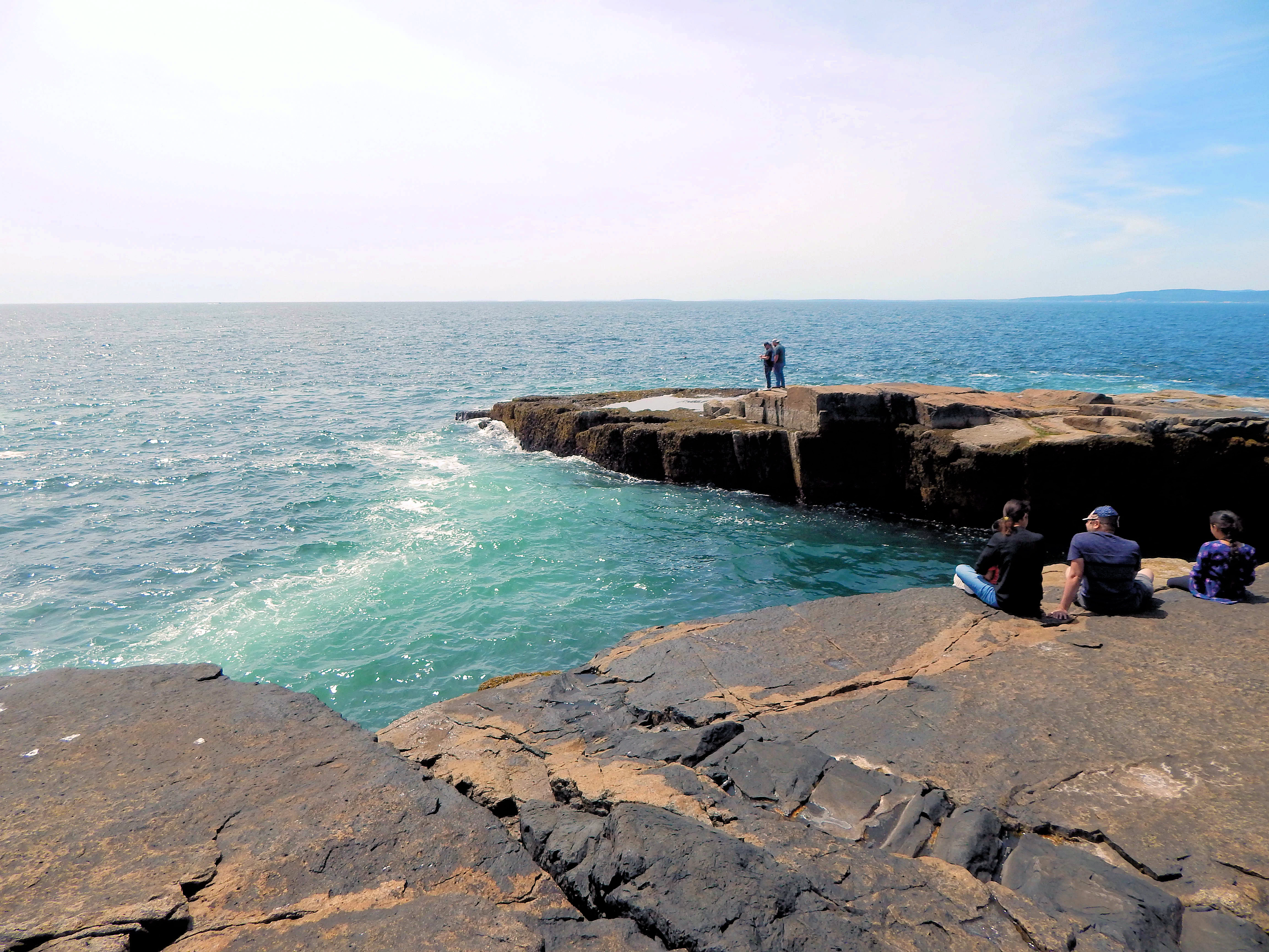
As you can see on the map (click the map link above), Schoodic Peninsula is only 4 miles east of Bar Harbor by boat or bird, but it is 48 miles by road. We had decided to explore that side of the Acadia National Park, because we felt that it would not be as crowded as Bar Harbor and because there were some interesting hikes and a beautiful point.
Schoodic Peninsula comprises 5% of the Acadia National Park, and it is similar in that it is heavily forested with a lot of rocky geography. As can be seen in some of the images below, the black color granite was caused by later volcanic activity - that black granite is called diabase or black igneous rock. Those black rock areas are over 200 million years old !
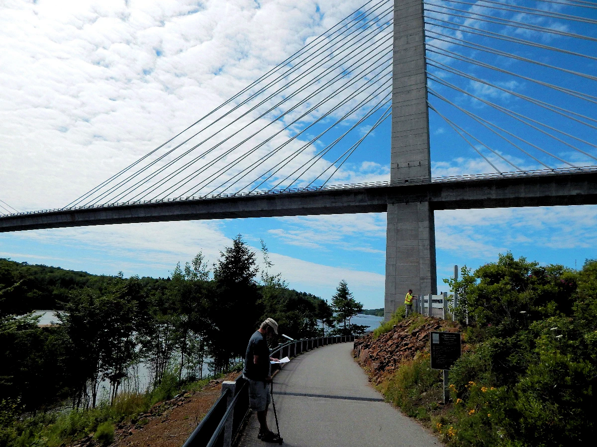
The Penobscot Narrows Bridge in Maine is a marvel of engineering and a striking architectural landmark. Spanning the Penobscot River, it connects Prospect and Verona Island, offering breathtaking panoramic views of the surrounding landscape. Notably, the bridge features an observation tower, the Penobscot Narrows Observatory, rising 420 feet above sea level. Visitors can take an elevator to the top for unparalleled vistas of the river, mountains, and coastal scenery. Completed in 2006, this cable-stayed bridge serves as a vital transportation link and a unique attraction, providing a memorable experience for both motorists and sightseers.
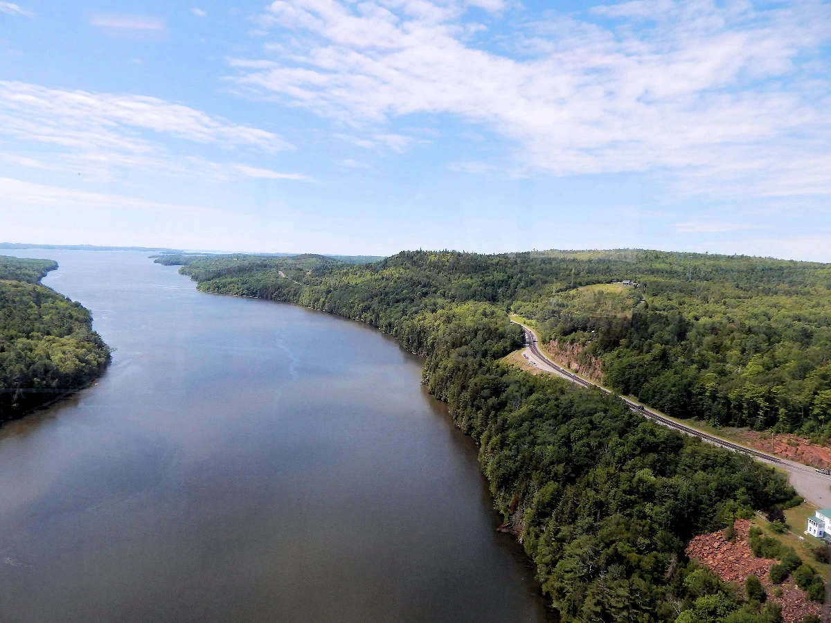 Penobscot River Bridge
This beautiful view of the Penobscot River was taken from the Tower Observatory at the Penobscot Narrows Bridge, offering a breathtaking perspective of the river winding its way south toward Penobscot Bay. The vast expanse of water below reflects the surrounding forested hills, a characteristic landscape of coastal Maine.
n the image, you can see Route 1 on the right-hand side, the highway we will soon take as we continue our journey back to Manchester, New Hampshire. This road follows a scenic path through charming small towns, rugged coastlines, and wooded areas, making it one of the most picturesque drives in New England.
Standing in the observatory, 420 feet above the river, it’s easy to appreciate the beauty and scale of the Penobscot River, a vital waterway that has played a key role in Maine’s history, particularly in the shipbuilding and lumber industries. The view feels both serene and awe-inspiring, offering a moment of reflection before we hit the road once more.
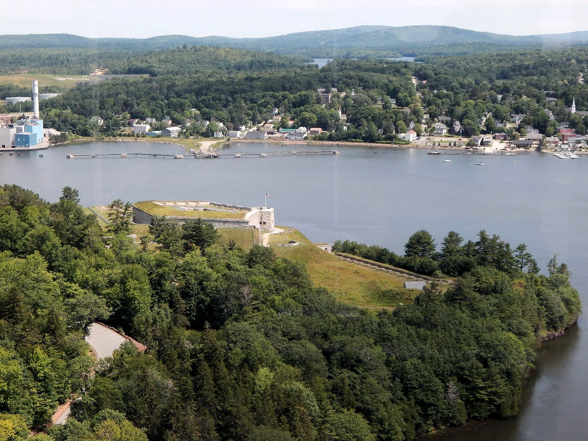
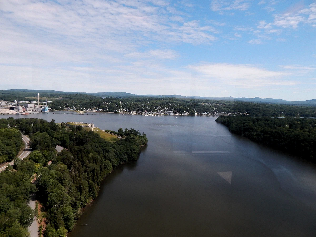 View North from Tower Observatory
This is a sweeping view of the Penobscot River, looking north from the Tower Observatory atop the Penobscot Narrows Bridge. In the distance, you can spot the quaint town of Bucksport, nestled along the riverbank with its charming homes and historic downtown area.
To the left of the river, partially hidden by the dense Maine forest, you can catch a glimpse of Fort Knox, a well-preserved 19th-century granite fortification that stands guard over the river. Constructed in the mid-1800s to defend against potential British naval threats, Fort Knox is a fascinating piece of American military history and a must-visit site in this area.
Bucksport, our next destination, sits directly across the river from Fort Knox and has a rich maritime history. The town’s scenic riverfront, complete with a charming waterfront walkway and historic sites, is a perfect spot to explore after taking in these panoramic views from the tower.
 Fort Knox from Bridge Tower
This is a closer and clearer view of Fort Knox, as seen from the Penobscot Narrows Bridge Observatory. The fort, constructed between 1844 and 1869, stands as one of the best-preserved examples of coastal defense architecture in the United States. Built entirely from granite sourced from nearby quarries, it was designed to protect the Penobscot River Valley from potential British attacks following conflicts during the American Revolution and the War of 1812.
Despite its imposing presence and strategic location, Fort Knox never saw active combat. No enemy forces ever threatened the region again after its construction, leaving the fort as a historical curiosity rather than a battlefield. Today, it serves as a powerful reminder of Maine's early efforts to safeguard its coastal and inland waterways, while offering visitors a chance to explore its massive walls, underground tunnels, and scenic overlooks of the Penobscot River.
From this vantage point atop the tower, the fort’s star-shaped layout and formidable granite walls can be fully appreciated.
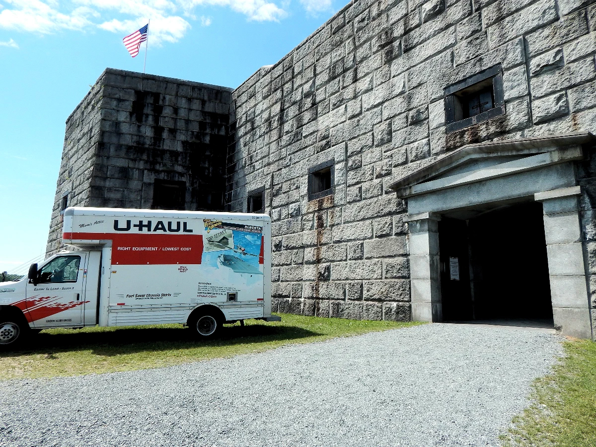 Exploring Fort Knox
 Exploring Fort Knox
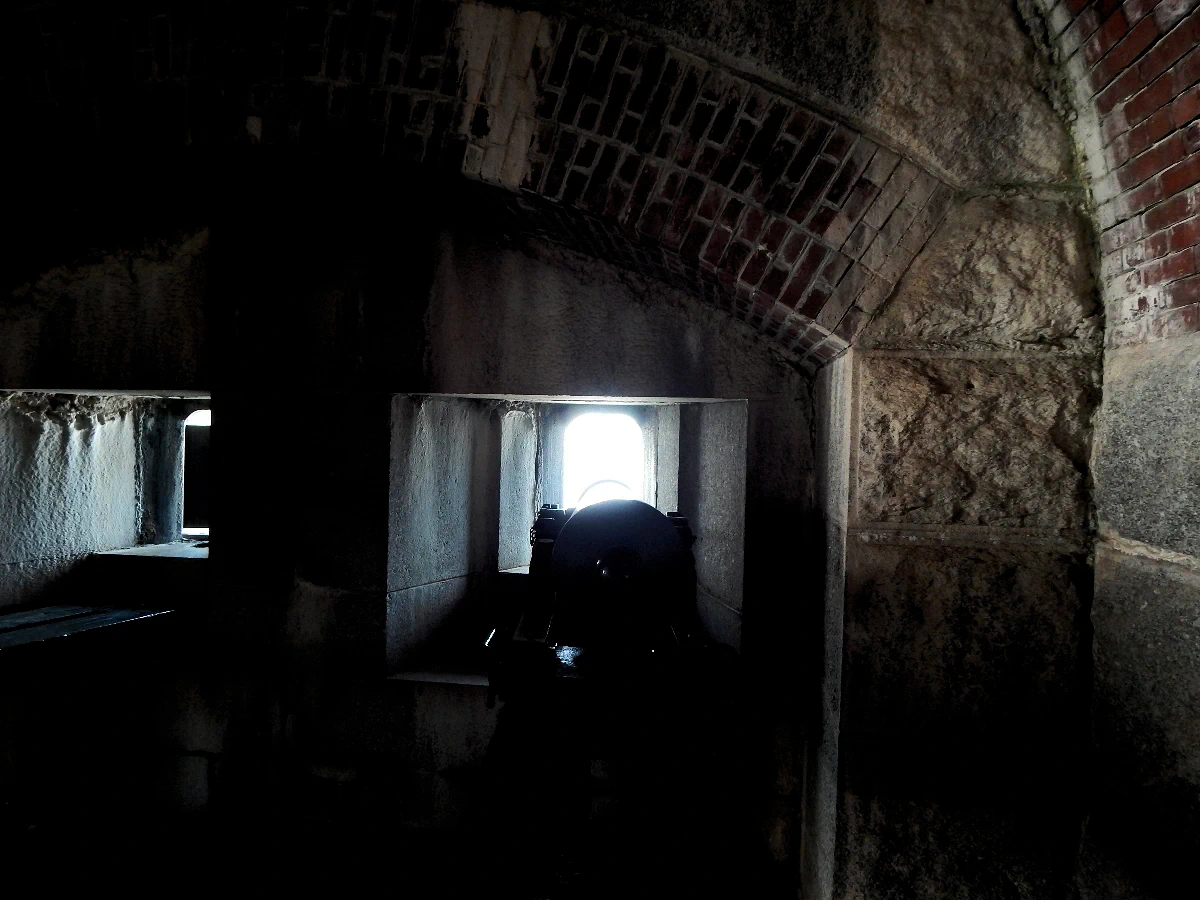 Exploring Fort Knox
Not sure why a U-Haul truck was parked at the entrance to Fort Knox - it may have belonged to a group of people preparing an exhibit inside the Fort. In fact, there were exhibits being setup for public viewing once we got inside.
The heavy artillery inside the Fort were comprised of 15 inch guns, however these artillery pieces are obviously not 15 inch units. To put that size artillery into perspective, a 15 inch weapon is the same size as WW1 battleships used to have as their main armament.
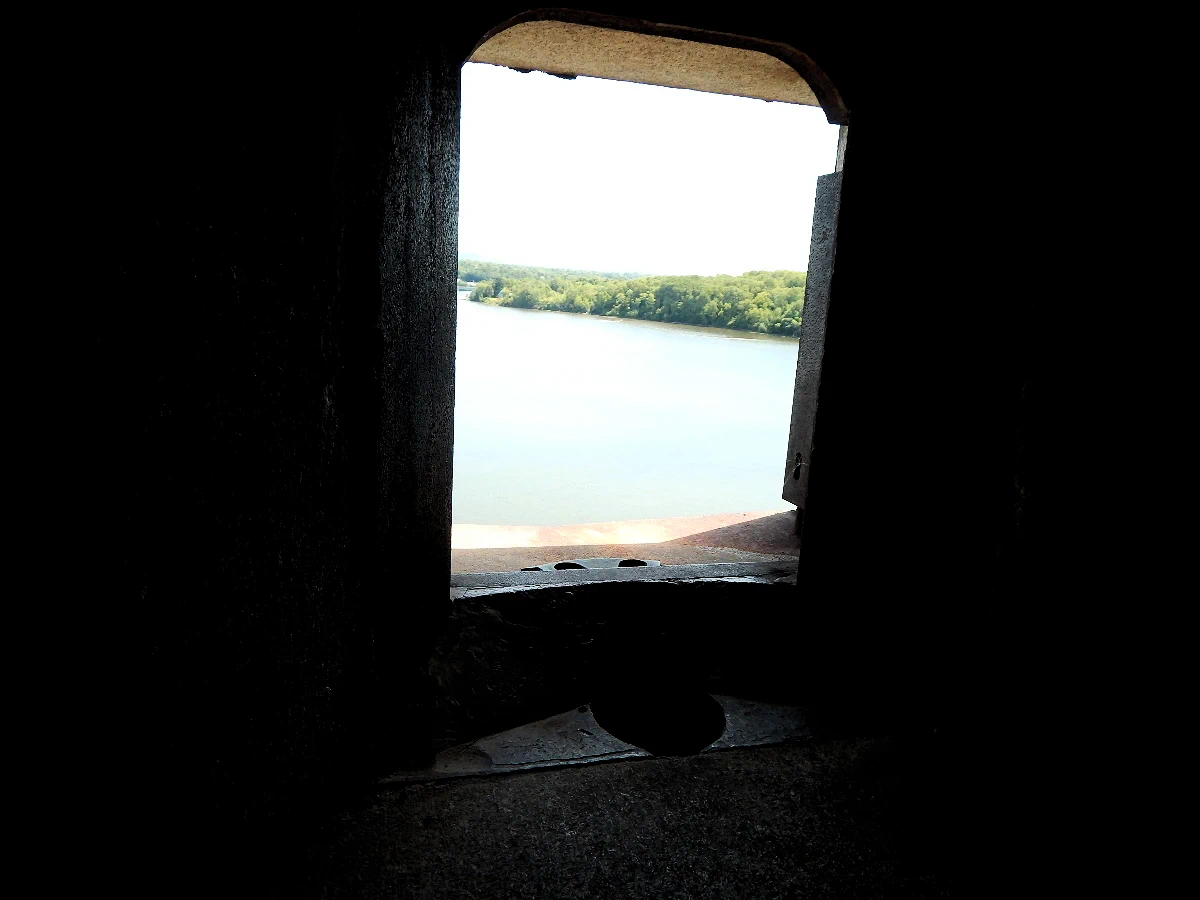 Fort Knox Gunport
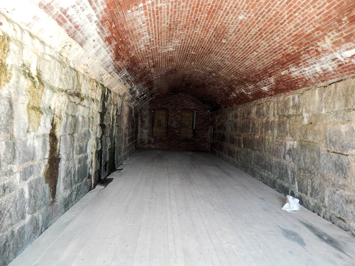 Fort Knox Artillery Storage Area
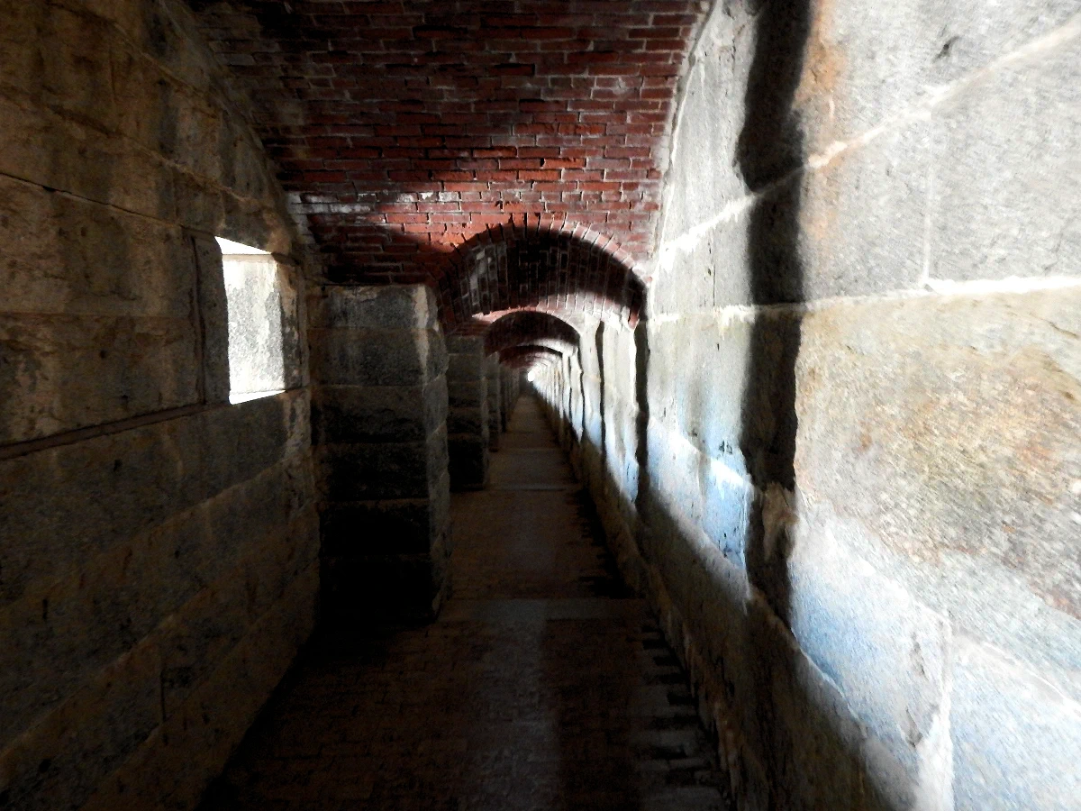 Fort Knox Passageway
Each artillery piece had their own portal (or "firing port"), to be able to fire upon anyone on the river. The firing ports provided only a limited traversal space, because the next artillery portal was expected to cover the additional areas.
The Fort had some very large spaces, probably originally utilized for storage of artillery shells, etc. And then each "firing port" and storage area, was connected by long protected walkways such that men could be rushed back & forth to resupply or to render aid as necessary.
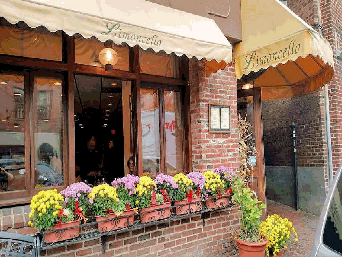
My sister and her husband drove up from Cape Cod, and we had a fantastic dinner at the Limoncello Restaurant in Boston's North-end. It is not possible to describe how good the food was, everything was absolutely perfect and we highly recommend it to one and all.
Ristorante Limoncello is a family-run Italian restaurant located in the heart of Boston's North End. The restaurant has a warm and inviting atmosphere, with murals of Italy on the walls and a menu of classic Italian dishes. The restaurant is known for its award-winning meatballs, as well as its veal, chicken, and fish dishes. The restaurant also has a wide selection of wines and Italian beers. If you ever are in the Boston area, do yourself a favor and go to this restaurant and enjoy a meal, you will be glad you did!
The dining experience at Limoncello Restaurant in Boston, MA, is a delightful journey into authentic Italian cuisine, offering a warm and welcoming atmosphere that makes guests feel at home. Located in the vibrant South End, Limoncello combines traditional flavors with modern touches, serving classic Italian dishes made from the finest, locally-sourced ingredients.
Limoncello’s menu features a variety of fresh pastas, hand-tossed pizzas, and seafood dishes, all expertly prepared with bold flavors and rich textures. Standout dishes include their signature pasta primavera, made with seasonal vegetables, and the veal marsala, a perfectly tender dish complemented by a rich, flavorful sauce. The wine list offers a curated selection of Italian wines, which pair perfectly with the dishes, elevating the overall dining experience.
This part of the trip was rather mundane, so we're not going to show any pics or text about flying out of Logan to Newark, and then onwards to Tampa. We got our car out of economy parking and motored back to Sarasota.
Note: All images featured on this page are the exclusive property of Just Traveling Thru, LLC, unless otherwise stated. When images from external sources are used, full credit is given to the original creator, along with a link to the specified license or usage terms. We are committed to respecting copyright and intellectual property rights, ensuring that all third-party images are properly attributed. If you have any questions regarding image ownership or usage rights, please feel free to contact us.
Affiliate Links: We may earn a commission if you make a purchase through one of our affiliate links. This helps support our travel content — thank you!
Content: To review any of our content, make suggestions and/or comments, please click the "About" menu link at the top of this page. You will find our "Contact Us" link on that drop-down menu.
 Click above Image to view larger Google Map
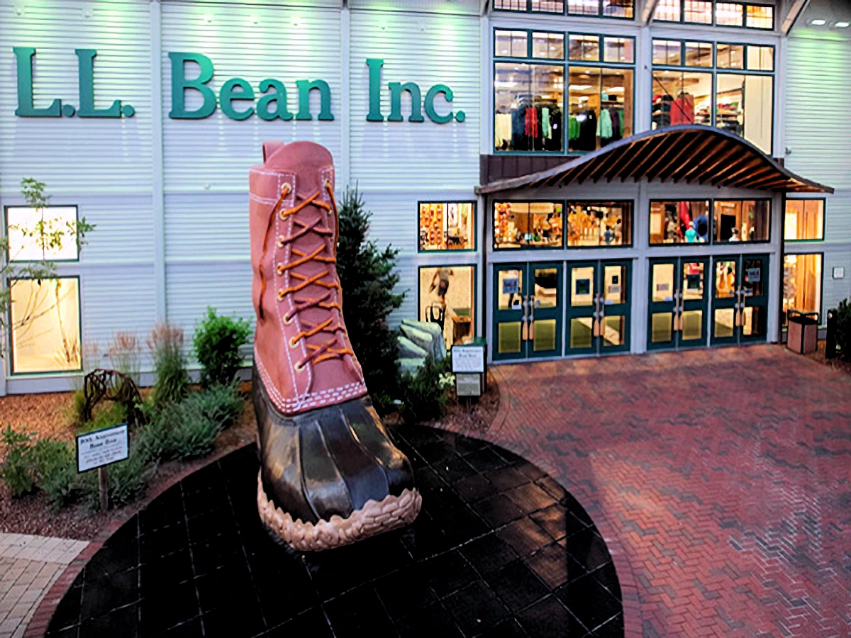