
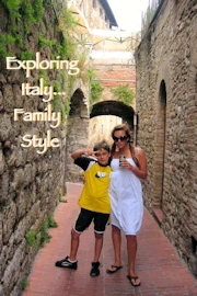
by Celeste Lipford and Terry Lipford - last updated on 10/5/2025

This was in fact, our first major trip to Europe with our children, we had visited other locations and/or Countries, but not with our children. From our prior planning research, we had arranged for a a driver & car (remember this is pre-Uber) because we had repeatedly read that a taxi from the airport to the Vatican was extremely expensive. This turned out to be a good decision because the driver had excellent knowledge of Rome city streets!
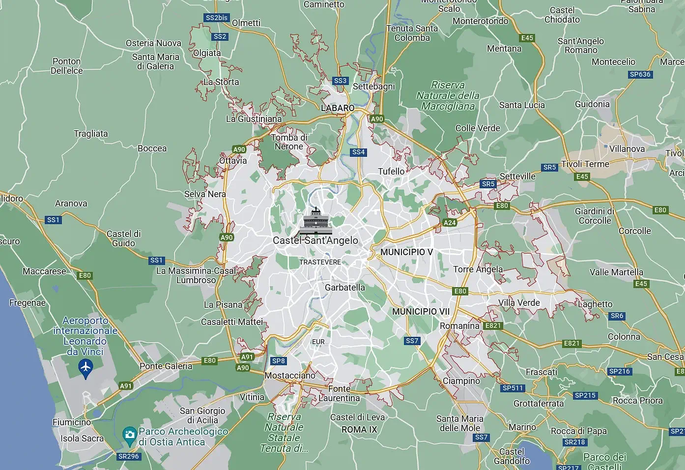
If you take a look at a map of the route you must drive to get to the Vatican area from the Airport, you will see that it is approximately 30 kilometers (18 miles) and that it is easier to get there if you come in from the west side on route A90 and the SS1/Via Aurelia. This brings you directly to the south side of the Vatican, where it was then easy to reach our condo rental.
 Click to view larger Google Map
Officially known as Fiumicino Airport, the Rome Leonardo da Vinci International Airport is the primary gateway to the Eternal City, welcoming travelers from around the globe to experience the timeless allure of Rome. Named after the illustrious Italian polymath Leonardo da Vinci, the airport is a testament to modern architecture.
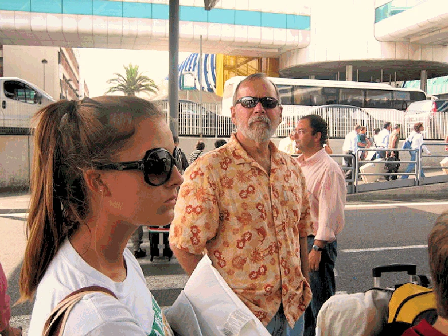
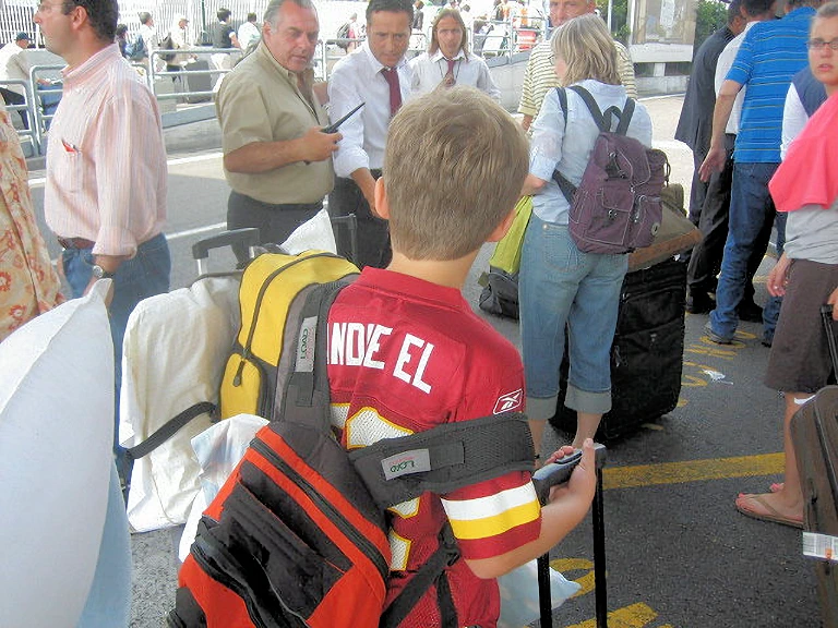
Here we are - thoroughly jet-lagged and struggling through the crowd to collect our luggage. We had previously arranged for a "car for hire" rather than use a taxi to Rome, as taxis are very expensive, so after we gatherered our luggage, we had to head outside the terminal and find our driver.
Our "car for hire" driver was very good with Rome directions - our apartment rental was on a very narrow one way street, and our driver quickly went around the block so that he could take us as close as he could to the apartment building entrance.
As of 9/8/2024 Google says that Rome had 1,656 hotels, with 604 three-star hotels and 439 four-star hotels. Four-star hotels have the most rooms, with nearly 36,000, while three-star hotels have the second-highest number of rooms, with roughly 19,800. Click here to view a Google Search Results list for all Rome accommodations.
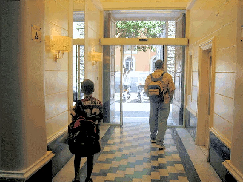
We utilized VRBO to find a family-sized condo near to the Vatican and the Tiber River, here we are just after we arrived. This accommodation turned out to be in a great location - close to the Vatican, close to the Tiber River and transportation of various types was accessible. It was also quite large, clean and comfortable.
It is important to remember that this trip was way, way prior to the proliferation of mapping software found on mobile telephones today. In other words, we are still glad that a "local" drove us to this rental because it was not easy to find and it was on a one way street that made getting there not straight forward! I should point out that even this local driver had difficulty getting to our rental location due to the traffic around the Vatican and the number of one way streets.
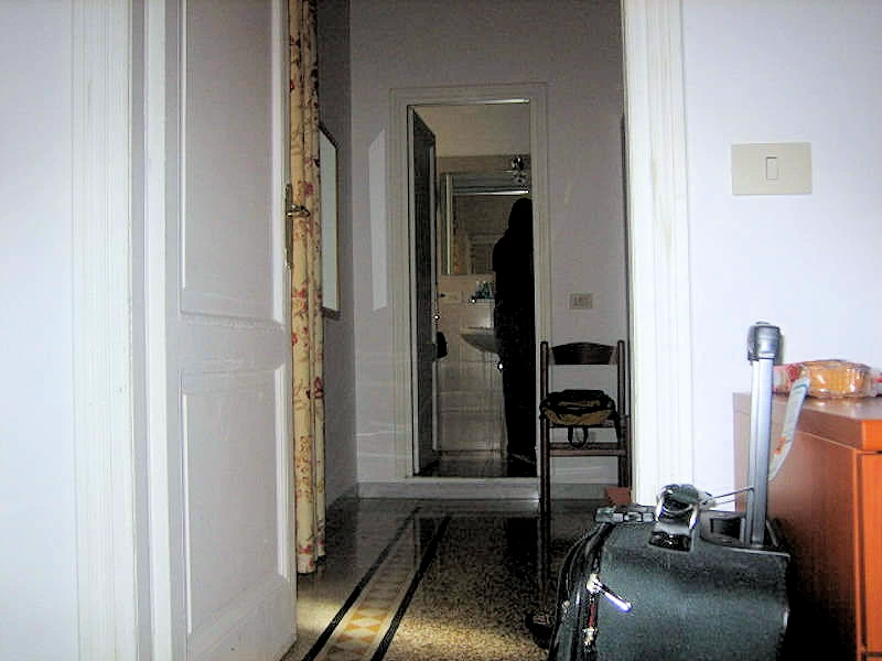
NOTE: Even though we rented this condo through VRBO it has long since been sold and the building was converted into all condos. The location was excellent though!
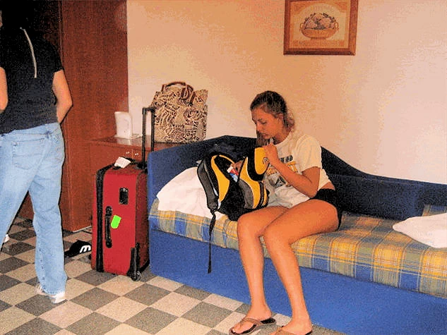 Jet Lag has set-in!
Chelsea attempting to find something in her backpack , even though she is jet-lagged! It is just crazy how jet lag makes even the
smallest task seem more difficult. Did I mention that it will "wear off" after a couple of days?
We followed our own advice; "On arrival, stay awake until an early local bedtime". If you doze off at 4 p.m. and wake up at
midnight, you've accomplished nothing. Plan a good walk or exploration until early evening. Jet lag hates fresh air, daylight, and
exercise. Your body may beg for sleep, but stand firm: Refuse.
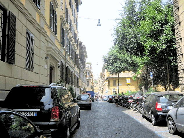 Our Rental Condo Neighborhood
Here is the street in front of our Rome condo, see how narrow it is and yet cars are parked everywhere? This is a typical parking scenario in Italy, and it makes you realize why scooters and bicycles are so popular!
Parking anywhere in Rome is a challenge, especially so in this neighborhood (this close to the Vatican) parking is way beyond difficult. There are a number of parking garages scattered around the area, but we had made the decision to not drive in Rome.
Due to the size of Rome (or click the Google Map link in the title line above) 496 square miles and in consideration of the enormous amount of historical and cultural locations in the city, it would be to your benefit to consider doing some in depth reading on what is there to be seen, how to get there, and how to move on to the next site. There are a number of books out there, here is a link to Amazon to search for books about Rome.
There are a wide variety of transportation methods you could utilize to explore Rome, ie;
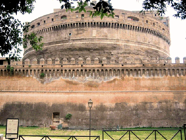
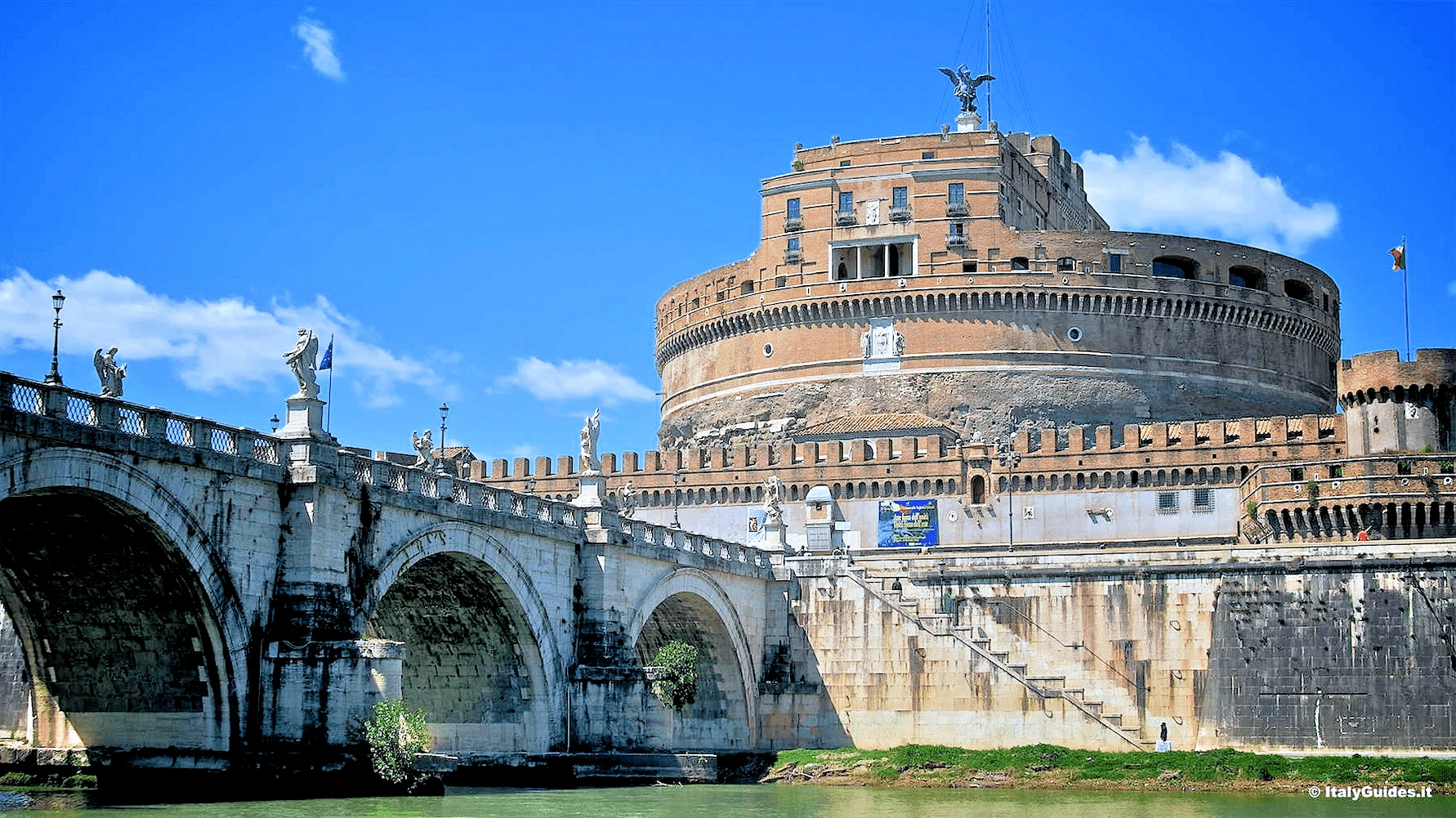
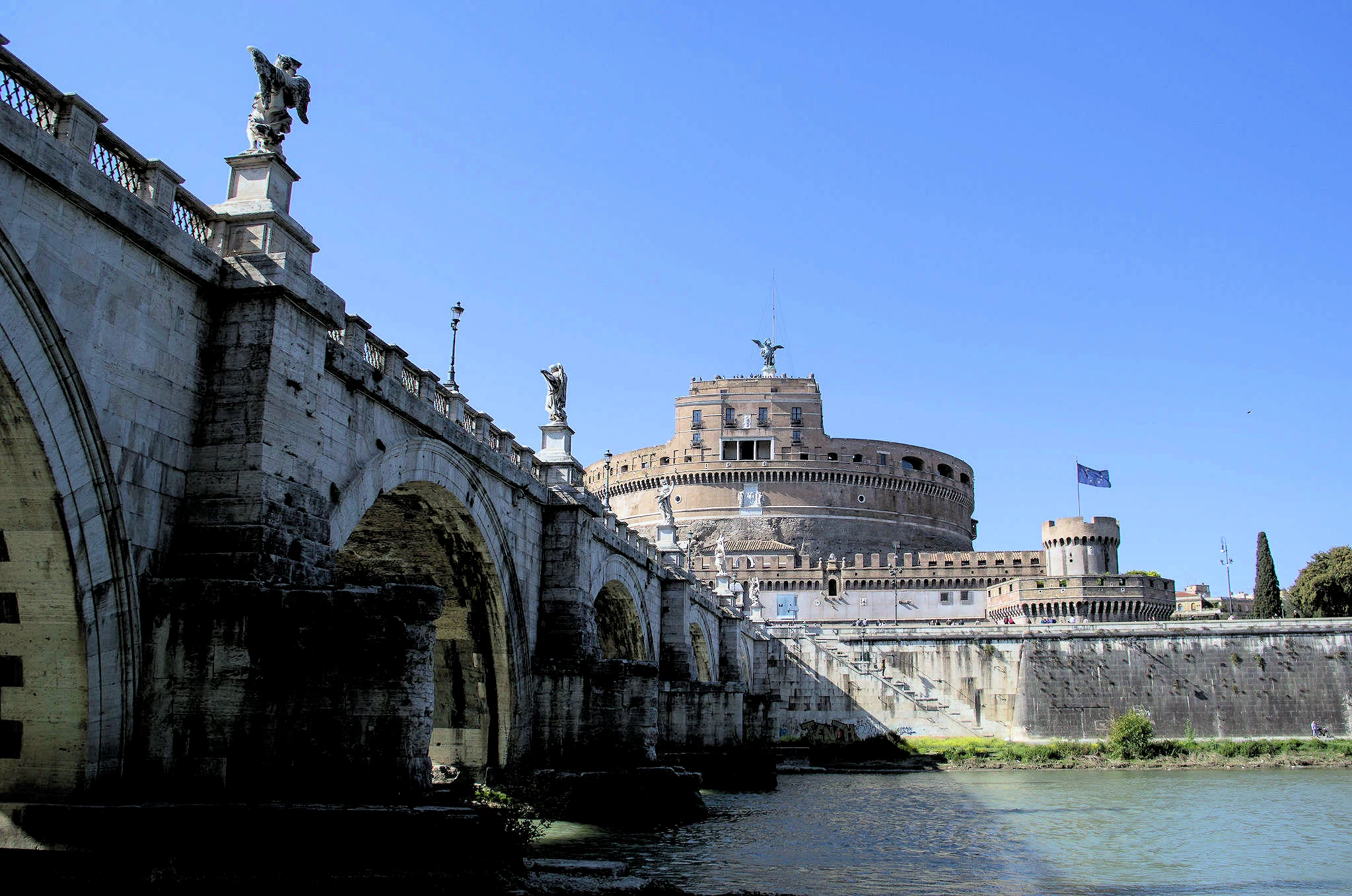
This is the Hadrian Masoleum, later called Castel Sant'Angelo. Built between 134 and 139 AD, and meant to be Hadrian's burial site. Originally the mausoleum was a decorated cylinder, with a garden top and golden quadriga.
The mausoleum is an impressive example of Roman architecture, with its towering circular structure and ornate decorations. It is made of concrete and faced with travertine marble, and features a spiral ramp leading to the top of the structure. At the top of the mausoleum, there is a bronze statue of the archangel Michael, which was added during the Renaissance.
Hadrian's ashes were placed here a year after his death in Baiae in 138, together with those of his wife Sabina, and his first adopted son, Lucius Aelius, who also died in 138 AD.
The popes converted the structure into a castle, beginning in the 14th century; Pope Nicholas III connected the castle to St Peter's Basilica by a covered fortified corridor called the Passetto di Borgo. The fortress was the refuge of Pope Clement VII from the siege of Charles V's Landsknechte during the Sack of Rome (1527), in which Benvenuto Cellini describes strolling the ramparts and shooting enemy soldiers.
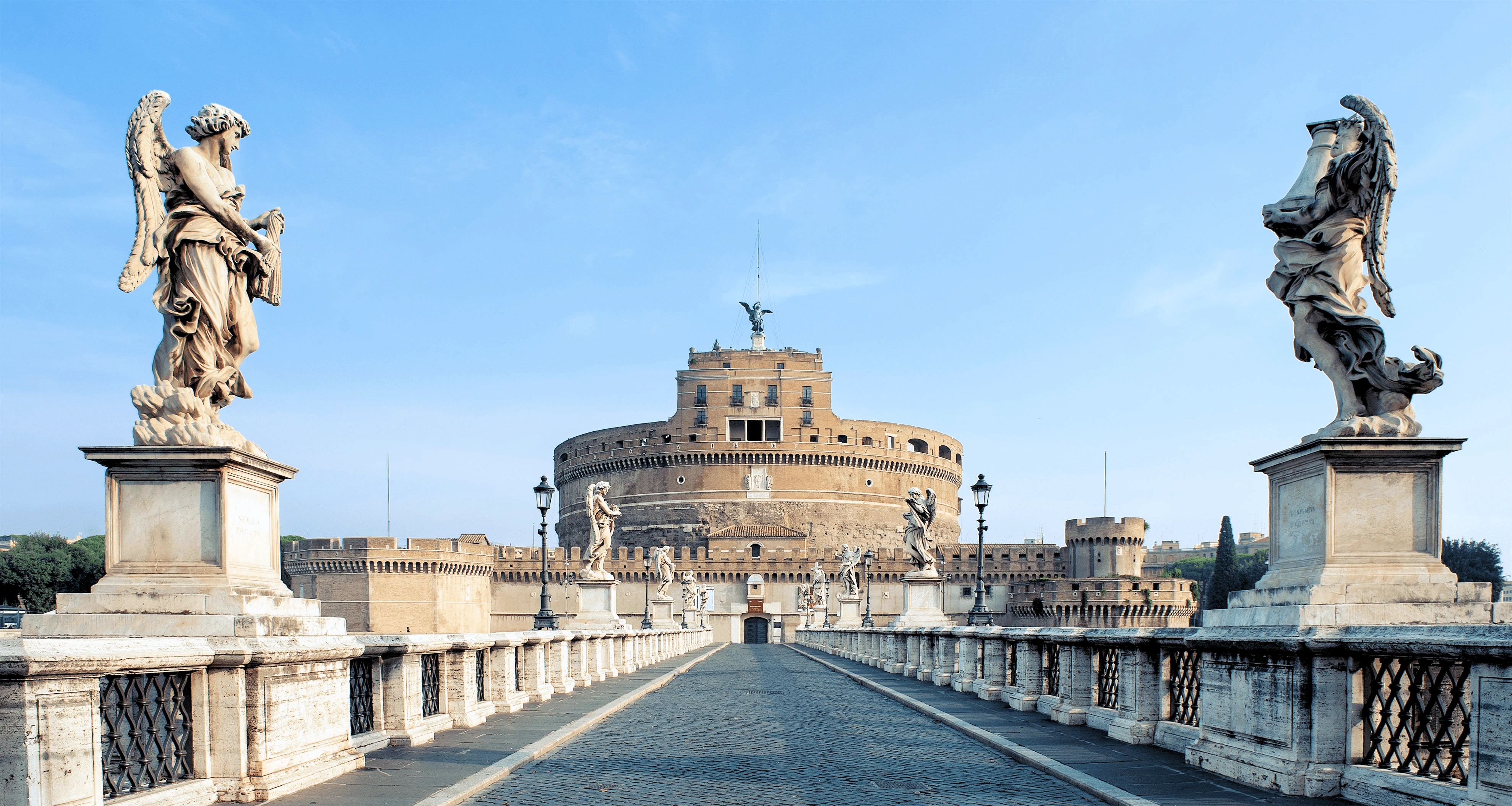
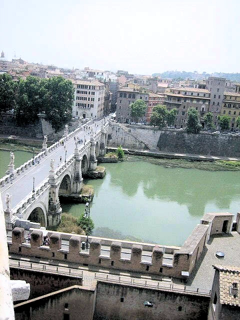
Ponte Sant'Angelo, originally the Aelian Bridge or Pons Aelius, is a Roman bridge completed in 134 AD by Roman Emperor Hadrian, to span the Tiber from the city centre to his newly constructed mausoleum, now the towering Castel Sant'Angelo.
The bridge features ten beautiful angel statues, designed by Bernini's disciples in the 17th century. Each statue represents a different aspect of the Passion of Christ, making the bridge a popular destination for religious pilgrims.
The bridge is faced with travertine marble and spans the Tiber with five arches, three of which are Roman; it was approached by means of ramp from the river. The bridge is now solely pedestrian, and provides a scenic view of Castel Sant'Angelo. It links the rioni of Ponte (which was named after the bridge itself), and Borgo, to whom the bridge administratively belongs.
 Castel Sant'Angelo Treasury Room
 Castel Sant'Angelo Treasury Room
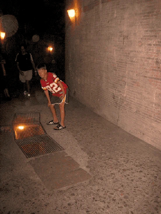 Castel Sant'Angelo Treasury Room
Hadrian's ashes were placed here a year after his death in Baiae in 138, together with those of his wife Sabina, and his first adopted son, Lucius Aelius, who died in 138. Following this, the remains of succeeding emperors were also placed here, the last recorded deposition being Caracalla in 217. The urns containing these ashes were probably placed in what is now known as the Treasury room deep within the building. The Treasury Room was originally used as a papal treasury, storing the wealth of the Church.
Among the room's most prized possessions are a collection of exquisitely crafted papal tiaras, adorned with precious stones and intricate goldwork. These elaborate headpieces, once worn by popes during ceremonial occasions, symbolize the power and authority of the papacy.
One of the most famous objects in the Treasury Room is the Papal Tiara of Paul III, a stunning gold crown adorned with pearls and precious stones. Other notable items include the Crown of Mary of Modena, the wife of King James II of England, and a collection of reliquaries containing the remains of various saints.
The Treasury Room also houses a collection of reliquaries, ornate containers used to hold religious relics. These precious objects, often embellished with jewels and carvings, are said to contain fragments of the bodies of saints or pieces of the True Cross.
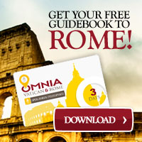
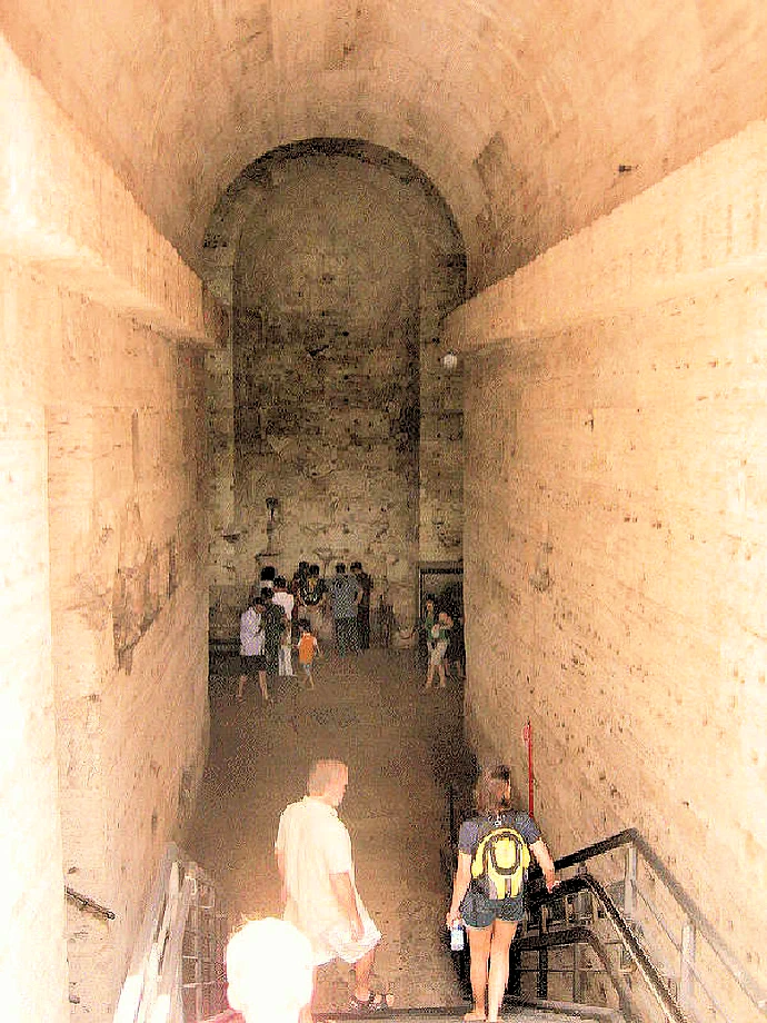
The tunnel under the Castle winds it's way back & forth for a considerable distance - all the way to the Vatican. Yes, it definitely felt a bit spooky knowing that many people's ashes had been stored down here!
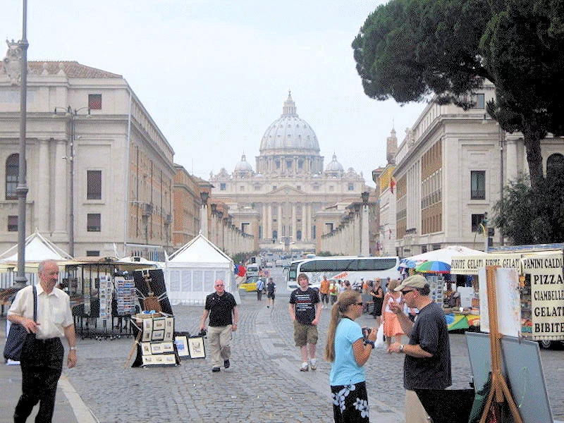
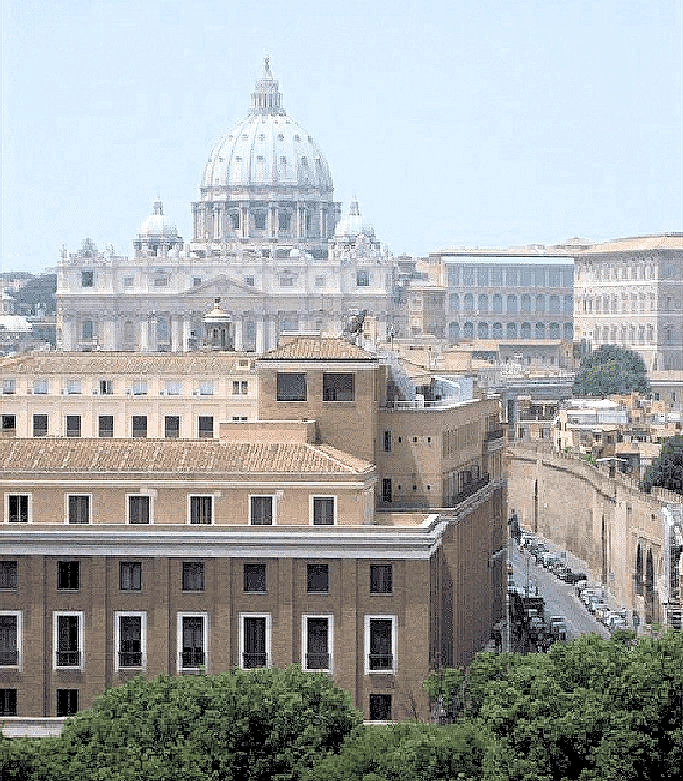
A good view of the Vatican from the Borgo Vittorio, nearly a straight run from our condo to the Vatican!
This area has everything you could possibly be looking for; super markets, restaurants, shops of all varieties, etc. In fact, we had a great pasta meal at Ristorante Da Marcello, discovered as we walked on the Borgo Pio headed back to our condo.
Because we were so near to the Vatican, there were numerous photo opportunities in that section of the City.
You may not be aware, but St. Peter's Dome is not the largest dome in Italy. That honor goes to the Santa Maria del Fiore in Florence, which is the largest brick & mortar dome in the entire world.
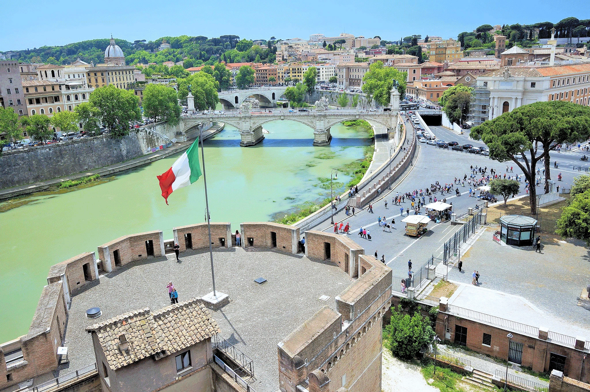
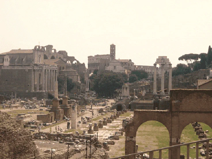
In image # 1, we are looking south from the top of Castel Sant'Angelo to the Tiber River, the Colosseum is off in the distance. That first bridge is the Ponte Vittorio Emanuele II and the second one is Ponte Principe Amedeo Savoia Aosta.
The Ponte Vittorio Emanuele II, also known as the "Vittoriano," is an iconic landmark that serves as a grand testament to Italy's unification. Inaugurated in 1911, this majestic bridge, adorned with intricate marblework, soaring bronze statues, and sweeping staircases, has become an enduring symbol of national pride and a popular tourist destination.
Image # 2 is the "Bridge of Angels" lined with statues of angels in flowing baroque robes. These were designed by Bernini, but likely were executed largely by his studio and assistants. This bridge is pedestrian only now, and the views are excellent.
The Ponte Sant'Angelo, also known as the Bridge of Angels, stands as a captivating testament to the city's rich history and artistic heritage. Originally constructed in 130 AD by Emperor Hadrian, this majestic bridge has witnessed the rise and fall of empires, the evolution of the city, and the enduring spirit of Rome.
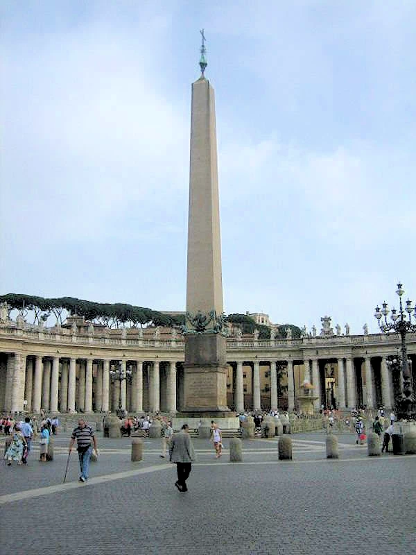
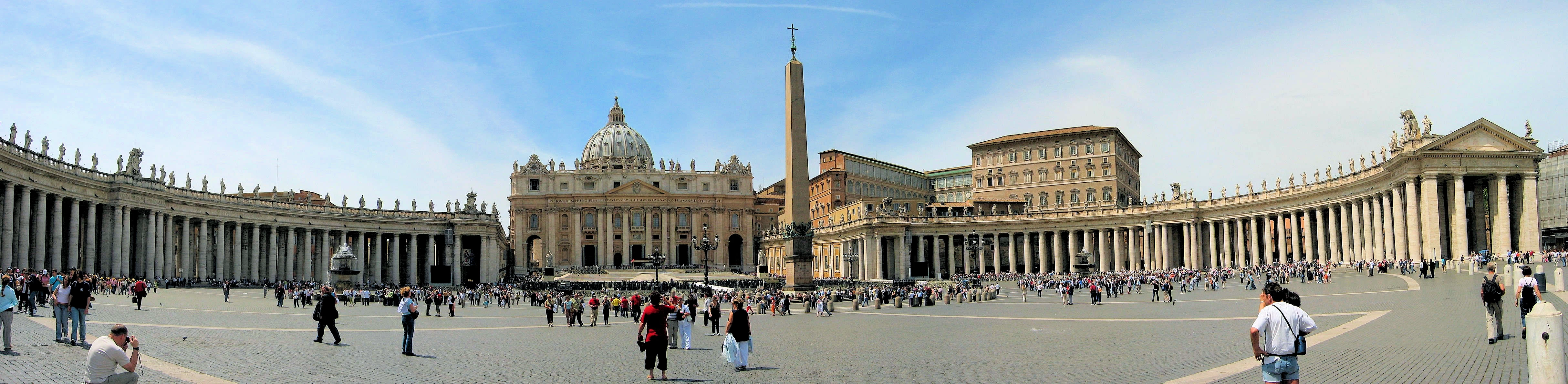 Saint Peter's Square
St. Peter's Square: a large plaza located directly in front of St. Peter's Basilica in the Vatican City, the papal enclave inside Rome, directly west of the neighborhood or rione of Borgo. Both the square and the basilica are named after Saint Peter, an apostle of Jesus considered by Catholics to be the first Pope.
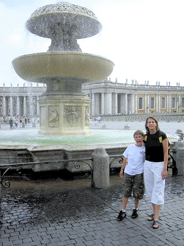
At the centre of the square is an ancient Egyptian obelisk, erected at the current site in 1586. Gian Lorenzo Bernini designed the square almost 100 years later, including the massive Doric colonnades, four columns deep, which embrace visitors in "the maternal arms of Mother Church". A granite fountain constructed by Bernini in 1675 matches another fountain designed by Carlo Maderno in 1613.
The Maderno Fountain (image # 1) is in the Piazza San Pietro (aka "St. Peter's Square"). The Vatican is behind the fountain. The granite fountain constructed by Bernini in 1675 matches another fountain designed by Carlo Maderno in 1613.
The obelisk (in image # 2) is an uninscribed Egyptian obelisk of red granite, 25.5 meters (84 ft) tall, supported on bronze lions and surmounted by the Chigi arms in bronze, in all 41 meters (135 ft) to the cross on its top. The obelisk was originally erected in Heliopolis, Egypt, around 1500 BC, was transported to Rome by Emperor Caligula in 39 AD and re-erected in the Circus of Nero.
In 1586, under the direction of Pope Sixtus V, the obelisk was relocated to its current position in the center of St. Peter's Square. This monumental feat of engineering, achieved using horse-drawn pulleys and a complex system of levers, involved transporting the 330-ton obelisk over a distance of nearly a mile.
NOTE: Image # 2 is the property of Silar via Wikimedia Commons using the Creative Commons CC BY-SA 4.0 License.
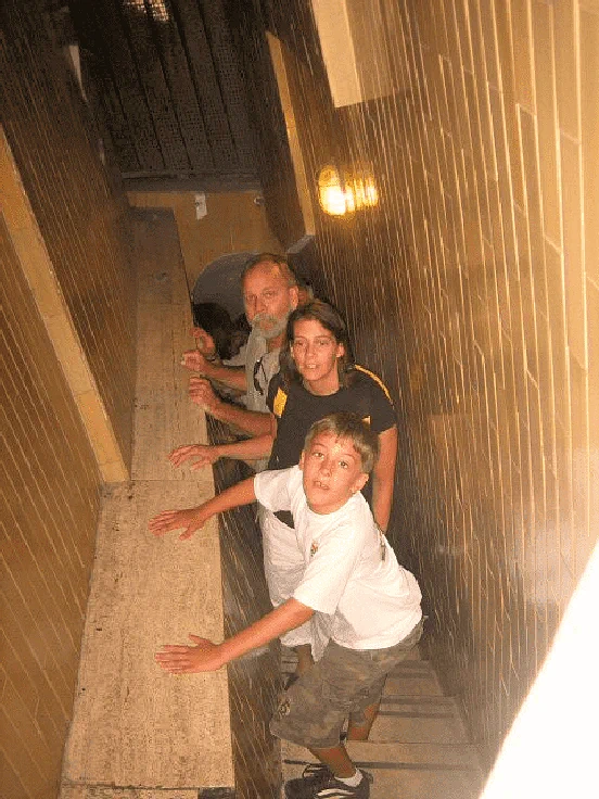
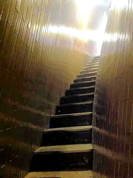
We discovered a route to walk up to the top of the dome. This walkway winds around the dome, all the way up to the top and then there is an opening directly over St. Peter's vault. We got a much better view of the vault than the people below!
The first part of the ascent is comprised of 231 steps, and that area is not strenuous, exhausting or claustrophobic. The second part is comprised of 320 stairs which become continously steeper and narrower as you proceed. Once you reach the top, a narrow passage leads to the Lantern, a small, circular chamber that crowns the dome. From this vantage point, you'll be rewarded with panoramic views of Rome, stretching from the Vatican City to the ancient ruins of the Roman Forum.
Michelangelo designed this magnificent dome. Remarkably, he started this project at the age of 71 years old. But when Michelangelo died in 1564, his students successfully continued Michelangelo’s vision, finishing the dome in 1590.
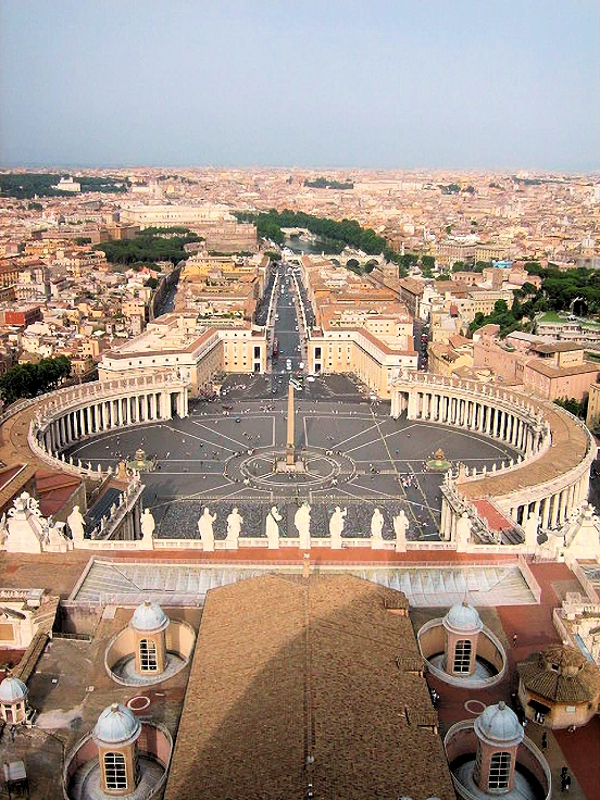
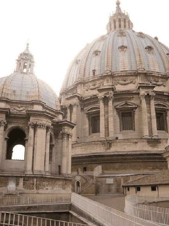
Once we reached the top of the Dome (image # 1), we noticed that you could walk out onto a viewing platform and get a great photo looking back towards the city of Rome. You have to remember that the Vatican is it's "own city" and not a part of Rome. That is St. Peter's Square below us and the Tiber River is in the distance.
Image # 2 is the view of St. Peter's dome when we turned around and faced the building. This is the kind of thing that every Vatican visitor should take advantage of, however we had not previously heard or read of it.
NOTE: The above comments were created in 2007, and it is now possible to pay a small fee and take this same walk up into the dome. Here is a link to a Google Search Results list for "how to climb up the saint peter's dome staircase"
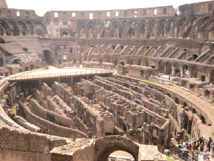
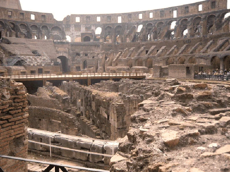
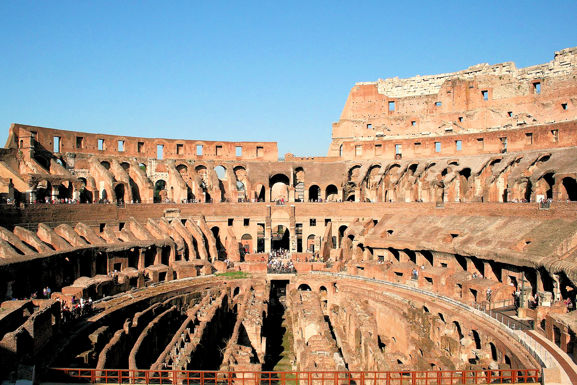
The official name at the time of it's construction, was the "Flavian Amphitheatre". Measuring an impressive 188 meters long, 156 meters wide, and 50 meters tall, the Colosseum's sheer size and grandeur are enough to leave visitors awestruck. Its elliptical shape, formed by intersecting three tiers of arches, provided seating for an estimated 50,000 spectators, all eager to witness the thrilling events that unfolded within its arena.
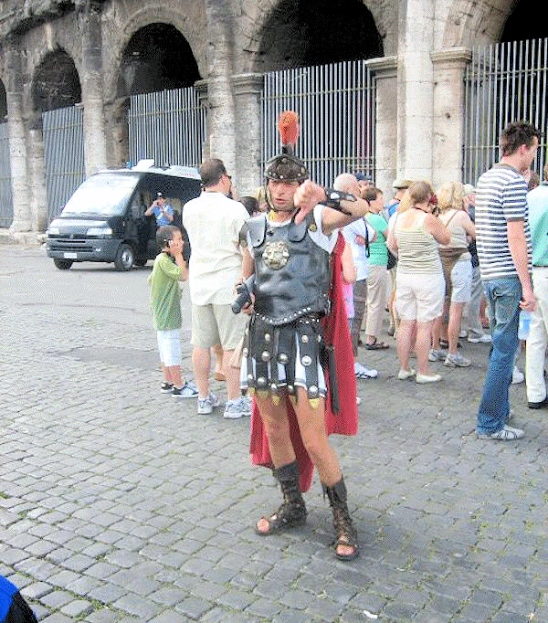
The Security guys were all dressed as Roman Soldiers and they were everywhere around the Colosseum, and this one has just noticed that our son Jeremy has on a Milan Soccer Team shirt. Obviously, this guy is not a Milano fan. We read later that there were also numerous "plain clothes" security as well, but of course we never saw any.
Click here to view the Roman Army Wikipedia page which will provide you with the history and evolution of this big part of Roman History.
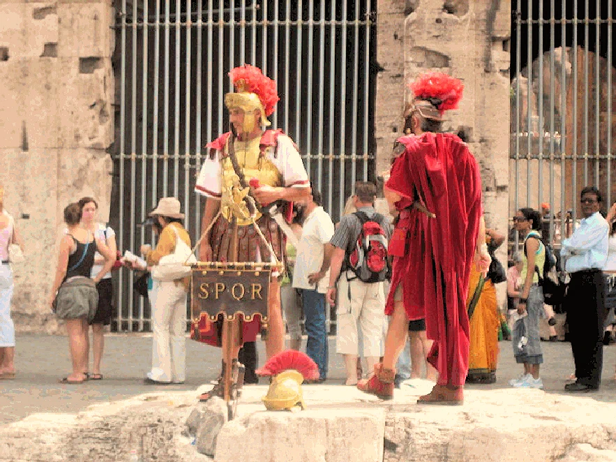
See the sign SPQR? That is an initialism of a phrase in Latin: Senātus Populusque Rōmānus ("The Roman Senate and People") or more freely as "The Senate and People of Rome"; referring to the government of the ancient Roman Republic, and used as an official emblem of the modern-day.
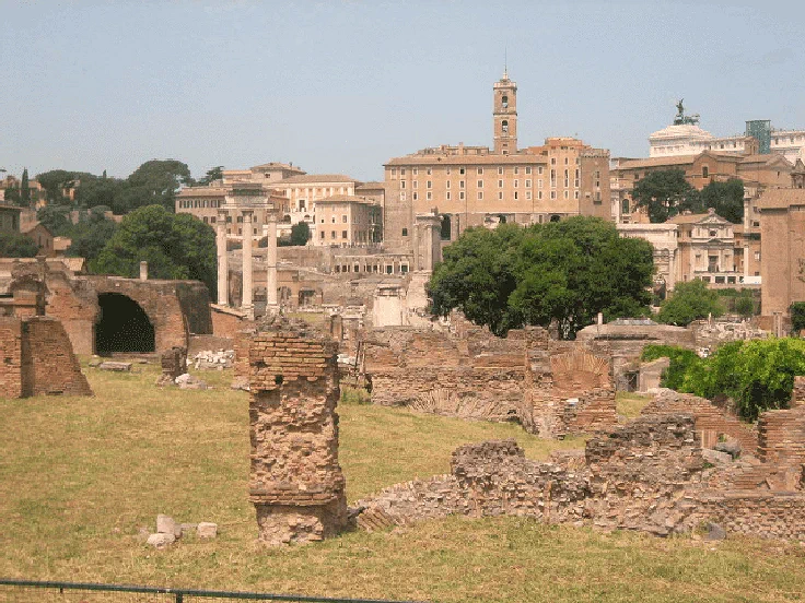
Located immediately north of the Colosseum, there isn't much left there except for ruins, but you can get a feel for what this city must have looked like 2,000 years ago! As you look about at these buildings, keep in mind that most were constructed during Caesar Augustus's reign. Augustus was Rome's first Emperor and he established a standing Roman army, a network of roads, and rebuilt much of the city of Rome.
On his deathbed, Augustus boasted "I found a Rome of bricks; I leave to you one of marble." Although there is some truth in the literal meaning of this, Cassius Dio asserts that it was a metaphor for the Empire's strength. Marble could be found in buildings of Rome before Augustus, but it was not extensively used as a building material until the reign of Augustus.
The arena floor was originally made of wood, and as can be seen, has long since deteriorated. The Roman architects created elevators to move things back and forth from below the surface to the storage areas below the Colosseum. These elevators were obviously rope-pulls, but they were the first elevators in the world.
The steps of St. Peter's in Rome are made of reused Colosseum stones. The outer wall of the Colosseum is estimated to have required over 100,000 cubic meters (3,531,466 ft) of travertine stone which were set, without mortar, and held together by 300 tons of iron clamps. It has been calculated that 300 tons of metal were used just for the clamps. This metal was plundered during the Middle Ages to make weapons. The holes where the iron clamps once were can now be seen throughout the whole structure of the Colosseum.
NOTE: The Colosseum stones were being removed and utilized to construct the Vatican, this went on until St. Leonard of Port Maurice complained to Pope Benedict XIV (1740–1758) who forbade the quarrying of the Colosseum and erected Stations of the Cross around the arena, which remained until February 1874. Without that intervention, it is likely that the Colosseum would have probably disappeared.
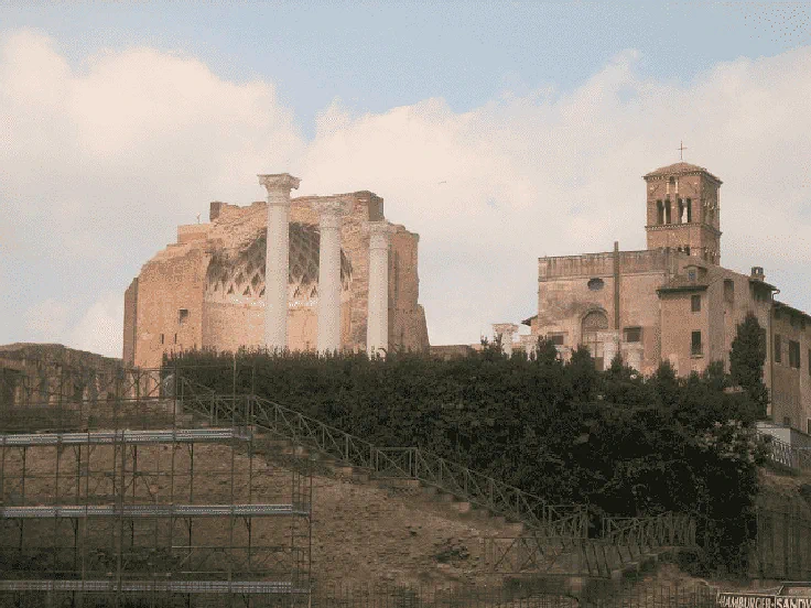
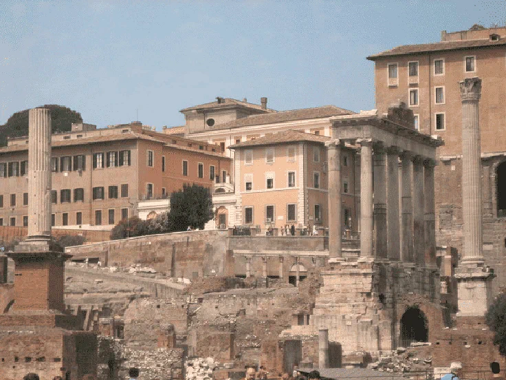
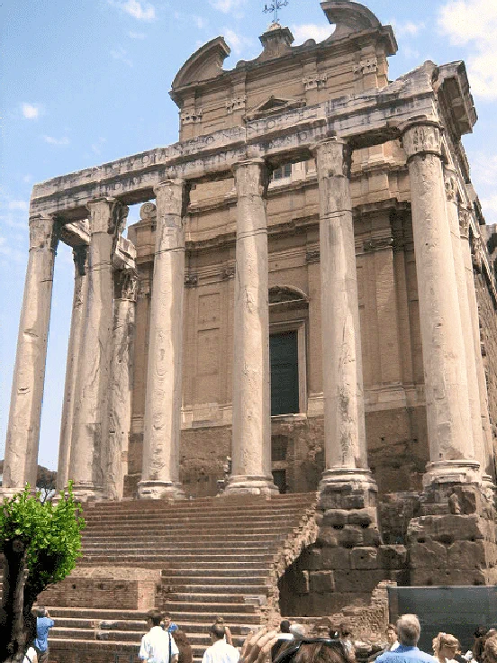
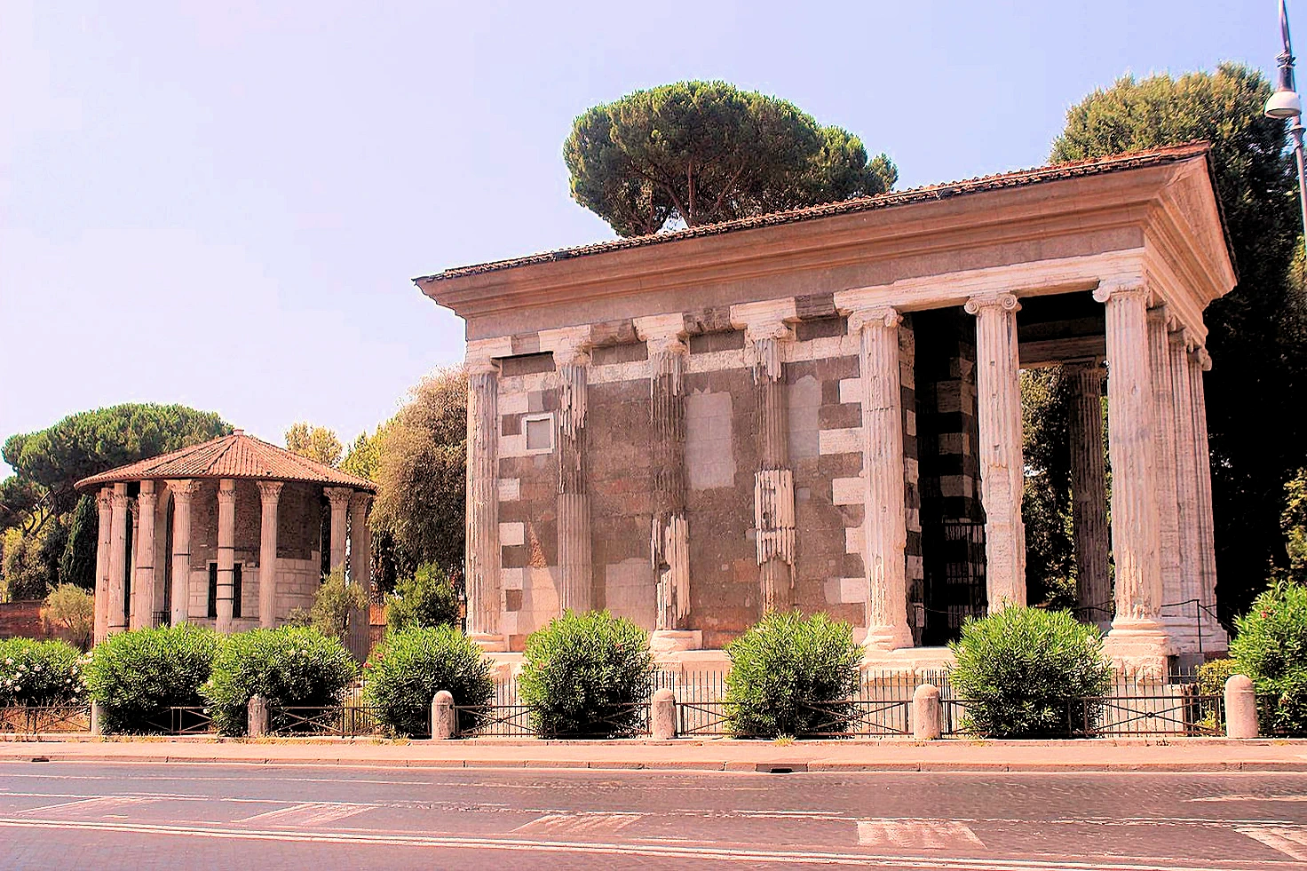
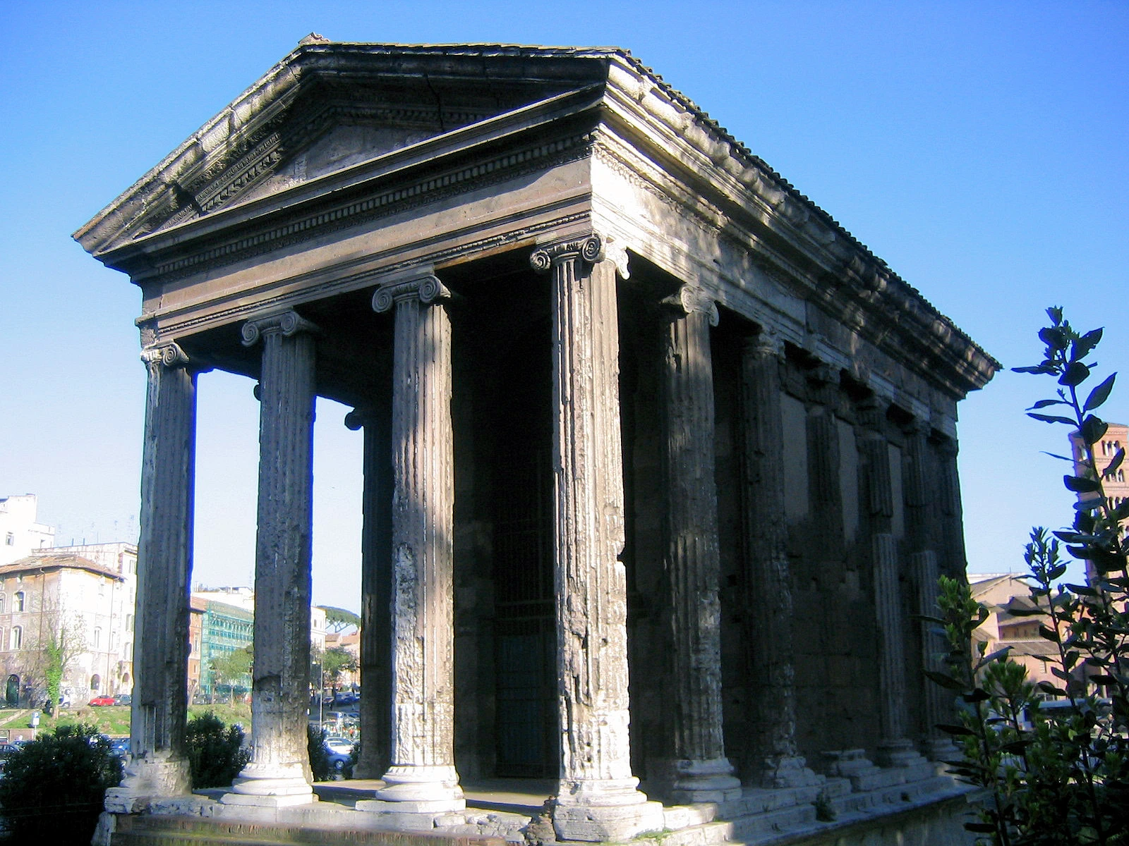
From the north end of the old city, looking back towards the Colosseum. The large multi-column building on the left, is the Tempio di Portuno, built between 80 and 120 BC.
The Tempio di Portuno or Temple of Fortuna Virilis ("manly fortune") is one of the best preserved of all Roman temples. Its dedication remains unclear, as ancient sources mention several temples in this area of Rome, without saying enough to make it clear which this is. It was called the Temple of Fortuna Virilis from the Renaissance, and remains better known by this name. If dedicated to Portunus, the god of keys, doors and livestock, and so granaries, it is the main temple dedicated to that god in Rome.
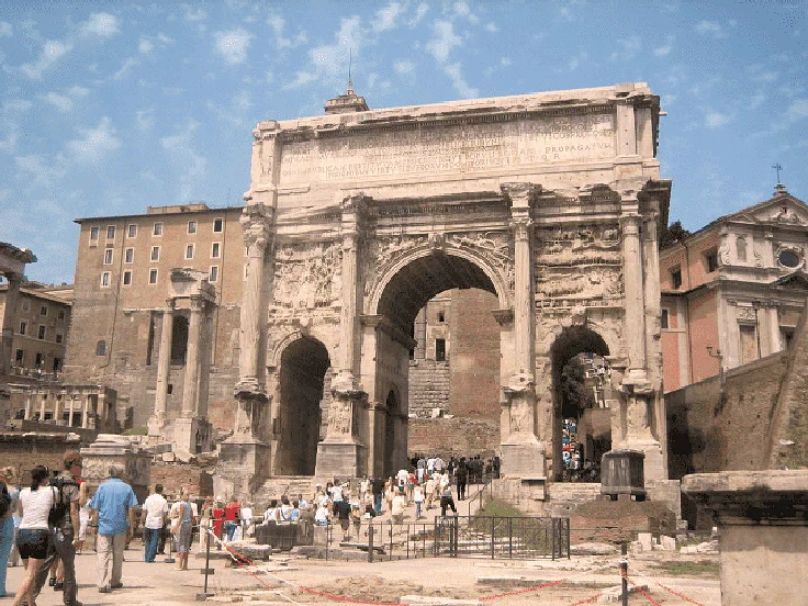
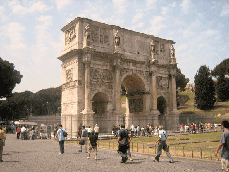
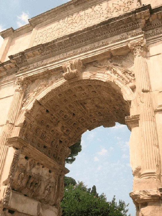
The Arch of Constantine is a triumphal arch in Rome dedicated to the emperor Constantine the Great. The arch was commissioned by the Roman Senate to commemorate Constantine’s victory over Maxentius at the Battle of Milvian Bridge in AD 312. Situated between the Colosseum and the Palatine Hill, the arch spans the Via triumphalis, the route taken by victorious military leaders when they entered the city in a triumphal procession. Dedicated in 315, it is the largest Roman triumphal arch, with overall dimensions of 21 meters high, 25.9 meters wide and 7.4 meters deep. It has three bays, the central one being 11.5 meters high and 6.5 meters wide and the laterals 7.4 meters by 3.4 meters each. The arch is constructed of brick-faced concrete reveted in marble.
The largest triumphal arch in the world is the Arch de Triomphe, commissioned by Napoléon I to commemorate his military conquests. Architect Jean François Thérèse Chalgrin’s creation is twice the size of the ancient Roman Arch of Constantine after which it is modeled.
If you ever saw the movie "Ben Hur" then you already know what took place here. If you never saw that movie, read on....
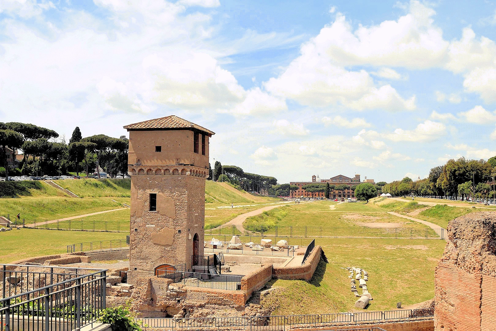
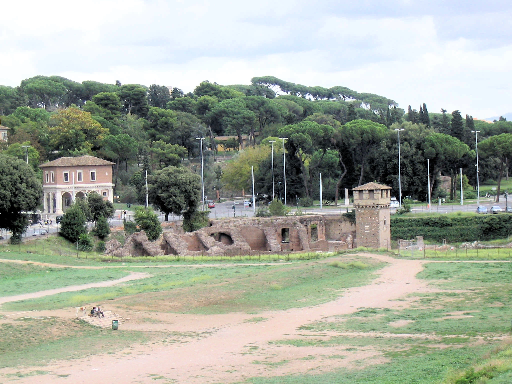
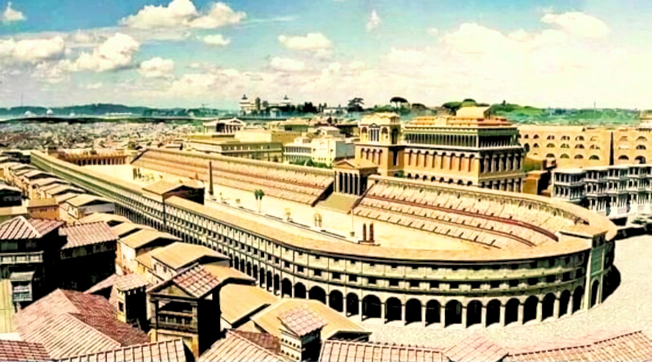
Quick Circus Maximus History LessonThe Circus Maximus (Latin for greatest or largest circus, in Italian Circo Massimo) is an ancient Roman chariot racing stadium and mass entertainment venue located at the Via del Circo Massimo. Situated in the valley between the Aventine and Palatine hills, it was the first and largest stadium in ancient Rome and its later Empire. It measured 621 m (2,037 ft) in length and 118 m (387 ft) in width and could accommodate over 150,000 spectators.
The Circus was Rome's largest venue for ludi, public games connected to Roman religious festivals. Ludi were sponsored by leading Romans or the Roman state for the benefit of the Roman people (populus Romanus) and gods. Most were held annually or at annual intervals on the Roman calendar. Others might be given to fulfill a religious vow, such as the games in celebration of a triumph. In Roman tradition, the earliest triumphal ludi at the Circus were vowed by Tarquin the Proud to Jupiter in the late Regal era for his victory over Pometia.
In image # 3 above, you can see what the Circus Maximum looked like when it was new. The Palatine hills are to the right and you can get a sense of how large it was.
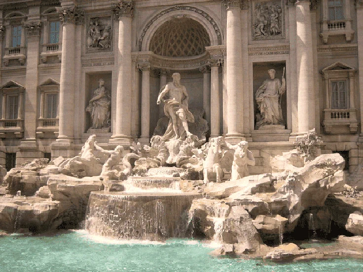
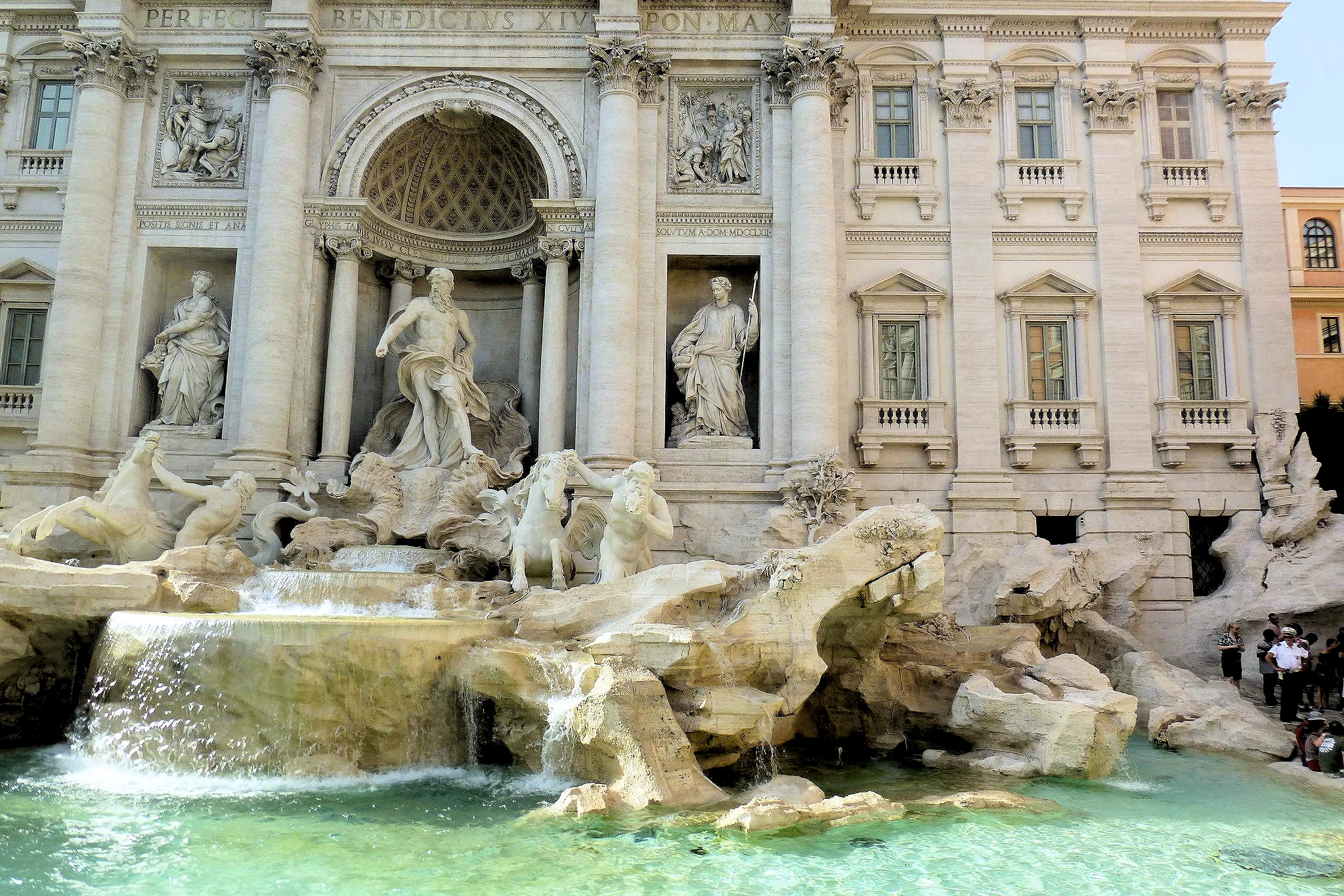
A fountain in the Trevi district in Rome, Italy, designed by Italian architect Nicola Salvi and completed by Pietro Bracci. Standing 26.3 metres (86 ft) high and 49.15 metres (161.3 ft) wide, it is the largest Baroque fountain in the city and one of the most famous fountains in the world.
The fountain is at the junction of three roads and marks the terminal point of the "modern" Acqua Vergine, the revived Aqua Virgo, one of the aqueducts that supplied water to ancient Rome. In 19 BC, supposedly with the help of a virgin, Roman technicians located a source of pure water some 8.1 miles from the city. (This scene is presented on the present fountain's façade.) However, the eventual indirect route of the aqueduct made its length approximately 14 miles.
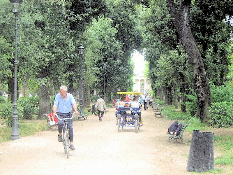 Villa Borghese Park
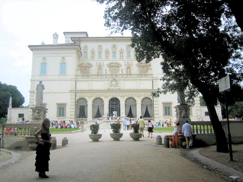 Villa Medici
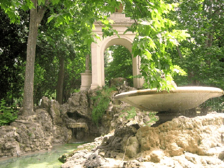 Villa Borghese Park
Villa Borghese is one of Rome’s most beloved green spaces—a beautifully landscaped park designed in the naturalistic English garden style. Spanning over 80 hectares (approximately 198 acres), it ranks as the third-largest public park in the city, after Villa Doria Pamphili and Villa Ada.
Originally developed as the private estate of Cardinal Scipione Borghese, a nephew of Pope Paul V and an avid patron of the arts, the gardens were laid out to complement the Villa Borghese Pinciana, a grand suburban villa perched on the edge of the Pincian Hill. The villa itself was designed by architect Flaminio Ponzio, based on Scipione’s own vision for a lavish retreat that would serve both as a pleasure residence and as a showcase for his expanding art collection.
While the initial layout of the gardens dates back to the 17th century, much of their current appearance is the result of a major redesign in the early 19th century, which introduced meandering pathways, wooded groves, open lawns, fountains, and scenic viewpoints reminiscent of an English landscape garden.
Today, Villa Borghese is not only a peaceful oasis in the heart of Rome but also a vibrant cultural hub, home to several notable institutions, including the Galleria Borghese, the Borghese Gallery Museum, the Pietro Canonica Museum, and the Casa del Cinema. With its blend of artistic heritage, architectural beauty, and natural tranquility, the park invites both locals and visitors to stroll, relax, and explore one of the city’s most enchanting outdoor spaces.
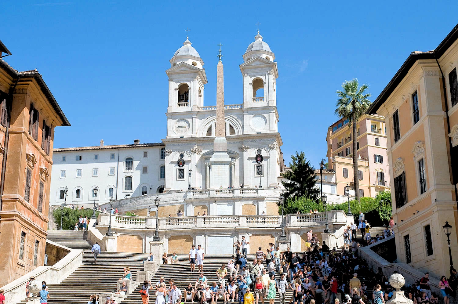
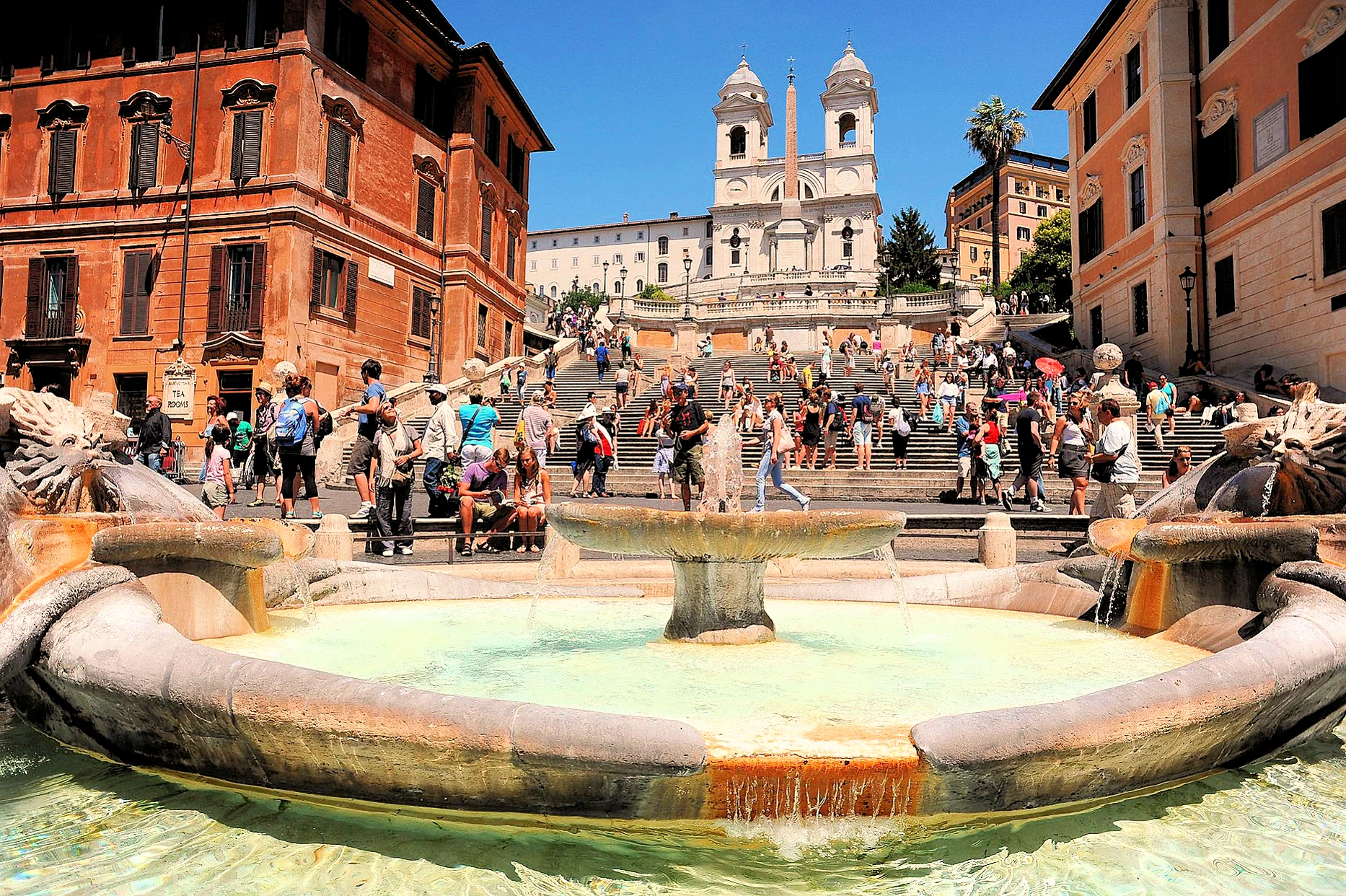
The Spanish Steps (Italian: Scalinata di Trinità dei Monti) are a set of steps in Rome, Italy, climbing a steep slope between the Piazza di Spagna at the base and Piazza Trinità dei Monti, dominated by the Trinità dei Monti church at the top.
The monumental stairway of 135 steps (the slightly elevated drainage system is often mistaken for the first step) was built with French diplomat Étienne Gueffier’s bequeathed funds of 20,000 scudi, in 1723–1725, linking the Bourbon Spanish Embassy, and the Trinità dei Monti church that was under the patronage of the Bourbon kings of France, both located above — to the Holy See in Palazzo Monaldeschi located below. The stairway was designed by architects Francesco de Sanctis and Alessandro Specchi.
After exploring Rome, we took the train to Florence, a trip of 162 miles that was completed in 1.5 hours. The route takes you through the Lazio and Tuscany regions, so the views through the windows are good.
The train systems in Europe are so comfortable and cost-effective, that it would have been foolish to have rented a car to make this trip.
The Airport is 30 kilometers from the Vatican, so you will have to utilize some local transportation; The best way to get from the Rome Airport to Vatican City is to ride the Leonardo Express Train which takes 32 minutes and costs €7 - €35. Or you could take an SIT bus (located at terminal # 3), which costs €2 - €7 and takes 45 minutes. Go to the SIT Buses Website for more information. You could also consider a taxi service or a Rome Airport Transfer (think "car for hire"), both are considerably more expensive than rail or bus.
How long should I stay in Rome? Four to five days is recommended to see the major attractions at a relaxed pace. If you want to take a day trip to a nearby city like Naples, Pompeii, or Orvieto, plan for a longer visit.
What is the best time of year to visit? Spring (April–May) and fall (September–October) offer the most comfortable weather and smaller crowds. Summer is hot and crowded, and winter can be rainy, though milder than many northern European destinations.
Should I buy tickets in advance? Yes, for major sites like the Colosseum, Vatican Museums, and Borghese Gallery, you should book tickets online well in advance. This allows you to secure a timed entry and skip the notoriously long lines.
What's the best way to avoid tourist traps? Research restaurants before you go, and avoid those with hawkers outside, menus in multiple languages, or photos of the food. Don't eat at restaurants directly next to major landmarks; instead, wander down a side street to find more authentic, local eateries.
Rome offers mixed but improving wheelchair accessibility, with significant challenges from cobblestone streets, broken sidewalks, and a limited public transport system. However, major attractions like the Colosseum, Pantheon, and Vatican Museums have adapted with elevators, ramps, and designated accessible routes, and accessible tours, accommodations, and specialized services are available to help navigate the city. While some areas require careful planning and a slower pace, many historical sights and modern amenities can be enjoyed by wheelchair users.
Is Rome a walkable city? Yes, the historic center is compact and best explored on foot. Walking allows you to stumble upon hidden gems and charming side streets.
What is the public transportation like? Rome's public transit consists of a metro, buses, and trams. The metro is fast and reliable for longer distances, while the buses can be extensive but sometimes run late due to traffic. For buses, you must buy tickets in advance at a tabaccheria (stores with a "T" sign) or metro station.
Should I use taxis or Uber? Only use official, licensed white taxis from designated taxi stands or by calling. Taxis cannot be hailed on the street. Uber is available but can be more expensive.
Is it a good idea to rent a car? No. Driving in Rome is stressful, and parking is limited. Many areas, including the historic center, have restricted traffic zones (ZTL) that tourists often can't enter. Driving is best left to locals.
What is the dress code for religious sites? When visiting holy sites like St. Peter's Basilica or the Pantheon, you must cover your knees and shoulders. It's wise to carry a light scarf or wrap for this purpose.
Is the tap water safe to drink? Yes, Rome's tap water is safe to drink, and you should carry a refillable bottle. The city has thousands of free public fountains, known as nasoni, for drinking water.
How do I avoid scams and pickpockets? Be vigilant in crowded tourist areas, particularly on public transit, as pickpocketing is common. Ignore street vendors who offer "free" gifts, as they will demand payment afterward.
When do Romans eat dinner? Romans typically eat dinner late, often around 8 p.m. or later. Many restaurants close between lunch and dinner service, though tourist-focused restaurants may stay open.
What should I know about ordering coffee? Don't order a cappuccino after 11 a.m., as locals view it as a breakfast-only drink. To save money, drink your coffee while standing at the bar, as sitting at a table often incurs a service charge.
Do restaurants serve bread for free? No, bread is often placed on the table but is not complimentary. If you don't want it, tell the waiter as soon as you sit down.
What are some local dishes to try? Rome is known for pasta dishes like cacio e pepe, carbonara, and amatriciana, as well as street food.
What wines should I try while in Rome? Be sure to try Frascati and other white wines from the Lazio region, such as those made from Bellone, Malvasia, and Trebbiano grapes. Red wine lovers should look for local options like Cesanese del Piglio or robust reds such as Sangiovese, Montepulciano, and Nero Buono. For sparkling wine, try Franciacorta or local Metodo Classico wines.
Rome is an interesting place to visit, however it is important to plan your trip there in order to make the trip as enjoyable as possible. Here are some informative links for you to perhaps utilize while you are planning;
Note: All images featured on this page are the exclusive property of Just Traveling Thru, LLC, unless otherwise stated. When images from external sources are used, full credit is given to the original creator, along with a link to the specified license or usage terms. We are committed to respecting copyright and intellectual property rights, ensuring that all third-party images are properly attributed. If you have any questions regarding image ownership or usage rights, please feel free to contact us.
Affiliate Links: We may earn a commission if you make a purchase through one of our affiliate links. This helps support our travel content — thank you!
Content: To review any of our content, make suggestions and/or comments, please click the "About" menu link at the top of this page. You will find our "Contact Us" link on that drop-down menu.

