
by Celeste Lipford and Terry Lipford - last updated on 9/12/2025
Yosemite is certainly high on everyone’s list of top national parks to visit in the United States and for good reason. Within its nearly 1,200 square miles you can experience the power of glaciers, the wonder and beauty of waterfalls (best viewed in the springtime), Yosemite Valley with views of El Capitan lurking around almost every corner, sprawling meadows and groves of giant sequoia trees.
Yosemite National Park, established in 1890, is one of the United States' first National Parks. Its history began with the Mariposa Battalion discovering the valley in 1851, during a conflict with Native American tribes. Soon after, artists like Albert Bierstadt and photographers like Carleton Watkins captured its beauty, inspiring public interest. In 1864, President Abraham Lincoln signed the Yosemite Grant, setting aside the valley and Mariposa Grove of Giant Sequoias as protected land. This marked the first time the federal government protected land for public use, laying the foundation for the National Park system.
Naturalist John Muir played a key role in Yosemite's preservation. His writings and advocacy led to Yosemite becoming a national park in 1890. Over the next decades, efforts to protect the park intensified, with Muir successfully pushing for federal management of the area. Yosemite has since become a symbol of America's commitment to preserving its natural landscapes
Total size of Yosemite is 1,187 square miles. 94% of which is “designated wilderness”. This is not quite ⅔ of the original size of the Park, land was removed from the Park dimensions early in the 1900s for various reasons, almost always commercial in nature.
Yosemite contains 800 miles of trails and/or bicycle paths and 214 miles of paved roads.
Various Indian tribes lived in Yosemite Valley for thousands of years; the Paiutes and the Miwok tribes were the most recent. There is a considerable amount of evidence that Indians lived in this area for the previous 3,000 years.
The first European/American visitors to Yosemite were a group of trappers led by the famous Jedebiah Smith in 1827. Even though Spain and subsequently Mexico had explored extensive areas of California, there is no recorded information about any exploration of the Sierra Nevada Mountains until Americans began visiting in the early 1800s. Even though Father Junipero Serra explored all of California from Mexico all the way to the Santa Rosa area, he and his exploration group never went inland towards the Sierra Nevada mountains.
In 1833 a group of trappers led by Joseph Walker appear to have entered Yosemite via the Merced Grove area. Unfortunately the journals created by that group were lost in a fire in a Philadelphia print shop while waiting to be printed. If this is accurate, these men were the first to see the Giant Sequoia trees.
California drove the Indian Tribes out of Yosemite Valley during the "Mariposa War" in 1851. The Army group that was sent to push the Indians out (the Mariposa Battalion) spent quite a bit of time in the Valley and the Doctor that came with them (Dr. Lafayette Bunnell) named many of the geographic features they came across in the Valley. The Army group found that the Indians already called the Valley “Yosemite” so they retained that name.
John Muir arrived in California in 1868 and took a job at a sheep ranch in Yosemite Valley. As he became familiar with the area, he began to realize that it needed to be protected from visitors who were slowly destroying the land, cutting down the giant trees and John Muir began a long campaign to have Yosemite protected by Federal laws. On 10/1/1890 Yosemite became a National Park and Muir turned his attention to other areas of California, and in 1892 he became one of the founding members of the Sierra Club.
Yosemite has been receiving over four million visitors annually, that number was 2.36 million in 2020 and 3.43 million in 2021. The National Park Service required reservations in 2021 & 2022, which may be an impact on annual visitation.
Yosemite is home to over 400 species of vertebrates, including black bears, mule deer, mountain lions, and more than 260 bird species.
Navigating Yosemite National Park in California USA for the first time can be overwhelming, so we've crafted a user-friendly three-day itinerary to help you make the most of your visit and to show you some of the top things to do in Yosemite. Yosemite was a standout highlight during our multi-week trip to the beautiful state of California. To make the most of your visit, especially if it's your first time navigating this iconic park, we've crafted a user-friendly three-day itinerary. Explore some of the top things to do in Yosemite National Park, including must-see sites and optional hikes, all conveniently outlined in our itinerary and accompanied by a Yosemite Route Map. Whether you're an active explorer or have physical limitations, our plan caters to all. And for the perfect Yosemite stay, discover the excellence of Rush Creek Lodge - one of the best places to stay in Yosemite, offering unparalleled comfort amidst breathtaking landscapes.
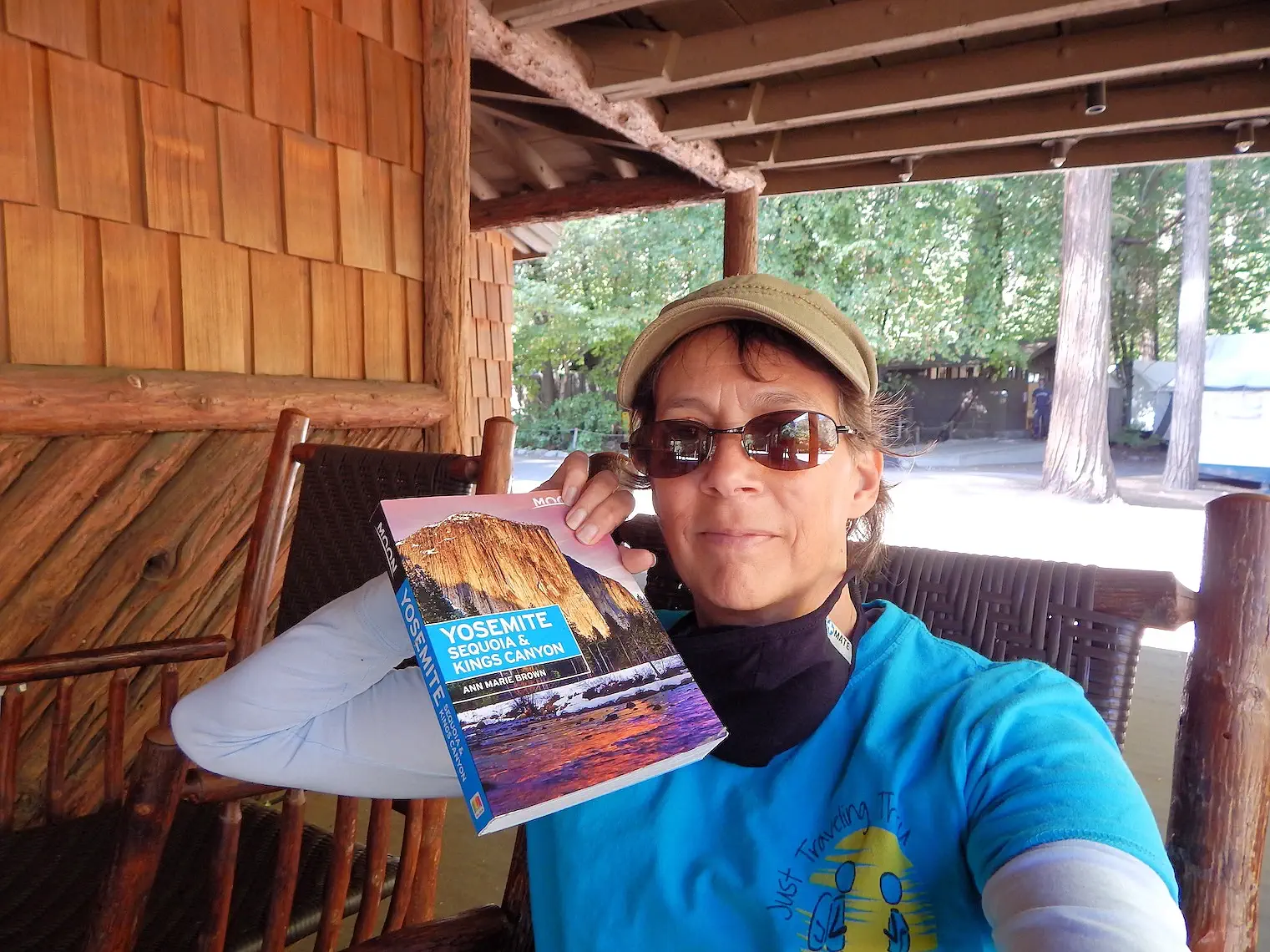
A book such as the "Yosemite, Sequoia and Kings Canyon" by Ann Marie Brown and published by Moon (click here to search Amazon for Yosemite media) is a useful tool for getting familiar with the parks and what there is to see and do. Since cell service is spotty in the park and frequently non existent doing things the old fashioned way and keeping a book with you in your pack is recommended.
We recommend also reading the newspaper (the "Yosemite Guide") with current information when you receive it at the park entrance so that you are aware of anything that will affect you while you are visiting and you can plan around it.
Usually there are buses that help move people around the park but due to COVID the buses were NOT running when we were there and that created some logistical challenges. The park is huge and there can be a lot of driving time. Reservations were required for the park when we visited but currently that restriction has been lifted. Head to the official Yosemite parks page for current information here.
If you aren’t staying in the park, getting there as early as possible is crucial to finding a parking space at the site that you are most interested in. We have a family joke and it seems to apply to wherever we travel & it goes like this; "Everyone arrives by 10:00 AM". This applies to boating on a lake, going to the beach, and clearly national parks as well. If you can get there much earlier than everyone else then you have a much better chance at finding a spot and having less crowds and lines.
It’s always easier to know what to do once you’ve been somewhere. We found the information about Yosemite a bit overwhelming and it was hard to come up with our plan. We thought we’d share some information to make it easier for first time visitors to get the lay of the land by providing a suggested three day itinerary. Note that this can be for people who are active or those who have some physical limitations. Much of the suggested itinerary involves driving to viewing areas. If you want more exercise add more hikes to your day.
NOTE: Scroll down to see our images and descriptions of our 3 day adventure in Yosemite.
Choosing the right place to stay can make your Yosemite adventure even more memorable. Whether you prefer being immersed in nature, staying close to the park’s main entrances, or relaxing in a cozy mountain town with dining and amenities, there are lodging options for every travel style. From in-park lodges with rustic charm to hotels and cabins in nearby communities like Mariposa, El Portal, and Oakhurst, your basecamp can set the tone for how you explore Yosemite’s stunning landscapes. Below are some of the best-rated accommodations to consider, each offering convenient access to the park’s iconic viewpoints, hiking trails, and scenic drives.
Below are five of the top-rated options based upon Google Review Ratings:
Google Search Results link for "accommodations in or near Yosemite National Park". Once you are on that page, you can change the search parameters to fit your requirements and Google will re-sort the list for you.

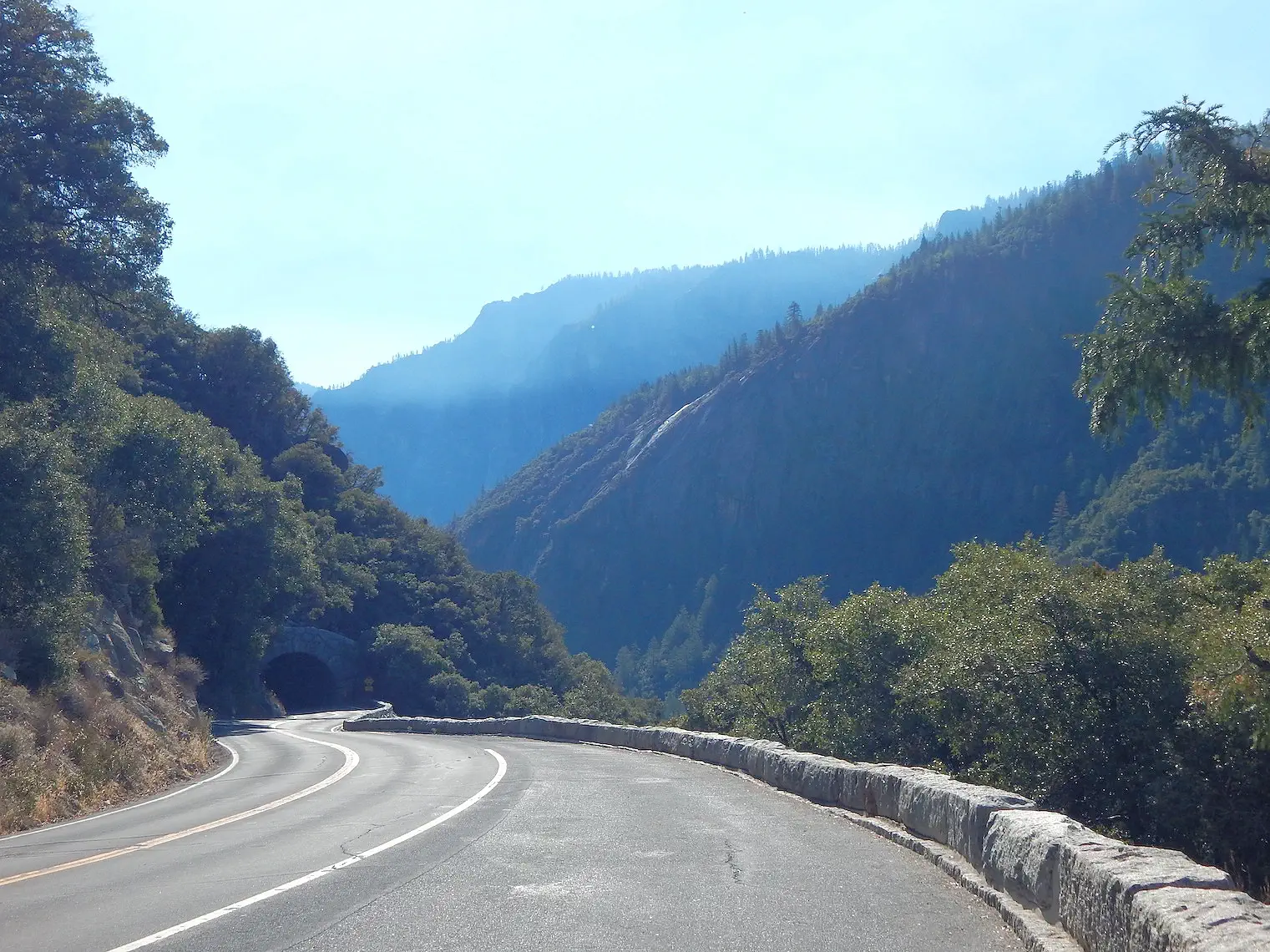
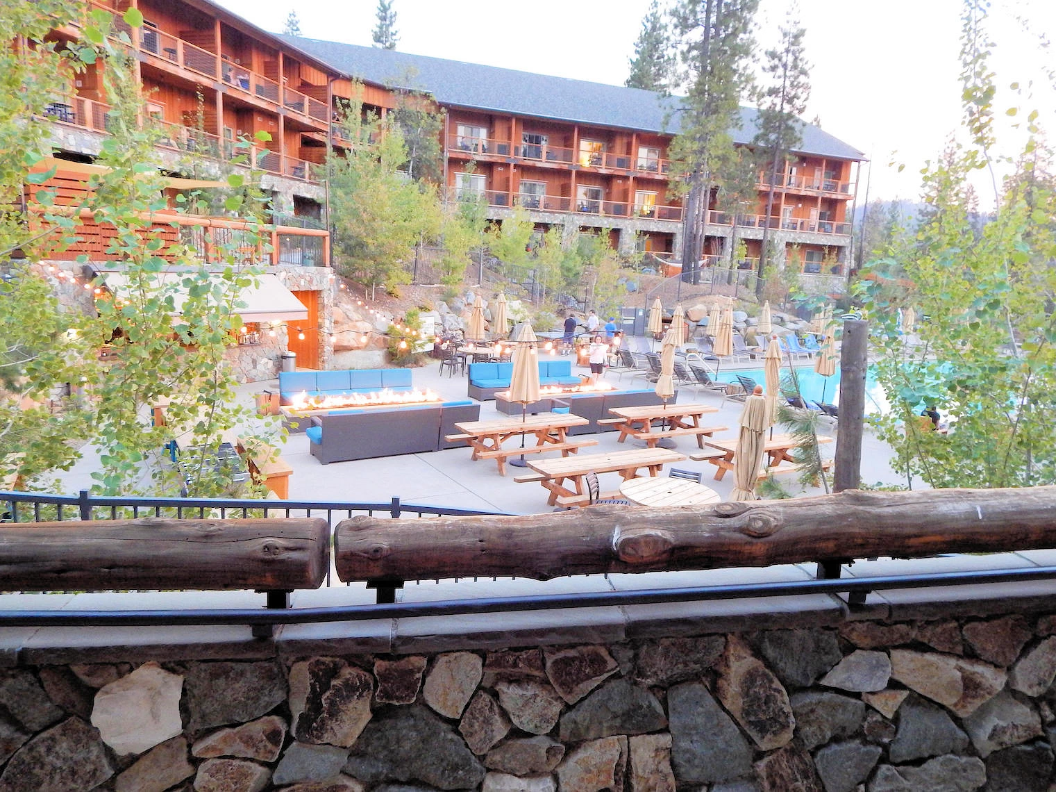
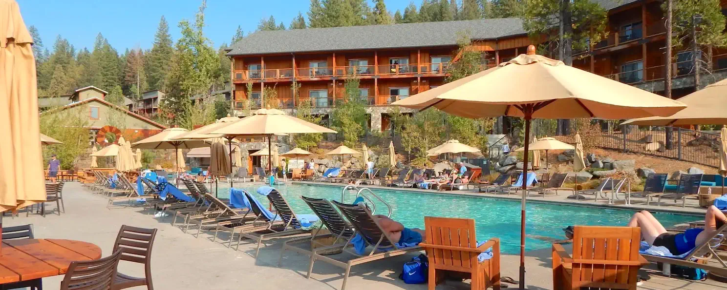
As you can see in this map, Rush Creek Lodge is approximately 25 miles from Curry Village, and the road twists & turns as it descends into Yosemite Valley - and joins Route 140. There are only 3 roads into the park from the western side; routes 120 & 140 and 41 and all 3 join together on the way to the village.
 Route 120 from Rush Creek Lodge
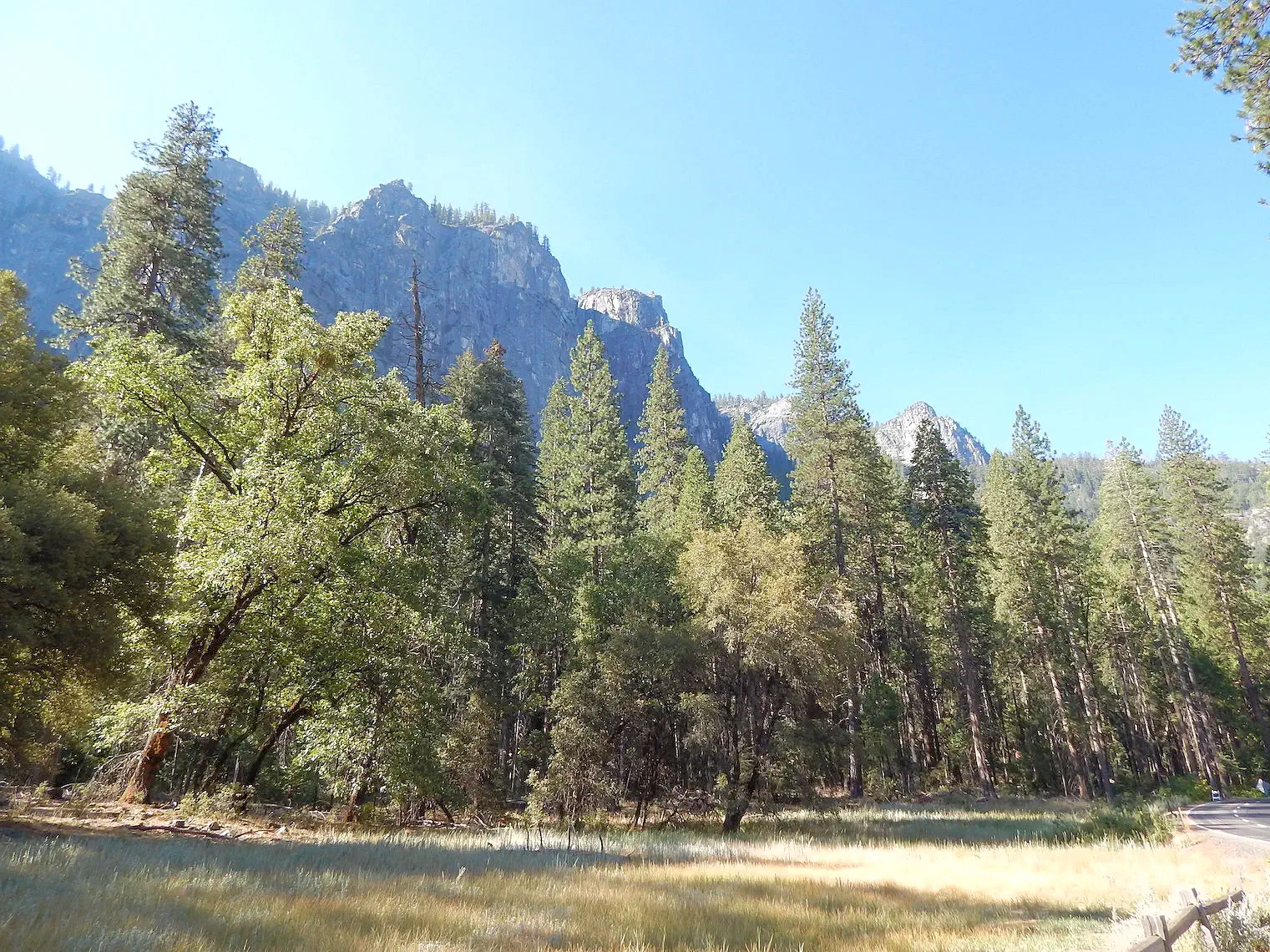 Route 120 merges with Big Oak Flag Road
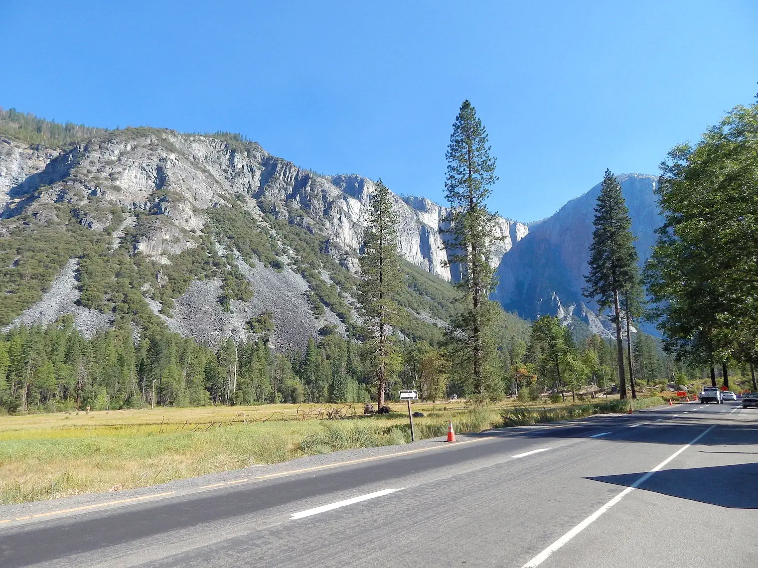 Big Oak Flat Road to Curry Village
The road into Yosemite Valley has been turned into a one way loop road to help with traffic flow. Pictures can be taken on the way in and on the way out. You may want to head to one of the parking areas (there are numerous turn-outs to park in or you could park at Curry Village) so that you get a parking place and take pictures on the way out of the park later on if you aren’t staying in the park itself.
There are numerous waterfalls with the biggest attraction being Yosemite falls which is the highest waterfall in North America dropping 2425 feet from the top to the base of the lower falls. We didn’t get to see the falls because it was dry when we went in September. Go earlier in the season if you want to see it in its full glory. Check out images of the falls in Yosemite here.
 First View of El Capitan
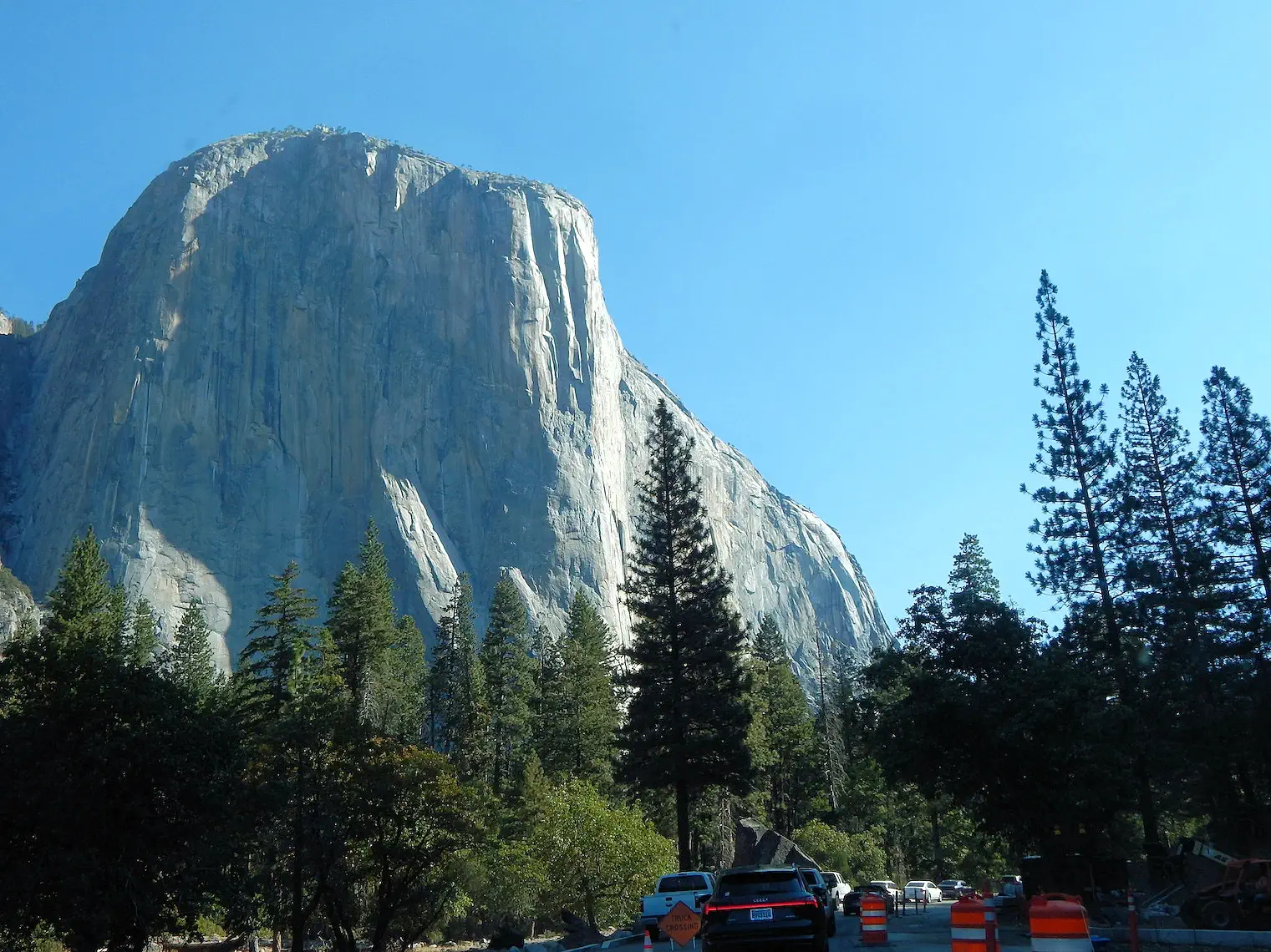 7,573 feet of El Capitan
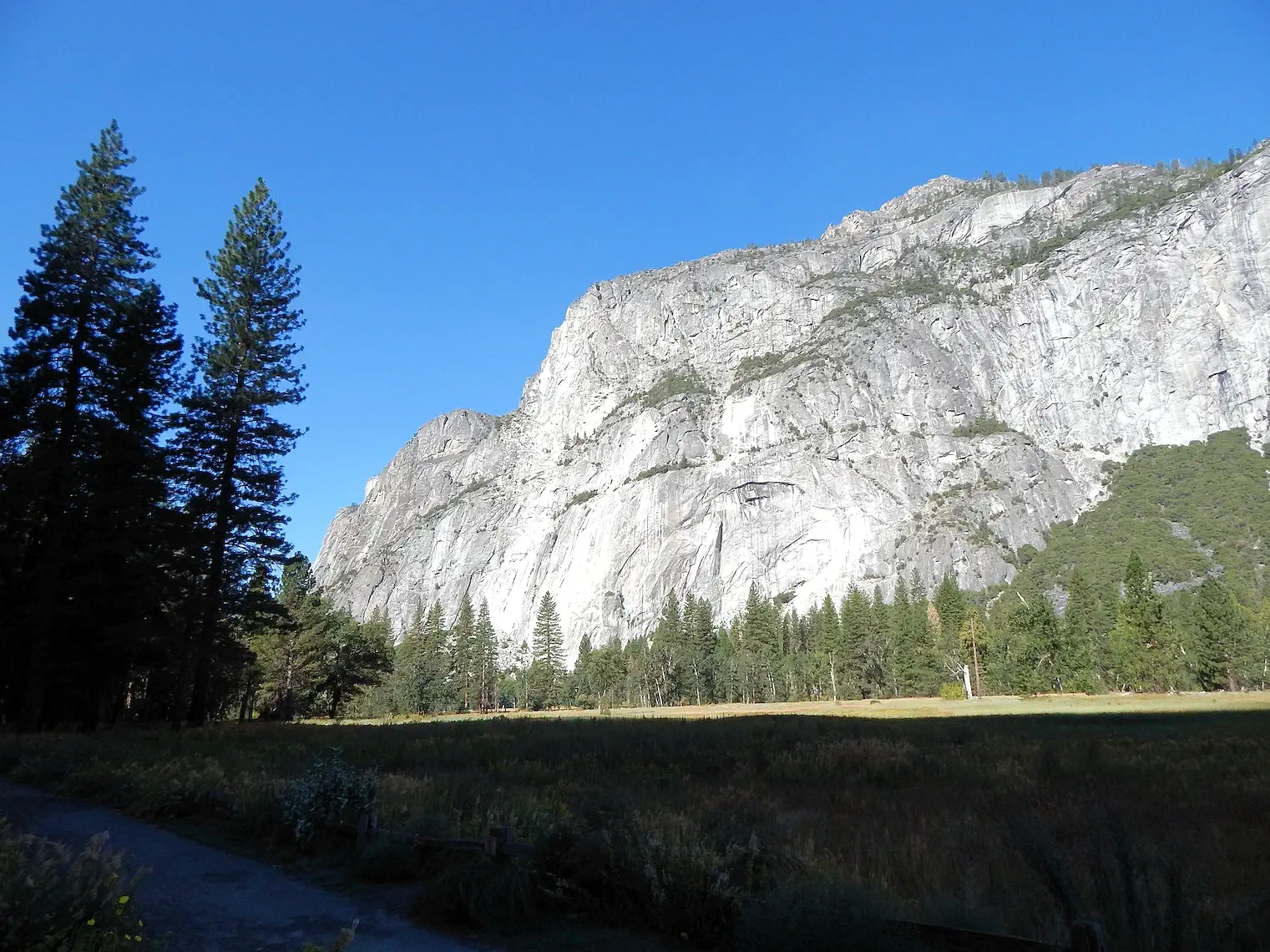 Granite Rock
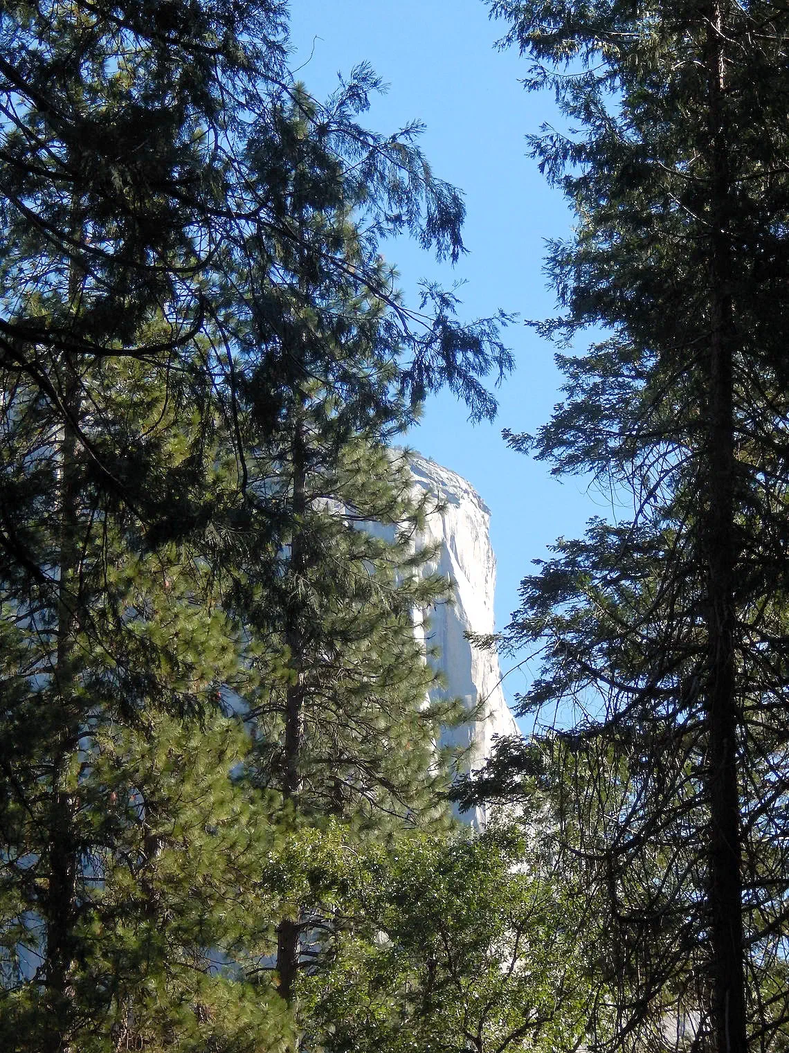 7,573 feet of El Capitan
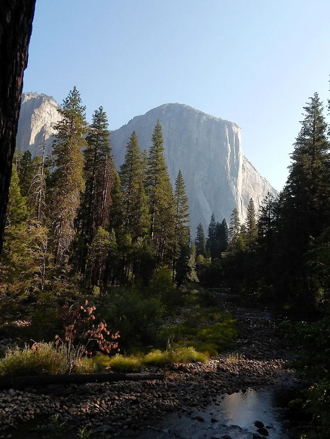 7,573 feet of El Capitan
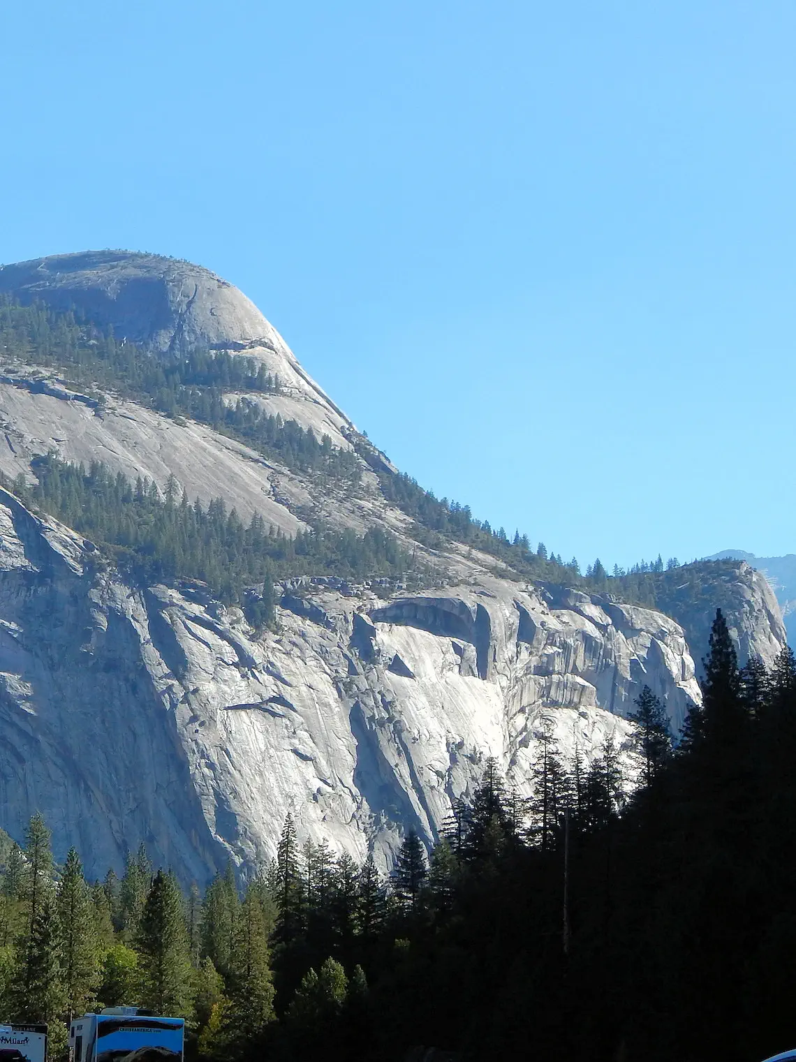 Half Dome
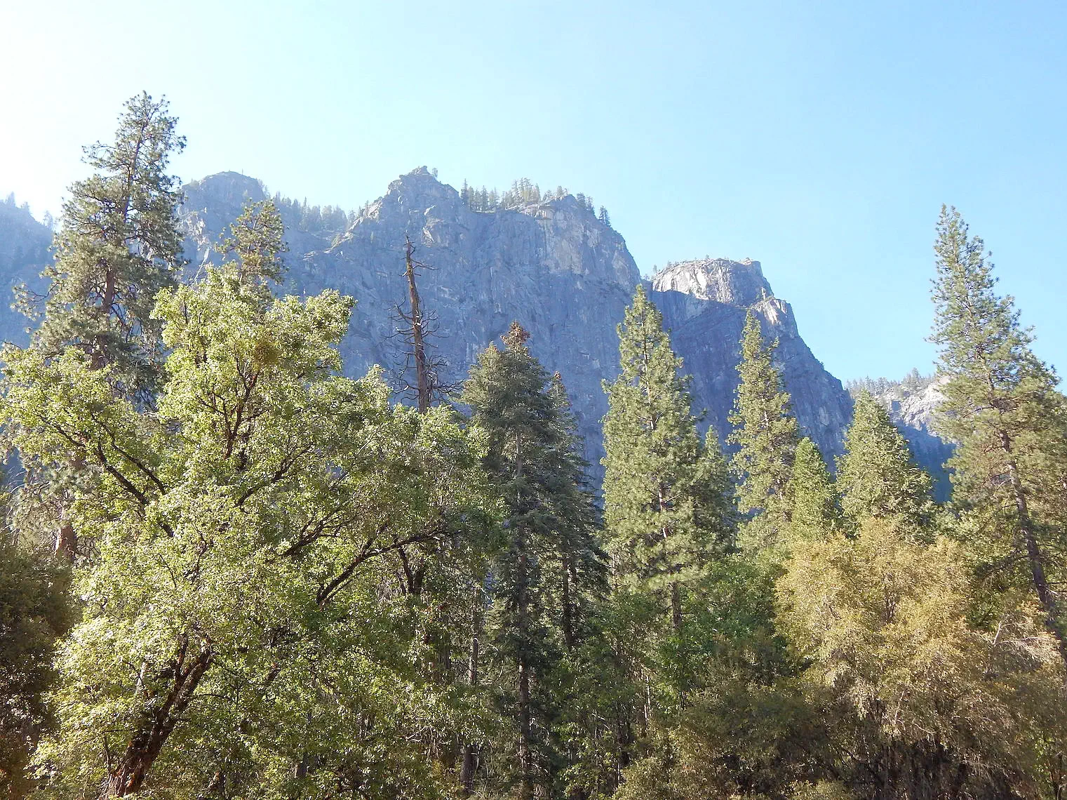
Yosemite Valley, a breathtaking centerpiece of Yosemite National Park, was sculpted by ancient glaciers over millions of years. Spanning approximately 7.5 miles in length and plunging up to 3,500 feet deep, this stunning valley represents a geological masterpiece. Although it makes up just about 1 percent of the park's total area, Yosemite Valley is the heart of visitor activity, drawing millions of people annually to its awe-inspiring landscapes.
Encircled by iconic granite peaks like the towering Half Dome and the majestic El Capitan, the valley offers unparalleled vistas that showcase nature's raw beauty and power. The granite walls of the valley rise dramatically, framing lush meadows, crystal-clear rivers, and dense forests below. These colossal rock formations are not only visually striking but are also magnets for climbers and adventurers from around the world.
The journey into Yosemite Valley itself is an experience to savor. Scenic drives, such as those along Big Oak Flat Road or Wawona Road, reveal spectacular views of these massive granite monoliths. Tunnel View, one of the most famous overlooks, provides a jaw-dropping introduction to the valley, featuring a panoramic perspective of El Capitan, Bridalveil Fall, and Half Dome, all in one frame.
There are numerous waterfalls with the biggest attraction being Yosemite falls which is the highest waterfall in North America dropping 2425 feet from the top to the base of the lower falls. We didn’t get to see the falls because it was dry when we went in September. Go earlier in the season if you want to see it in its full glory. Check out images of the falls in Yosemite here.
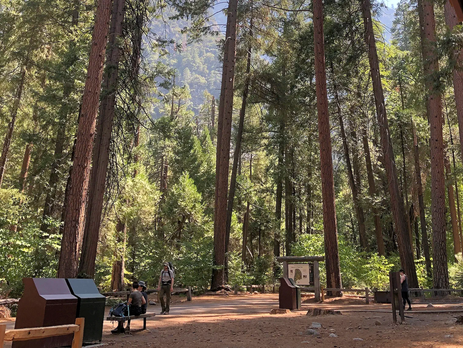 Curry Village Parking Lot
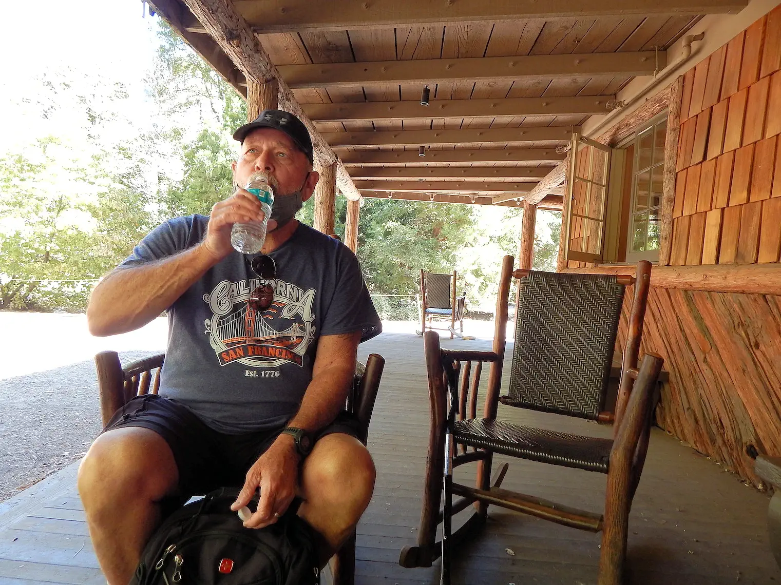 Hydrating before Mist Trail Hike
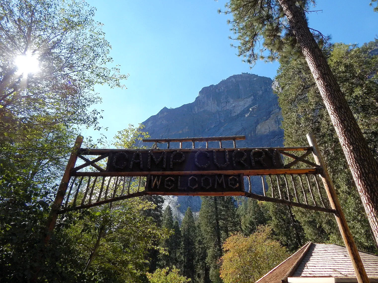 Camp Curry Welcome Sign
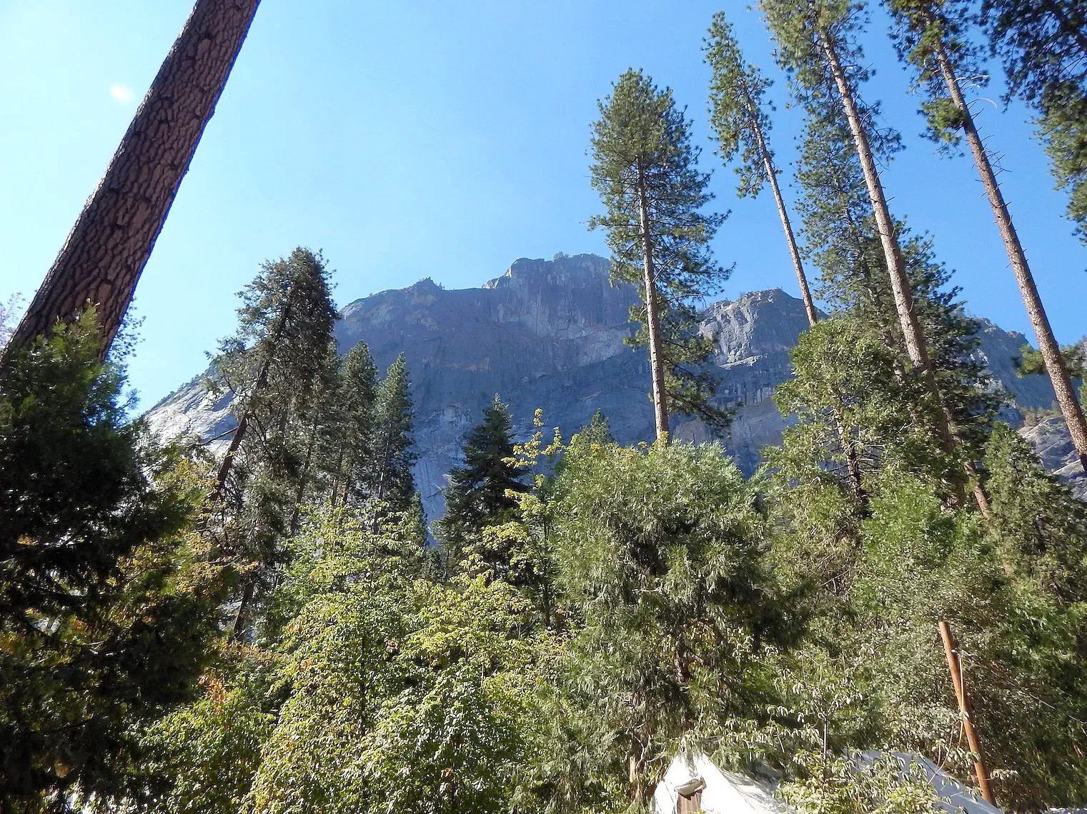 Columbia Rock from Curry Village
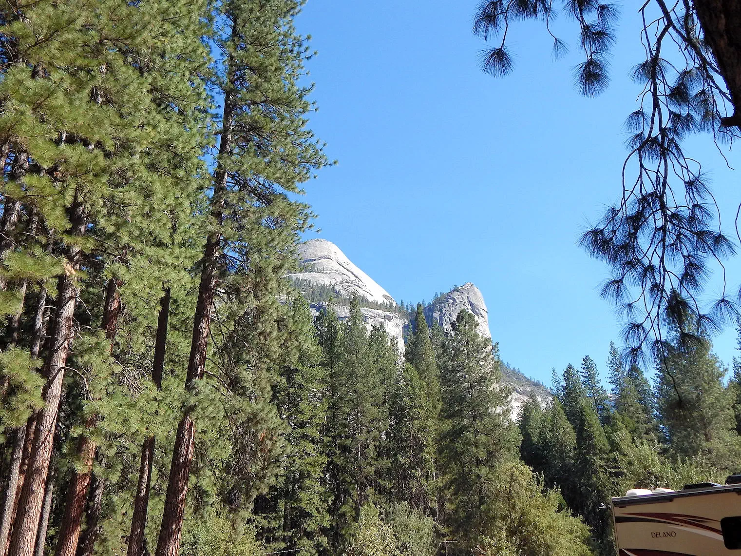 North Dome from Curry Village
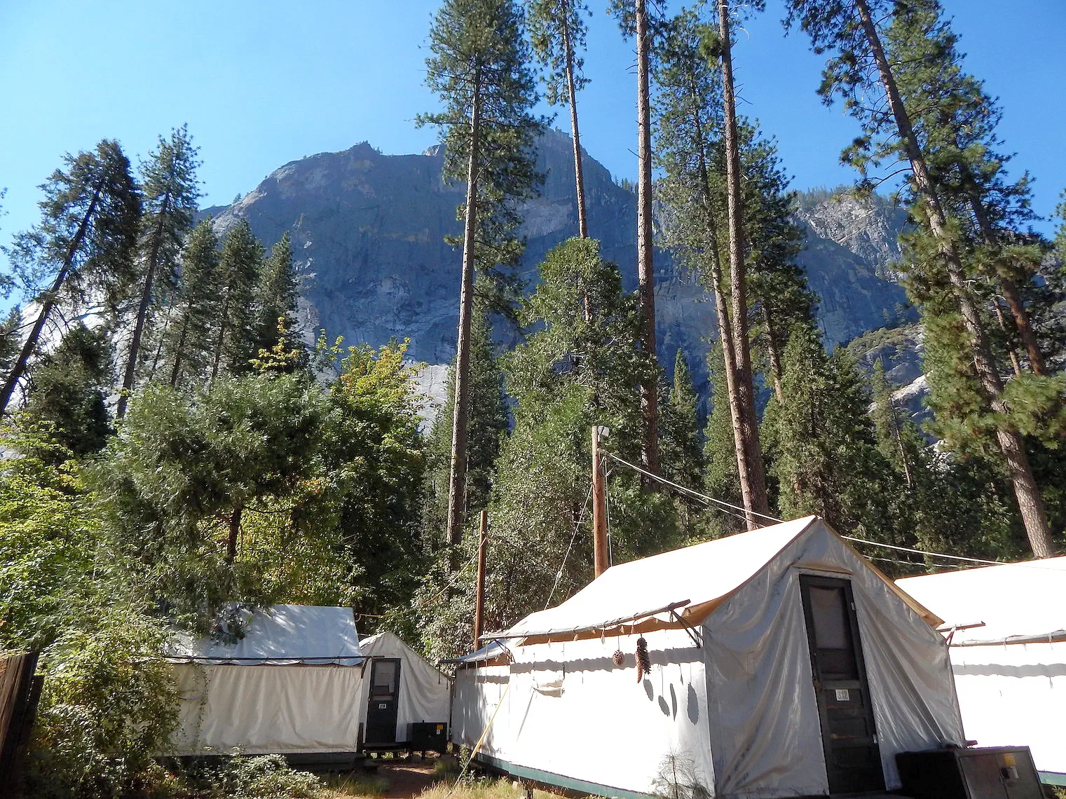 Curry Village Campground Area
Curry Village which used to be known as Half Dome Village has a good sized parking lot and is a great location to park if you want to reach the Mist Trail to Vernal Falls. You can get provisions, eat breakfast, use the rest rooms and ask questions of a Yosemite park ranger about the park and hikes and even rent bikes. Note that some of the text we ran across still mentions Half Dome village. Just remember that they are the same village.
Curry Village also features standard hotel rooms, wood cabins and canvas tent cabin accommodations. Numerous dining options and activities are available at the Village. There is a gift shop, multiple dining options, a bar, a mountaineering school, and an outdoor swimming pool on the premises. Did I forget to mention the public restrooms ? It is a nice central location for accessing numerous hikes and a great place to stay or park for the day to access sites in the valley. When the buses are running you can grab a ride and leave your car parked in the lot for the day.
More Info for Curry Village
Image Credits:
All of the above images are the property of Just Traveling Thru, LLC.
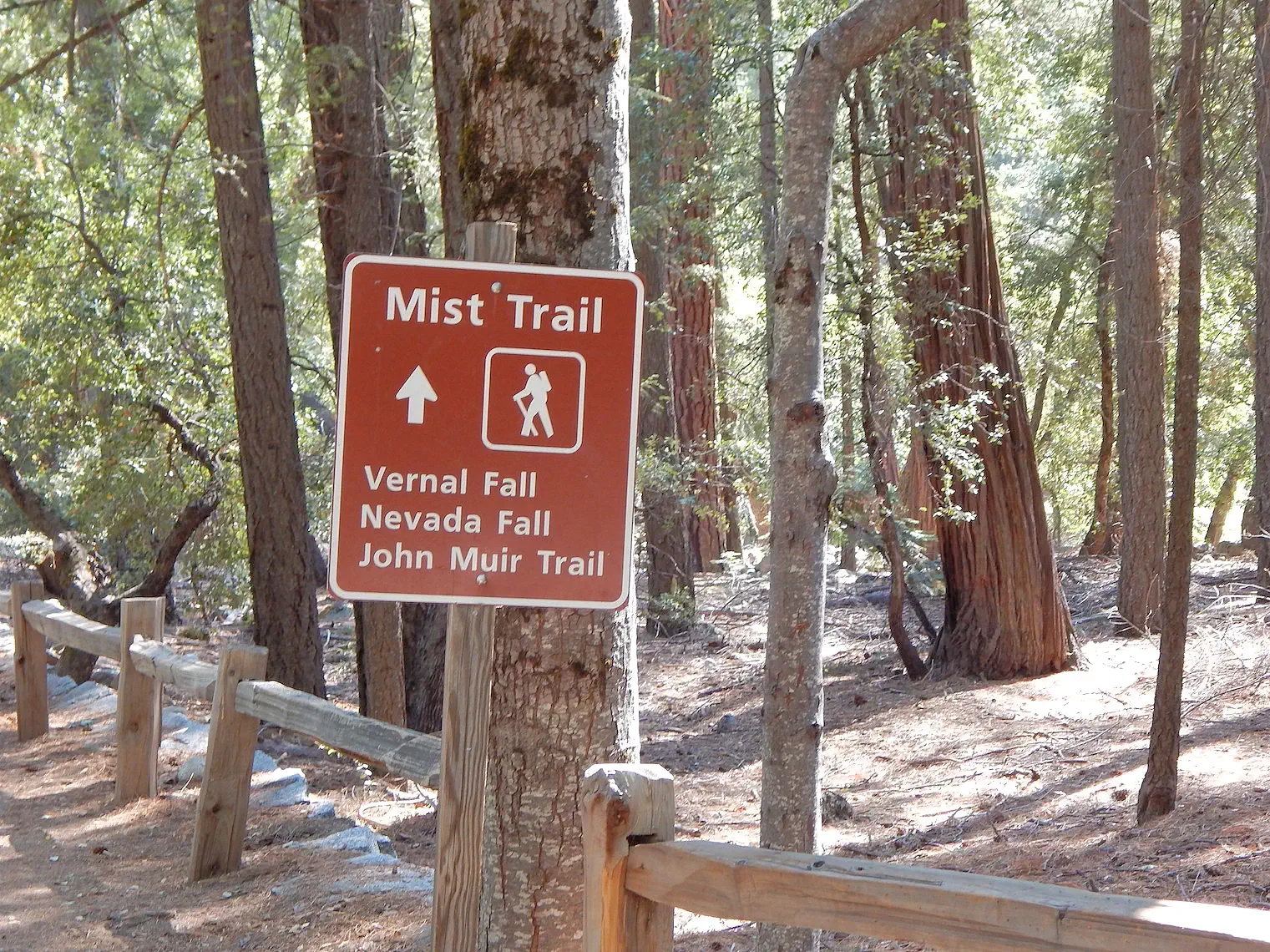 Mist Trail Trailhead
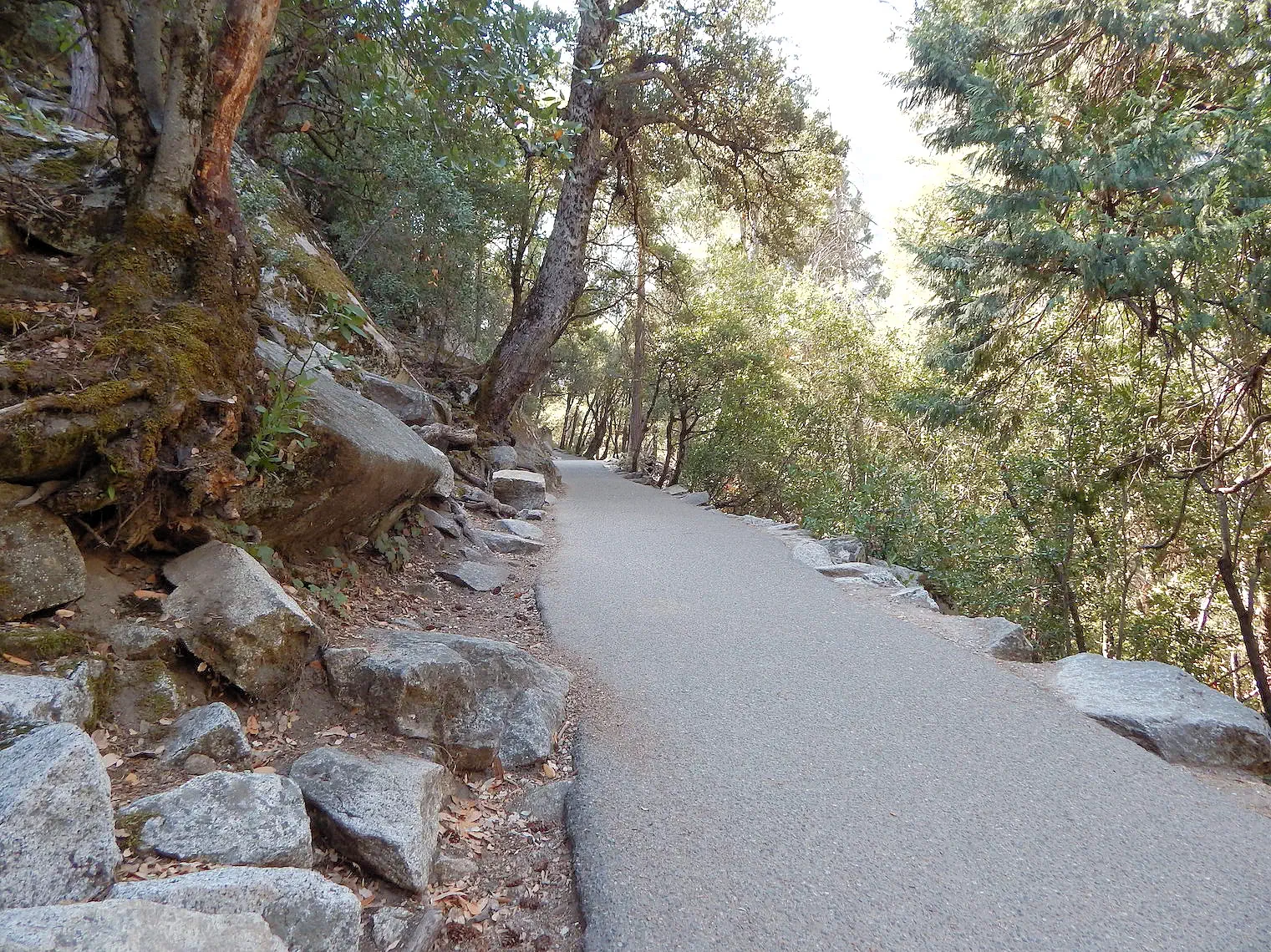 Mist Trail Ascent
 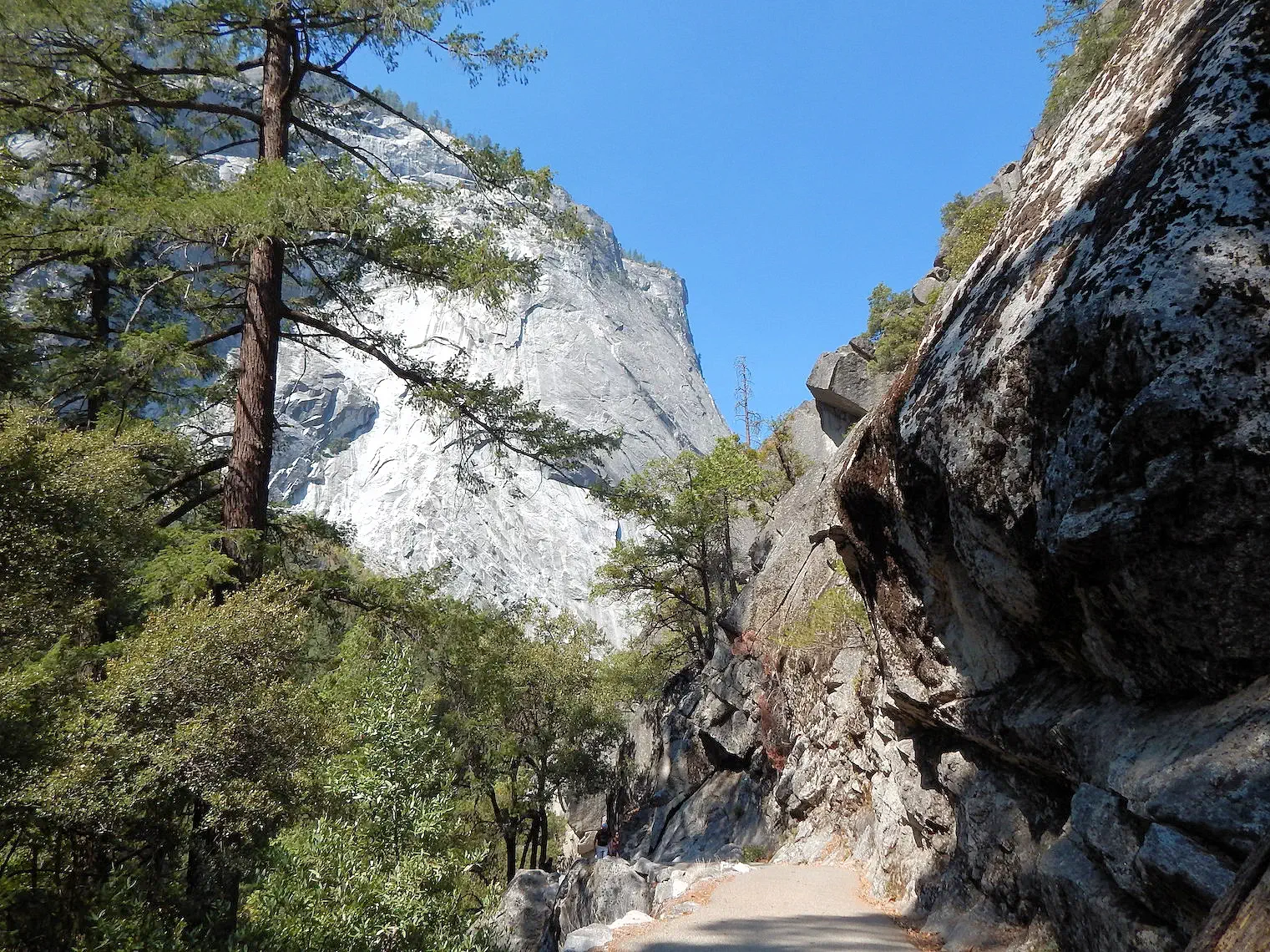 Mist Trail Ascent 1.8 Miles from Curry Village
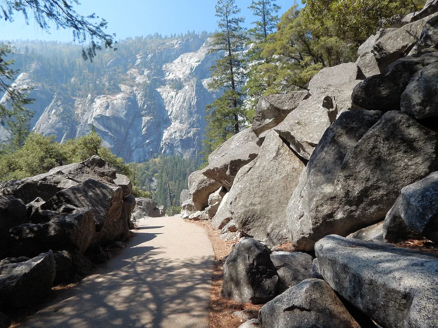 Mist Trail Elevation Gain of About 400 Feet
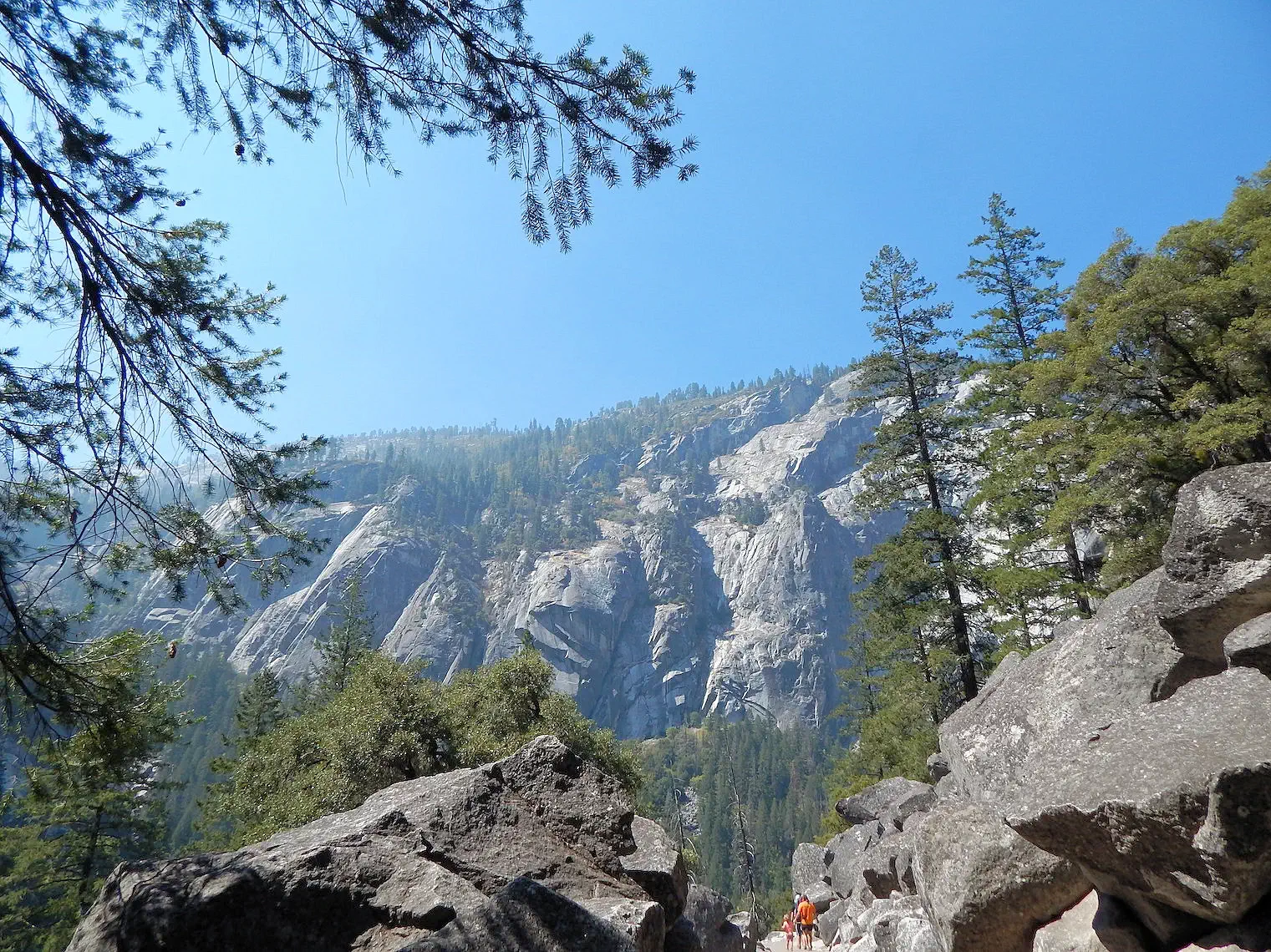 Glacier Point as seen from the Mist Trail
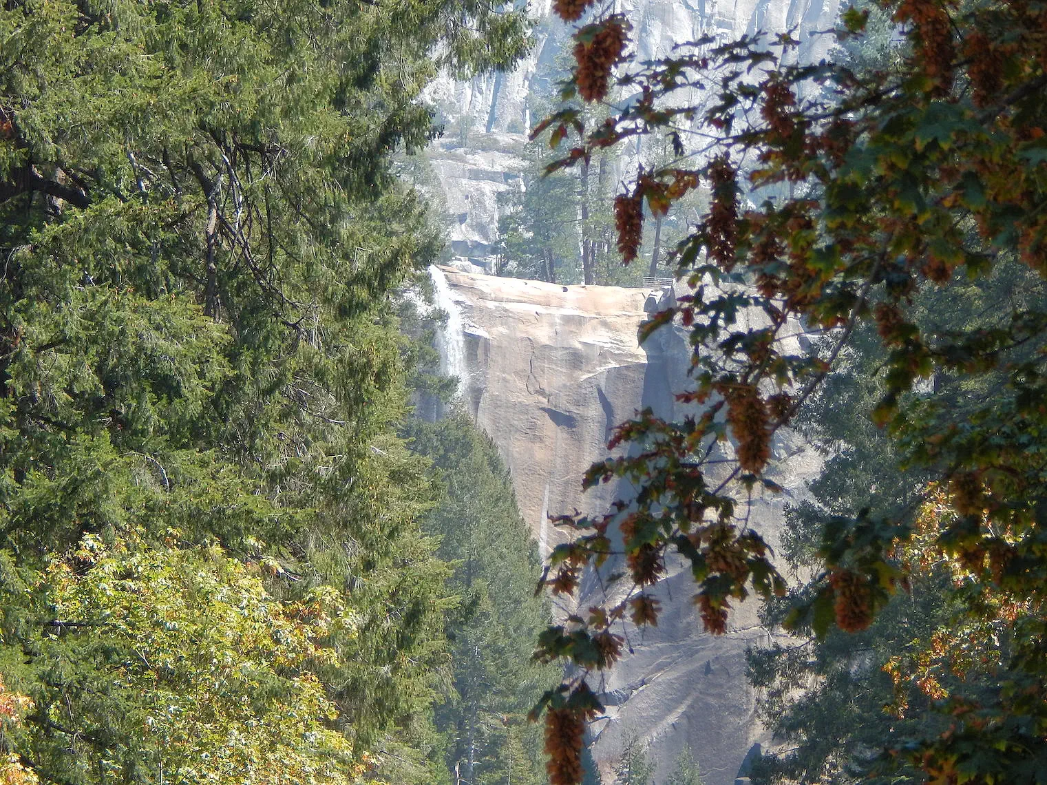 317 foot Vernal Fall Waterfall
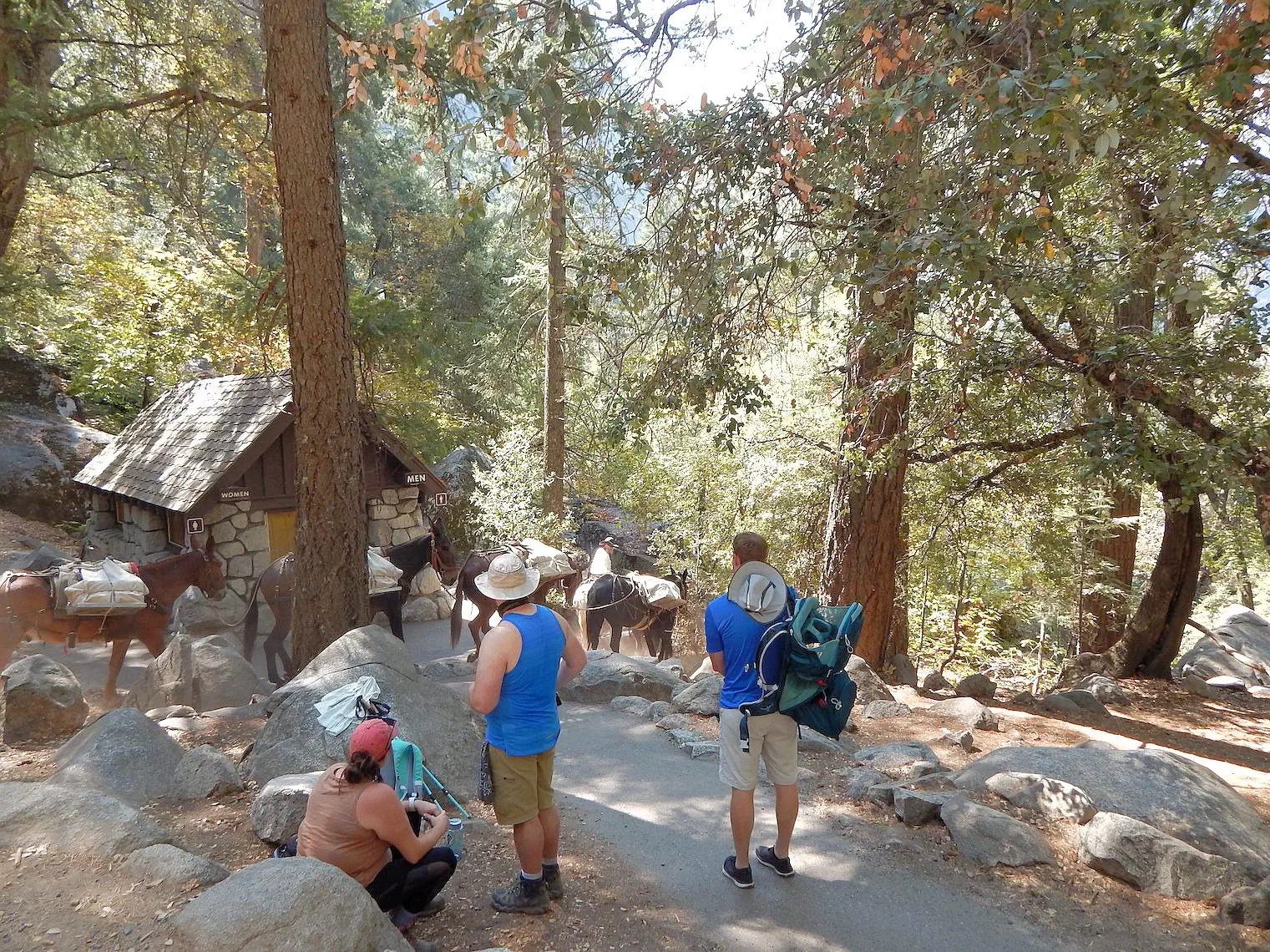 Vernal Fall Footbridge Area
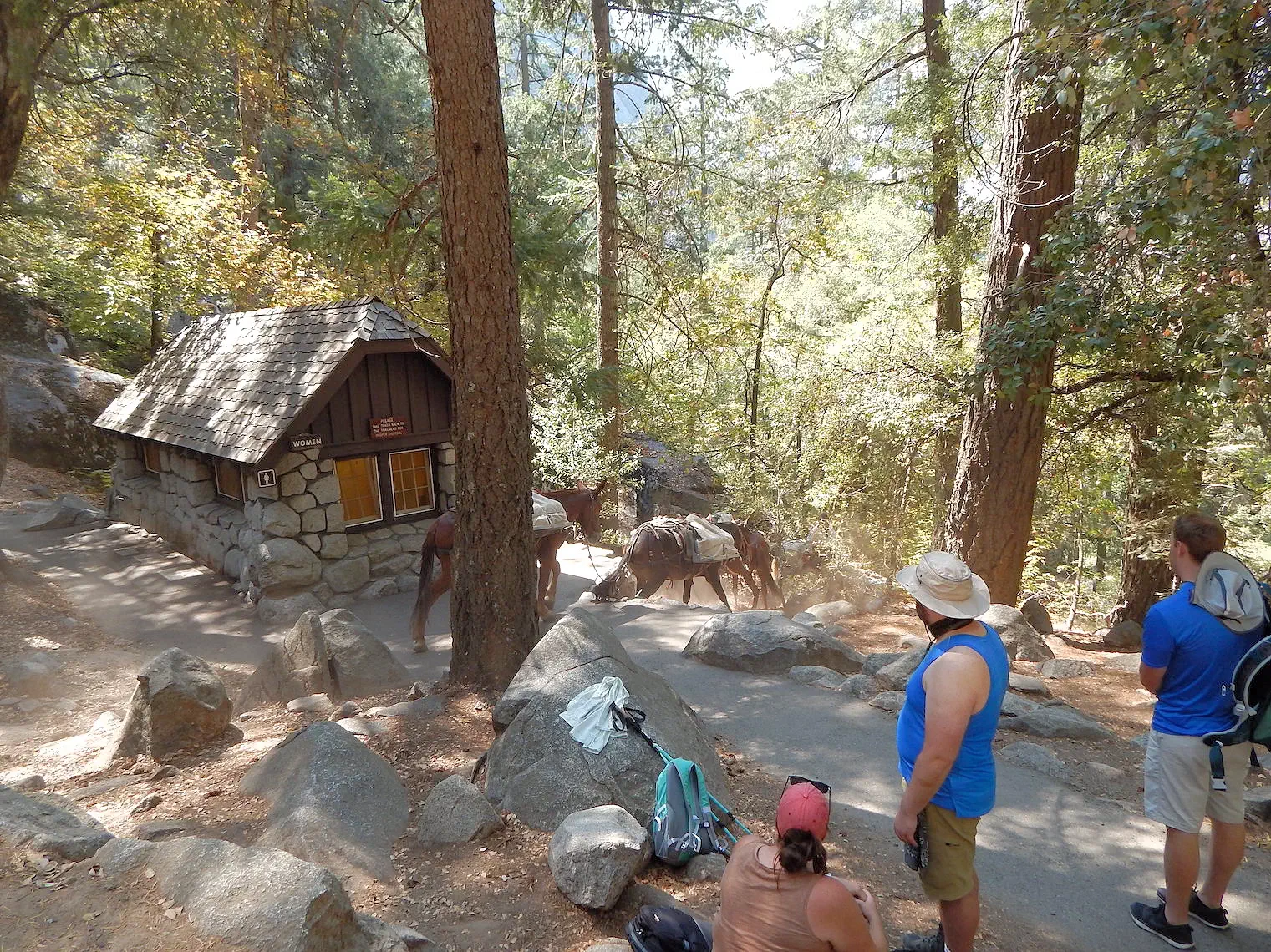 Vernal Fall Footbridge Area
 Selfie at the Vernal Fall Footbridge
The Mist Trail vertically climbs 400ft in about 1.6 miles. Along the way you are rewarded with views across Yosemite Valley and then rewarded at the top with views of the Vernal Fall Waterfall. In the spring the falls are really flowing. While we were there it was more like a trickle. visit the National Park Service page for more info.
The Vernal Falls Footbridge crosses the Merced River. The footbridge is a mile from the Mist Trail trailhead and the elevation rise is 300 feet, but neither of those numbers can make you understand how steep the trail was. Even though the difficulty rating is 4 out of 10, it certainly kicked my butt! There is a water fountain there, and you can see how everyone has decided to chill out for a few minutes. From the footbridge, the trail continues up to the top of the Vernal Falls, but since it was dry, we decided to take a break and then head back down.
WARNING: Do not jump into the Merced River, when it is "high volume" the current is very strong and you could easily be swept away!.
NOTE: See that mule-train in these images - they were hauling something back down to the bottom, but we have no idea what it was?
More Info for Mist Trail
Image Credits:
All of the above images are the property of Just Traveling Thru, LLC.
 Click above Image to view larger Google Map
As shown in this map, Rush Creek Lodge is approximately 26 miles from Glacier Point, and the road twists & turns as it descends into Yosemite Valley - so you will need to realize that there is no quick way to drive there! The views along the road to Glacier Point are non-stop fascinating, so the ride is long but enjoyable. There are a number of "picture opportunity pull-outs" along the way, take advantage of them!
 Glacier Point Reference Map
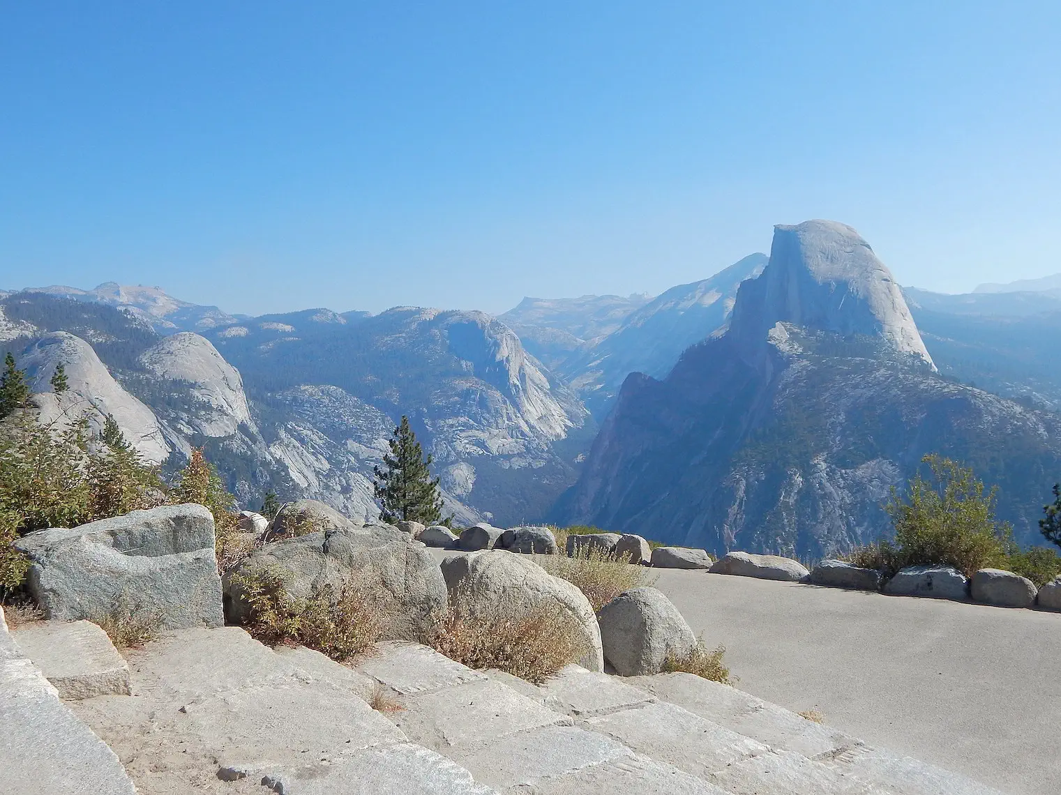 View of Half Dome from Glacier Point
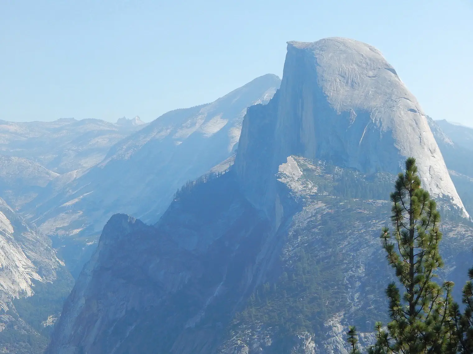 View of Half Dome from Glacier Point
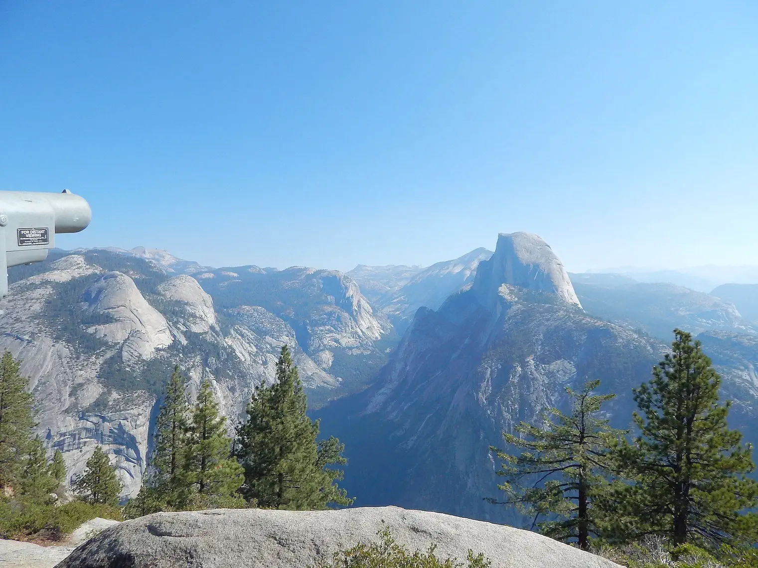 View of Half Dome from Glacier Point
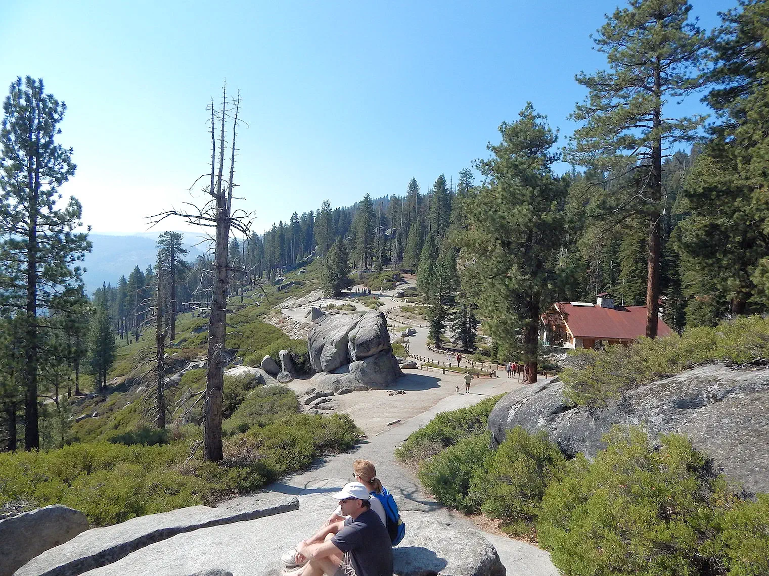 Glacier Point Visitor Center
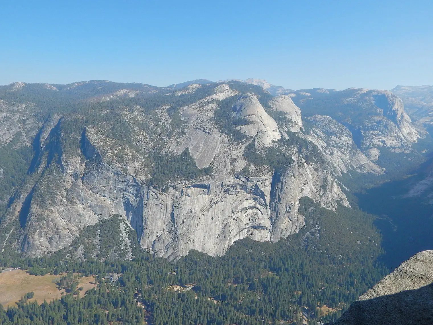 View of El Capitan from Glacier Point
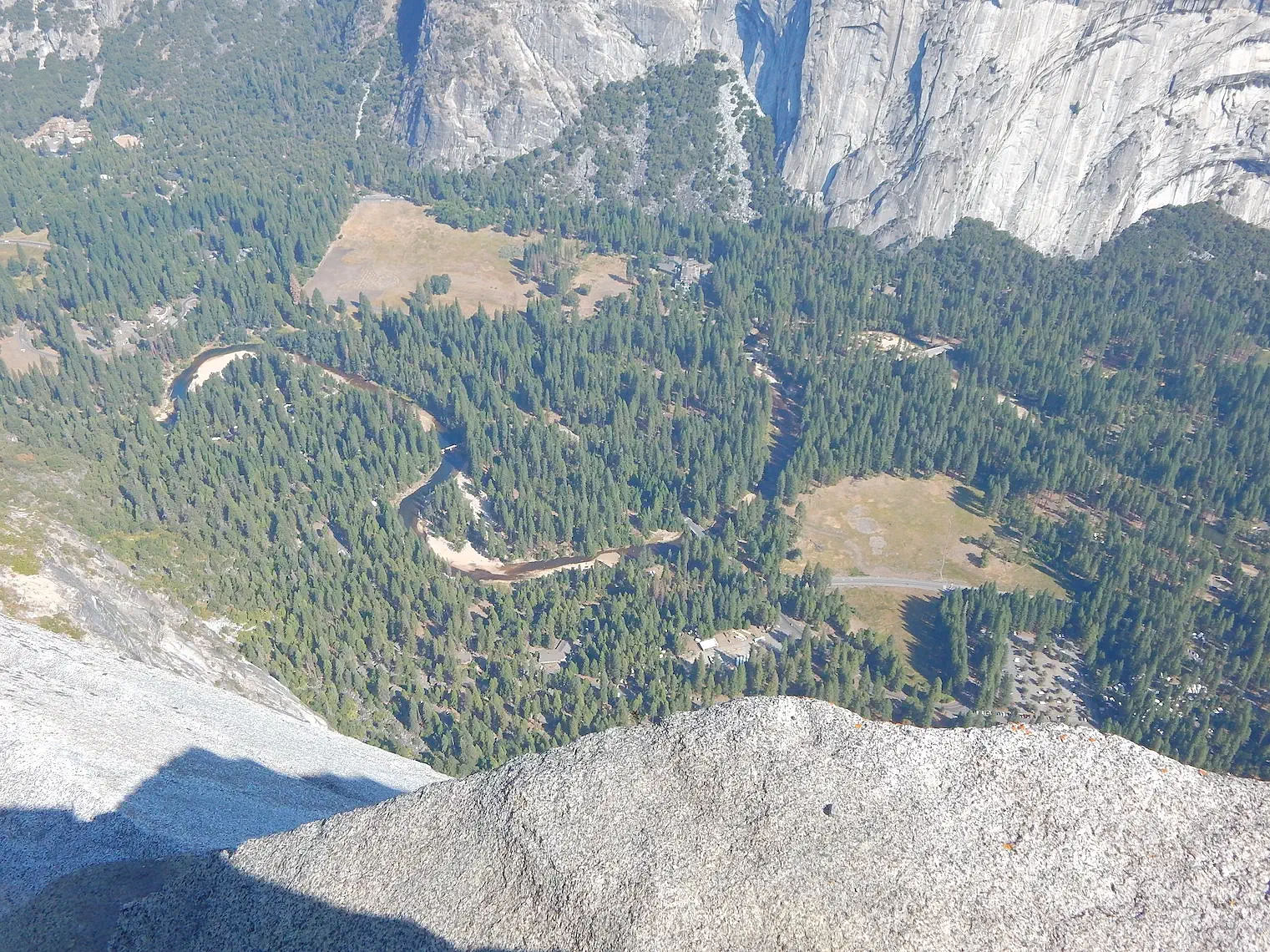 3,214 feet above Curry Village
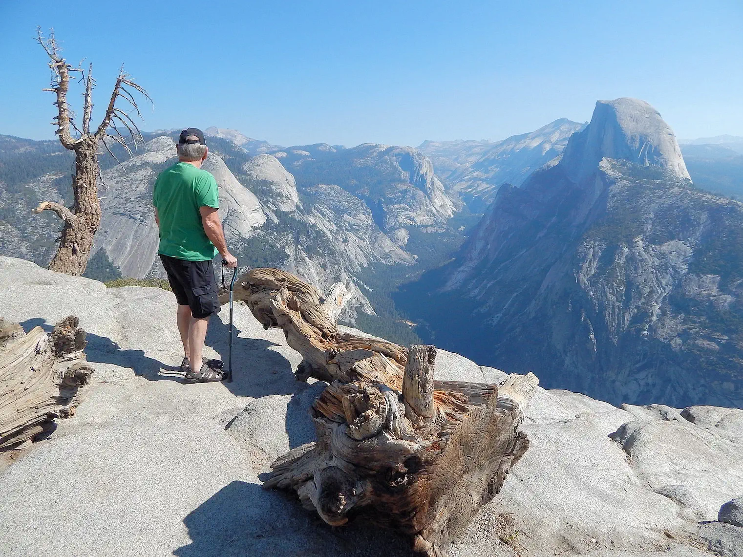 Yosemite Valley
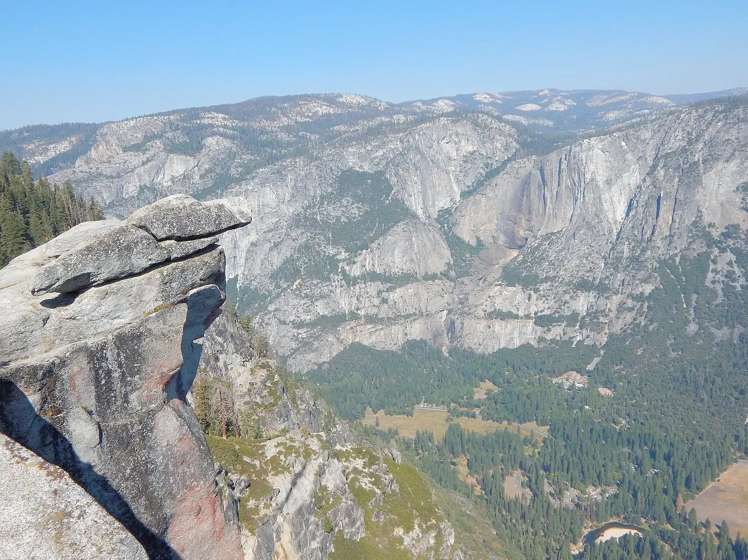 Looking West from Glacier Point
It is a 32.9 mile drive (says Google Maps) from Curry Village to the vista area of Glacier Point, however, it is only approximately 4.5 miles via the Four Mile Trail (one way). It should be noted that the National Park Service states that the Four Mile Trail is strenuous and you should be in excellent hiking condition to do this hike but it is supposed to be the ultimate Yosemite Hike.
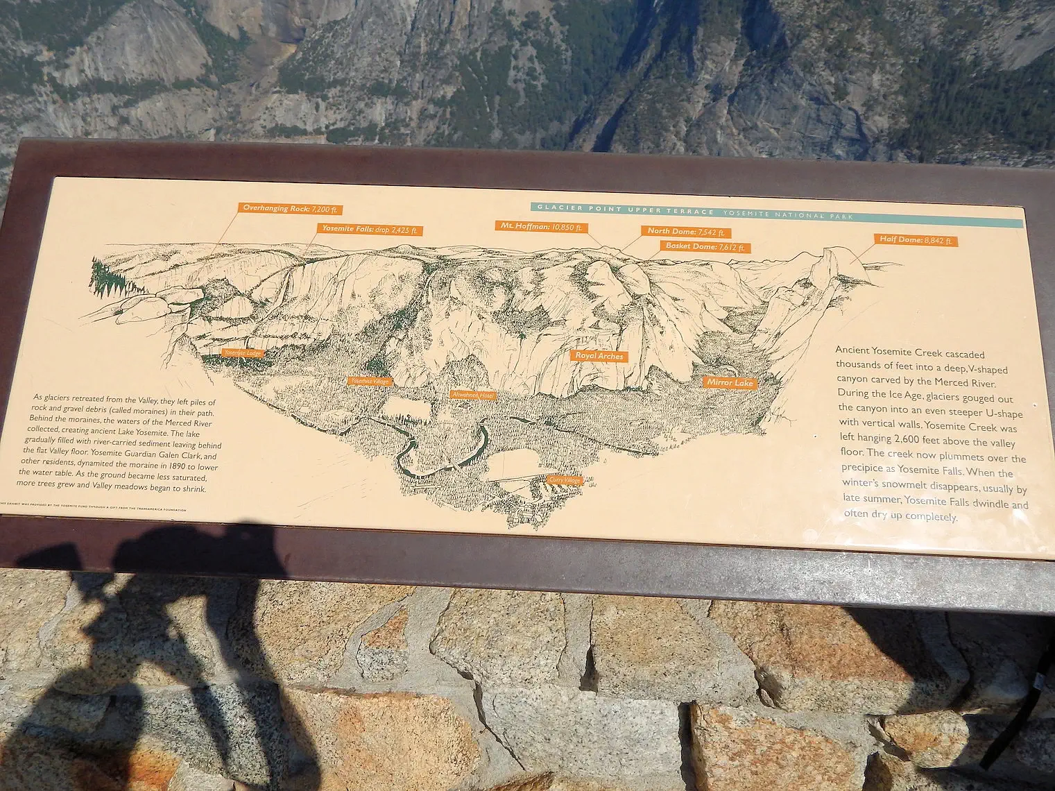
Glacier Point is located on the south wall of Yosemite Valley at an elevation of 7,214 feet, 3,200 feet above Curry Village (previously known as "Half Dome"). The point offers a superb view of several of Yosemite National Park's well-known landmarks, including Yosemite Valley, Yosemite Falls, Half Dome, Vernal Fall, Nevada Fall, and Clouds Rest. Between 1872 and 1968, it was the site of the Yosemite Firefall.
The Glacier point overlook allows you to see the entire valley and envision how glaciers formed it 2 to 3 million years ago. The USGS site provides information about the geology of Yosemite.
More Info for Glacier Point
Image Credits:
All of the above images are the property of Just Traveling Thru, LLC.
 Merced Trailhead Marker
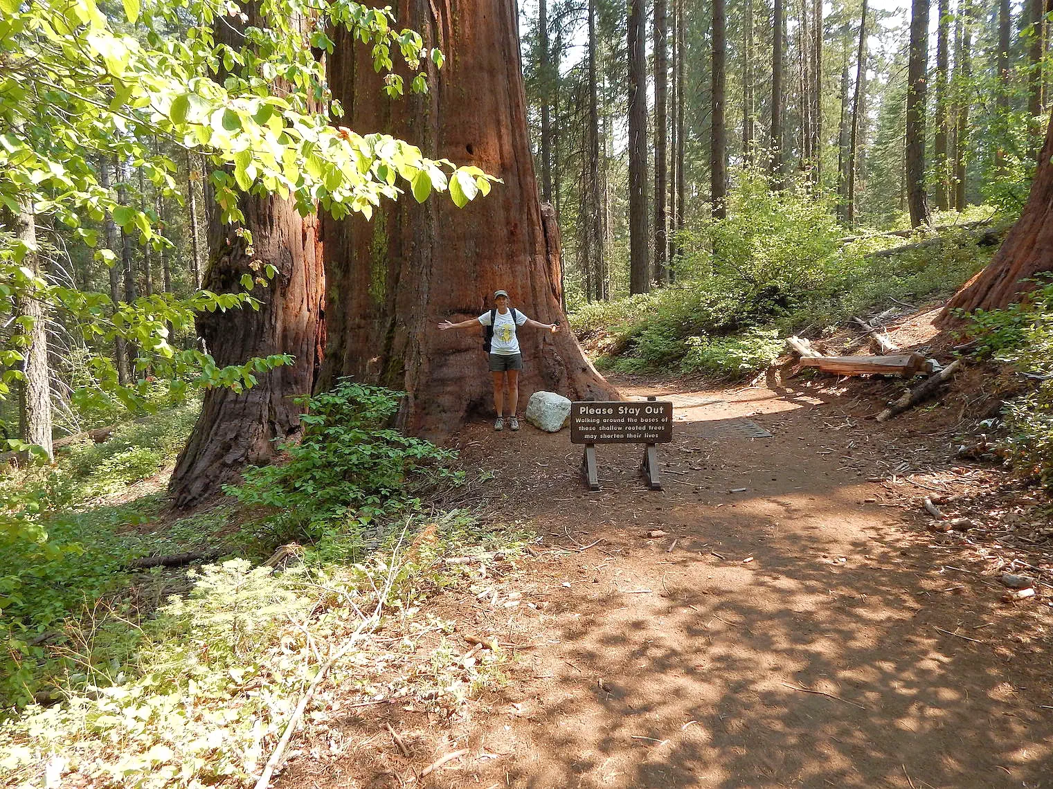 Giant Sequoias are Amazing
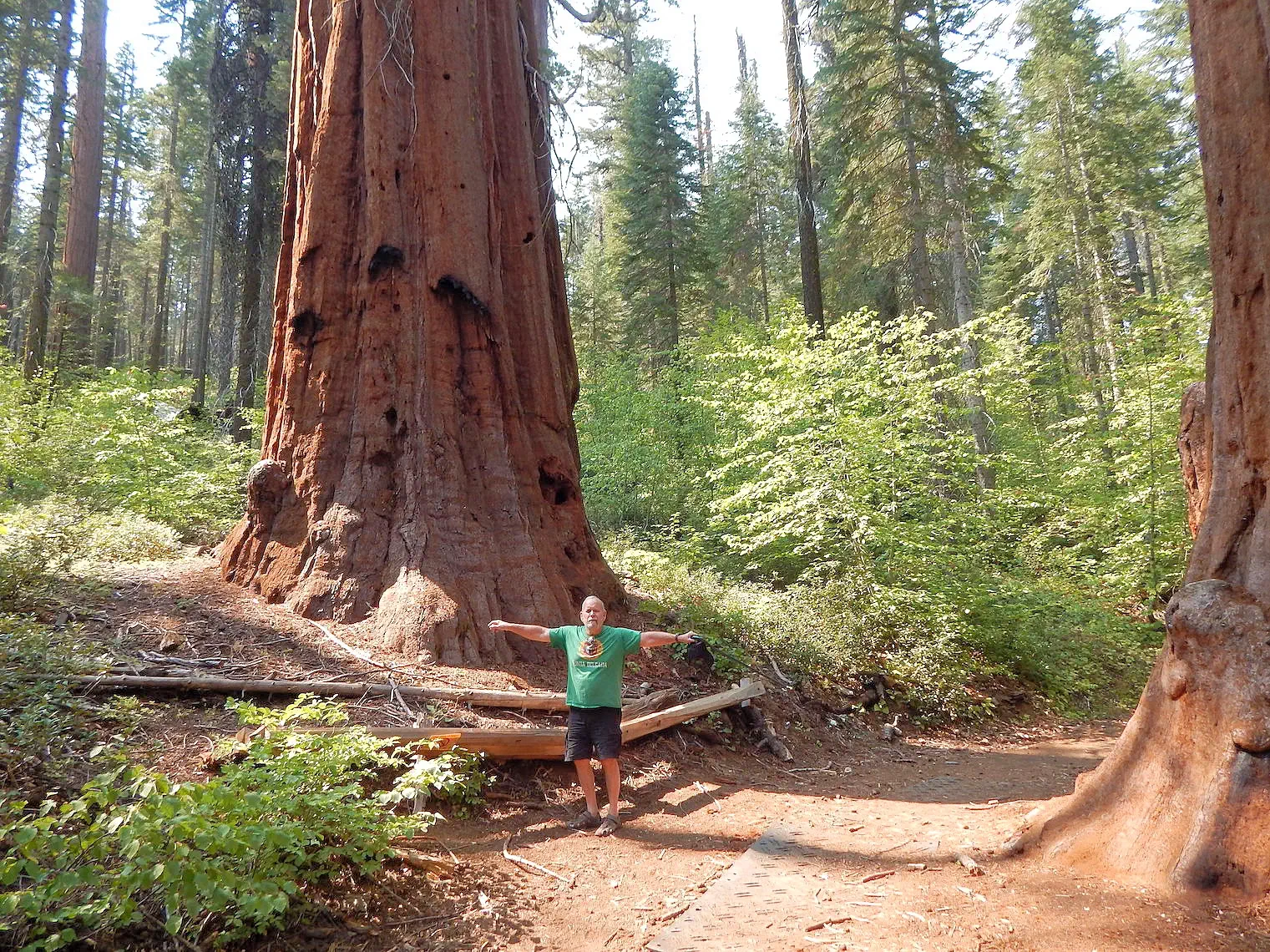 Giant Sequoias are Amazing
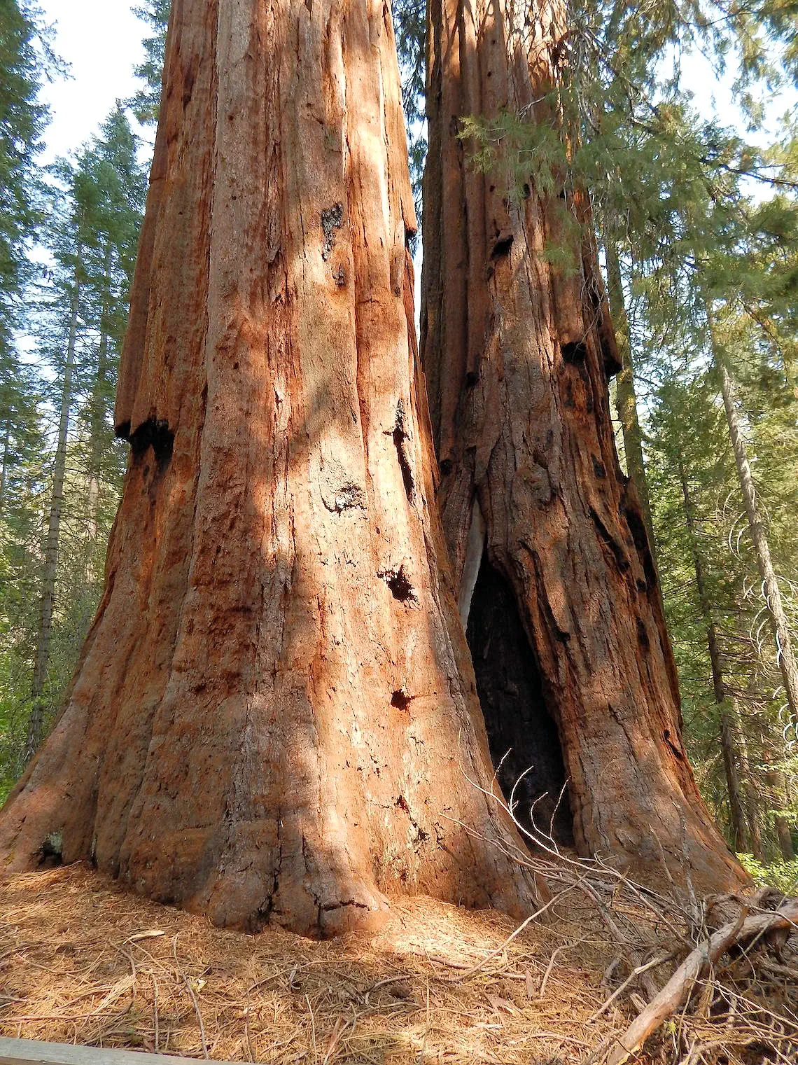 This Tree had to have been 50 or 60 feet in circumference
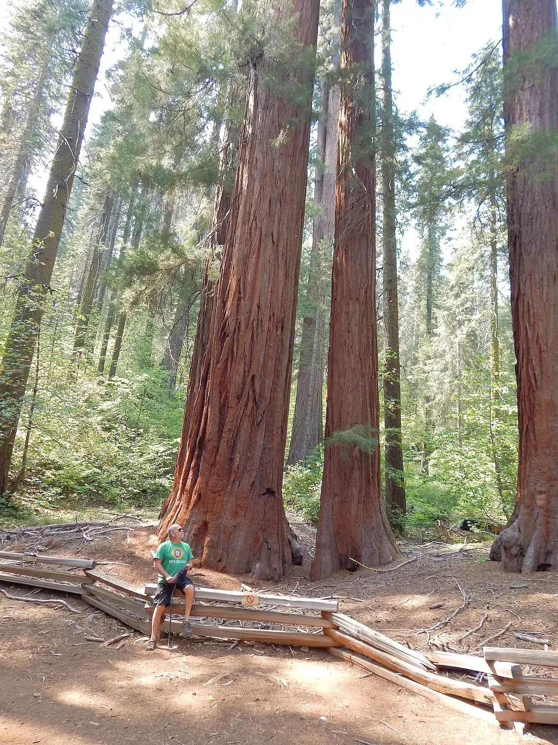 Pause to Take it all in
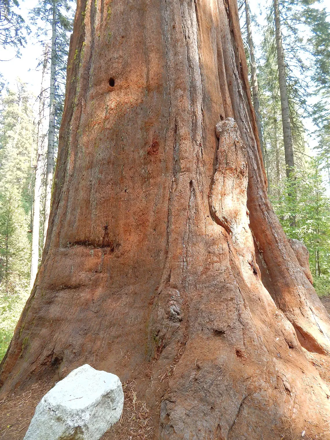 Giant Sequoias are Amazing
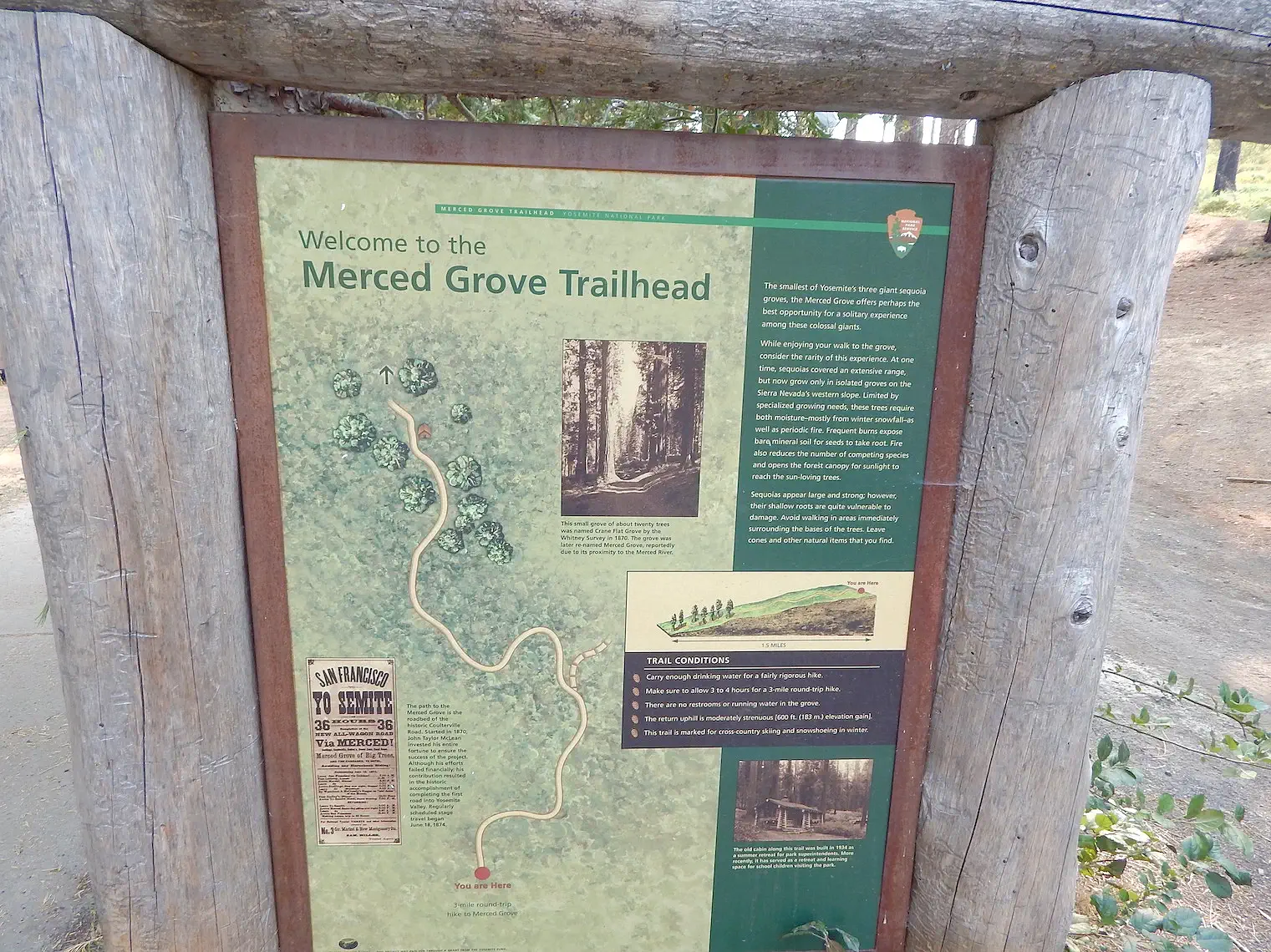
For our day 3, we chose to visit Merced Grove due to its proximity to our hotel and the fact that it was an easy hike down to see the Sequoia trees. After the previous two days we needed some relaxation and decided to spend the rest of day three hanging out at the Rush Creek Lodge and enjoying the amenities.
The hike to Merced Grove from the trailhead parking area is approximately 3 miles round trip, making it 1.5 miles each way. The trail descends about 600 feet to the grove, which means you'll encounter an uphill climb on the return journey. Hikers typically complete the round trip in 2 to 4 hours, depending on pace and time spent admiring the giant sequoias. The trail is well-marked and offers a serene experience through a forested landscape, culminating in the secluded Merced Grove, home to about 20 mature giant sequoias. Please note that the grove is temporarily closed for tree work and biomass removal, with an expected reopening towards the end of 2024.
The trail was not excessively steep, but it was certainly a continuously downhill grade with very few flat spots. The grove was impressive with about 20 large trees spread out over the last .4 km of the trail. There is a cabin that marks the end of the grove. Once you get to the cabin you know you've seen the bulk of the trees. You can sit and take a rest there before returning back. Bring water and snacks as there aren't any amenities on this trail.
The Merced Grove Trail is a remnant of the old Coulterville Road, a route used by stage coach companies in the 1800's to bring visitors to Yosemite. The Coulterville Road was the first stagecoach road (opened in June 1874) that reached the Yosemite Valley floor. Before that, the only way to get there was by horse, mule or foot along treacherous trails. In 1870, the Coulterville and Yosemite Turnpike company was organized by Mariposa County citizens that lived on the north side of the Merced River and near Coulterville to build a wagon road from Bower Cave to the western boundary of the Yosemite Valley Grant. Remember, this was long before Yosemite National Park was created.
The above information came from the Wikipedia Article about the Merced Grove.
All of the above images (unless otherwise noted) are the property of Just Traveling Thru, LLC.
Plan Your Visit Travel Resources — Maps, Parking, Passes & Links
As of 2025, Yosemite’s NPS pages indicate you do not need an entrance reservation to drive into the park. Always check the official page before you go in case temporary peak-hours systems return. See “Permits & Reservations” for the latest.
They open seasonally, usually late spring to fall, but exact dates vary with snowpack and repairs. Check the Tioga & Glacier Point status page for current info.
Yosemite Valley shuttles are free, typically running daily with frequent service; no ticket required. See the shuttle page for hours and stop maps.
Yes. A permit is required when the cables are up (lotteries via Recreation.gov). Backpackers also need a Half Dome add-on in addition to a wilderness permit.
Yes—store all food and scented items as posted. Use bear lockers in front-country areas and bear-resistant canisters in the backcountry; rentals are available in the park.
Check NPS webcams for Yosemite Valley and high-country views; use Caltrans QuickMap for state highway closures and chain controls.
Lodges and campsites both inside and outside the park book up very quickly, especially for the spring and summer. Reservations should be made well in advance through the official park concessionaire or Recreation.gov.
A permit is required to hike the Half Dome cables. They are issued via a preseason lottery and a daily lottery.
Connectivity is limited throughout most of the park.
Here is a link to AllTrails for hikes in Yosemite, they are a good source of info and you will be able to find other hiker comments, maps, etc.
Here is a link to the National Park Service page for hikes in Yosemite.
Mariposa Grove is the most visited, with other groves including Tuolumne Grove and Merced Grove.
Good parking is difficult to find in Yosemite, especially in Yosemite Valley during peak season. Arriving very early, before 8 a.m., is the best strategy for securing a spot. For more flexibility, utilize the free shuttle system or the regional YARTS bus to avoid driving inside the park entirely.
Arrive early Parking lots in Yosemite Valley often fill by mid-morning, particularly in the summer.
Use the free shuttle Once you find a spot, it's best to leave your car and use the complimentary Valleywide Shuttle to get around. This saves you from moving your car and having to find another space at each new destination.
Use YARTS For visitors staying outside the park, the Yosemite Area Regional Transportation System (YARTS) is a convenient option. The bus service brings you directly into the park and includes the park entrance fee in its fare.
Make a reservation For periods of high visitation, a peak-hours reservation may be required to enter the park. These reservations are required from 6 a.m. to 2 p.m. on specific dates.
Store food properly Keep all food and scented items in food lockers to avoid attracting bears, especially at night. Never leave food in your car overnight.
Here is a link to the Yosemite Website page where you will find a list of their webcams.
2025 Government Shutdown
Most National Parks remain open during a government shutdown, but with reduced services and staffing. Parks may be accessible, but facilities like visitor centers, campgrounds, and websites might be closed, and services like trash pickup and restroom maintenance can be significantly impacted. Visitors should check individual park websites for current conditions before going and be prepared with extra supplies and awareness that emergency services may be limited.
Gates and roads are generally open to allow access to outdoor areas.
More Info Travel Resources — Maps, Parking, Passes & Links
Note: All images featured on this page are the exclusive property of Just Traveling Thru, LLC, unless otherwise stated. When images from external sources are used, full credit is given to the original creator, along with a link to the specified license or usage terms. We are committed to respecting copyright and intellectual property rights, ensuring that all third-party images are properly attributed. If you have any questions regarding image ownership or usage rights, please feel free to contact us.
Affiliate Links: We may earn a commission if you make a purchase through one of our affiliate links. This helps support our travel content — thank you!
Content: To review any of our content, make suggestions and/or comments, please click the "About" menu link at the top of this page. You will find our "Contact Us" link on that drop-down menu.

