
by Celeste Lipford and Terry Lipford - last updated on 10/21/2025
Santa Monica was the site of my first job in the Computer Software Industry, I worked there for Scientific Data Systems (SDS) just prior to the Xerox purchase of SDS - who turned the company into Xerox Data Systems (XDS). Santa Monica had not originally been one of our "Trip Destinations", but with the fires burning in Sequoia National Park, we were forced to change our Trip Itinerary.
Due to those fires (our Three Rivers cabin reservation was cancelled due to its proximity to the fire), the opportunity arose for us to spend some time near Santa Monica (and Agoura Hills, CA), I realized that Celeste and I would be able to visit the Santa Monica Pier area, and I could show her some of my old stomping grounds.
The northern sections of the city of Santa Monica once belonged to Rancho San Vicente y Santa Monica and Rancho Boca de Santa Monica (prior to 1848 when California became a U.S. possession). The Sepulveda family sold 38,409 acres of Rancho San Vicente y Santa Monica for $54,000 in 1872 to Colonel Robert S. Baker and his wife, Arcadia Bandini de Stearns Baker. They then subdivided part of their joint holdings in 1875 and created the town of Santa Monica. The town site fronted on the ocean and was bounded on the northwest by Montana Avenue, on the southeast by Colorado Avenue and on the northeast by 26th Street. The avenues were all named after the states of the West, the streets being simply numbered. The first lots in Santa Monica were sold on July 15, 1875. Click here to read the full Wikipedia Article on Santa Monica.
By 1879, the Southern Pacific Railroad connected Santa Monica to Los Angeles, spurring development. In 1909, the famous Santa Monica Pier was built, initially serving as a municipal pier and later as an entertainment destination.
The beaches in the Santa Monica area, while naturally occurring, have been significantly modified and expanded through man-made efforts. In the early 20th century, coastal erosion and the growing popularity of beach activities led to initiatives to enhance the shoreline.
One of the largest efforts occurred in the 1930s when beach nourishment was undertaken to widen the beaches. Sand was dredged and transported from offshore or nearby coastal areas to create the expansive, wide beaches seen today. They brought in sand from the dunes that existed further south in Playa del Rey, by what is now the sprawling Los Angeles International Airport, as well as sand from the Pacific Ocean floor, and from a failed project to create a marina in Santa Monica. Millions of cubic yards of sand were brought in over time to create and maintain the beach's iconic wide shores, enhancing its appeal as a major attraction for visitors. Additionally, the construction of breakwaters and jetties helped protect the beach from erosion and maintain its new, larger size.
By the 1950s and 1960s, the Santa Monica beach areas were further developed with amenities such as piers, parking lots, and public facilities to cater to the influx of visitors. The beach along Santa Monica Bay became a more structured and managed space, designed to support recreational use while preventing coastal erosion.

If you enjoy our videos click here to subscribe to our Youtube Channel.
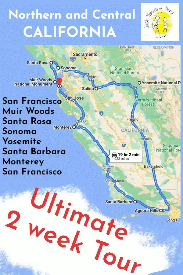
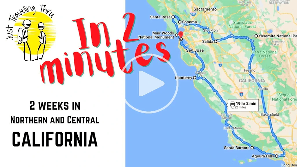
Click the above video poster image to view our California road trip which allows you to get a glimpse of San Francisco, Muir Woods, Sausalito, Napa and Sonoma, Yosemite, Santa Monica, Santa Barbara, Pacific Coast Highway, Monterey, Carmel by the Sea... We did this short video to inspire others to try it out.
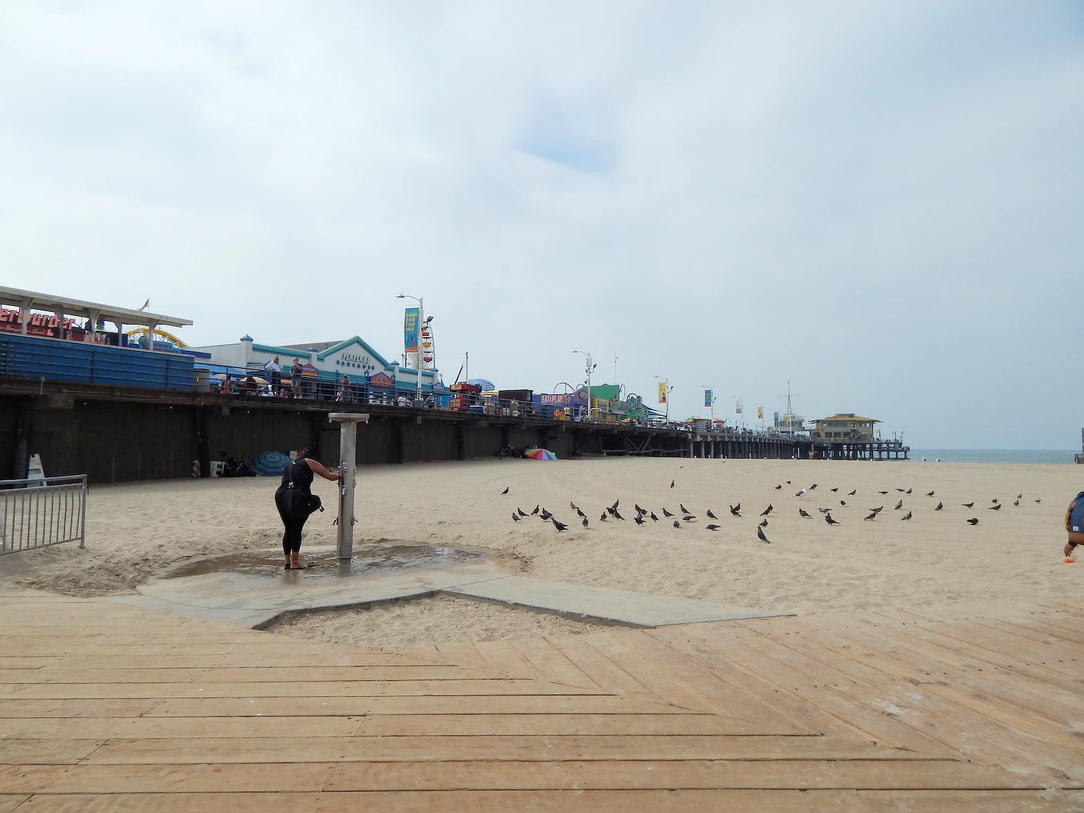 Santa Monica Pier from the Beach
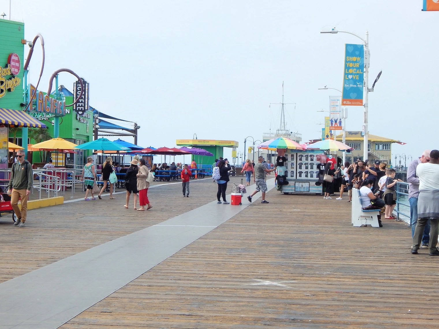 Pier Arcade Area
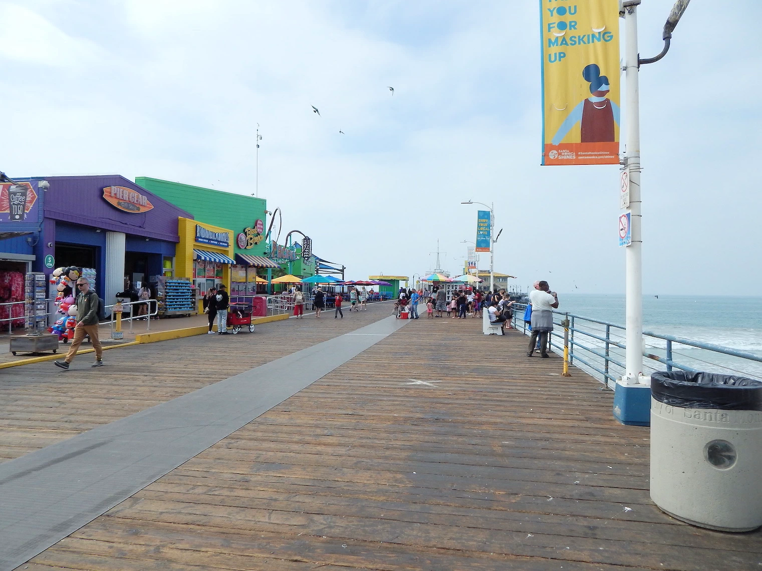 Exploring the Pacific Park
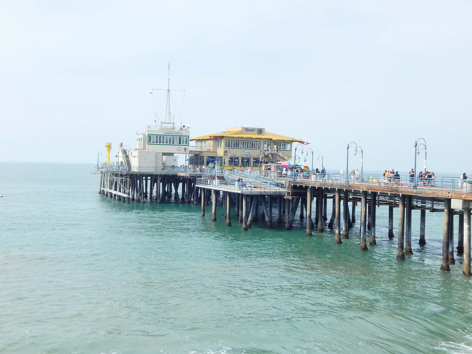 Pier View from the Pacific Park Area
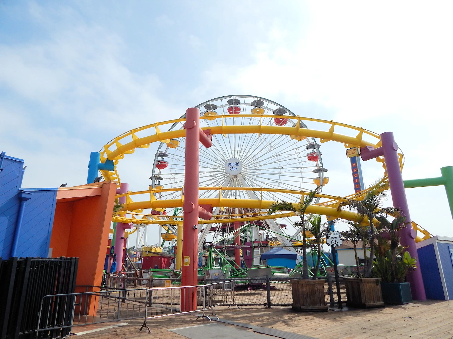 Exploring the Pacific Park
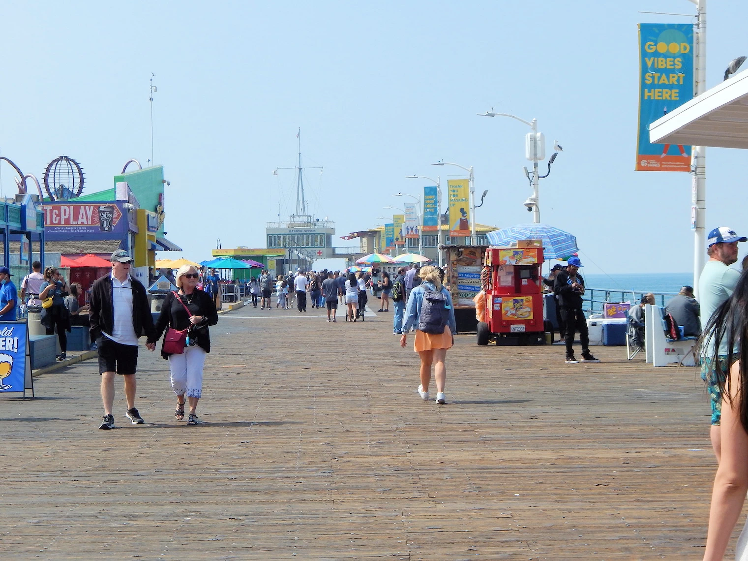 Exploring the Pacific Park
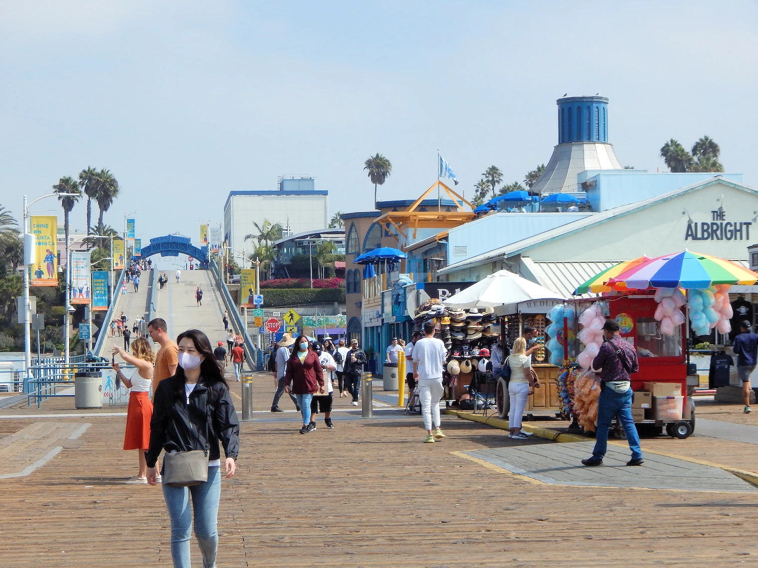 Exploring the Pacific Park
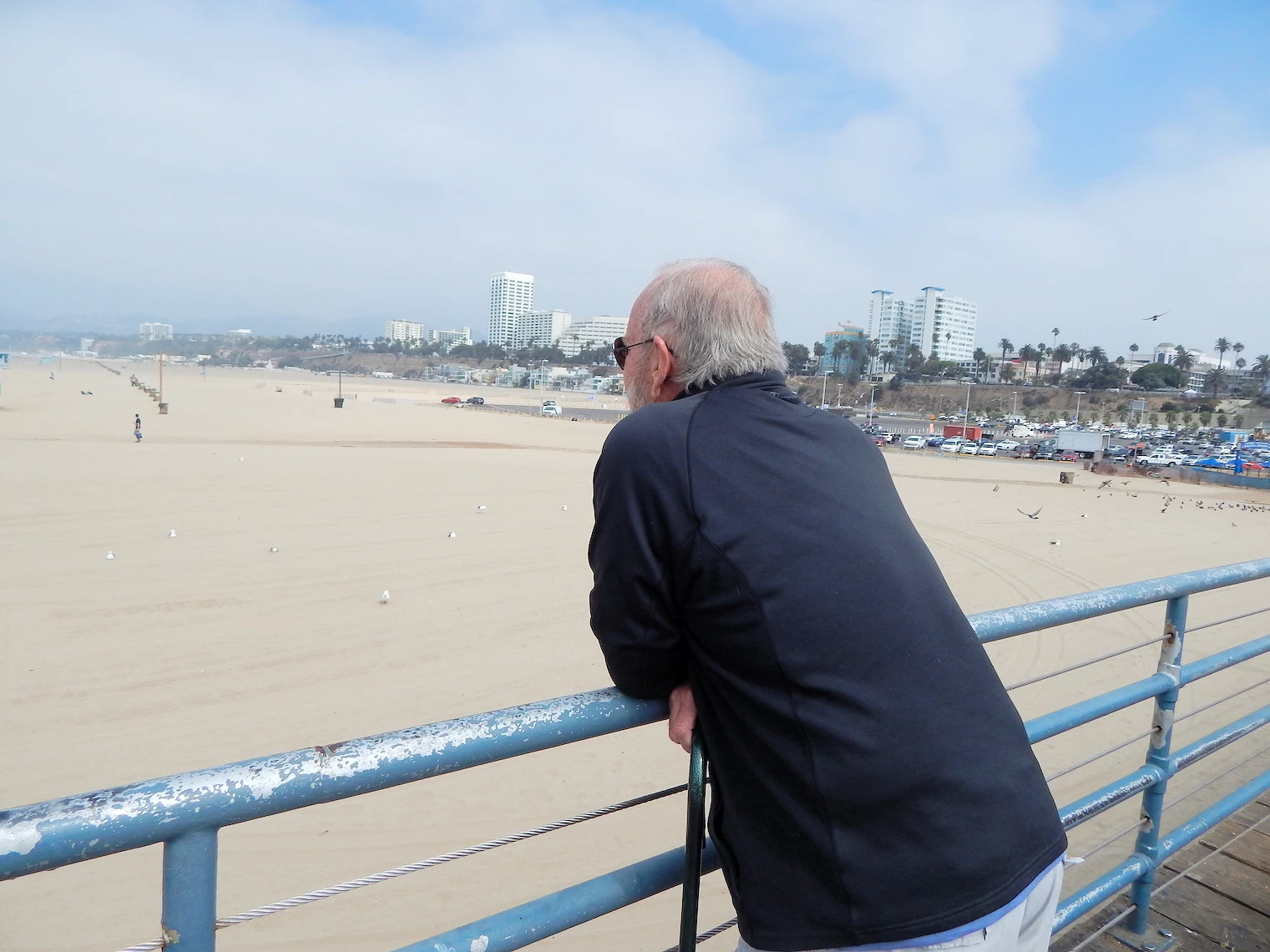 Beach Southside View
 Beach Northside View
The Santa Monica Pier opened in 1909 with the seemingly mundane purpose of sanitation. The long, narrow Municipal Pier was built to extend sewage pipes far from the shore. However, its stunning ocean views made it a popular spot for strolling and fishing. This unexpected popularity caught the eye of amusement entrepreneur Charles Looff. Looff, who built Coney Island's first carousel, saw the pier's potential and constructed his own Pleasure Pier in 1916 right next door. This pier, featuring the iconic Looff Hippodrome with its merry-go-rounds, Wurlitzer organs, and thrilling rides, became a magnet for fun seekers. The two piers eventually merged, forming the Santa Monica Pier we know today.
The pier went through various stages from those early days until the 1970's when the Santa Monica City Council slated the pier for destruction & replacement, and the citizens of the city reacted vigorously and defeated the attempt. Three of the council members were eventually defeated during elections !
In 1983 the pier was badly damaged by a storm, and the city created the Pier Restoration and Development Task Force to oversee the pier's reconstruction. The reconstruction work took until April 1990 to complete and once again, the pier was a popular destination. The pier's real revival came in 1996 with the opening of Pacific Park, the first permanent amusement park on the pier since the 1930s. Anchored by the world-famous Pacific Wheel Ferris wheel, the park brought back the spirit of fun and frivolity.
The pier now draws over four million visitors annually, and it remains a popular recreation area. As you can see in our images, the beaches on both sides of the pier are very large and are popular with swimmers & surfers alike.
When I worked in Santa Monica, we would occasionally come over to the Pier area to eat lunch, or to hang out after work. Venice Beach is only a couple of miles south of the Pier, so there were a number of places to hang out along the beach.
 Malibu Beach Parking Lot
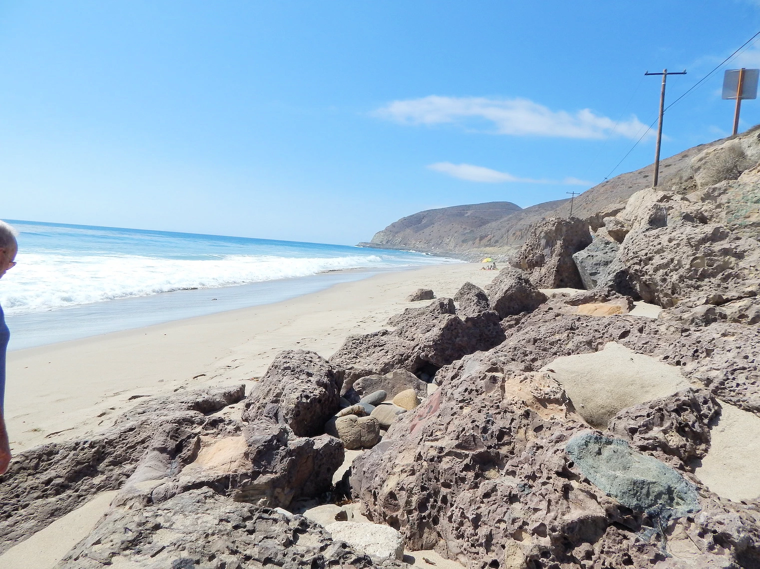 Malibu Beach
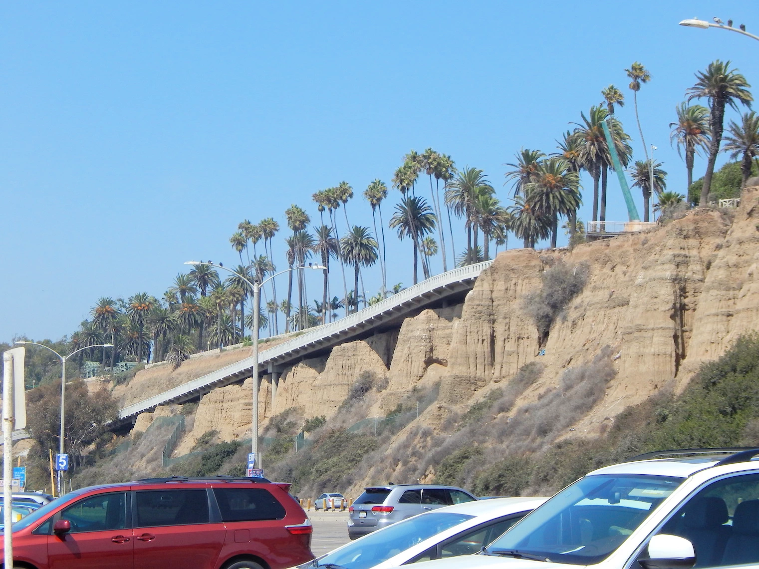
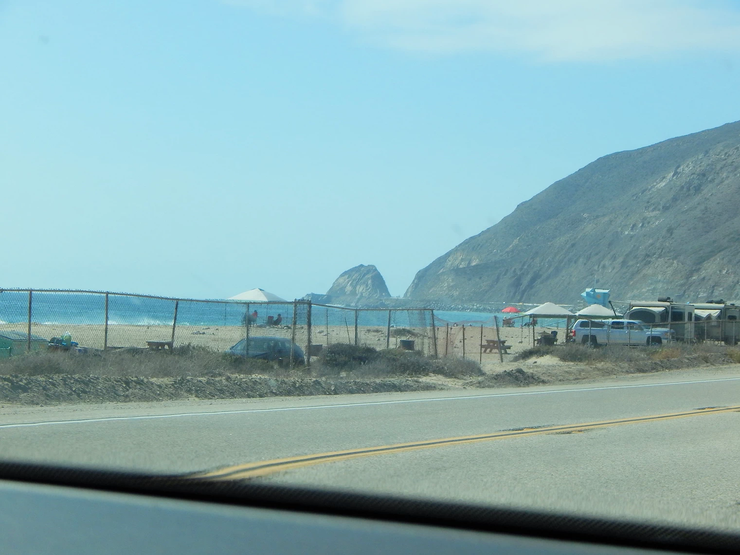 Headed North on 101
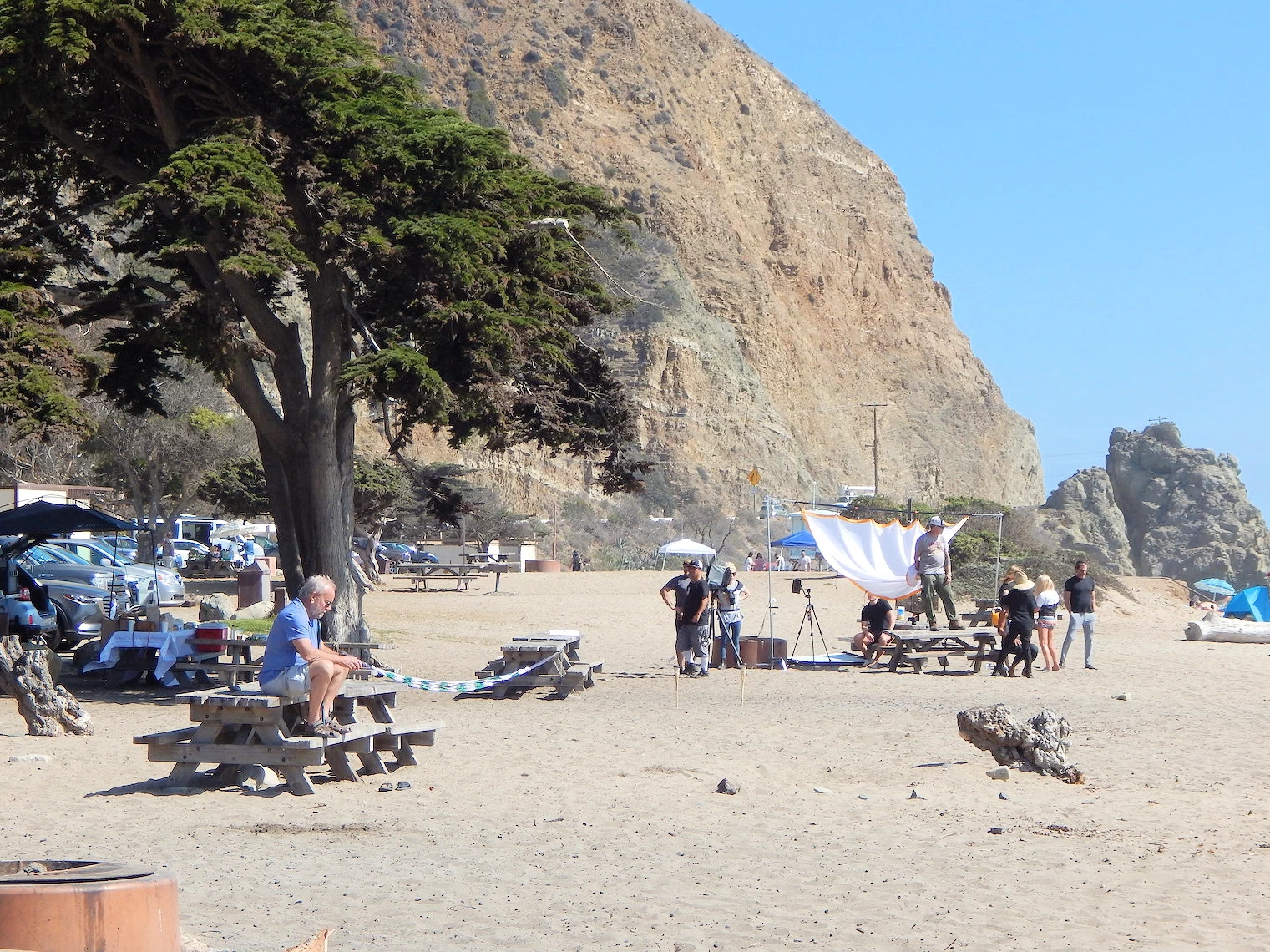 Sycamore Canyon Campground Beach
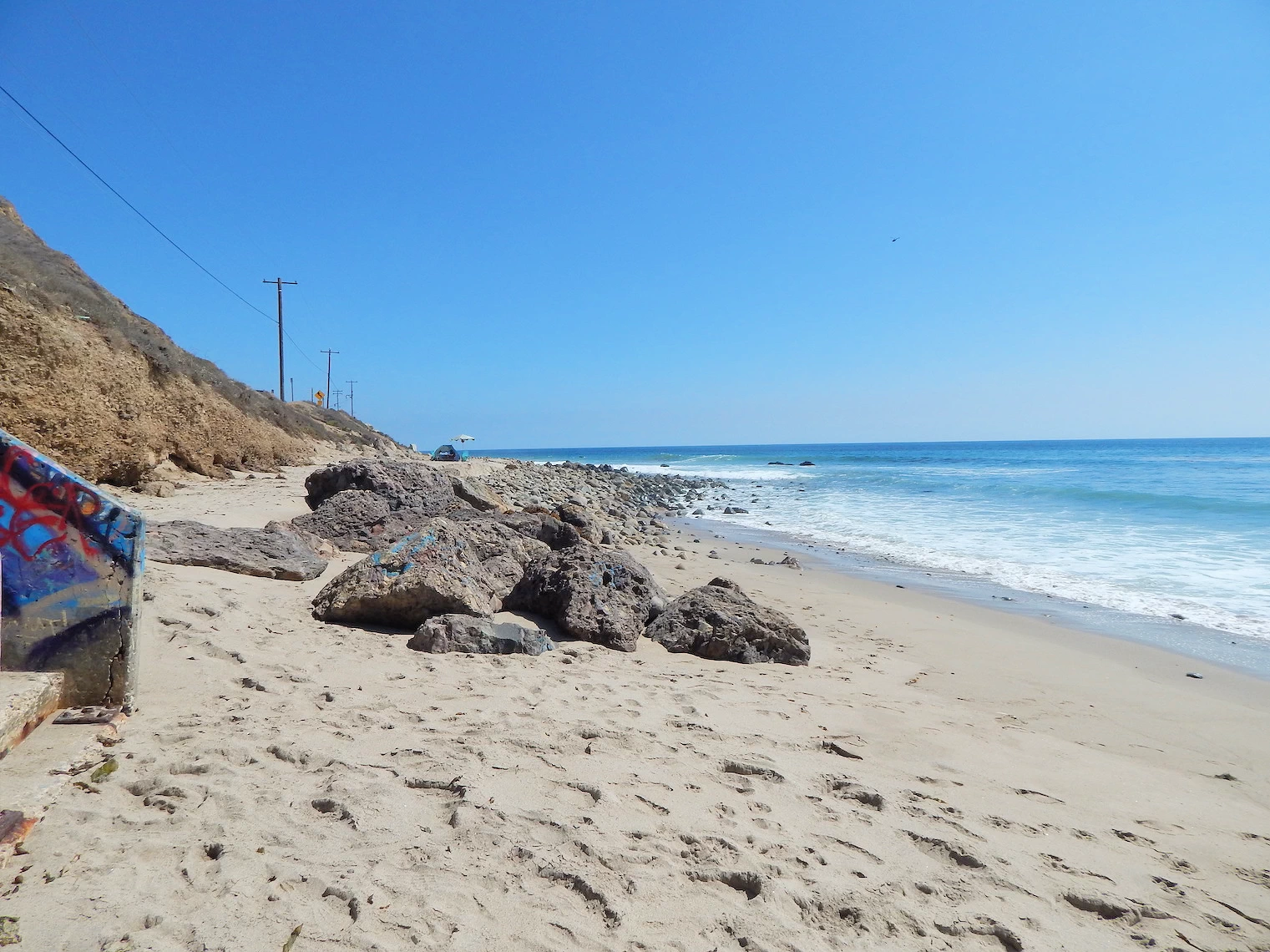 Sycamore Canyon Campground Beach
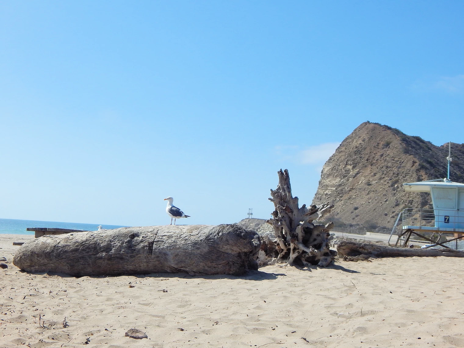 Sycamore Canyon Campground Beach
After a morning of exploring the pier & watching a bunch of kids surfing, we got back onto the highway and drove north on 101. Santa Barbara is 84 miles from the Pier and along the way we traversed Malibu Beach, which is one of the prettiest and uncrowded beaches anywhere near Los Angeles County.
As you can see in these images, we stopped at various locations along the coast for several reasons; one was that our hotel check-in in Santa Barbara was not until 3PM, and secondly was because the beaches we passed going north were just so pretty. Yet just about every beach we passed would be deserted ?
The last 3 images above were taken at Sycamore Canyon Campground, which was so pretty that we decided to stop and explore. This park is still 52 miles south of Santa Barbara, but as I pointed out previously, we had to delay our arrival in order to be able to check-in to our hotel room. Sycamore Canyon contains hiking trails and picnic spots - click here to go to the California Parks page for Sycamore Canyon Campground amenities and a full description of what you can find there.
In image # 4 above, you can see a video crew is filming either an advertisement or location scenes for some other purpose. They were busy the entire time we were there, taping, moving position and taping again.
Plan Your Visit to Santa Monica Travel Resources — Maps, Parking, Passes & Links
Parking & Peak Times
The Pier deck and beachfront lots fill on weekends and at sunset. Use Lots 1–9 North or downtown structures + a short walk; arrive early or after 6 p.m. for easier parking.
E-Line to the Beach
Skip traffic: ride LA Metro’s E Line to Downtown Santa Monica Station (≈10-minute walk to the Pier). Great on busy days and for sunset visits.
Bike the Strand
The Marvin Braude Bike Trail runs ~22 miles along the coast. Keep right, mind pedestrians near the Pier, and go early for quieter riding and softer light.
Is there an entrance fee for the pier? No, general admission to the pier is free.
What are the hours? The pier is typically open from 6 a.m. to 10 p.m., though hours for attractions, shops, and restaurants may vary. You should check their calendar to make sure that the date & time you prefer will fit their schedule. Click this link to view their calendar.
What is there to do on the pier? Attractions and activities on the Santa Monica Pier include the solar-powered Ferris wheel at Pacific Park, the Heal the Bay Aquarium, various games and arcades, dining and shopping options, and fishing. The pier also features the West Coaster roller coaster and offers opportunities to see street performers. For more details, visit Pacific Park.
Can you bring dogs on the pier? Yes, leashed dogs are permitted on the pier, but they are not allowed on the sandy beach.
Is fishing allowed? Yes, fishing is allowed on the pier without a license.
Is the Santa Monica Pier accessible? Yes, the Santa Monica Pier is wheelchair accessible, with accessible entrances, restrooms, and designated parking. For visitors with mobility issues, beach wheelchairs can be rented at the beach level from the Heal the Bay Aquarium to use on the sand.
Are there dining options on the pier? Yes, the Santa Monica Pier offers a variety of dining options, from casual fast-food spots to sit-down restaurants with ocean views, many of which specialize in fresh seafood. Here is a link to a list of dining locations on the pier.
Yes, there are approximately 28 restaurants within walking distance of the pier according to OPENTABLE.COM. Click the link to view the list.
What are the Santa Monica Beach dimensions? It is 3.5 miles (5.6 km) long and has parks, picnic areas, playgrounds, restrooms, as well as staffed lifeguard stations, the Muscle Beach, bike rentals, concessions, a few hotels, a bike path, and wooden pathways for beachgoers with disabilities. The beach's width has increased significantly over time due to beach nourishment projects, growing from 30 meters to 150 meters in the late 20th century.
Are dogs allowed on the pier or the beach? No, dogs are not allowed on the sandy beach. They are only permitted on the pier itself. Leashed dogs are allowed on the Santa Monica Pier and the surrounding boardwalks.
Can you smoke on the beach & the pier? No, smoking is prohibited on both the beach and the pier. Smoking is prohibited on the Santa Monica Pier and beaches due to a combination of public health, safety, and environmental concerns, as it is illegal in most public areas in Los Angeles. The ban aims to protect people from secondhand smoke, prevent fire hazards, and prevent litter from cigarette butts which are harmful to marine life and wildlife.
How far is Santa Monica from LAX? It is approximately 9 miles away, but travel time can be anywhere from 30 to 45 minutes, depending on traffic conditions.
How do you get around in Santa Monica? You can get around Santa Monica by using public transportation like the Metro E Line rail and Big Blue Bus, ride-sharing services like Uber, or by renting e-scooters and bikes. The city is also very walkable, with pedestrian-friendly sidewalks and dedicated bike paths, including coastal boardwalks. For free local rides within a designated zone, you can use the Circuit shuttle App.
Where can you park? The pier has multiple parking lots, including one directly on the pier and others nearby. Parking rates vary depending on the season. Click this link to view a Google Map of "parking near the Santa Monica pier".
What is the weather like? Like much of Southern California, Santa Monica is known for its mild and sunny weather throughout the year.
Yes, the Santa Monica Pier has been featured in numerous movies and TV shows, including iconic titles like "Forrest Gump," "Iron Man," "The Sting," and "Modern Family". It is a popular filming location due to its recognizable landmarks and Pacific Ocean setting. Click the link to view the complete list on IMDB.COM.
Santa Monica Looff Hippodrome: Built in 1916, this building houses the historic merry-go-round and is the oldest building on the pier. It is both a Santa Monica and a National Historic Landmark.
The Santa Monica Pier Arch: The iconic arch at the entrance to the pier was originally built in 1940 and has become one of the most photographed landmarks in the area.
The "End of the Trail" Route 66 Sign: The pier marks the official western end of the famous "Mother Road," Route 66.
Note: All images featured on this page are the exclusive property of Just Traveling Thru, LLC, unless otherwise stated. When images from external sources are used, full credit is given to the original creator, along with a link to the specified license or usage terms. We are committed to respecting copyright and intellectual property rights, ensuring that all third-party images are properly attributed. If you have any questions regarding image ownership or usage rights, please feel free to contact us.
Affiliate Links: We may earn a commission if you make a purchase through one of our affiliate links. This helps support our travel content — thank you!
Content: To review any of our content, make suggestions and/or comments, please click the "About" menu link at the top of this page. You will find our "Contact Us" link on that drop-down menu.
 Click above Image to view larger Google Map

