
by Celeste Lipford and Terry Lipford - last updated on 5/12/2025
In 2021, with COVID still shaping travel plans, we decided to explore more of the United States, embracing the beauty and diversity of domestic destinations. Northern and Central California had long been on our list—an alluring region filled with iconic landscapes, rich history, and world-class cuisine. The thought of experiencing San Francisco’s rolling hills, fresh seafood, towering redwoods, renowned wine country, the breathtaking scenery of Yosemite, and the dramatic twists and turns of the Pacific Coast Highway was simply irresistible.
California is a land of incredible contrasts, boasting the most diverse terrain in the United States. Stretching over 1,040 miles from the Mexican border to Oregon, the state offers everything from rugged coastlines and the majestic Sierra Nevada mountains to the fertile Central Valley, sun-scorched deserts, and an ideal climate for viticulture. With nine national parks—more than any other state—and 280 state parks, California is a dream destination for outdoor enthusiasts, nature lovers, and those who appreciate scenic cities, rolling hills, and picturesque coastlines. Whether you’re hiking through ancient forests, savoring fresh farm-to-table cuisine, or sipping wine with panoramic vineyard views, California promises an unforgettable experience at every turn.
We’re excited to share our two-week road trip itinerary, a carefully crafted loop that begins and ends in San Francisco. Having both visited the city before—but never together—we knew it would be the perfect starting point. Not only is San Francisco easily accessible with direct flights from Tampa, but its mild climate, breathtaking views, and vibrant food scene made it an ideal gateway to our California adventure. Escaping the sweltering heat and humidity of a Florida summer, we couldn’t wait to immerse ourselves in the crisp coastal air, explore legendary landmarks, and embark on a journey filled with unforgettable sights, flavors, and experiences.
California's overall size is 163,696 square miles (101,676,000 acres).
State Parks: ~1.6 million acres = ~2,449 square miles.
National Parks: ~13.3 million acres = ~20,782 square miles.
Water: 7,916 to 7,928 square miles of water area.
49,294,000 acres of California are part of either a National or a State Park. That represents 47.05% of the entire area of the State.
California has 280 State Parks, which is one of the largest State Park Systems in the world. Those State Parks receive over 68 million visitors every year.
California's overall size is 163,696 square miles, of which 155,959 square miles are land and 7,737 square miles are covered by water. This makes California the third largest State ranked by area size; Alaska is #1 and Texas is #2.
As of July 1, 2024, California's estimated population was approximately 39.43 million people, maintaining its status as the most populous state in the United States.
California has the highest and lowest points in the contiguous United States.
Highest Point: Mount Whitney (14,505 feet / 4,421 meters) – The tallest mountain in the contiguous United States, located in the Sierra Nevada range.
Lowest Point: Badwater Basin (-282 feet / -86 meters) – The lowest point in North America, located in Death Valley National Park.
Interestingly, these two points are only about 85 miles (137 km) apart as the crow flies, highlighting California's extreme elevation contrasts.
Death Valley is the hottest, driest AND lowest National Park in the country! Despite its morbid name, due to these extremes, a great diversity of life lives within this park.
Yes, California is the birthplace of the internet. In 1969, the first ARPANET message was sent from a UCLA site.
In 1850, California became the 31st state. Prior to its statehood, the state was an independent country for one month in 1846.
On average, California experiences over 100,000 earthquakes a year.
Yes, California contains over 300 ghost towns.
Yes, the Hyperion, a coast redwood in Redwood National Park, stands at 379.7 feet (115.7 meters).
Yes, if California were a country, its $4 trillion economy would be the world’s fifth largest.
Napa and Sonoma counties make California the 4th largest wine producer in the world.
The current top 5 are (in production order); Italy, France, Spain, United States and Argentina. California produces over 90% of all wine produced in the United States.
Early filmmakers moved to California to escape Thomas Edison's patents on movie-making equipment. The early film center was in Santa Barbara, however by the 1920s, Hollywood had better studio infrastructure and business connections, attracting major productions and overshadowing Santa Barbara’s film industry.
California is consistently the top state for film production, hosting a significant portion of projects. The number of movies and/or TV shows is a huge number, click here to view the IMDB.COM list of projects.
If you enjoy our videos click here to subscribe to our Youtube Channel.
Click the above video poster image to view our California road trip which allows you to get a glimpse of San Francisco, Muir Woods, Sausalito, Napa and Sonoma, Yosemite, Santa Monica, Santa Barbara, Pacific Coast Highway, Monterey, Carmel by the Sea... We did this short video to inspire others to try it out.
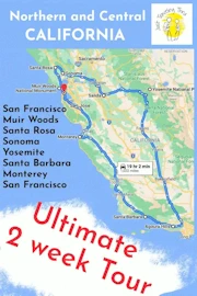
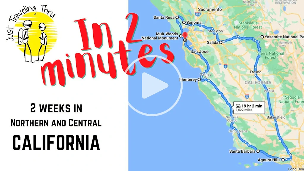
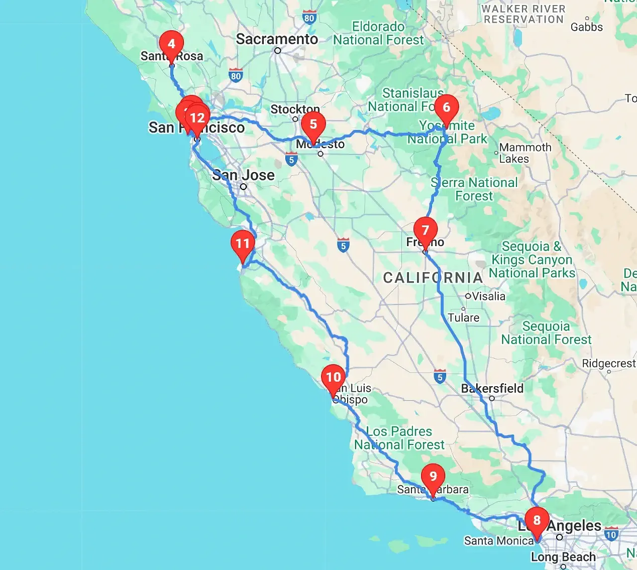 Our California Route
Base camp at the Hilton Financial District for our explorations around the city.
To explore the Bonita Point Lighthouse and Fort Baker areas.
To explore Sausalito and eat lunch.
To explore the heart of the Sonoma County Wine District.
Overnight rest stop along the way to Yosemite.
Our Yosemite Base Camp where we stayed at the Rush Creek Lodge.
Fresno, CA - this was an entertainment side stop, as we had read about this place and also wanted to get lunch.
To explore the Santa Monica Pier & beaches area.
Our base camp to explore the Santa Barbara area.
A photo stop to explore Morro Bay and Morro Rock.
To explore the Monterey Bay and Carmel by the Sea areas.
Our Route Map: Click here to view a larger Google Map of our route.
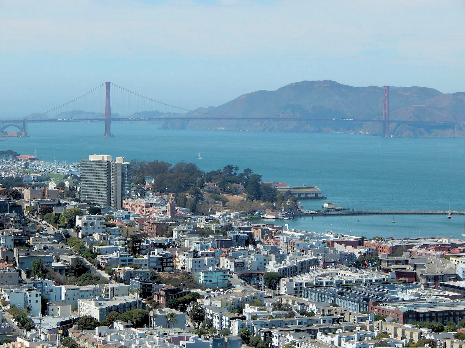 San Francisco Bay
We flew into San Francisco and our plan was to spend several days here and explore some of the sites we had not previously visited, as well as to visit an old friend of ours - and - have some good seafood. This is a photogenic city and it is easy to move about - take your pick of transportation; walking, cable cars, buses, etc.
To view our explorations there, click here to view our San Francisco page.
 San Francisco Golden Gate Bridge
We visited this area on the day we departed San Francisco, and since we started the drive north to Santa Rosa early in the day, we decided to visit an area on the north side of the Golden Gate Bridge that is not widely known. The Bonita Point area has previously been an Army Coastal Defense Artillery station and later was a missile base (and is now just an old Light House). The north side of the Golden Gate Bridge is adjacent to the Fort Baker area, and the route into Sausalito is just beyond.
We completed this phase of the trip with lunch in Sausalito, in a deli that serves excellent food (the "Venice Gourmet Delicatessen"). They provide sidewalk seating and a beautiful view of the Sausalito Bay.
To view how cool it is there, click here to view our Bonita Point & Sausalito page.
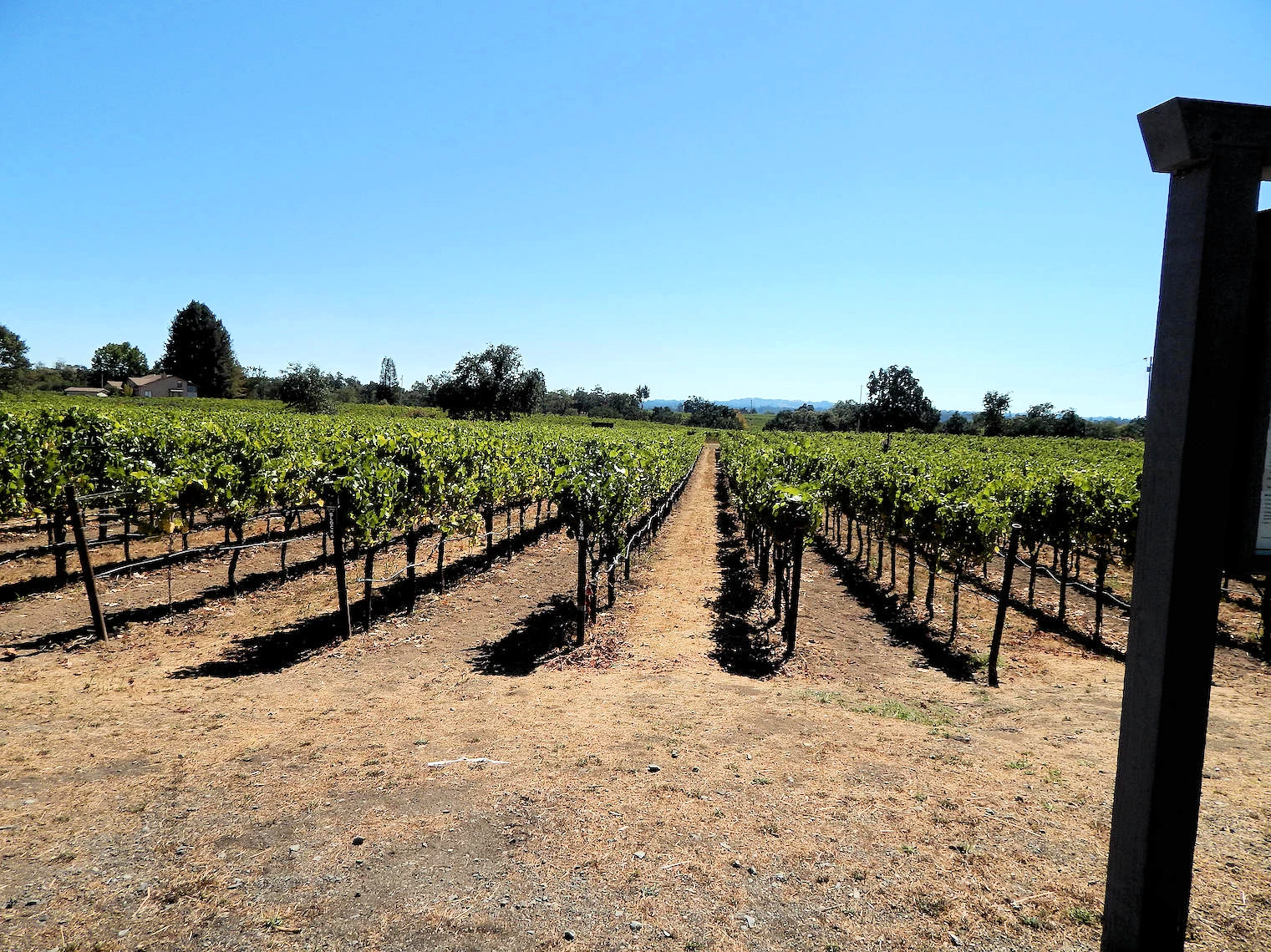 DeLoach Vineyards Santa Rosa
One of the reasons we visited Santa Rosa was because of it's location in Sonoma County, with a number of vineyards (450+) scattered around the county. Our first stop was at DeLoach Vineyards. They are located at 1791 Olivet Road northwest of Santa Rosa.
The wine tastings were comprised of their Russian River Chardonnay, a Cabernet Sauvignon and several different Pinot Noirs. We enjoyed the Chardonnay quite a bit, and obtained a bottle as we were departing.
To view our Wine Country explorations, click here to view our Santa Rosa page.
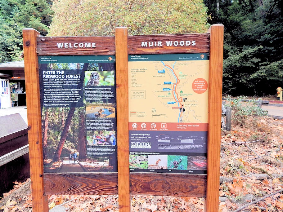 Muir Woods National Monument
We had intentionally bypassed Muir Woods on the way up to Santa Rosa because our National Monument reservations were not valid until the next day. Yes, you have to have a reservation from the Park Website as they only allow a certain number of cars to enter each day.
If you were to be in this area and you had a desire to see Muir Woods, there are tour bus services that will collect you from various locations and take you to the Park. Note that the parking restrictions do not apply to tour buses, because they drive in and drop you off and pick you up later. There is a park entrance fee of $15 per adult.
To view our Wine Country explorations, click here to view our Muir Woods page.
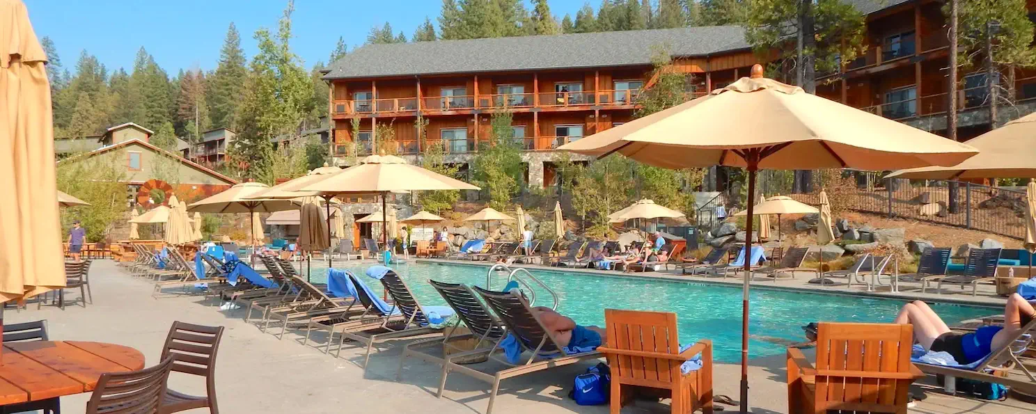
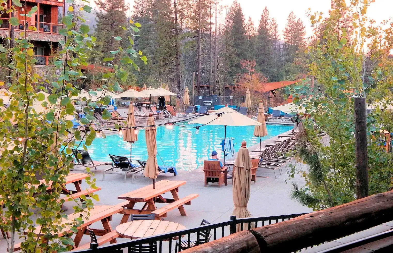 Rush Creek Lodge & Spa
Rustic luxury and modern comfort: Rush Creek Lodge is not quite "inside" Yosemite National Park, it is located approximately 1.5 miles outside the Park on route 120. We wanted to have a place where we could relax after a day of hiking or site-seeing, a place where we could have an adult beverage and a comfortable bed - and this place met all of our expectations!
This is the newest Lodge in or near Yosemite National Park, and it is really very comfortable; lots of parking, nice sized pool, super sized hot tub, dining room, and a nice bar. When you step inside the lodge and discover a warm and inviting ambiance; The lobby features a towering stone fireplace, natural wood accents, and an expansive deck overlooking the picturesque landscape. The guest rooms, ranging from cozy cabins to spacious suites, offer modern comforts with a touch of rustic charm, each featuring plush beds, private balconies, and stunning views of the surrounding beauty.
To view our stay there, click here to view our Rush Creek Lodge page.
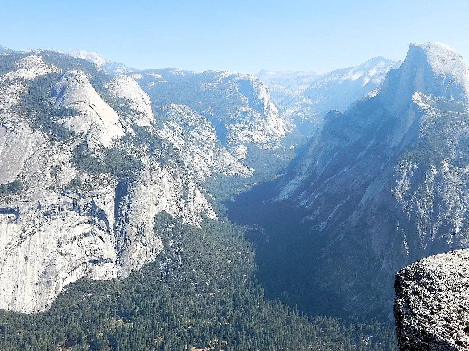 Yosemite National Park
A Journey Through Nature's Masterpiece: Towering granite cliffs, cascading waterfalls, meadows bursting with wildflowers, and ancient sequoia groves – Yosemite National Park is a symphony of natural wonders that leaves visitors breathless. Immerse yourself in the beauty of this UNESCO World Heritage Site and discover why it's a must-visit for any nature enthusiast.
This is a stunning park; it is not only geographically diverse, it is a huge park at 1,187 square miles, elevation ranges from 2,127 to 13,114 feet and contains five major vegetation zones. Curry Village is somewhat near the center of Yosemite, and it is 30 miles driving distance from the Rush Creek Lodge. Yosemite is also home to one of the tallest waterfalls in the world.
To view our park explorations, click here to view our Yosemite Park page.
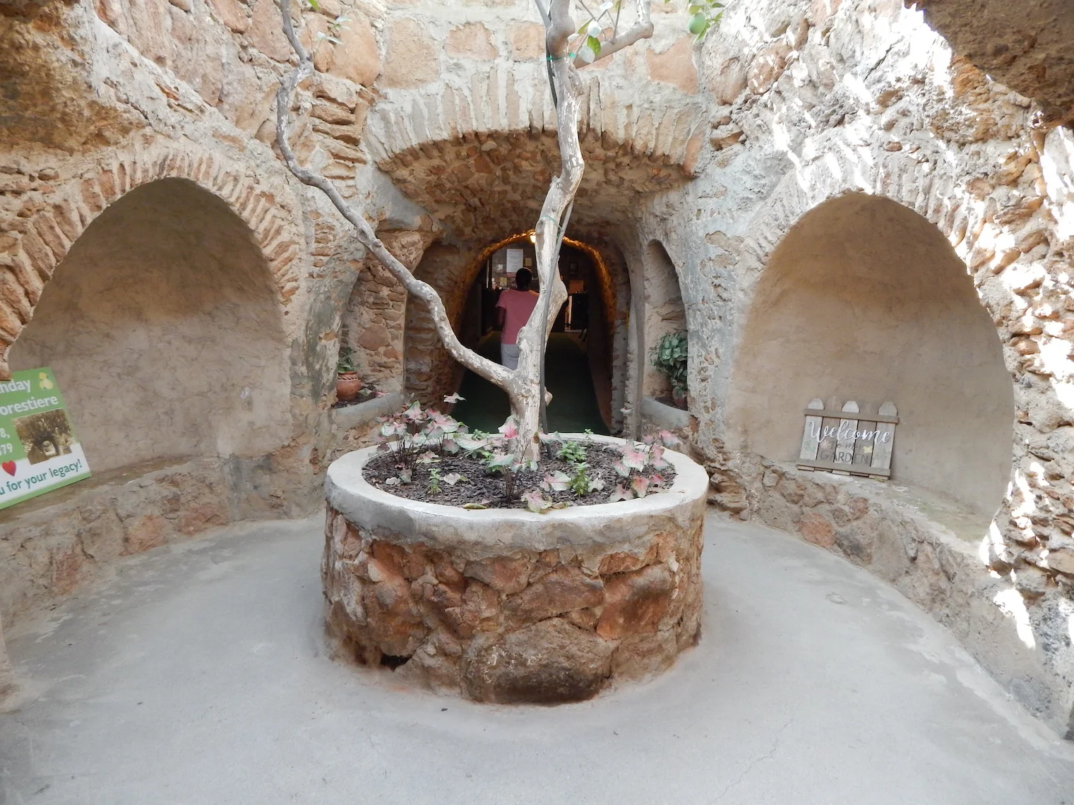 Forestiere Underground Gardens
We were driving south on Route 99 and pondering where to stop for lunch. Celeste did some Google research on what there was to do or see in Fresno, and she discovered the Forestiere Underground Gardens. After discussing it, Celeste did some further research and we agreed that we would combine a "lunch stop" with a visit to the garden site. We had no idea of what to expect from an "underground garden", but it sounded interesting.
This subterranean wonder, carved by hand over a period of 40 years by Italian immigrant Baldassare Forestiere, is more than just a garden; it's a testament to human ingenuity and a fascinating glimpse into an unconventional life. Forestiere, frustrated by the harsh climate and infertile soil, sought refuge and a means to grow his fruits and vegetables underground. Using nothing but simple tools and his unwavering determination, he carved a network of tunnels, courtyards, and rooms, transforming the barren earth into a thriving oasis.
To view our visit, click here to view our Forestiere Underground Garden page and you will be amazed at what Baldassare Forestiere was able to do underground!
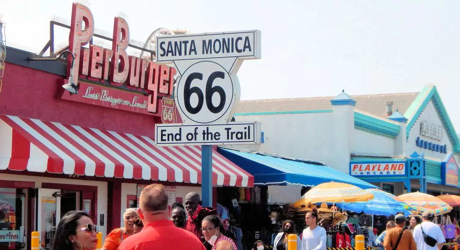 Santa Monica Pier
Sunshine, Surf, and Style by the Sea: Because of the fires burning in & around King's Canyon and Sequoia National Parks, we had to modify our trip plans because the cabin we had rented (in the Sequoia National Park area) to allow us to visit those two National Parks, was not available due to the evacuation requirements. So we wound up staying an extra day in Yosemite and we added a side trip to allow us to visit Santa Monica. My first ever software industry job had been in Santa Monica, so it was a treat to visit there again after all these years.
The iconic Santa Monica Pier, stretching out into the sea like a welcoming arm, offers amusement park rides, street performers, and breathtaking panoramic views. Sunbathe on the golden sands, ride the waves with a surfboard, or simply stroll along the beach promenade and feel the salty air invigorate your senses.
To view our visit, click here to view our Santa Monica page.
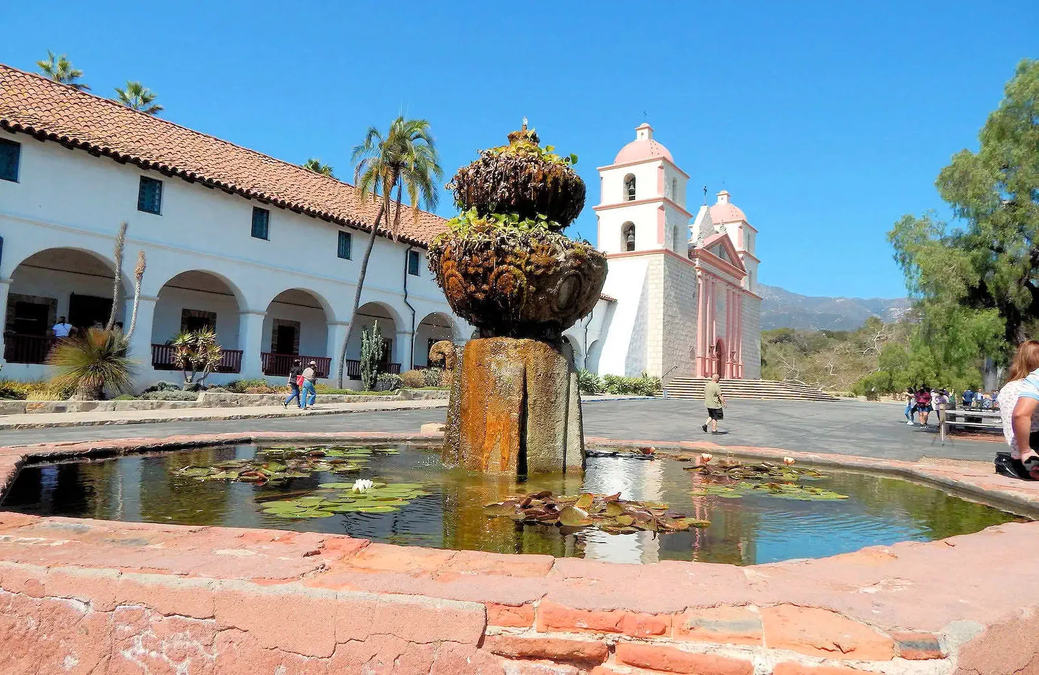 Mission Santa Barbara
Breathtaking Views, Unforgettable Vibes: Santa Barbara was even nicer after a brief side-trip into Santa Monica - a more laid back vibe, beautiful beach and coastline and our stay at the Hilton Santa Barbara Beachfront Resort provided us with an ideal location to explore this pretty city.
Santa Barbara's stunning coastline forms the backdrop for endless possibilities. Relax on the pristine sands of Butterfly Beach, ride the waves at Hendry's Beach, or kayak alongside playful sea lions at Stearns Wharf. As the sun dips below the horizon, stroll along the pier and savor the mesmerizing sunset, painting the sky in fiery hues.
To view what we saw there, click here to view our Santa Barbara page.
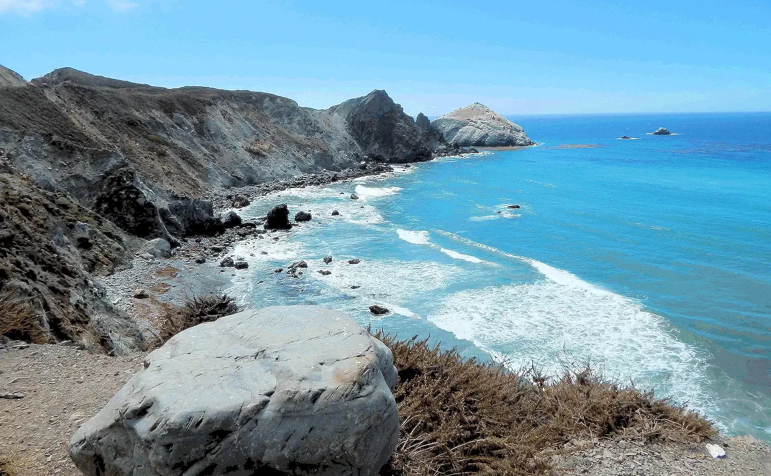 Pacific Coast Highway
A driving route north from Santa Barbara to Monterey Bay can be done several different ways, but if you have never driven the coastal route north, you will have never had the opportunity to see the diversity of California geography. We drove north on US 101 to Morro Bay, where we stopped for a photo opportunity and we then continued north on Route 1.
We had hoped to visit Hearst Castle, but unfortunately the access road to the castle was still being rebuilt after a storm damaged it. The castle complex was built by William Randolph Hearst and was designed by Julia Morgan during the timeframe 1919 through 1947. The Hearst Castle itself was donated to the State of California by the Hearst family, but the 83,000 acre Hearst Ranch that surrounds the Castle still belongs to the Hearst Family.
To view this stunning drive, click here to view our Pacific Coast Highway page.
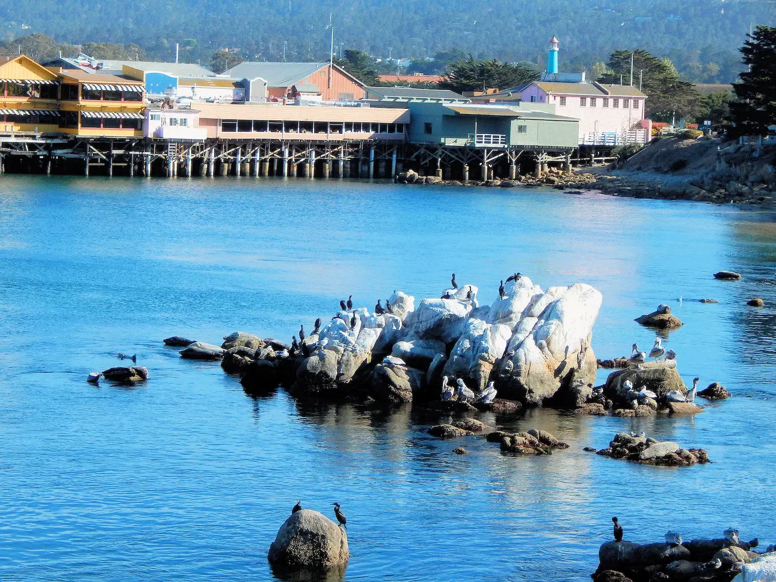 Monterey Bay
After the long drive up the Coastal Highway to reach Monterey, we were excited to get out of the car and begin to explore this area. Monterey's previous life as a "Sardine Cannery Town" ended in the early 1950's and they have been evolving into a tourist town ever since.
We had several restaurant "tips" that we wanted to research, the first being near to our hotel the "Monterey Bay Inn". The restaurant "Osteria Al Mare" was primarily an Italian Restaurant, good menu/good food and excellent service staff.
To view this beautiful coastal city, click here to view our Monterey page.
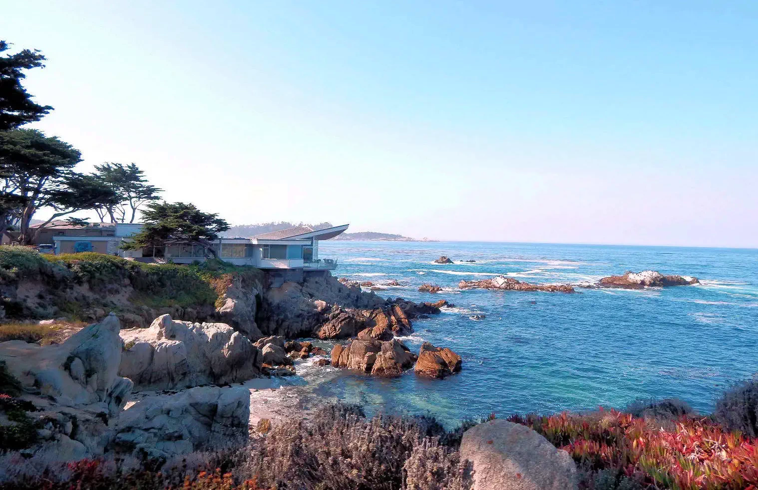 17 Mile Drive near Carmel-by-the-Sea
Carmel is immediately south of Monterey and the most scenic way to arrive there is to drive south on the "17 mile loop" and exit once you've seen the Carmel beach area and head into the village section. The houses along the coast are all unique and all very expensive !
Point Lobos is south of Carmel and is a California State Reserve area that provides some hiking and beautiful Pacific Ocean views.
To view our explorations there, click here to view our Carmel page.
Note: All images featured on this page are the exclusive property of Just Traveling Thru, LLC, unless otherwise stated. When images from external sources are used, full credit is given to the original creator, along with a link to the specified license or usage terms. We are committed to respecting copyright and intellectual property rights, ensuring that all third-party images are properly attributed. If you have any questions regarding image ownership or usage rights, please feel free to contact us.
Affiliate Links: We may earn a commission if you make a purchase through one of our affiliate links. This helps support our travel content — thank you!
Content: To review any of our content, make suggestions and/or comments, please click the "About" menu link at the top of this page. You will find our "Contact Us" link on that drop-down menu.