
by Celeste Lipford and Terry Lipford - last updated on 10/7/2025
This is a drive that everyone should take at least once in their life - it is a beautiful way to see just how diverse California geography can be! From our hotel in Santa Barbara to our next hotel in Monterey Bay was a distance of 234 miles (see our route map below) - but the twists and turns that this highway goes through on the way to Monterey just have to be seen to be believed! It is also the perfect trip to take with your significant other. Get in your car, pack a picnic lunch or get reservations for a romantic restaurant along the way.
Please be aware that this highway is known by several names, ie; Pacific Coast Highway (PCH), Cabrillo Highway, Shoreline Highway, or Coast Highway. Within this page, we will refer to it as "Pacific Coast Highway".
The complete history of this highway can be found here (Wikipedia Page) This is an interesting story, and it covers the history of this highway thoroughly. Imagine if you will, a highway 656 miles in length that was under construction from the 1930's era to 1964! Read the Wikipedia story to find out more.
Our end goal of this drive was to drive to Monterey, but the concept of driving north along this beautiful coastline was just too good to ignore. Yeah, we could have gone north on I-5 or any of the other routes that would have brought us to Monterey, but California SR-1 is a unique route that is just amazing and you get to drive by Hearst Castle and numerous beautiful bays.
The Pacific Coast Highway (PCH), also known as Highway 1, is famous for its breathtaking coastal views, cliffs, and ocean sunsets.
Stretching over 650 miles, it’s California’s longest state highway, running from Leggett in Northern California to Dana Point in Southern California.
Built between 1919 and 1934, workers had to carve the highway into rugged cliffs—especially in Big Sur, one of the most challenging sections.
Located in Big Sur, Bixby Bridge (completed in 1932) is one of the most photographed and tallest concrete bridges in the U.S.
Much of the highway’s Big Sur section was built using labor from San Quentin State Prison inmates due to the dangerous work conditions.
A landslide at Mud Creek buried a large portion of the highway under 6 million cubic yards of rock and dirt, closing it for over a year.
In Leggett, you can visit the Chandelier Tree, a massive redwood with a carved-out tunnel big enough for cars to drive through.
Newspaper magnate William Randolph Hearst’s Castle in San Simeon is one of the grandest mansions in the U.S., built in the early 1900s.
Piedras Blancas Elephant Seal Rookery, near San Simeon, is home to thousands of elephant seals, which gather on the beaches year-round.
The highway runs through Central Coast wine country, including Paso Robles and Santa Ynez Valley, known for world-class wineries.
The highway has been featured in countless movies, TV shows, and commercials, including Big Little Lies and The Fast and the Furious franchise. Over 600 movies and/or TV shows have utilized this highway for filming, click here to see the complete list of all those videos.
The highway is often mistaken for a single road, but it actually merges with U.S. Highway 101 and other routes in different sections.
With its sharp turns, sheer cliffs, and foggy conditions, PCH is considered beautiful yet treacherous, especially around Big Sur.
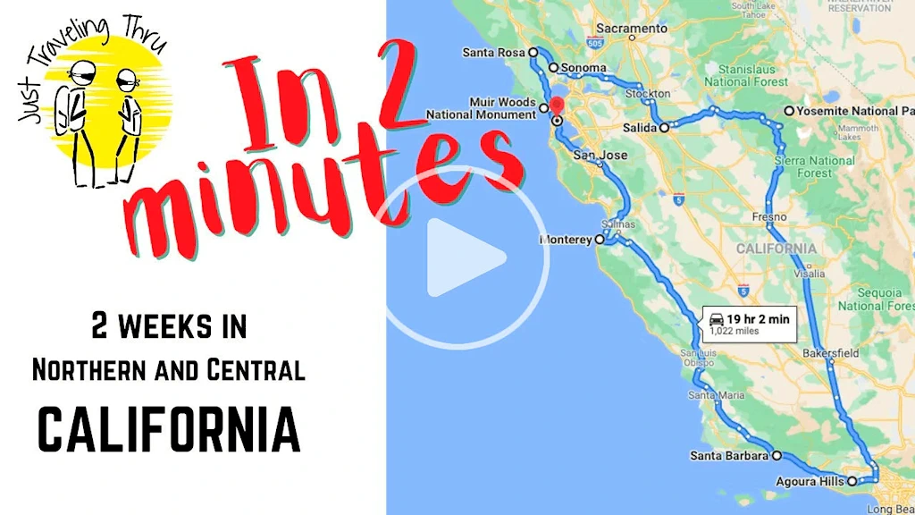 Click this image to watch a great overview video of our California trip. This video is the property of Just Traveling Thru, LLC.
If you enjoy our videos click here to subscribe to our Youtube Channel.

Our route to Monterey from Santa Barbara was simple; straight north on the 101 to Morro Bay, and then north on route 1 until we got to Monterey. Along the way, our intent was to stop at whatever looked interesting, and that wound up being Morro Bay. We stopped briefly in San Luis Obispo for an iced coffee and a snack and then drove on to the coast.
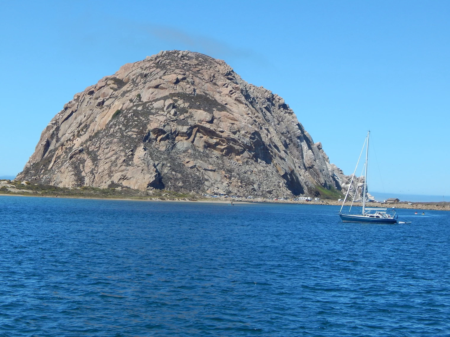
When we came across Morro Rock which you can see from the highway we had to stop. As you can see from the pictures it’s a large rock sitting amidst the Pacific Ocean just off shore. There is a causeway that connects it to the mainland which makes it a tied island. The uniqueness of the rock inspired us to learn more. We discovered that it is a volcanic plug which is created when magma hardens within a vent of an active volcano. According to wikipedia Morro Rock is 23 million years old and one of 13 such volcanic plugs in the area. It is illegal to climb the rock due to its fragile nature. There is some interesting information on the wiki site regarding the rock and the tribal history of the Salinan and Chumash tribes.
NOTE: To read more about "Volcanic Plugs" click here as most of the larger hills between San Luis Obispo and Morro Bay are all volcanic plugs.
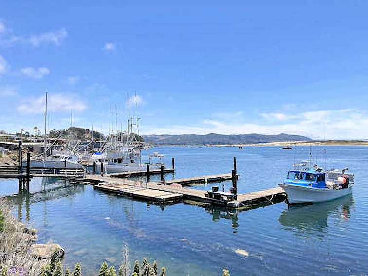
The Morro Bay Pier gave us an exceptional view of Morro Rock and also placed us in an area with a number of small shops and restaurants. Depending on the time you arrive it could be a good place to stop for breakfast or lunch and shop in the many local stores by the harbor.
More Info for Morro Bay
Image Credits:
All of the above images are the property of Just Traveling Thru, LLC.
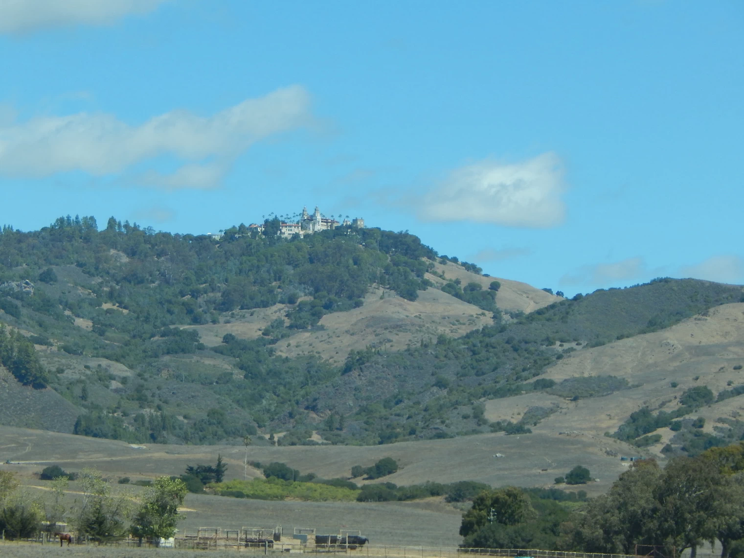 Hearst Castle in the Distance
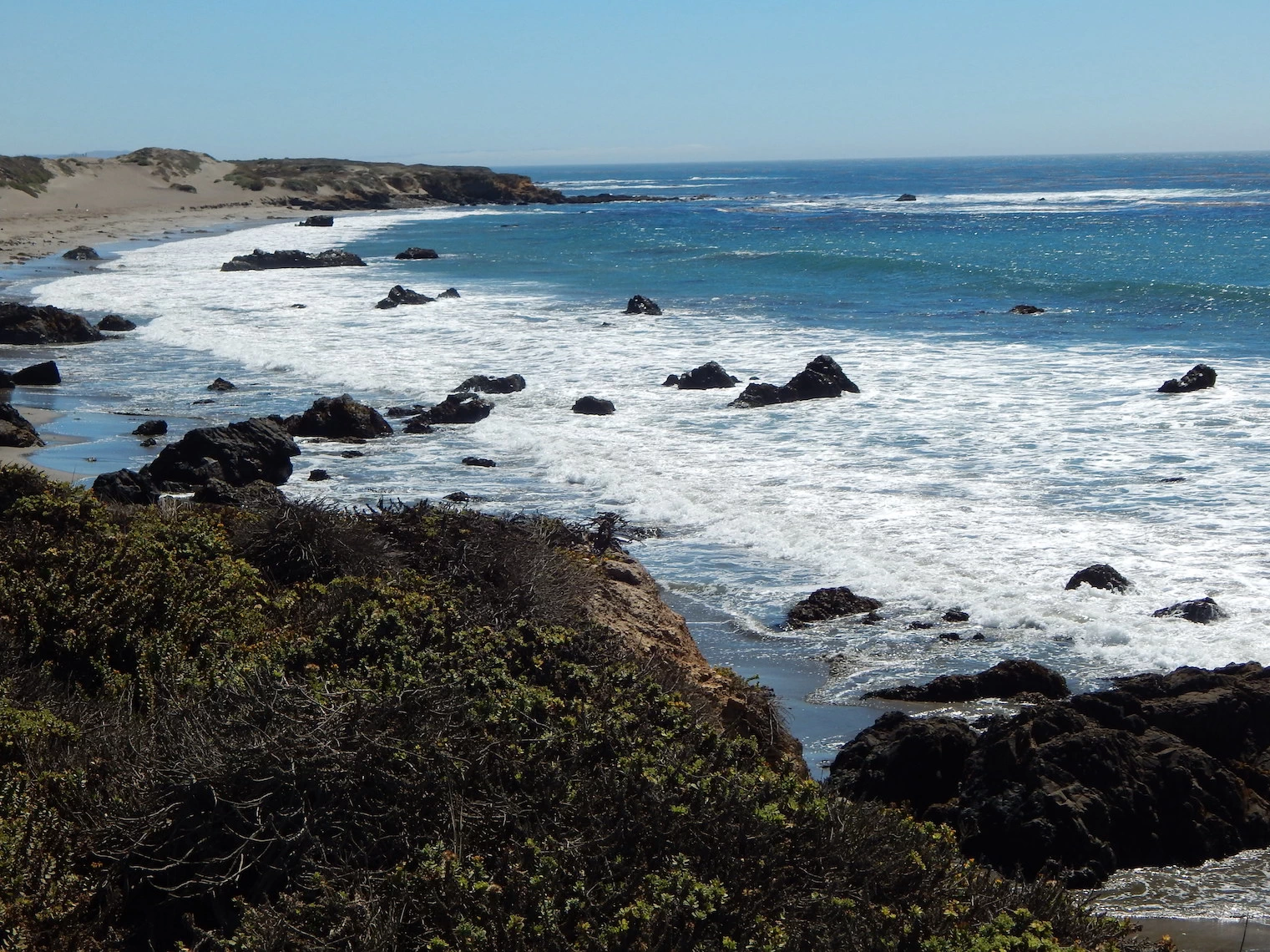 San Simeon Beach
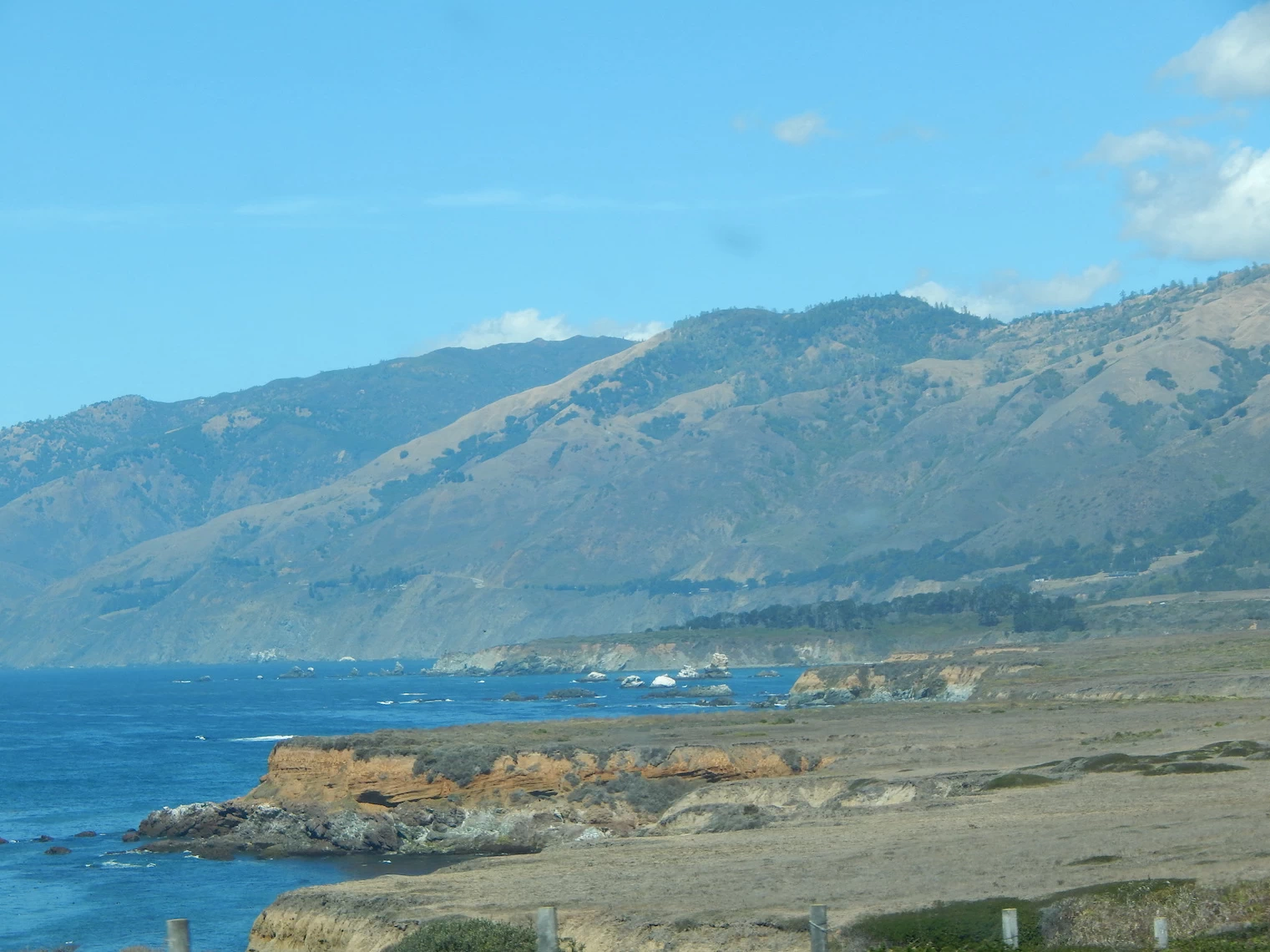 Looking North from San Simeon Beach
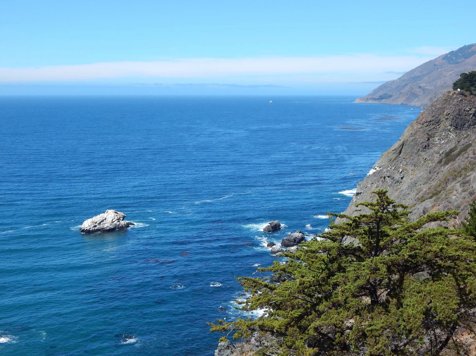 Big Sur Area
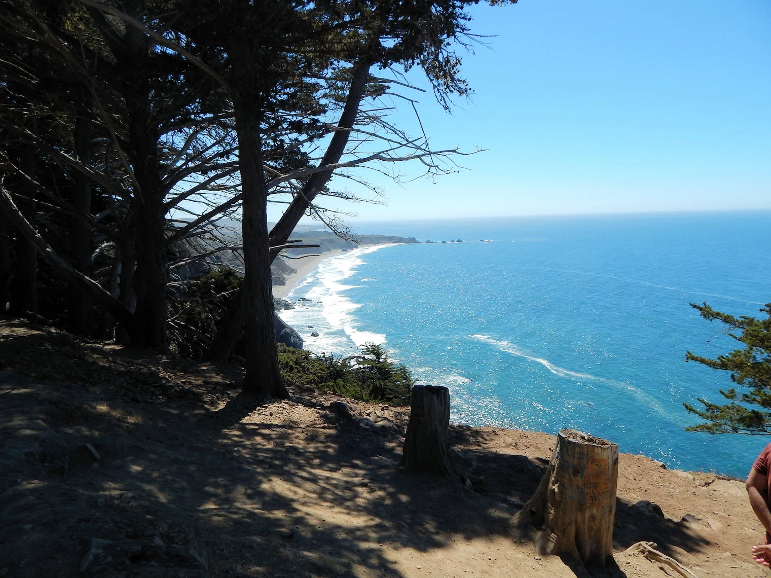 Big Sur Coastline
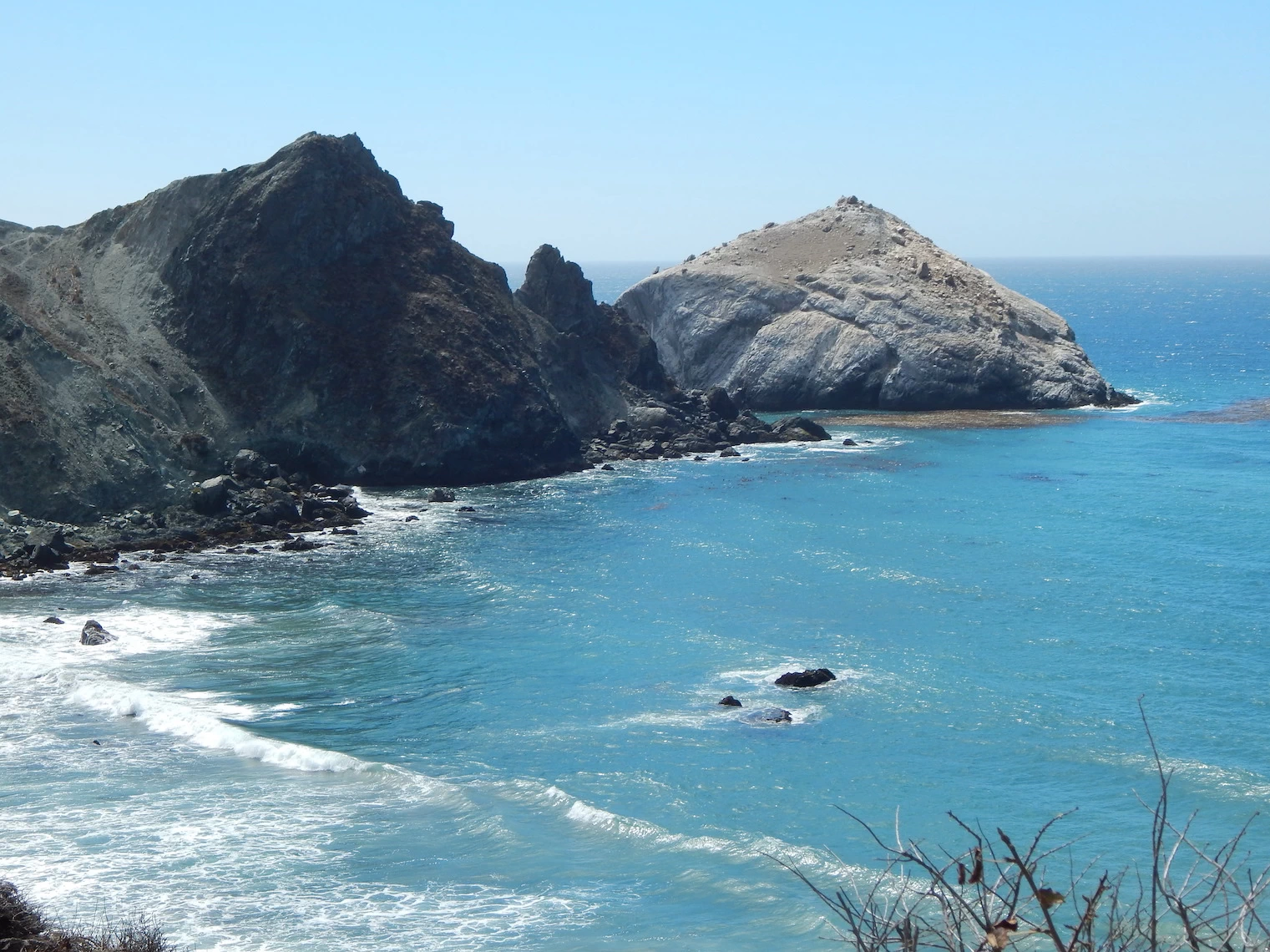 Willow Creek Beach
After enjoying Morro Bay and stretching our legs, we rejoined SR-1 and headed north again. Along the way to Ragged Point, are several beautiful beaches and the views from SR-1 are outstanding. Ragged Point is considered to be the southern boundary of the Big Sur. Halfway there and you will pass San Simeon, home of the Hearst Castle.
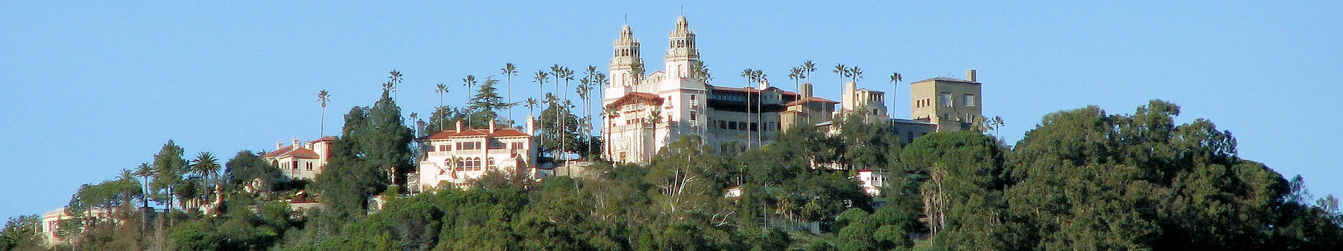
You won't be able to see it in the smaller image, but if you click image # 1 you should be able to see Hearst Castle at the top of the Santa Lucia Mountains, 1,600 feet above the Pacific Ocean. Unfortunately for us, the access road from route 1 to the Hearst Castle was still undergoing repairs from storm damage - so the image here is as close as we got. The Castle had been part of our overall plan but one cannot argue with road damage.
I had visited Hearst Castle many years ago but Celeste has never been. Hearst Castle is something that should be on your list if you take the drive. It’s a fascinating castle.
 Above image of Hearst Castle is the property of Fietsbel via
Wikimedia Commons using the CC BY-SA 3.0 License
Above image of Hearst Castle is the property of Fietsbel via
Wikimedia Commons using the CC BY-SA 3.0 License 29 miles north of Morro Bay on the Pacific Coast Highway, we arrived at the San Simeon area. As can be seen in this Google Map, we had utilized a turnout on the Coast Highway below Hearst Castle. We knew the access road was still being rebuilt, and we did not have entry reservations either, so the best we could do was admire it from afar.
Hearst Castle, located in San Simeon, California, is an iconic estate with a rich history tied to media mogul William Randolph Hearst. Construction began in 1919, when Hearst inherited the land from his mother and decided to build a retreat atop the coastal hills. He hired renowned architect Julia Morgan to design what he originally called "La Cuesta Encantada" (The Enchanted Hill).
The land on which Hearst Castle stands was originally part of a 40,000-acre ranch purchased by William Randolph Hearst’s father, George Hearst, in 1865. Over time, the family expanded the property to 250,000 acres. George Hearst used the land primarily for cattle ranching, and young William spent much of his childhood exploring the vast wilderness.
After inheriting the estate from his mother, Phoebe Apperson Hearst, in 1919, William Randolph Hearst decided to build a residence that would be both a family retreat and a showcase for his massive art collection. He hired Julia Morgan, the first woman licensed as an architect in California, to design the estate.
Construction of what would become Hearst Castle began in 1919 and continued for nearly three decades. Hearst and Morgan collaborated closely, and their combined vision led to the creation of a sprawling compound of gardens, terraces, pools, and buildings. By the late 1930s, Hearst’s fortune had begun to dwindle, and construction on the estate slowed. In 1947, Hearst left the castle due to declining health and moved to Beverly Hills, where he died in 1951. Construction on the estate was never fully completed, though it was largely finished by the time of Hearst’s departure.
In 1957, the Hearst family donated the estate to the state of California, and it was turned into a state historical monument. It opened to the public as Hearst San Simeon State Historical Monument, and today, it is managed by California State Parks. Visitors can tour various parts of the estate, including the gardens, the pools, and many of the interior rooms.
More Info for Hearst Castle
Image Credits:
All of the above images, unless otherwise noted, are the property of Just Traveling Thru, LLC.
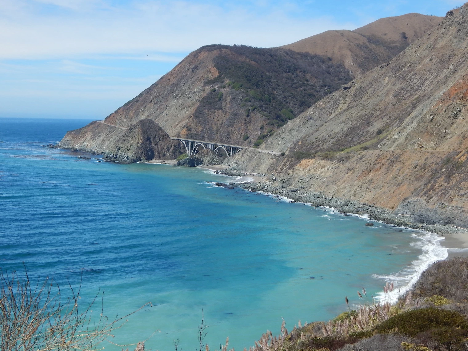
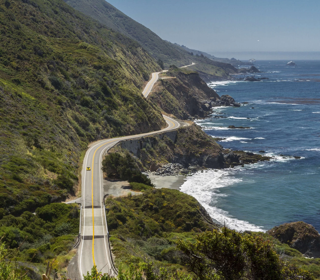
The Big Sur area of the Pacific Coast Highway starts at San Simeon and ends near Carmel Highlands, just south of Monterey. The Pfeiffer Big Sur state park runs along this part of the coastline and offers camping, hiking, restrooms and a nature center. Check out the California Parks page for more info.
Image # 1 shows the Bixby Creek Bridge; when it was completed it was the highest single-span arch bridge in the world, and it remains one of the tallest and is located just 13 miles south of Carmel, CA.
The geography begins to change at Ragged Point on route 1 as you drive north. Ragged Point is located at the southern end of the Pfeiffer Big Sur State Park, which extends (in the northern area) nearly to Point Lobos just south of Carmel. More trees are present, and there are a small number of restaurants on the Ocean side of route 1.
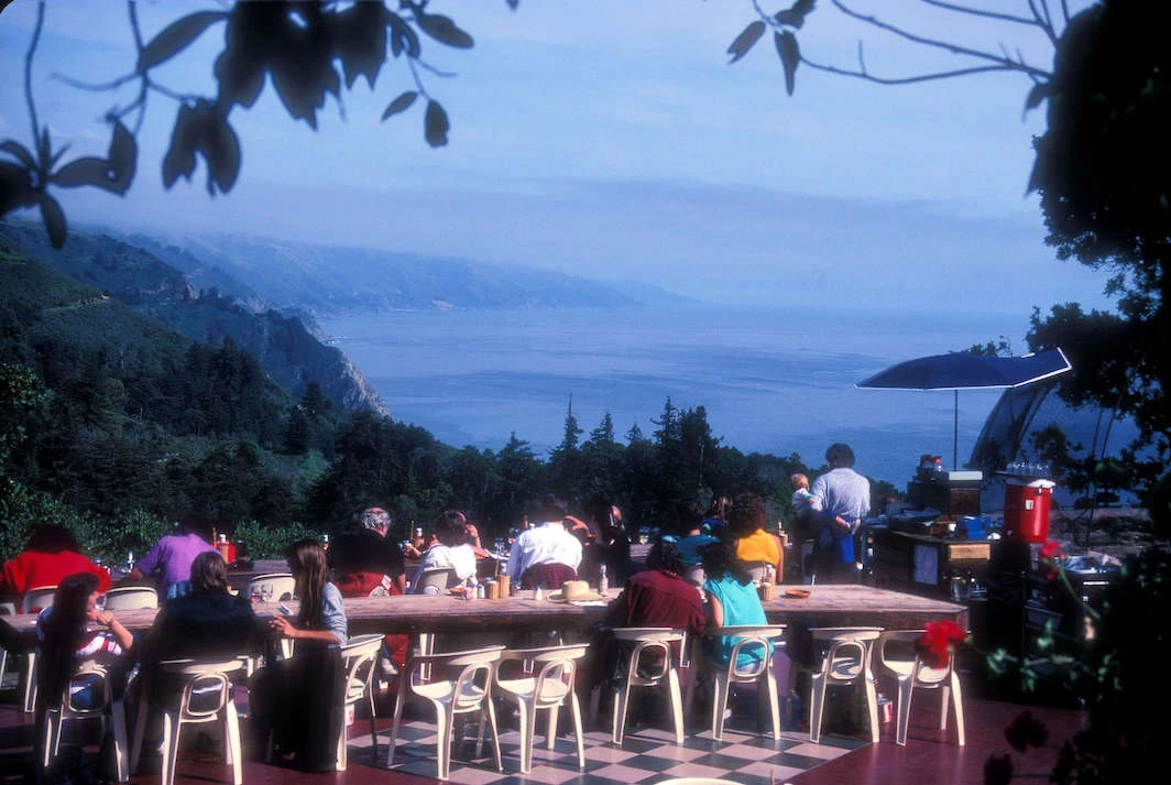
Speaking of restaurants, there is one in particular that is perched on a cliff above the Pacific Ocean coastline that is famous, the Nepenthe Restaurant. They have a large open air terrace, and there is inside and outside seating available for diners. We did not have time to stop for a meal, but the available parking was completely filled, giving us some idea of the popularity of this restaurant.
Based upon what we've read: The restaurant offers a unique and unforgettable dining experience characterized by breathtaking views, excellent food, and a serene atmosphere. Perched 800 feet above the Pacific Ocean along Highway 1, Nepenthe's location provides stunning vistas of the rugged Big Sur coastline. The restaurant is famous for its relaxed vibe, drawing travelers, artists, and writers alike.
More Info for Big Sur
Image Credits:
Which direction should you drive?
The most common advice is to drive south, from north to south. This puts your vehicle in the lane closest to the ocean, giving you unobstructed views and easier access to scenic viewpoints and turnouts.
How long does the trip take?
While you could technically drive California's portion of the PCH in 10–12 hours, most travelers recommend taking 3–7 days to allow for stops and sightseeing. A full road trip of the West Coast from Washington to San Diego would require at least 10 days.
What are the must-see spots?
Some of the most popular attractions include the Big Sur coast, which features the rugged cliffs and coastline between Carmel and San Simeon; major cities like San Francisco, Los Angeles, and San Diego; and charming towns such as Santa Barbara and Carmel-by-the-Sea.
Where should you stay?
Towns like Santa Barbara, Pismo Beach, and Cambria are recommended for overnight stops. For those interested in camping, there are many campgrounds available in national and state parks along the route, but popular spots should be booked months in advance.
When is the best time to drive the PCH?
The ideal time is from late spring to early fall (April through October), when the weather is mild, skies are clearer, and there are more daylight hours.
When is the best time to avoid crowds?
For fewer crowds, consider visiting during the shoulder seasons of spring (March–May) or fall (September–November). Summer is the busiest time of year for traffic.
Is the PCH dangerous to drive?
The PCH is generally a safe drive, but some sections are known for narrower lanes and sharper turns, especially around Big Sur. It's a two-lane, undivided highway for much of its length, so drivers should take their time, especially on curves.
Should you be concerned about road closures?
Yes, particularly in the Big Sur area, mudslides or landslides can cause temporary road closures, especially after heavy rain. Travelers should always check for the latest road conditions with Caltrans website before starting their trip.
What should you pack?
It is wise to pack in layers, as coastal areas can be cool and overcast even in the summer, while temperatures can increase significantly a few miles inland. Other essentials include sunscreen, a hat, and plenty of water.
What's the weather like?
The weather along the coast is often chilly, overcast, and windy. It can change quickly, so having layers and a windbreaker or rain jacket is a good idea.


Note: All images featured on this page are the exclusive property of Just Traveling Thru, LLC, unless otherwise stated. When images from external sources are used, full credit is given to the original creator, along with a link to the specified license or usage terms. We are committed to respecting copyright and intellectual property rights, ensuring that all third-party images are properly attributed. If you have any questions regarding image ownership or usage rights, please feel free to contact us.
Affiliate Links: We may earn a commission if you make a purchase through one of our affiliate links. This helps support our travel content — thank you!
Content: To review any of our content, make suggestions and/or comments, please click the "About" menu link at the top of this page. You will find our "Contact Us" link on that drop-down menu.
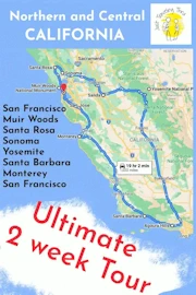
 Click above Image to view larger Google Map
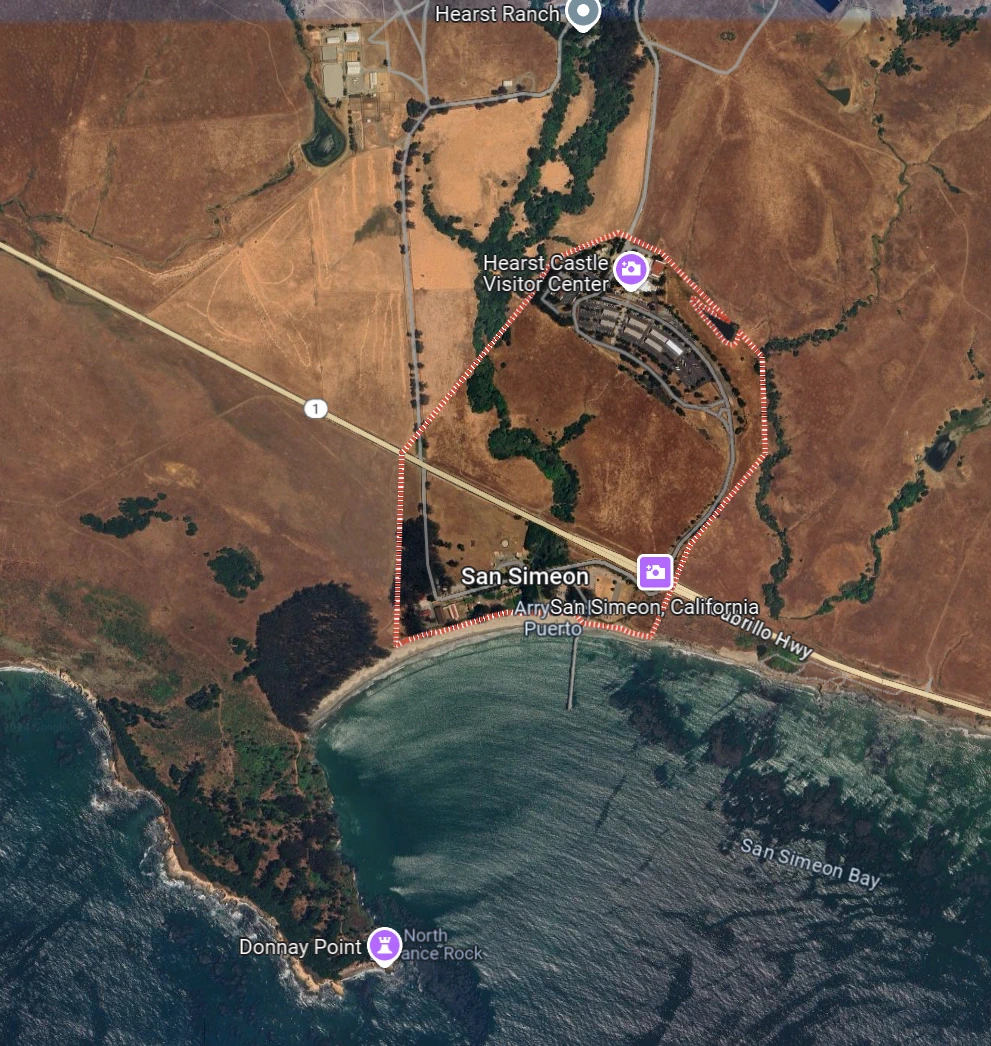 Click this image to view a larger Google Map
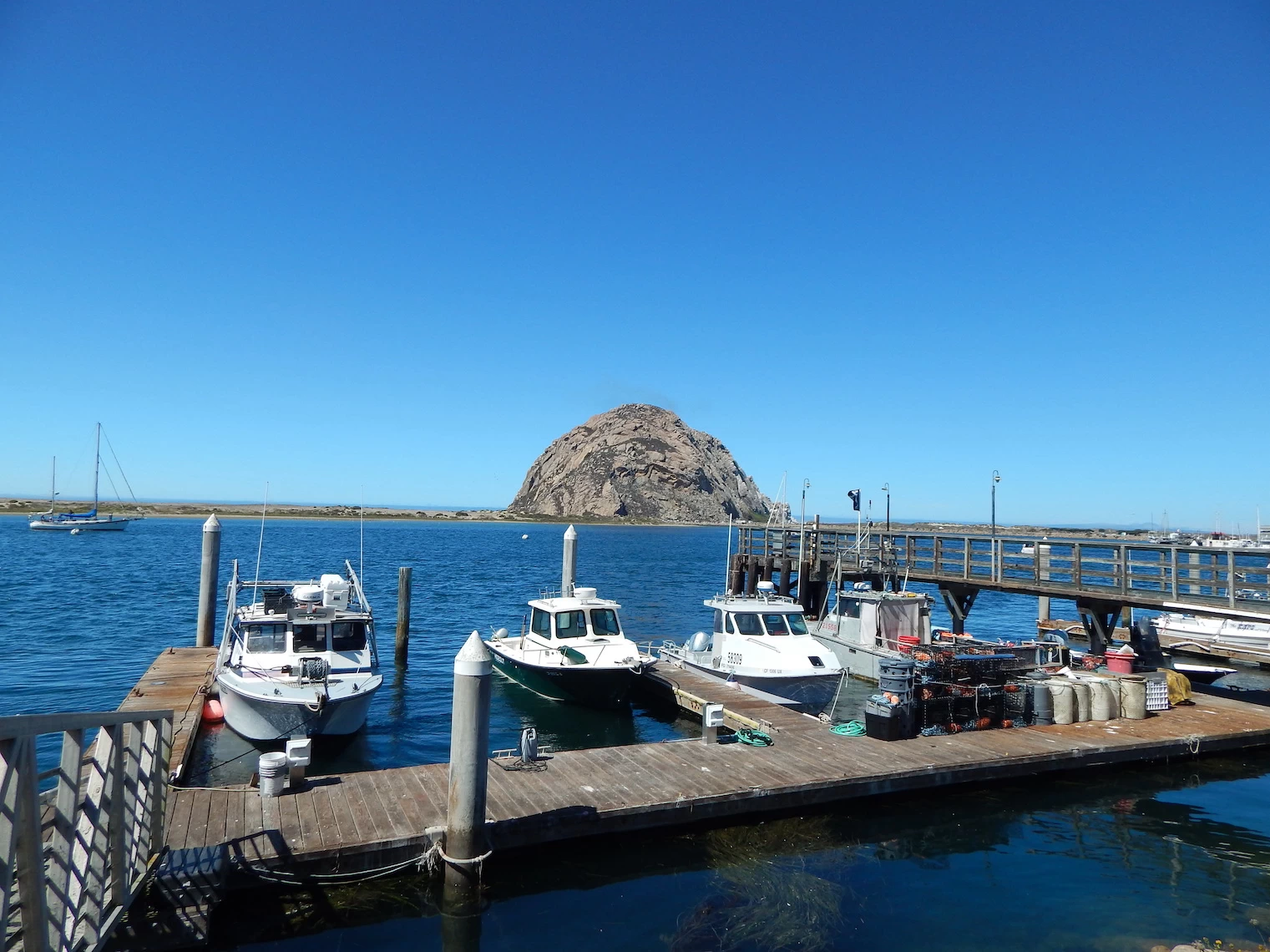