
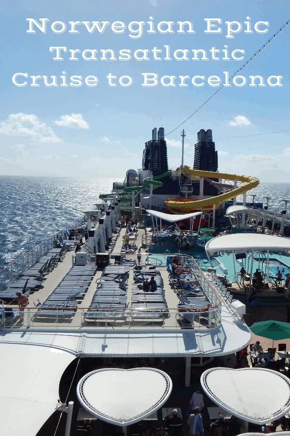
by Celeste Lipford and Terry Lipford - last updated on 10/5/2025
We were onboard the
Norwegian Cruise Lines 'Epic'
on a repositioning cruise from Port Canaveral, FL to Barcelona with various stops along the way - the first stop
being Ponta Delgada.
Ponta Delgada is 3,198 sea miles from Port Canaveral and 914 sea miles southwest of Portugal and it is the largest municipality
(concelho) and economic capital of the Autonomous Region of the Azores in Portugal. It is located on São Miguel Island, the
largest and most populous in the Azores archipelago. The island has been populated since 1444 and Ponta Delgada was started in the year 1450.
Ponta Delgada Quick History Lesson: In 1427, São Miguel became the second of the islands discovered by Gonçalo Velho Cabral to be settled by colonists from continental Portugal. This date is uncertain, and it is believed that the island was discovered between 1426 and 1437 and inscribed in portolans from the middle of the 15th century. Its discovery was later recorded by Father Gaspar Frutuoso in the seminal history of the Azores.
The first capital of the island was Vila Franca do Campo, which was devastated by the 1522 Vila Franca earthquake and landslides. The tragedy helped to elevate Ponta Delgada to the administrative and economic status of capital and business centre from 1546.
Ponta Delgada is the largest city and administrative capital of the Azores, an autonomous region of Portugal located in the North Atlantic Ocean. It is situated on the southern coast of São Miguel Island, the largest island in the Azores archipelago. Ponta Delgada lies approximately 900 miles (1,450 km) west of mainland Portugal and about 2,400 miles (3,900 km) east of North America. Known for its picturesque coastline, volcanic landscapes, and historic architecture, the city serves as the main gateway to the Azores and is an important cultural and economic hub in the region.
The ocean around Ponta Delgada is quite deep. The average depth around the Azores archipelago is about 3,000 meters (approximately 9,843 feet), according to Frontiers. The Azores Plateau, where the islands are located, is less than 2,000 meters (6,600 feet) below sea level, according to Wikipedia. The Pico-São Jorge channel, located between some of the other Azores islands, can be between 1,600 and 4,000 feet deep. The point being, this is very much a mid-Ocean Mountain!
This was the first Norwegian Epic cruise port stop since it departed Florida.
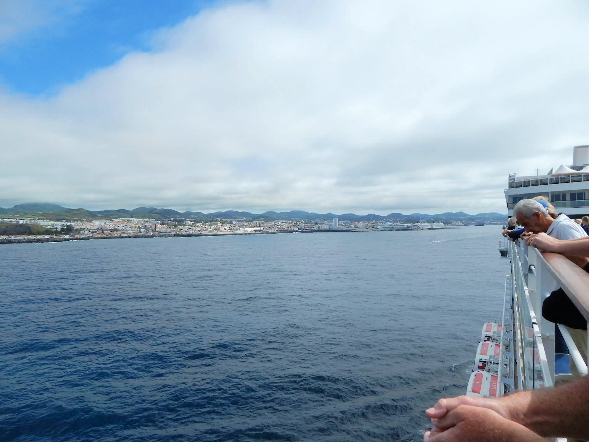
The ship's scheduled arrival was 12:00PM and the assigned docking location was alongside the Molhe do Porto. This entire pier is also occupied by a series of shops, bars and restaurants so it was an interesting stroll into the city. No need for a taxi here, the walking distance into town was brief, the weather was nice, and it was great to be ashore after 7 days at sea!
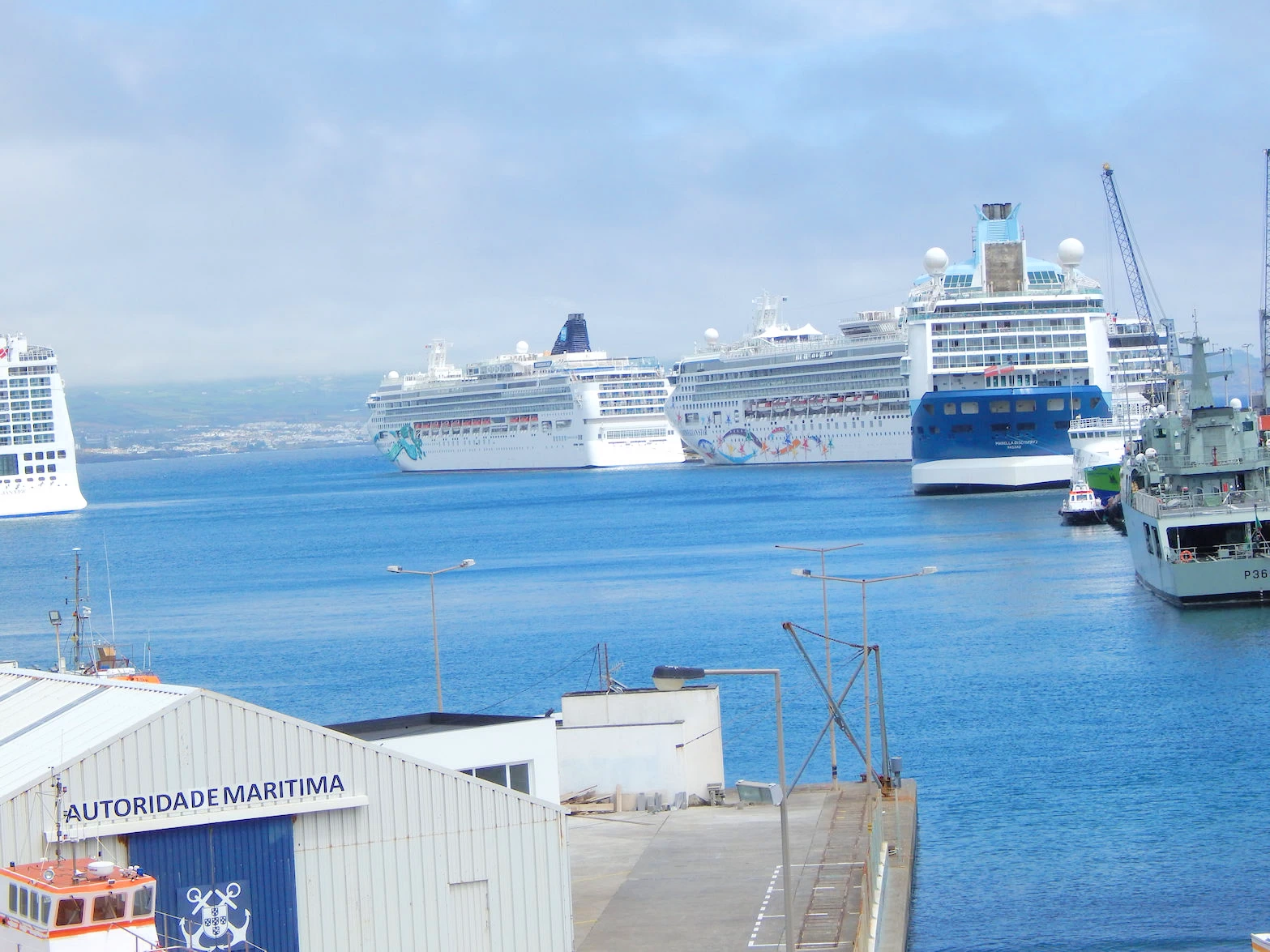
 Ponta Delgada Harbor
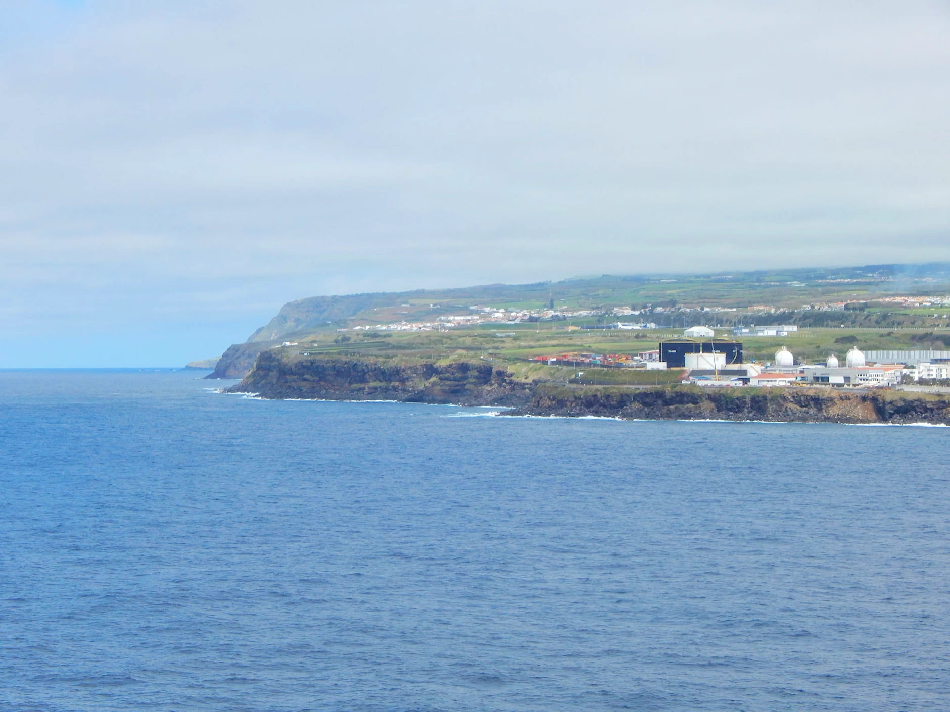 Ponta Delgada Harbor
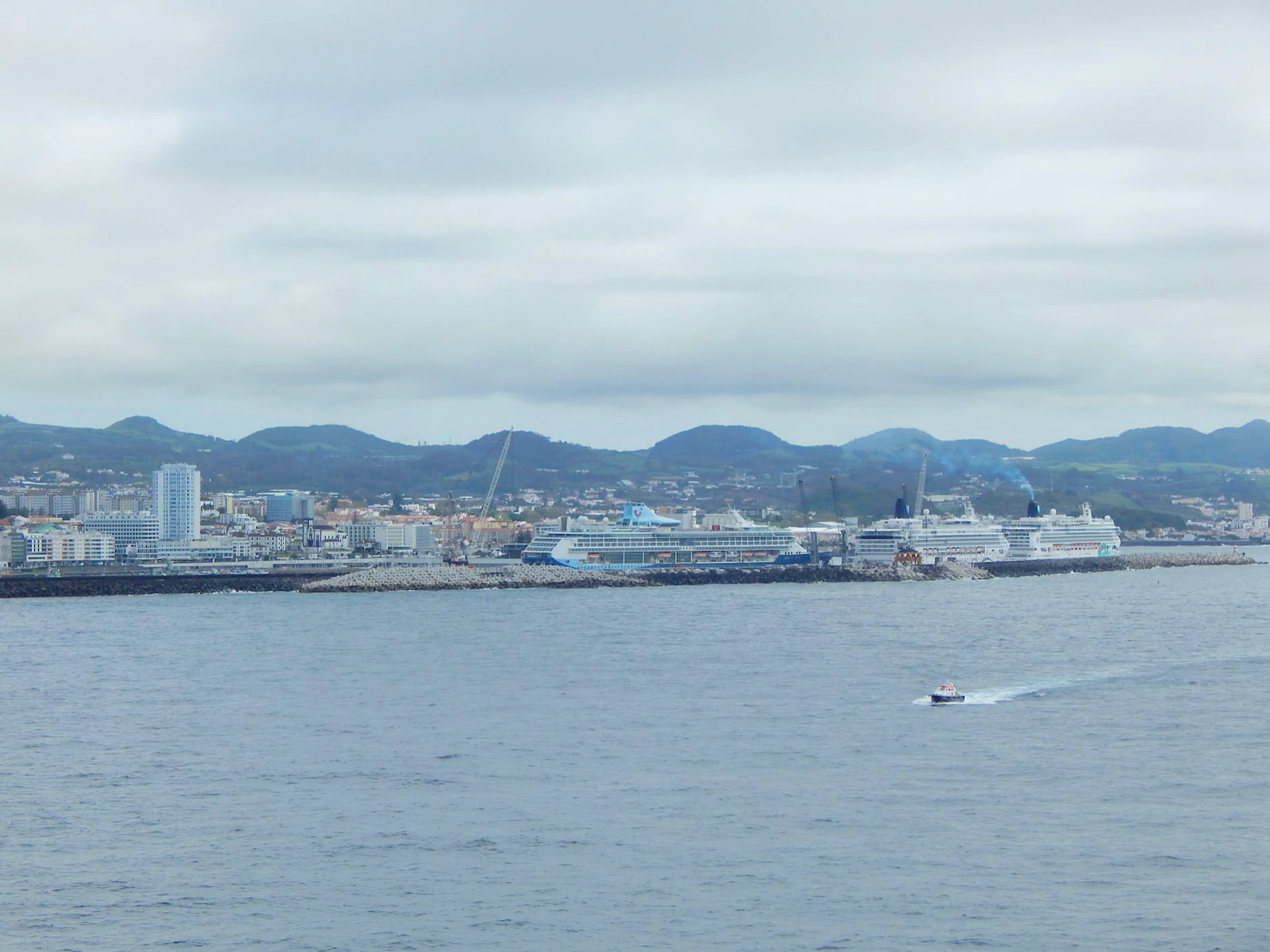 Ponta Delgada Harbor
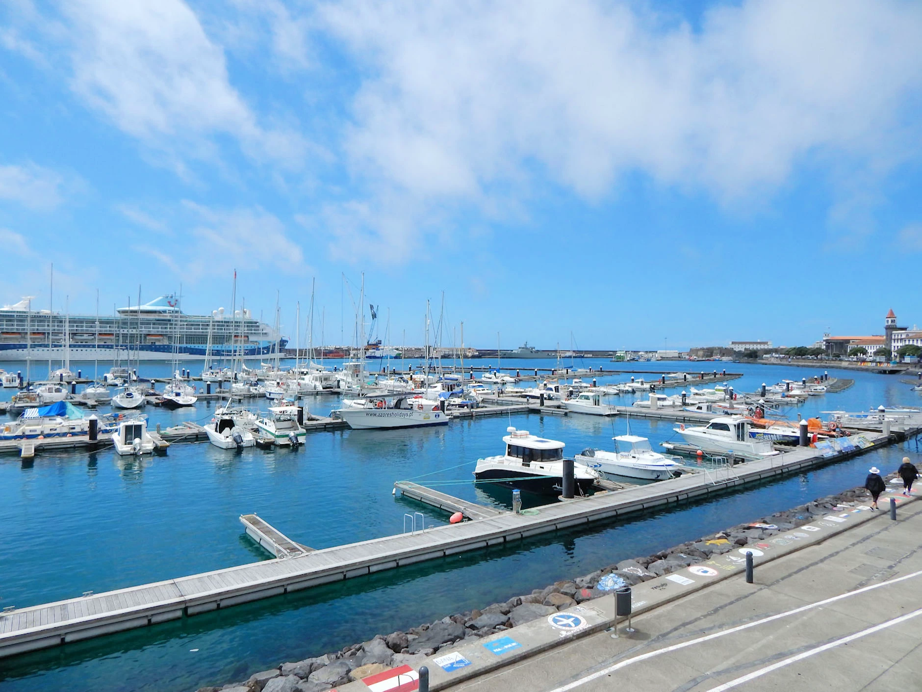 Ponta Delgada Harbor
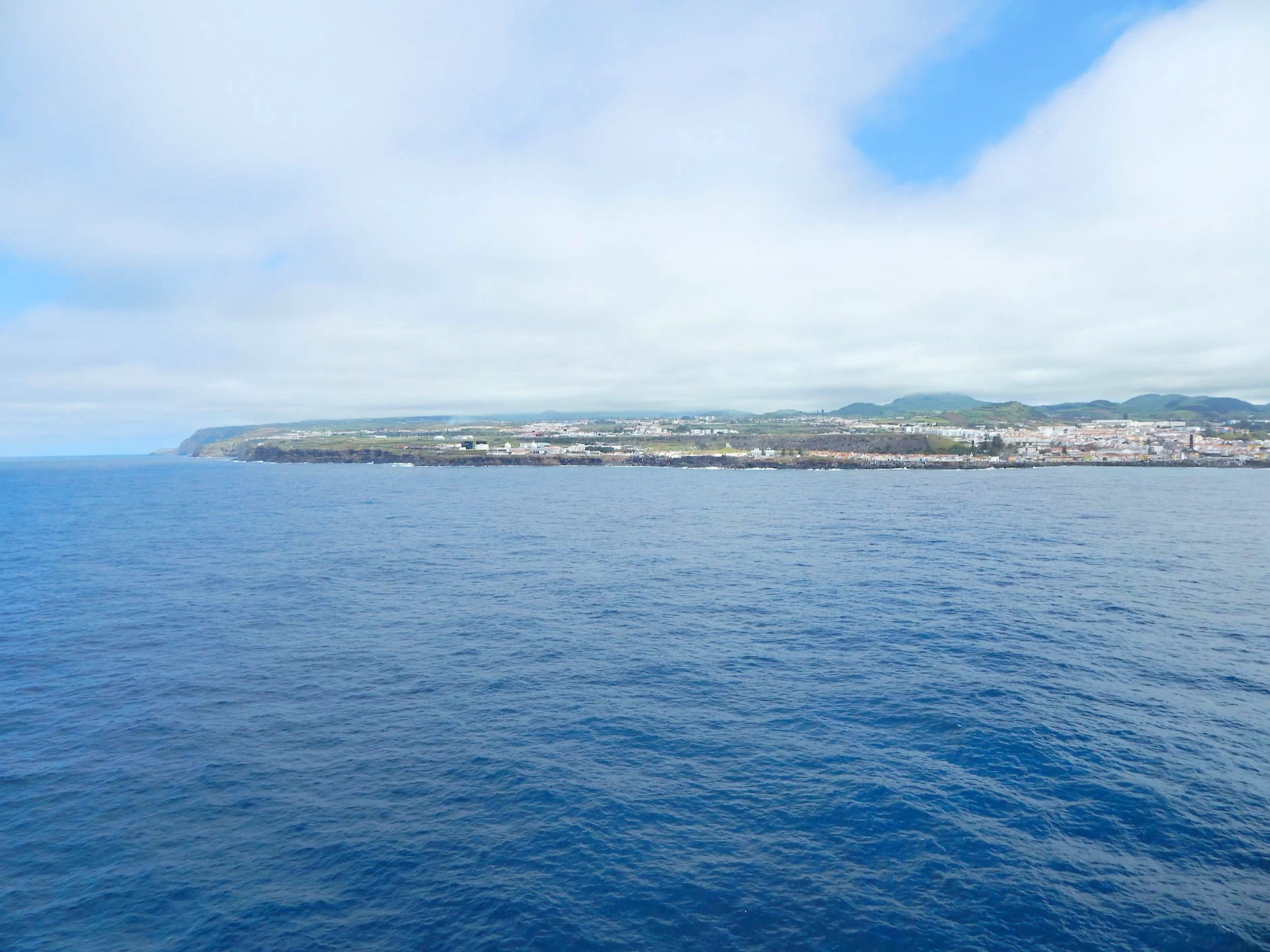 Ponta Delgada Harbor
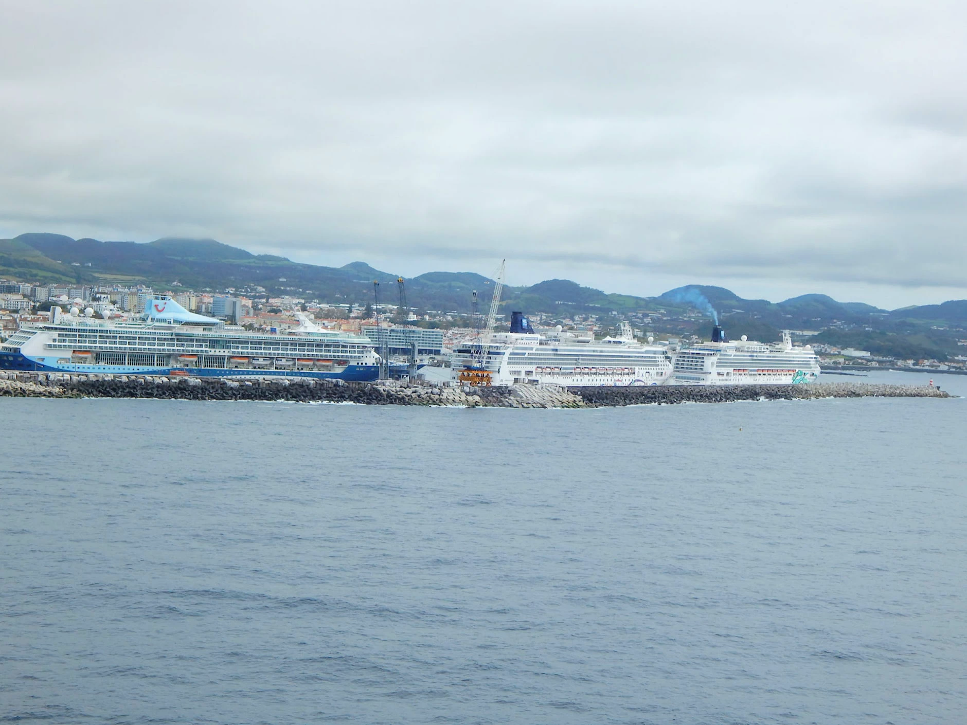 Ponta Delgada Harbor
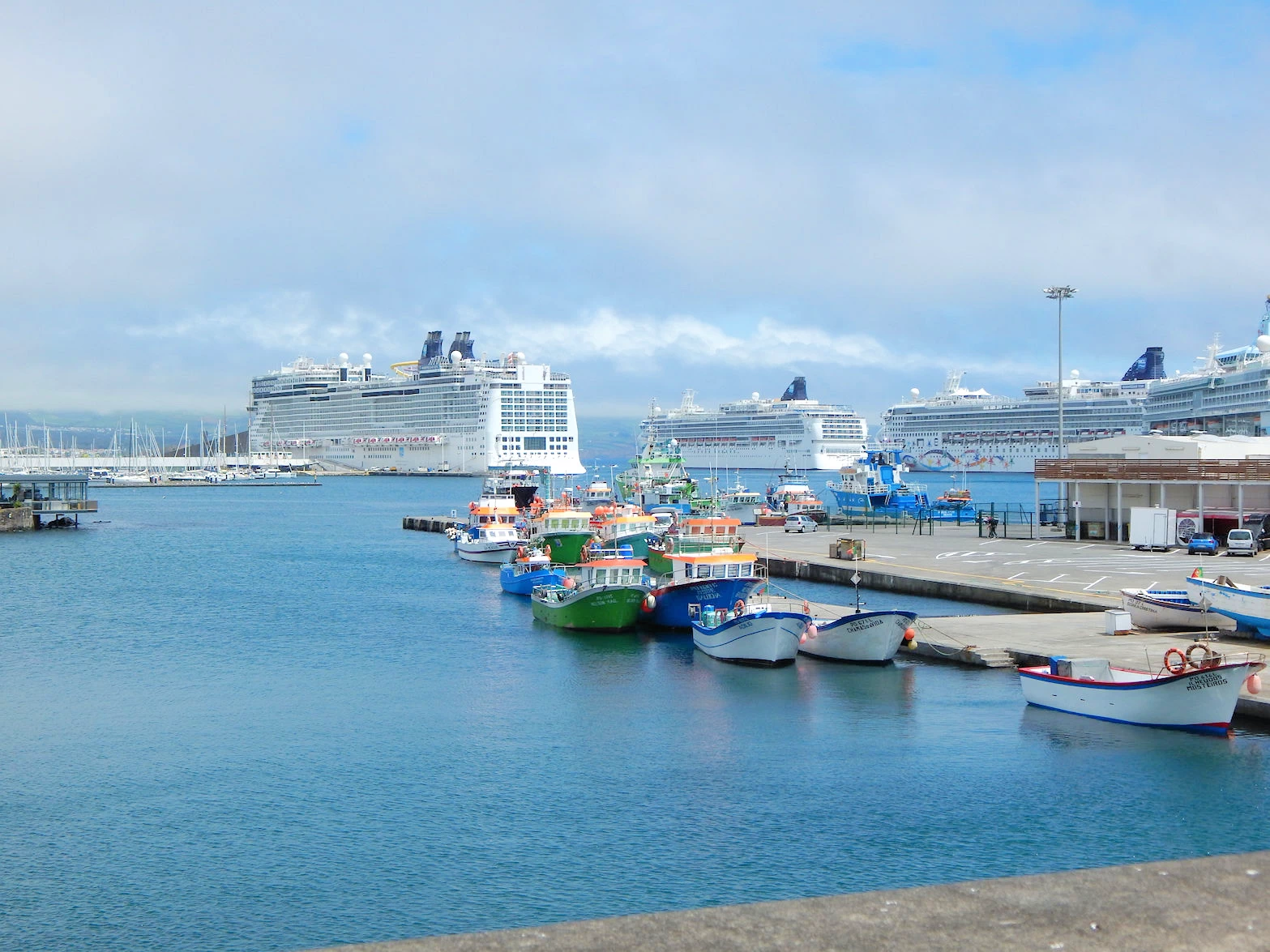
As an ex-Navy sailor & a boat owner for many years, I was repeatedly impressed with the manner in which the Norwegian Epic was manuevered by the ship's Captain, let me explain; If you look at a map of the harbor you will be able to see that the harbor, although compact, has a long combined dock & breakwater named "Molhe do Porto", which is where the Norwegian Epic was going to tie up. Now because this is a compact harbor, without sufficient room for the Epic to turn around for departure (ie; no "turning basin"), the Captain/Pilot backed the ship into it's berth along the dock. This is technically interesting, but once I read that the Norwegian Epic has bow & stern thrusters I knew that docking would not be difficult. The ship was brought into the vicinity of the Molhe, the bow was swung about, and the ship was then backed into it's berth easily without any tug boats being required.
Now to put the above into perspective and to further explain why I found our docking so interesting, the Norwegian Epic size; 1,081 feet in length, 133 feet in width, over 155,000 tons & over 200 feet in height (keel to top). And yet the ship was maneuvered next to the dock without a pause!
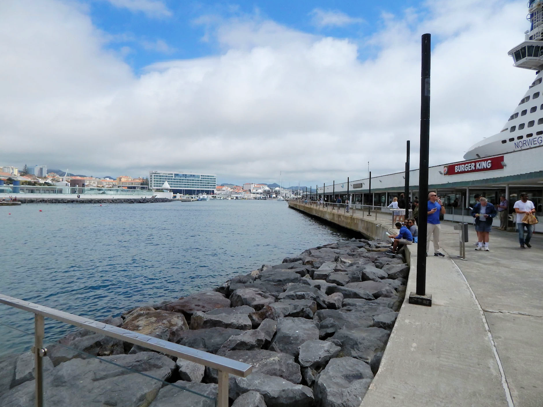 Molhe do Porto Area
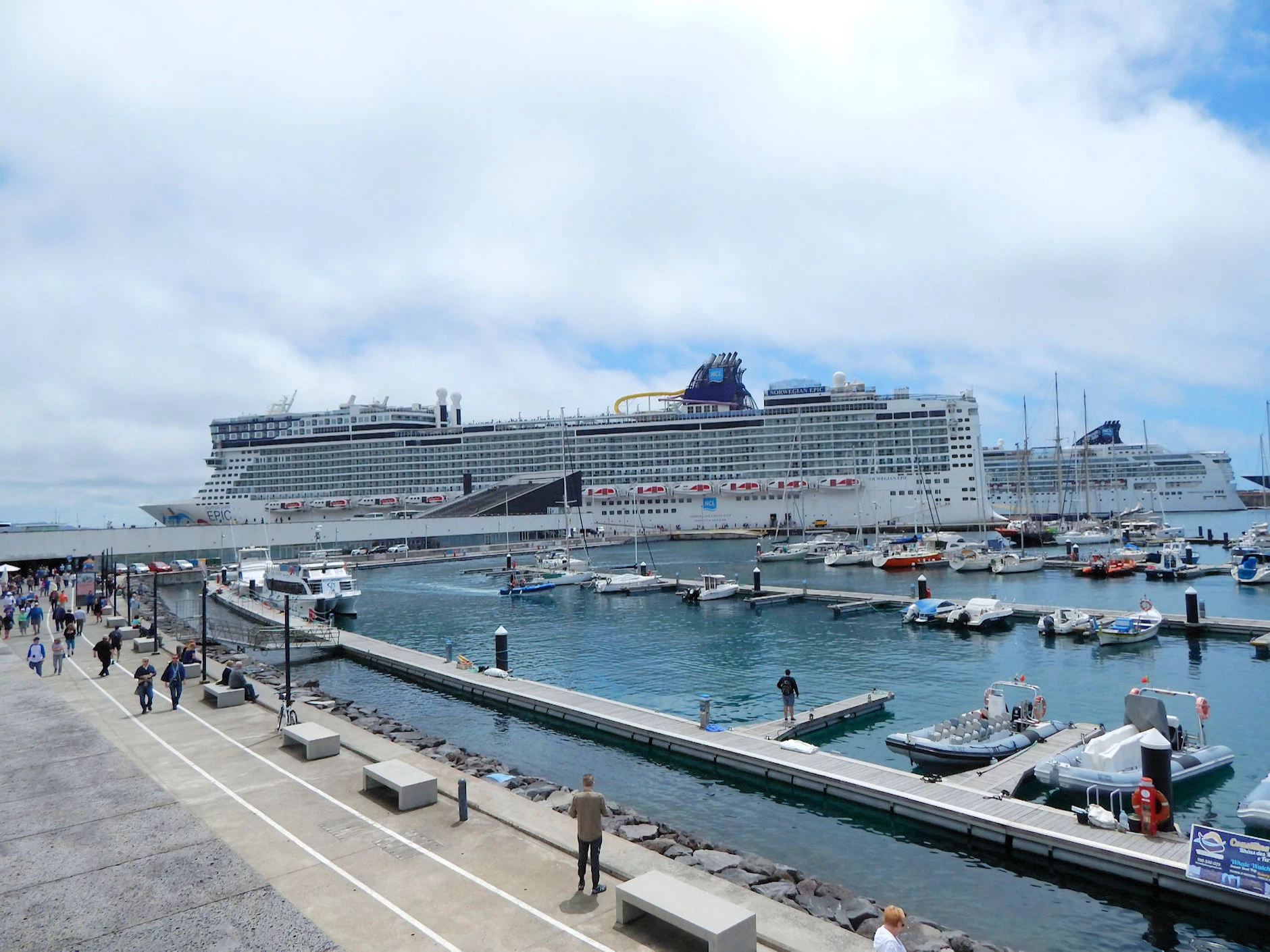 Molhe do Porto Area
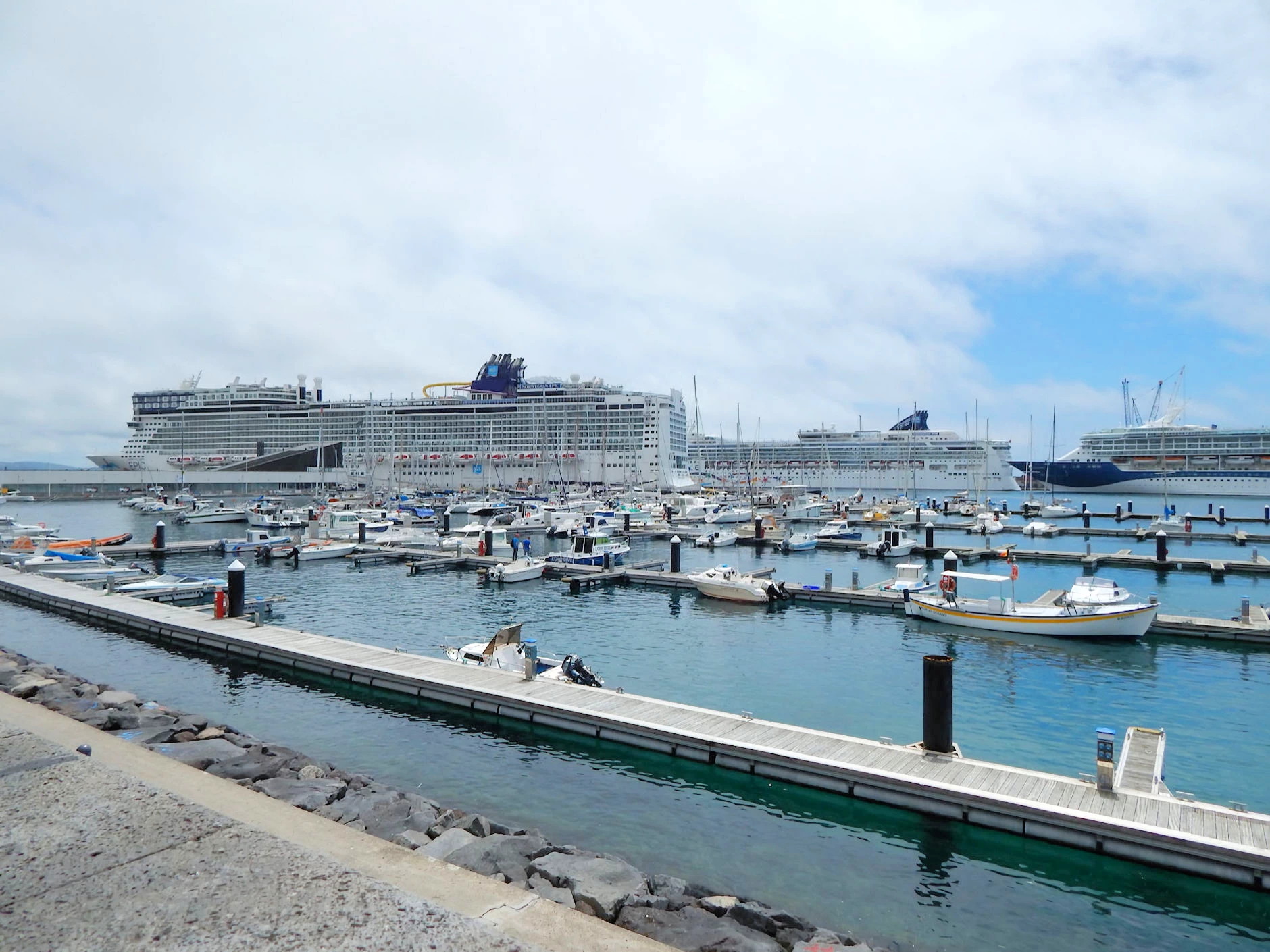 Molhe do Porto Area
The above pictures may give you some idea of the shops and bars on the Molhe do Porto. All we had to do to walk into town from the ship, was to walk past the shops and exit onto the city street that parallels the harbor.
As you can see in the third image above, all of the cruise ships would "back into" their docking locations because there is no "turning basin" in this harbor to allow them to turn around. So having the bow aimed at the departure direction allows them a simpler/faster exit.
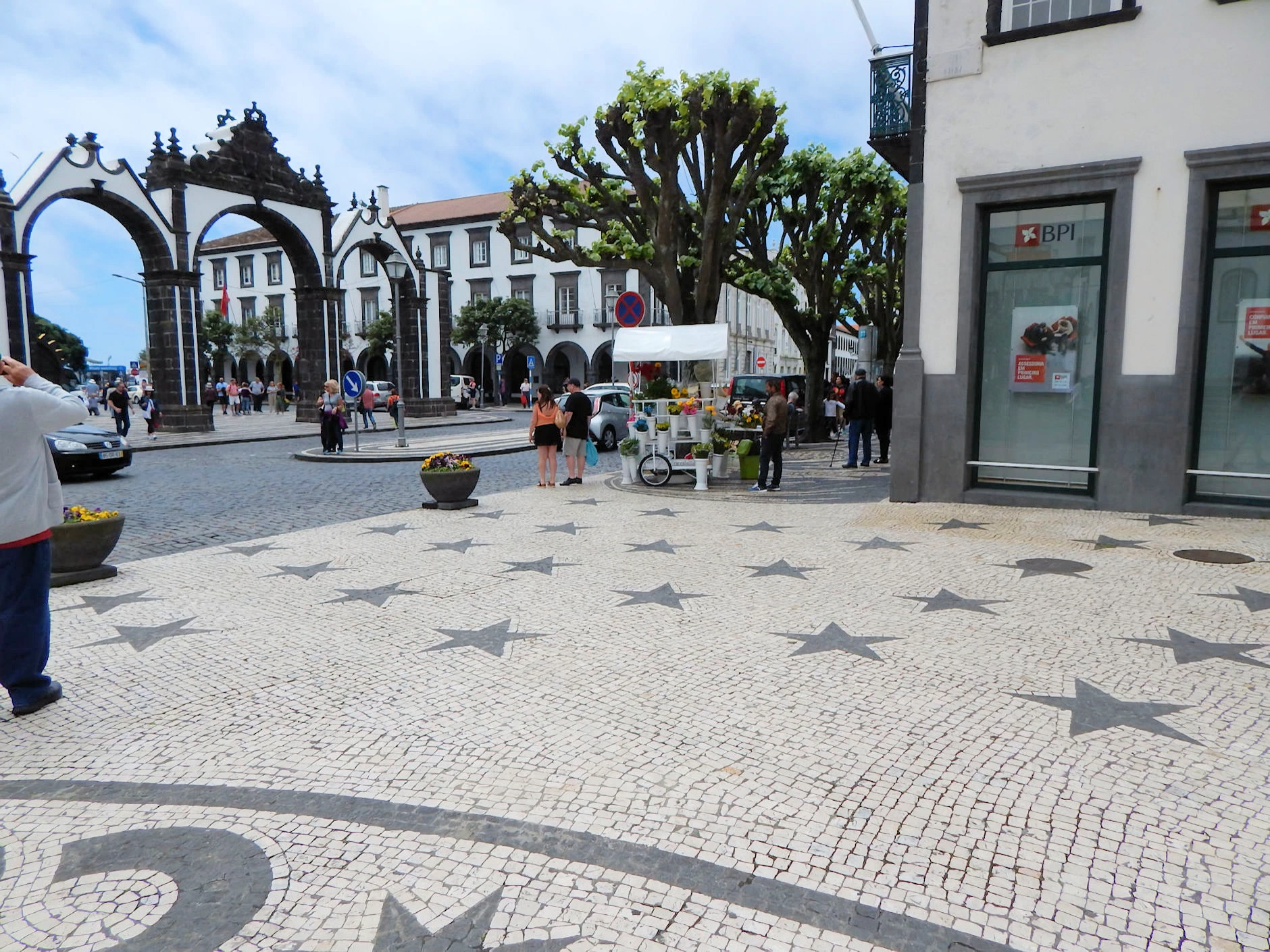
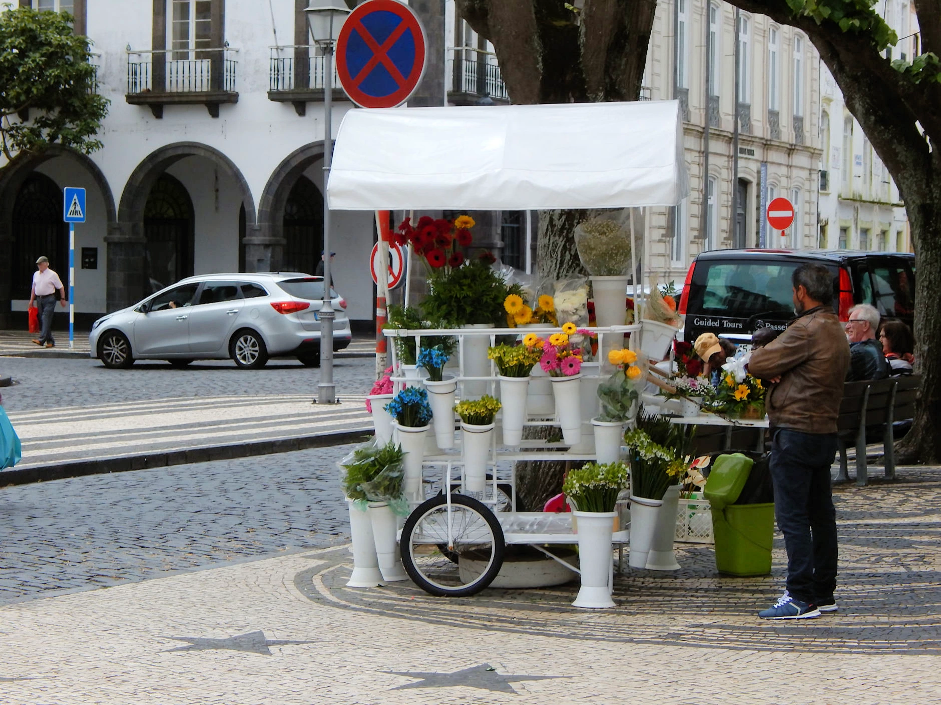
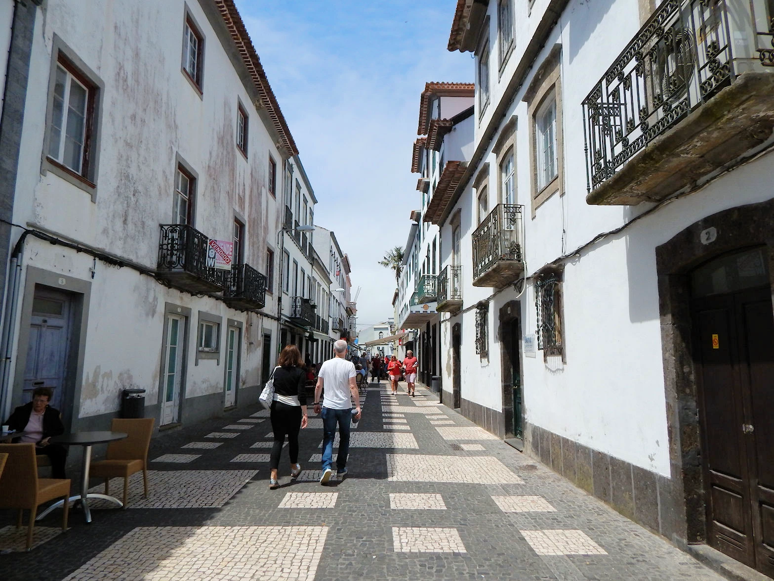
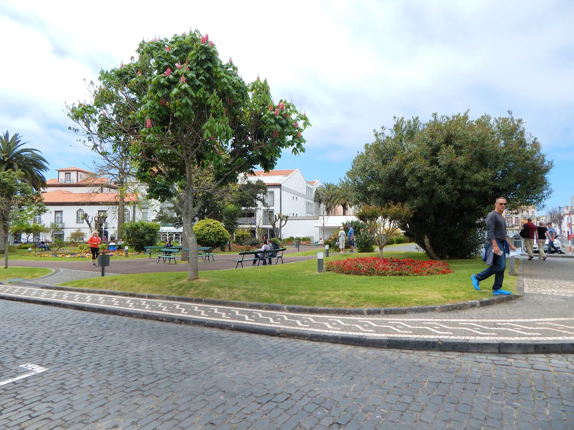
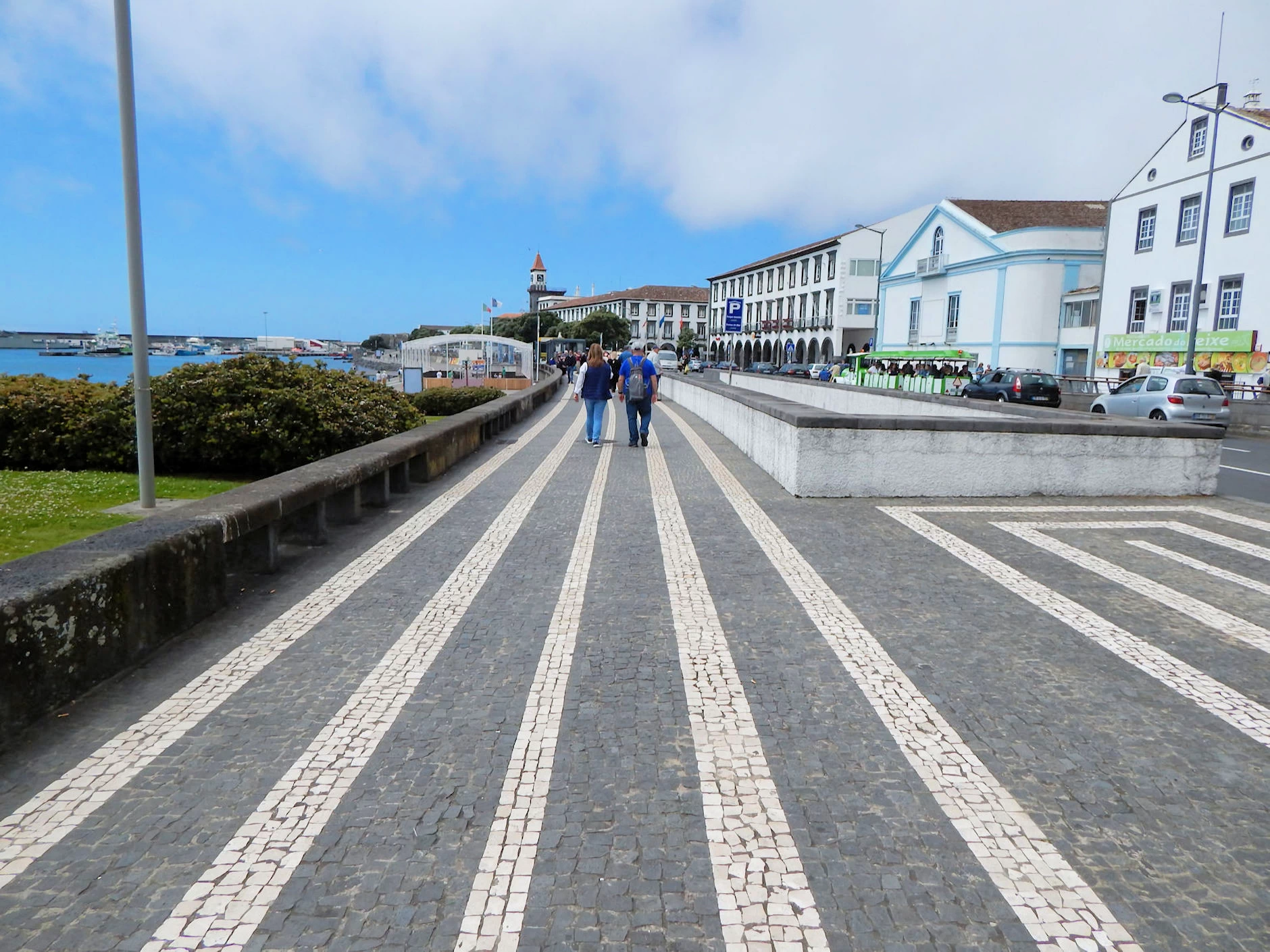 Exploring Ponta Delgada
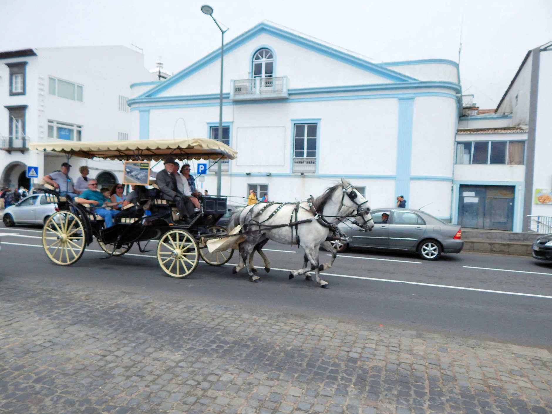 Exploring Ponta Delgada
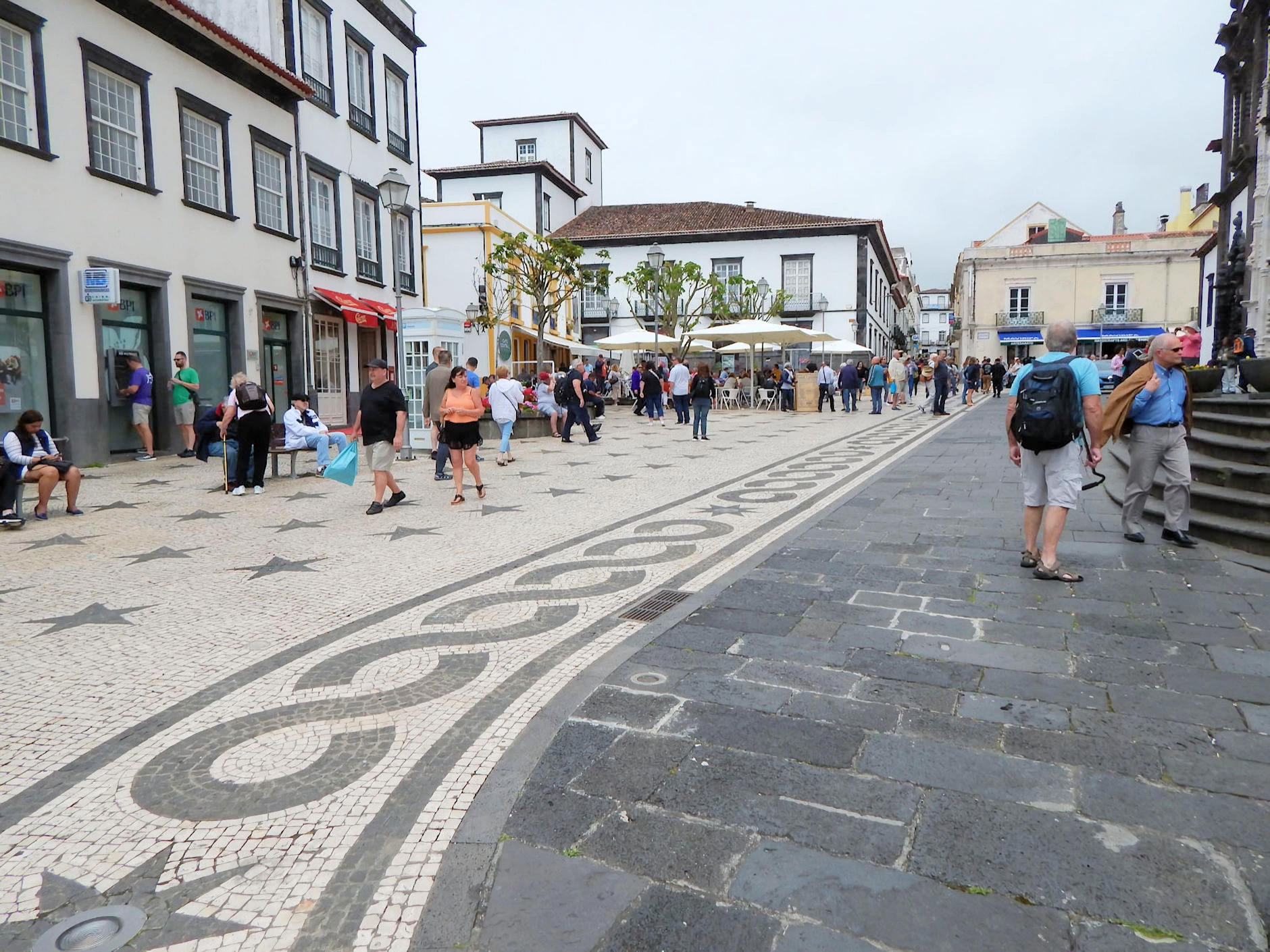 Exploring Ponta Delgada
Ponta Delgada is a small city and therefore easily walkable. We had no specific destination in mind, so we decided just to explore and try to find some interesting places and maybe some pastel de natas,
The street that paralled the harbor had a series of shops, restaurants and various other businesses and some of the sidewalks and streets had a nicely artistic appearance due to the manner in which the tiles were laid out.
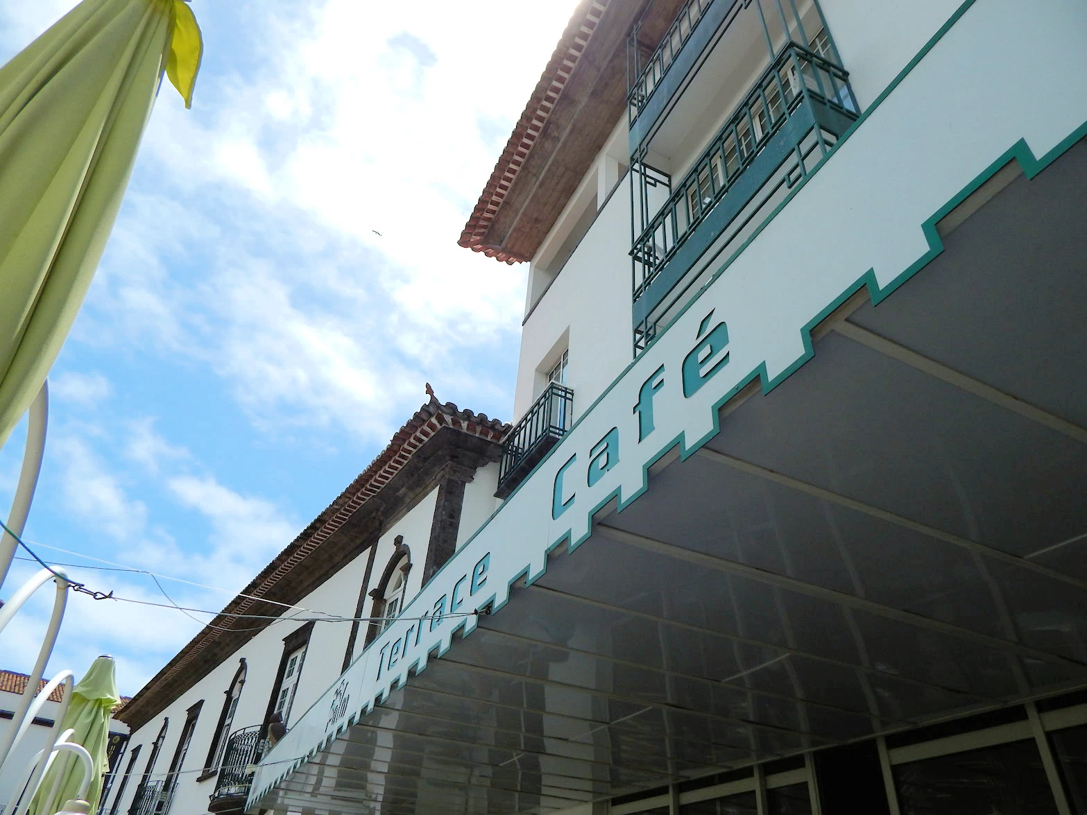
We decided to have lunch at the Restaurant Palm Terrace Cafe. The weather was beautiful and we were able to sit outside in the garden terrace (there are two modern dining rooms inside, but it was way too nice to be sitting inside). We ordered a cheese plate for our appetizer and Celeste had their fish stew and I had shrimp in a garlic sauce. We had a small bottle of Vinho Verde (one of our favorite Portuguese white wines) which complimented the sunny day. The prices were reasonable and the food authentic to the region.
Their menu contains a good selection of seafood and pastas items as well as International and Portuguese dishes, reasonable wine list and a small selection of desserts. Their address is Rua Marquês da Praia e Monforte, 40 (or to be brief, look for the Hotel Talisman.
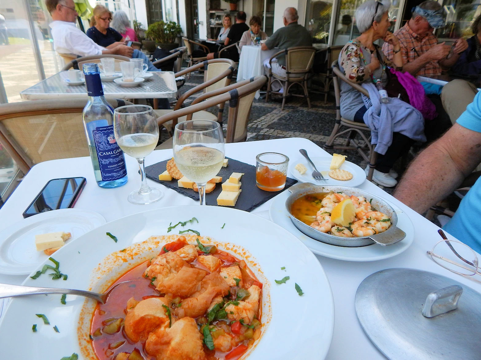 Restaurant Palm Terrace Cafe
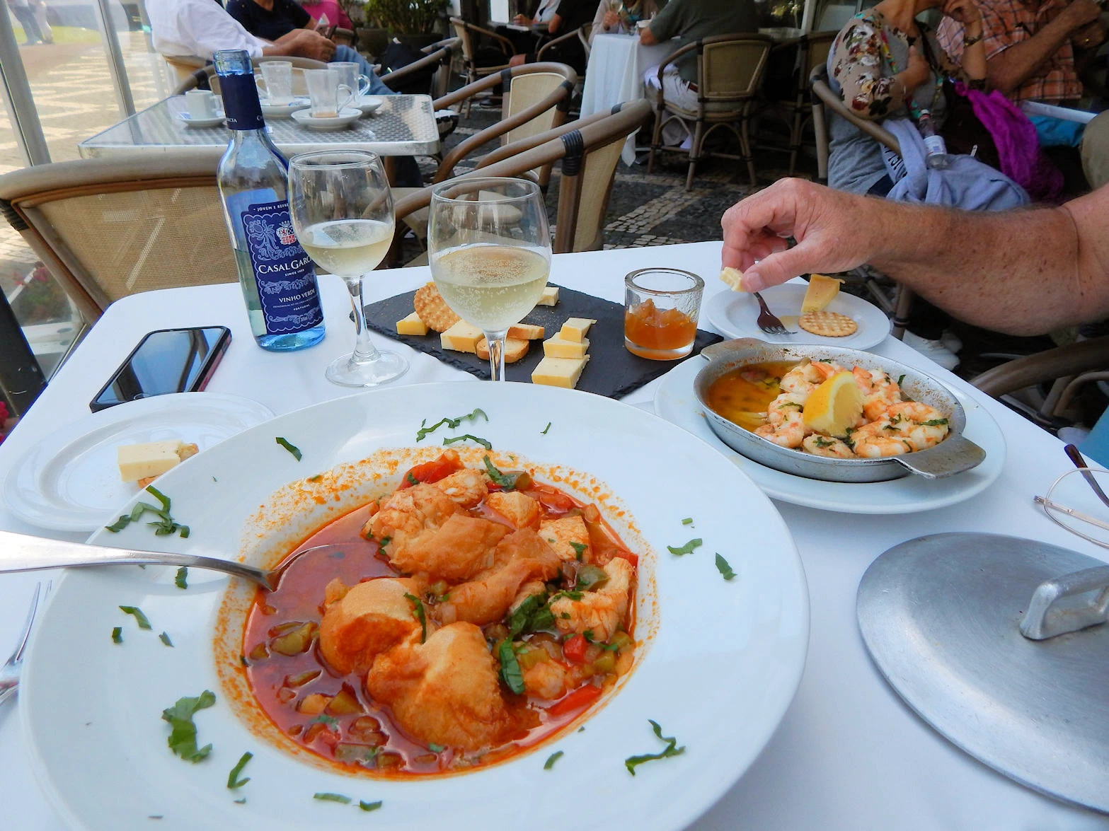 Restaurant Palm Terrace Cafe
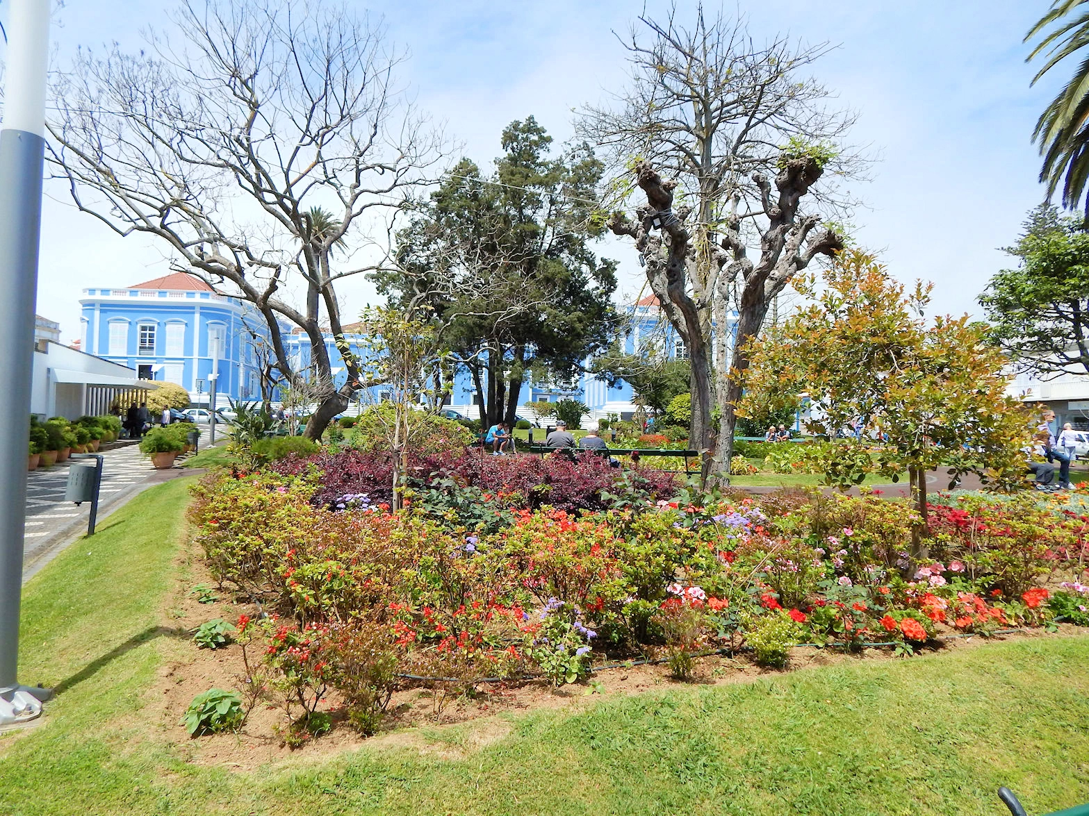 Restaurant Palm Terrace Cafe
The Palm Terrace Café in Ponta Delgada is a charming restaurant that is part of the Hotel Talisman, which sits adjacent to the café. Conveniently located in the heart of the city, both the hotel and the restaurant enjoy a prime spot next to the picturesque Jardim Padre Sena Freitas, a beautifully maintained garden that adds a serene backdrop to your dining experience.
The restaurant is known for its blend of traditional Azorean flavors and contemporary cuisine, featuring fresh, locally sourced ingredients. Its convenient location near key attractions in Ponta Delgada makes it a popular choice for both locals and tourists looking for a relaxing spot to enjoy a meal or coffee break.
Ponta Delgada Eateries
Ponta Delgada's restaurant scene offers a wide array of culinary experiences, ranging from traditional Azorean fare to modern and international cuisines. Here is a link to a Google Search Results list for "Ponta Delgada Restaurants".More Info for the Palm Terrace Cafe
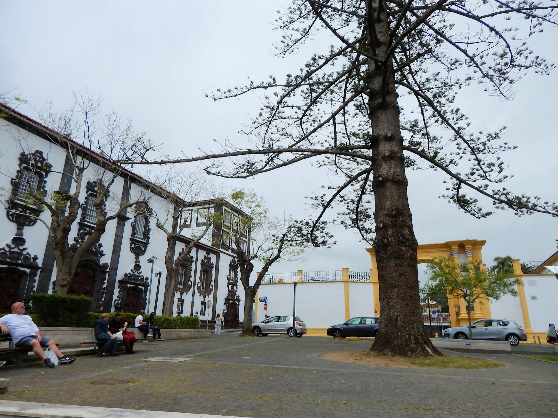
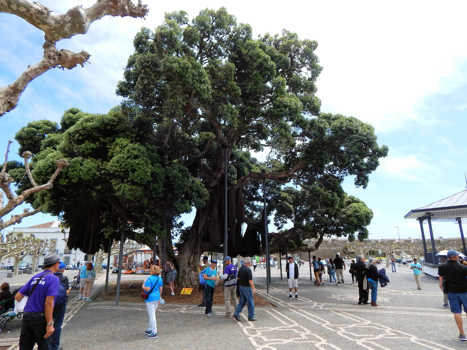
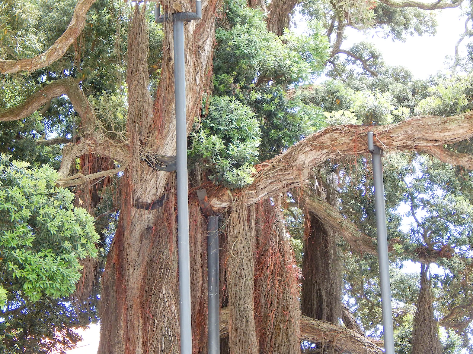
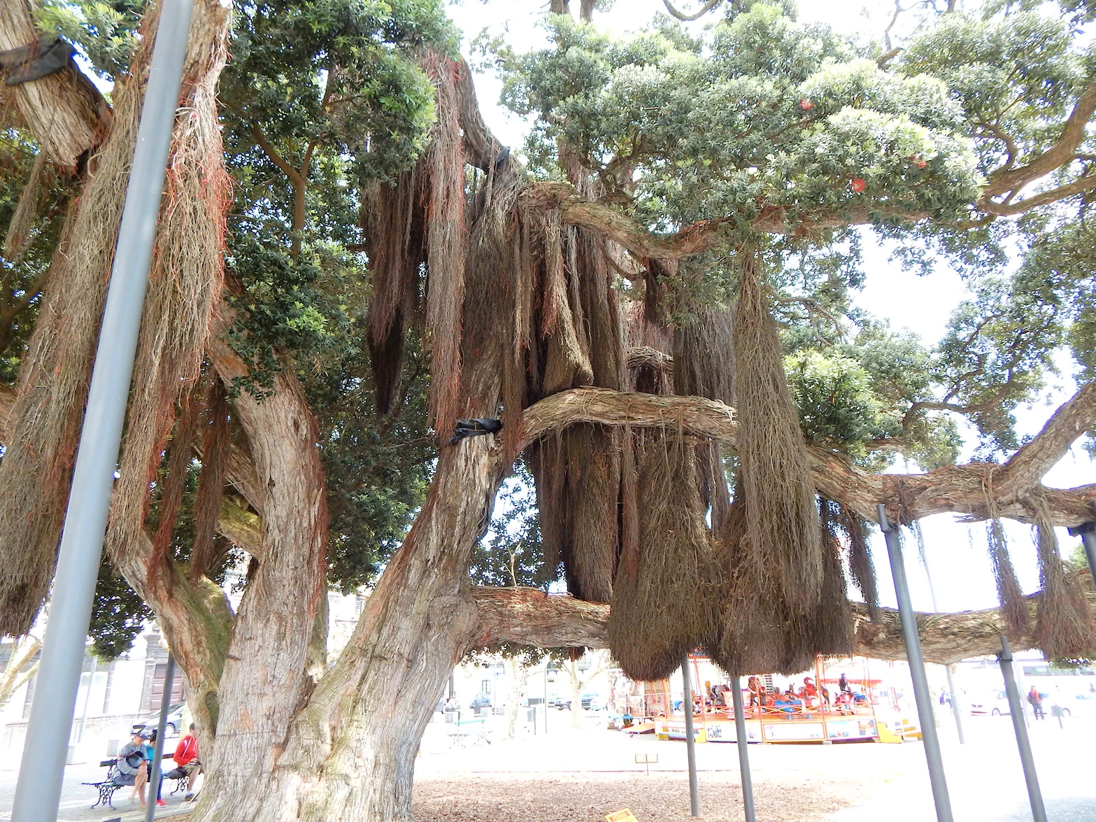
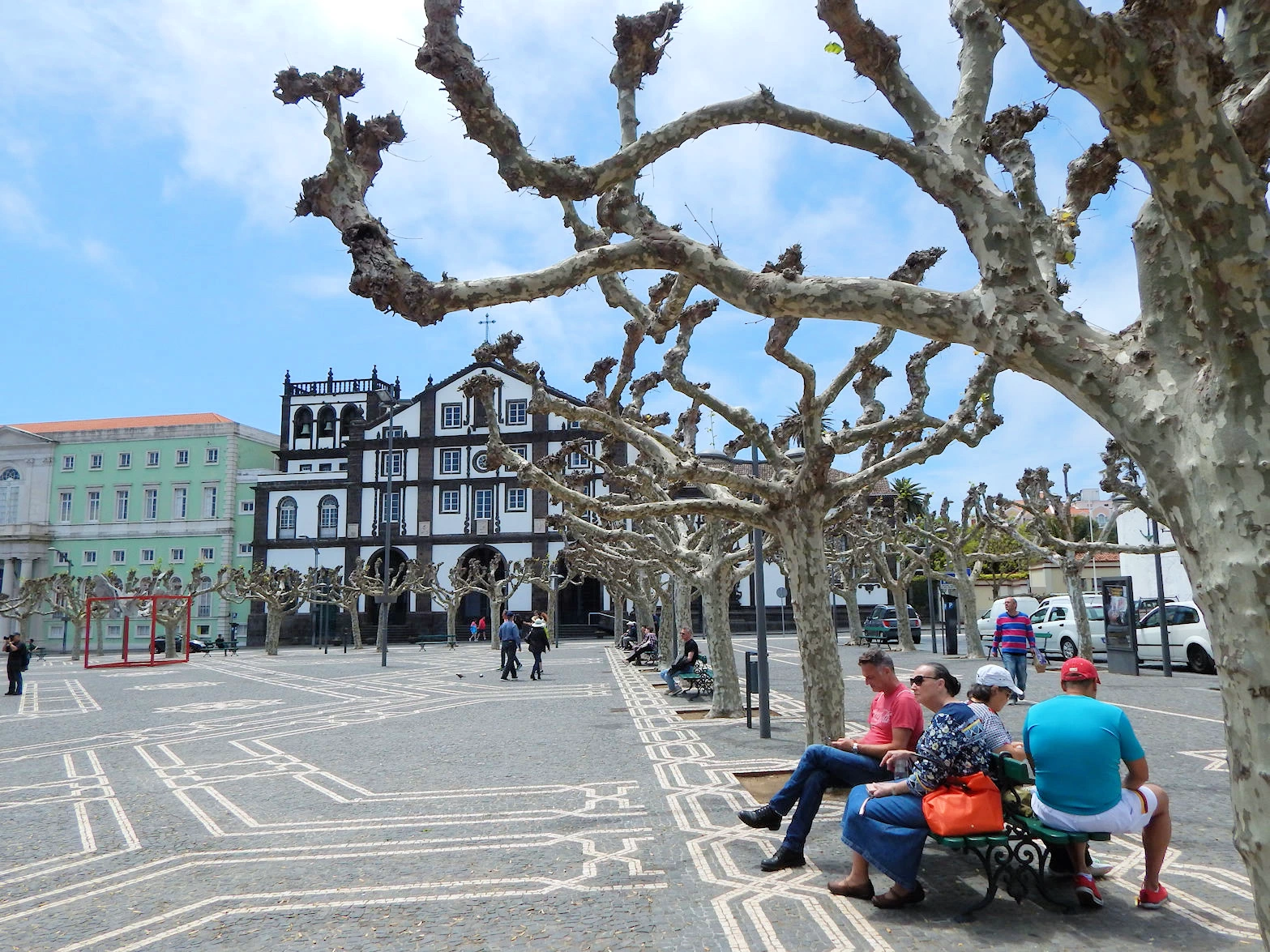
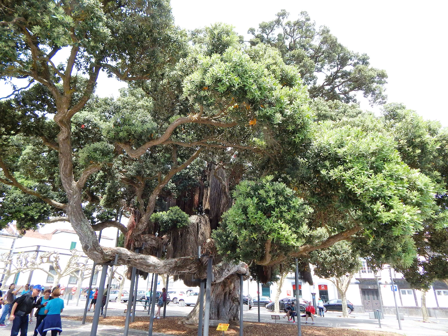
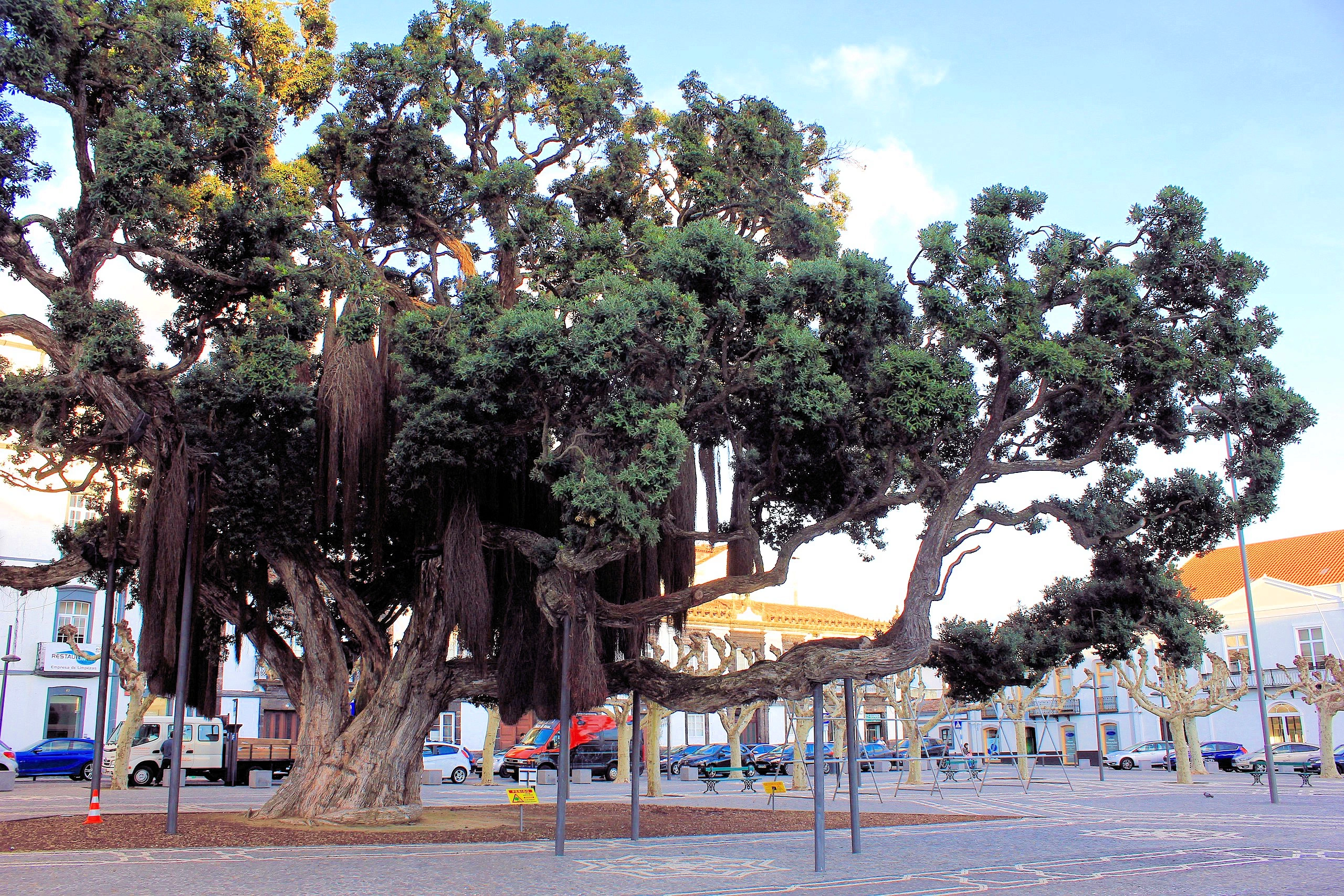
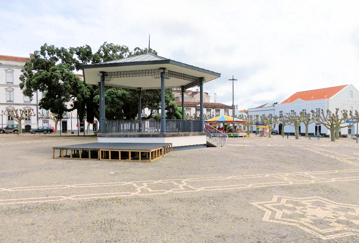
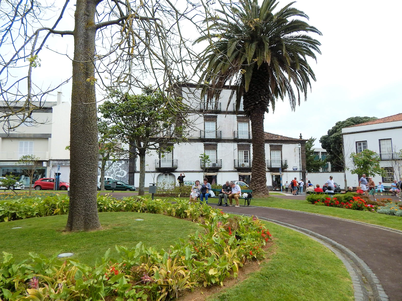
On our stroll back in the direction of the harbor, we came across the Campo de São Francisco. This large square had several large trees ("metrosiderus tomentosa" originally from Australia) that looked like banyan trees. The trees had "support poles" holding up the enormous tree limbs that spread out over the area around the tree. The square was surrounded by several interesting buildings, including a pretty church named Santuário do Senhor Santo Cristo dos Milagres.
More Info for Campo de São Francisco
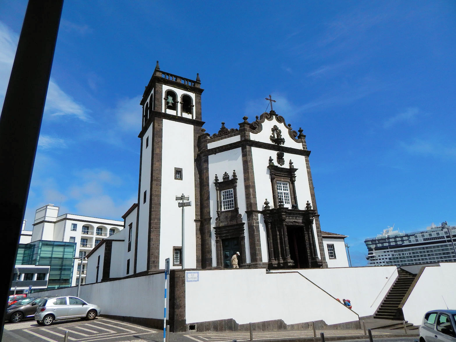
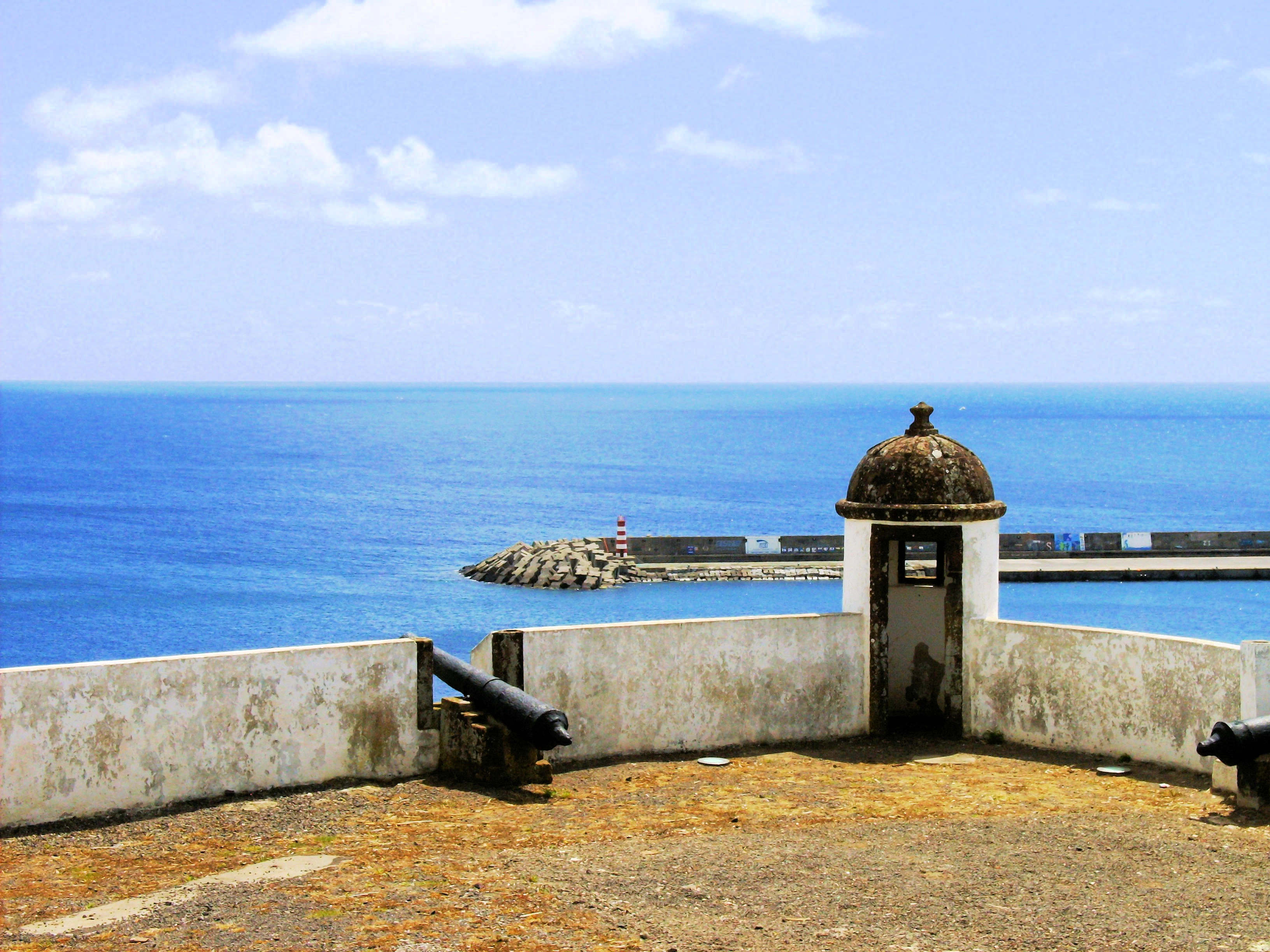
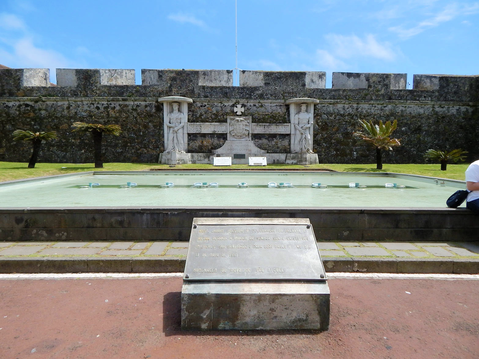
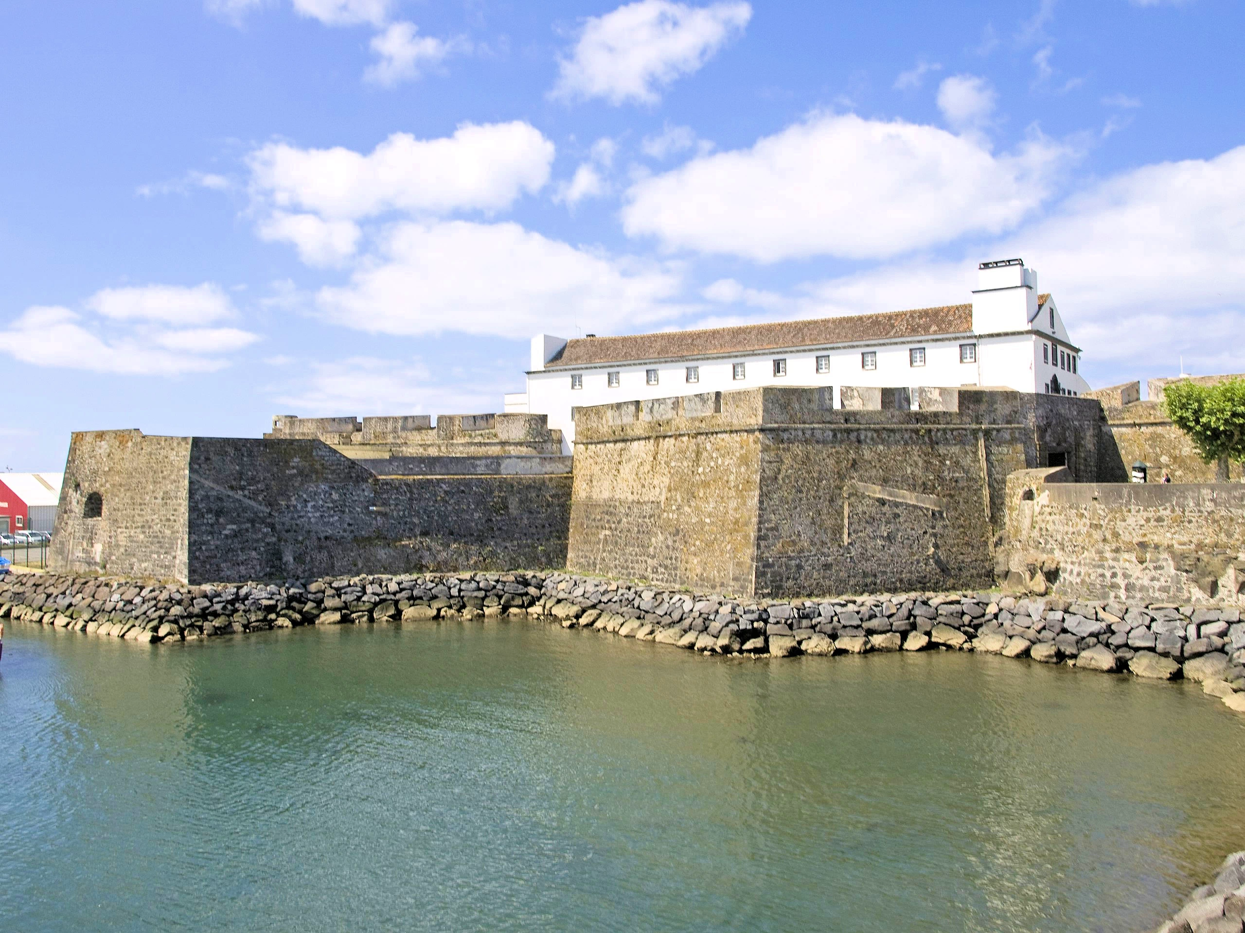
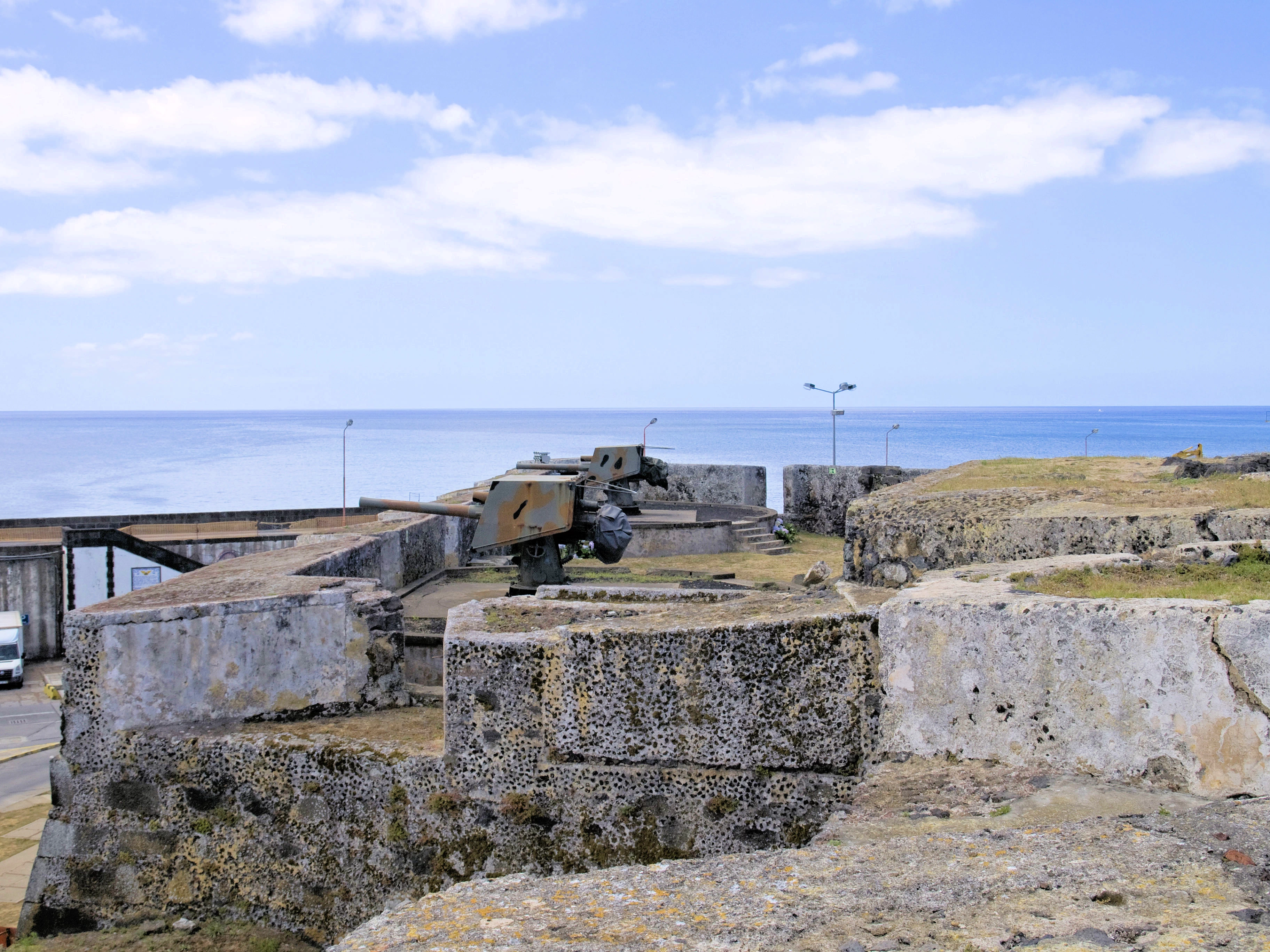
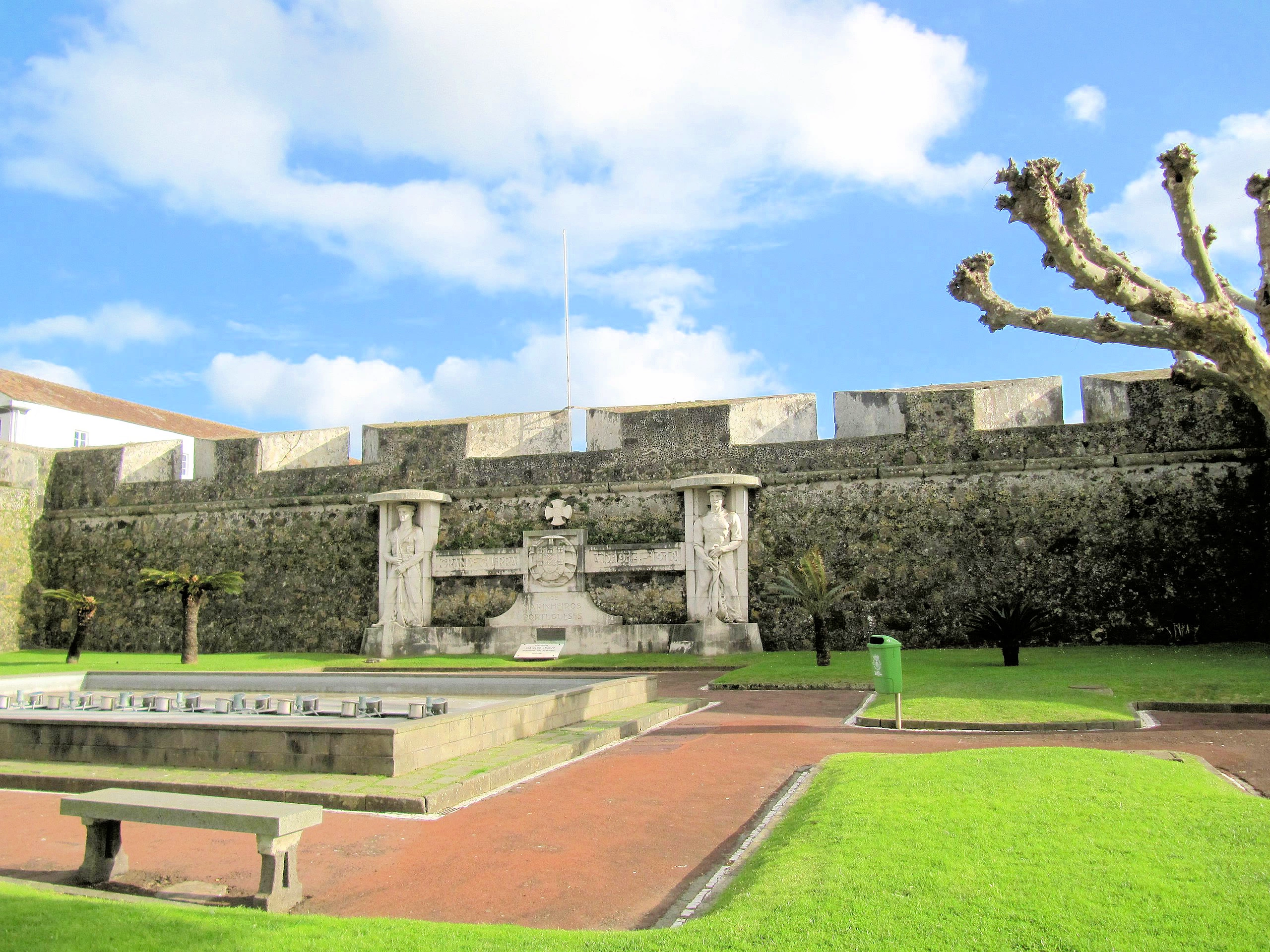
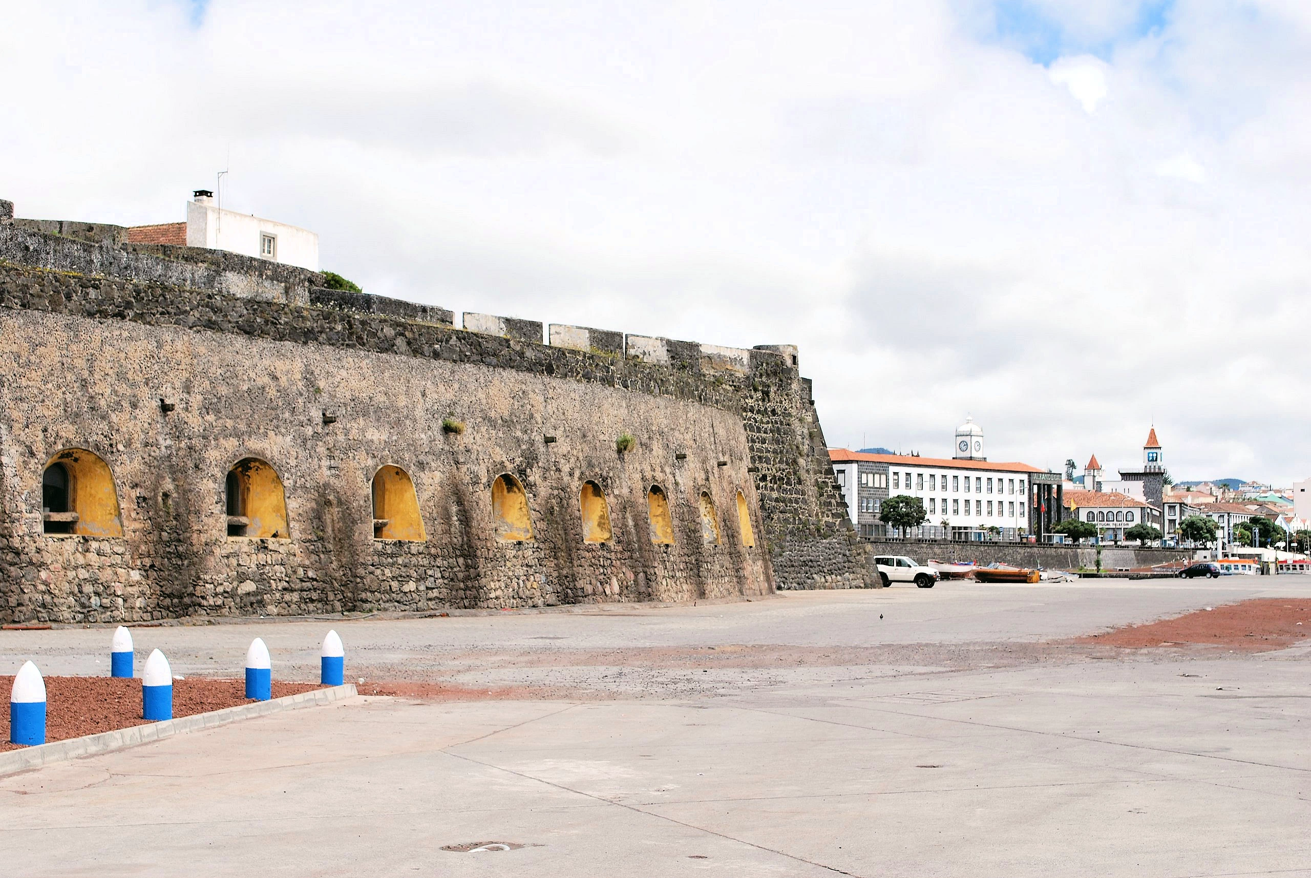
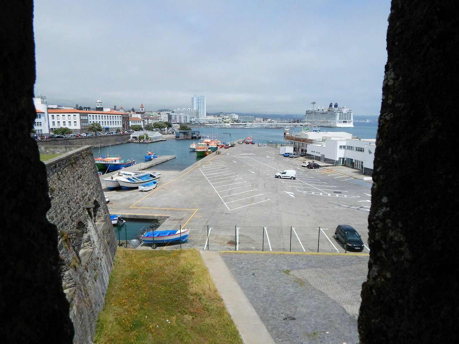
The Fort is located just to the south of the Campo de São Francisco square, and since it looked interesting, it became our next exploration goal. The Fort is now a combination of a museum as well as the original fortress itself, and it has a commanding view of the harbor. Considering that the Fort was originally constructed in 1560, it is in very good condition.
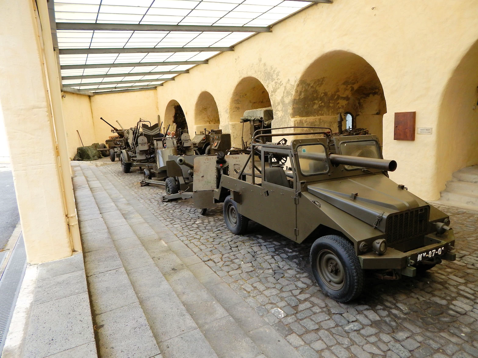
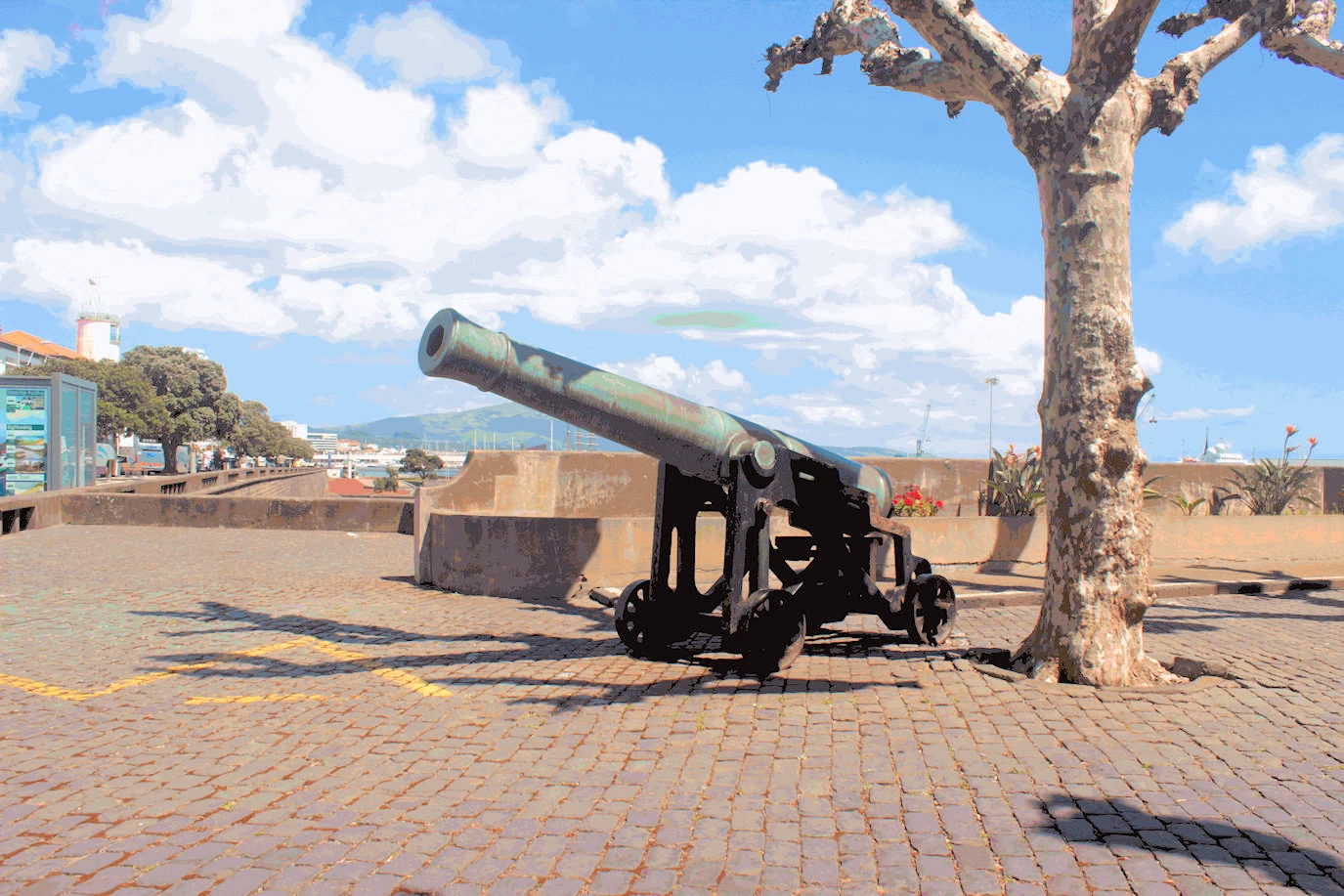
Visitors to Fort São Brás in Ponta Delgada, Azores, will step back into a significant part of Azorean history. The 16th-century fortress, originally built to defend against pirates, features thick stone walls, cannons, and panoramic views of the Atlantic Ocean. Inside, the museum offers insights into the region’s military history, showcasing artifacts, weaponry, and exhibits on the role of the Portuguese navy. The combination of historical exhibits and stunning ocean views makes this fort a fascinating and scenic destination.
The Fort São Brás is a polygonal base construction, designed by the Italian Tommaso Benedetti, with four bastions at the angles, prepared to receive pieces of artillery and low wall curtains, of great thickness. In its interior there is a square of arms and, in its around, a set of buildings of times and diverse configurations. Over the centuries, it has been altered with new additions and transformations. The fort was constructed in the sixteenth century with the purpose of protecting Ponta Delgada from pirates.
The analysis of the work of the seventeenth-century chronicler Gaspar Frutuoso who described in detail the most remarkable things on the island and reported the different incursions of privateers until then, circa 1586-1590, indicates only a lookout on the Fort site: "(...) guarded the hermitage of Our Lady of Conception, which is on the port (...)". Other warnings came from the lookouts then also in the Figueiral and Marvão.
When English privateers attacked in 1589 the High Rock was already possibly strapped with some cots and hawks, throwing stones as projectiles: "(...) declined Captain Bras Soares de Sousa from where the artillery is below the port (...). In this way, it is accepted that the primitive construction of the fort dates back to the beginning of the seventeenth century, or more probably to the second half of the same century, when the Captain-Major João Falcão de Sousa, 10th captain of the granary of Santa Maria (1654-1657), he held the position of Superintendent of the Fortification Works of the island.
The fort's role has now become a combined military museum and place of interest for tourists. As Portugal has had a series of military adventures in their prior colonies, the museum contains artifacts & images from those adventures.
More Info for Fort São Brás
The ship required all passengers to be back onboard prior to 7:30PM, so we decided to head back to the ship at approximately 6:15pm and find out what was on the menu for dinner! This would allow us to be at the dinner table during the ship's departure, which provides you with a view of the harbor as the cruise ship heads out to sea.
You can see that there were quite a few cruise ships in port that day, but that did not result in crowded conditions ashore. The city is relatively small & very walkable.
What is the best time of year to visit Ponta Delgada? The Azores have a mild, subtropical climate year-round, but the best time to visit is during the warmer, drier months from July to September. You can experience "four seasons in one day" due to the changeable weather, so layering your clothing is always a good idea.
What should I pack? Pack layers of clothing for unpredictable weather, including a lightweight jacket and rain gear. Good walking shoes are a must, both for exploring the city's cobblestone streets and for hiking on the island.
Do I need a rental car? A rental car is highly recommended if you plan to explore São Miguel beyond Ponta Delgada, as public transportation outside the city is limited. However, the city itself is best explored on foot. Taxis are also readily available.
How do I get to Ponta Delgada? You can reach Ponta Delgada's João Paulo II Airport (PDL) by direct flights from mainland Portugal and major North American and European cities. For inter-island travel, Azores Airlines is the main carrier.
City Gates (Portas da Cidade): An iconic 18th-century archway monument that serves as the city's symbol.
Carlos Machado Museum: Features an extensive collection of Azorean ethnography and natural history.
Mercado da Graça: A bustling market with vendors selling fresh fish, produce, and local cheeses.
Jardim António Borges: A botanical garden featuring exotic plants, walking trails, and grottoes.
Forte de São Brás: A 16th-century fortress offering a military museum and views of the harbor.
What local foods should I try? Be sure to sample local delicacies like fresh seafood, the volcanic stew cozido das Furnas, and the local sweet potatoes. The island's signature cheese and regional pineapple are also must-tries.
Is it necessary to speak Portuguese? While Portuguese is the official language, many people in tourist areas like Ponta Delgada speak English. However, learning a few basic Portuguese phrases is always appreciated by locals.
Is it safe to visit? The Azores are generally very safe. However, as with any tourist area, visitors should be mindful of petty crime like pickpocketing in crowded areas.
Ponta Delgada presents a mixed bag for wheelchair users, offering some accessible features alongside significant challenges posed by its traditional cobblestone streets and older infrastructure. The city and São Miguel island as a whole are becoming more accessible, particularly with the help of specialized tour operators.
Cobblestone streets: The historic center of Ponta Delgada is known for its beautiful cobblestone streets. While charming, they can be very difficult to navigate in a wheelchair due to their uneven surfaces.
Narrow and uneven sidewalks: The sidewalks in older areas are often narrow, with varying widths and frequent curb ramps that can be poorly maintained or nonexistent.
Modern infrastructure: The main avenue along the coast has wide, smooth sidewalks with accessible curb ramps, making it a good area for wheelchair users. The Ponta Delgada Airport (PDL) also offers "MyWay" assistance for travelers with reduced mobility.
You should be aware that Norwegian Cruise Lines (NCL) varies where their ships go, as well as what ships they will reposition. To determine where NCL is sending what ships, you should visit their website. Our list of ports below, is based upon what the "Epic" did when we were onboard in 2019.

Norwegian 'Epic' Cruise Overview
Click here to read more on our Cruise Overview Page

Ponta Delgada, Portugal
Click here to read more on our Ponta Delgada Page

Funchal Madeira Portugal
Click here to read more on our Funchal Page

Cadiz/Seville, Spain
Click here to read more on our Cadiz/Seville Page

Malaga, Spain
Click here to read more on our Malaga Page

Cartagena, Spain
Click here to read more on our Cartagena Page

Mallorca, Spain
Click here to read more on our Mallorca Page

Barcelona, Spain
Click here to read more on our Barcelona Page
Note: All images featured on this page are the exclusive property of Just Traveling Thru, LLC, unless otherwise stated. When images from external sources are used, full credit is given to the original creator, along with a link to the specified license or usage terms. We are committed to respecting copyright and intellectual property rights, ensuring that all third-party images are properly attributed. If you have any questions regarding image ownership or usage rights, please feel free to contact us.
Affiliate Links: We may earn a commission if you make a purchase through one of our affiliate links. This helps support our travel content — thank you!
Content: To review any of our content, make suggestions and/or comments, please click the "About" menu link at the top of this page. You will find our "Contact Us" link on that drop-down menu.
 Click above Image to view larger Google Map

