
by Celeste Lipford and Terry Lipford - last updated on 9/8/2025
Arches National Park is one of Utah's mighty 5 national parks. It is known mostly for its more than 2,000 natural arches. In addition to arches you'll find giant balanced rocks, huge fins, petrified dunes and other amazing rock formations that rise out of the desert floor. Arches was the third stop on our 16 day tour of Colorado and Utah. You can visit our trip itinerary here.
The National Park Service (NPS) currently requires a "date & time" reservation to enter (for more detailed information here is a link to the NPS site). Our reservation had been at 1:00 pm, however, we ended up missing it when we arrived because we took longer exploring Colorado National Monument than we had planned on. The good news is that the timed entry requirement is dropped prior to 6:00 AM and after 5:00 PM. So, being morning people, we got up early the next day and drove over before sunrise. This turned out perfectly for us and we caught some interesting photos before the sun fully came up. We were at double arch as the sun rose! You can see some of those images in the sections below and check out our video for a tour of the park.

If you enjoy our videos click here to subscribe to our Youtube Channel.

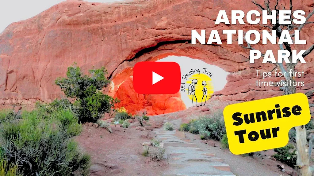
Click the above video poster image to experience the magic of "Sunrise at Arches National Park" in this virtual visit through the stunning red rock landscapes in Arches National Park in Utah. Arches is one of the Big 5 Utah National Parks! There are over 2000 natural arches in the park. Get the pro tips you need for a successful one day visit to Arches National Park and drive through some of the major s ites in Arches National Park at sunrise including Delicate Arch, North and South Windows, Turret Arch, Sand Dune Arch, Balanced Rock, and more. Join us to learn what you need to know before you visit.
The park was originally established as a National Monument on April 12, 1929, by President Herbert Hoover. In 1971, Congress changed the status of Arches to National Park from National Monument.
There are four main categories of Arches found in the Park; Cliff Wall Arches, Free-Standing Arches, Pothole Arches and Natural Bridges.
The entire region began to rise 15 million years ago, and increasing erosion caused removal of the sedimentary rocks above the Entrada Sandstone. Once at the surface, erosional forces began to act upon the sandstone layers creating the famous arches with the national park.
Temperatures in Arches National Park can fluctuate over 40 Degrees in a single day. Annual low temperatures can reach 22 degrees farenheit in January and over 100 degrees farenheit in July.
There are over 400 types of plants found in Arches National Park.
There are over 50 species of mammals that live in Arches National Park.
The park's area is 310.31 square kilometers (76,680 acres; 119.81 square miles) in size.
The park receives over 1.8 million visitors annually. Between 2011 and 2021, the park saw a 74% increase in visitation, leading to infrastructure challenges and the implementation of a timed entry reservation system during peak seasons to manage the crowds.
Arches National Park has the densest concentration of natural stone arches in the world. There are over 2,000 documented arches in the park, plus pinnacles, balanced rocks, fins and other geologic formations. Some of the most famous arches include Delicate Arch, Landscape Arch, and Double Arch.
Yes, during peak season (April 1 - October 31) timed entry permits are required. Reserve yours online in advance at this link.
No, Landscape Arch is the longest natural arch in North America, stretching 306 feet (93.3 m) across. At its thinnest point, it is only 6 feet (1.8 meters) thick. The largest natural arch in the world is Fairy Bridge (Xianren Bridge) in Guangxi, China.
With over 2,000 natural sandstone arches, plus countless spires, pinnacles, and balanced rocks, Arches is a masterpiece of natural erosion. It's the world's densest concentration of these unique and awe-inspiring formations.
Shoulder seasons – spring (April-May) and fall (September-October) – offer the perfect balance of pleasant weather and fewer crowds. Summer (June-August) is the most popular but temperatures often exceed 100°F. Winter brings cooler weather but may occasionally bring snow. The park is open 24 hours a day. Late afternoon and evening hours offer beautiful sunsets and reduced crowding, and naturally dark night skies sparkle overhead. During summer months, many trailhead parking lots fill by 7:30 am.
You can see the highlights within a day, but we recommend two or three days to fully explore and appreciate its wonders. Multiple days allow for longer hikes, stargazing, and less rushed itineraries.
Activities with pets are very limited at Arches. You may not take a pet on any hiking trails. You may have your pet with you in the campground, and at pullouts along the paved scenic drives. You may walk your pets on roads or in parking lots, but they must be leashed at all times when outside a vehicle.
Yes. A timed entry reservation is required to enter the park even if you have an existing pass. Annual passes cover the payment of entrance fees, so annual or senior pass holders only need to pay the $2 reservation fee. Go to this link to obtain a date & time entry ticket.
The National Park Service Page for Arches National Park has a lot of good information, and we would suggest that you go there if you have more questions.
Avoid visiting on holidays & weekends in the Summer Time.
To beat the crowds, try entering the park early in the morning or late in the afternoon. Temperatures are cooler and the light is better for photography.
Carpool if you can. Consider hiring a company to shuttle you to and from the park (visit Discover Moab Website to see what's available).
Parking for oversize vehicles (RVs, trailers) is extremely limited. Leave oversized vehicles in town, or in the visitor center parking lot.
Delicate Arch: The iconic symbol of Utah and the most famous arch in the park.
Landscape Arch: The longest arch in North America.
Balanced Rock: A precariously balanced boulder defying gravity.
Devils Garden: A fascinating area with a concentration of arches.
Windows Section: A cluster of photogenic arches close together.
Delicate Arch Trail: Moderate 3-mile hike to the park's most iconic arch.
Landscape Arch Trail: Easy 1.6-mile hike to the longest arch.
Devils Garden Trail: Moderate hike with options to see multiple arches.
Double O Arch Trail: Challenging hike showcasing two impressive arches.
Fiery Furnace: The Fiery Furnace is a maze-like formation that requires a special permit for entry. Permits are limited and can be obtained online in advance.
Or click here to view an AllTrails list of hikes in Arches National Park.
Yes! The main park road provides scenic views and access to many trailheads. Keep in mind that traffic backs up during peak season. Consider biking or using park shuttles to avoid congestion.
Beat the heat: Summer temperatures are extreme. Hike early, bring plenty of water, and seek shade during midday.
Timed entry: Reserve your timed entry ticket in advance online at The National Park Service Website.
Plan ahead: Research trails, pack snacks, dress in layers, and check weather forecasts.
The National Park Service Senior Lifetime Pass is a bargain, and if you visit parks often, your Senior Pass will provide you (and up to 3 passengers in your vehicle) with a no-cost entrance. Click here to visit the NPS site to obtain more info and purchase your own Senior Pass.
The red and orange color of the park's sandstone formations comes from iron oxide, which is essentially rust.
2025 Government Shutdown
Most National Parks remain open during a government shutdown, but with reduced services and staffing. Parks may be accessible, but facilities like visitor centers, campgrounds, and websites might be closed, and services like trash pickup and restroom maintenance can be significantly impacted. Visitors should check individual park websites for current conditions before going and be prepared with extra supplies and awareness that emergency services may be limited.
Gates and roads are generally open to allow access to outdoor areas.

Arches National Park is located in eastern Utah, near the town of Moab. It sits approximately:
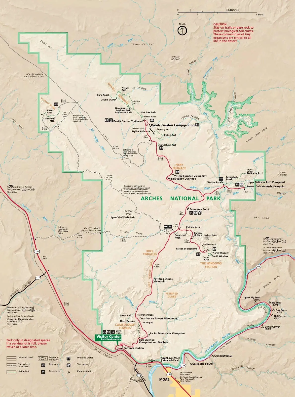
The map image above is the property of National Park Service via their website.
As of 2020, the Moab area featured approximately 2,888 hotel and resort rooms, 71 bed and breakfast units, 524 condos and miscellaneous units, and 1,223 commercial campground sites. Additionally, the Bureau of Land Management (BLM) maintains 26 campgrounds in the Moab area, providing numerous first-come, first-served campsites for visitors seeking a more rustic experience. These options collectively offer a wide array of lodging choices for travelers exploring Moab and its surrounding natural attractions. The following are the top five most popular accommodations in Moab based upon Google Reviews;
Moab, Utah is essentially the only major town in the area and so it is the best place to stay when visiting Arches. There are tons of restaurants and hotels and a community that supports the parks in the area including Arches National Park, Canyonlands National Park, and Dead Horse State park. Here you can find just about anything you need including jeep rentals and other off roading vehicles and locals with lots of knowledge that can tell you the best places to explore. Check out our Canyonlands page for our exploration of the Shafer Trail in Canyonlands and other info about renting your offroad vehicle. (To view how we did that drive, click here)
We stayed at a Hampton Inn in Moab, Utah. We often select Hilton properties and this Hampton Inn was what you would expect for a Hilton property. We had a king suite and the room was very large. It was clean, had good beds, a refrigerator and free breakfast. That’s all that we needed.
We wound up eating out only one night while we were there, at the Moab Diner. I had one of the best liver & onions meals I have had in a long time ! An incredibly good meal, the service was prompt, efficient and friendly. Just for the record, we didn't eat dinner out on the other nights there because we had some nice charcuterie fixins from the Moab City Market (and a good bottle of red!).
There are many other places where you can find a meal, click here to view a Google Search Results List for restaurants in Moab.
The Moab Brewery was on our list to visit from our research, but we could not work in a visit that fit into our schedule. We found numerous people who said that it is a good pub. The Trip Advisor reviews vary all over the place, perhaps your experience will be better?
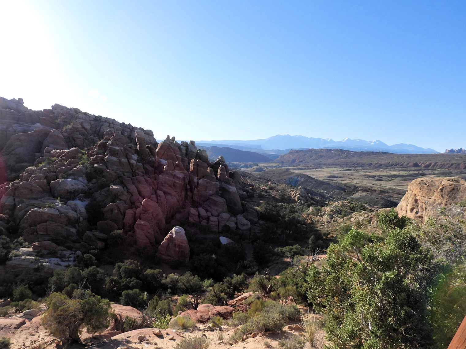
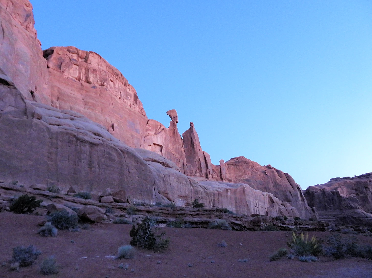 Park Avenue area at Sunrise
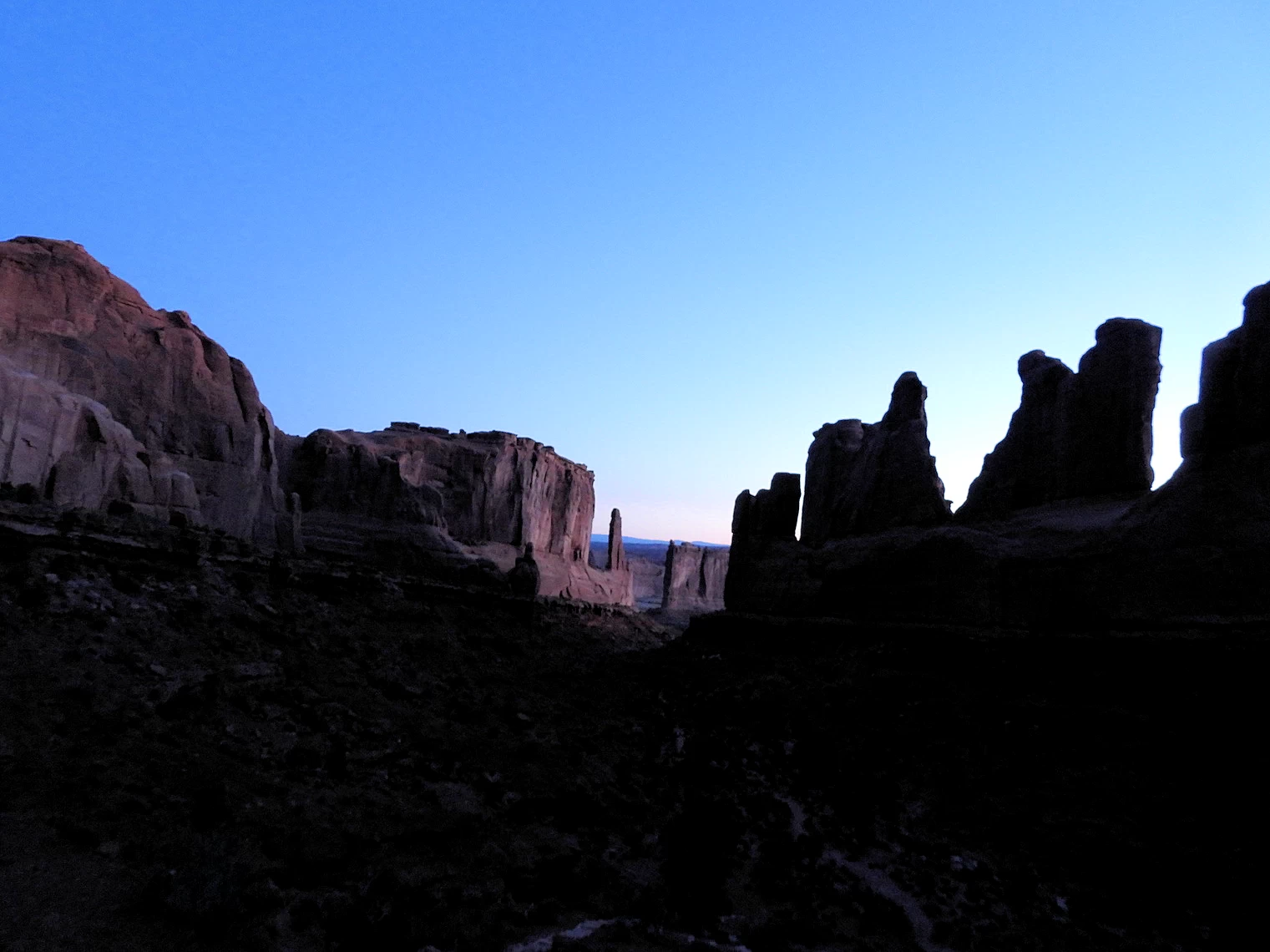 Park Avenue area at Sunrise
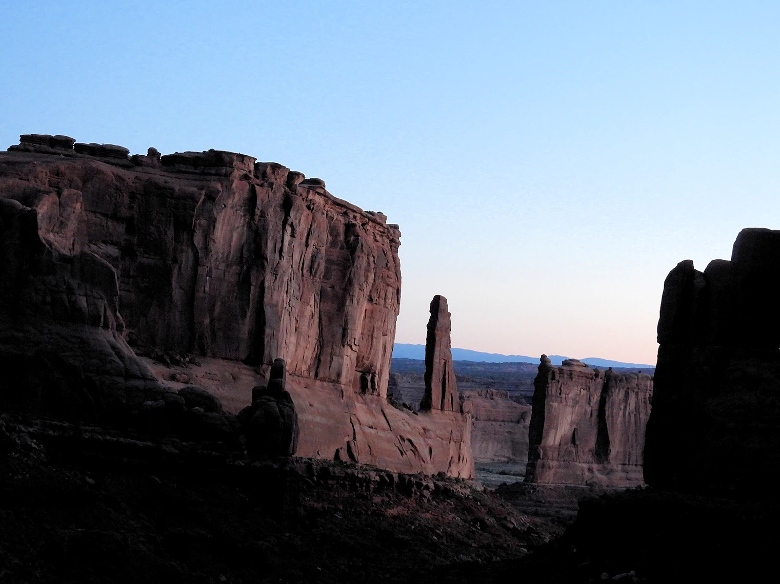 Park Avenue area at Sunrise
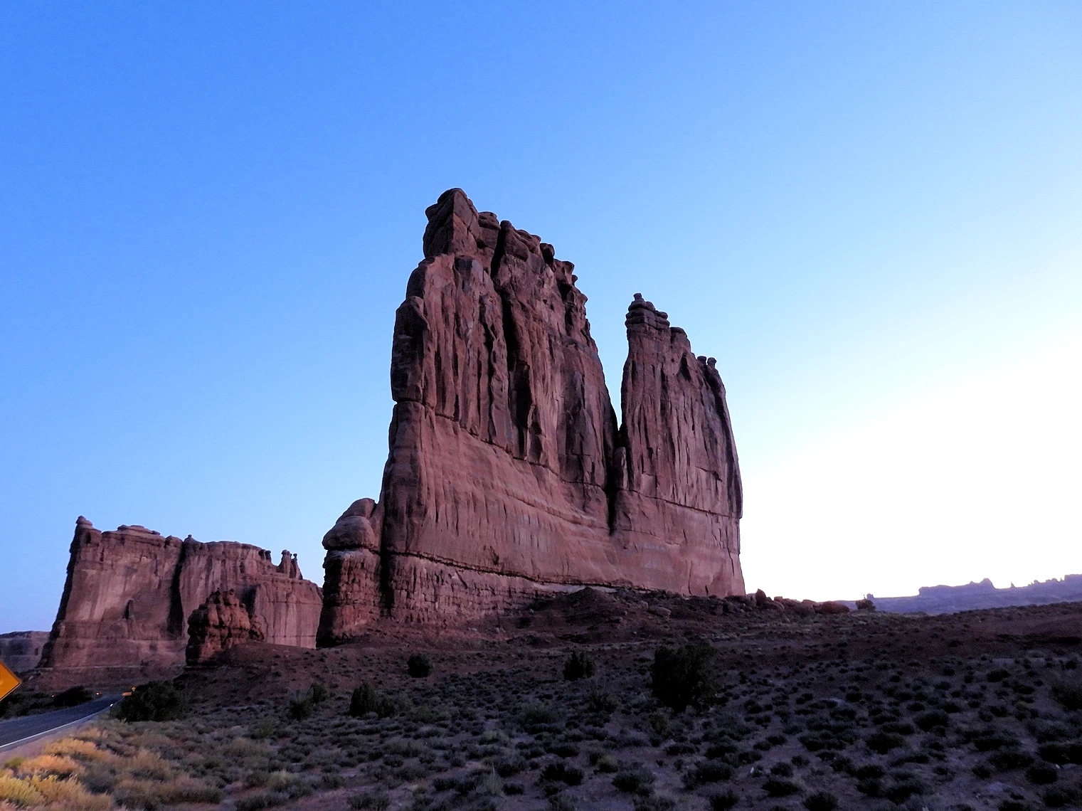 Court House Towers at Sunrise
Only four miles from the Arches National Park Visitors Center, this is the first park pullout we came across. The parking area was empty so we parked and took the walk up the trail.
Unfortunately for our photography efforts all of the rock formations were beautiful, but the light level was so low that we did not get any good images. Since we knew from research that the Park "Windows Section" was a great place to be for a sunrise, we decided to drive there.
Click here to view a Google Images set for the Courthouse Towers rock formations.
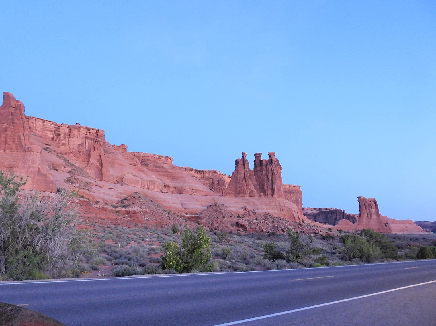 Approaching the Three Gossips Area
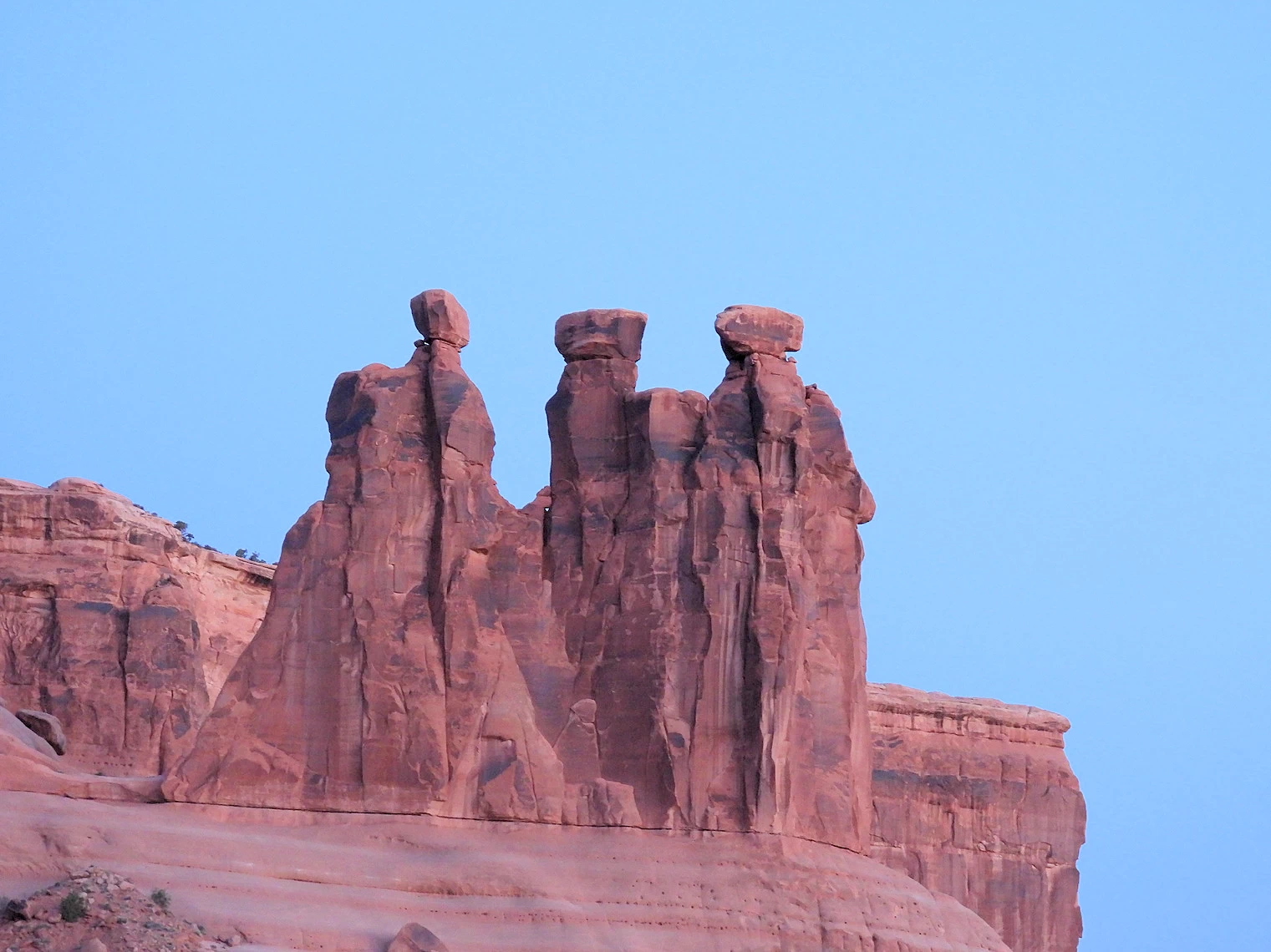 The Three Gossips Area
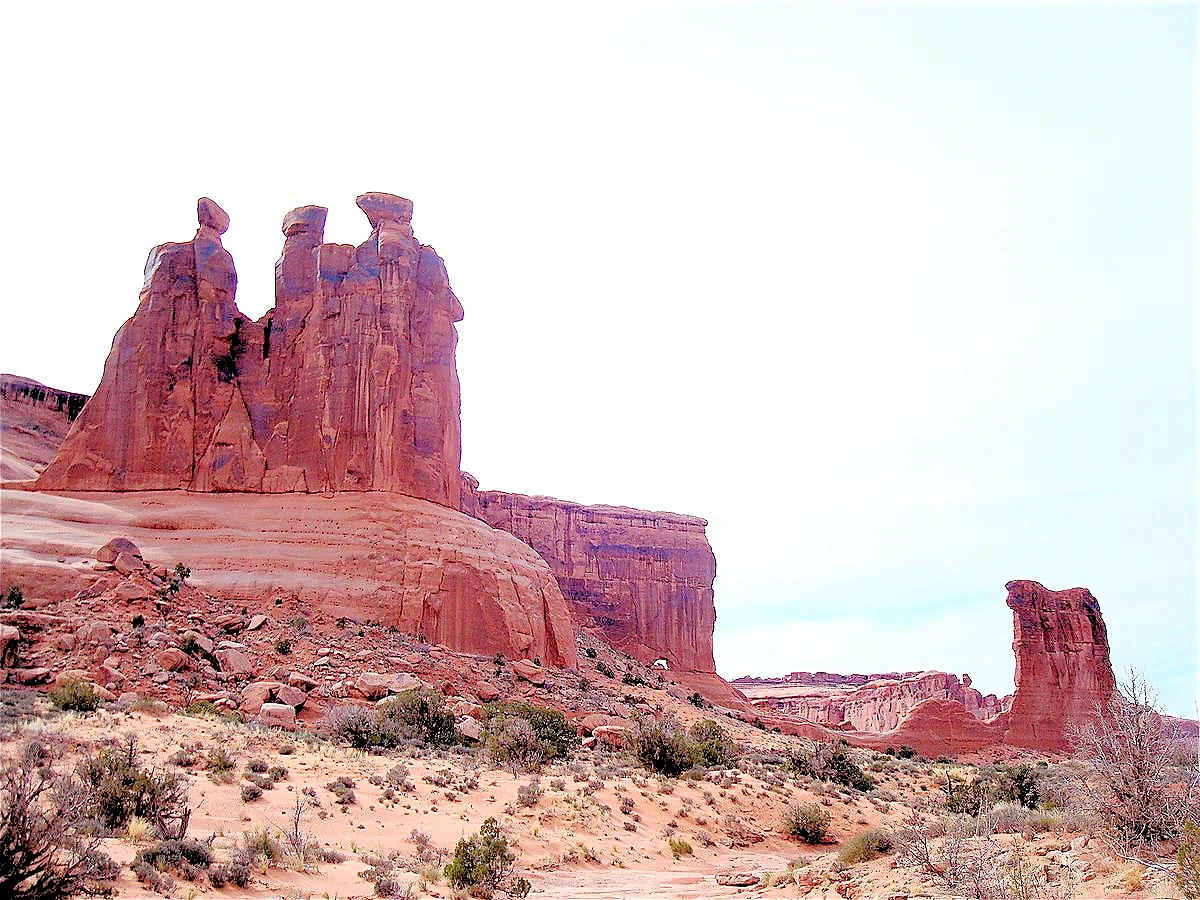 The Three Gossips Area
Three Gossips is a mid-sized sandstone tower (about 350 feet at its tallest wall) sitting atop a roundish pedestal within the Courthouse Towers "cluster" that also includes The Argon Tower, The Organ, Tower Of Babel, Sheep Rock, and The Lamb.
Image Credits: Images 1 & 2 are the property of Just Traveling Thru, LLC. Image # 3 is the property of Wine Country Inn via Wikimedia (CC-by-SA 3.0).
Click here to view a Google Search Results Images Set for the Three Gossips Tower.
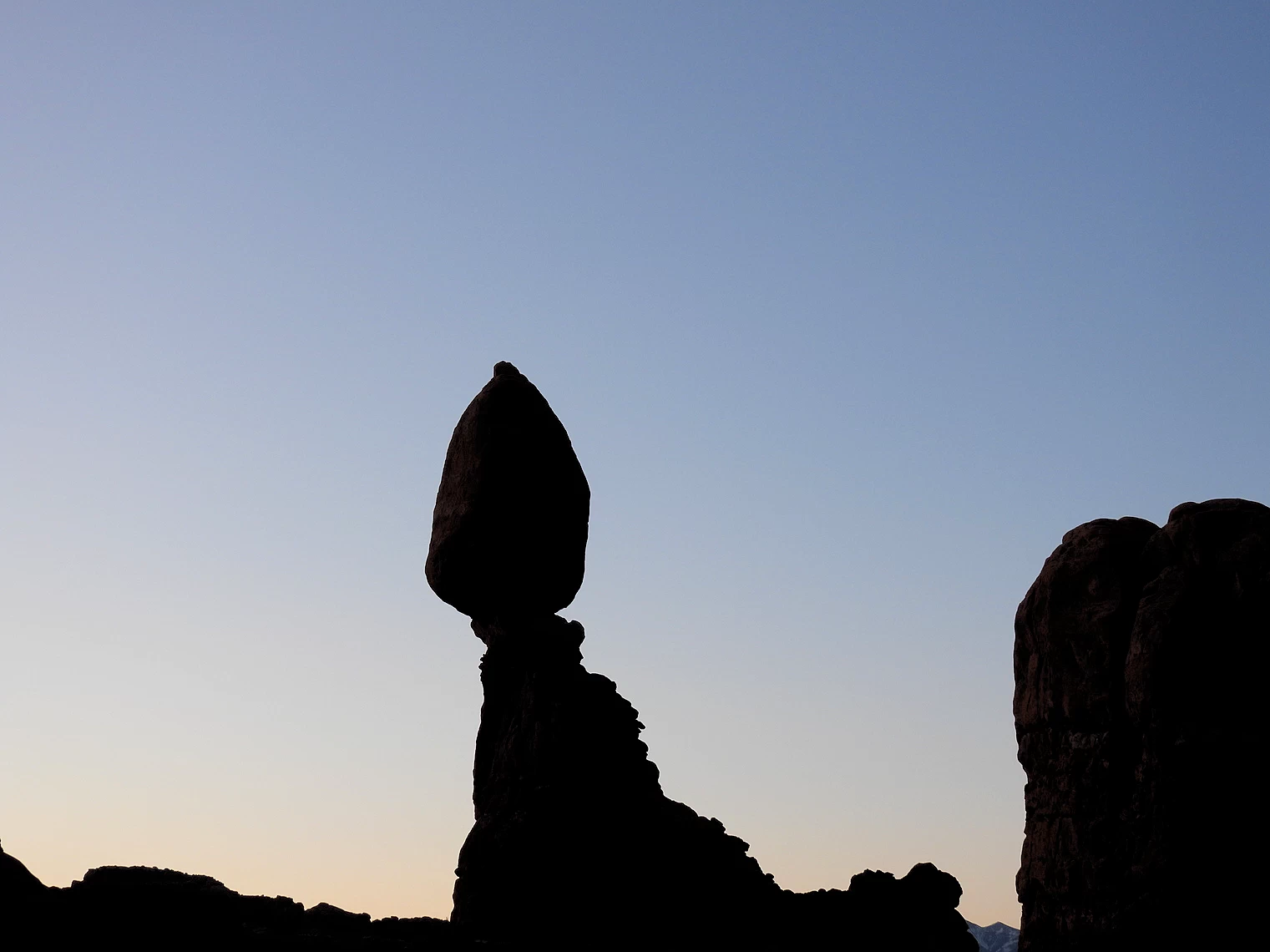
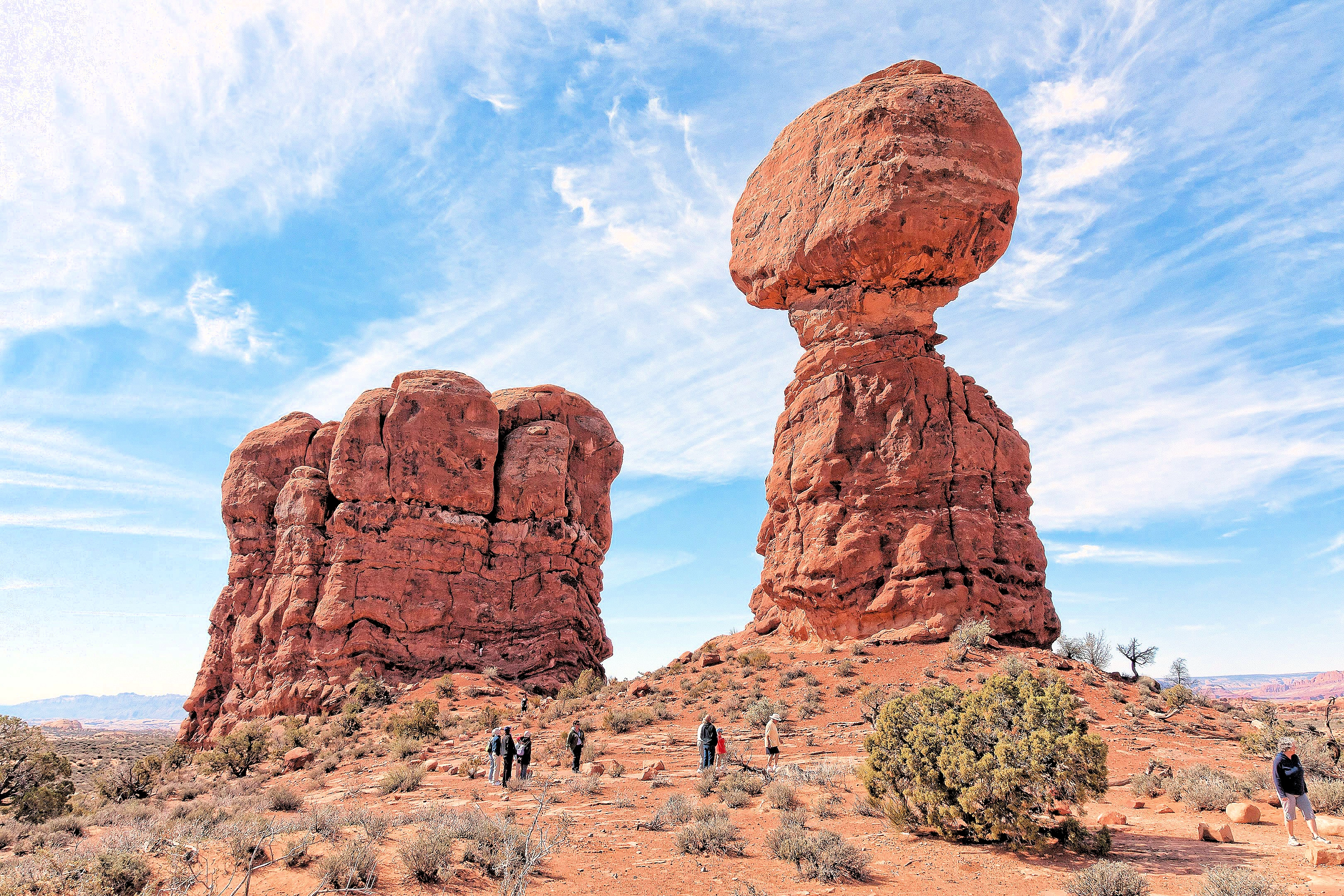
Balanced Rock is one of the most iconic and accessible landmarks in Arches National Park, located just 9.2 miles from the park entrance along the main road. This stunning formation is impossible to miss and serves as a must-see for visitors due to its unique and captivating appearance. The total height of Balanced Rock is 128 feet, with the enormous rock perched precariously atop its base rising 55 feet above the ground. Weighing an estimated 3,600 tons, the massive boulder defies gravity, creating a breathtaking natural spectacle.
What makes Balanced Rock particularly remarkable is how it showcases the geological processes that shaped this region over millions of years. Erosion has played a key role in sculpting the delicate pedestal that supports the immense weight of the rock above. Visitors can enjoy a short, easy walking trail that loops around the formation, offering multiple angles to admire its structure and the surrounding desert landscape.
Balanced Rock is not only a photographer’s dream but also a testament to the power of nature's artistry. As one of the park’s most photographed and recognizable features, it encapsulates the awe-inspiring beauty of Arches National Park and the dynamic forces that continue to shape its landscape.
As you can see in image # 1, it was still not quite daylight and the image is quite dark. Image credits are as follows;
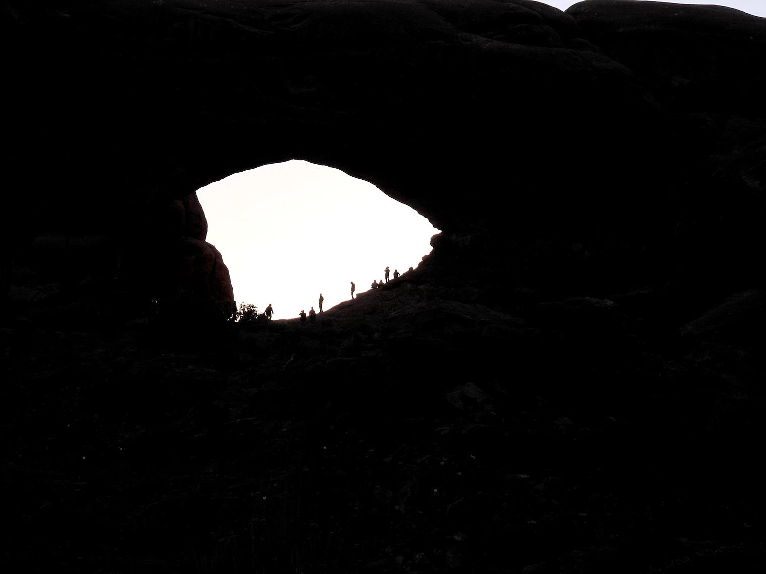 North Window Arch at Sunrise
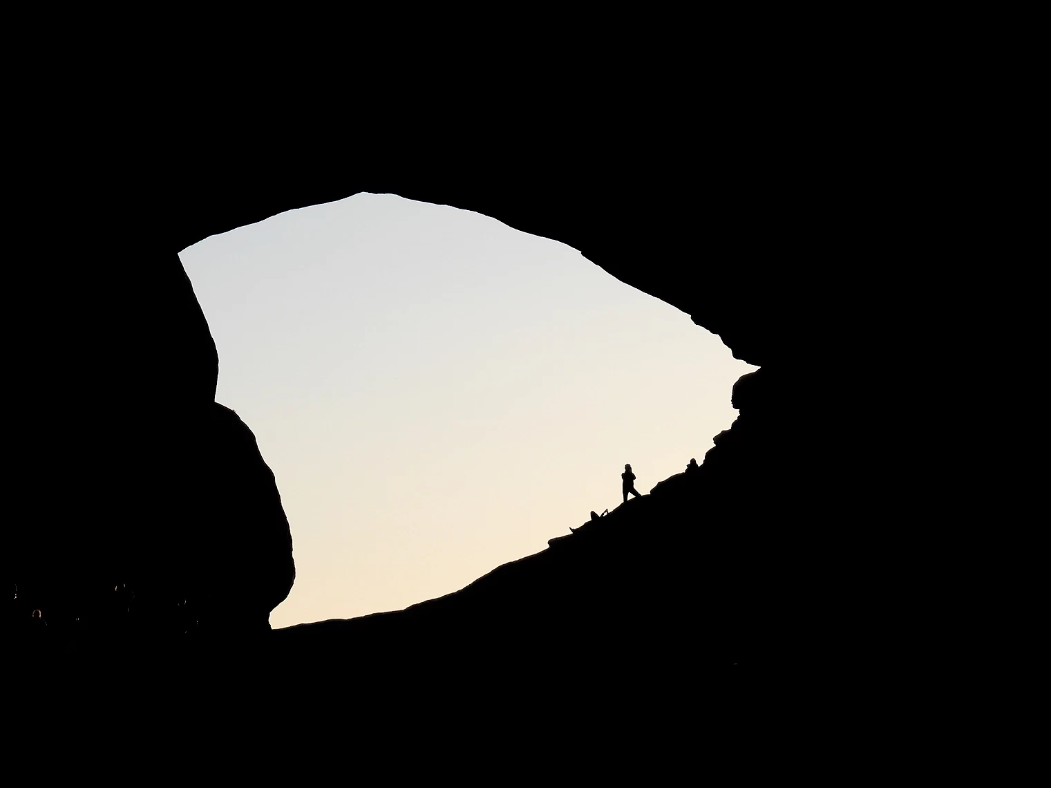 North Window Arch at Sunrise
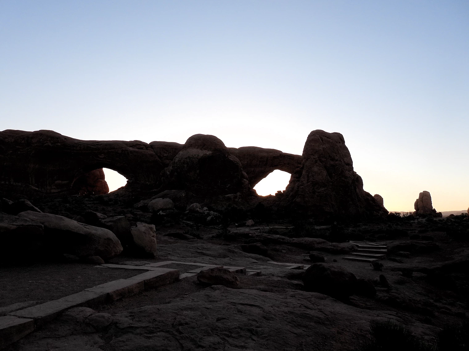 Double Arch at Sunrise
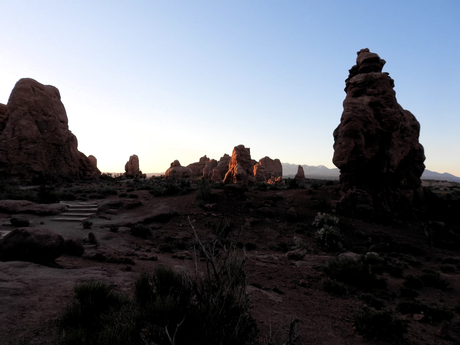 Sunrise is Starting!
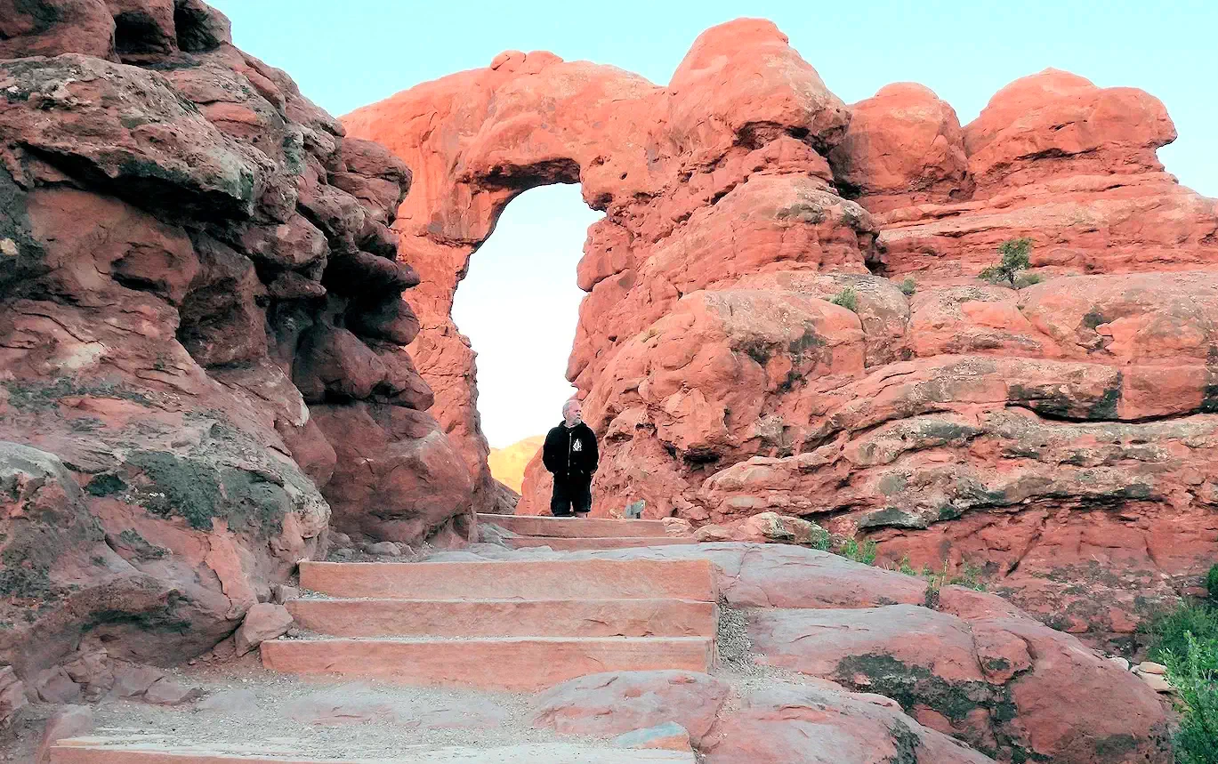 Stairs to Turret Arch
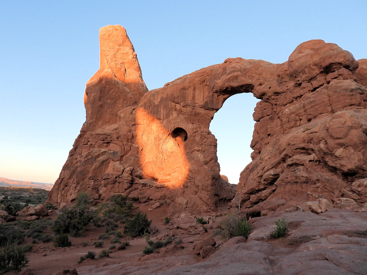 The Turret Arch
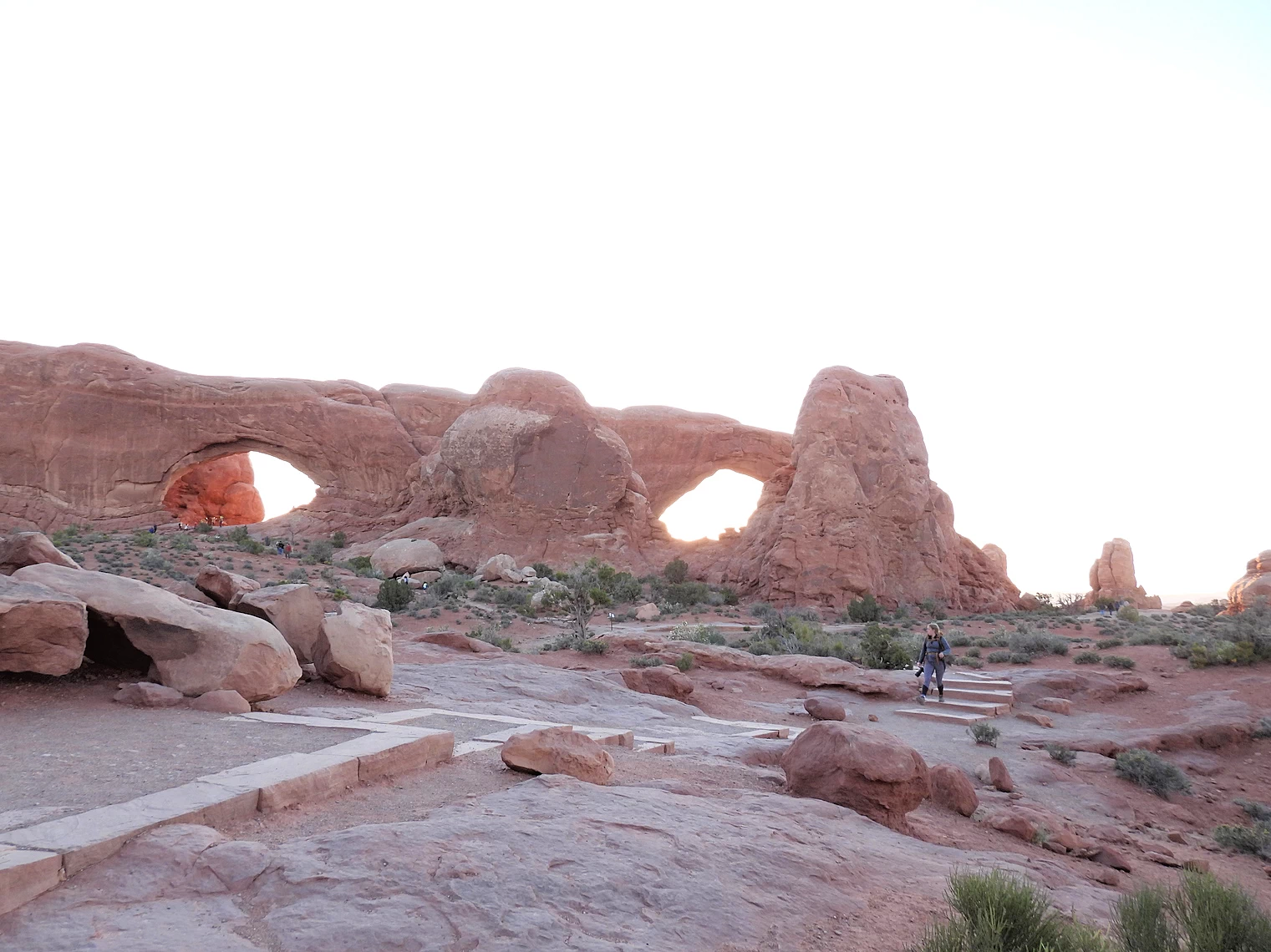 Double Arch
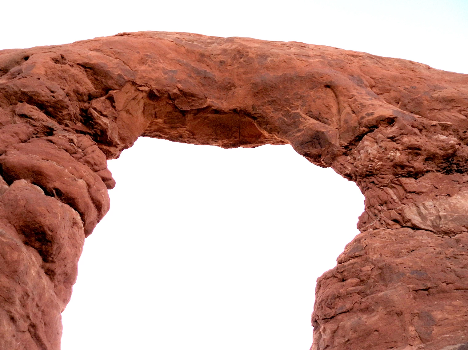 Top of Turret Arch
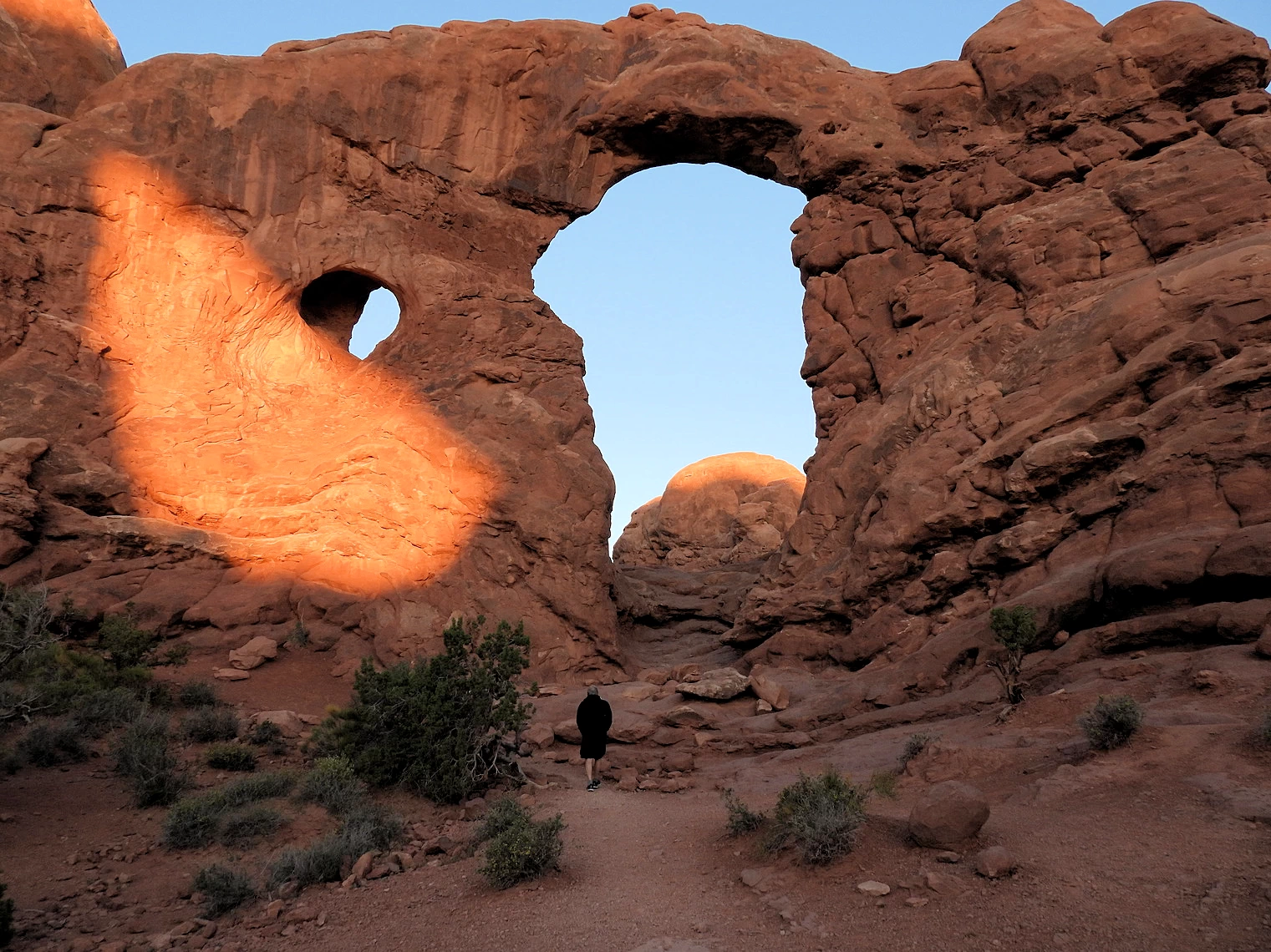 Walkway to Turret Arch
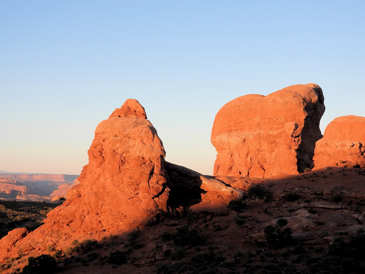 Northside of Turret Arch
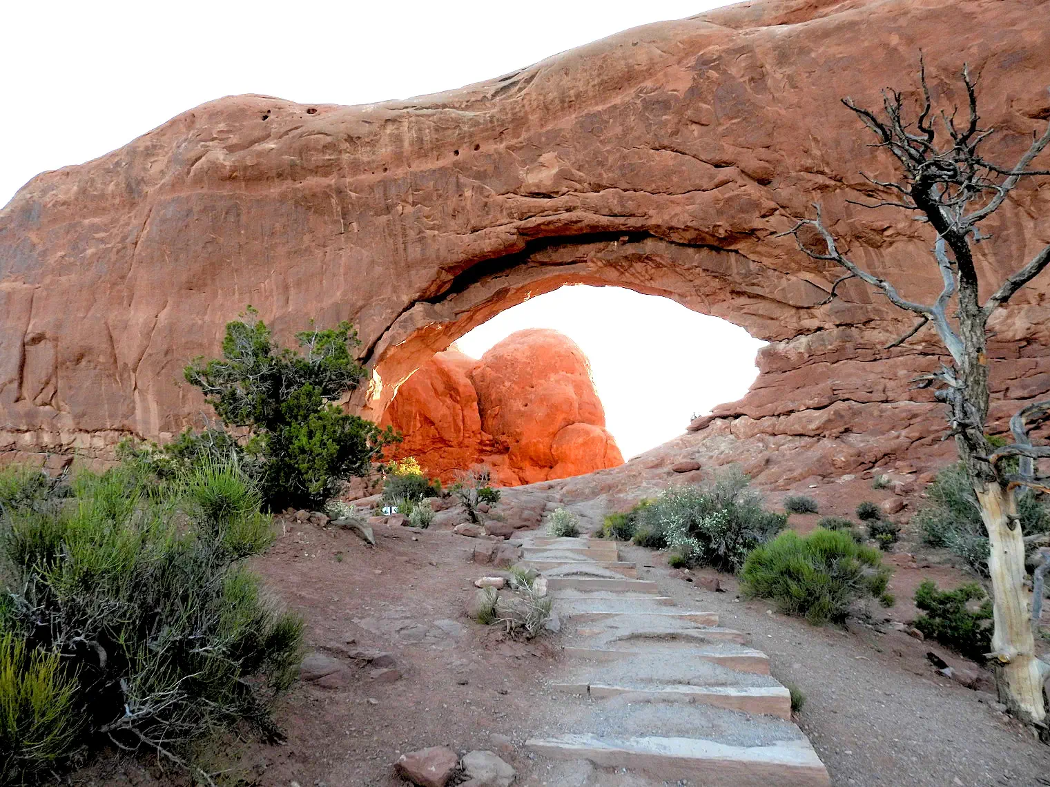 South Window Arch
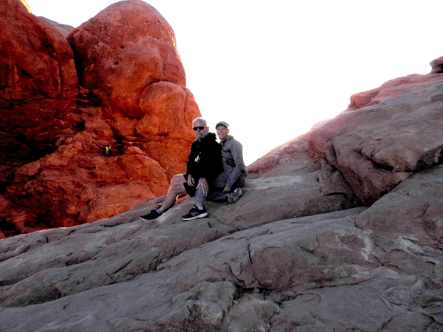 Selfie at South Window Arch
The Windows section is comprised of several different formations; North Window, South Window, Turret Arch, and Double Arch. The North & South Windows (also known as the Spectacles) stand side by side, though separated by some distance, cut from the same sandstone fin. A large “nose” separates the Spectacle arches visually from the southwest, made of a gigantic fin remnant over 100 feet wide. Directly southwest of the Windows sits Turret Arch with its vigilant tower standing beside. The whole Windows area is full of unique and captivating stone formations, with many arches among them.
Double Arch was formed differently from most of the arches in the park. It is what is known as a pothole arch, formed by water erosion from above rather than more typical erosion from the side. The larger opening has a span of 148 feet (45 meters) and a height of 104 feet (32 meters).These dimensions give the arch the tallest opening and second-longest span in the park. The Double Arch is north of the parking area, and we did not visit it while we were there - as we spent all of our time at the Spectacles & Turret Arch.
By the time we got here, the sun was on it's way and as we walked around this area, it rose completely and revealed an interesting set of views.
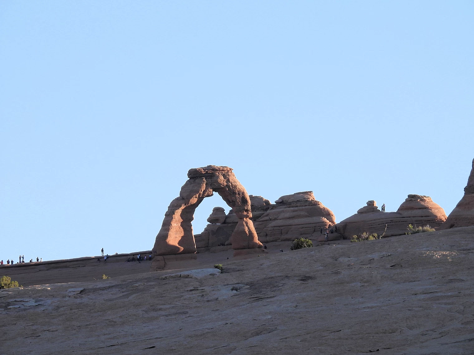 Delicate Arch at Sunrise
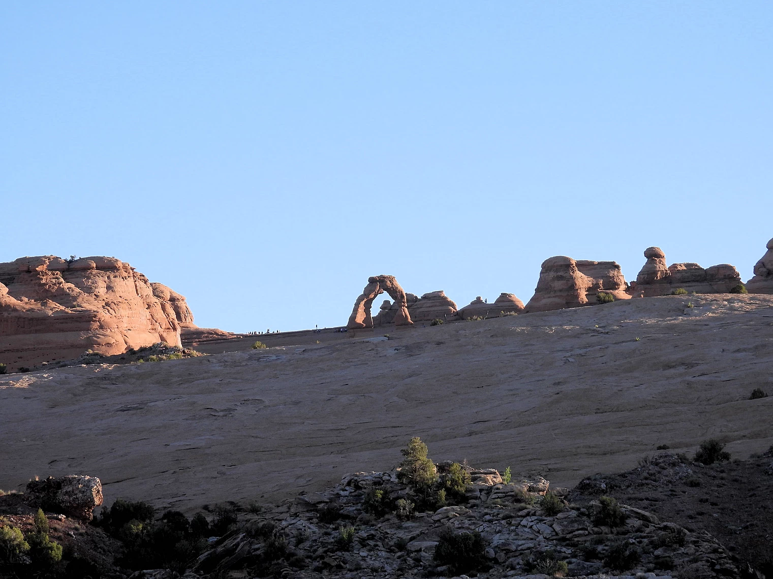 Delicate Arch from Parking Lot
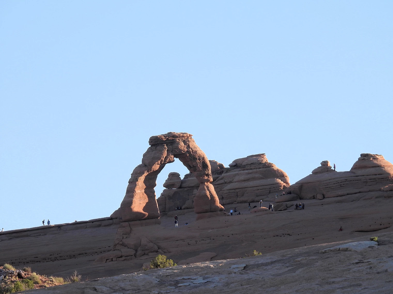 Delicate Arch up Close
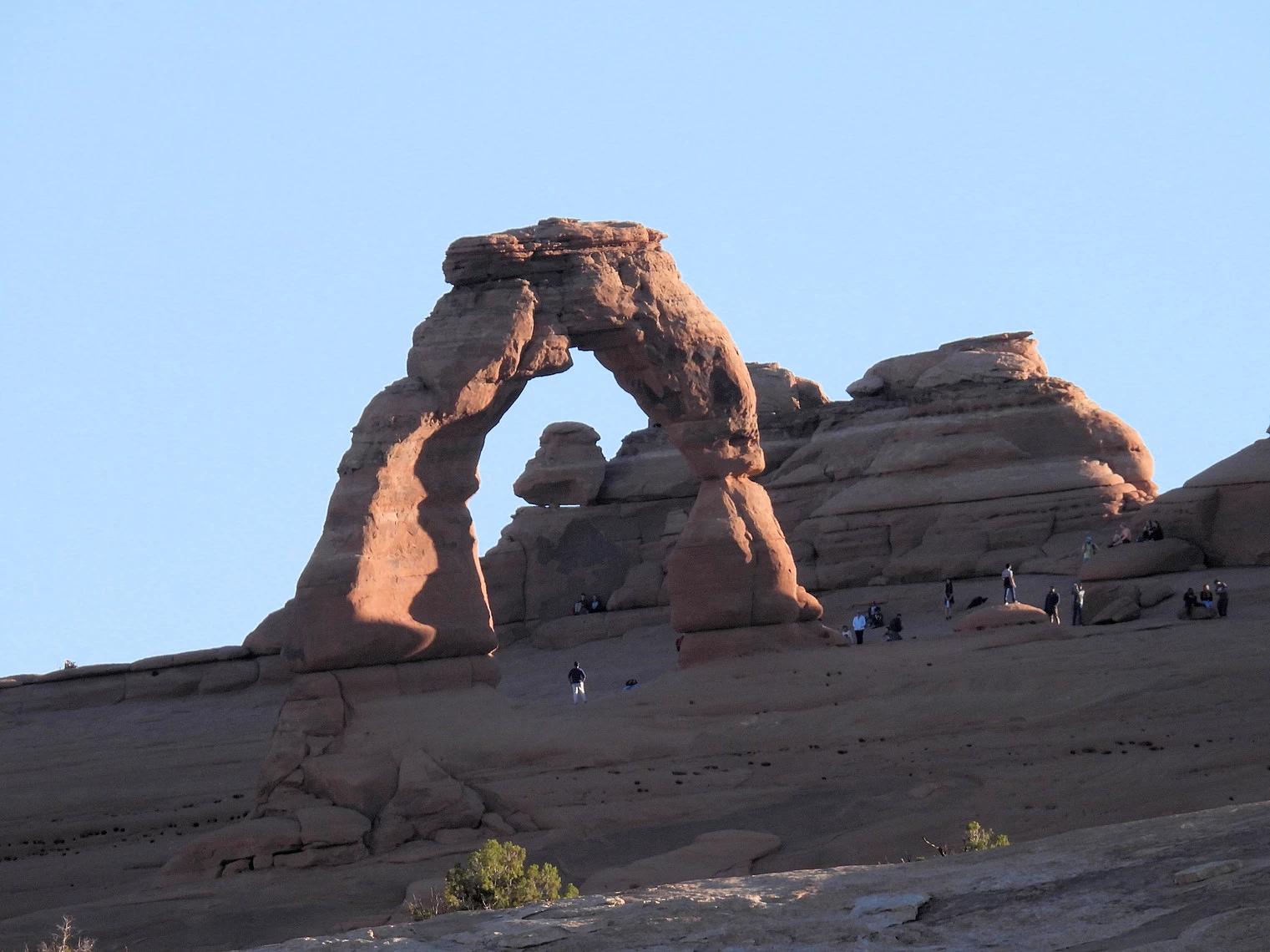 Delicate Arch up Close
Delicate Arch is the most widely recognized landmark in Arches National Park and is depicted on Utah license plates and a postage stamp commemorating Utah's centennial anniversary of admission to the Union in 1996. The arch, which features an opening 46 feet high and 32 feet wide, is the largest free-standing arch in the park, and — as the name implies — it seems to defy gravity in its size and design.
Hiking Delicate Arch Trail: That said, this isn’t an easy hike, as it contains a significant climb up a steep
slickrock slope. There’s no shade, and it gets quite hot in the summer, so anyone taking this trail should be prepared for
what’s to come. For those who aren’t up for the hike, there are two other viewing options: The Lower Delicate Arch Viewpoint
just down the road only requires a 100-yard walk over flat ground to get a fine look at the arch from a mile away. From the
Upper Viewpoint, you get a slightly less obstructed view, but you need to walk half a mile with some stairs. The opening of
the arch cannot be seen from the road, so the Delicate Arch Trail is the only way for visitors to get a good look at the
formation up close.
The above text came from the
Visit Utah site,
as we did not take this hike. We were on a time schedule and had to keep moving on.
 Trail Entrance
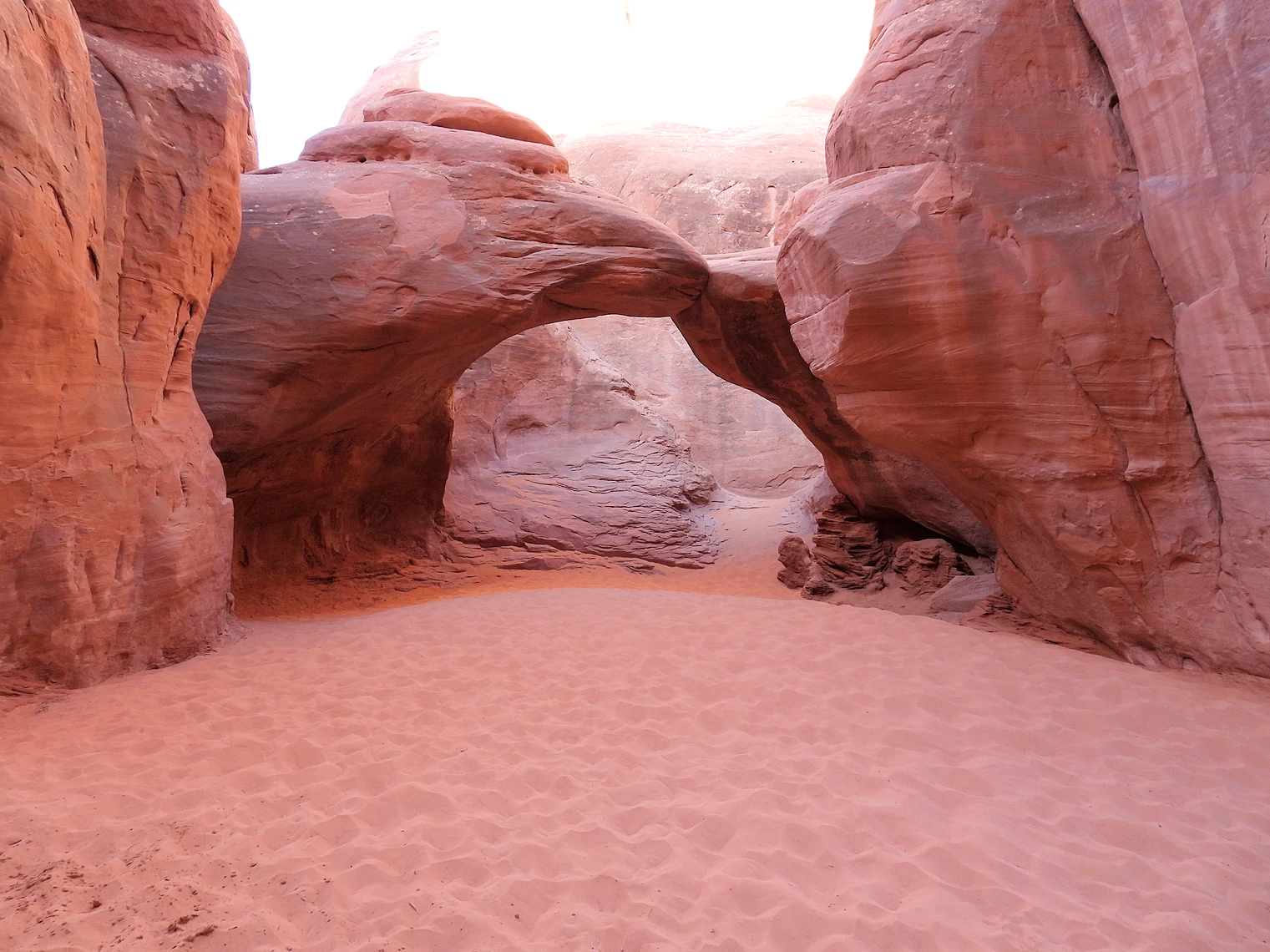
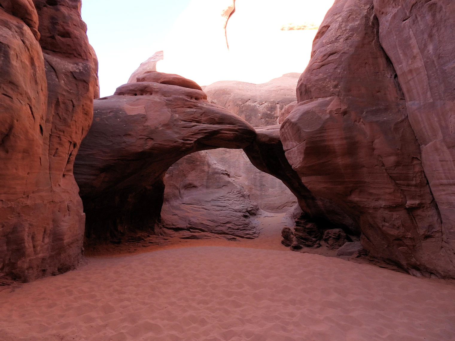 Sand Dune Arch
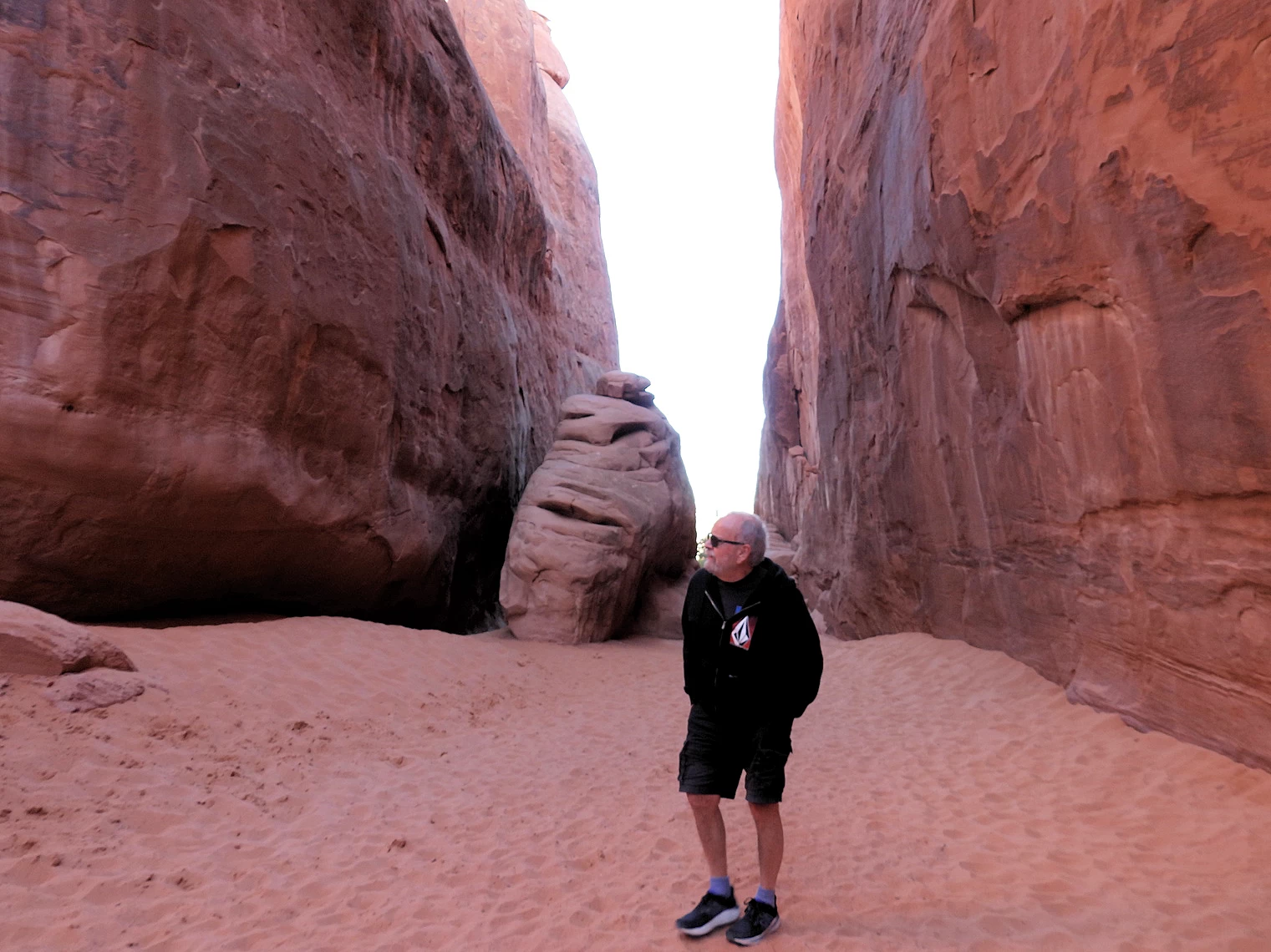 In the Shade & the wind is blowing Briskly
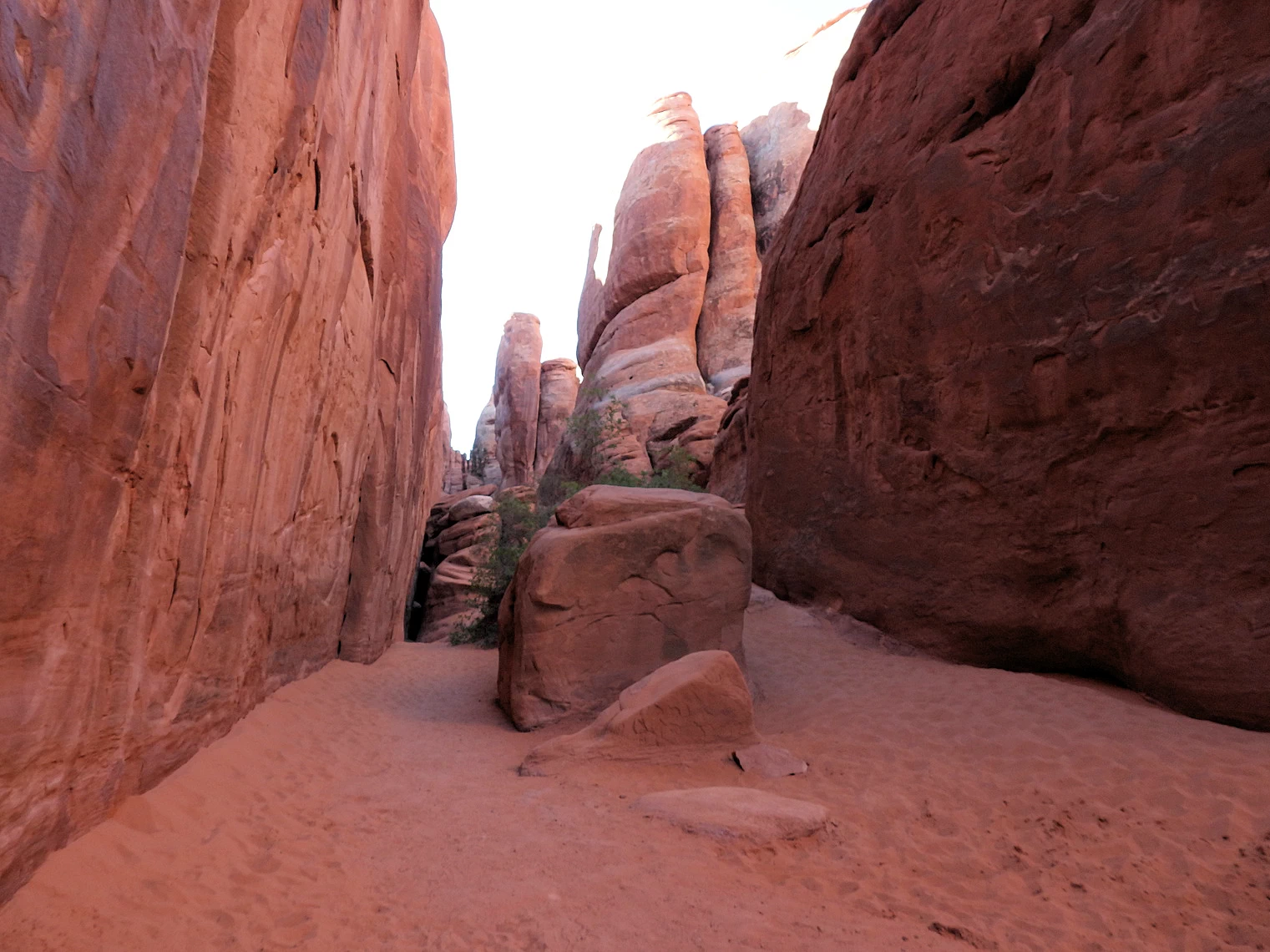 Rock Formations Everywhere
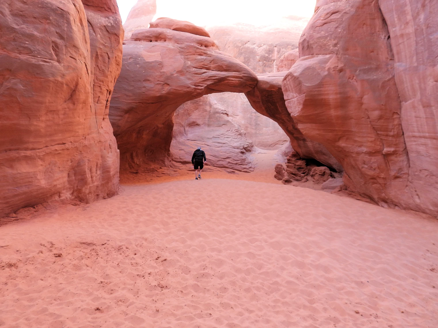 Back through Sand Dune Arch
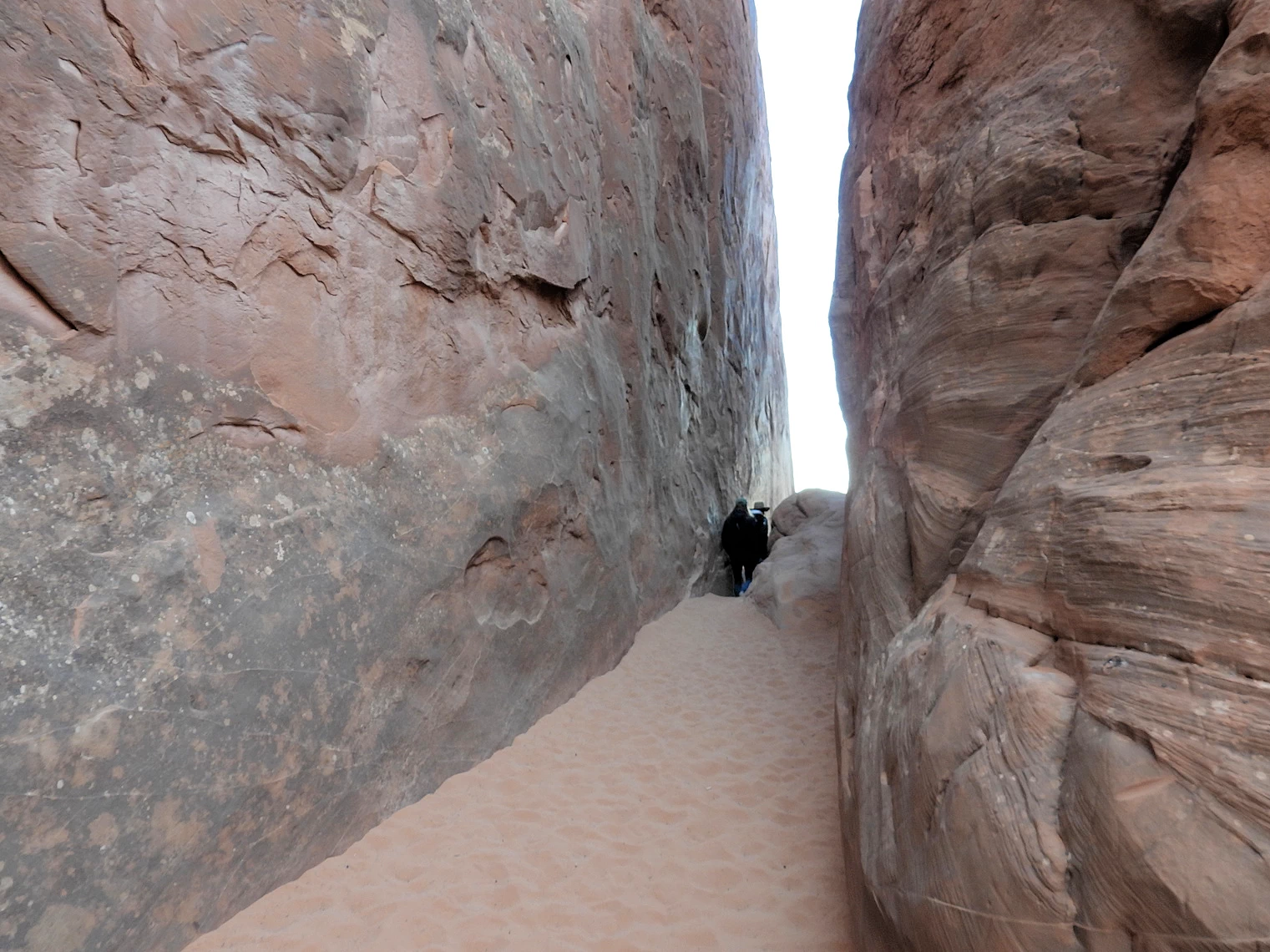 Slot Canyon area of Sand Dune Arch
Sand Dune Arch, as its name suggests, is surrounded by an abundance of sand, the result of wind-driven accumulation at the base of this natural wonder. The arch itself is nestled in the shade for much of the day, offering a cool respite from the sun. It is flanked by two imposing sandstone fins, which add to the dramatic, otherworldly atmosphere of the area.
The trail leading to the arch is a manageable 0.3-mile roundtrip, making it an easily accessible destination for hikers of all levels. While the path is mostly a sandy walk, it offers the unique experience of hiking through a narrow slot canyon, which adds an element of adventure to the otherwise serene trek. The fine, soft sand underfoot feels like walking along a beach, enhancing the sense of tranquility and relaxation.
The trail is largely shaded, which is a welcome relief, especially during the warmer months. The interplay of sunlight and shadow as it filters through the canyon walls creates a beautiful and peaceful environment, making this a perfect spot to pause and take in the natural beauty. Whether you're taking in the striking arch, the surrounding fins, or the quiet, sandy expanse, Sand Dune Arch offers an unforgettable experience in a tranquil, almost magical setting.
 Fiery Furnace Canyon
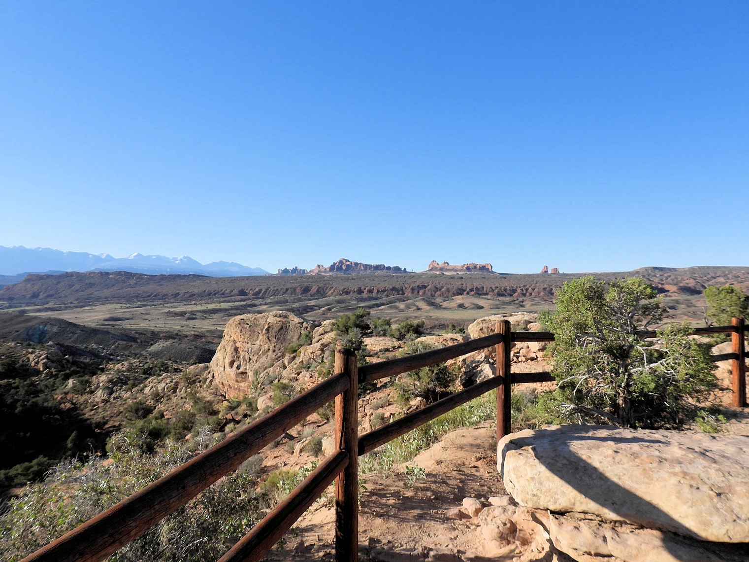 Fiery Furnace Viewpoint
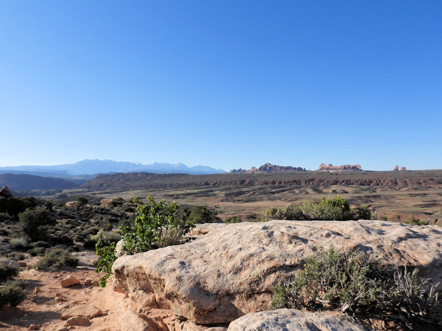 Looking West from Fiery Furnace Viewpoint
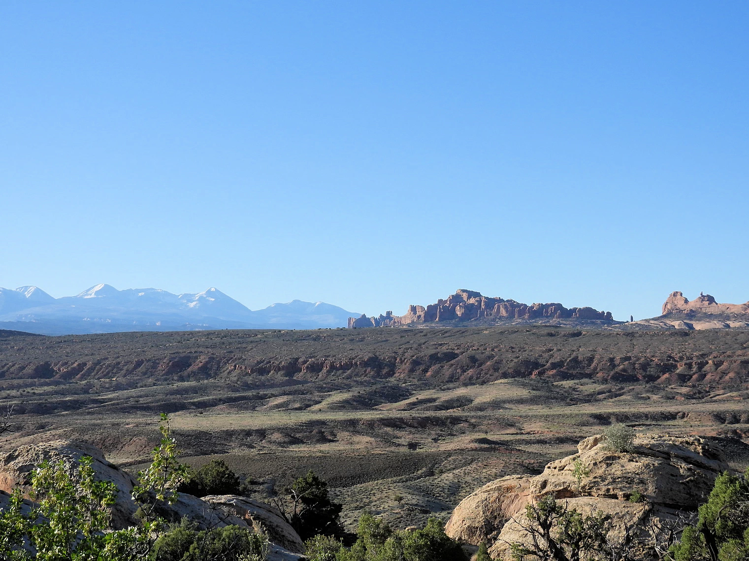 Looking South from Fiery Furnace Viewpoint
The Fiery Furnace is a collection of narrow sandstone canyons, fins and natural arches located near the center of Arches National Park in Utah, United States. The area is a popular hiking destination that was named for the reddish hue it exhibits in sunset light.
The Fiery Furnace Viewpoint is accessible from the main park road approximately five miles north of Balanced Rock. The overlook provides views into an area thick with fins, spires and arches. There are no maintained trails through the Fiery Furnace. The area is open to park visitors, but a permit must be obtained at the visitor center to access the area. Ranger-led walks into the Fiery Furnace are available from April through October.
The scenic drive in Arches passes many outstanding natural features. Parking is limited at all destinations, and popular trailheads like Delicate Arch and Devils Garden may fill for hours at a time, especially on weekends and holidays. View the National Park Service Traffic & Travel Tips page for advice on making the most of your time (and avoiding the crowds).
While it may be tempting to explore National Parks with an off-road vehicle like an ATV, RZR, or UTV, it's important to know that these vehicles are not permitted within most National Park boundaries, including popular Southwest destinations like Arches, Bryce, Canyonlands and Zion.
Only street-legal, highway-capable vehicles (like Jeeps with proper plates, lights, and safety equipment) are allowed on designated park roads. Even then, true “off-roading” — driving off established roads — is strictly prohibited.
Many OHV rentals are intended for use on Bureau of Land Management (BLM) or National Forest lands adjacent to the parks, not inside them.
For official guidance, see the National Park Service’s policy on vehicle use (NPS.gov).
Plan ahead, stay on legal trails, and enjoy the landscape responsibly.
Exploring Arches National Park is one of those trips where a little planning pays off in a big way. With more than 2,000 natural stone arches and a steady flow of visitors, it’s easy to miss the highlights—or waste time circling for parking—if you go in without a strategy. Every major formation, from Delicate Arch to Devils Garden, has its own parking lot, but spaces are limited and fill quickly, especially during peak season. Crowds concentrate around sunrise and sunset, when the light is most dramatic for photography, so knowing where you want to be (and when) makes all the difference.
Plan Your Visit — Timed Entry, Parking, Trails & Weather
Quick links for reservations, parking strategy, conditions, and trail planning.
Plan Your Visit – Arches National Park
Arches is busiest in spring and fall, with mornings and late afternoons offering the best light and the heaviest crowds. During peak season (April–October), a timed entry reservation is required to drive into the park. Parking is limited at every trailhead, and lots at Delicate Arch, Devils Garden, and especially The Windows Section fill before sunrise, as many visitors head there to watch first light. Long entry lines also form well before dawn, but holding an NPS annual pass can speed you through the gate. Our experience showed that arriving as early as 5AM meant no rangers were yet at the booths, no cars were queued up, and we were able to drive directly to each arch and secure parking with ease. Always carry plenty of water, as shade is minimal, and check the NPS website for current conditions, closures, and reservation details before your trip.
Arches Travel Resources — Maps, Timed Entry, Parking & Trails
Quick, reliable links to plan your visit.
 Click above map to view a larger Google Map
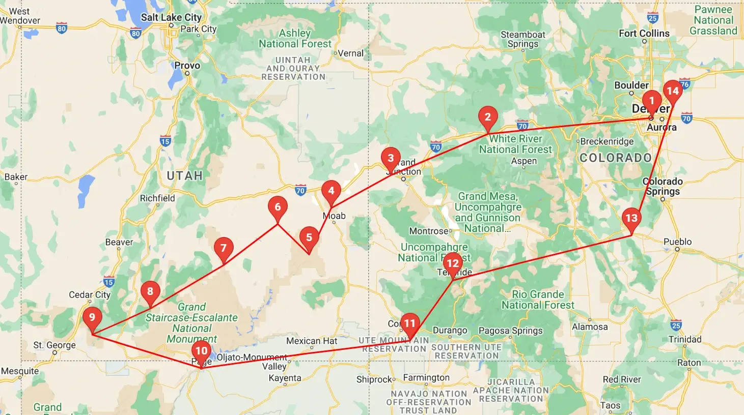
 As you can see by the this map, our trip covered 3 different states, approximately 1,600 road miles and allowed us to see some spectacular geography. You might think that a trip of this distance would be something that would result in a "tired of driving" mood - but our stops were so diverse with such incredible geography and fun things to do, that we found that we looked forward to each morning to where we could continue our adventures!
Click any link below to go directly to that page;
Note: All images featured on this page are the exclusive property of Just Traveling Thru, LLC, unless otherwise stated. When images from external sources are used, full credit is given to the original creator, along with a link to the specified license or usage terms. We are committed to respecting copyright and intellectual property rights, ensuring that all third-party images are properly attributed. If you have any questions regarding image ownership or usage rights, please feel free to contact us.
Affiliate Links: We may earn a commission if you make a purchase through one of our affiliate links. This helps support our travel content — thank you!
Content: To review any of our content, make suggestions and/or comments, please click the "About" menu link at the top of this page. You will find our "Contact Us" link on that drop-down menu.

