
by Celeste Lipford and Terry Lipford - last updated on 10/13/2025
This portion of our Colorado/Utah/Arizona trip is day 3 through 6 in Moab, UT. We picked Moab primarily because it allowed us to be able to visit Arches National Park, Canyonlands National Park, Dead Horse State Park and to endulge in an epic off-road adventure with a Jeep we rented. And I should also mention that secondarily it was because Moab is the largest city in that area of Utah. There are other smaller towns on U.S. 191, but none have the scope of services that Moab offers.
Off-road exploration in Canyonlands National Park unveils a different side of this breathtaking landscape. While the paved roads offer scenic overlooks, venturing onto the dirt paths grants access to hidden gems and a more intimate experience with the park's rugged beauty.
However, tackling Canyonlands backcountry requires a well-equipped 4WD vehicle and a good understanding of off-roading principles. The trails can be challenging, with steep inclines, loose gravel, and narrow switchbacks.
Canyonlands was established in 1964 and it is the largest national park in Utah, covering 527.5 square miles. The park is divided by the Colorado and Green Rivers into three distinct districts; the Island in the Sky, the Needles, and the Maze. Horseshoe Canyon is also part of Canyonlands National Park but is geographically separate.
Please note that this page covers all aspects of our stay in Moab, UT as it pertains to the list of places below. Arches National Park is covered on a separate page, however, we were still in Moab when we visited that park.
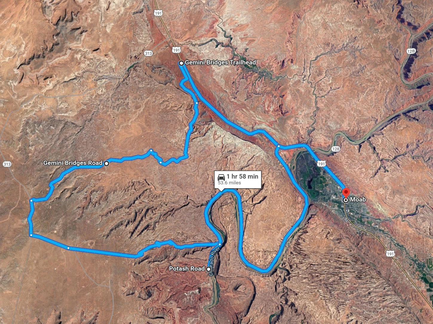
This page covers the following destinations we explored while in Moab (please use the intra-page menu as well), which includes; Dead Horse State Park, Gemini Bridges, driving the Shafer Trail and some information about Moab Utah as well. We also traversed Potash Road past the Potash Ponds area, after we had descended the Shafer Trail.

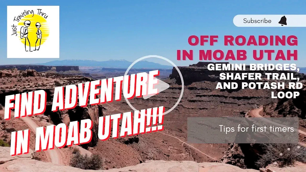
If you enjoy our videos click here to subscribe to our Youtube Channel.

Click the above image to view our Discover Utah Off Roading Adventures in Moab, Utah video, explore these easy Jeep trails in the heart of Canyonlands National Park—one of Utah's Big 5 National Parks. This one-day loop adventure takes you through iconic sites like Gemini Bridges and a glimpse of Canyonlands' Island in the Sky district. Descend the legendary Shafer Trail and return via Potash Rd, all while soaking in the mesmerizing landscapes. Ideal for first-timers with guts that won't get nervous with the steep drop offs on the side of the Shafer Trail road. This video provides instructions on doing the entire loop. My heart was racing but luckily Terry had the trail under control!
On September 12, 1964, President Lyndon B. Johnson signed Public Law 88-590 establishing 257,640 acres as Canyonlands National Park.
Canyonlands National Park covers an area of about 337,598 acres (136,621 hectares).
Canyonlands National Park sees annual visitation numbers ranging from around 730,000 to 800,000 visitors in recent years. In 2023, the park had 800,322 visitors, reflecting steady interest. For official and updated statistics, the National Park Service (NPS) website provides detailed records.
Canyonlands National Park consists of two portions: the main portion, which comprises the bulk of the park’s area, and the detached and considerably smaller Horseshoe Canyon unit. The park is also divided into four districts: Island in the Sky, The Needles, The Maze, and the rivers themselves (the confluence of the Colorado and Green Rivers).
Almost 50 species of mammal are known to live in Canyonlands including black bears, coyotes, skunks, bats, elk, foxes, bobcats, badgers, two species of ring-tailed cats, pronghorns, and cougars.
Yes, Canyonlands National Park is the largest National Park in Utah, and the 23rd largest in North America.
Effective June 1, 2018, Arches & Canyonlands National Park entrance fee will be $30 per vehicle or $25 per motorcycle. Fees and/or passes can be obtained online at the National Parks Service website. The lifetime pass is still one of the best bargains available.
The park is open 24 hours a day, year-round, but some facilities may close during the winter season. Please refer to the National Park Service Website for current information.
There are none, it's best to bring what you'll need for your visit. Please bring food & water and remain hydrated - and remove your trash when you depart. Please refer to the National Park Service Website for current information.
21 movies or TV shows have utilized the park for filming, see the complete list - on IMDB from this link.
Since our "home base" was at the Moab Hampton Inn, you can see how convenient a Moab location is for Canyonlands as well as Arches National Parks. We could be off-roading way out at Gemini Bridges, yet we could be back at our hotel within an hour.
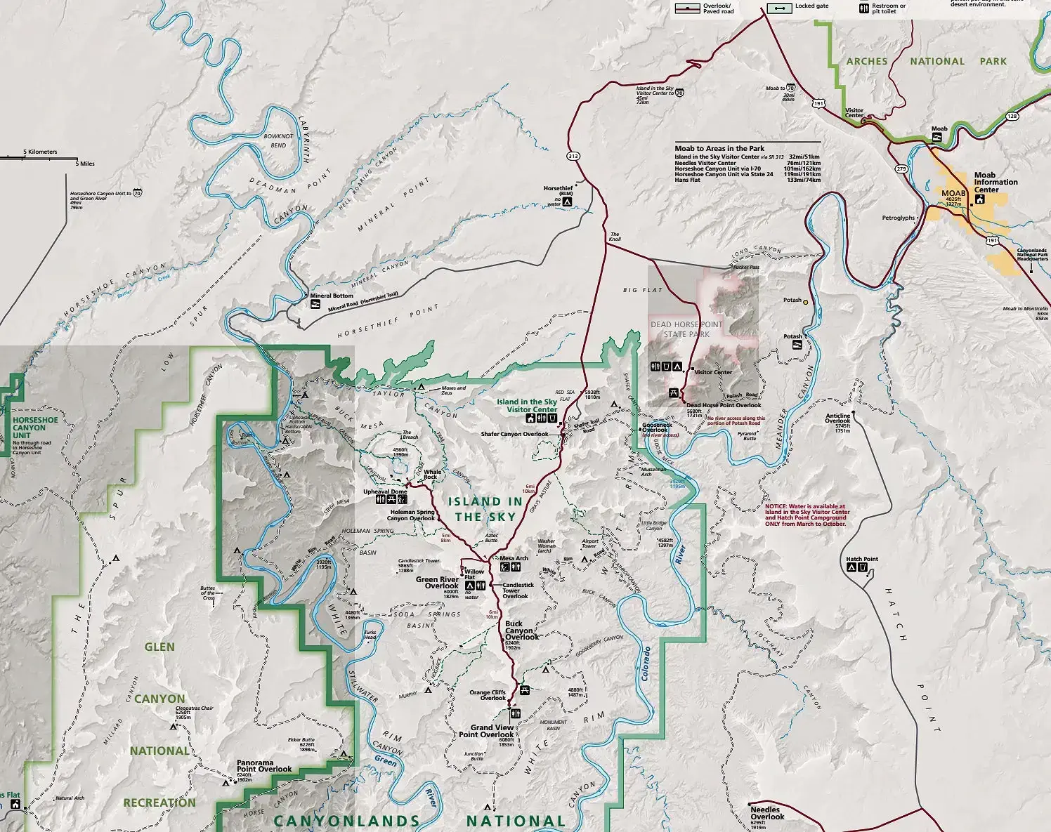
Image Credit: The above map image is the property of the National Park Service via their website.
 Dead Horse State Park Map
This park is located northeast of Canyonlands National Park. As this is a Utah State Park and not a National Park you should be aware that your America the Beautiful pass does not work there and so won't cover the Dead Horse State Park entrance fee.
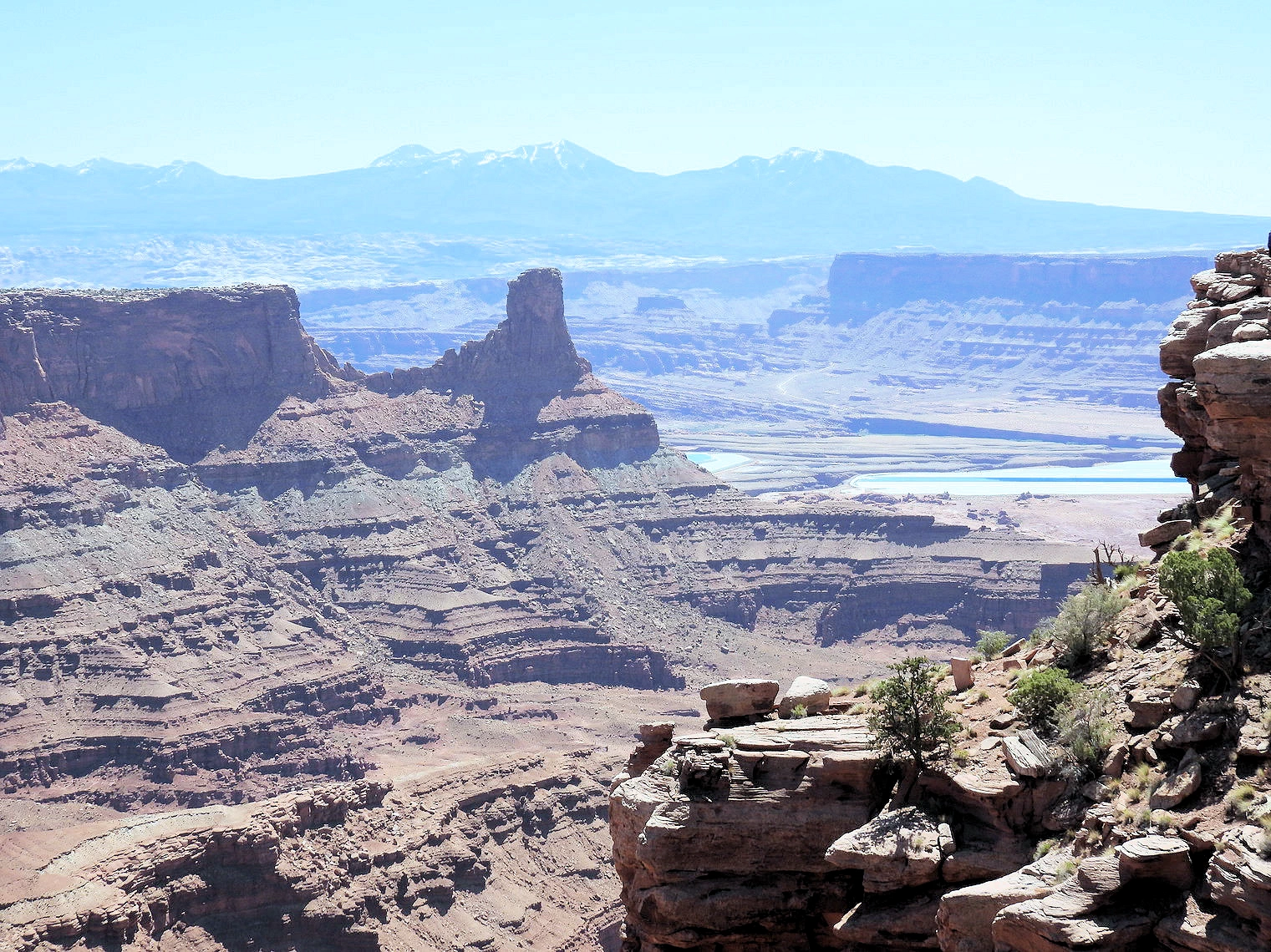
The view from Dead Horse Point Overlook in Utah is nothing short of breathtaking. Perched 2,000 feet above the Colorado River, the overlook offers a sweeping panorama of dramatic canyonlands, sheer cliffs, and winding river bends. The vibrant red and orange hues of the rugged sandstone contrast sharply with the shimmering blue waters of the Colorado below. Layers of sedimentary rock, carved over millions of years by erosion, create a mesmerizing tapestry of mesas, buttes, and spires stretching far into the horizon.
From this vantage point, you can see the iconic Gooseneck of the Colorado River, a sharp curve that showcases nature's artistry in shaping the landscape. Sunrises and sunsets here are particularly magical, as the shifting light transforms the canyons into a glowing masterpiece. Dead Horse Point's stunning views provide a serene yet humbling reminder of the region's timeless beauty and geological history.
 Colorado River in the Distance
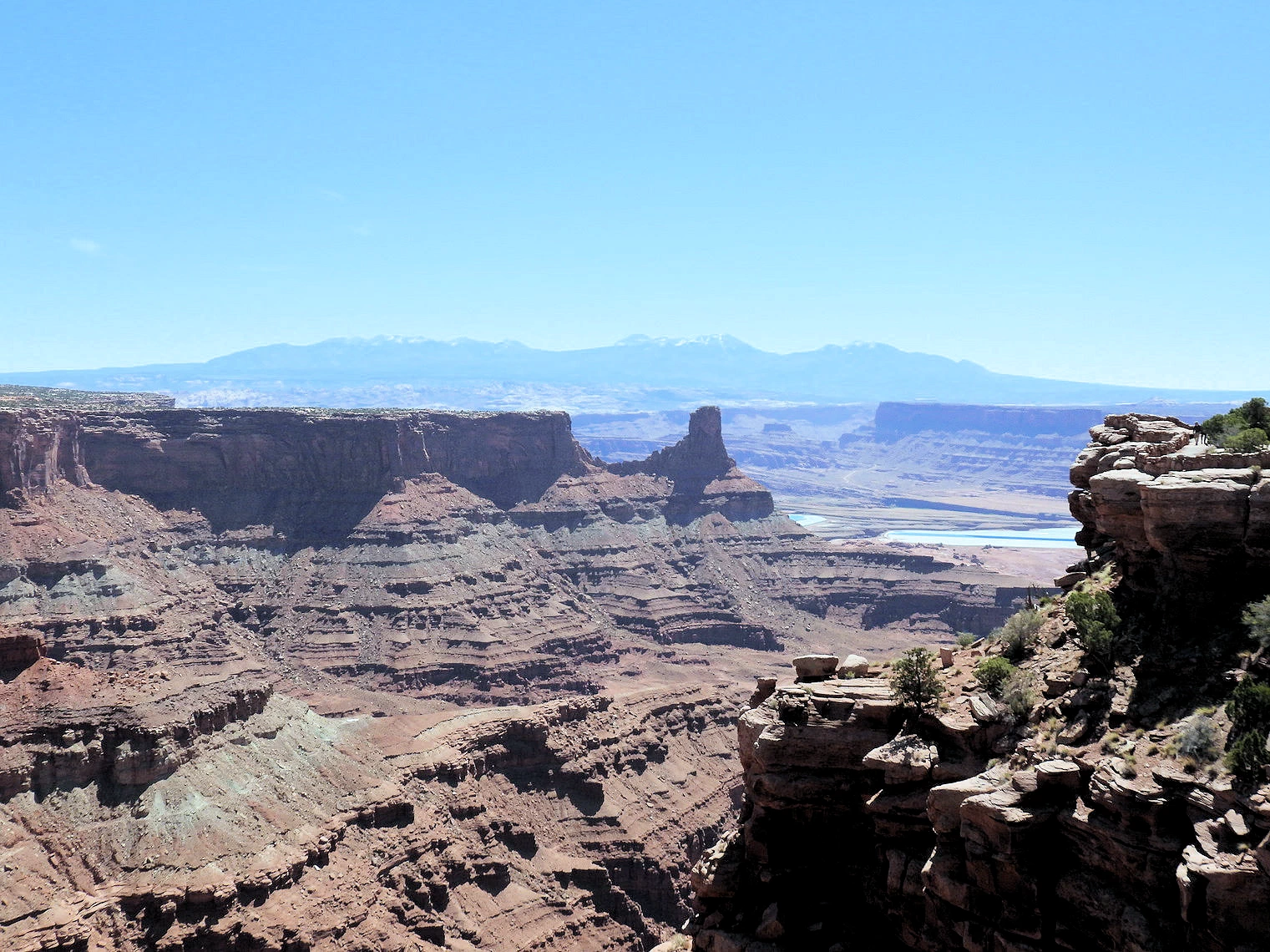 Two Thousand Feet above the River
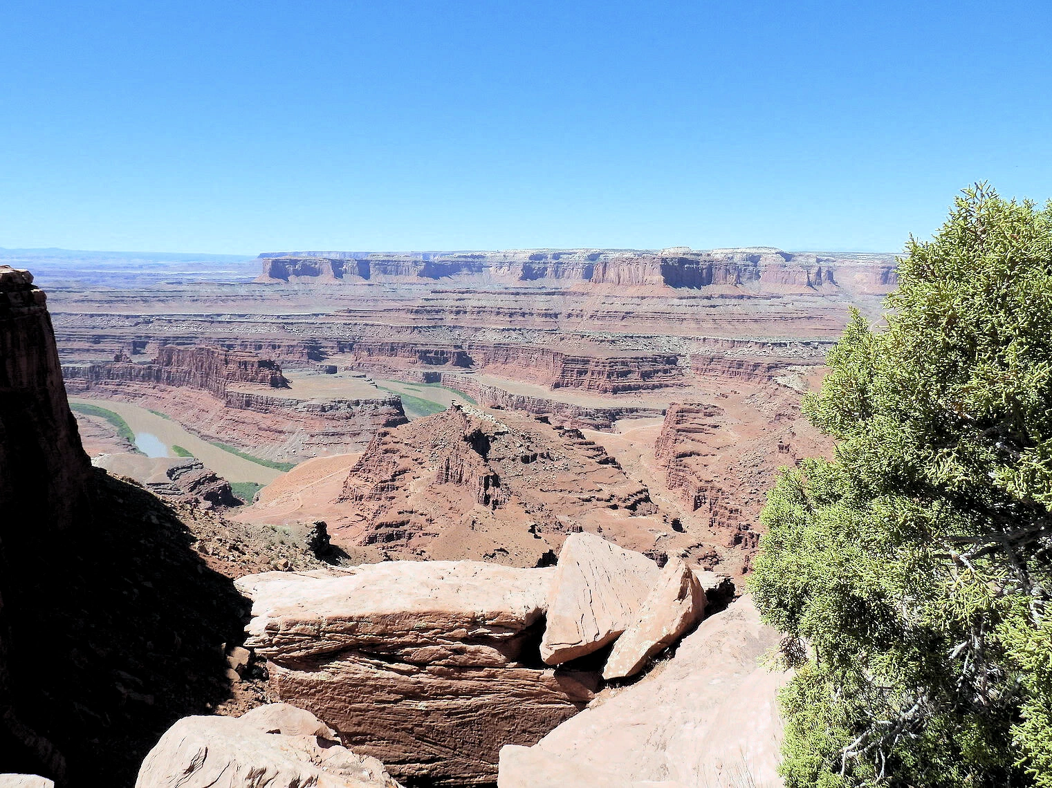 The Gooseneck River Area
On our drive to the visitor center and main overlook, we couldn’t resist stopping at the first pull-out along the way. The view of Dead Horse Canyon below was absolutely mesmerizing, and it beckoned us to pause and take in the scenery. This spot offers an unparalleled vantage point, allowing you to walk right up to the edge of the cliff for completely unobstructed views. The sheer drop and expansive vista provided a thrilling perspective on the canyon’s rugged beauty, showcasing the dramatic landscape carved over millennia.
This overlook was an excellent introduction to the grandeur of the area, and it gave us a moment to appreciate the scale and depth of the canyon before continuing on to the more structured visitor experience. If you're curious about the origin of this location's unique name and its history, we’ve included a link to a fascinating Wikipedia article below for further reading.
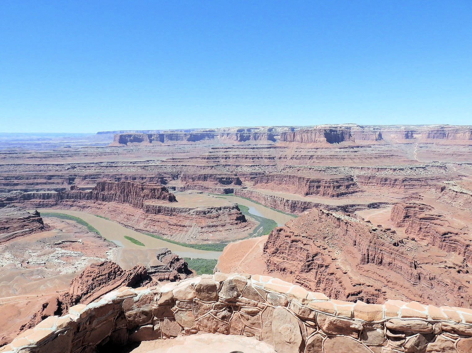 Colorado River GooseneckVisitor Center view of the Gooseneck
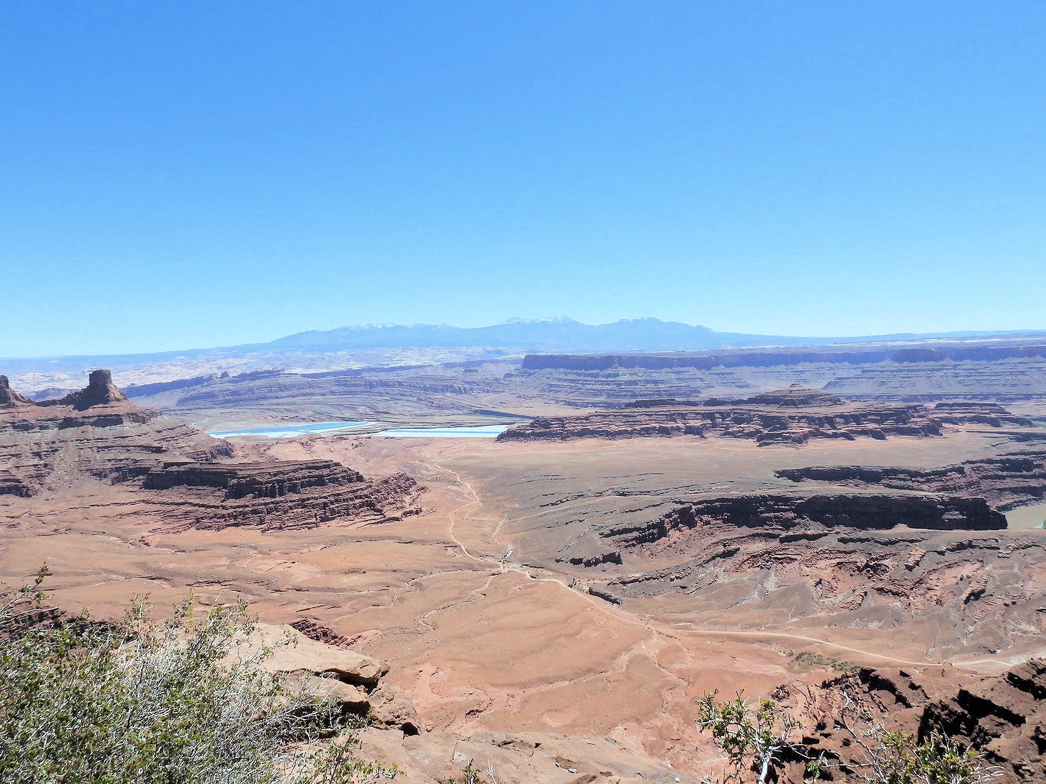 Potash Pond Complex in the Distance
We continued our journey to the Visitor's Center and the covered overlook, where we were greeted with breathtaking panoramic views of the canyon. The expansive vista stretched out before us, showcasing the dramatic red rock formations, sheer cliffs, and winding trails below. It was a perfect spot to pause and take in the grandeur of the landscape.
As we studied the map provided at the Visitor's Center, we were surprised to discover that the Shafer Trail, which we had driven the previous day, now lay far below us within the canyon. Seeing the trail from this elevated perspective gave us a newfound appreciation for the rugged terrain we had traversed. The juxtaposition of our current vantage point with the winding road below highlighted the immense scale and beauty of the area, making the experience all the more memorable.
In images 1 & 2 you can see the Colorado River, but in image # 3 that is the Potash Pond complex, those lakes play a key role in the mining of potassium chloride deposits from underground.
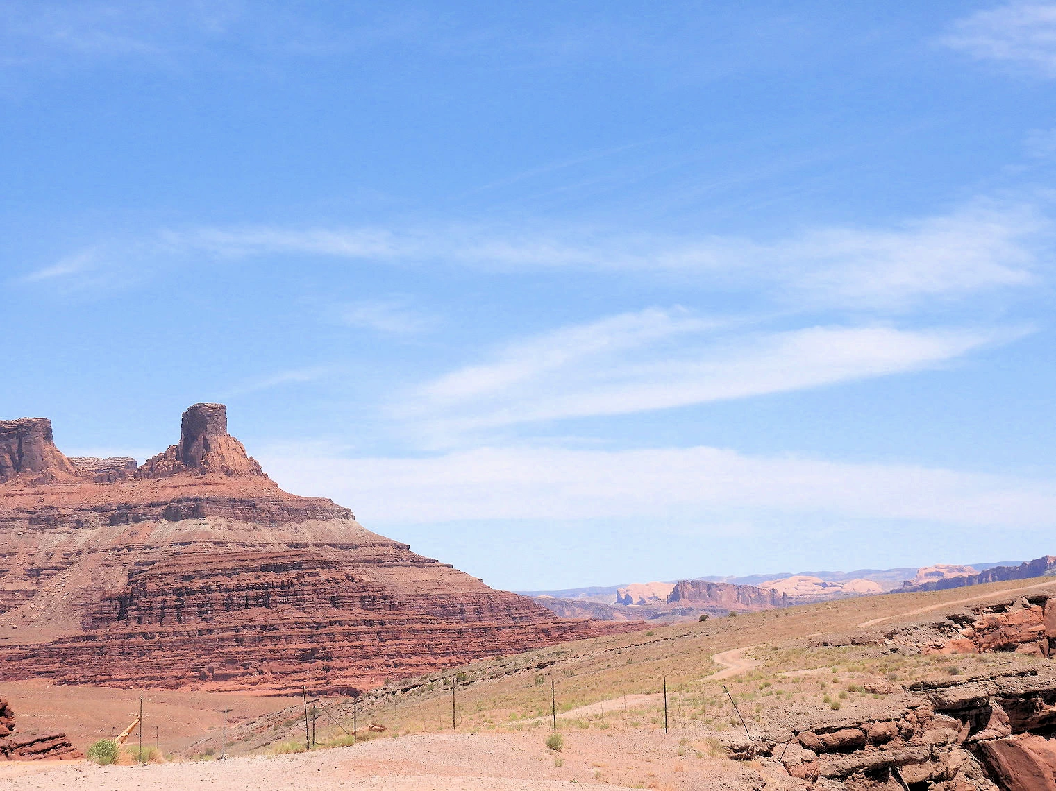
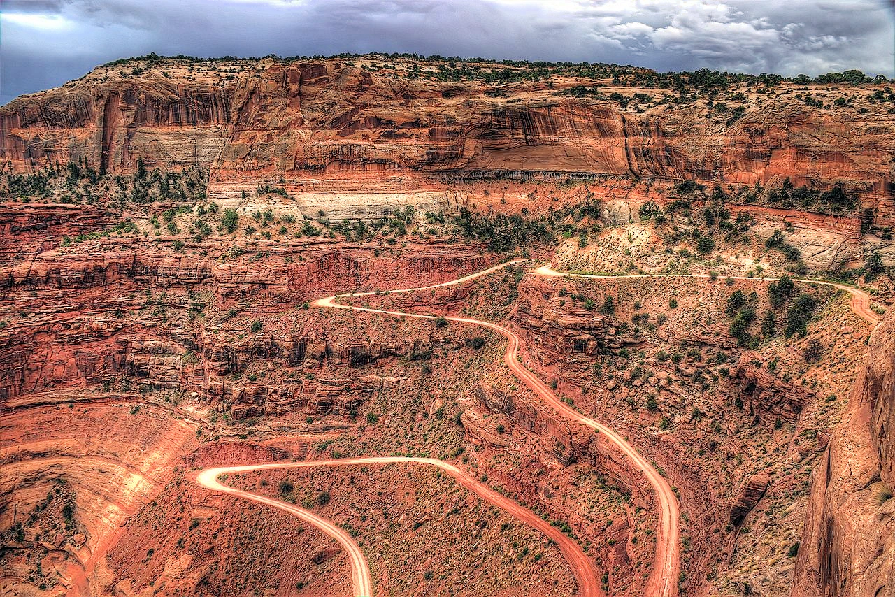
Located north of Moab, in Grand County, in southern Utah, USA, Gemini Bridges Trail is the name of a very scenic journey. You should not attempt this without a serious vehicle that can handle off-roading. If you are looking for the real Moab experience, this is it.
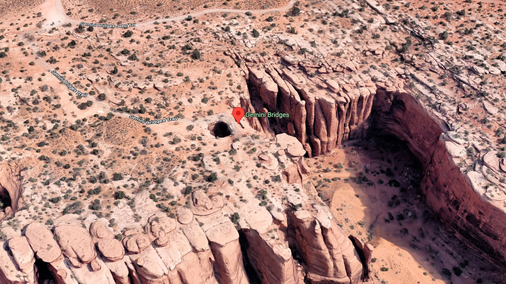
In this image, the parking lot is in the upper left corner of the picture and the walk down to the bridges is perhaps 125 yards or so. Beyond the bridges is a canyon, perhaps 150 feet below where we were standing.
How to Drive to Gemini Bridges from Moab
There is a sign on route 191 indicating where you must turn left to enter Gemini Bridges Road, it is approximately 9 miles north of Moab. The road ascends as it parallels route 191 and then turns southwest into the desert area, where you are going to find sandy washes and large rocks. Be careful, as this is also a mountain biking area !
 Entry from Route 191
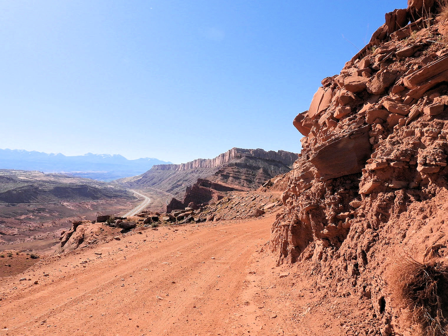 Court Point
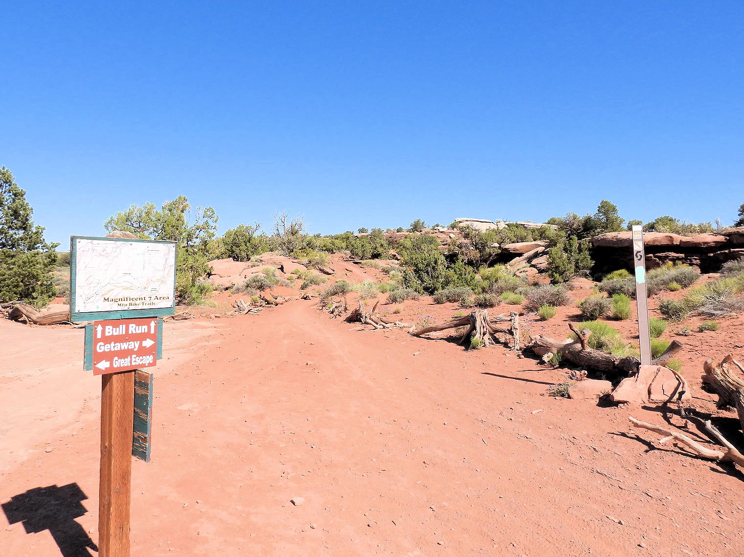 One of the few road signs we found
To reach this off-road trail, you drive north on route 191 from Moab and exit west (left) onto Gemini Bridges Road (also known as Highway 313 access). This dirt road trail will ascend to Court Point (5,699 feet) where the trail will swing southwest. The route immediately begins with a rough descent into a canyon, featuring a series of tight switchbacks. While the road is not overly technical, it is bumpy and may require a high-clearance or 4x4 vehicle, especially after rainfall. It is not a difficult trail, but it is a continously rough road. You will see very few signs, but watch for the turnout to Gemini Bridges.
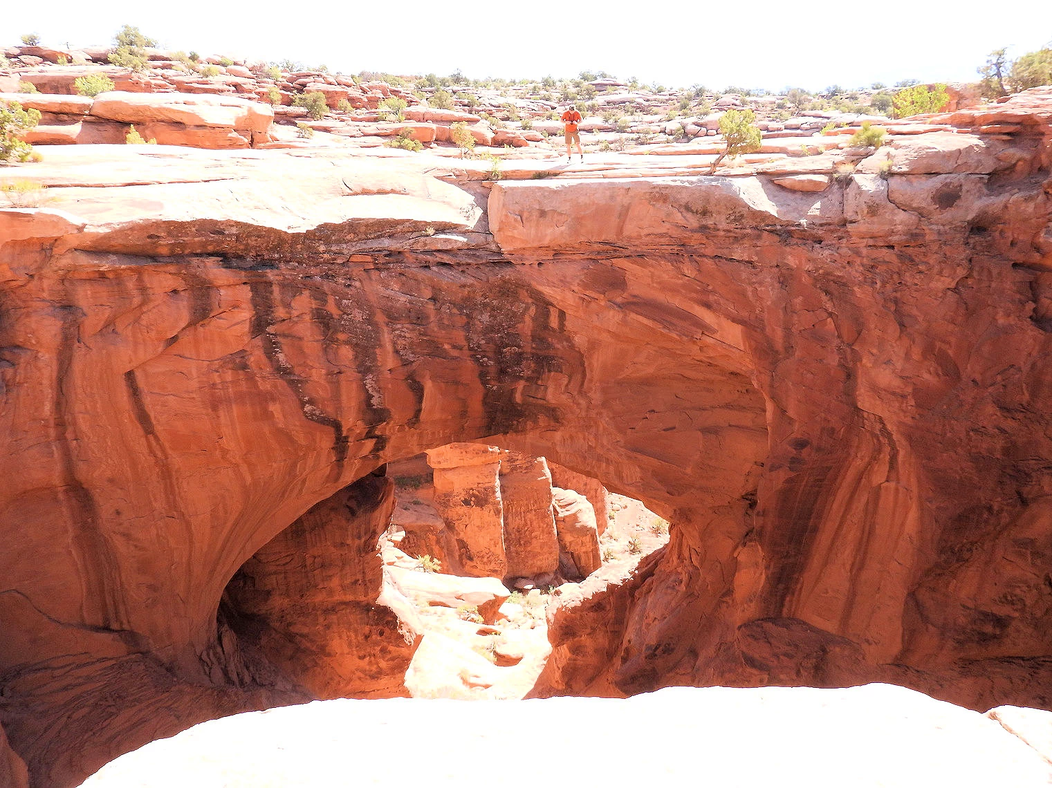 Gemini Bridges Arch
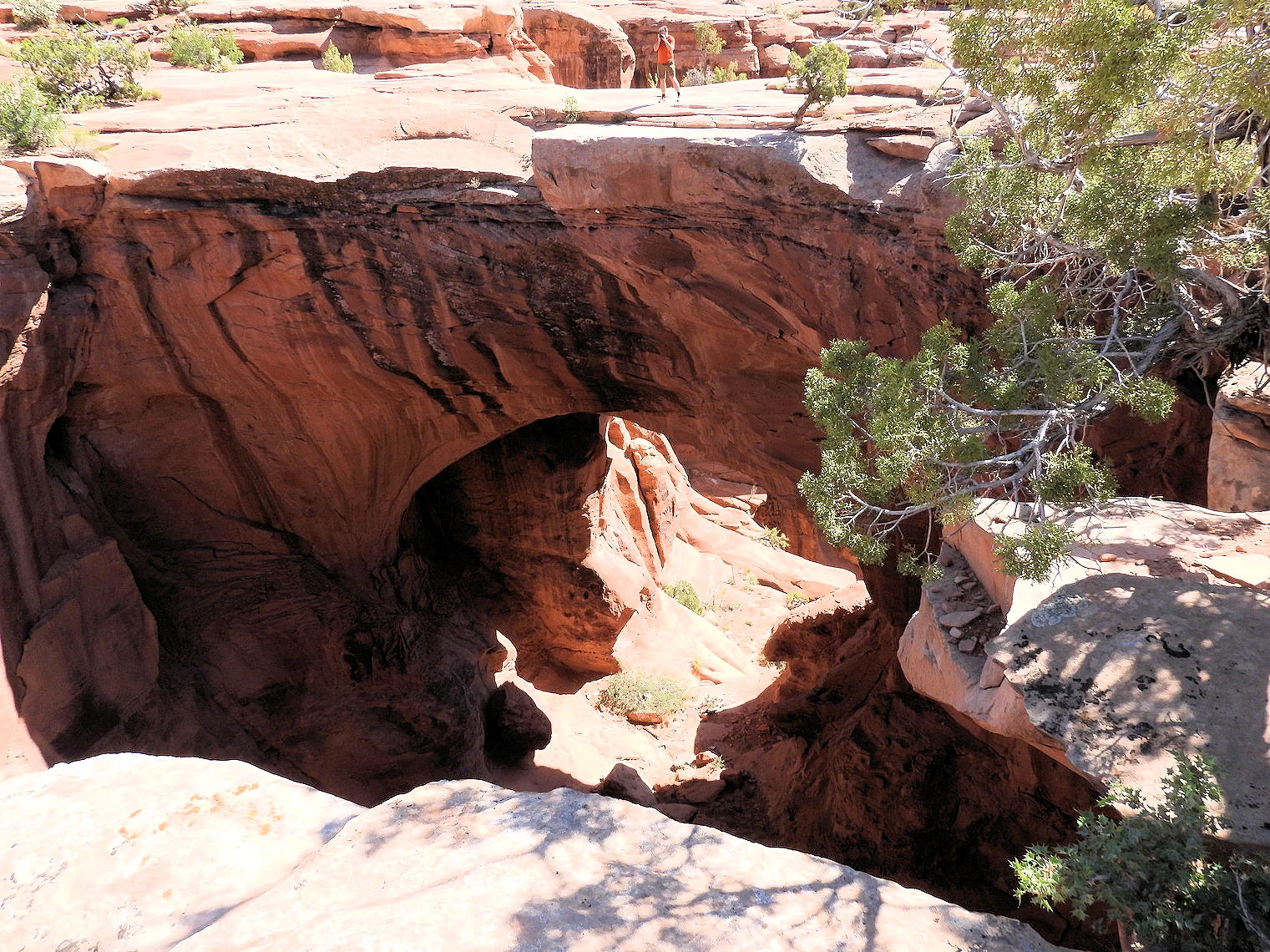 Gemini Bridges Arch
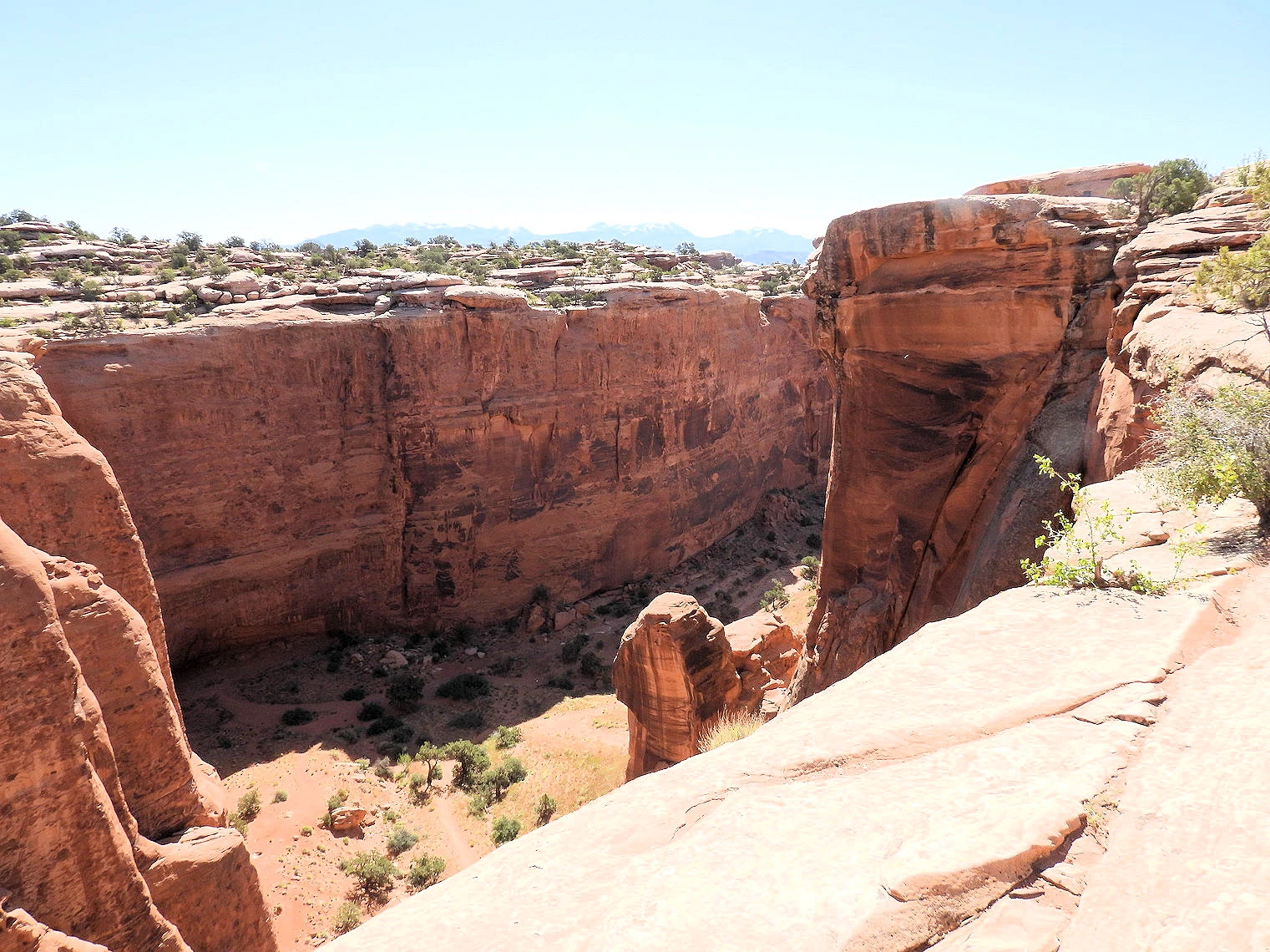 Bull Canyon below Gemini Bridges
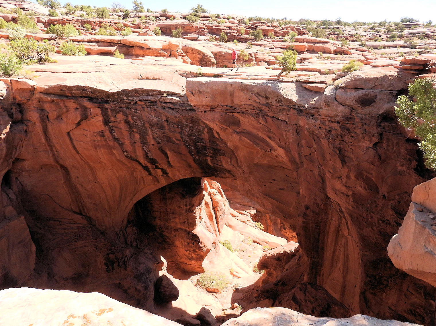 Gemini Bridges Arch view from Northside
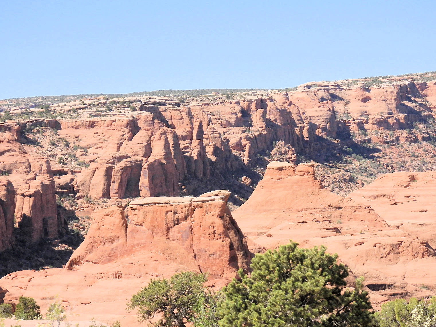 Bull Canyon marching off to the South
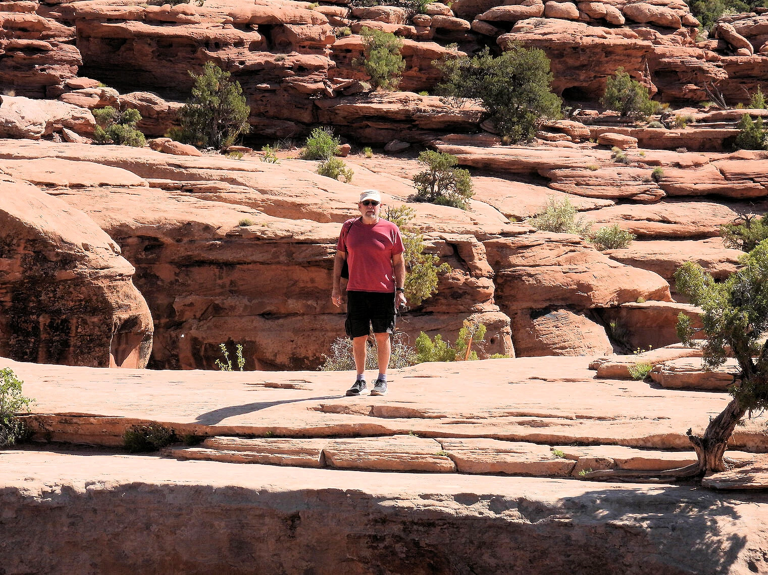 I Would hate to have fallen!
Once you reach the Gemini Bridges area parking lot, park your vehicle and walk down (following the blue trail markers) to the natural arches. Unlike most arch viewpoints, this trail leads to the top of the bridges where you can walk across them and see down into Bull Canyon below. These two bridges are named after the Gemini twins of Roman mythology, Castor and Pollux.
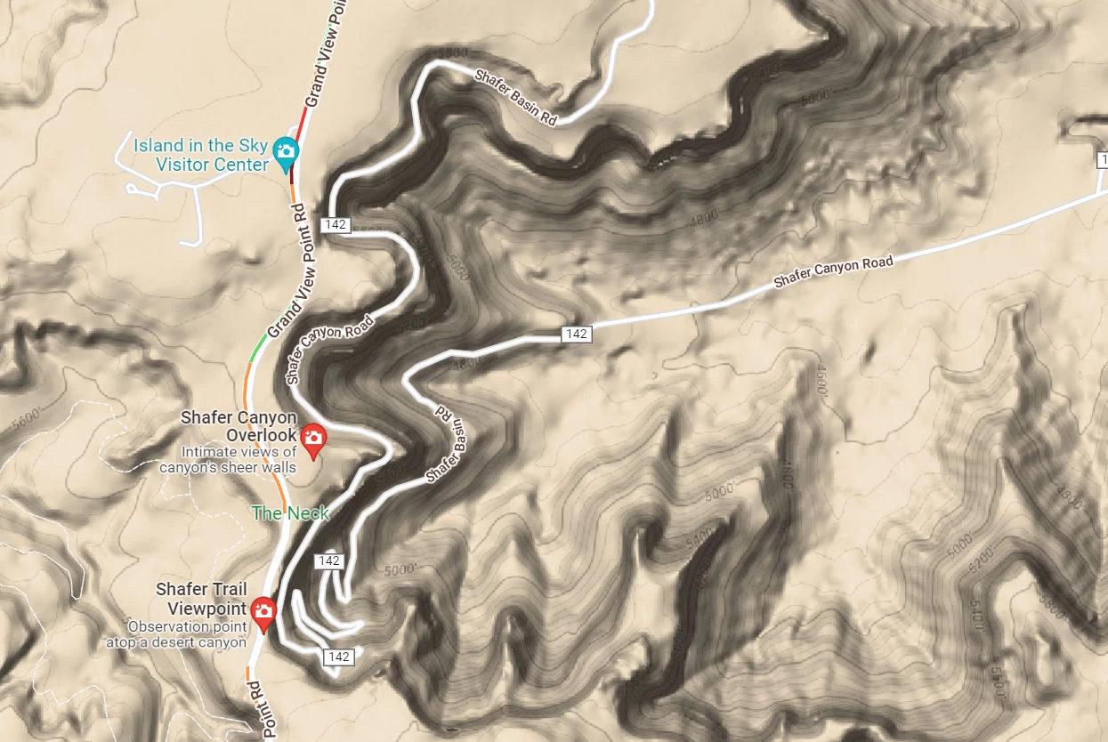
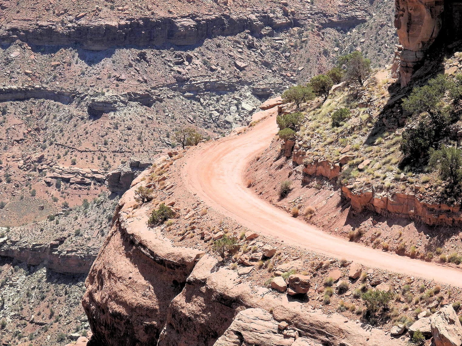
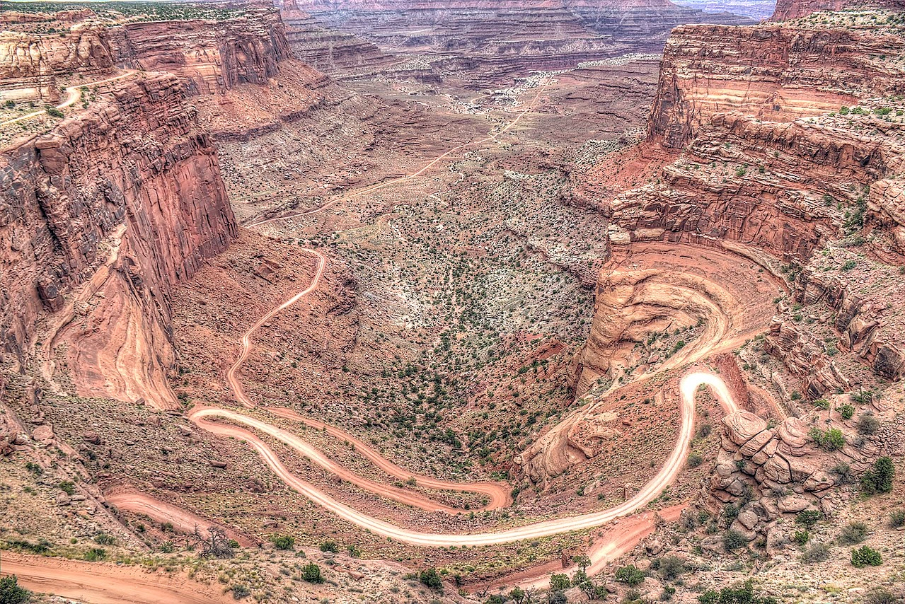
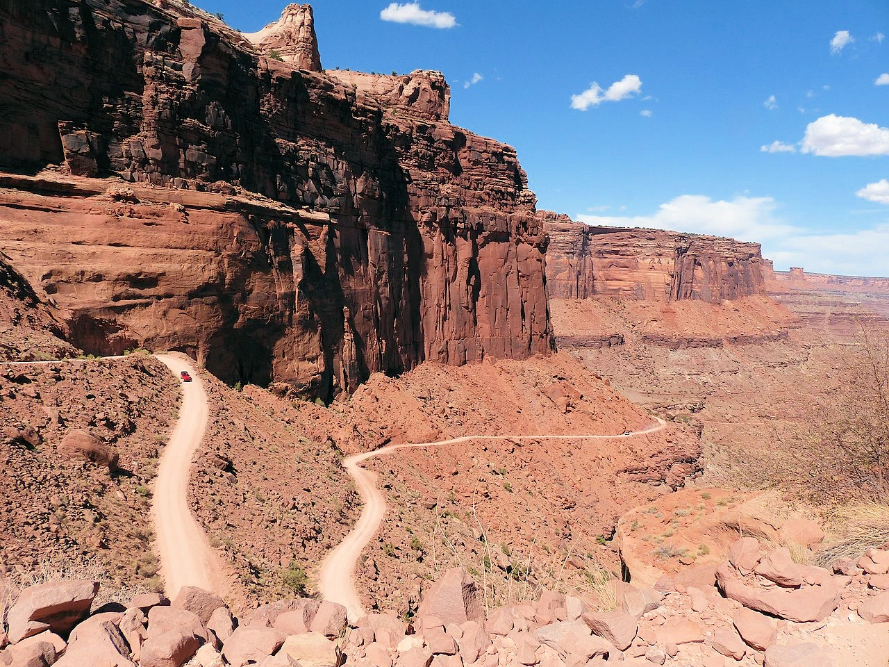
On Utah route 313 that leads to the Island in the Sky Visitor Center, you will see a sign for Shafer Trail on your left (Shafer Canyon Road). This part of the trail almost immediately turns into a descent and the switchbacks begin. It is important to remain cautious on the switchbacks, as there are no guard rails and the pullouts are generally only on each switchback corner. Vehicles ascending the trail have the right of way, so you will have to be diligent about being aware of oncoming vehicles and to allow them full access to the trail.
 No Guard Rails on this Road!
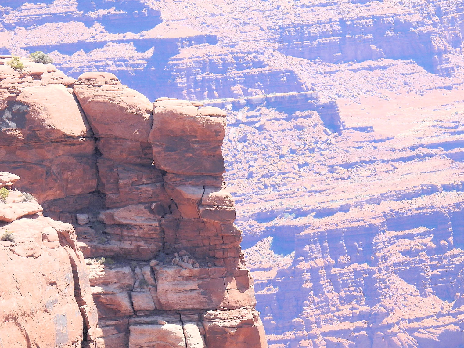 Incredible Cliffs!
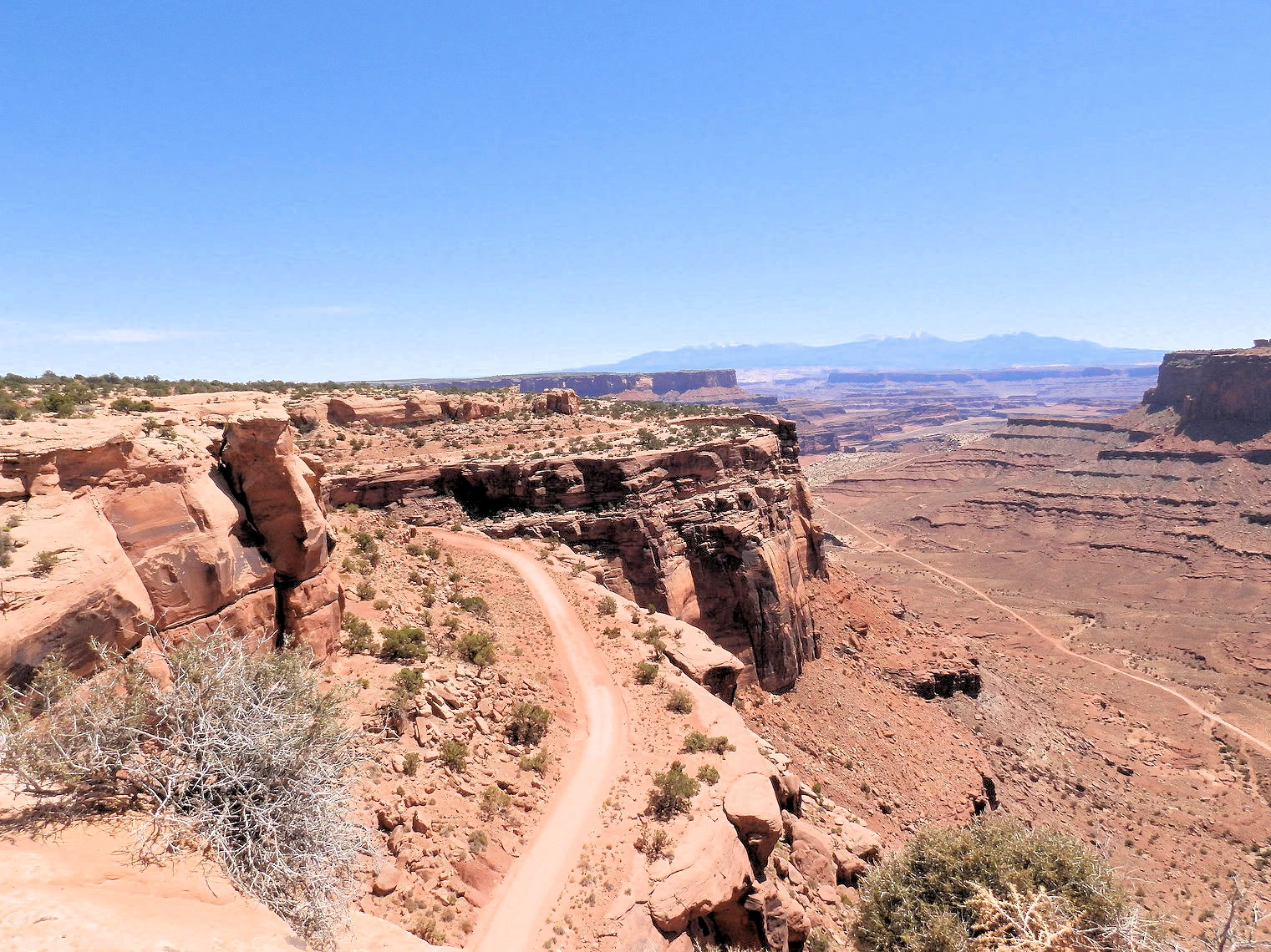 Top of the Shafer Trail
The switchback section of the Shafer Trail is a breathtaking yet challenging route that carves its way down 1,500 feet (457 meters) of vibrant sandstone cliffs, offering awe-inspiring views of Canyonlands National Park. This rugged, one-lane trail requires careful navigation, but strategically placed pullouts allow vehicles climbing uphill to pass, as they have the right of way over those descending.
Designed for adventurous spirits, the Shafer Trail demands a high-clearance 4WD vehicle, making it accessible for most off-road enthusiasts without the need for a heavily modified vehicle. The trail features steep gradients of up to 16% and tight switchbacks, with loose gravel, narrow passages, and occasional low overhangs adding to the excitement. For those seeking an off-road experience with unparalleled scenery, this well-maintained road delivers.
However, the Shafer Trail is not without its risks. Wet weather, including rain or snow, can make the surface dangerously slippery, turning the adventure into a hazard. Always check the weather forecast before setting out, and postpone your trip if precipitation is expected. Proper preparation, including adequate supplies and a reliable vehicle, is essential for a safe and rewarding journey down this iconic Utah trail.
 Potash Road Area
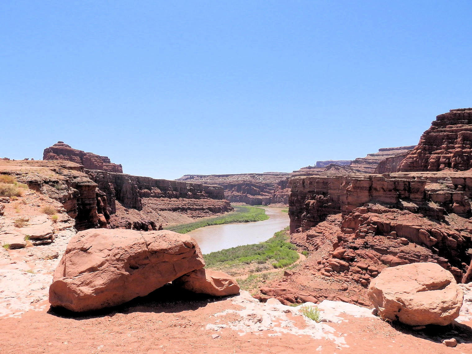 Colorado River near Potash Pond Area
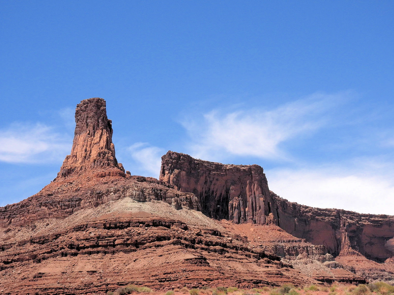 Rock Formations near Potash Pond
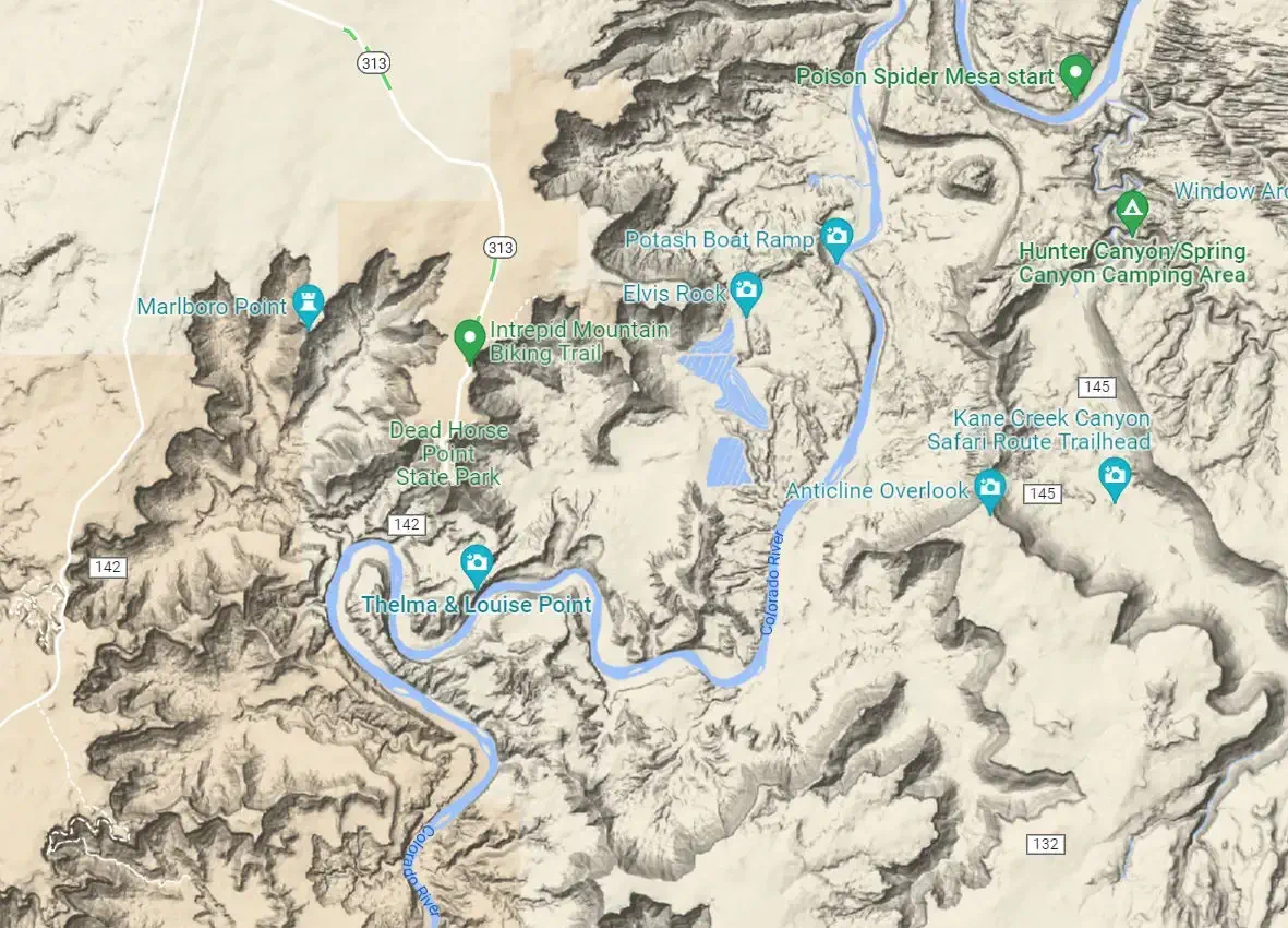
Once you reach the canyon below, you can either take the route back to route 313, or you can turn left onto Potash Road. This will take you past the Potash Ponds and eventually to route 191 where you can return to Moab. The road becomes "Shafer Basin" (route 142) and you will want to stay observant such that you will turn northeast onto "Potash Road" which will bring you to the evaporation ponds. All of this section of the trail is near the Colorado River and you will pass "Thelma & Louise Point" just before you turn northeast onto Potash Road.
We wound up eating out only one night while we were there, at the Moab Diner. I had one of the best liver & onions meals I have had in a long time ! An incredibly good meal, the service was prompt, efficient and friendly. Just for the record, we didn't eat dinner out on the other nights there because we had some nice charcuterie fixins from the Moab City Market (and a good bottle of red!).
The Moab Brewery was on our list to visit from our research, but we could not work in a visit that fit into our schedule. We found numerous people who said that it is a good pub. The Trip Advisor reviews vary all over the place, perhaps your experience will be better?
We stayed at the Moab Hampton Inn, because it was close to the center of town and near various restaurants. There are quite a few other accommodations, click our "All accommodations in Moab link" below for a complete Google Search Results list.
IMAGE CREDIT: Image is the property of Hilton, Inc. from their Moab Hampton Inn Website.
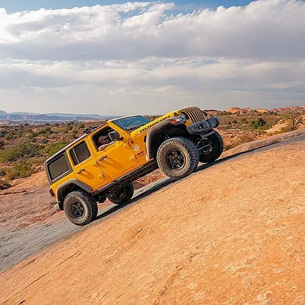
We rented a Jeep from Canyonlands Jeep Adventures and they were very polite and helpful. The vehicle we rented was new and had low mileage and they gave us a cooler with ice & water bottles already loaded. The Jeep had larger off-road tires, which gave it higher ground clearance. This was very useful as the trails we drove on had frequent sandy washes and multiple rocks - so the higher ground clearance was good to have.
They have a large parking lot there and you can leave your vehicle parked there, or you could take it back to where you are staying. We decided to leave our rental car there, as their parking lot is well lit at night.
There are a number of off-road vehicle rental facilities in Moab for you to select from (see our Google Search Results list link below). NOTE: Much of the public land surrounding Canyonlands and Arches National Parks is open to ATV and UTV travel on designated routes. However, it's important to note that riding these vehicles is not allowed within either Arches or Canyonlands National Parks. Jeeps are allowed, ATV & UTV type vehicles are not. In Moab, if the ATV or UTV is registered as "street legal", then you can operate those vehicles on the city streets. for more information, go to the National Park Service page about park regulations.
I used the phrase "public land" to distinguish it from the two big National Parks. So for example, you could drive your off-road vehicle from Moab on Utah Route 279 to the Potash Ponds and then continue west on Utah Route 142 until that road ends at the Shafer Trail road. At that point, there is a sign that warns you that you are about to enter Canyonlands National Park and that off-road vehicles are not allowed.
Are off-road vehicles (OHVs/ATVs/UTVs) allowed in Canyonlands?
Do I need a permit for the White Rim Road or other backcountry roads?
Do I need a high-clearance 4×4? Is AWD enough?
Where do I check current road conditions?
Are drones allowed?
Are there water, gas, food, or lodging in the park?
Is Gemini Bridges inside Canyonlands?
What are the different districts of Canyonlands?
2025 Government Shutdown
Most National Parks remain open during a government shutdown, but with reduced services and staffing. Parks may be accessible, but facilities like visitor centers, campgrounds, and websites might be closed, and services like trash pickup and restroom maintenance can be significantly impacted. Visitors should check individual park websites for current conditions before going and be prepared with extra supplies and awareness that emergency services may be limited.
Gates and roads are generally open to allow access to outdoor areas.
Although no single website can provide you with all there is to know about Moab, Utah or Canyonlands, we have attempted to provide you with a lot of information on this page - most of which we utilized to build our trip planning document. This area is packed with interesting things to see and do, and these things are spread out across a very large amount of geography. Pack sturdy shoes, sun protection, and reusable water bottles. Download park maps and consider booking lodging in advance, especially during peak season. Moab awaits - plan your escape today!
These URLs are the current NPS/Recreation.gov references for Canyonlands: home, maps, conditions/alerts, road status, fees, day-use & overnight permits, White Rim/Shafer guidance.
Base in Moab: All the practical stuff—hotels, restaurants, groceries, fuel, outfitters, and 4×4 rentals—is in Moab. Inside Canyonlands you’ll find viewpoints, trails, and pit toilets, but virtually no services. Stock up in town (water, snacks, fuel) and make dinner/lodging reservations in advance, especially spring–fall weekends.
The Moab Diner
We had dinner at the Moab Diner and; it was a good experience because the service was very good, the food was quite good and reasonably priced.
Plan Your Visit to Canyonlands Travel Resources — Maps, Parking, Passes & Links


More Info Travel Resources — Maps, Parking, Passes & Links
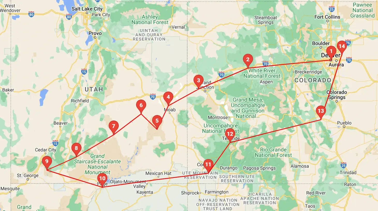 Click above map to view a larger Google Map
 As you can see by the this map, our trip covered 3 different states, approximately 1,600 road miles and allowed us to see some spectacular geography. You might think that a trip of this distance would be something that would result in a "tired of driving" mood - but our stops were so diverse with such incredible geography and fun things to do, that we found that we looked forward to each morning to where we could continue our adventures!
Click any link below to go directly to that page;
Note: All images featured on this page are the exclusive property of Just Traveling Thru, LLC, unless otherwise stated. When images from external sources are used, full credit is given to the original creator, along with a link to the specified license or usage terms. We are committed to respecting copyright and intellectual property rights, ensuring that all third-party images are properly attributed. If you have any questions regarding image ownership or usage rights, please feel free to contact us.
Affiliate Links: We may earn a commission if you make a purchase through one of our affiliate links. This helps support our travel content — thank you!
Content: To review any of our content, make suggestions and/or comments, please click the "About" menu link at the top of this page. You will find our "Contact Us" link on that drop-down menu.