
by Celeste Lipford and Terry Lipford - last updated on 9/11/2025
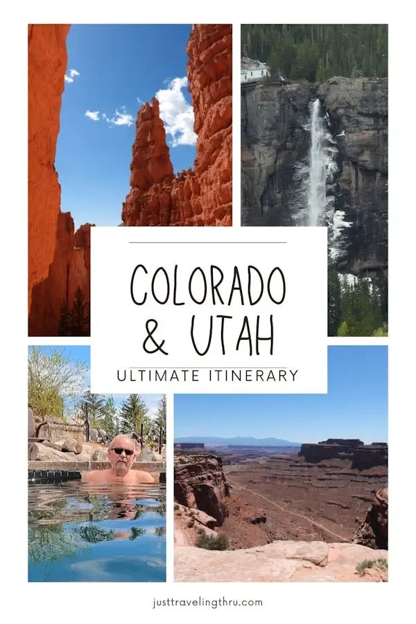
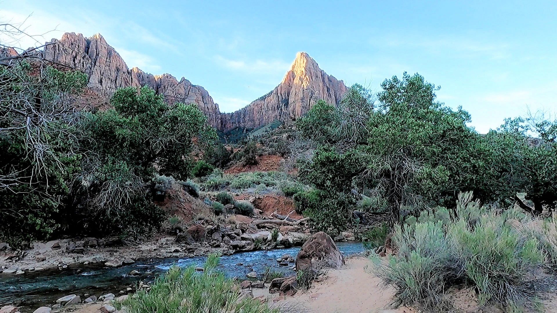
Zion was our last stop in Utah on a 16 day road trip that we took across Colorado and Utah (click here to view that trip overview page). Each of the Utah parks has a different ambience. Zion is a stark contrast from Arches National Park, Bryce Canyon and Canyonlands. Zion sits at about 3,666 to 8,726 ft in elevation, however, the Virgin River flows through the canyon and even though the park is in an arid environment the canyon floor in contrast to the other parks is much more verdant and full of trees, plants and animal life. We were pleasantly surprised by the greenery.
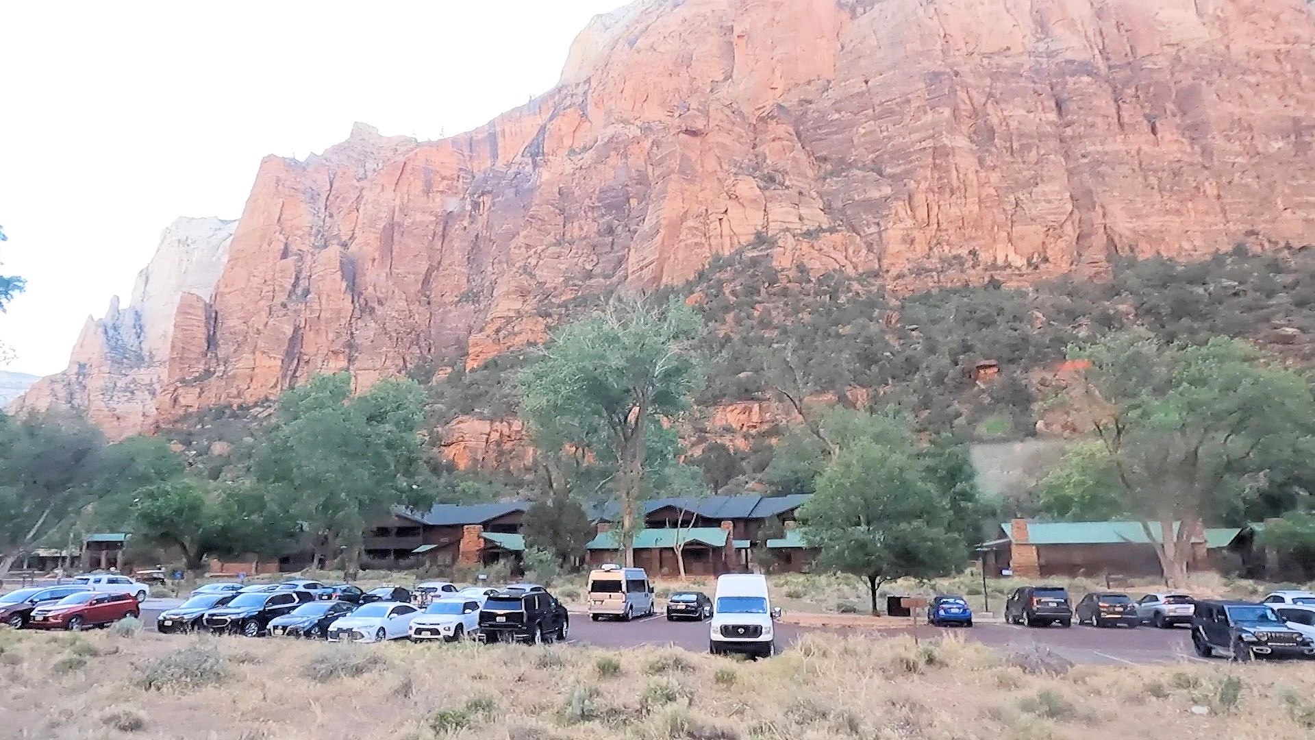
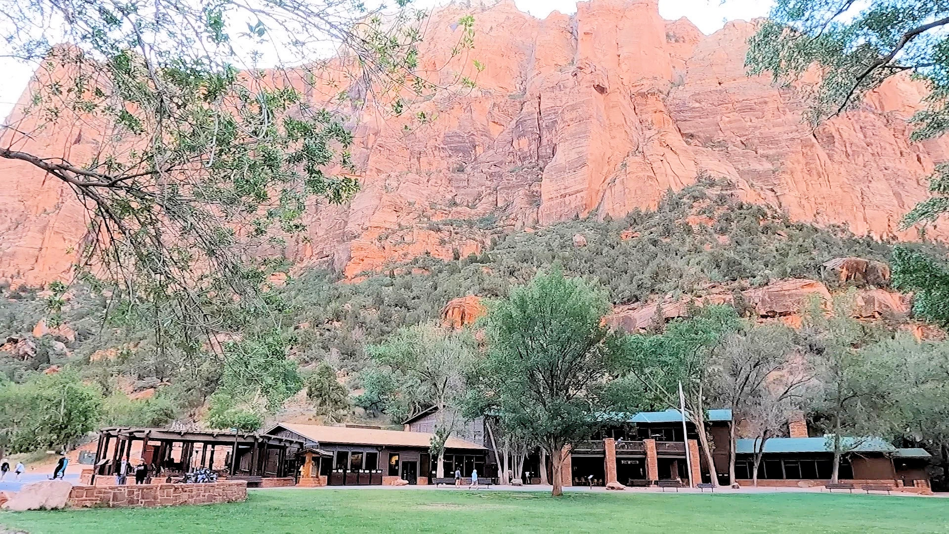
The Virgin River flows to the Emerald Pools creating waterfalls and hanging gardens which are accessible by hikes ranging from easy (the lower pools and middle pools) to more moderate to strenuous (the upper pool). The Emerald Pools hikes are located across from the Zion National Park Lodge which is situated in the canyon and surrounded by grass and trees.
The Zion Mount Carmel Highway and Zion Canyon Scenic drives offer stunning overlooks and views of steep cliffs and jagged peaks. Zion Mount Carmel Highway cuts from the east entrance of the park to the center of the park and you can drive your car while the Zion Canyon scenic drive is only accessible by bus due to the volume of visitors each year.
Hiking the Narrows is one of the most popular things to do in the park because you get to hike in the Virgin River through narrow canyons where there is no trail. You must get your feet wet for this hike and it’s best to have a hiking stick. You can stop when you want and turn around or attempt the entire ten mile trip. Many people rent special shoes to hike the narrows. Some options for renting equipment and "river walking shoes" are; Zion Outfitter and/or Zion Guru.
The trail starts at the Temple of the Sinawava trail which to reach this trail you hike along the river for about a mile. Many people, just do this part of the trail for it’s beauty and verdant hanging gardens and scenery and to watch all of the people heading into the Narrows at the end of the trail. Please note that The Narrows can be dangerous if there is a flash flood so check the warnings before entering.
If you enjoy our videos click here to subscribe to our Youtube Channel.
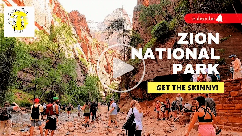
Click the above video poster image to view our Zion National Park video - it is one of Utah’s Big 5 national parks and it is a large park with the most visitors each year. Get the information that you need to plan your own journey, with a 3 day itinerary for visiting Zion National Park and the pro tips you need for a successful first-time visit to the park and things to do at Zion National Park. It's a beautiful park with lots to see and do next to the quaint town of Springdale. We were there in May and we think May is one of the best times to visit Utah.
Congress established the area as a national park in 1919. A second Zion National Monument (now called the Kolob Canyons) was established by presidential proclamation in 1937. Congress added the Kolob Canyons to Zion National Park in 1956. The park currently encompasses 148,733 acres.
Zion National Park draws over 5 million visitors annually due to its diverse topography, soaring sandstone cliffs, mystical slot canyons, cascading waterfalls, colorful hanging gardens, lonesome desert plateaus, and clear-flowing rivers.
The park was enlarged in 1956, by the addition of adjacent land that had also been named Zion National Monument but is now called Kolob Canyons; the entire park now occupies 229 square miles (593 square km) or 146,597 acres.
Zion’s elevation varies by 5,000 feet; Elevation ranges from 3,666 feet at Coalpits Wash to 8,726 feet at Horse Ranch Mountain in the Kolob Canyon section of the park.
Yes, Zion National Park’s geology features some of the tallest sandstone monoliths in the world. The Great White Throne – One of Zion’s most famous monoliths, standing at 2,350 feet (716 meters) above the canyon floor.
Zion National Park boasts canyons as deep as 500 feet and rock monoliths as tall as 450 feet.
Checkerboard Mesa’s distinct crosshatch pattern is due to wind and weathering.
The north face of the Great White Throne rim rises 2,350 feet from the Zion canyon floor.
Yes, Angels Landing is considered one of the most dangerous and challenging hikes in the U.S. due to its steep drop-offs, narrow ridges, and high exposure to sheer cliffs. At least 17 deaths have been recorded since 2000. The final half-mile is especially risky, with 1,000-foot drops on both sides. Zion now requires a permit to control crowds. To stay safe, use the chains, check the weather, and know your limits—stopping at Scout Lookout is a safer alternative.
The Watchman Trail in Zion National Park is not considered a climber’s paradise—it is a hiking trail, not a rock-climbing route. However, The Watchman itself, the towering 2,555-foot (779 meters) sandstone peak, is a notable landmark in Zion and draws attention from climbers due to its sheer cliffs and striking appearance.
No, Zion National Park does not contain the longest freestanding arches in the world. While Zion has several natural arches, such as Kolob Arch and Crawford Arch, the longest freestanding arches are found elsewhere. Landscape Arch in Arches National Park at 290 feet (88.4 meters) in length, is the longest freestanding natural arch in the world.
Zion National Park has served as a picturesque backdrop for numerous films and television shows over the years. According to IMDB, the park has been featured in dozens of productions, making it one of the most popular filming locations among U.S. national parks. Click the link to see the complete list on the IMDB website.
There are four entrances to Zion National Park;
Yes — from spring through late fall, the main canyon is accessible only via the mandatory park shuttle. No tickets are needed to ride, but you must pay the park entrance fee. Private vehicles are restricted during shuttle season.
Angels Landing is a strenuous 5.4-mile hike with exposed drop-offs. A permit is required to hike the chained section. The trail is not recommended for those afraid of heights or unsteady on narrow ledges. See our section (on this page) about Angels Landing.
Yes, but water levels and temperatures vary. In summer, many visitors hike in regular shoes with trekking poles. In cooler months, renting dry pants or dry suits from outfitters in Springdale is strongly recommended.
Spring and fall offer the best balance of weather and crowds. Summer can be very hot and extremely busy. Winter is quieter and cooler, but some trails may be icy.
Yes — Riverside Walk, Lower Emerald Pools, and Weeping Rock (when open) are short, family-friendly trails with beautiful canyon views.
Yes, during the winter season (late fall through early spring) private vehicles are allowed into Zion Canyon. The Kolob Canyons and Kolob Terrace areas are always accessible by car.
2025 Government Shutdown
Most National Parks remain open during a government shutdown, but with reduced services and staffing. Parks may be accessible, but facilities like visitor centers, campgrounds, and websites might be closed, and services like trash pickup and restroom maintenance can be significantly impacted. Visitors should check individual park websites for current conditions before going and be prepared with extra supplies and awareness that emergency services may be limited.
Gates and roads are generally open to allow access to outdoor areas.
The most commonly used entrances for Zion are the west (via Springdale) entrance and the east entrance.
The west entrance is where the Zion Visitor Center is located and is also where the town of Springdale resides which is where many people stay when visiting the area.
The east entrance (route 9) is the best way to enter if you are traveling from the Bryce Canyon area. However, there is a tunnel that has size restrictions including no bikes or pedestrians and height and width restrictions.
WARNING: Any vehicle over 13ft, 1 inches or higher can not pass through the tunnel. We saw a family in a camper get turned away at the entrance due to the height restriction. It is a long way around to the south entrance and needless to say the family was not happy. refer to the National Park Services website for specific restrictions.

The Image Map is the property of the National Park Service via their Website. All other images are the property of Just Traveling Thru, LLC unless otherwise noted.
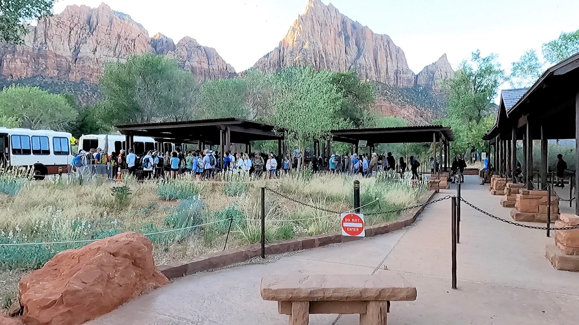
Zion has a large number of visitors each year and we found it to be the most crowded of the parks that we visited. To help with the crowds there are two free shuttle buses; One that runs through the town of Springdale and drops you at the park entrance and one that drives along the Zion Canyon Scenic drive and stops at various viewpoints and hiking trails along the drive.
The Zion Canyon Shuttle connects the Zion Canyon Visitor Center to stops on the Zion Canyon Scenic Drive. Shuttles leave every few minutes and go either north or south. You can exit the shuttle at any open stop. No ticket or reservation is needed to ride the park shuttle; check seasonal dates/hours before you go.
Check the map to see what to expect in the park. You may get on and off at any open shuttle stop. Most visitors start shuttle trips at the Zion Canyon Visitor Center, but if you are staying at the Zion Lodge, you can board the shuttle there. You cannot board a shuttle to go up canyon (north) at Canyon Junction.
Shuttle Usage
During busy times you are required to use the shuttle for the scenic drive as no cars are allowed along the route. The visitor center parking lot fills up rather quickly In the morning and the lines for the shuttle bus get fairly long.
Parking Warning
If you don’t get there early to get parking you can take the Springdale shuttle to the entrance. This bus is free and travels along route 9 through the town of Springdale. We found a convenient stop right outside of our hotel.
Mt. Carmel Tunnel
Check the National Park Service Page for current restrictions & prohibitions.The top accommodations in Springdale offer a range of experiences, from luxury retreats to cozy lodges. Here are five highly-rated options:
As of 10/24/2024 Google says there are over 95 accommodations in Springdale, UT. If you would prefer to do your own research here is a link to a Google Search Results list of "accommodations in Springdale, UT".
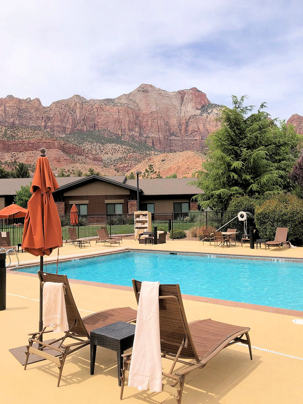
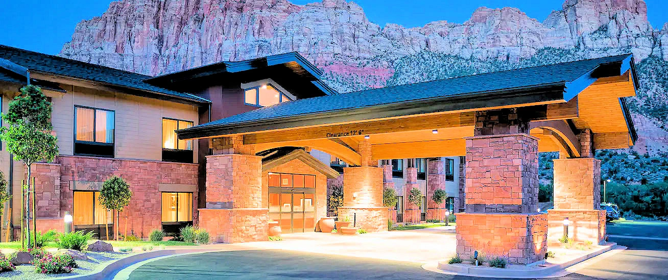
We selected a Hilton property because of it's proximity to the Park Visitor's Center and additionally because there was bus service between the hotel and the park. The Springdale Shuttle Bus stop was several blocks from the hotel.
OK we are enthusiasts of the Hilton Hotel chain, but this is a nice property and with restaurants just across the street and bus service to the park, this was a good place to be. With limited parking available in the park, there was no reason for us to hassle over parking when the bus service was right outside our hotel.
Springdale, Utah, offers a surprising variety of dining options for its size, especially given its proximity to Zion National Park. The town has 30+ restaurants, ranging from casual cafés to upscale dining. If you would prefer to do your own research, here is a Google Search Results list of "restaurants in Springdale, UT" - sorted by the "most highly rated by guests".
Here are the top 5 restaurants in Springdale, UT;
Good Restaurant!
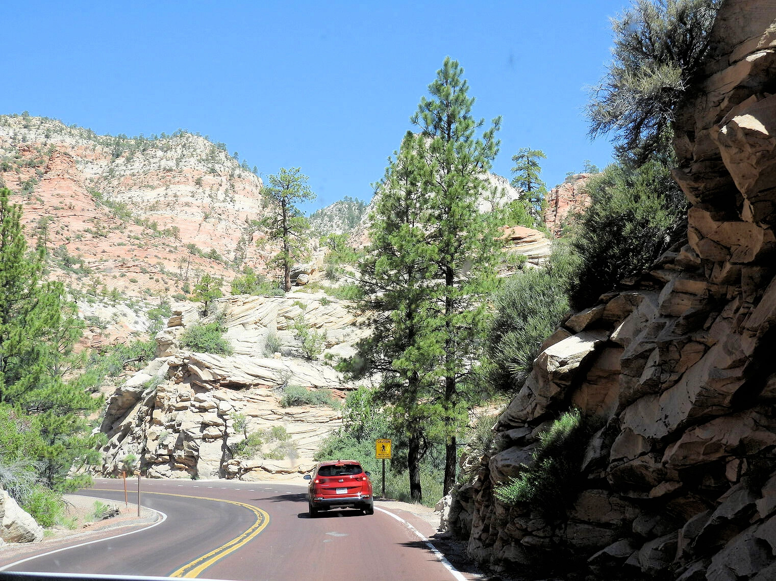
We had dinner across the street from our hotel at the Bit & Spur Restaurant & Saloon and we enjoyed it quite a bit. It is a popular cantina for contemporary Mexican & Southwestern fare plus a robust selection of craft beers. Here is a link to their menus page.The construction of the Zion-Mount Carmel Highway took approximately three years, from 1927 to 1930. This impressive project involved complex engineering to carve the road through Zion National Park’s rugged landscape, including the excavation of the 1.1-mile tunnel through the Navajo sandstone cliffs. The tunnel was particularly challenging due to the hard rock and the need to create openings along the tunnel walls to provide ventilation and stunning views of the canyon.
The roadway offers a stunning drive through the park’s unique landscapes and was an engineering marvel for its time, featuring the Zion-Mount Carmel Tunnel, a 1.1-mile tunnel that was carved through the sandstone cliffs. The tunnel, with its six large windows, provides breathtaking views of the surrounding canyon as drivers pass through.
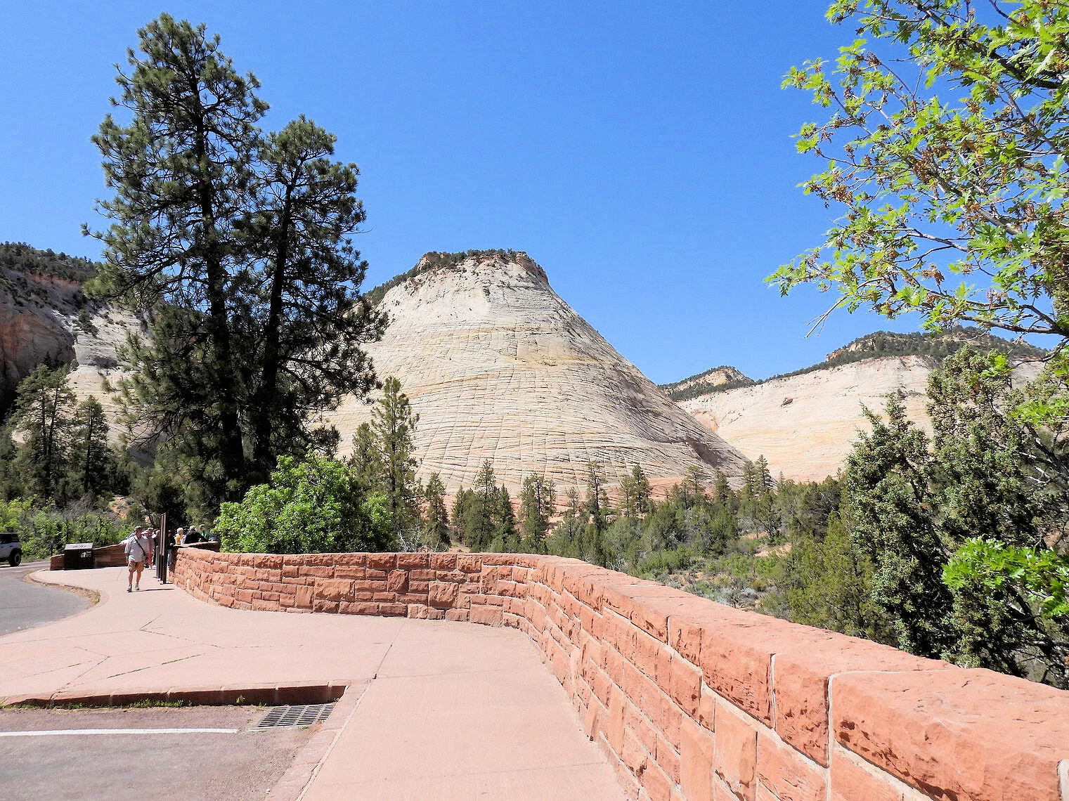
The highway offers dramatic views of towering sandstone formations, including checkerboard mesas, sheer cliffs, and steep canyons. One of the highlights of the drive is the series of hairpin switchbacks descending into the canyon, providing panoramic vistas along the way.
In addition to the scenic beauty, the road also serves as a vital link between Zion National Park and other major attractions, such as Bryce Canyon and the Grand Canyon's North Rim. Visitors frequently use this highway to access the eastern part of Zion, which is less crowded but equally stunning, with opportunities for hiking and photography.
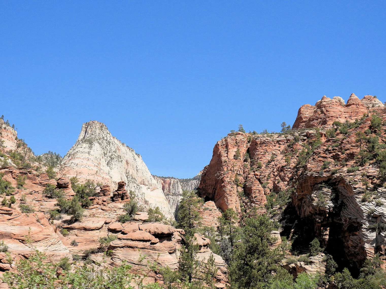
 Mount Carmel Tunnel East Entrance
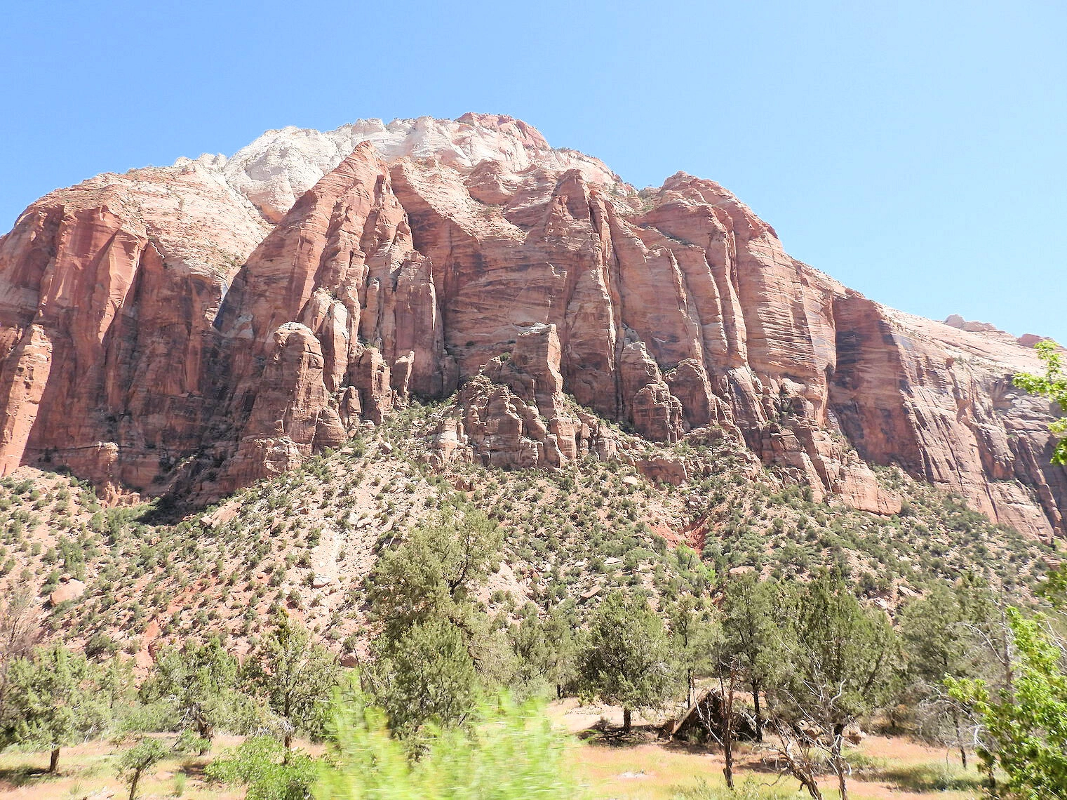 The East Temple
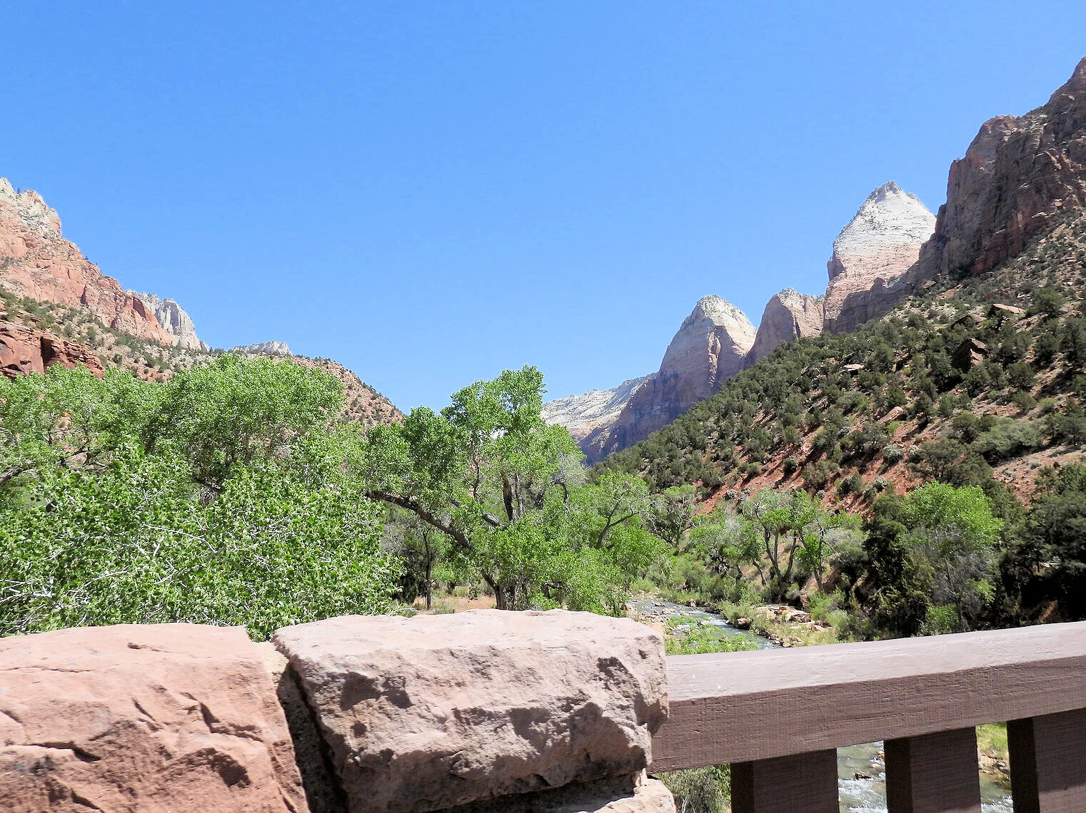 Checkerboard Mesa View Area
The tunnel is 1.1 miles long and was constructed in 1927, and completed in 1930 by the Nevada Construction Co. Prohibited vehicles include those over 13 feet 1 inch tall, semi-trucks, vehicles carrying hazardous materials, vehicles weighing more than 50,000 pounds, single vehicles over 40 feet long, or combined vehicles over 50 feet long. Bicycles and pedestrians are also banned from the tunnel, which has no artificial lighting.
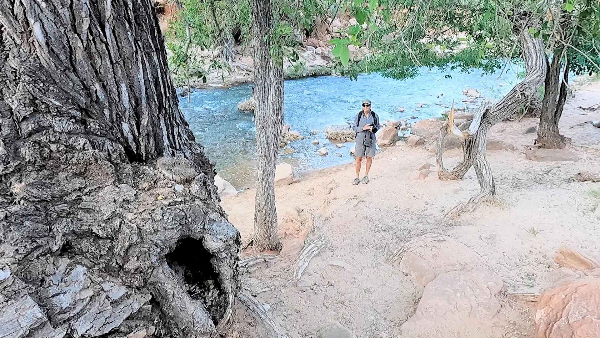
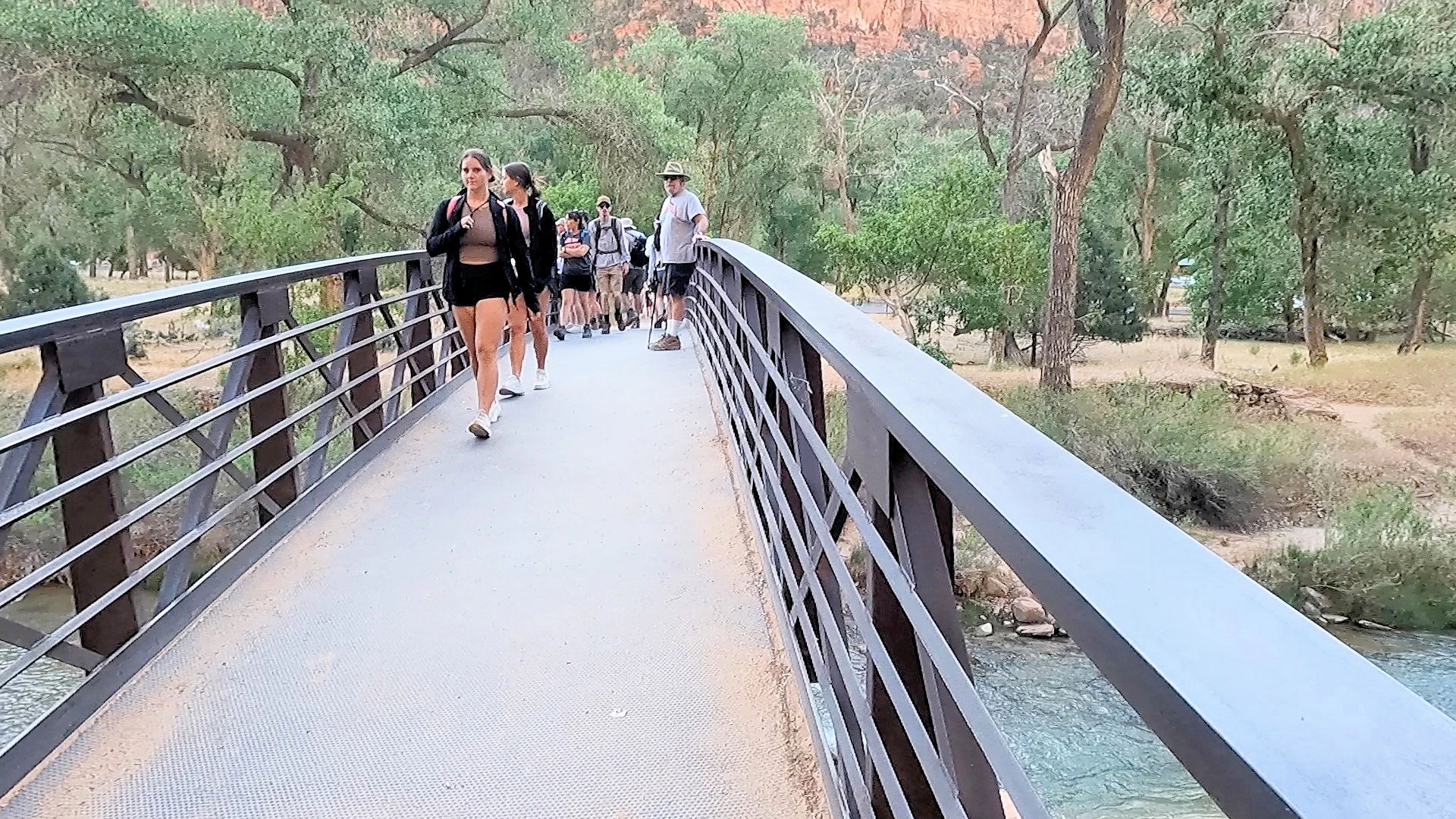
We decided to explore the Virgin River trails that start immediately next to the Visitor Center's parking lot. The Watchman Trail splits into two parts just before the south campground where the Watchman Trail continues heading east on the eastern side of the Virgin River and the Pa'Rus continues north alongside the south campground.
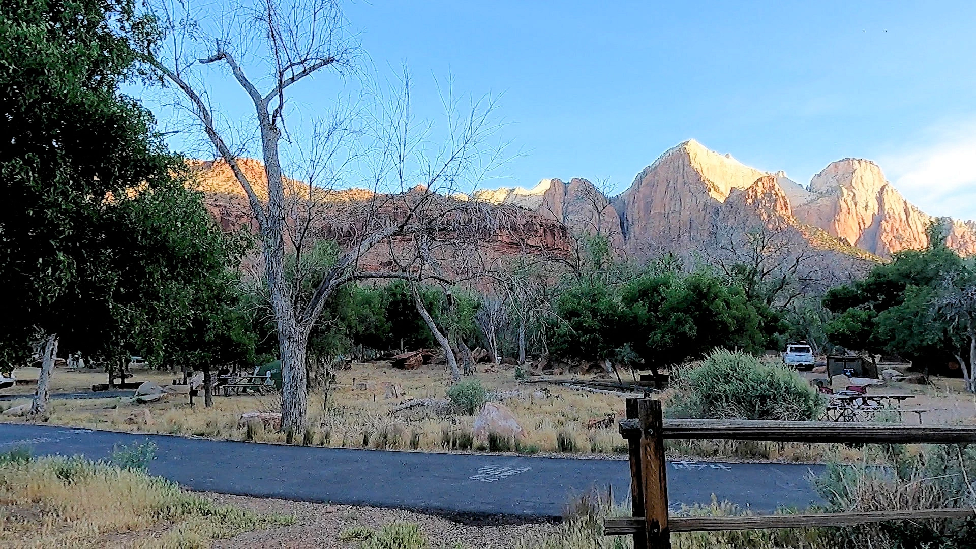
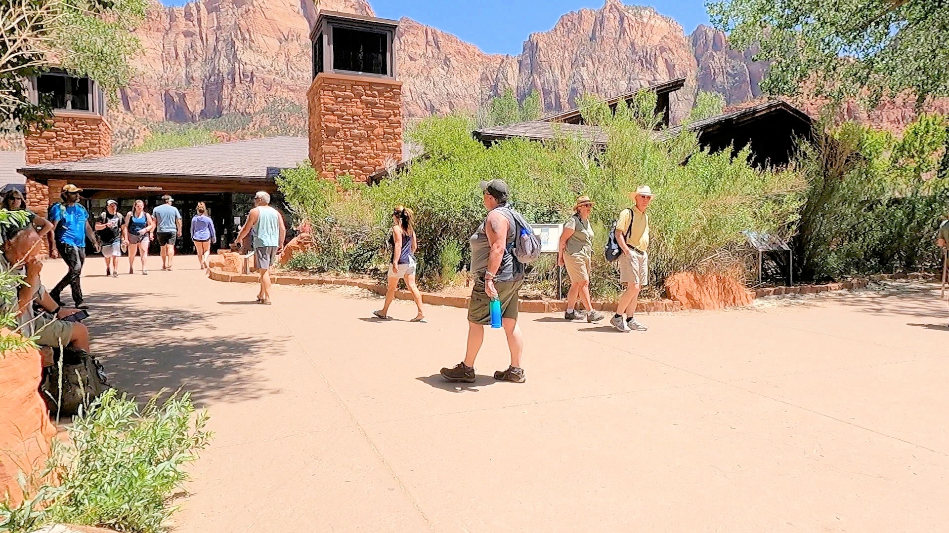
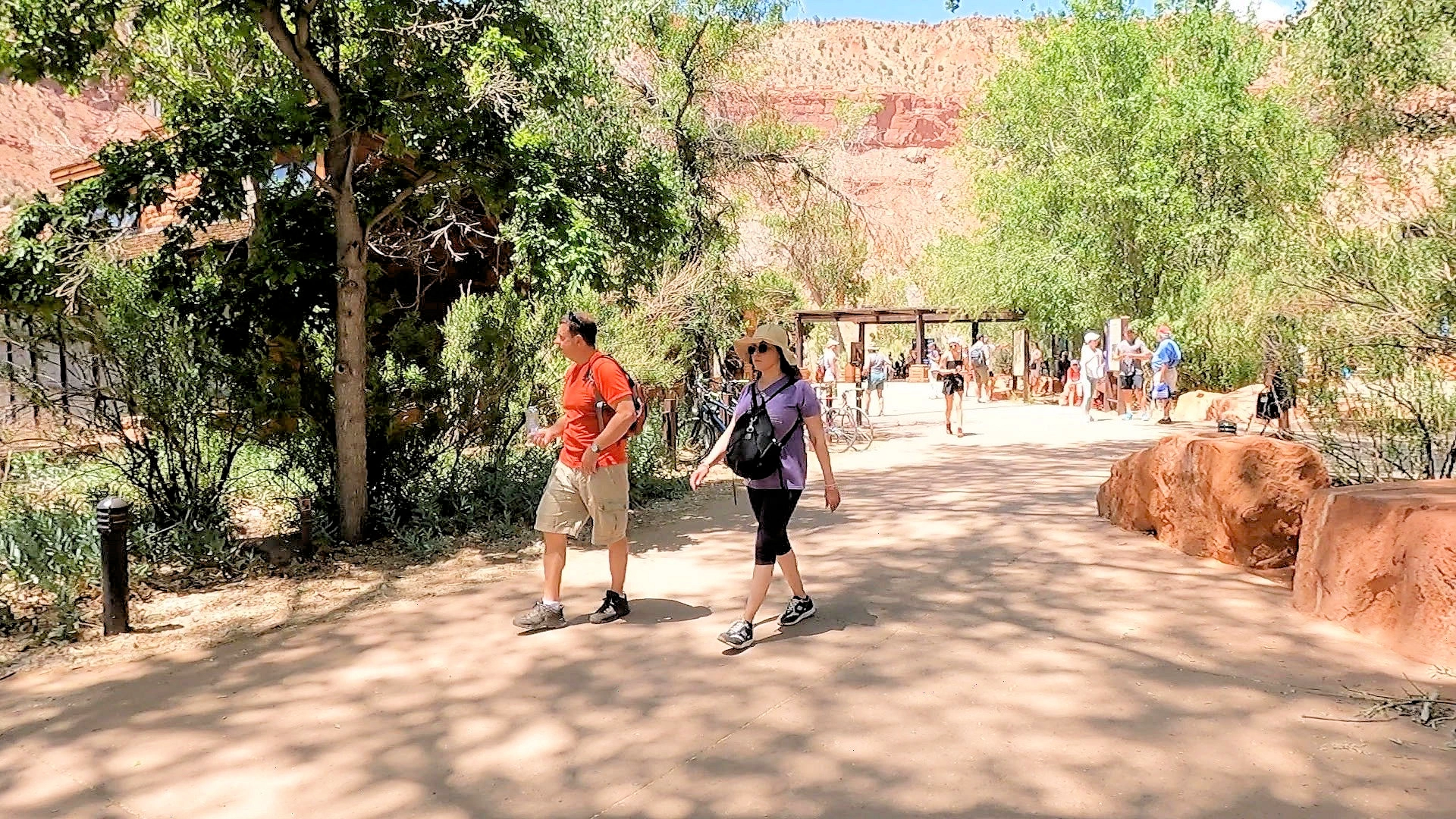
For our first full day's adventure, we left our car parked at our motel, took the shuttle bus to the park entrance and walked in. The visitor center was our first stop, because everything starts from there. The bus stop was very busy, so our first exploration was to take a quick walk through the Visitor's Center and then we headed over towards the Virgin River and the trail that parallels the river next to the south campground.
After we got back from our river exploration, we decided to head back to the motel and take advantage of the hotel laundry and the swimming pool.
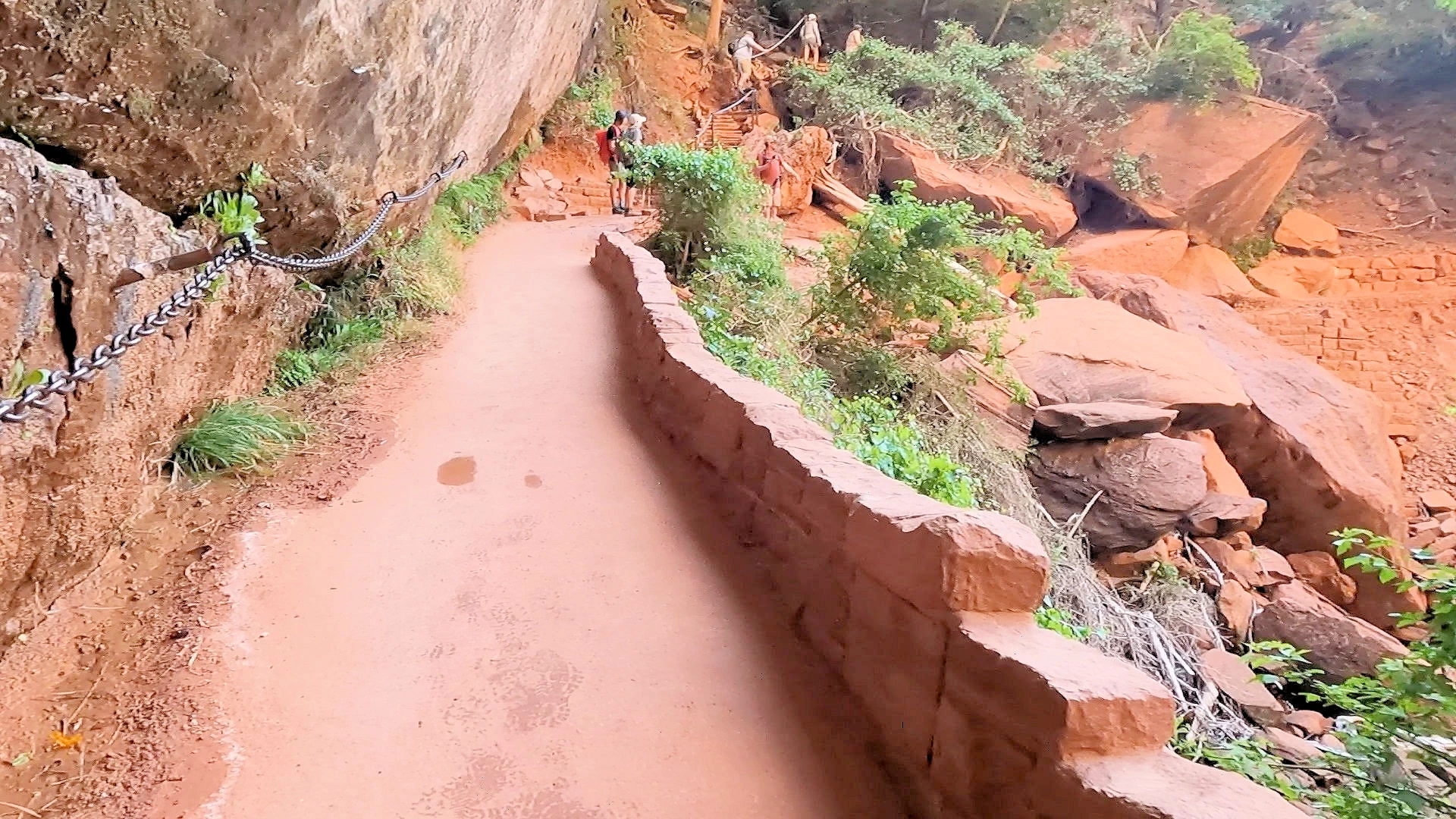
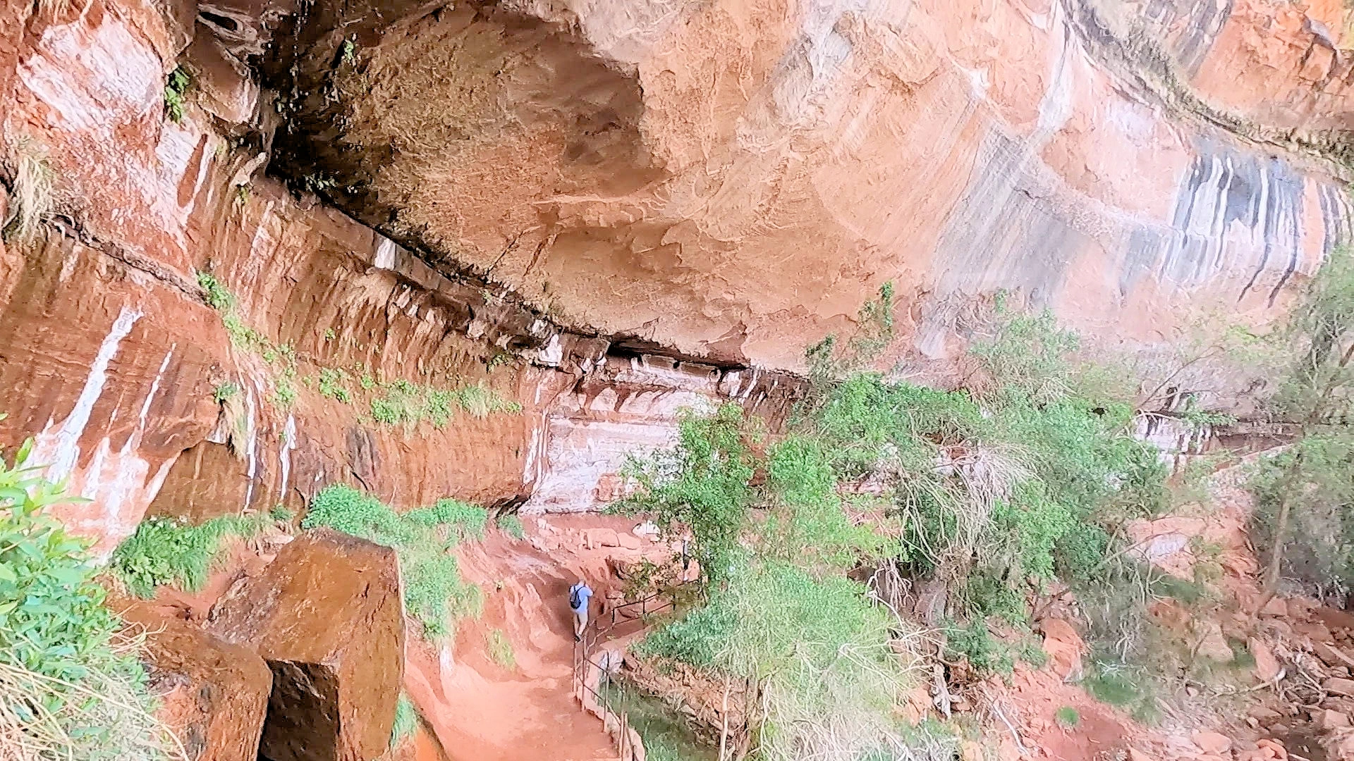
The Emerald Pools Trailhead is across the river from the Zion Lodge (shuttle stop #5). From the shuttle stop, you will follow the sidewalk across the Lodge Lawn to the crosswalk. Cross the Zion Canyon Road and continue across the bridge. Follow the trail on the right to begin hiking Lower Emerald Pool Trail. This is not a difficult trail at all, and the shade is frequent - the payoff is the falls that are to be found at the end of the trail.
As you can see on the map image, there are three trails associated with the Emerald Pools (after you cross the bridge):
Our second day goal was to ride the park shuttle bus to the top of Zion Canyon scenic drive - the entire route is "bus only". The shuttle bus stops at a number of places, each providing different hiking trails. Our first hike was the Lower Emerald Pool Trail. The shuttle bus stops at the Zion Lodge, and the trail head is just across the street from the lodge.
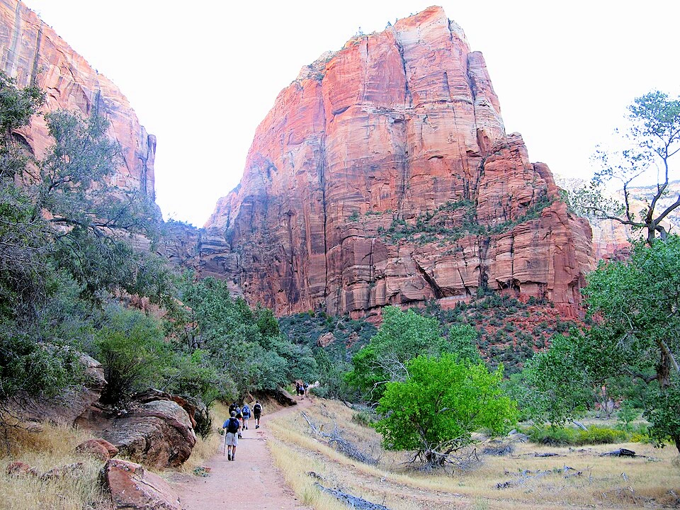
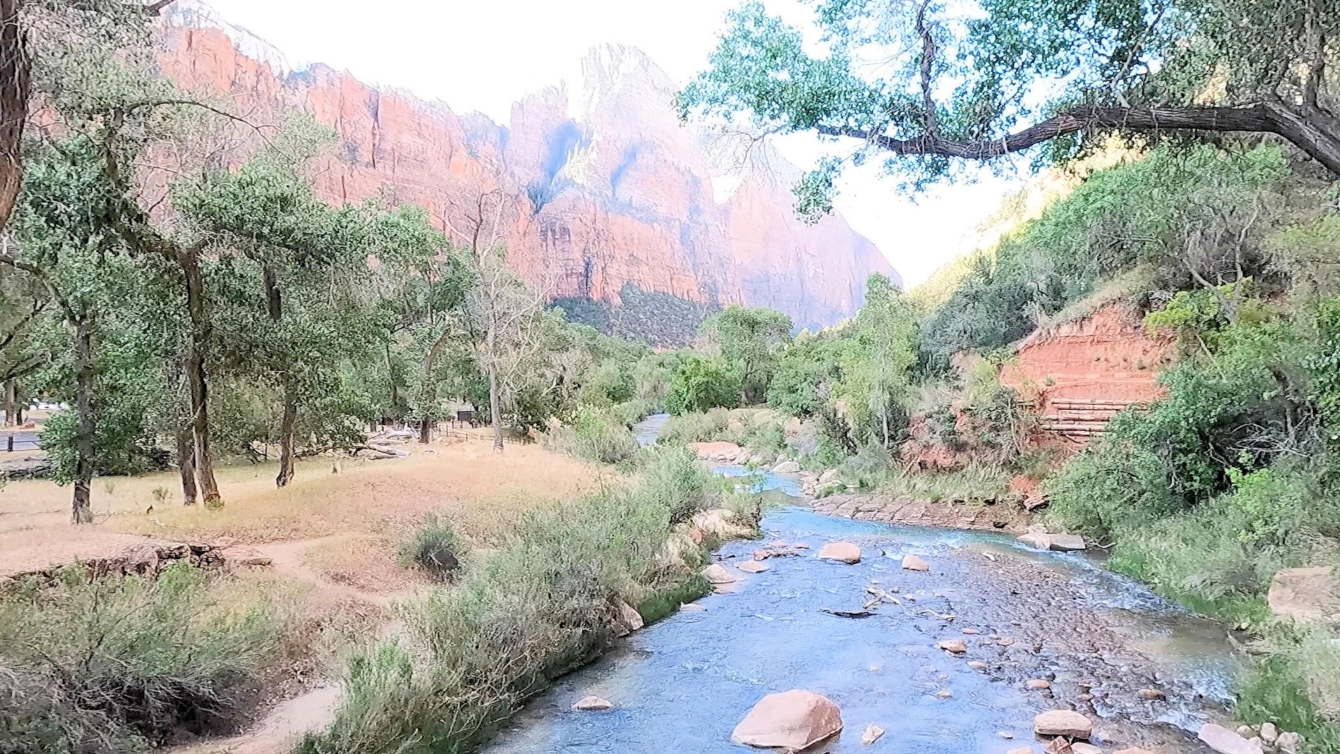
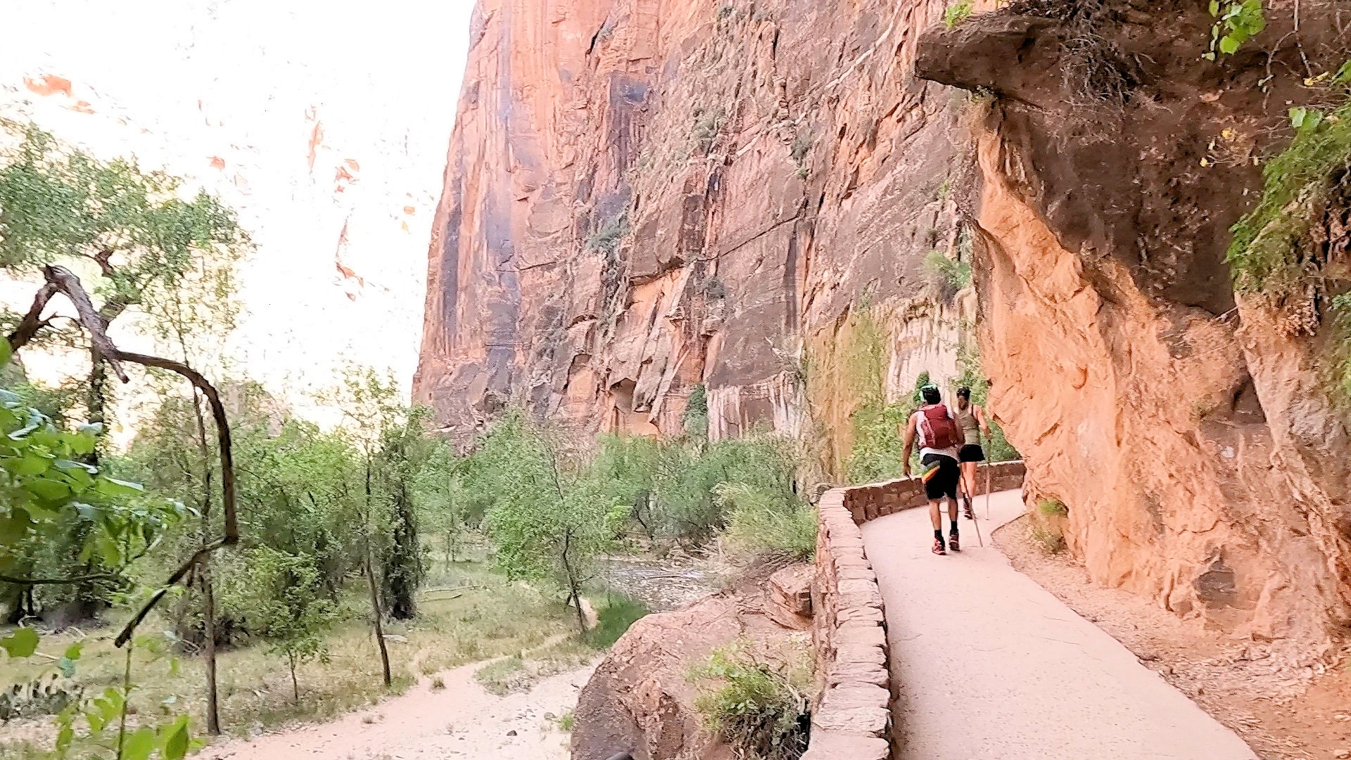
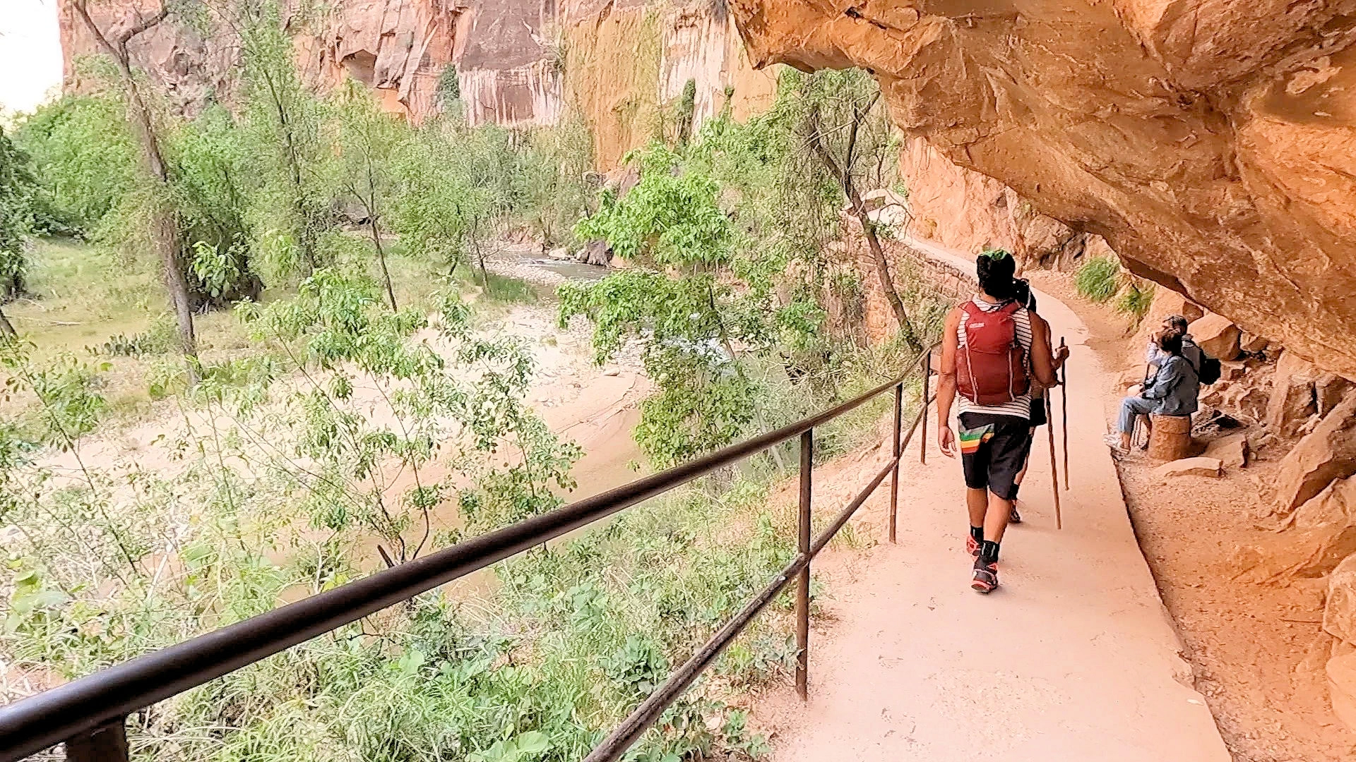
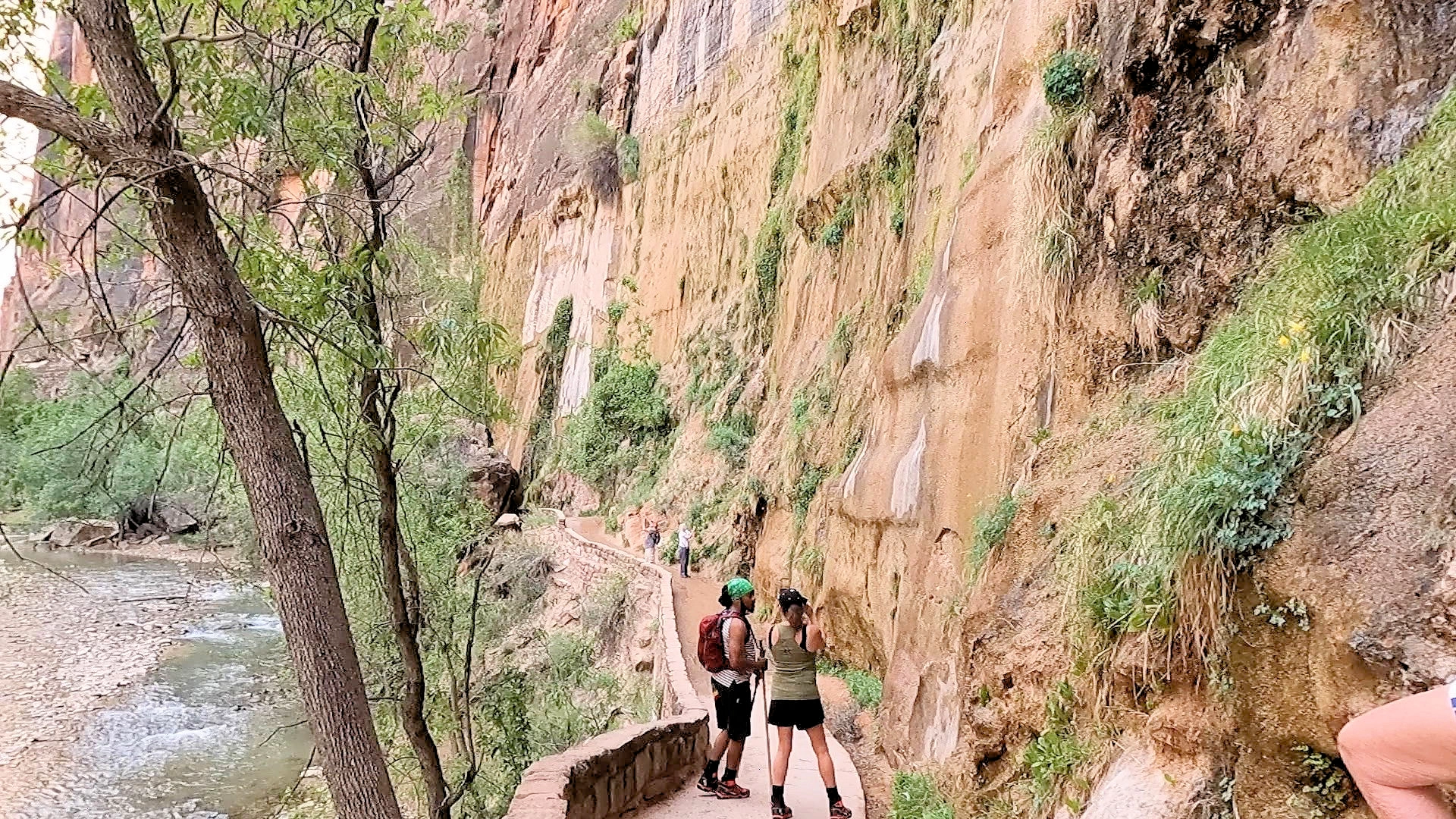
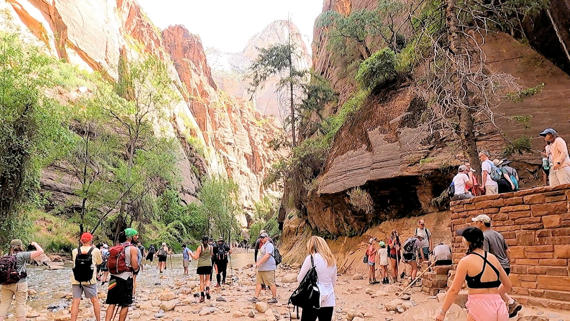
The hike from the Temple of Sinawava to The Narrows in Zion National Park is a breathtaking journey through one of the park’s most iconic landscapes. The Temple of Sinawava serves as the final shuttle stop along the scenic Zion Canyon, where the Riverside Walk begins. This paved, 1-mile trail is relatively easy, offering views of the Virgin River and lush vegetation, as well as occasional wildlife sightings like mule deer and various bird species.
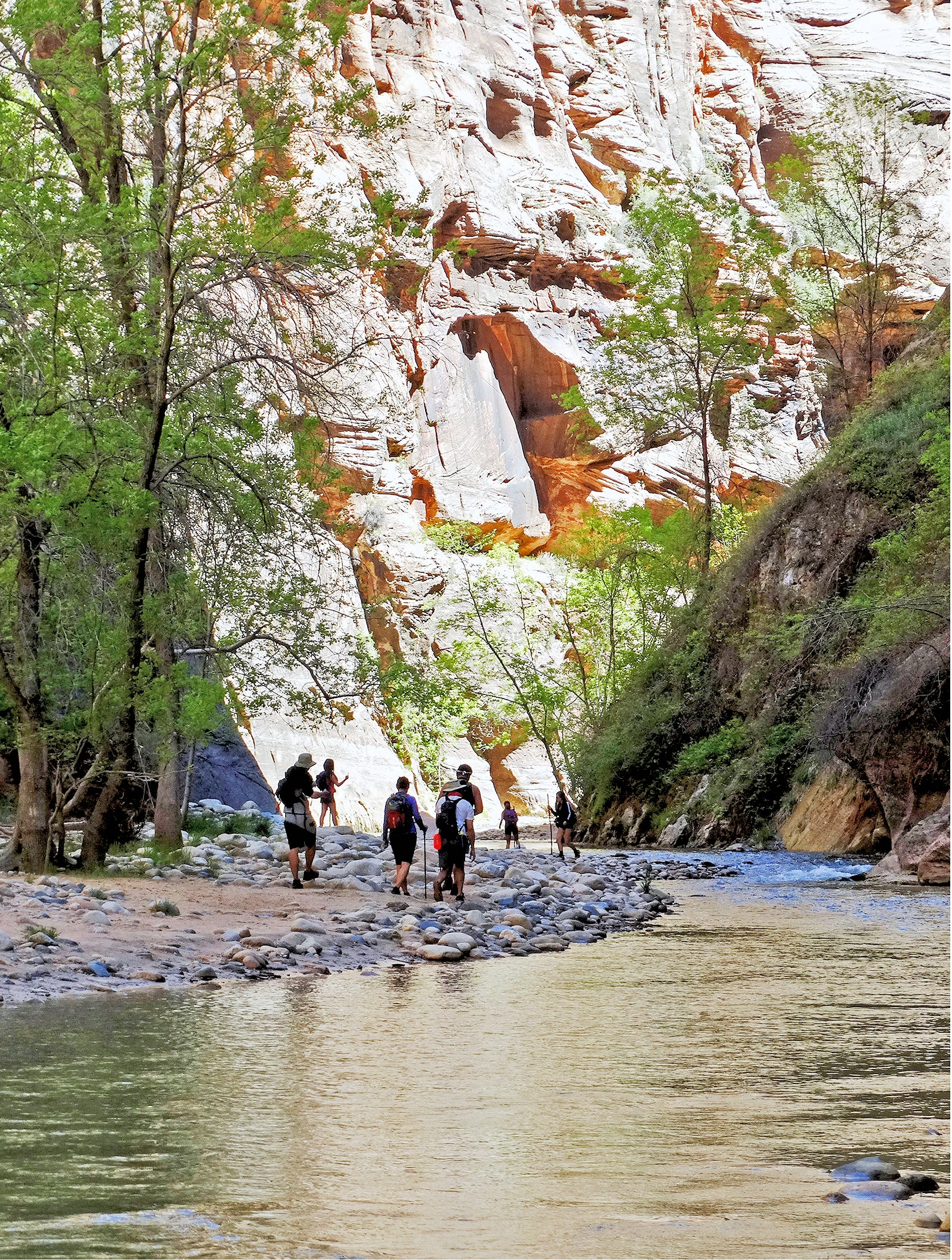
After the Riverside Walk ends, The Narrows trail begins, transforming into a riverbed hike that requires hikers to wade through the Virgin River. As you venture deeper, the canyon walls narrow dramatically, reaching up to 1,000 feet high while the riverbed becomes only 20–30 feet wide in places. The Narrows hike continues for several miles, though many hikers turn around at popular points like Wall Street, where the canyon’s iconic tall, narrow walls create awe-inspiring views.
NOTE: Each Shuttle Bus Stop is numbered, pay attention to where you got on or got off, so that you can navigate properly.
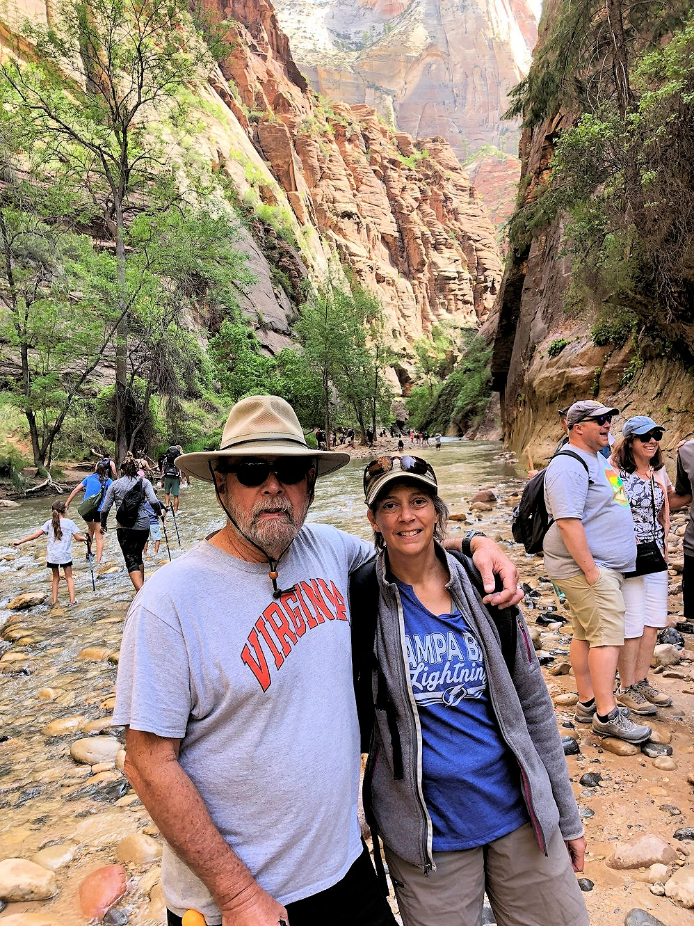
After our hike to the Lower Emerald Pool, we jumped back onto the free Zion Canyon shuttle and went to the top of the Canyon - the Temple of Sinawava. We then hiked up the Riverside Walk trail and then continued hiking to the first river crossing to see some of the best "narrows" sections of the North Fork of the Virgin River.
We hiked up to the Narrows Entrance and stopped to get some pics, the trail continues onwards for 10 more miles (round trip) or 6 miles to the Wall Street section, but we stopped at this point. We did not have "water shoes" and with me using a cane, we did not feel like we were capable of tackling such a trek.
Image Credit: Image # 2 is the property of Don Graham via Wikimedia Commons using the CC BY-SA 2.0 license. All other images are the property of Just Traveling Thru, LLC unless otherwise noted.
Nope, we did not go the rest of the way to see all of the Narrows as we did not have river shoes, nor enough water to keep us hydrated. So we reluctantly had to hike back and catch the shuttle back to the Visitor Center so we could head back to the motel and take care of our growing pile of dirty clothes!
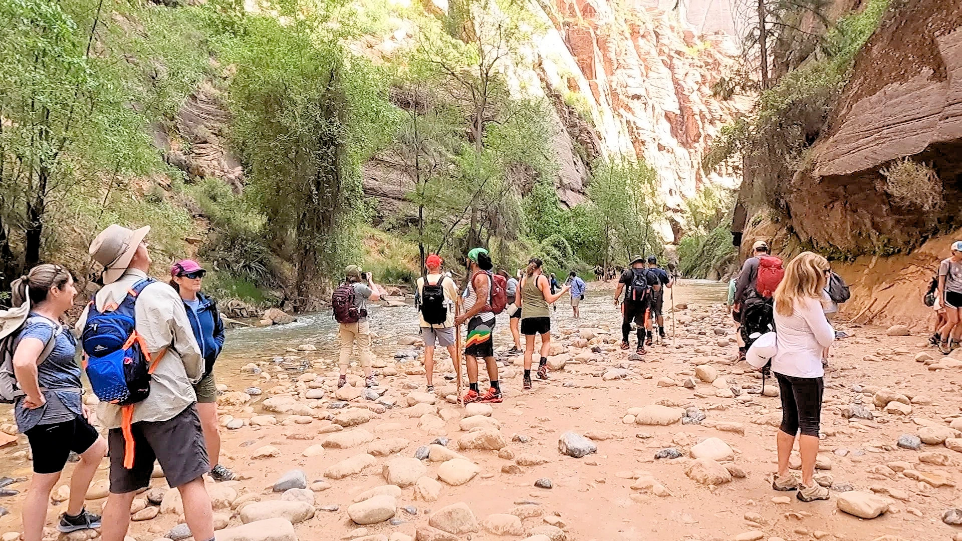
You can see in this picture the people behind us starting to cross the Virgin River to begin their hike to the Narrows. The canyon is a bit narrow, hence the name.
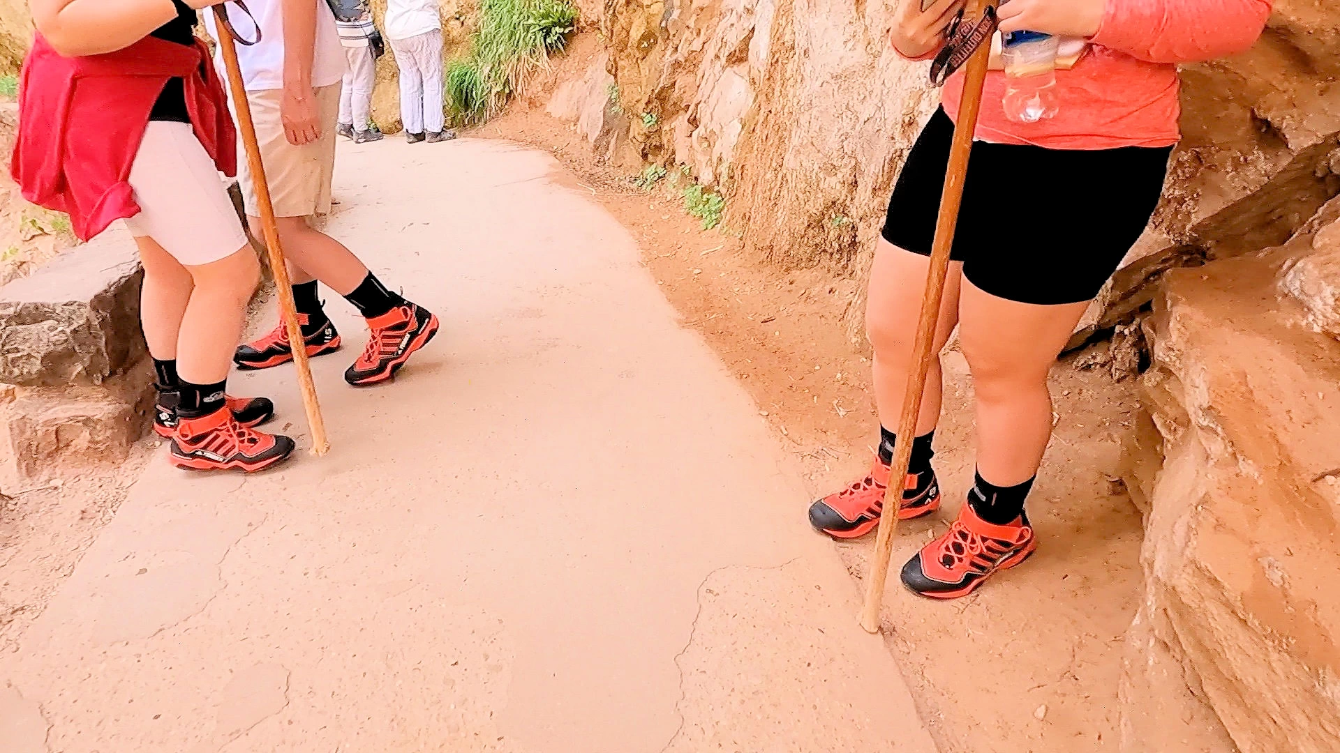
NOTE: You can see in image # 4 that many people were wearing similar "river walking shoes" all in the color red. This was because everyone was renting those shoes from the same place in Springdale!
Quick History Lesson: Geologist Grove Karl Gilbert was the first recorded caucasian man to travel the Zion Narrows, in 1872 as part of a government survey expedition led by Major John Wesley Powell (note; yes, the same person who explored the Colorado River down to the Grand Canyon). Gilbert made the trip on horseback, and it is believed he was the first to use the term "the Narrows."
While it may be tempting to explore National Parks with an off-road vehicle like an ATV, RZR, or UTV, it's important to know that these vehicles are not permitted within most National Park boundaries, including popular Southwest destinations like Arches, Bryce, Canyonlands and Zion.
Only street-legal, highway-capable vehicles (like Jeeps with proper plates, lights, and safety equipment) are allowed on designated park roads. Even then, true “off-roading” — driving off established roads — is strictly prohibited.
Many OHV rentals are intended for use on Bureau of Land Management (BLM) or National Forest lands adjacent to the parks, not inside them.
🛈 For official guidance, see the National Park Service’s policy on vehicle use (NPS.gov).
Plan ahead, stay on legal trails, and enjoy the landscape responsibly.
By now, you have no doubt noticed that there are no pictures or narrative on this page about the famous Angels Landing hike. That is because we did not go there - for several reasons. First reason is that starting April 1, 2022 a hiking permit is now required by the National Park Service (NPS). These permits are available only via an online lottery. And we did not acquire the permits.
The second reason is that the Angels Landing trail is a 4.3-mile out-and-back strenous trail that is slippery & dangerous when wet. The trail has an elevation gain of 1,827 feet and is considered a highly challenging route. With me requiring a cane to walk, we just did not think that I would able to manage such a hike. I'd love to come back here someday and do this trail, but I have to get my hip issues corrected before that could take place.
If you would like to learn more about the Angels Landing Trail, take a look at the "All Trails Website" article about it. There you will find maps and other information pertinent to hiking that trail.
More Info for Angels Landing
Zion is compact but wildly popular—most of Zion Canyon is car-free whenever the park shuttle is running, so plan around shuttle hours and parking at the Visitor Center or in Springdale. Signature hikes like Angels Landing may require a permit, and The Narrows depends on current river conditions.
Aim for early morning or late afternoon to beat crowds and heat. Bring plenty of water and sun protection, check conditions/closures before you go, and use the shuttle to string together viewpoints and trailheads without moving the car.
Plan Your Visit Travel Resources — Maps, Parking, Passes & Links
Where to Stay & Eat Travel Resources — Maps, Parking, Passes & Links
More Info Travel Resources — Maps, Parking, Passes & Links
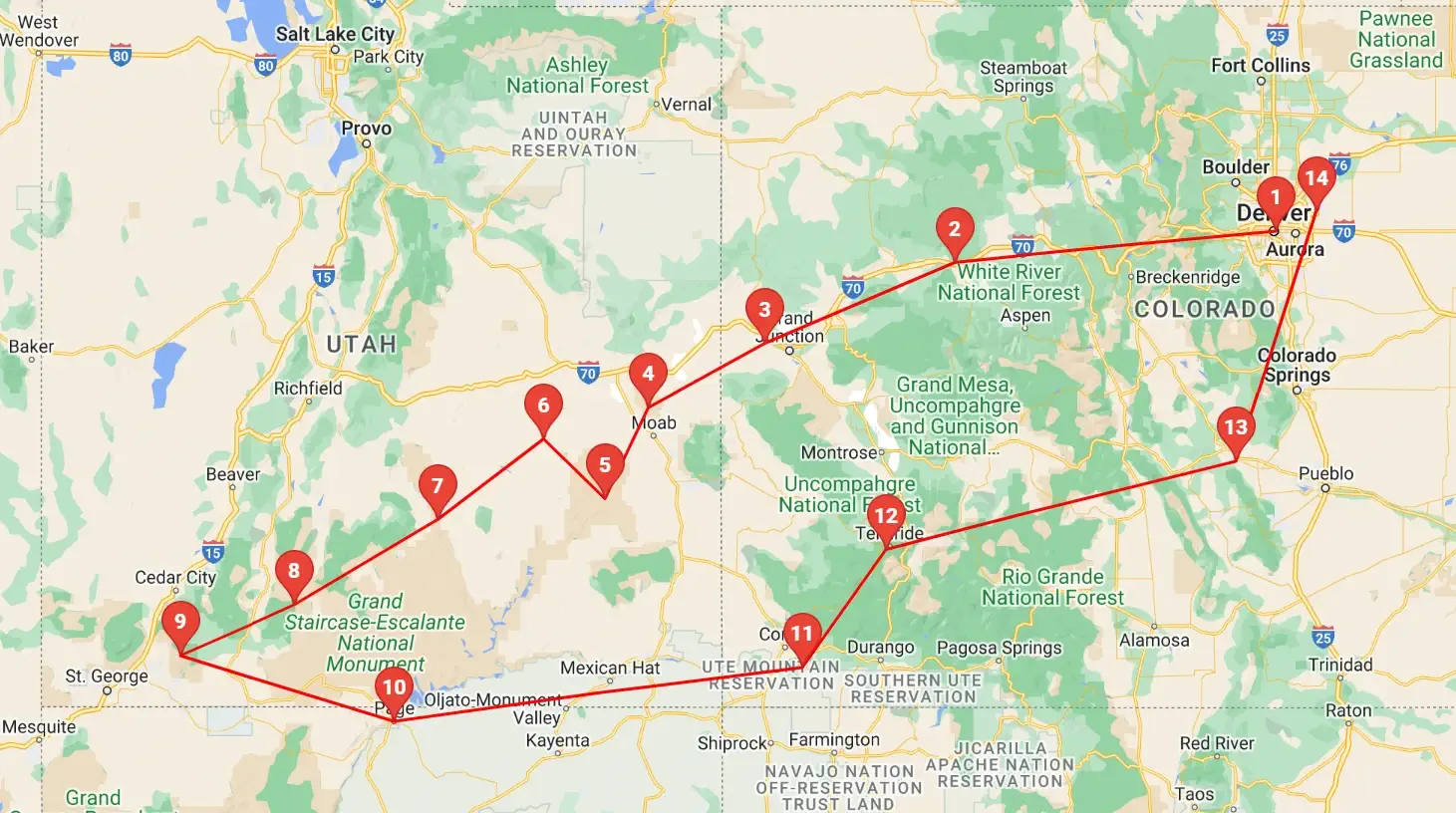 Click above map to view a larger Google Map
 As you can see by the this map, our trip covered 3 different states, approximately 1,600 road miles and allowed us to see some spectacular geography. You might think that a trip of this distance would be something that would result in a "tired of driving" mood - but our stops were so diverse with such incredible geography and fun things to do, that we found that we looked forward to each morning to where we could continue our adventures!
Click any link below to go directly to that page;
Note: All images featured on this page are the exclusive property of Just Traveling Thru, LLC, unless otherwise stated. When images from external sources are used, full credit is given to the original creator, along with a link to the specified license or usage terms. We are committed to respecting copyright and intellectual property rights, ensuring that all third-party images are properly attributed. If you have any questions regarding image ownership or usage rights, please feel free to contact us.
Affiliate Links: We may earn a commission if you make a purchase through one of our affiliate links. This helps support our travel content — thank you!
Content: To review any of our content, make suggestions and/or comments, please click the "About" menu link at the top of this page. You will find our "Contact Us" link on that drop-down menu.
 Click above Image to view larger Google Map
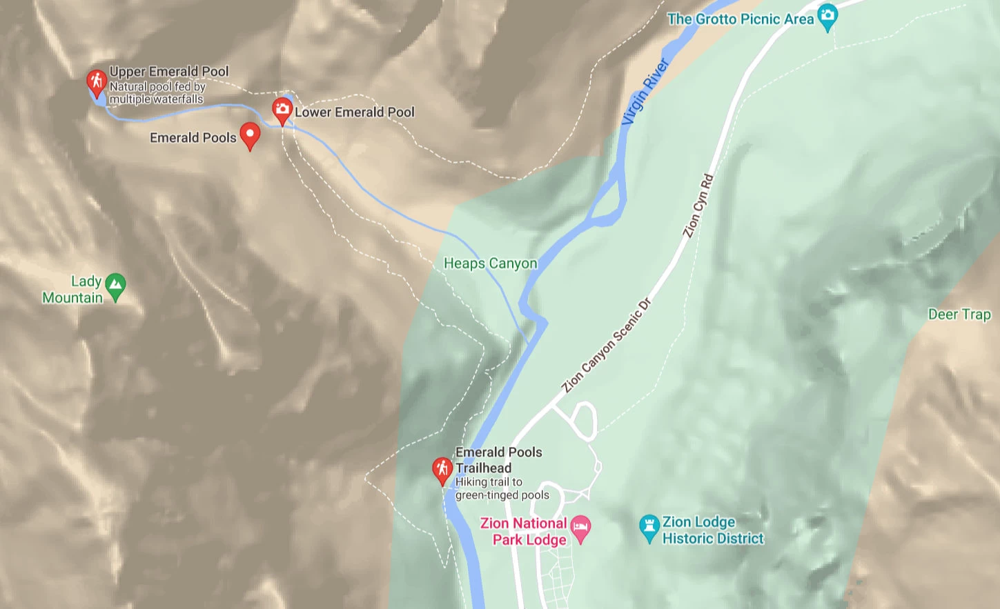 Click above Image to view larger Google Map
