by Celeste Lipford and Terry Lipford - last updated on 10/19/2025
Our drive from Durango to Telluride via Route 550 through Silverton is an unforgettable journey through the heart of Colorado’s rugged and awe-inspiring San Juan Mountains. Known as the Million Dollar Highway, this legendary route is famous for its dramatic scenery, steep inclines, and hair-raising switchbacks that hug the mountainside with little to no guardrails. As you ascend through high-altitude passes, you'll be treated to sweeping panoramic views of deep canyons, towering peaks, and cascading waterfalls. Along the way, the historic mining towns of Silverton and Ouray offer charming stops filled with rich history, quaint shops, and local eateries. Whether you're visiting in summer, when wildflowers blanket the meadows, or in winter, when the snow-covered peaks create a breathtaking winter wonderland, this drive is a must for anyone seeking an unforgettable Colorado adventure.
Highlights of the Drive:
The elevation of the town is 8,750 feet above sea level. The town is situated at the local minimum elevation, so there is virtually nowhere to go but up from there. The surrounding mountains reach heights of 12,000 to 14,000 feet.
Yes, it is typical to get altitude sickness when visiting Telluride because the town is at a high elevation (around 8,700 feet) and the air contains less oxygen. Symptoms can include headaches, nausea, and dizziness, and it's common for people who live at lower elevations to experience them within the first 6-24 hours of arrival.
The gondola is free to pedestrians and skiers who want to travel between Telluride and Mountain Village. Mountain bikers and hikers can also ride the gondola to access the ski area trails. There are handicap accessible cars as well as cabins designated for pets.
This location provides some of the nicest weather in North America. Telluride boasts over 300 days of sunshine a year, and if it is not snowing or sprinkling, Telluride is pure sunshine. Winters are mild in comparison to other resorts to the north. Summers are comfortable days and cool nights. The air is dry here with low humidity, which may impact people used to higher humidity.
No, free parking is available in several locations around the Village, including; the Gondola parking garage, Meadows Run parking, Heritage parking garage, Town Hall Plaza parking, South Village parking center and North Village parking center. Some of the side streets allow free two-hour parking, and a few back streets have unlimited parking, however, because Telluride is very walkable, once you are parked it is simple to move about the downtown area. Here is a link to a Telluride Parking location map.
There are approximately 110 hotels in Telluride, even more if you consider that there a number to be found in the Mountain Village area above Telluride. We selected the Ice House Condos & Suites (via Search Expedia) because it had secure parking and is located close to the gondola and places to eat. Here is a link to a Google Search Result for hotels in Telluride.
Telluride is moderately wheelchair friendly, especially in the town center and Mountain Village, but accessibility can be challenging due to the mountainous terrain and historic nature of some buildings. The best experiences are accessible, but some wilderness areas and historic sites are not.
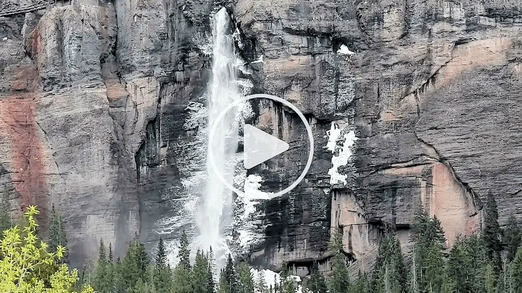
That is the Smuggler-Union Hydroelectric Power Plant and it was constructed in 1907, specifically to power the Smuggler-Union Mining Company's operations. It is known for its dramatic location at the top of Bridal Veil Falls (the cliff is over 400 feet tall). After being decommissioned in 1953, it was restored and is once again operational today.

Here are five of the most popular restaurants in Telluride, known for their standout cuisine and unique dining experiences. Each item is linked to that restaurant's web page;
There are a number of places to eat in Telluride and if you would like to perform your own research, here is a link to a Google Search Results for "places to eat in telluride colorado". Note that you can re-sort this list however you prefer.
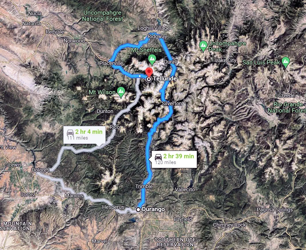
Telluride & Durango had been in our plans since day zero, we knew we wanted to explore both areas. The drive north from Durango was exciting as it passes through some amazing mountains & passes. The route we used (route 550) is 120 miles in length.
The Million Dollar Highway is part of the San Juan Skyway and is one of the most spectacular drives in Colorado. The road climbs up to and crosses 3 very high mountain passes; Coal Bank Pass (10,640 feet), Molas Pass (10,970 feet) and Red Mountain Pass (11,018 feet). The stretch between Silverton and Ouray, the part everyone talks about, is only 25 miles in length but takes about 42 minutes to traverse.
You will drive by the Yankee Girl Silver Mine while you are on the Red Mountain Pass, which dates from 1882. That mine was owned by the famous industrialists James McKay and W. J. Hammond. The mine was one of the most productive in the Red Mountain Mining District, yielding exceptionally high-grade silver ore during its peak in the late 1800s. This mine had a vertical shaft descending over 1,200 feet, a remarkable feat of engineering for the time.
You will note that there are no guard rails on the Million Dollar Highway and that is because the snow plow operators need to be able to push the snow off the highway. It does tend to add a level of danger to the drive, as the lack of guard rails and very few turnouts add a lot of stress to this drive!
There is a lot of information available about this area, click here to view a Google Search Results list for that topic.
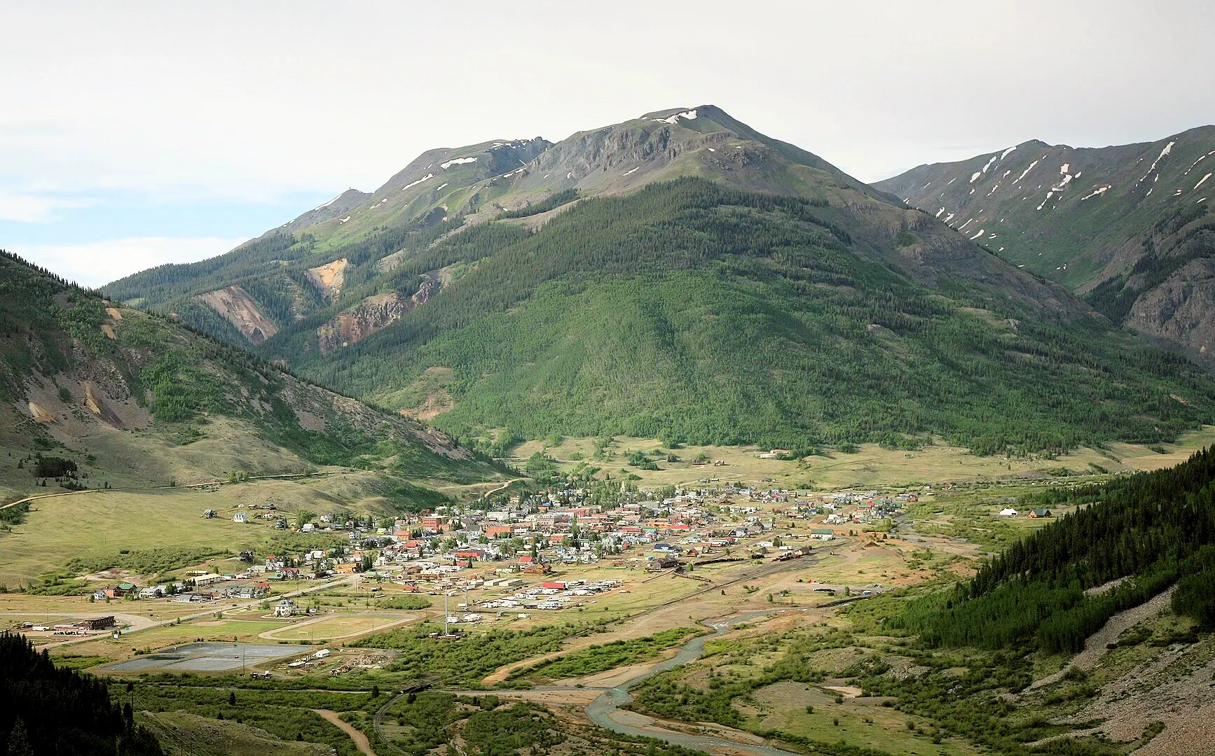 Silverton as seen from Route 550
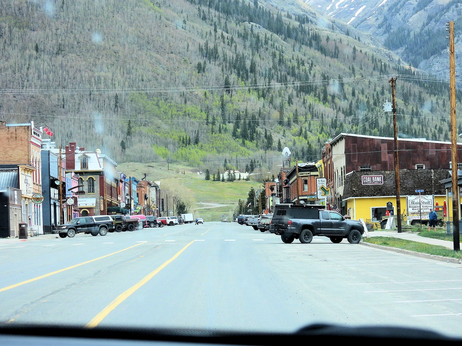 Greene Street Downtown Silverton, CO
 The Coffee Bear Downtown Silverton, CO
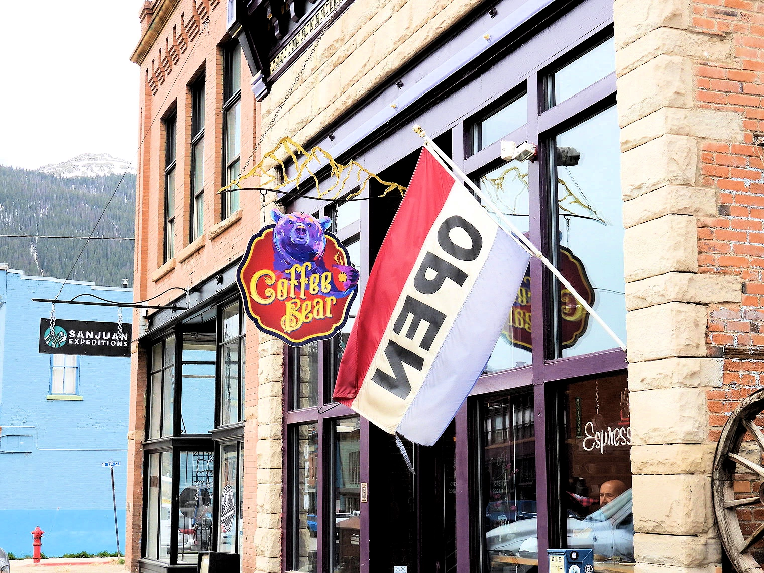 The Coffee Bear Entrance Silverton, CO
The first town we came across driving north, was Silverton, CO. Even though we had only driven 50 miles since Durango, all of that was on steep mountain uphills & downhills and we were ready for some vehicle gas & coffee, we decided to stop and take care of those necessities. This is a more isolated part of Colorado, for example, Silverton is the only incorporated town in San Juan County.
We found a coffee shop in Silverton (the Coffee Bear) and the coffee was excellent and the pastries were really good! If you are ever in the Silverton area, do yourself a favor and try to stop at the Coffee Bear and give them a try - you will be glad that you did. You can view their menu on their website link, and we can testify to the fact that the coffee and baked goods we had were excellent.
Silverton stands as a testament to Colorado's Wild West heritage and alpine beauty. This charming town, surrounded by towering peaks and alpine meadows, exudes a frontier ambiance with its well-preserved Victorian architecture. The heart of Silverton lies in its historic district, where you can step back in time to explore saloons, boutique shops, and the famous Blair Street, known for its colorful past as a red-light district.
Silverton is a very small town, population was 622 in 2020. Originally called "Bakers Park", Silverton sits in a flat area of the Animas River valley (at 9,318 feet above sea level) and it is surrounded by steep peaks. Most of the peaks surrounding Silverton are thirteeners, the highest being Storm Peak, at 13,487 feet. The town is less than 15 miles from 7 of Colorado's 53 fourteeners, and is known as one of the premier gateways into the Colorado backcountry.
Silverton offers a variety of outdoor activities, including hiking, biking, rafting, horseback riding, and hunting. It's also the terminus of the Durango & Silverton Narrow Gauge Railroad, which offers steam train rides from Durango to Silverton.
More Info for Silverton, CO
Image Credits:
 Telluride Gondola
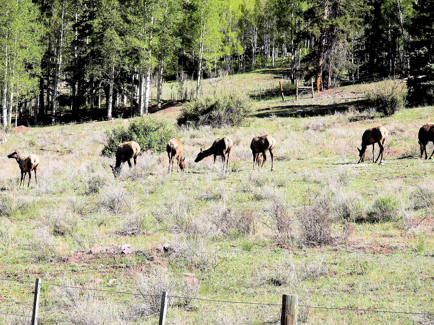 Rocky Mountain Elk
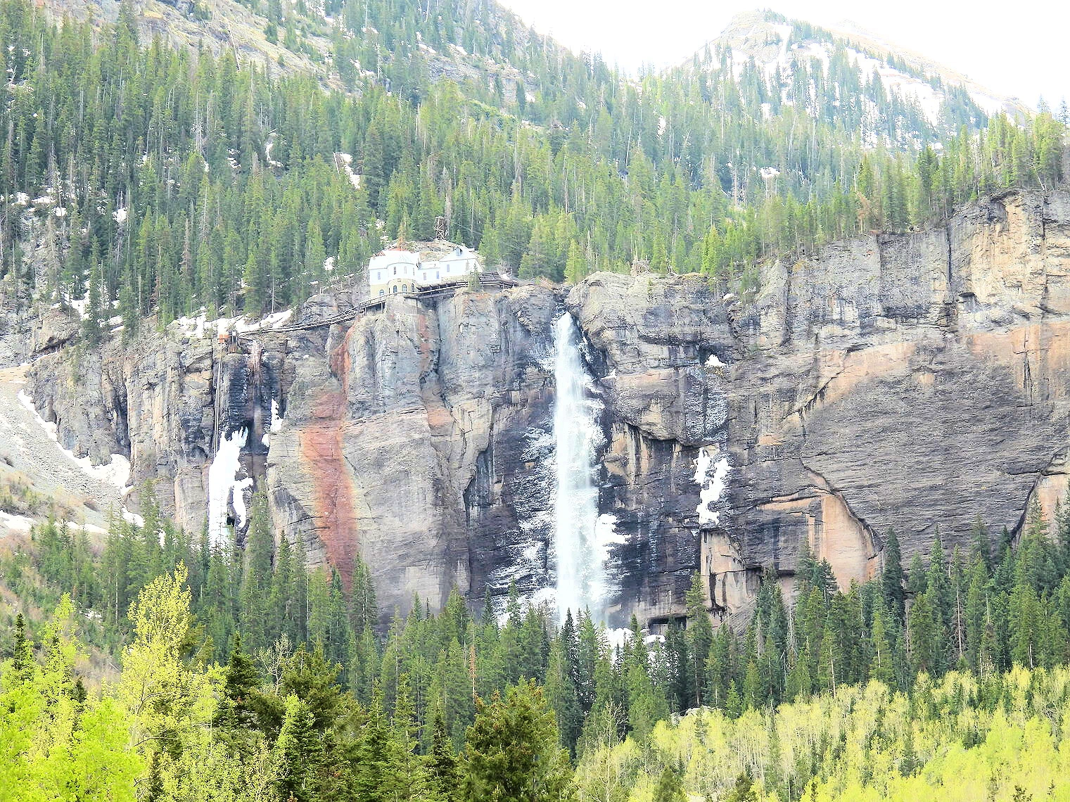 Bridal Veil Falls
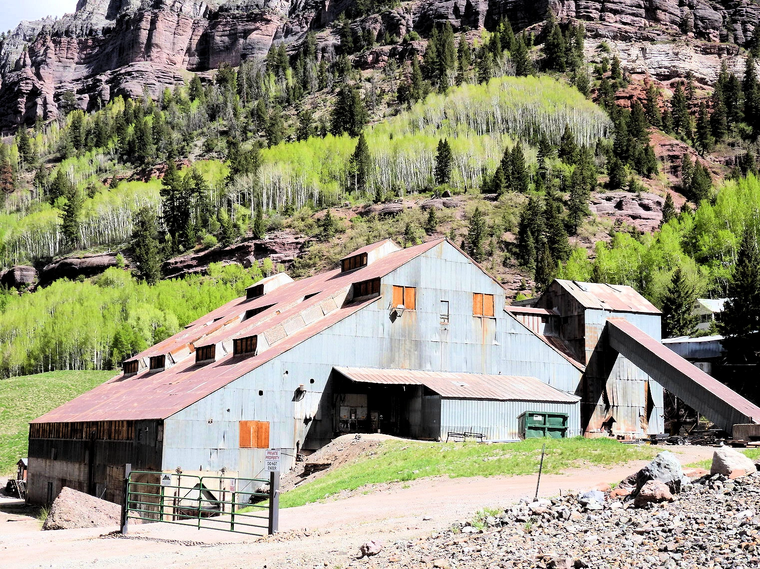 Idarado Pandora Mill
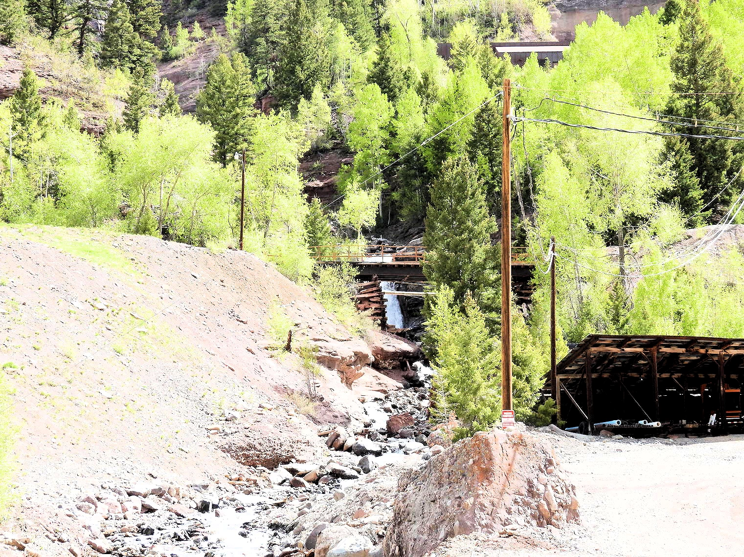 Mining Remains
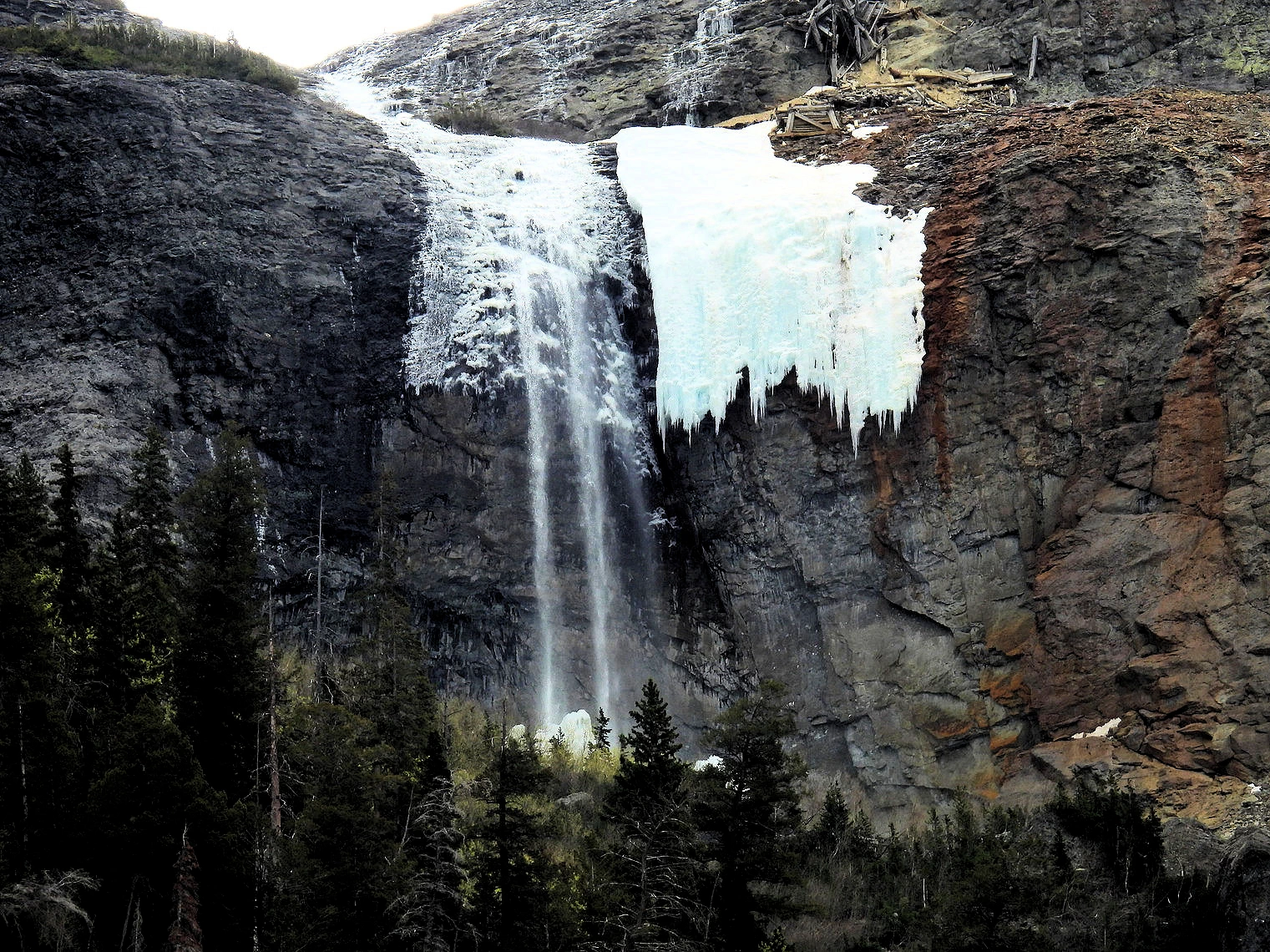 Telluride Falls
As you approach Telluride, the dramatic scenery takes center stage. Surrounded by towering peaks and framed by the rugged beauty of the Rockies, the town welcomes you with open arms. The historic architecture of Victorian-era buildings adds a touch of old-world charm, while the crisp mountain air signals the beginning of your alpine adventure.
At the entrance to Telluride, there was a large field where over two dozen Elk were grazing. These animals were not fenced in, they were just hanging out and grazing. Despite appearances, elk are sensitive to human presence and prefer to be left alone. Yet the migratory nature of the species means that they can’t simply retreat to more remote areas — they need corridors like the Telluride Valley Floor to travel between lower elevations in the winter and higher elevations in the summer.
At the eastern end of Telluride you can find the original gold mine, and above that (on the same road) you can find Bridal Veil Falls. There is a building at the top of the falls, it is the Smuggler-Union Hydroelectric Power Plant. It sits on a 400 foot cliff, constructed in 1907 to provide electricity to the gold mine below. There is a parking lot just beyond the gold mine building, where hikers park and depart from to hike up to the top of the Bridal Veil Falls. There is a 4WD trail you could drive on, but there is a warning at the parking lot that describes that it is a one lane road with very few turnouts and you are required to use only high clearance 4WD vehicles. Click here to read about the hiking trail up to the falls.
The historic Main Street of Telluride is a shopper's paradise, adorned with colorful Victorian facades housing a diverse array of boutiques, art galleries, and specialty stores. Explore local shops like Scarpe, offering stylish footwear, or Between the Covers Bookstore, a haven for literature lovers. Discover one-of-a-kind treasures at Telluride Truffle for artisan chocolates or indulge in mountain-inspired home decor at Two Skirts. The shopping scene seamlessly blends upscale boutiques with authentic mountain-town flair, providing a perfect balance for those seeking both luxury and local authenticity. As you wander through the picturesque streets, the backdrop of majestic peaks adds a touch of magic to your shopping excursion, making each purchase a memory to be cherished against the breathtaking backdrop of the San Juan Mountains.
Above Telluride is the Mountain Village area, which contains quite a bit of ski resort accommodations and other commercial entities devoted to people who came there to ski. The gondola connects Telluride to Mountain Village, so regardless of where you stay, you can get back and forth easily.
NOTE: This video is the property of Just Traveling Thru, LLC.
If you enjoy our videos click here to subscribe to our Youtube Channel.
Click the above video poster image to see our video of the tallest free-falling waterfall in Colorado. Telluride is a beautiful and remote ski town. It was quiet when we were there. The falls are spectacular and we were thrilled to see a heard of elk hanging out on the way into town. Telluride was worth the stop on our 16 day tour of Colorado and Utah.
Plan Your Trip to Telluride Travel Resources — Maps, Parking, Passes & Links
Free Gondola Basics
The gondola between Telluride and Mountain Village is free and scenic. Check seasonal hours, and ride at sunset for views without the hike.
Altitude & Hydration
Telluride sits ~8,750 ft (2,667 m). Hydrate, take it easy on day one, and watch for symptoms of altitude sickness—especially if you’re doing bigger hikes.
Seasonal Road Notes
Mountain passes and backroads can close due to snow, ice, or mud. Check COtrip and San Miguel County Road Conditions updates before heading to trailheads or high passes.Epic Ski Pass Savings
Telluride is part of the Epic Pass program. If you plan to ski multiple Epic resorts, buy your pass early in the season—savings can be substantial and it covers lift access here too.
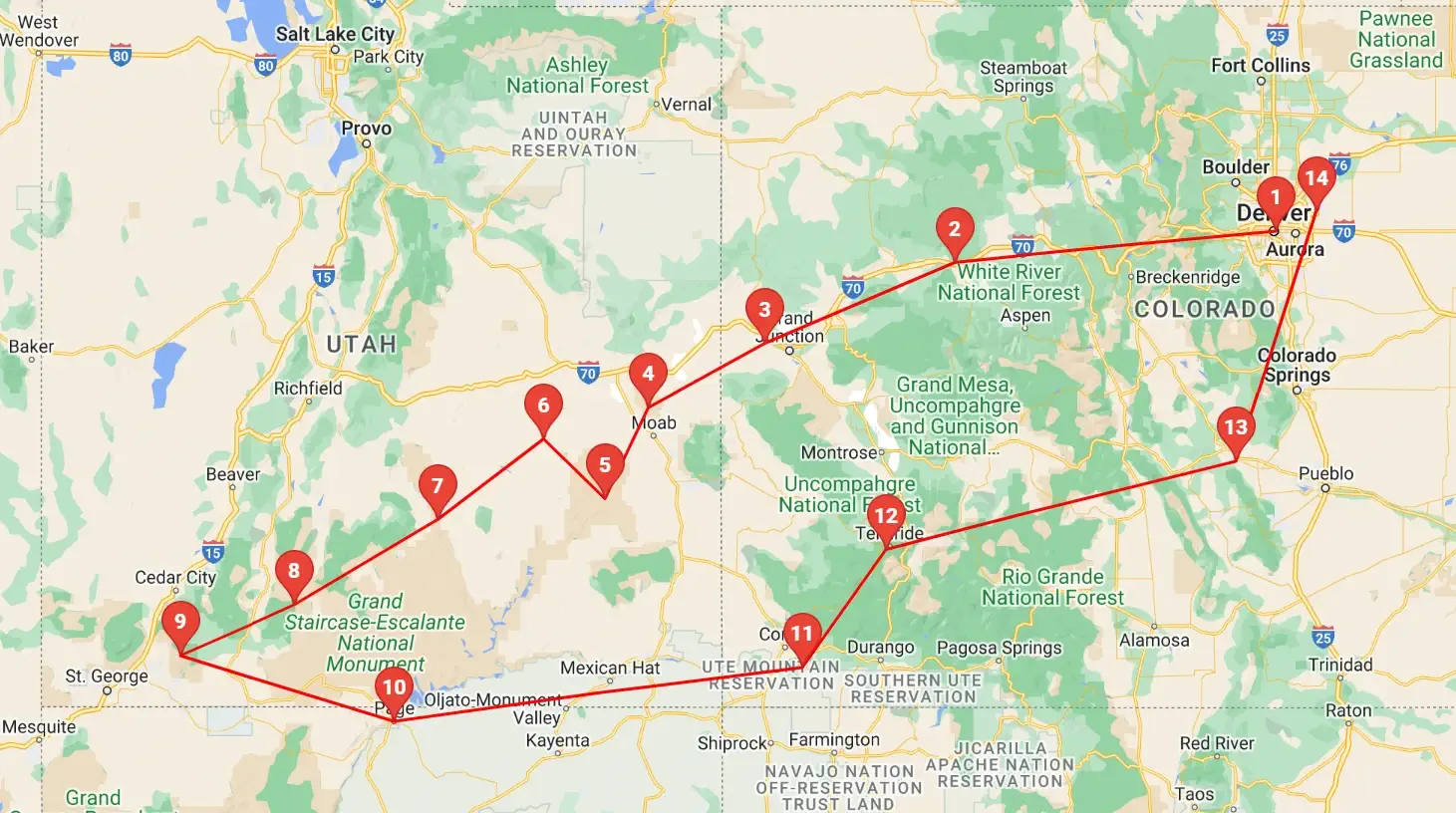 Click above map to view a larger Google Map
 As you can see by the this map, our trip covered 3 different states, approximately 1,600 road miles and allowed us to see some spectacular geography. You might think that a trip of this distance would be something that would result in a "tired of driving" mood - but our stops were so diverse with such incredible geography and fun things to do, that we found that we looked forward to each morning to where we could continue our adventures!
Click any link below to go directly to that page;
Note: All images featured on this page are the exclusive property of Just Traveling Thru, LLC, unless otherwise stated. When images from external sources are used, full credit is given to the original creator, along with a link to the specified license or usage terms. We are committed to respecting copyright and intellectual property rights, ensuring that all third-party images are properly attributed. If you have any questions regarding image ownership or usage rights, please feel free to contact us.
Affiliate Links: We may earn a commission if you make a purchase through one of our affiliate links. This helps support our travel content — thank you!
Content: To review any of our content, make suggestions and/or comments, please click the "About" menu link at the top of this page. You will find our "Contact Us" link on that drop-down menu.