
by Celeste Lipford and Terry Lipford - last updated on 8/13/2025
Capitol Reef National Park is in Utah's south-central desert. It surrounds a long wrinkle in the earth known as the Waterpocket Fold; The Waterpocket Fold is an awe-inspiring geological wonder nestled in Utah's Capitol Reef National Park, is a testament to the Earth's ancient history and the power of geological forces. Stretching nearly 100 miles, this colossal fold stands as a majestic natural fold in the Earth's crust, revealing layer upon layer of rock formations that date back millions of years. Carved by the relentless forces of erosion, the Fold showcases a mesmerizing array of colors, textures, and shapes that tell the story of the planet's geological evolution. As you traverse the park's scenic roads and hiking trails, the Waterpocket Fold's towering cliffs, hidden canyons, and stunning viewpoints offer a captivating glimpse into the dynamic forces that have shaped our world over countless eons.
After our Little Wild Horse Canyon hike was completed, we drove south back to route 24 and headed west to Torrey, UT where we would spend the night next to Capitol Reef National Park.
The park designated as a national monument on August 2, 1937, by President Franklin D. Roosevelt. However, it wasn't until December 18, 1971, that it was redesignated as Capitol Reef National Park through the National Parks and Recreation Act.
The park’s name comes from the "capitol-like" rock formations resembling the U.S. Capitol building's dome and the "reef" of cliffs that were challenging to cross in the early days of exploration.
The park lies on some 377 square miles and showcases the Waterpocket Fold, a dramatic wrinkle in the Earth that extends over 100 miles. Elevation within Capitol Reef National Park varies from 4,000 feet to over 11,000 feet. Running in a distinct north-south direction, Capitol Reef National Park is a strikingly long and narrow expanse of land. Spanning a remarkable 60 miles from north to south, the park is relatively compact in width, averaging only 6 miles from east to west. This narrow profile gives the park its unique shape, which is primarily defined by the Waterpocket Fold, a geological feature that runs the length of the park. The park’s elongated structure offers a diverse range of landscapes, from towering cliffs and canyons to expansive desert vistas, all within this narrow corridor. Its distinct geography allows visitors to explore a wide variety of environments in a relatively short distance.
Capitol Reef National Park has experienced significant growth in annual visitation over the past decade. In 2024, the park welcomed over 1.4 million visitors, marking its highest attendance since establishment. This represents an 81% increase in visitation since 2014. In 2023, the park hosted approximately 1.27 million visitors, indicating a slight decrease from the previous year. These figures highlight Capitol Reef's growing popularity among national park enthusiasts.
Capitol Reef National Park has an arid climate with precipitation averaging 7.91 inches (20.1 cm) annually at the park visitor center weather station. Much of the precipitation falls during the summer monsoon season, usually from July to September.
Capitol Reef's highest elevation is 8,960 feet near Billings Pass, lowest elevation is 3,877 feet at Halls Creek.
Capitol Reef entrance fees are $20 per vehicle or $10 per individual on foot or bike and passes are valid for 7 days. Fees and/or passes can be obtained online at the National Parks Service website. The lifetime pass is still one of the best bargains available.
The best time to visit Capitol Reef National Park is undoubtedly during the fall months, typically from late September to early November. During this season, the daytime temperatures are comfortably cool, making for pleasant hiking and outdoor activities, while the nights turn crisp and refreshing, though rarely dipping into freezing temperatures. This mild weather creates the perfect environment for exploring the park’s stunning landscapes without the extreme heat of summer or the cold of winter.
In addition to the favorable weather, fall also marks the peak of the harvest season in the historic Fruita orchards. Late summer and early fall are ideal for wandering through these lush orchards, where visitors can pick a variety of ripened fruits, including apricots, mulberries, apples, and more. This charming experience not only allows you to immerse yourself in the rich history of the Fruita area—once home to Mormon settlers—but also provides a taste of the region’s agricultural heritage. The bounty of fresh fruit adds a delightful touch to the already beautiful surroundings, making it a memorable part of your Capitol Reef visit.
Capitol Reef National Park is located in the heart of south-central Utah, situated within the expansive and rugged terrain of the Colorado Plateau. The park stretches an impressive 60 miles (97 km) from north to south, while its width averages just 6 miles (9.7 km), giving it a distinct, narrow profile. This unique shape is largely defined by the Waterpocket Fold, a dramatic geological feature that runs the length of the park, creating stunning cliffs, canyons, and mesas along its path.
We stayed in Torrey, as it is the closest location where we could find reasonably priced accommodations, and as you can see in this map, it is close to the park. When we departed Torrey, we decided to drive south on Utah route 12, as that would take us through some more of the Grand Staircase area. Google Maps will tell you to drive on route 24, but it is a slightly longer drive.
Park entrance fees are $20 per vehicle (includes all occupants), and we continue to point out to all who will listen that the National Park Service annual and/or lifetime passes are one of the biggest bargains available. Click here to read more about park entrance fees.
Image Credit: The map image is the property of the National Park Service via Wikimedia Commons using a Public Domain license.
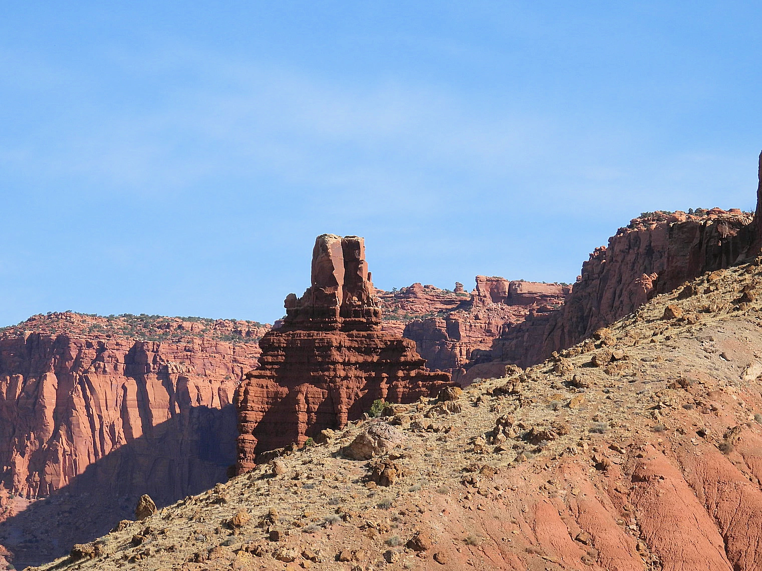 Chimney Rock
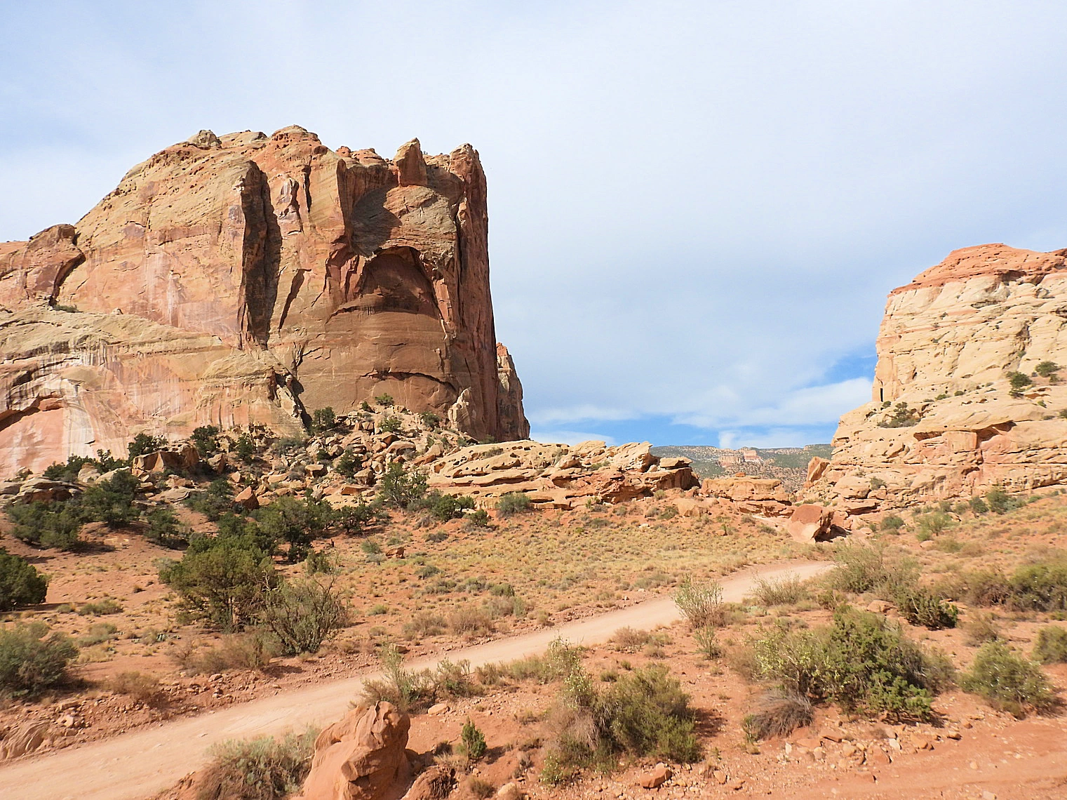 Capitol Gorge Road
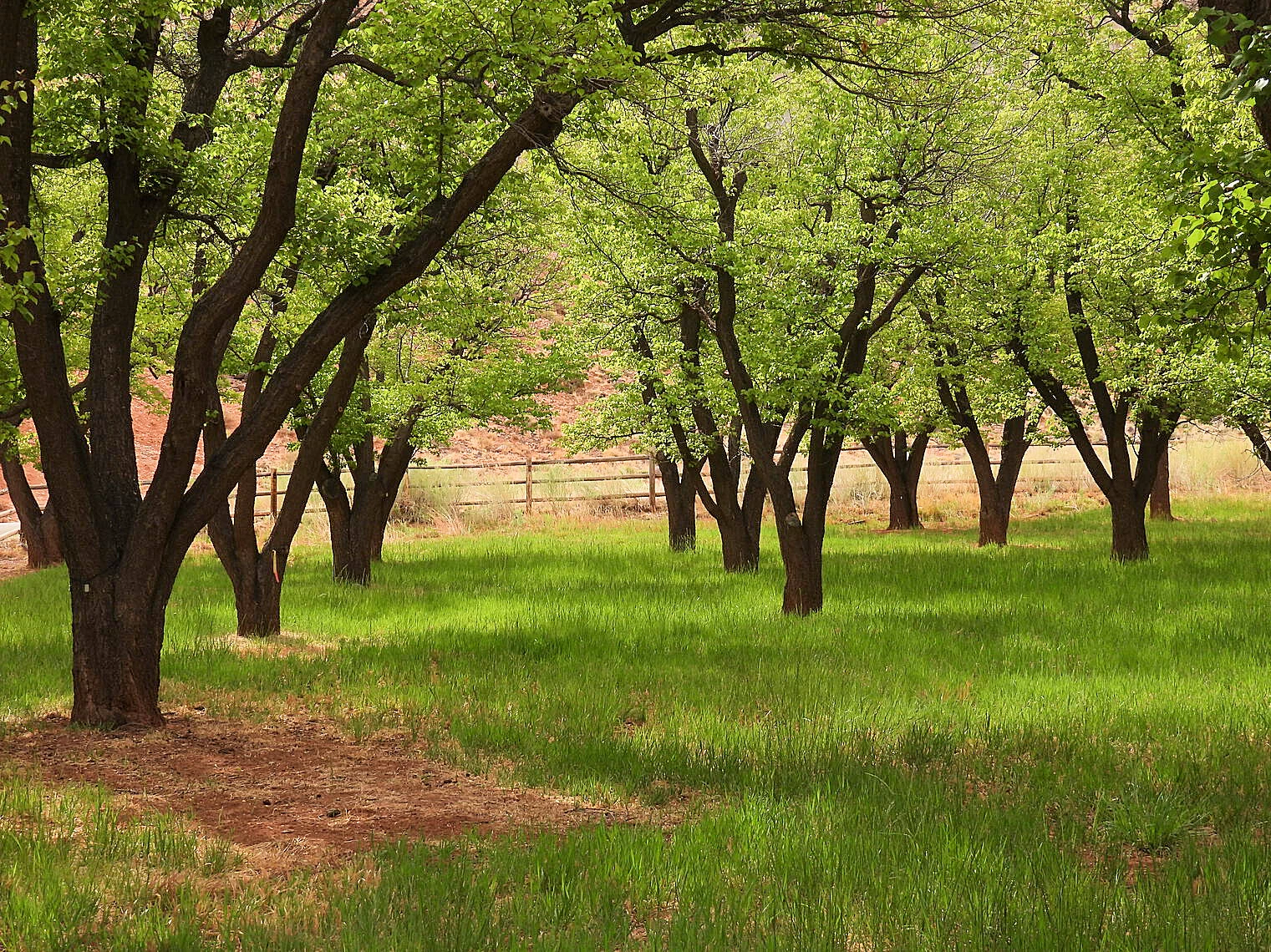 The Orchards at Capitol Reef
Capitol Reef National Park is a captivating landscape that surrounds one of the most unique geological features in the American West—the Waterpocket Fold. This immense, nearly 100-mile-long wrinkle in the Earth's crust stretches through the park, showcasing dramatic layers of golden sandstone, vibrant red rock formations, and winding canyons. These geological formations create a stunning tapestry of natural beauty, offering a variety of scenic vistas, hiking opportunities, and photographic moments.
Among the park's most iconic sights is Chimney Rock, a striking rock pillar that rises high above the surrounding landscape, its solitary form a testament to the erosive forces that shaped the area. Another must-see is Hickman Bridge, a magnificent natural arch that spans a deep canyon, offering hikers a chance to marvel at the impressive geological processes that created this stunning formation. Capitol Reef itself, from which the park gets its name, is known for its striking white sandstone domes. These domes, resembling the domed structure of a capitol building, stand in sharp contrast to the red and orange hues of the surrounding cliffs, creating a breathtaking and iconic view that draws visitors from all over the world.
The park is also home to a wealth of other scenic wonders, including rugged canyons, hidden valleys, and ancient petroglyphs left behind by Native American cultures. With its rich history, diverse ecosystems, and awe-inspiring rock formations, Capitol Reef National Park offers a truly unforgettable experience for anyone who visits. Whether you're exploring on foot, by car, or simply taking in the panoramic views, the park's striking landscapes are sure to leave a lasting impression.
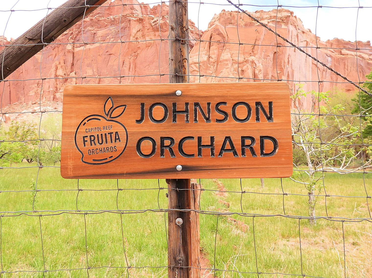 Fruita Campground Johnson Orchard
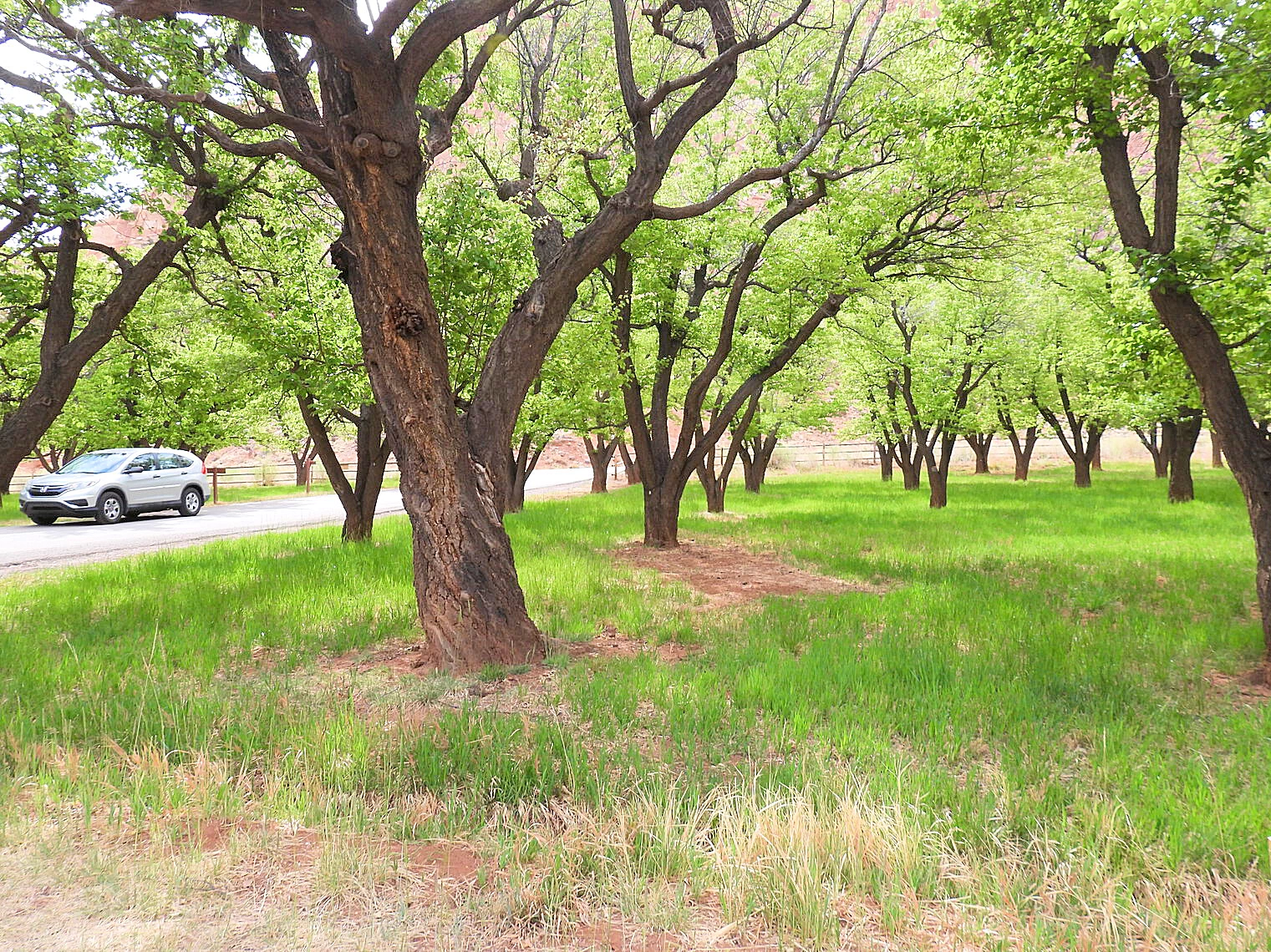 Fruit Trees at Fruita Campground
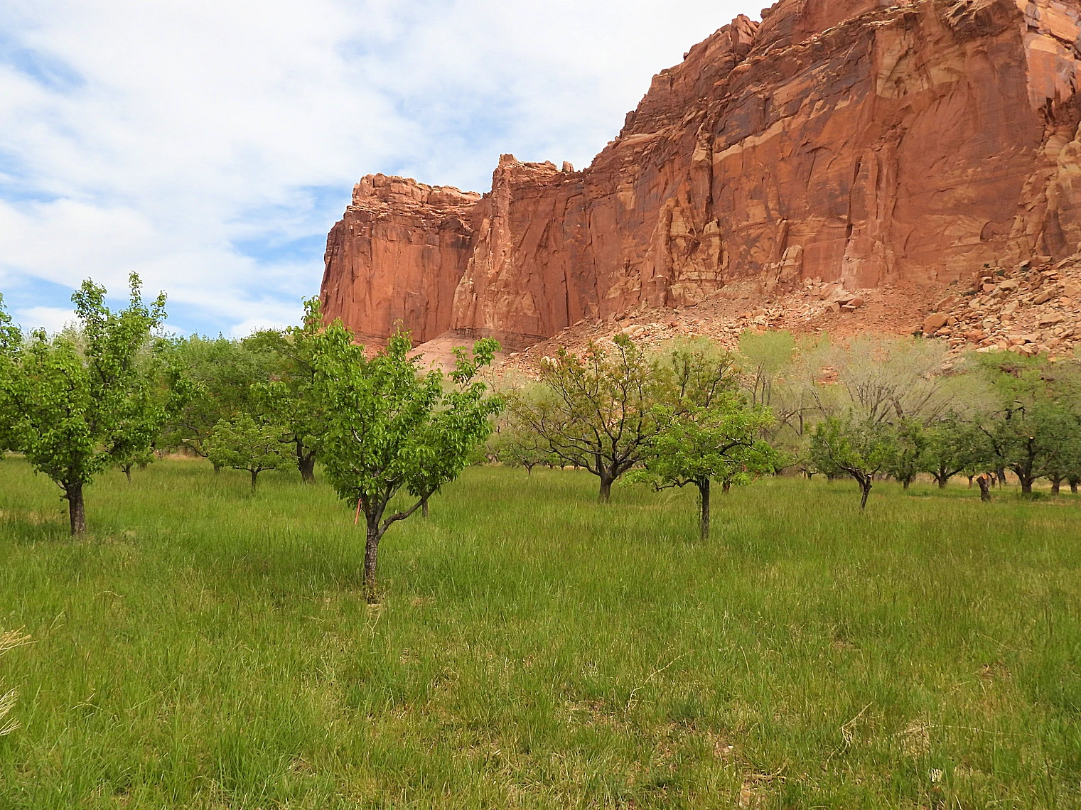 Fruit Orchards at Fruita Campground
The Fruita Campground is a charming, peaceful retreat situated next to the meandering Fremont River, surrounded by a landscape of historic orchard trees. With 71 well-equipped sites, each featuring a firepit and picnic table, the campground offers visitors a blend of modern amenities and rich historical charm. It's the perfect spot to immerse yourself in the natural beauty of Capitol Reef National Park while experiencing the unique legacy of the Fruita settlement.
The orchard trees that surround the campground hold a deep connection to the region's history. Planted in the 1880s by Nels Johnson, a pioneer who settled in Capitol Reef country and homesteaded in Fruita, these orchards tell the story of early settlers who recognized the area's fertile land. The Fremont River, which flows nearby, provided essential water, while the heat reflected off the canyon walls created a microclimate perfect for growing fruit. Johnson’s early plantings included apple, peach, pear, plum, walnut, and almond trees—fruits that are still enjoyed today. His efforts laid the foundation for a farming community that thrived in this unique environment.
Nels Johnson later married Mary Jane Behunin, the daughter of another early Fruita resident, Elijah Cutler Behunin, a man known for his contributions to the area’s early development. Elijah Behunin built a small cabin in the area that still stands today along Utah Highway 24. This historical cabin serves as a reminder of the pioneer spirit and resilience of the settlers who made Fruita their home.
Today, the Fruita Campground and surrounding orchards offer more than just a place to camp—they provide a connection to the past, where visitors can enjoy the serenity of nature while reflecting on the early homesteaders' legacy. Whether you're walking through the orchards, camping beside the river, or simply soaking in the views, the Fruita area is a living testament to the enduring spirit of the people who settled in Capitol Reef's rugged landscape.
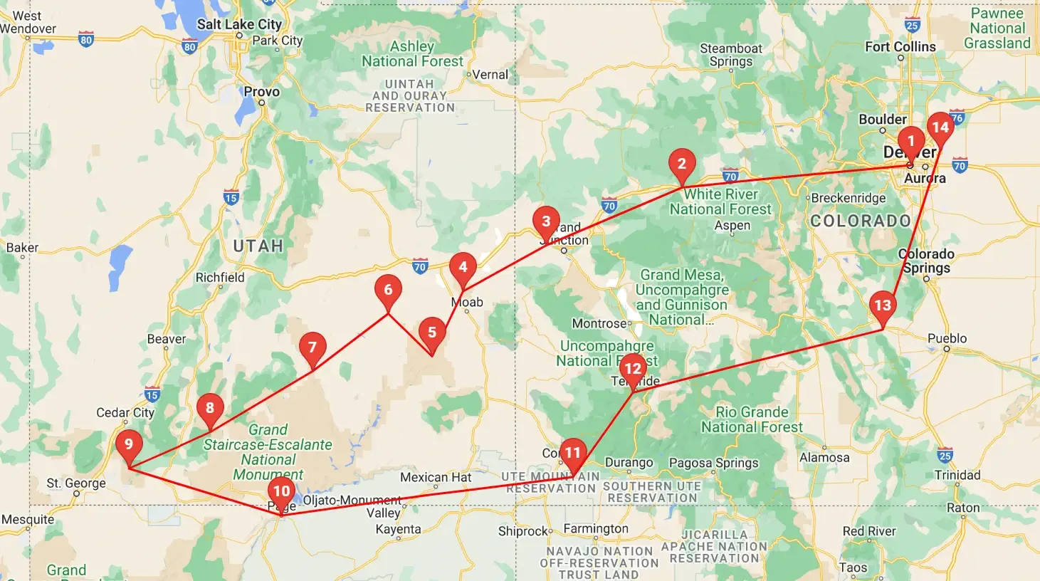 Click above map to view a larger Google Map
 As you can see by the this map, our trip covered 3 different states, approximately 1,600 road miles and allowed us to see some spectacular geography. You might think that a trip of this distance would be something that would result in a "tired of driving" mood - but our stops were so diverse with such incredible geography and fun things to do, that we found that we looked forward to each morning to where we could continue our adventures!
Click any link below to go directly to that page;
Note: All images featured on this page are the exclusive property of Just Traveling Thru, LLC, unless otherwise stated. When images from external sources are used, full credit is given to the original creator, along with a link to the specified license or usage terms. We are committed to respecting copyright and intellectual property rights, ensuring that all third-party images are properly attributed. If you have any questions regarding image ownership or usage rights, please feel free to contact us.
Affiliate Links: We may earn a commission if you make a purchase through one of our affiliate links. This helps support our travel content — thank you!
Content: To review any of our content, make suggestions and/or comments, please click the "About" menu link at the top of this page. You will find our "Contact Us" link on that drop-down menu.
 Click Image to view a larger Google Map
