
by Celeste Lipford and Terry Lipford - last updated on 9/12/2025
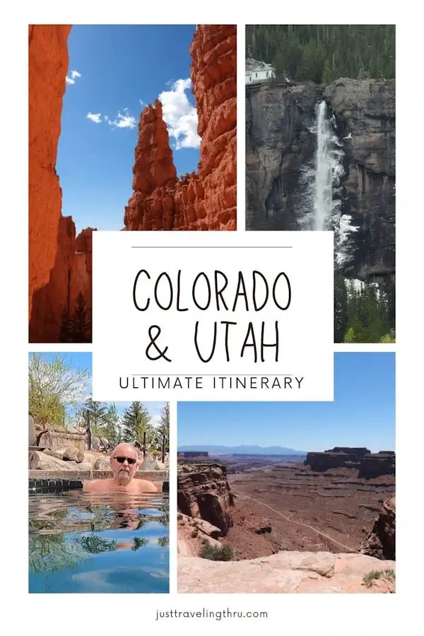
This was stop #8 on our unforgettable journey through Utah’s Mighty Five—a trip that took us through some of the most breathtaking landscapes in the American Southwest. Each park along the way had its own unique charm, from the towering cliffs of Zion to the mesmerizing arches of Arches National Park, but arriving here felt like stepping into an entirely different world.
If you're curious about our full adventure and want to see how this stop fit into the bigger picture, be sure to click the Travel Tile to explore our trip overview page. There, you’ll find highlights from each of the Big Five parks, insights into our favorite trails and viewpoints, and tips for planning your own Utah road trip.
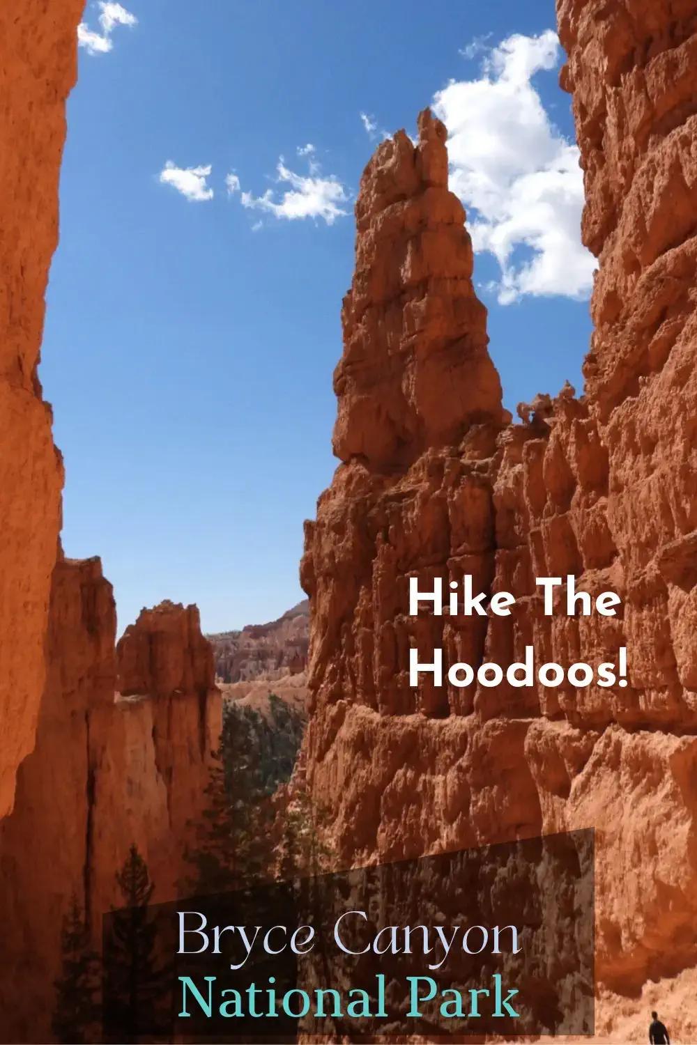
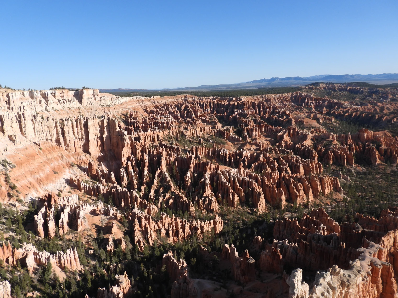
Bryce Canyon National Park, spanning 35,835 acres in southern Utah, is a breathtaking natural wonder renowned for its vibrant crimson hoodoos—otherworldly, spire-shaped rock formations sculpted by millions of years of freezing, thawing, and erosion. Unlike a traditional canyon, Bryce is a vast series of amphitheaters carved into the Paunsaugunt Plateau, with the most famous being the Bryce Amphitheater, home to the densest collection of hoodoos found anywhere on Earth.
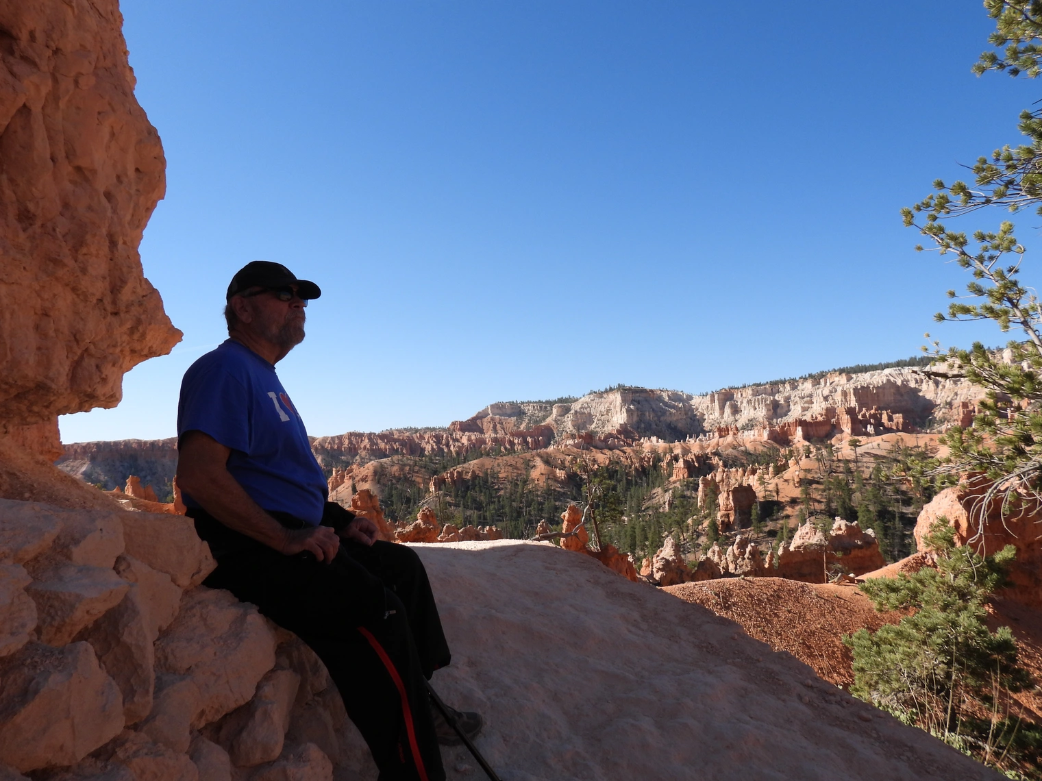
The park’s dramatic beauty can be admired from numerous scenic viewpoints along the Rim Trail, offering sweeping panoramas of the rugged landscape below. Sunrise Point and Sunset Point provide prime locations to witness the interplay of light and color as the sun casts warm hues over the hoodoos. Inspiration Point offers a breathtaking multi-tiered view, while Bryce Point, one of the highest elevations in the park, delivers a stunning vantage of the entire amphitheater, especially at dawn when the landscape glows in brilliant reds and oranges.
For those looking to immerse themselves in the park’s terrain, Bryce Canyon’s extensive trail system caters to all skill levels. The Navajo Loop Trail, with its famous Wall Street section, leads hikers through narrow slot canyons lined with towering rock walls, while the Queen’s Garden Trail provides a gentler descent into the formations, weaving through whimsical rock spires. More adventurous hikers can embark on the Peekaboo Loop or the Fairyland Loop, which wind through remote, less-visited areas, revealing stunning, unspoiled landscapes.
Thanks to its high elevation (8,000–9,000 feet) and minimal light pollution, Bryce Canyon is an International Dark Sky Park, making it one of the best places in the world for stargazing. On clear nights, visitors can witness an awe-inspiring view of the Milky Way, thousands of twinkling stars, and celestial phenomena rarely visible in urban settings. The park also hosts astronomy programs and full-moon hikes, offering a unique nocturnal perspective of the hoodoos.
Wildlife is abundant in Bryce Canyon, adding to its natural charm. Visitors frequently encounter mule deer, Utah prairie dogs, and rock squirrels, while over 200 bird species, including the striking peregrine falcon and the majestic California condor, soar through the skies. In the quieter, forested areas of the park, lucky explorers might even spot elk or mountain lions.
On June 7, 1924, Congress passed a bill to establish Utah National Park, when all land within the national monument would become the property of the United States. The land was acquired and the name was restored to Bryce Canyon. On February 25, 1928, Bryce Canyon officially became a national park.
Legislation enlarged the park to its current size of 35,835 acres. Bryce is famous for its unique geology, consisting of a series of horseshoe-shaped amphitheaters carved from the eastern edge of the Paunsaugunt Plateau in southern Utah.
Over two million visitors come to experience the otherworldly magic of Bryce Canyon National Park each year.
The Bryce Canyon area was settled by Mormon pioneers in the 1850s and was named after Ebenezer Bryce, who homesteaded in the area in 1874.
The area around Bryce Canyon became a National Monument in 1923 and was designated as a National Park in 1928.
Bryce Canyon Park covers an area of 145 square kilometers (56 square miles) or 14,502 hectares (35,835 acres).
Rainbow Point is the highest part of the park at 2,775 meters (9,105 feet) and Yellow Creek is the lowest part of the park at 2,020 meters (6,620 feet).
The major feature of the park is Bryce Canyon, which was not formed from erosion initiated from a central stream, meaning it technically is not a canyon.
The erosional force of frost-wedging and the dissolving power of rainwater have shaped the colorful limestone rock of the Claron Formation into bizarre shapes including slot canyons, windows, fins, and spires called “hoodoos.”
Bryce Canyon's rocks are among the youngest of those on the Colorado Plateau, dating back a mere 65 million years ago to the Cretaceous period.
7-day entrance passes to Bryce Canyon National Park cost $35 for vehicles and $20 per person for motorcyclists, bicyclists, and pedestrians. The fee includes unlimited use of the free shuttle bus that runs from late May through early October. Park annual passes can be found on the National Park Service website.
Bryce Canyon National Park is located at a relatively high elevation of 8,000 to 9,000 feet, meaning that it is much cooler than at Utah's other national parks such as Zion, Canyonlands, and Arches.
Yes, Bryce Canyon National park has officially gained International Dark Sky status.
No, Bryce Canyon is not actually a canyon. Despite its name, Bryce Canyon is actually a series of 14 amphitheaters carved by erosion.
Bristlecone pines in Bryce Canyon National Park are some of the oldest living trees on Earth. Some of these trees are over 5,000 years old!
According to IMDB, Bryce Canyon has been featured in 32 productions. Click the link to see the complete list on the IMDB website.
If you enjoy our videos click here to subscribe to our Youtube Channel.

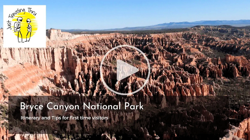
Click the video poster image to view our Bryce Canyon National Park - Itinerary and Tips for First Time Visitors video. Follow this Bryce Canyon itinerary. Get the tips you need for a successful stay and get a glimpse of the major sites to see including an up close look at the hoodoos! Take a hike in Bryce Canyon on the Queens Garden/Navajo Loop trail; one of the most scenic trails in the park.
Bryce Canyon was easily one of our favorite parks of the Utah big 5! We visited the top 5 in Utah and Mesa Verde and the Colorado National Monument during our 16 day tour. Bryce Canyon is further from some of the major cities but worth the visit.
After departing our basecamp in Torrey, UT, we drove to Bryce Canyon National Park - or perhaps I should say we drove to Tropic, UT as that was where we stayed. We did not want to stay at one of the motels adjacent to the park, or in the park lodge, as they were very expensive. The motel in Tropic, UT ( Bryce Canyon Log Cabins) was comfortable and we had a cabin suite which fit our requirements nicely. Staying in Tropic also allowed us to be 10 miles from Bryce Canyon National Park, which was a nice drive as there was very little traffic early in the morning.
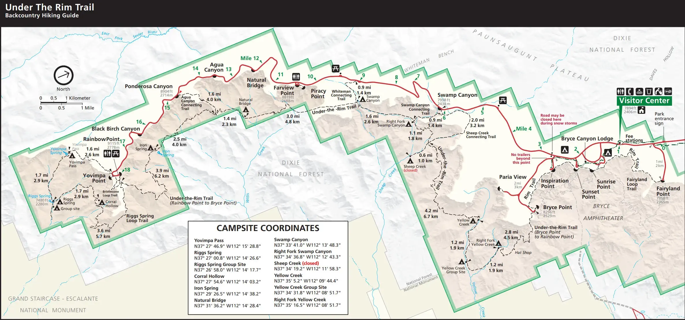
As you can see in this National Park Map, Bryce Canyon is long and narrow - it is approximately 18 miles from the Visitor Center to Rainbow Point. The park shuttle buses do not provide service beyond Bryce Point, so if you want to see Rainbow Point you will have to drive there.

As of 2/24/2025 here are five of the most popular restaurants near Bryce Canyon National Park, based upon Google Review Ratings;
There are a number of places to eat near Bryce Canyon National Park, here is a Google Search Results list of all restaurants.
Accommodations near Bryce Canyon National Park range from rustic to luxurious, catering to diverse preferences and budgets. Visitors can choose from charming lodges, cozy cabins, and budget-friendly motels located just minutes from the park entrance. Bryce Canyon City and nearby towns like Tropic and Panguitch offer convenient options, including chain hotels and family-run inns. For nature lovers, campgrounds and RV parks provide an immersive outdoor experience. Many accommodations feature amenities like free shuttles, dining, and scenic views, ensuring a comfortable stay. Booking in advance is recommended, especially during peak seasons, as availability can be limited.
Here are the top 5 guest rated accommodations near Bryce Canyon National Park:
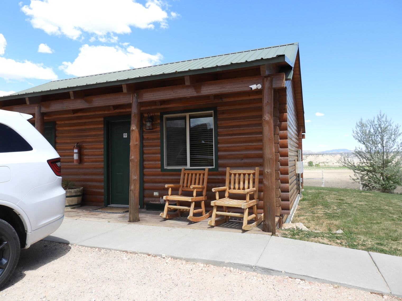
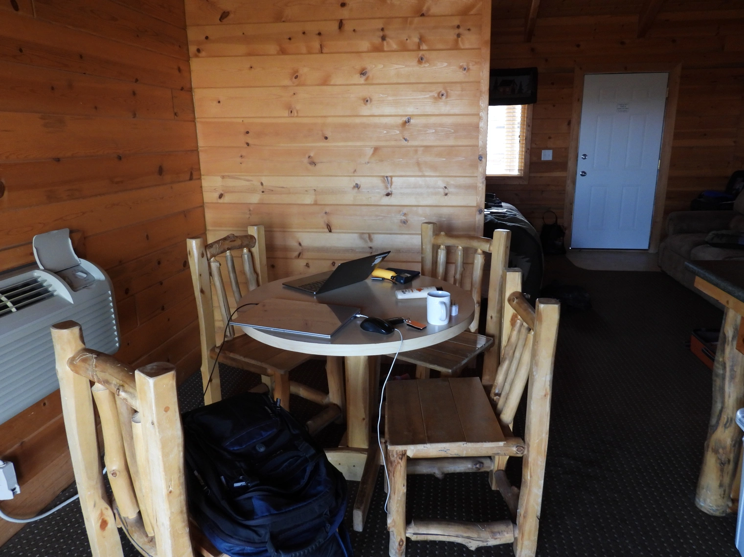
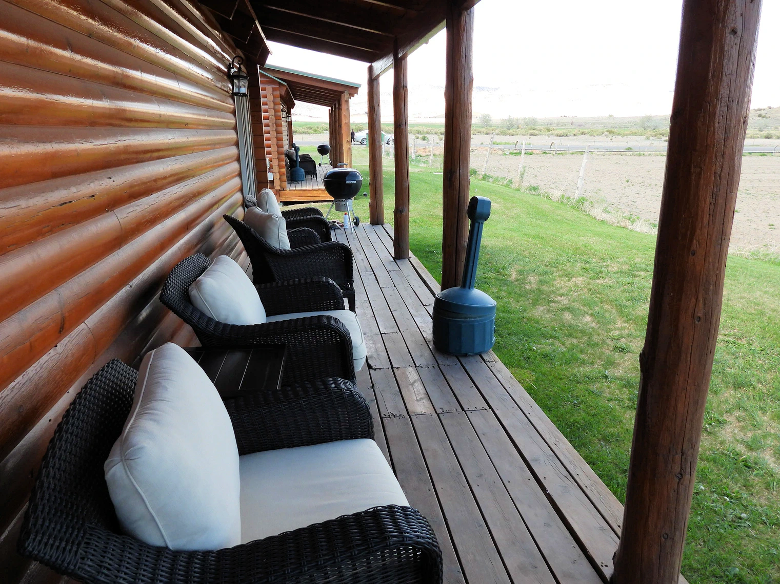
We stayed at the Bryce Canyon Log Cabins in Tropic, UT and really enjoyed our stay there. The cabin was very comfortable, well equipped and the bed was comfortable also.
In the next section of this page, we will show more about the Bryce Canyon Log Cabins - and yes, it is very quiet in Tropic, UT.
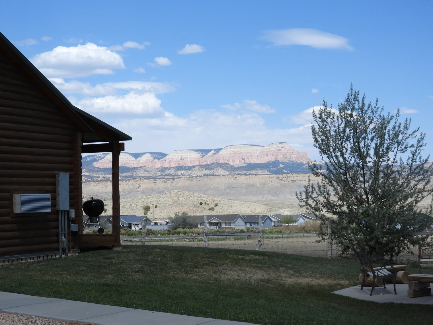
Staying in Tropic turned out to be a great decision - it was only 8 miles from the park, there is a great BBQ shop in town, there is a small grocery store, gas station - there was everything we needed. The icing on the cake was that the log cabin we stayed in was comfortable and had a small kitchen and a great view from the back porch of the cabin.
More Info about Bryce Canyon Log Cabins
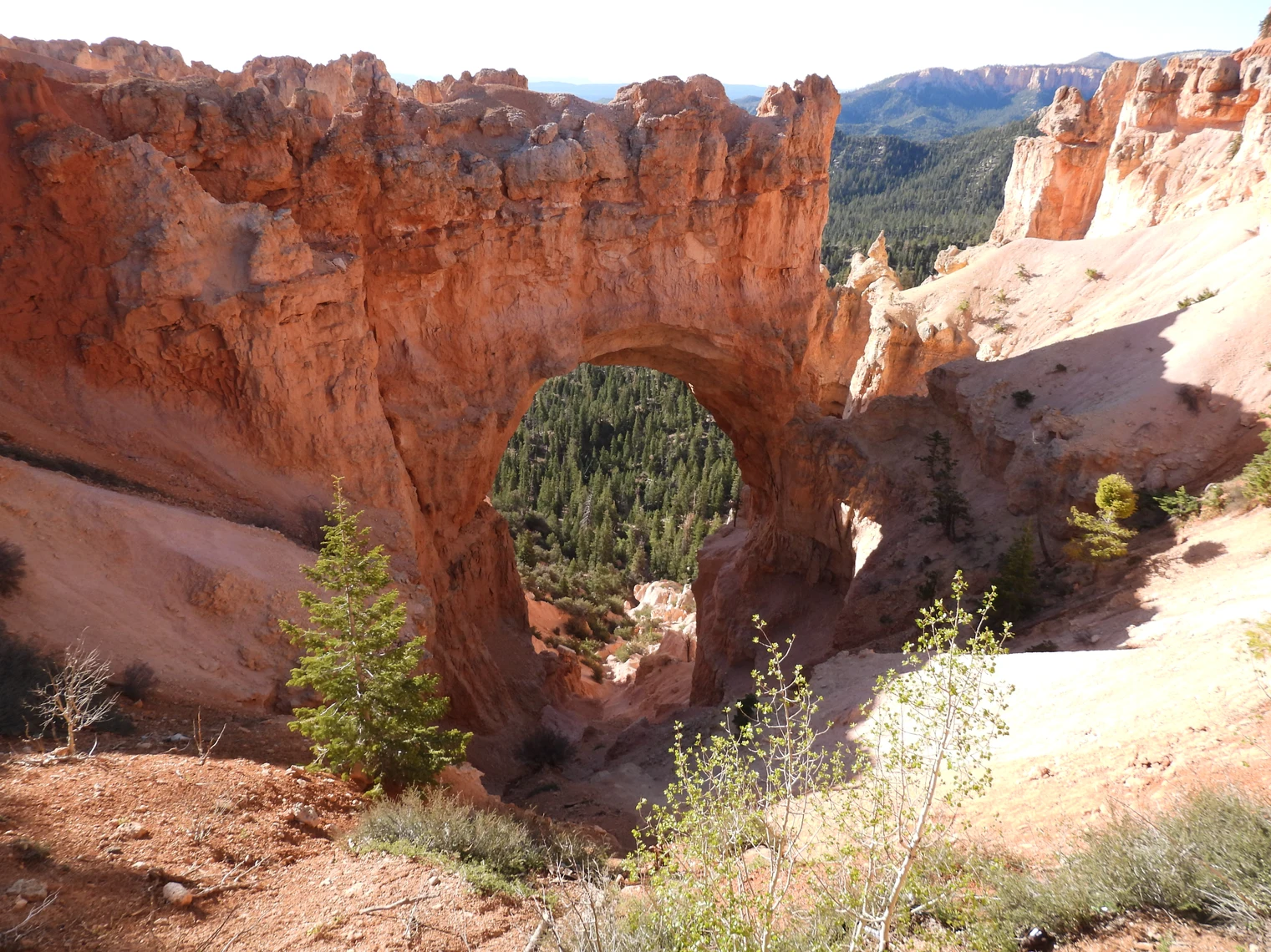
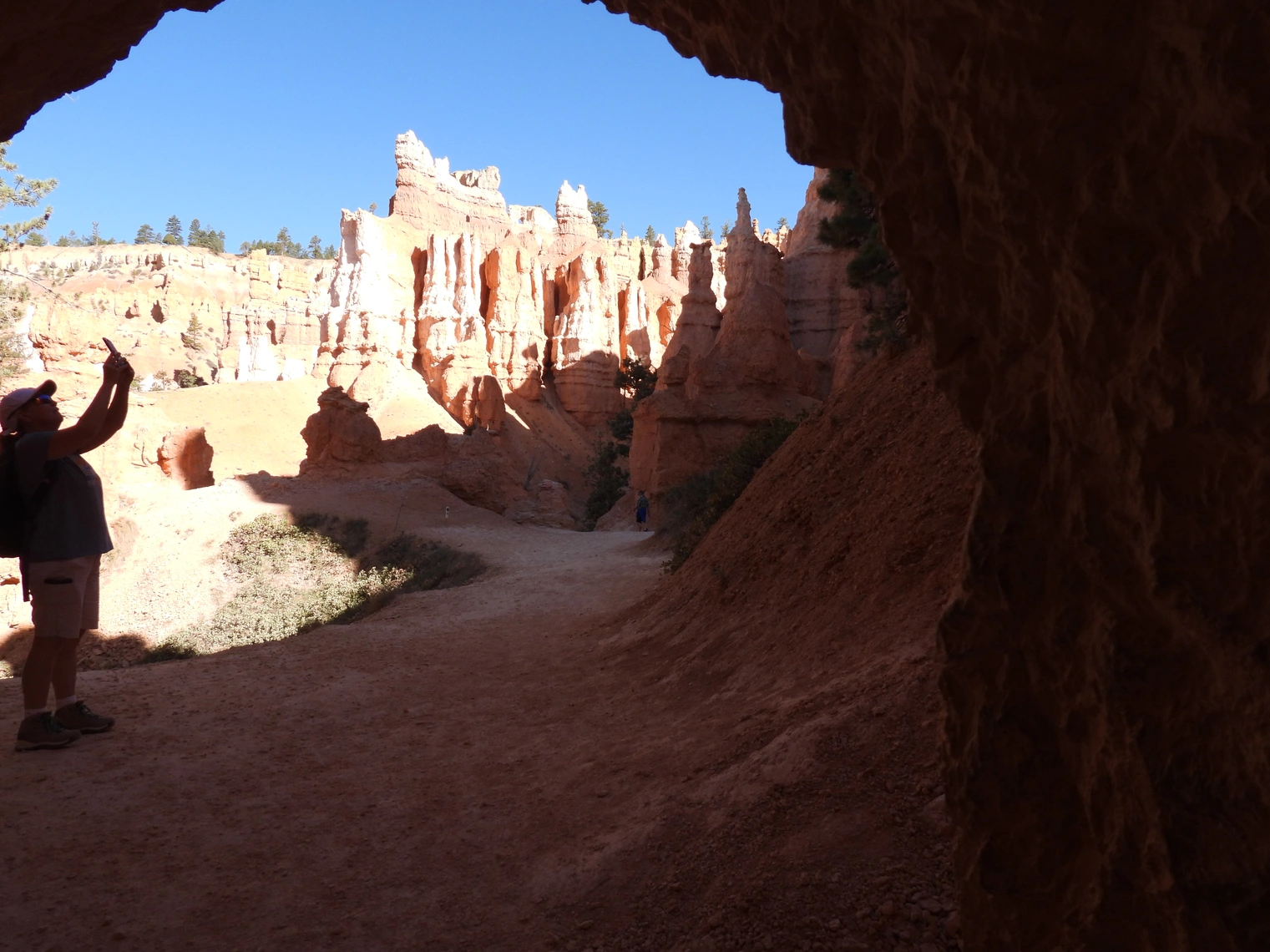
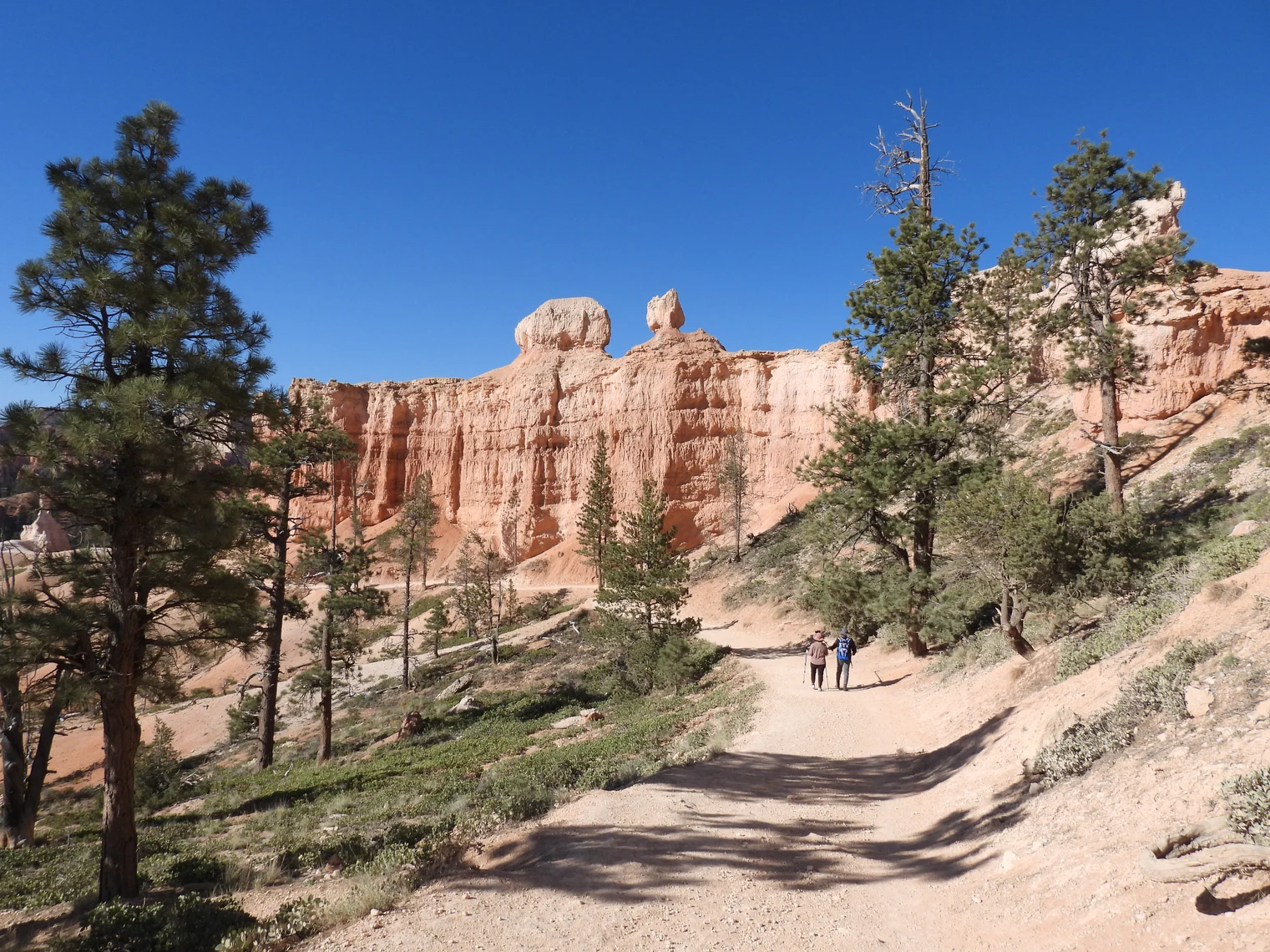
Our first morning's adventure was to drive over to the park and to trek the Queens Garden & Navajo Loop Trail - it is easily the most popular hiking trail in the park; the trail forms a 3.1-mile (5 km) scenic loop that leads you through a maze of towering hoodoos, sculpted spires, and vibrant red rock formations that define the heart of the canyon.
The initial trail descent along the Queens Garden path, offers breathtaking views of rock formations like Queen Victoria. Midway through, it transitions into the Navajo Loop, taking you past iconic landmarks such as Thor’s Hammer and Wall Street. While the descent is fairly moderate, the final half-mile climb out of the canyon is a steep and demanding ascent — one that left us gasping for breath and pausing often to catch it.
Although rated as a “moderate” trail on All Trails, we can attest that the final stretch feels much more strenuous due to the rapid elevation gain of roughly 632 feet. It’s a workout — but one with unforgettable views and a deep sense of accomplishment at the end.
After we completed the hike and returned to Sunset Point, we caught one of the park shuttles back to Sunrise Point, as by then my butt was dragging ! The shuttle buses are great for allowing visitors to park at one location and then move about the park on their buses. The buses do not go all the way to the Rainbow Point however.
NOTE: This trail is steep going down and even steeper going back up to the rim. It is imperative that you are wearing good quality hiking boots or shoes or your feet are going to not be happy with you. Take a look here at the hiking shoes & boots offered by REI. You are also going to need to bring water with you.
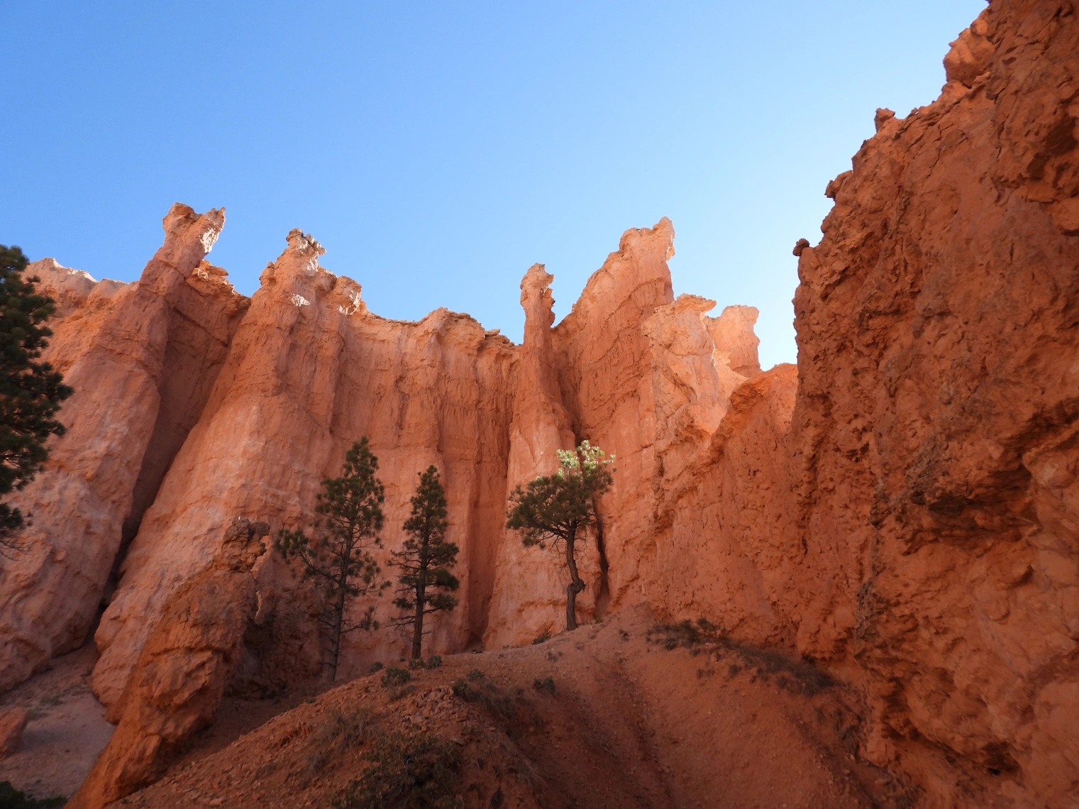
 Rock Formations along the Queen's Trail
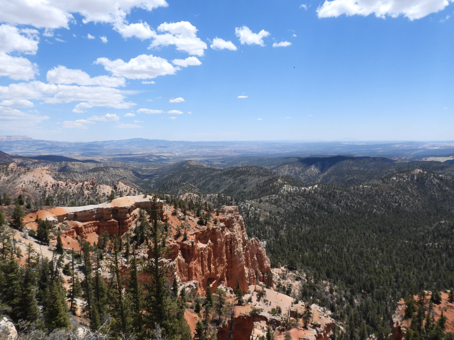 Fairview Point from Queen's Trail
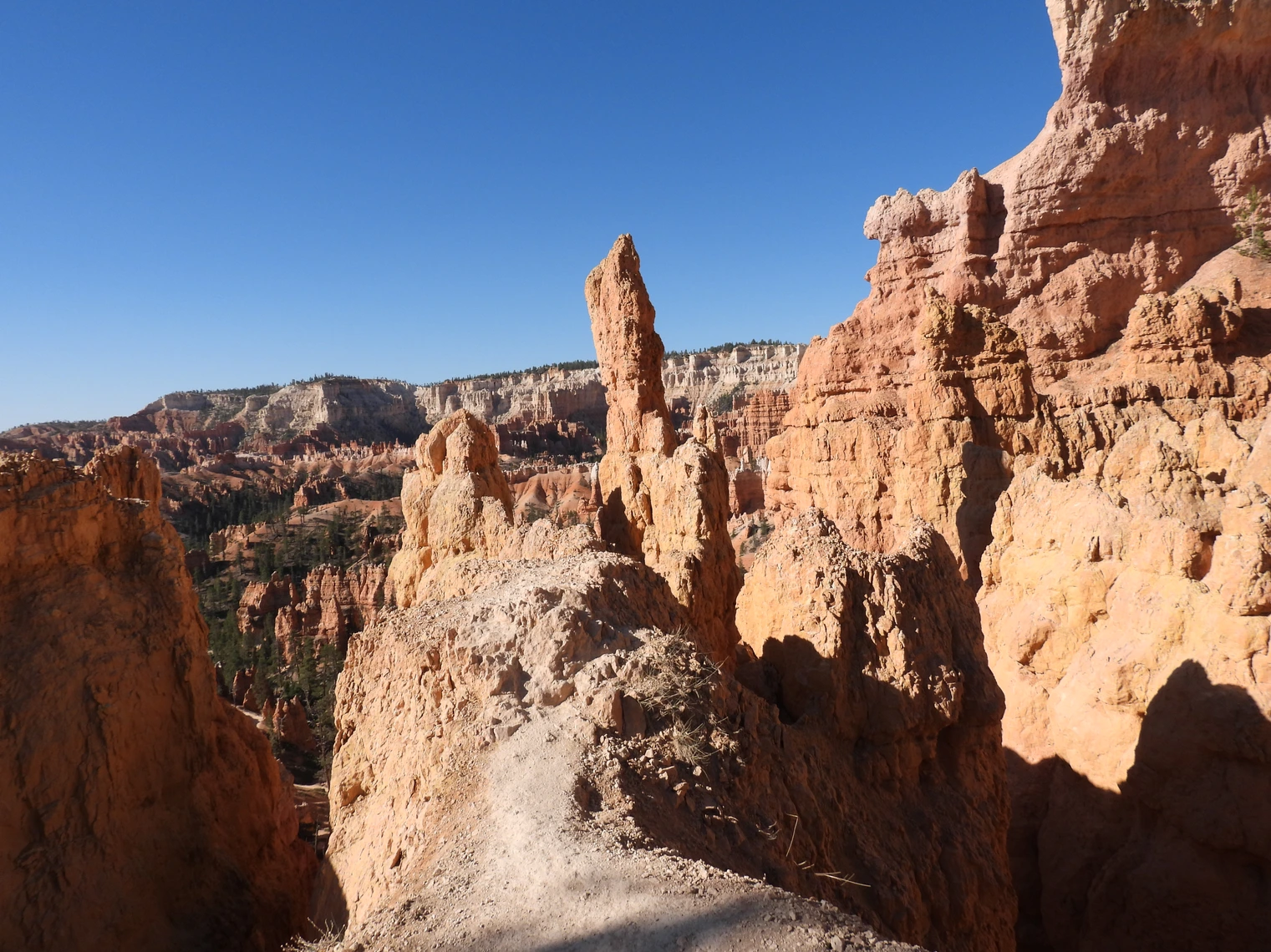 Amphitheater Area from Queen's Trail
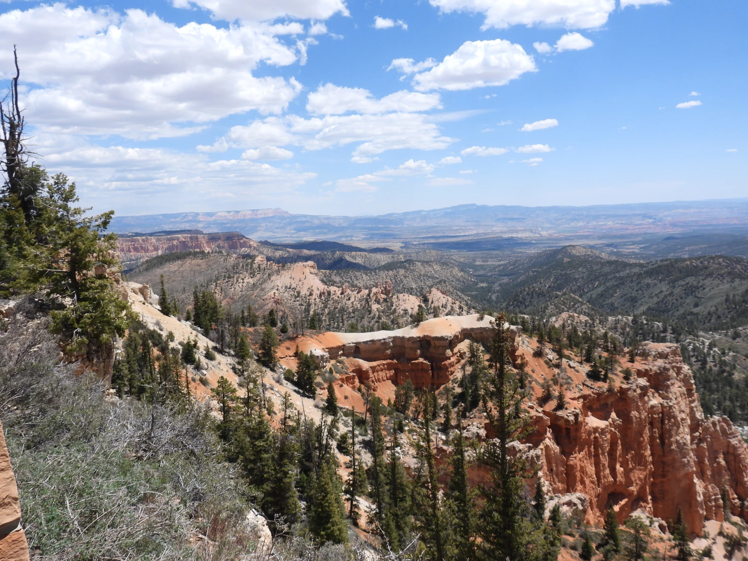
On our last day there, we drove to Natural Bridge and Rainbow Point. This is as far as you can drive in the park, as the road ends at Rainbow Point. It is 22 miles from the Visitor's Center to Rainbow Point, so be sure you have the time to burn!
While it may be tempting to explore National Parks with an off-road vehicle like an ATV, RZR, or UTV, it's important to know that these vehicles are not permitted within most National Park boundaries, including popular Southwest destinations like Arches, Bryce, Canyonlands and Zion.
Only street-legal, highway-capable vehicles (like Jeeps with proper plates, lights, and safety equipment) are allowed on designated park roads. Even then, true “off-roading” — driving off established roads — is strictly prohibited.
Many OHV rentals are intended for use on Bureau of Land Management (BLM) or National Forest lands adjacent to the parks, not inside them.
🛈 For official guidance, see the National Park Service’s policy on vehicle use (NPS.gov).
Plan ahead, stay on legal trails, and enjoy the landscape responsibly.
Does Bryce Canyon have a shuttle?
Yes, seasonal shuttles run between Bryce Canyon City and key viewpoints/trailheads in the park. It’s free with your park entry; check the NPS page for current dates and hours.
What are the Best viewpoints for sunrise/sunset?
Sunrise and Sunset Points (Bryce Amphitheater) are classics; Inspiration and Bryce Point offer sweeping views. Arrive early—parking fills fast in peak months.
What are the must-do hikes?
Navajo Loop + Queen’s Garden (combine for a great figure-8), Peekaboo Loop for longer, and the Rim Trail for easy viewpoints.
For a comprehensive list of trails and other info including hiker comments, maps, etc - click this link to go to the All Trails website page about hiking in Bryce Canyon National Park.
What is the weather and altitude?
The rim sits 8,000–9,000 ft (2,400–2,700 m). Expect cooler temps, strong sun, and afternoon storms in summer. Hydrate, layer up, and watch for lightning.
Is the park open year-round?
Yes, Bryce Canyon National Park is open 24 hours a day, 365 days a year. Park services, such as the visitor center, have seasonal hours.
When is the best time to visit?
The peak season is from June to September, offering ideal weather for hiking, but it is also the most crowded. For cooler weather, fewer people, and opportunities to see snow on the hoodoos, consider visiting in the fall, spring, or winter.
What are the best hikes?
For first-time visitors, the Queen's/Navajo Combination Loop is the most popular hike, offering spectacular views of the hoodoos. For an easier option, the paved section of the Rim Trail between Sunrise and Sunset Points is accessible for all skill levels.
Where are the best spots for sunrise and sunset?
Almost all viewpoints face east and provide excellent views of the canyon bathed in rich, dramatic light in the morning. Popular spots for sunrise are Sunrise Point and Bryce Point. For sunset, the sun sets behind the amphitheater, so Inspiration Point or Paria View offer great perspectives.
Are pets allowed on the trails?
Pets are only permitted on paved surfaces, including campgrounds, parking lots, paved roads, and the section of the Rim Trail between Sunrise and Sunset Points. They are not allowed on unpaved trails.
What are some of the less crowded trails?
The Fairyland Loop Trail, which offers solitude on an 8-mile trek, and the Bristlecone Loop Trail, a 1-mile forested path with fewer visitors and ancient trees. For a less crowded experience that still goes into the canyon, the Tower Bridge Trail is a moderate out-and-back option that can be extended to connect with the Fairyland Loop for a longer hike. The Mossy Cave Trail is a very easy option outside the main amphitheater, making it less busy than popular rim trails.
What are hoodoos?
Hoodoos are irregularly shaped rock spires formed by erosion. Bryce Canyon is home to the largest concentration of hoodoos in the world. The hoodoos are carved over millions of years by a process called "ice wedging," where freezing and thawing water expands in rock fractures and breaks the rock apart.
Why isn't it a true canyon?
Despite its name, Bryce Canyon is not a canyon carved by a single river. It is a series of natural amphitheaters created by erosion along the eastern side of the Paunsaugunt Plateau.
What wildlife can I see?
Common wildlife includes mule deer, pronghorn, Utah prairie dogs, chipmunks, and a wide variety of birds. Less common but present species include elk, black bears, and mountain lions.
Yes, parking can be difficult at Bryce Canyon National Park, especially during peak season, because the lots at popular viewpoints often fill up quickly. To avoid parking challenges, it is recommended to arrive early, before 9:00 a.m., or use the free park shuttle service to get around the key areas.
2025 Government Shutdown
Most National Parks remain open during a government shutdown, but with reduced services and staffing. Parks may be accessible, but facilities like visitor centers, campgrounds, and websites might be closed, and services like trash pickup and restroom maintenance can be significantly impacted. Visitors should check individual park websites for current conditions before going and be prepared with extra supplies and awareness that emergency services may be limited.
Gates and roads are generally open to allow access to outdoor areas.
Plan Your Visit Travel Resources — Maps, Parking, Passes & Links
Where to Stay & Eat Travel Resources — Maps, Parking, Passes & Links
More Info Travel Resources — Maps, Parking, Passes & Links
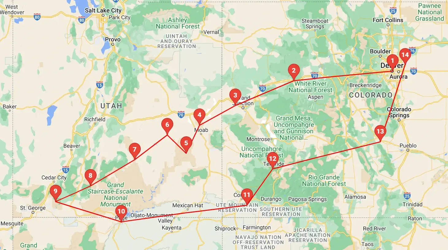 Click above map to view a larger Google Map
 As you can see by the this map, our trip covered 3 different states, approximately 1,600 road miles and allowed us to see some spectacular geography. You might think that a trip of this distance would be something that would result in a "tired of driving" mood - but our stops were so diverse with such incredible geography and fun things to do, that we found that we looked forward to each morning to where we could continue our adventures!
Click any link below to go directly to that page;
Note: All images featured on this page are the exclusive property of Just Traveling Thru, LLC, unless otherwise stated. When images from external sources are used, full credit is given to the original creator, along with a link to the specified license or usage terms. We are committed to respecting copyright and intellectual property rights, ensuring that all third-party images are properly attributed. If you have any questions regarding image ownership or usage rights, please feel free to contact us.
Affiliate Links: We may earn a commission if you make a purchase through one of our affiliate links. This helps support our travel content — thank you!
Content: To review any of our content, make suggestions and/or comments, please click the "About" menu link at the top of this page. You will find our "Contact Us" link on that drop-down menu.
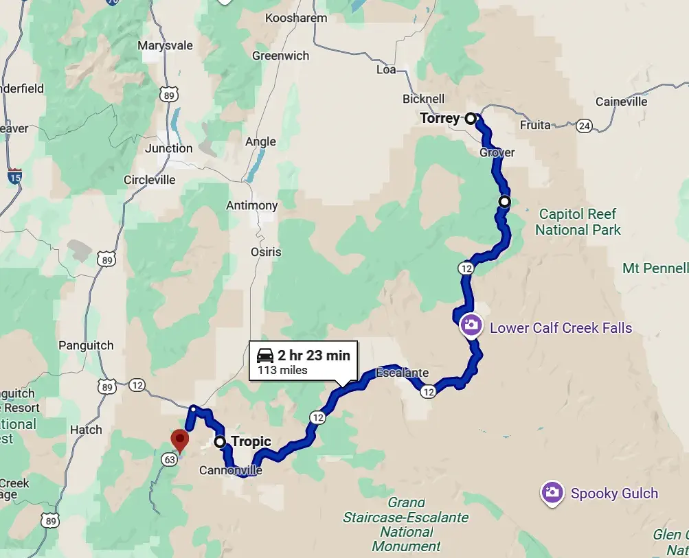 Click Image to view a larger map
