
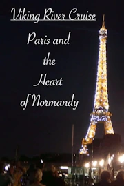
by Celeste Lipford and Terry Lipford - last updated on 9/30/2025
Our Viking Cruise Ship, the Viking Spirit, was moored in Rouen, France, marking the final westbound port stop of our incredible journey. With Arromanches-les-Bains located approximately 160 kilometers away, Viking offered a guided bus tour day trip to the Normandy landing beaches, an experience that the majority of passengers eagerly signed up for. The opportunity to visit the historic D-Day sites was one we simply couldn’t pass up.
Our day began with yet another delicious breakfast aboard the Viking Spirit, where we enjoyed a spread of fresh pastries, eggs, and steaming hot coffee while taking in the scenic views along the Seine. By 8:00 AM, we boarded the comfortable Viking tour buses, equipped with expert guides ready to provide historical insights along the way. The drive took us through the picturesque Normandy countryside, passing rolling fields, charming villages, and the iconic hedgerows that played a crucial role in the post-invasion battles of 1944.
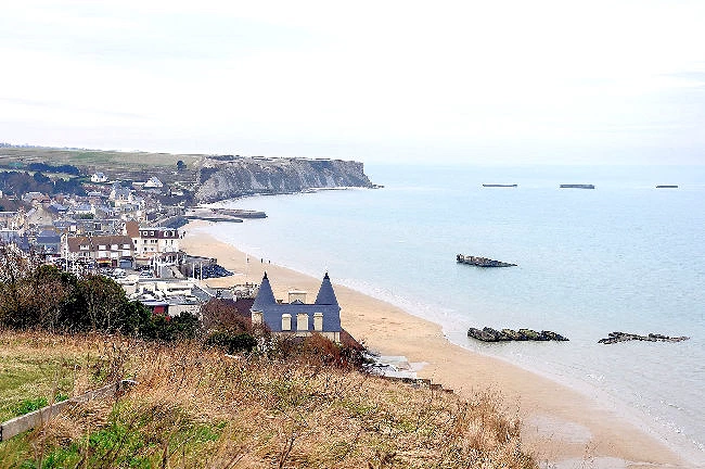
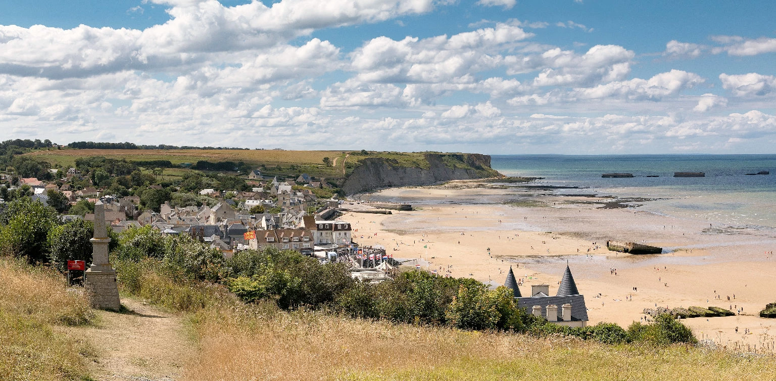
Our first stop was Gold Beach, one of the five Allied landing sectors of Operation Overlord, where British forces stormed the shores on June 6, 1944. This crucial invasion point, stretching between Le Hamel and Ver-sur-Mer, was the site of intense fighting as British troops, supported by amphibious tanks and artillery, pushed inland against German resistance. Here, we stood on the very sands where history was made, gazing out at the remnants of the Mulberry Harbor, the artificial port designed by the Allies to facilitate the landing of troops and supplies.
This was just the beginning of what would be a deeply moving and unforgettable day exploring the battlefields, cemeteries, and memorials that commemorate the bravery and sacrifice of those who fought for freedom.
From an historical perspective, this was just an amazing tour, to see and stand and walk on the same beaches, that the invasion forces landed upon, it felt like we were walking inside a history book! Several interesting points were made that I was not aware of, ie;
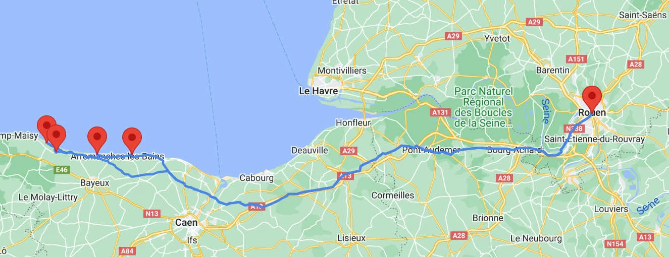 Click above image to view a larger Google Map
As can be seen by the above map, Rouen is 163 kilometers from Arromanche. Viking had arranged for a number of buses to take our tour group to the Arromanche area. Embarking on a day trip by bus from Rouen to Arromanches, France offers a delightful blend of history, picturesque landscapes, and coastal charm. As you leave the medieval city of Rouen behind, the bus journey reveals rolling countryside adorned with charming villages and lush green fields. Upon reaching Arromanches, we were transported back to a significant moment in history — the D-Day landings of World War II. We explored the remnants of Mulberry Harbor, a remarkable engineering feat!
As part of Operation Overlord, British forces landed on Gold Beach to secure a crucial foothold in German-occupied territory. The invasion involved coordinated efforts by infantry, engineers, and armored units. Despite facing challenges such as strong German defenses, the Allies successfully established a beachhead, contributing to the overall success of the Normandy landings. Today, remnants of this historic event, including bunkers and memorials, can still be explored on Gold Beach.
The Gold Beach area was more than 8 kilometers wide and included the coastal towns of La Rivière and Le Hamel. On the western end of the beach was the small port of Arromanches, and slightly west of that port was the town of Longues-sur-Mer.
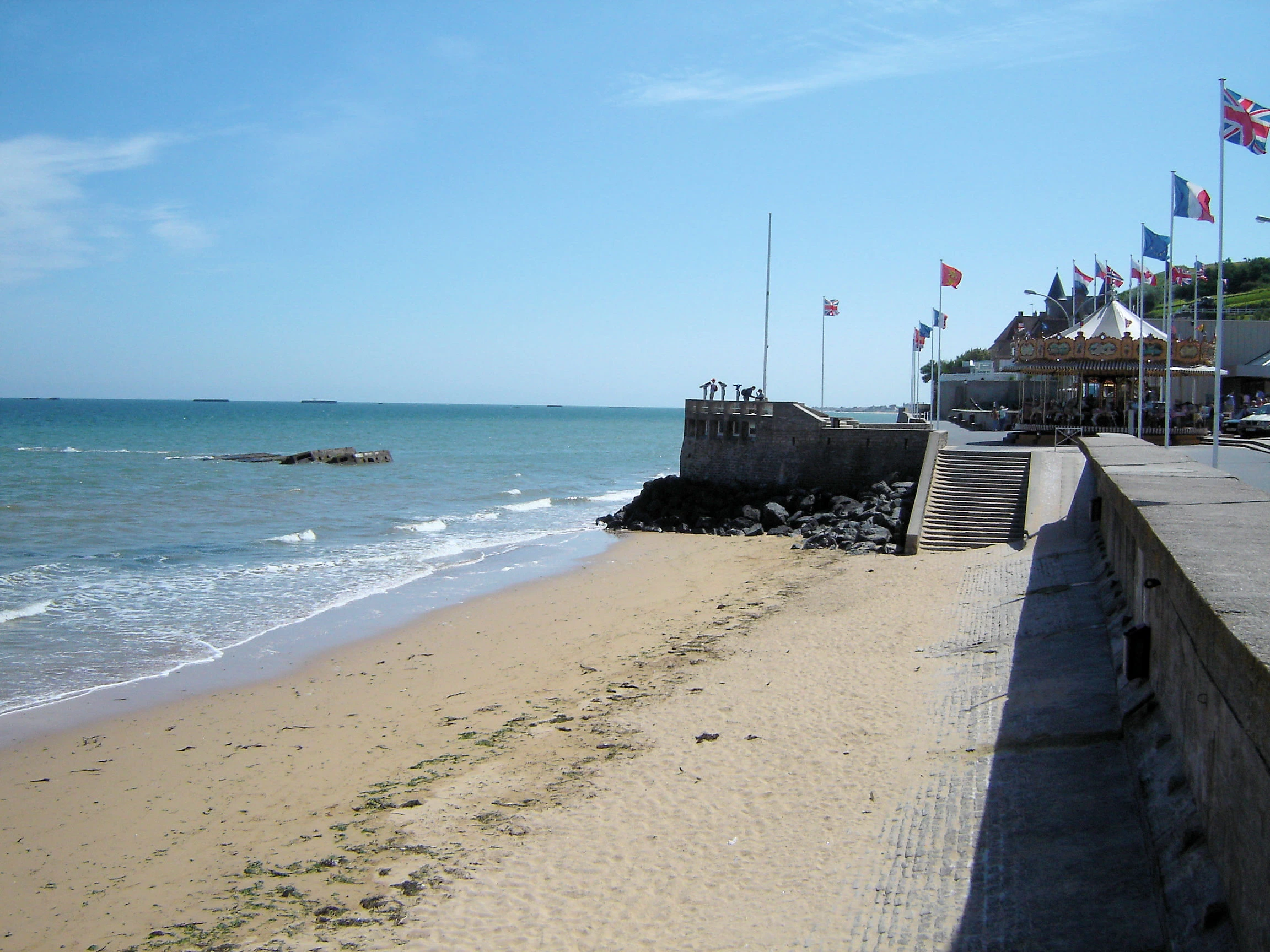
The seawall at Arromanches, France, plays a vital role in protecting the picturesque coastal town from the powerful tides of the English Channel, which can vary dramatically, rising and falling up to 7 meters or more in a single day. This tidal fluctuation reveals wide stretches of sandy beach at low tide and brings the sea close to the seawall at high tide.
This was morning low tide, and the water was approximately 200 yards out from the sea wall (Celeste hiked out to the water, just to be able to say she stood in the English Channel). The height of the sea wall is because not only does the tide rise considerably, but a storm will bring the water blasting against it ! Tidal variation here ranges between 3 to 6 meters (9+ to 18+ feet) in height.
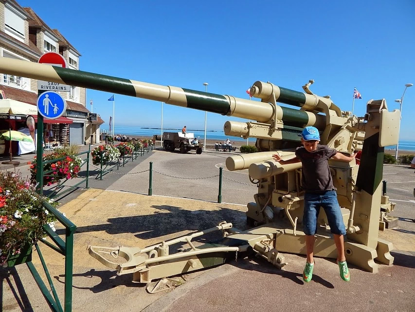
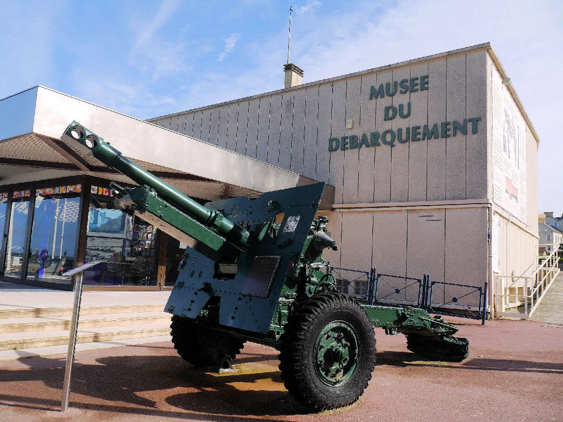
The Musée du Débarquement in Arromanches is conveniently located near the bus parking lot, making it an easy stop for visitors exploring this historic town. The museum showcases an impressive collection of military equipment from the D-Day invasion, offering a glimpse into the technology and strategy behind this pivotal moment in history.
One notable exhibit is a German 88mm gun, famously effective as both a tank killer and an anti-aircraft weapon. On the day of our visit, it proved to be a magnet for children, who excitedly climbed and played around it, giving life to this static relic of war. The museum is situated on Place du Six Juin 1944, aptly named to commemorate the Allied landings. With its prime location and engaging displays, the museum serves as a powerful reminder of the bravery and sacrifices that shaped the course of World War II.
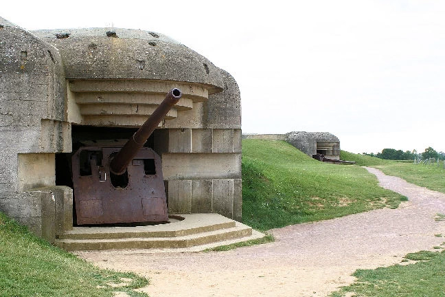
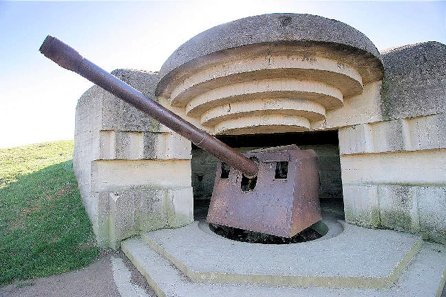
After lunch, the tour bus took us to the Longues-sur-Mer Artillery Battery, six kilometers from Arromanche.
This was a World War II German artillery battery constructed near the French village of Longues-sur-Mer. The battery was sited on a 60 meter (200 foot) cliff overlooking the sea and formed a part of Germany's Atlantic Wall coastal fortifications. It was located between the Allied landing beaches of Gold and Omaha and shelled both beaches on D-Day (6 June 1944). These were 150mm large guns with a range of 20 kilometers and a rate of fire of six to eight shots per minute.
This image is the property of Myrabella via Wikimedia Commons.
Image is the property of Imperial War Museum via Wikimedia Commons using the Public Domain License.
Image is the property of Oxyman via Wikimedia Commons.
Image is the property of Хрюша via Wikimedia Commons using a CC BY-SA 3.0 Creative Commons License.
Image is the property of Just Traveling Thru, LLC.
Image is the property of Myrabella via Wikimedia Commons.
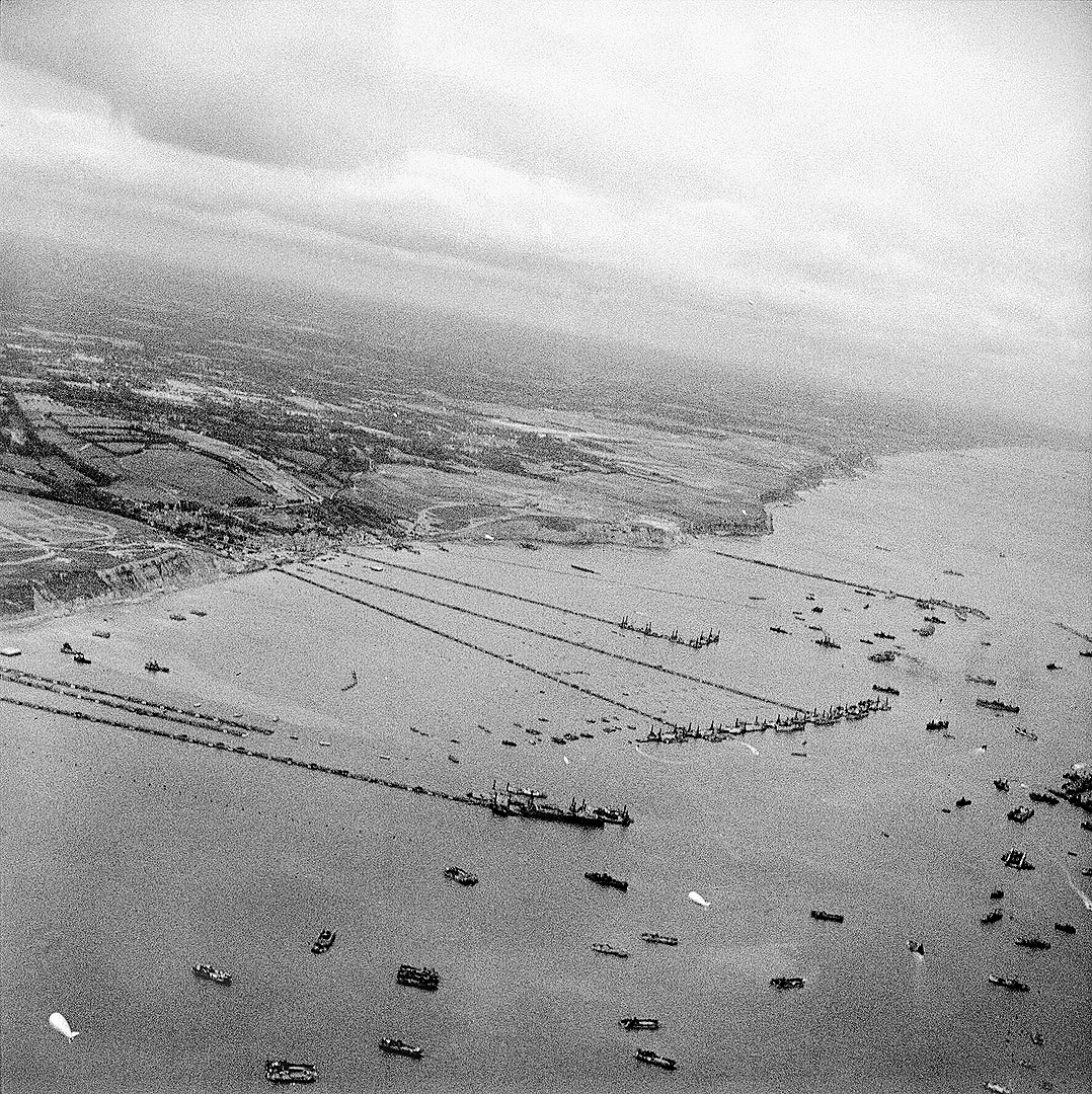
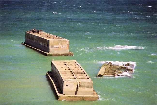
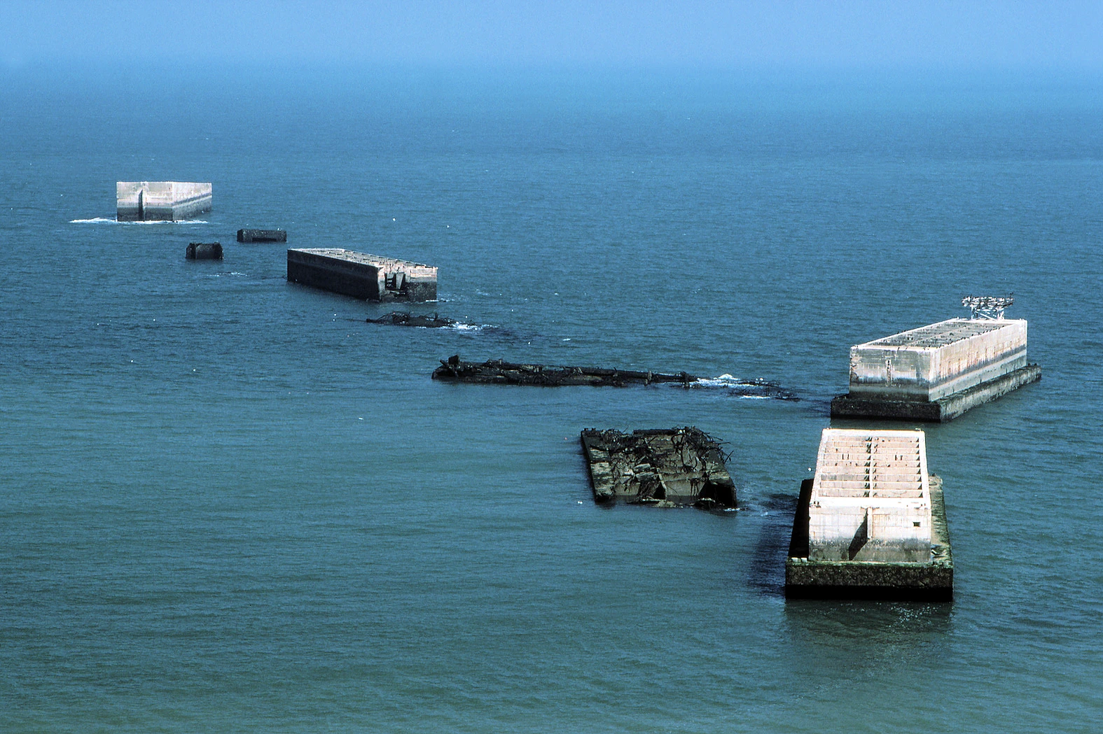
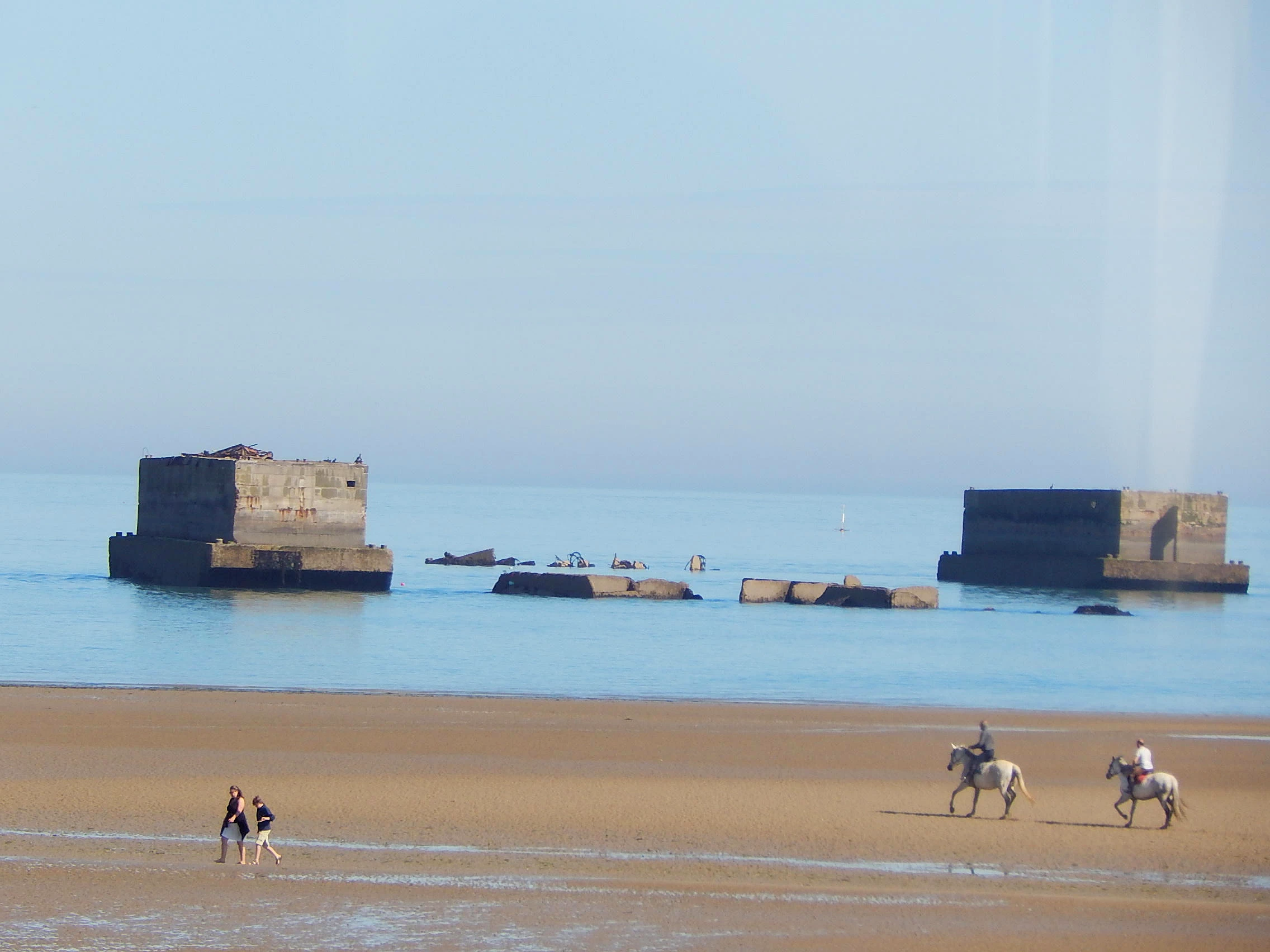
The Mulberry Units were used to construct "Mulberry Harbours" or temporary portable harbours developed by the United Kingdom during the Second World War to facilitate the rapid offloading of cargo onto beaches during the Allied invasion of Normandy in June 1944.
As you can see in the black & white image (taken in September 1944 above Arromanches) these Mulberry Harbors were used continously to bring soldiers and supplies ashore during and after the invasion. Without these harbors, heavy guns and armored vehicles would have been impossible to put ashore.
After the Allies successfully held the beachheads following D-Day, two prefabricated harbours were towed in sections across the English Channel from England with the invading army and assembled off Omaha Beach (Arromanches). The fact that they are still intact today is a testament to their sturdy construction.
NOTE: The history of these WW2 Mulberry Units is fascinating, click here to go to the Wikipedia Mulberry Harbor Article Page to read more about them.
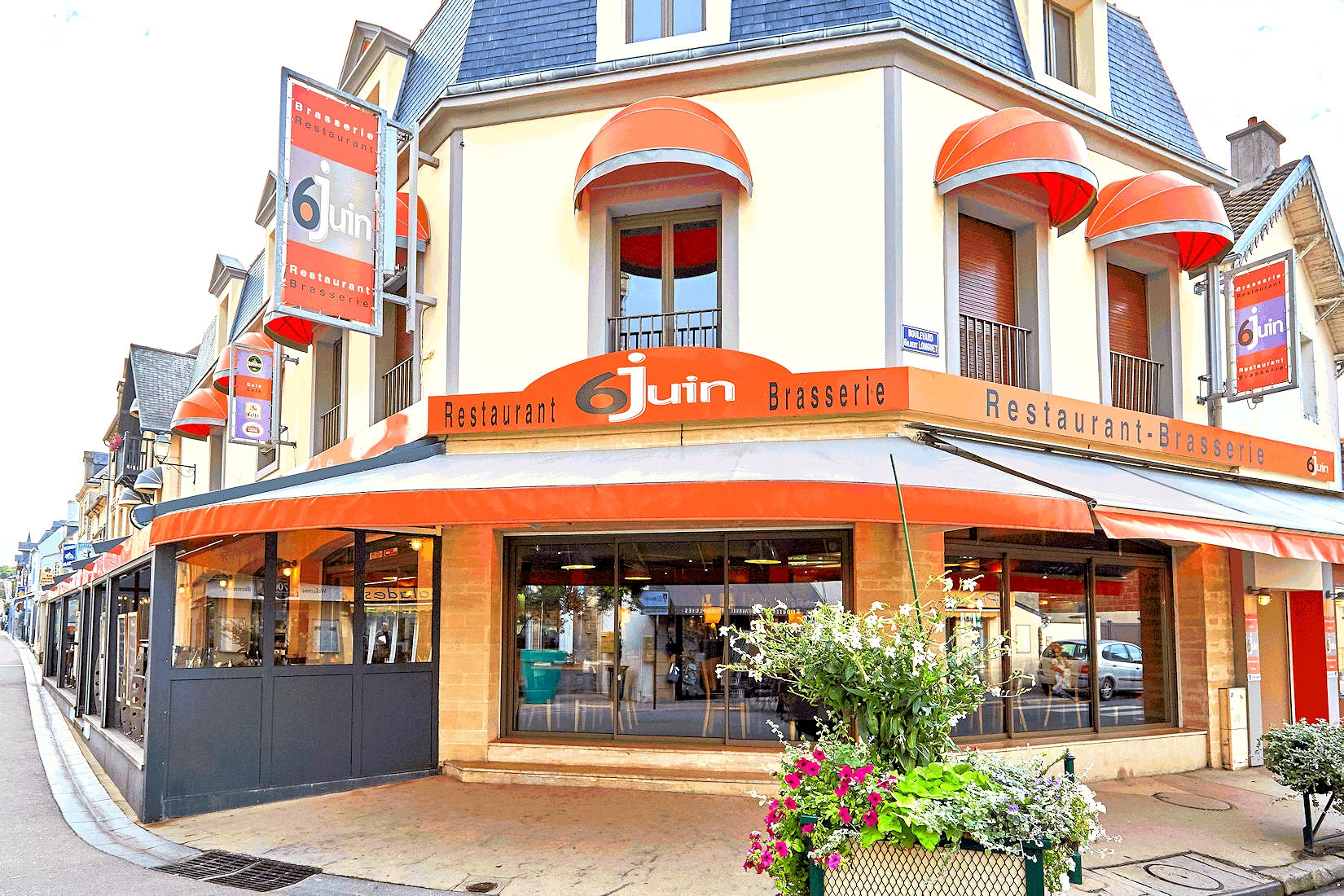
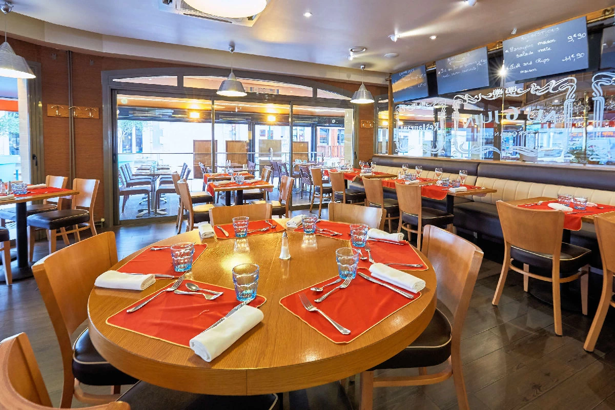
After a nice lunch at the Bar du Six Juin in Arromanches, we all piled back onto the tour buses for a stop at the Longues-sur-Mer Artillery Battery before we headed off to the Colleville-Sur-Mer cemetery.
WARNING: Our entire tour group ate lunch here, and even though Viking Cruises had given them a "head count", because Americans like to "spread out" and as we were the last people to enter the pub, we nearly did not get a seat! Moral of the story is to not be the last people to enter on these types of tours.
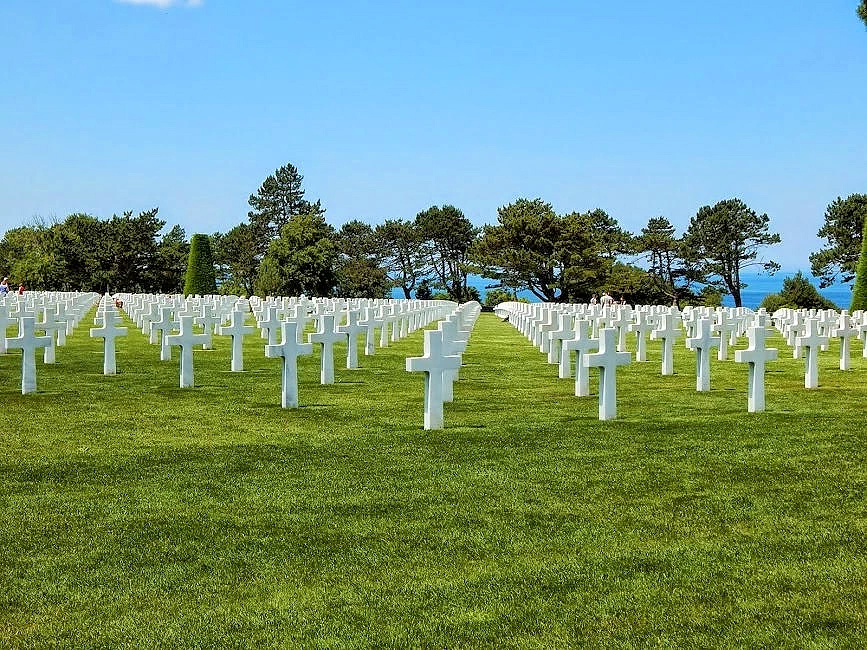
These images show you a small portion of the 9,387 grave sites in Colleville-sur-mer cemetery. Jewish graves have a star on them, all others have the standard cross. The name of the deceased and the date of their death, and birth location, is recorded on each cross.
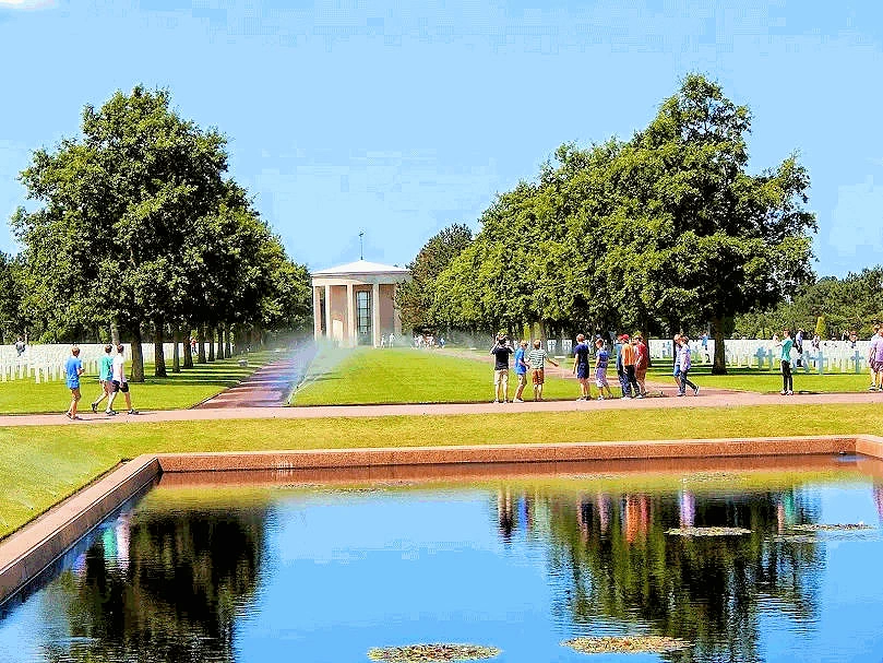
The memorial includes maps and details of the Normandy landings and military operations that followed. At the memorial's center is the "Spirit of American Youth Rising from the Waves", a bronze statue. The cemetery also includes two different flag poles which at two different times people gather around the American flags to watch them lower and fold both flags. This not only honors the United States but all the 9,387 people in the cemetery plus everyone who fought in the war.
This cemetery was established by the U.S. First Army on June 8, 1944 and dedicated in 1956, and is the most visited cemetery run by the American Battle Monuments Commission (ABMC) with one million visitors a year. In 2007, the ABMC opened a visitor center at the cemetery, relating the global significance and meaning of Operation Overlord. It was the first American cemetery on European soil in World War II.
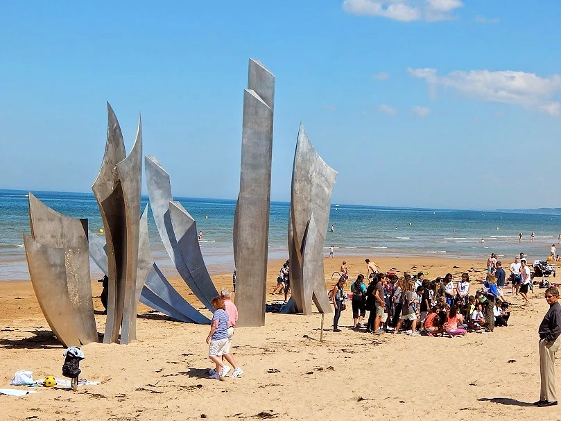
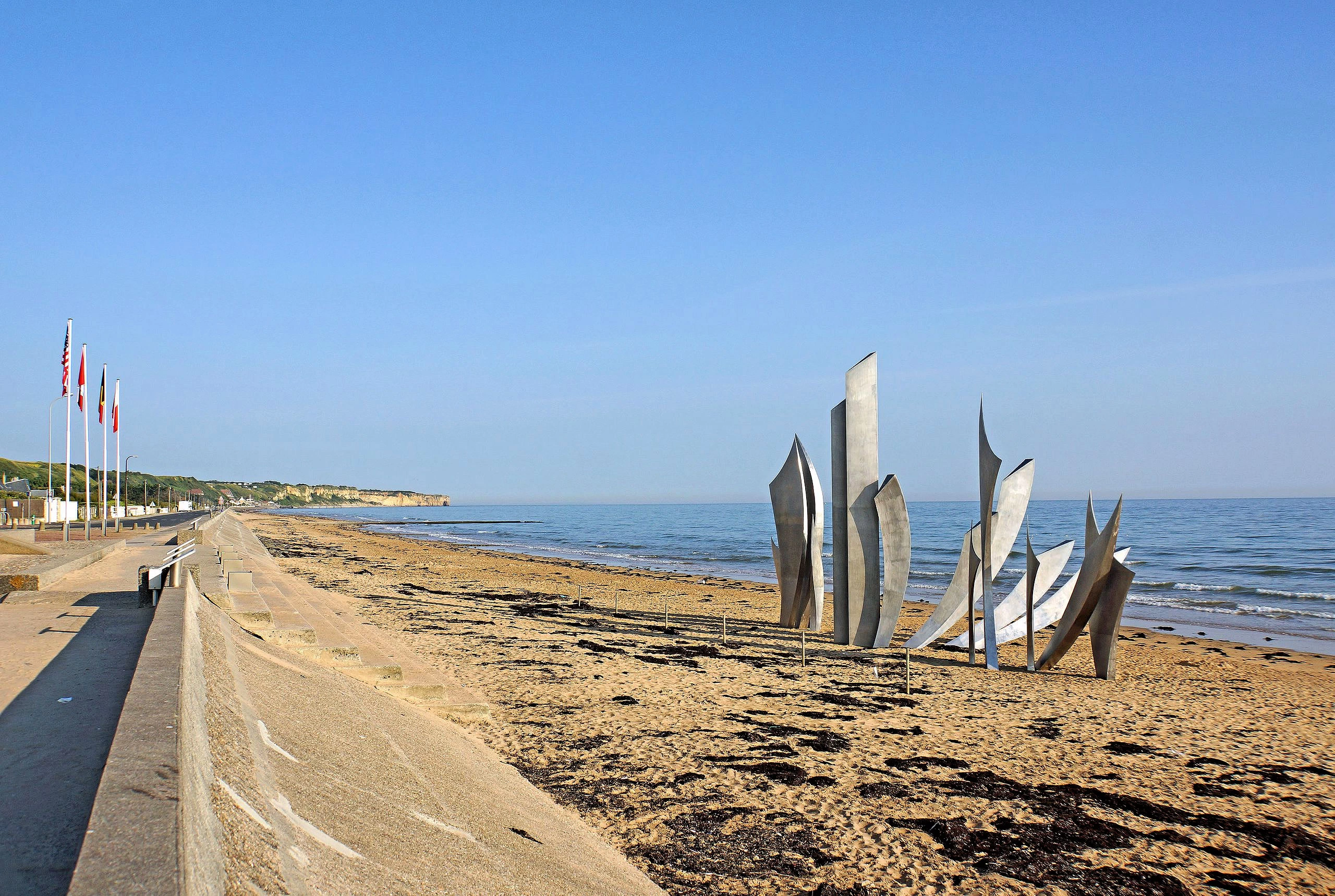
The Les Braves Memorial stands on Omaha Beach, a powerful tribute to the bravery and sacrifice of Allied soldiers during the D-Day landings on June 6, 1944. Created by French sculptor Anilore Banon, the monument was unveiled in 2004 to commemorate the 60th anniversary of the invasion.
The sculpture consists of three symbolic elements: The Wings of Hope, representing the courage that carried soldiers forward; Rise, Freedom!, symbolizing the struggle to liberate Europe; and The Wings of Fraternity, honoring the bond between nations united against tyranny. Made of stainless steel, the memorial reflects light beautifully and contrasts with the sandy beach and crashing waves.
Its placement on the exact site of the landings makes it especially poignant, encouraging reflection on the enormity of the sacrifice made here. Visitors are moved by its soaring forms and the historical weight of standing where freedom was fought for so fiercely.
Arromanches is known for being the site of the Mulberry harbor, a temporary artificial port built to supply British and Canadian troops after the Normandy landings on Gold Beach during D-Day.
The Mulberry Harbours were two temporary, pre-fabricated harbors built in England and towed across the English Channel to Normandy following the D-Day invasion in June 1944. One was assembled at Arromanches (codenamed Port Winston) and the other at Omaha Beach.
Visitors typically reach Arromanches by car, with the nearest train station in the town of Bayeux. Buses also connect Bayeux and Arromanches.
Yes, many of the key sites, including Gold Beach and the harbor remnants, are within walking distance.
Yes, Arromanches is generally wheelchair friendly, with a flat, accessible promenade, wheelchair-accessible facilities at the Musée du Débarquement, and good access to the Royal Engineers Memorial. While beach access to the harbor remnants at low tide can be challenging due to sand and terrain, much of the town itself is welcoming for wheelchair users.
The period between April and October is recommended for the best weather, although the summer months can be crowded. It is possible to see the main sights in a half-day or a full day, but you will need more time to visit other D-Day beaches and historical sites across Normandy.
NOTE: Below are some useful links where you can find even more information about the areas we have described on this page. There are of course, many other useful websites & pages, so for something specific, we would suggest using Google Search.


The following list contains links to all of our other French Destinations & Information Pages, click any link to go to that page.
Note: All images featured on this page are the exclusive property of Just Traveling Thru, LLC, unless otherwise stated. When images from external sources are used, full credit is given to the original creator, along with a link to the specified license or usage terms. We are committed to respecting copyright and intellectual property rights, ensuring that all third-party images are properly attributed. If you have any questions regarding image ownership or usage rights, please feel free to contact us.
Affiliate Links: We may earn a commission if you make a purchase through one of our affiliate links. This helps support our travel content — thank you!
Content: To review any of our content, make suggestions and/or comments, please click the "About" menu link at the top of this page. You will find our "Contact Us" link on that drop-down menu.