
by Celeste Lipford and Terry Lipford - last updated on 9/24/2025
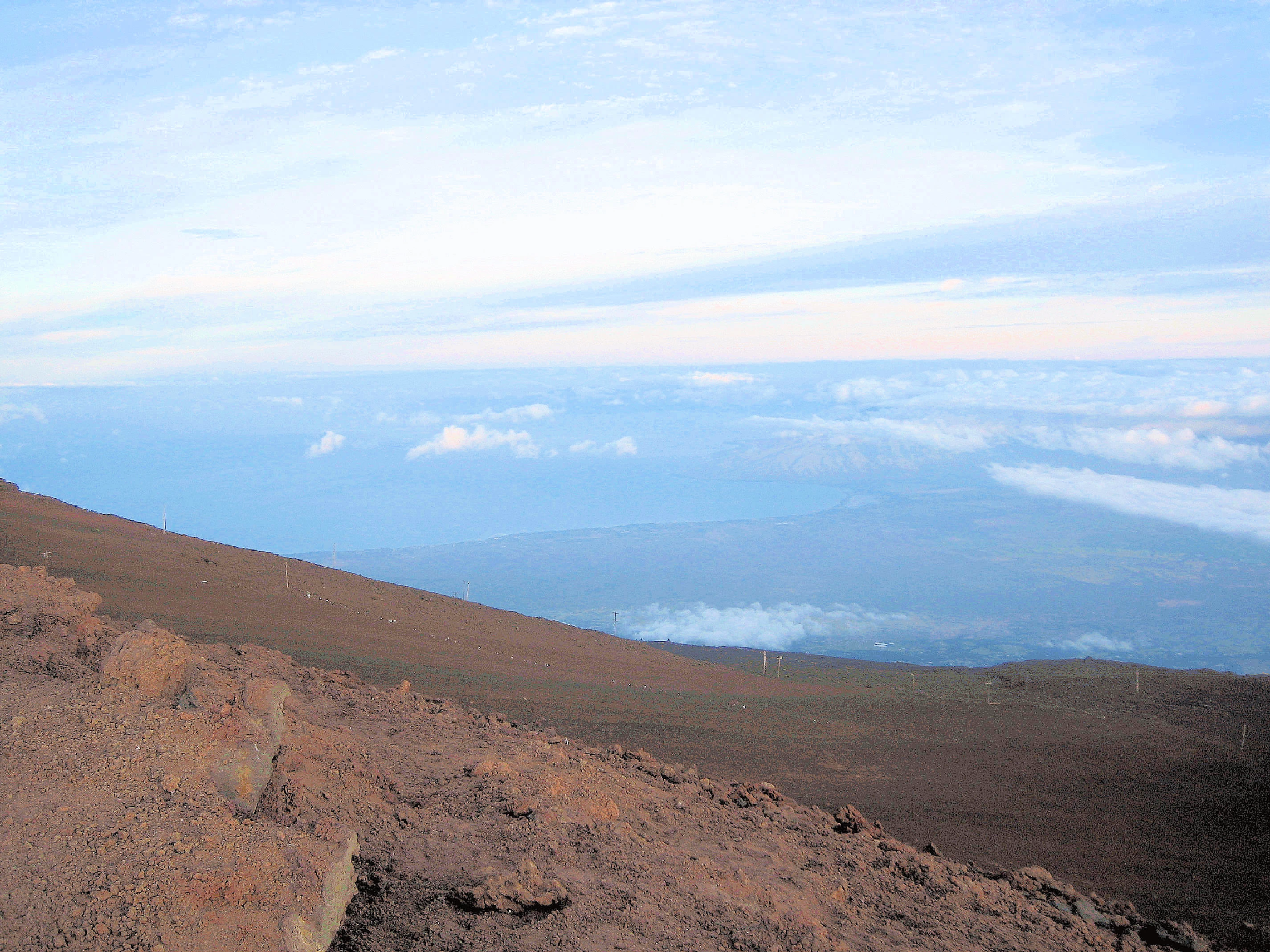
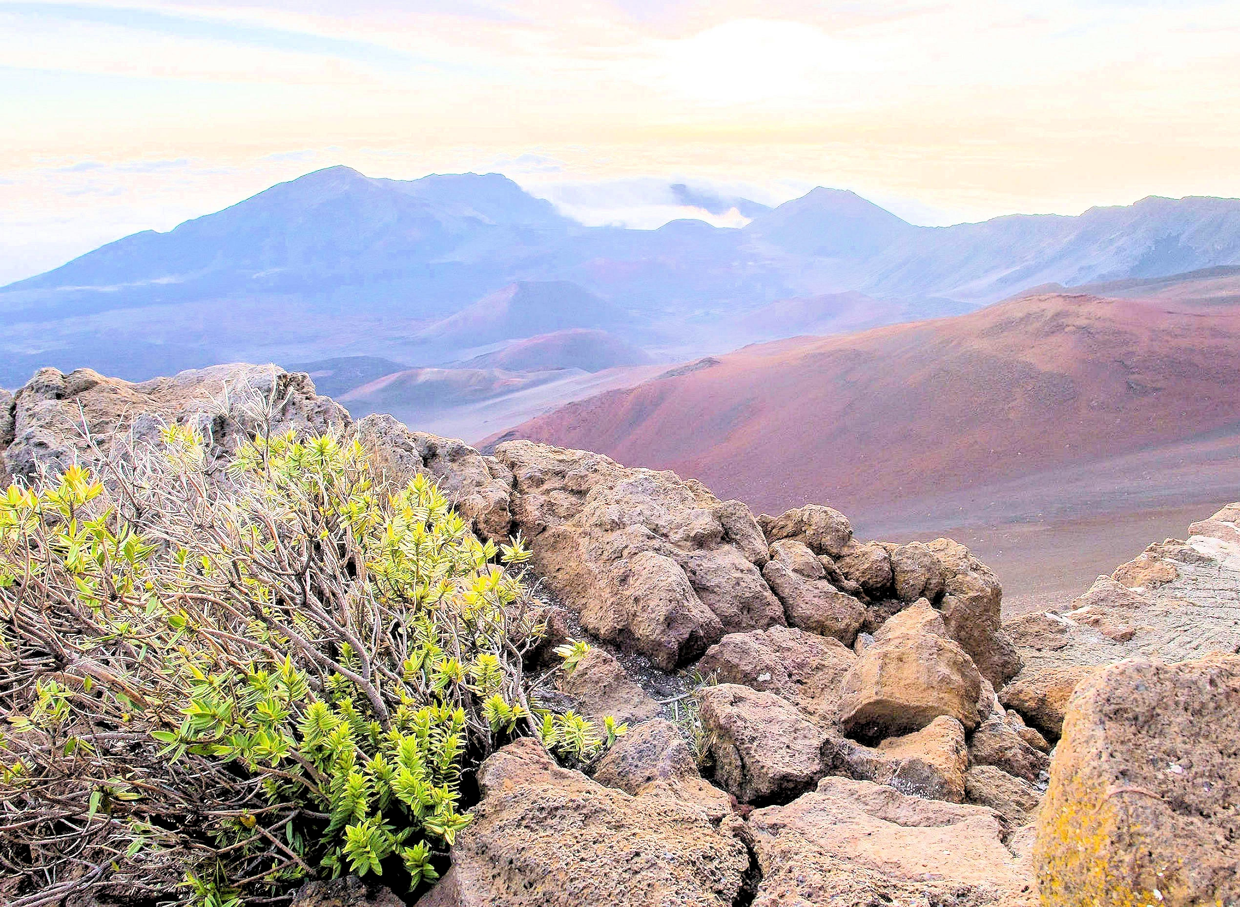
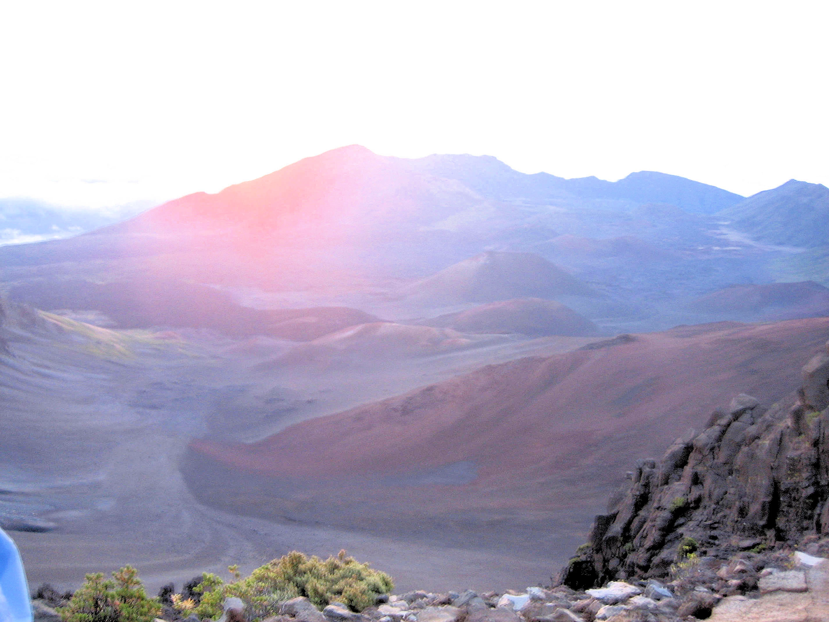
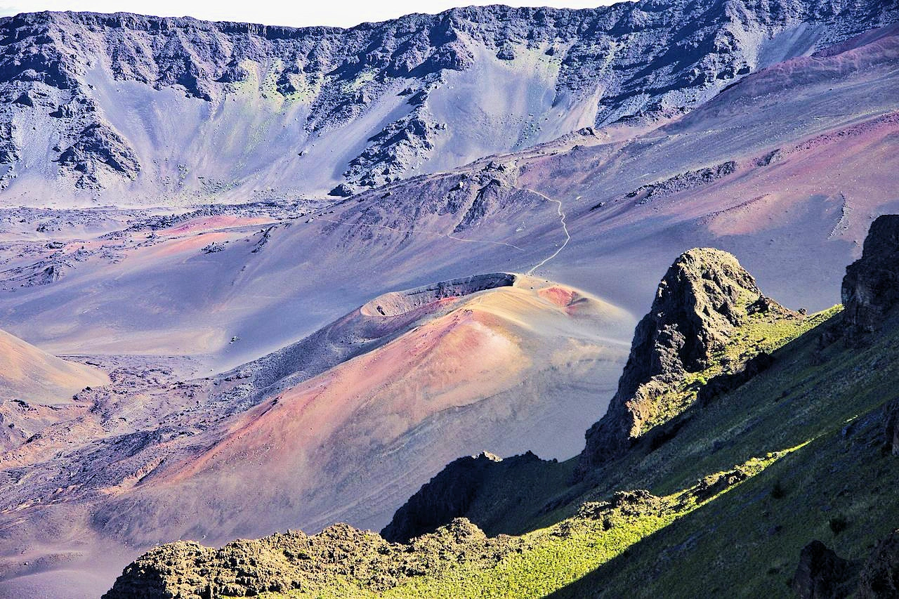
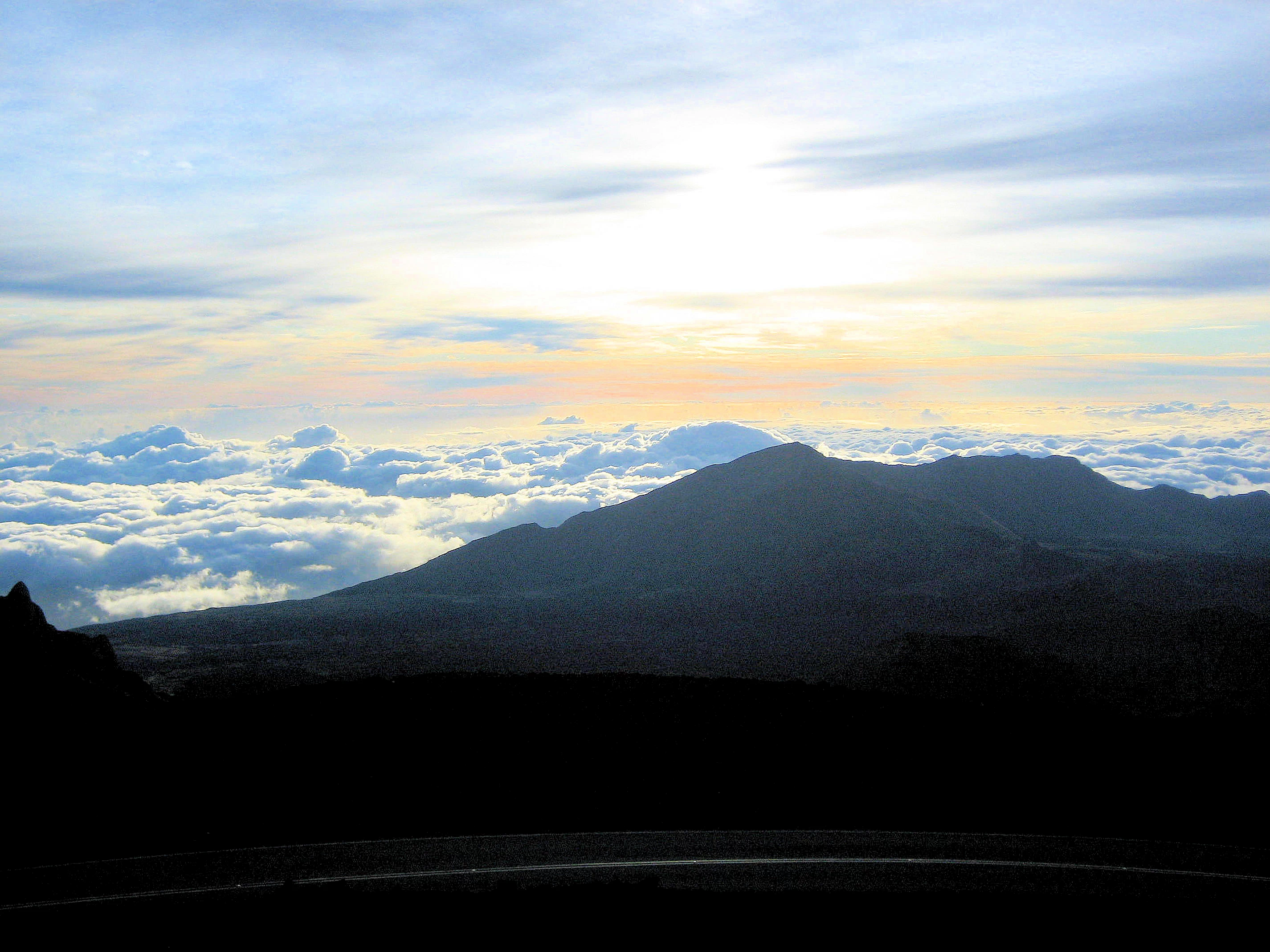
The Haleakalā "crater" is actually a vast, otherworldly erosional valley on the dormant shield volcano, formed by the merging of two ancient valleys and not by a typical volcanic collapse. The massive depression, measuring nearly 7 miles across and 3,000 feet deep, features a rugged landscape of multicolored cinder cones and volcanic flows that were later filled in by subsequent eruptions. Rising over 10,000 feet above sea level, this lunar-like terrain is revered in Hawaiian legend as the place where the demigod Maui captured the sun and is a popular destination for visitors to witness breathtaking sunrises and sunsets above the clouds.
Haleakalā National Park is a place of profound cultural and ecological significance, centered on the magnificent Haleakalā volcano. Its history as a protected area began in 1916 as part of the original Hawaiʻi National Park, alongside the volcanoes of Kīlauea and Mauna Loa on the island of Hawaiʻi. The two areas, located on different islands, were split 45 years later. On July 1, 1961, the Haleakalā section was officially established as its own separate national park.
Even before its designation as a national park, the Haleakalā area held immense importance to Polynesian and Native Hawaiian cultures. The name "Haleakalā" translates to "house of the sun" and is rooted in the legend of the demigod Māui. According to the tale, Māui lassoed the sun from the mountain's summit to slow its journey across the sky, thereby lengthening the day for his people. For millennia, Native Hawaiians have considered the volcano a sacred place, or wao akua (realm of the gods), where priests (kahuna) conducted ceremonies and rituals. The remote wilderness of the park, including its volcanic crater, also served as a location for spiritual practices and celestial navigation training. The deep cultural connection between the Hawaiian people and this sacred land continues to be honored and preserved by the park today.
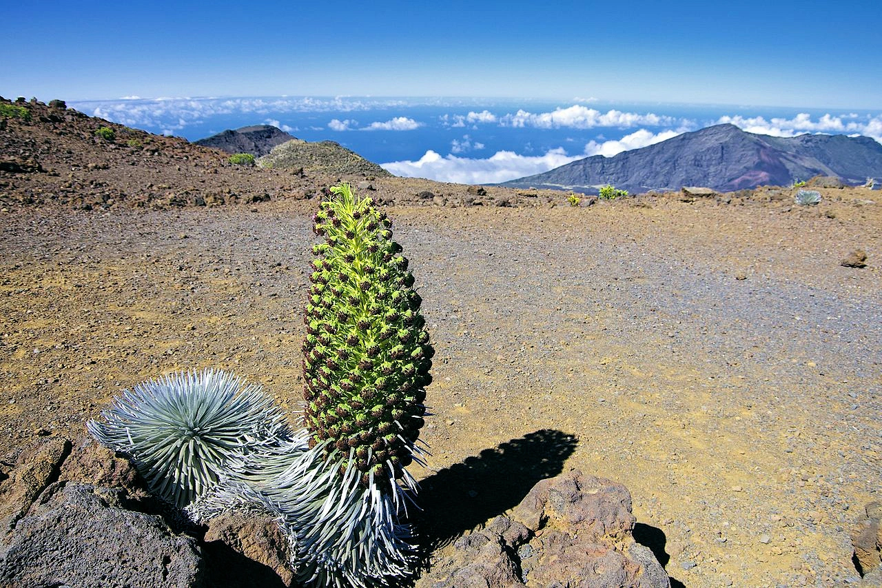
The geological and ecological history of Haleakalā is equally compelling. The volcano itself is a dormant shield volcano, which last erupted sometime between 1480 and 1600 AD. Its immense "crater" is not a volcanic depression but a result of prolonged erosion, formed by the meeting of two large valleys that later were partially filled by subsequent lava flows. The park's 33,265 acres protect a wide array of ecosystems, from the high-altitude, desolate volcanic summit to the lush coastal rainforests of the Kīpahulu District. This unique landscape is home to more endangered species than any other national park in the U.S., including the rare ʻāhinahina (Haleakalā silversword) plant and the Hawaiian goose (nēnē), which has been successfully reintroduced to the area. These efforts reflect the park's ongoing mission to preserve both the natural and cultural heritage of this extraordinary and ancient landscape.
The 38 mile drive up to the summit of Haleakalā is not for the faint of heart, but it is an unforgettable adventure into another world. The paved, two-lane Haleakalā Highway twists its way from sea level to over 10,000 feet, featuring numerous blind turns, 32 switchbacks, and steep drop-offs that test even the most experienced drivers. The drive is especially perilous for those who attempt it in the dark to catch the famous sunrise, with no streetlights to guide the way. Yet, those who brave the journey are rewarded with a view of the world from above the clouds, a sight that makes the challenging drive worthwhile.
The road's danger lies in its steepness and lack of guardrails in certain spots. While the Haleakalā Highway is well-maintained and has just one bridge, it is essential for drivers to remain cautious, particularly when descending. Overusing brakes on the way down is extremely dangerous and can cause them to overheat, fade, or fail entirely. The best practice is to use a low gear to let the engine do most of the braking. Other potential hazards include rare icy patches during winter months, sudden cloud cover that severely reduces visibility, and encountering wildlife like nēnē geese and cattle that may wander onto the road.
Despite the challenges, the changing scenery of the drive is a breathtaking spectacle. The journey begins in the lush green fields of Maui's lower elevations, with sweeping views of the coastline. As the car ascends, the landscape dramatically changes, transitioning from forests into dry, shrub-filled lands and finally to the stark, rocky, and otherworldly red terrain near the summit. The final destination offers a stunning view down into the volcano's massive, dormant crater, where visitors can gaze upon a landscape unlike any other on Earth.
For those who accept the challenge, the drive to the top of Haleakalā is not merely a means to an end but a dramatic and beautiful journey in itself. It is a testament to the fact that the most incredible views are often preceded by the most formidable climbs. Arriving at the summit, with the crisp, thin air and the expansive panorama stretching out below, offers a profound sense of accomplishment and a humbling perspective on the power and beauty of nature.
No. The summit and Kīpahulu districts are not connected by a road through the crater; you drive around the island to visit both.
No. Launching, landing, or operating drones is prohibited in the park unless specifically authorized. To obtain drone approval for Haleakalā National Park, you must submit a Special Use Permit application to the National Park Service (NPS) and receive written permission from the superintendent, as drone use is generally prohibited by policy.
Keonehe‘ehe‘e (Sliding Sands) into the crater, Halemau‘u switchbacks, and short summit overlooks. High altitude makes hikes more strenuous—know your turnaround point.
Very limited. No gas or groceries in the park; Stock water, food, and fuel before you drive up.
Yes—sunrise uses a timed reservation system released in advance. Daytime entry typically does not require a reservation; always confirm current rules before you go.
Pack a base layer, warm mid-layer, windproof shell, hat/gloves, and closed shoes. Even in summer, pre-dawn wind can feel near freezing.
Summit area pullouts near the Visitor Center; arrive early to park and walk safely.
Sunset is easier logistics (no pre-dawn drive) and no sunrise permit window; bring warm layers.
Yes—sample the Keoneheʻeheʻe (Sliding Sands) trail for crater views. Yes, you need a Haleakalā National Park entrance fee for the Sliding Sands hike, and a reservation is required for park entry before 7:00 AM if you intend to arrive in time to experience sunrise. You do not need a separate permit for the hike itself, but you must have a valid reservation and pay the standard park entrance fee to be admitted.
Summit Area (pre-dawn/sunset): Park near the Summit Visitor Center; walk to nearby viewpoints. Arrive early, bring layers and a headlamp.
Sliding Sands (Keoneheʻeheʻe) Sampler: After sunrise, hike 20–40 minutes down from the trailhead for crater views; turn around as needed (remember the climb back up).
Leleiwi or Kalahaku Overlook: Short, spectacular pullouts on the drive—great for mid-morning photo stops or golden-hour light.
Tip: Fuel and food are limited—top up before the drive; carry water and sun protection.
No, Haleakalā National Park, however, has been recognized by the United Nations as an International Biosphere Reserve in 1980, a distinction for areas important for conservation and sustainable use of resources, and is a sacred site in Hawaiian culture.
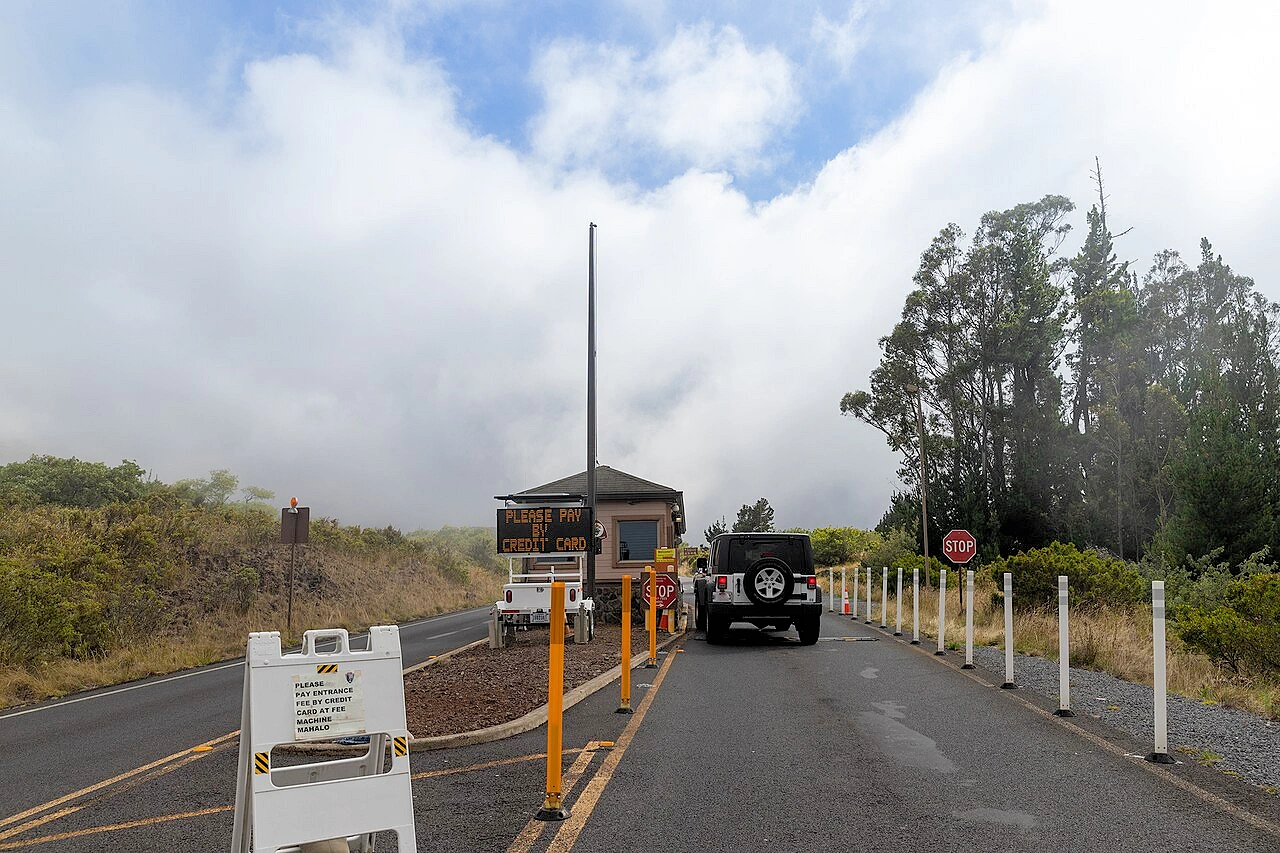
Haleakalā National Park's standard fee for a 3-day standard entrance pass to Haleakalā National Park is $15.00 per vehicle. To enter Haleakalā National Park for sunrise (3:00 AM to 7:00 AM), you need a reservation for a $1.00 per vehicle fee, which is in addition to the standard park entrance fee. Alternatively, you can use the America the Beautiful National Parks Pass for free entry, which is valid for one year. Cashless payments, including credit and debit cards, are accepted. Check the Recration.gov website for current information and prices.
Yes, The drive to the Haleakalā summit can be very challenging due to the winding, steep road with steep drop-offs and potential for fog and strong winds, but it is generally considered safe and manageable for confident drivers. Key safety measures include using low gear for descent, obeying speed limits, pulling over at designated areas, checking weather conditions, and driving with caution due to wildlife and the remote nature of the park roads. The road has 32 switchbacks, with the steepest sections reaching up to an 11% grade and average inclines of around 5.3%. It is a long, twisting two-lane road with very steep drop-offs, blind turns, and no guardrails, requiring careful driving, especially at night.
To avoid bicycle tour groups on Haleakalā, drive up to the summit during hours they aren't actively biking down, such as during the late morning or early afternoon when their tours are finishing up, or go at a different time of day altogether, like for sunset. You can also expect to see fewer groups on weekdays compared to weekends, and fewer groups during the off-season.
To arrange a hike in Haleakalā National Park, you'll need to plan around specific requirements, especially for sunrise viewing, where a Recreation.gov reservation is essential. You'll also pay the park entrance fee and may need permits for backpacking or cabin stays, booked through the same Recreation.gov website. Research your chosen trails and create a contingency plan for popular areas like the summit, which can have limited parking.
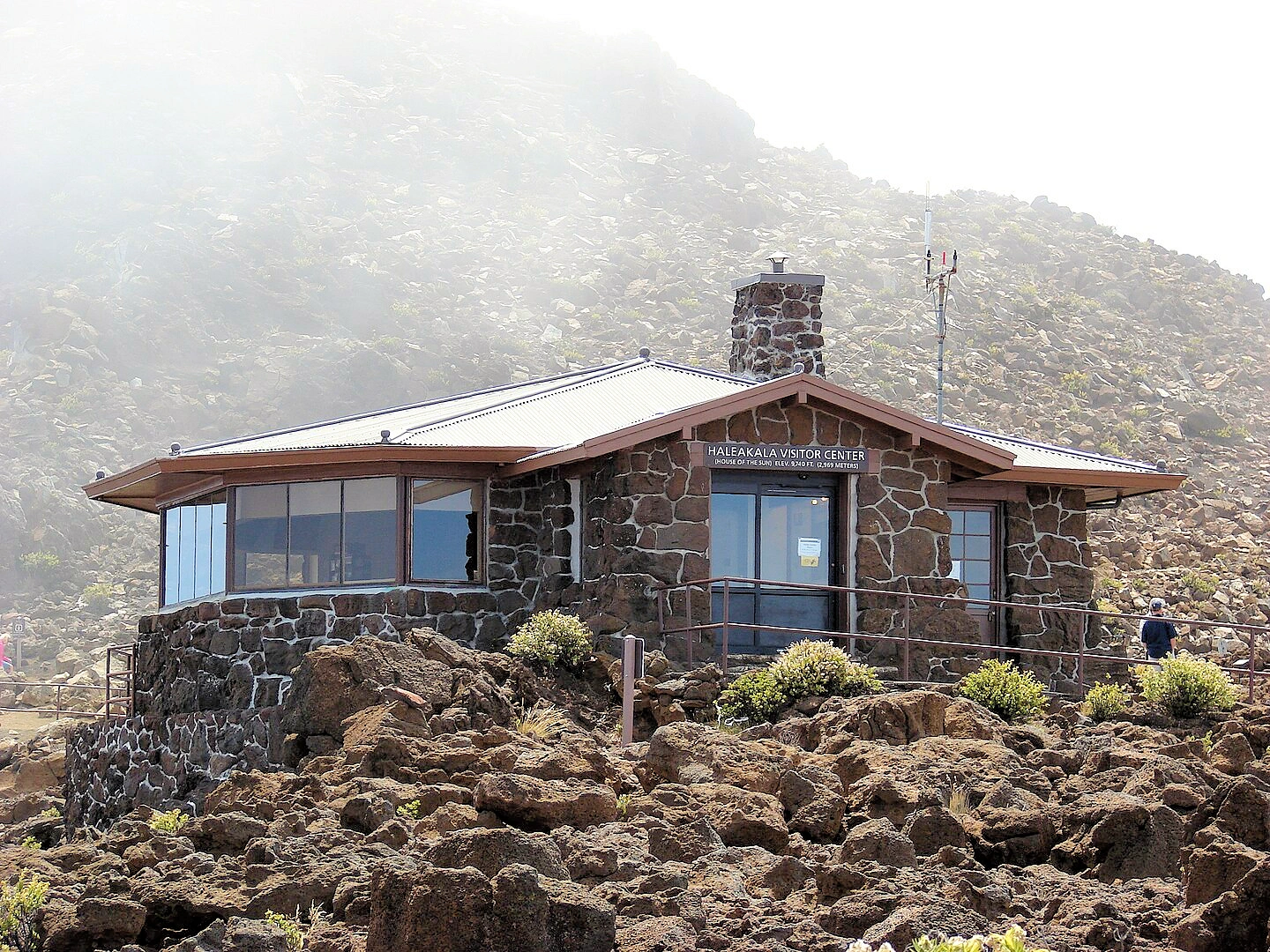
The best photo spots on the Haleakalā summit overlook include the Haleakalā Visitor Center for expansive crater views, the Kalahaku Overlook for breathtaking scenery and historical information, and the peak of Pu`u Ula (the summit's highest point) for panoramic, 360-degree views of the volcanic landscape and cinder cones. For unique perspectives, consider the Leleiwi Overlook or take the short, paved Pa Ka'oao Trail (White Hill Trail) from the visitor center.
Yes. A separate sunrise reservation is required for vehicles entering the park between 3:00–7:00 a.m. Reservations open 60 days in advance, with an extra batch 2 days ahead at 7:00 a.m. HST. This fee is separate from your park entry pass.
Very. At an elevation 10,023 feet — windchill can feel near-freezing with strong winds; bring winter layers, hat, and gloves—even in summer. On our last trip to the summit, we were on Maui in September and the summit temperature was in the 30 degree range before sunrise.
Before you make plans to drive to the summit, take a look at the Haleakala summit weather forecast from the National Weather Service.
The typical drive time to the Haleakalā Summit from the Hawaii Route 36 (Piʻilani Highway) turnoff is approximately 1 hour and 30 minutes to 2 hours, though you should also account for the early hour and winding, potentially dark, conditions. Keep in mind that there are no services at the summit, so you will want to stock up on food & drinks and make sure your gas tank is full.
To safely drive down from the Haleakalā summit, the single most critical step is to use a low gear, not your brakes, to manage your speed on the long, steep descent. Crater Road (Highway 378) features a significant elevation drop with numerous twists and turns, and relying solely on your brakes can cause them to overheat, fail, or even catch fire.
Plan Your Visit Travel Resources — Maps, Parking, Passes & Links
Where to Stay & Eat Travel Resources — Maps, Parking, Passes & Links
2025 Government Shutdown
Most National Parks remain open during a government shutdown, but with reduced services and staffing. Parks may be accessible, but facilities like visitor centers, campgrounds, and websites might be closed, and services like trash pickup and restroom maintenance can be significantly impacted. Visitors should check individual park websites for current conditions before going and be prepared with extra supplies and awareness that emergency services may be limited.
Gates and roads are generally open to allow access to outdoor areas.
More Info Travel Resources — Maps, Parking, Passes & Links
Note: All images featured on this page are the exclusive property of Just Traveling Thru, LLC, unless otherwise stated. When images from external sources are used, full credit is given to the original creator, along with a link to the specified license or usage terms. We are committed to respecting copyright and intellectual property rights, ensuring that all third-party images are properly attributed. If you have any questions regarding image ownership or usage rights, please feel free to contact us.
Affiliate Links: We may earn a commission if you make a purchase through one of our affiliate links. This helps support our travel content — thank you!
Content: To review any of our content, make suggestions and/or comments, please click the "About" menu link at the top of this page. You will find our "Contact Us" link on that drop-down menu.